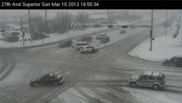
Here was the webcam from earlier Sunday in
Lincoln, Nebraska at 27th and Superior. It appears that the weekend snow
storm caused a few traffic problems around town.
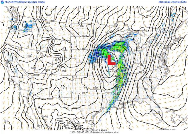
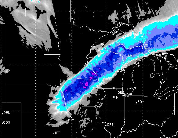
Classic Spring Storm
Here was a look at the storm on Sunday
afternoon as it was winding up over the central part of the country.
Note the 'comma' shape to the storm, denoting a mature state. Pretty
classic in spring of fall to see heavy snow on the northwest flank and
strong to severe storms on it's southern flank.
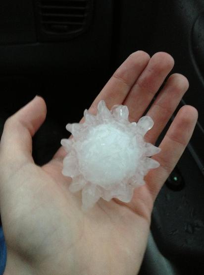
Baseball Size Hail in Texas
Thanks to @TXStormChasers for this picture
north of Decatur, TX. Could you imagine a near baseball size hailstone
flying at you? YIKES!
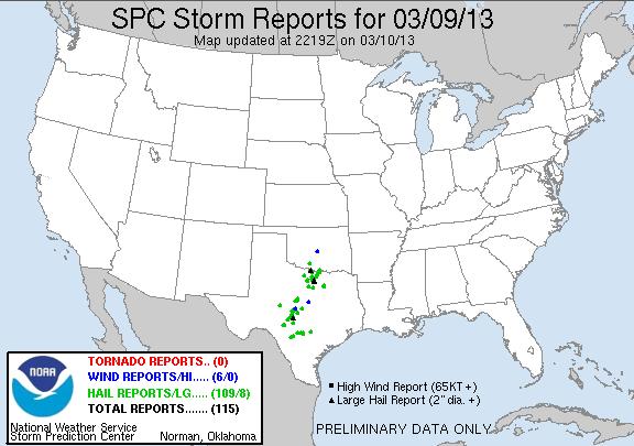
Saturday Storm Reports
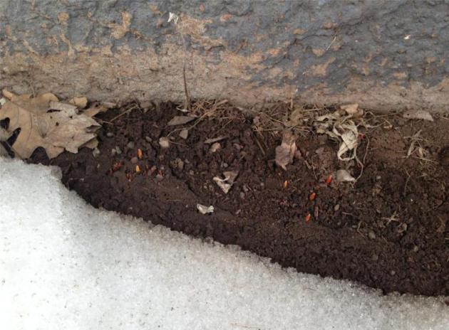
Tulips Popping In Superior, Wisconsin?
Thanks to my good friend, Jon Ellis, from
Superior, Wisconsin for the picuture below. Even with a decent amount of
snow of the ground, the intensity of the sun is helping to awake any
ready tulip bulbs that don't have snow cover over them. It's another
testiment to how strong the sun is getting at this time of the year!
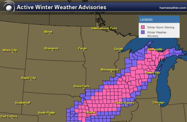
More Snow on the Way
The National Weather Service has
issued winter weather headlines for locations into the Great Lakes
region through Monday. Heavy, wet, shovelable snow is expected across
the region.
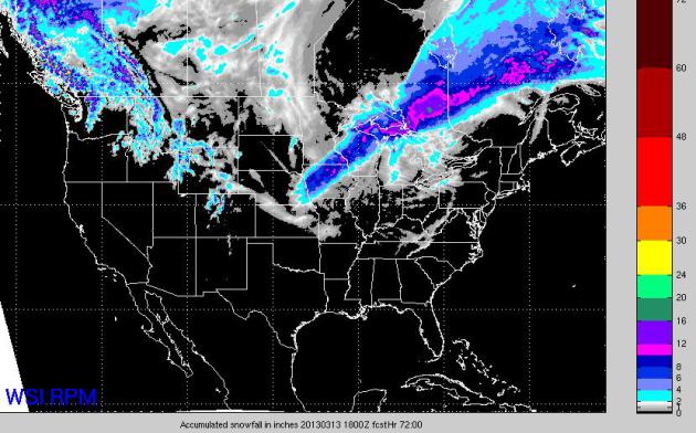
Snowfall Expected
The high resolution, RPM model suggests 6"+ in a fairly large swath from Iowa to the U.P. of Michigan through Monday.
National Snowfall
The 3 day national snowfall
forecast suggests that the heaviest band will occur across the Great
Lakes region through Monday. Other than some high elevation snow out
west, light snow potential will be possible across the Plains through
midday Wednesday.
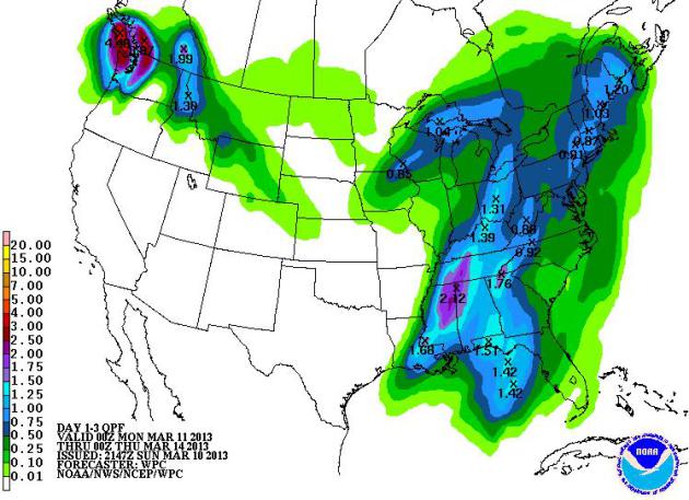
National Precipitation Forecast
NOAA's HPC 3 day precipitation
forecast suggests that the same storm responsible for heavier snow
across the Great Lakes Region through Monday will also be responsible
for heavier rain across the Southeast through Tuesday before sweeping
east into the Altantic Ocean.
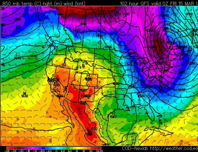
Cool in the Northeast...
As the storm moves east, it will
draw down cooler Canadian air and keep most of the Northeast cool
through the end of the week. Note also how the Southwest looks to be
quite a bit warmer by the end of the week!
Thanks for checking in, have a great week ahead!
Check me out on Twiter @TNelsonWNTV
