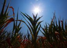
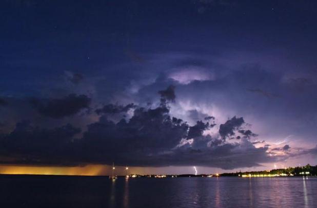
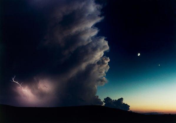
47,577 warm weather records across the USA since January 1. Details from NOAA NCDC below.
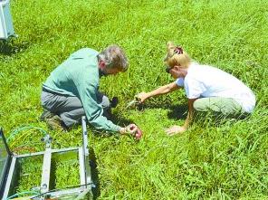
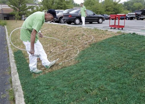
Turf Painting Spreads As Drought Ravages Lawns. Some
residents of Indiana have just given up (on their lawns). It's easier
to spray-paint it green than worry about rain (and mowing). The story
from AP and
Fox 35 Orlando; here's an excerpt: "
INDIANAPOLIS
(AP) - When this summer's drought turned her prized lawn brown, Terri
LoPrimo fought back, but not with sprinklers: She had it painted green,
making her suddenly lush-appearing yard the envy of her neighborhood.
The Staten Island, N.Y., resident and her husband, Ronnie, hired a
local entrepreneur to spruce up their yard by spraying it with a
deep-green organic dye. By Monday, the couple's property was aglow with
newly green blades of grass and no watering needed to sustain it. "It
looks just like a spring lawn, the way it looks after a rain. It's
really gorgeous," said LoPrimo, a 62-year-old retiree. With two-thirds
of the nation covered by a drought that stretches from coast to coast,
residents and businesses in normally well-watered areas are catching on
to the lawn-painting practice employed for years in the West and
Southwest to give luster to faded turf."
Photo credit above: "
Ronnie Sharp, left, and Brandy
Birdwell of Imperial Painting, spray turf paint on a drought ravished
lawn outside a auto repair shop in Indianapolis, Friday, July 20, 2012.
Without cutting the color will last four to six months." (AP Photo/Michael Conroy)
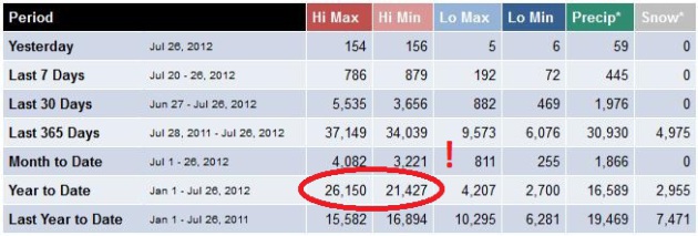
A Record Number Of Records? NOAA NCDC
shows over 26,000 record highs, more than 21,000 record warm nighttime
lows since January 1. That compares with just under 7,000 cold weather
records since the beginning of the year. Good grief.
Watch The Olympics Live On Your Computer. Now
prime-time is 24/7; NBC boldly experimenting with technology that allows
consumers to watch specific Olympic events as they unfold. With
"authentication" (basically proving you have a cable or satellite
subscription) you can watch all events from the London Olympics live.
Click here to get started.
* I have DirecTV, entered my e-mail and password and it worked like a
charm. Kudos to NBC for taking a calculated risk and making events live
to subscribers on their terms
"
The Twin Cities went from having an average of 13 cool summer
days to 9, from 7 dangerously hot days to more than 11, and from 2 heat
waves to 3 each summer." - excerpt of a new, UCS (Union of
Concerned Scientists) paper focused on the frequency and intensity of
heat waves across the Midwest. Details below.
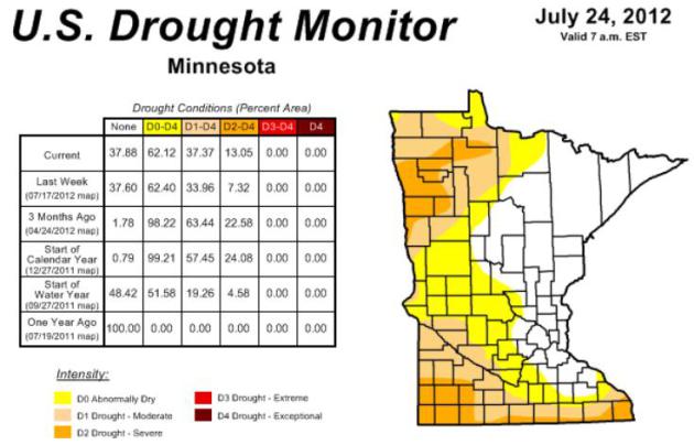
37.37% of Minnesota is in a moderate drought, up
from 33.96% of the state on July 17. Soil moisture is in good shape in
and near the Twin Cities metro north to Duluth. Details below.
13.05% of the state is in a severe drought, up from 7.32% of Minnesota a week ago.
Dual Polarization. The local Twin Cities NWS is
upgrading to "dual pol" on August 20; the radar may be down for as long
as 2 weeks during the upgrade. Details below.
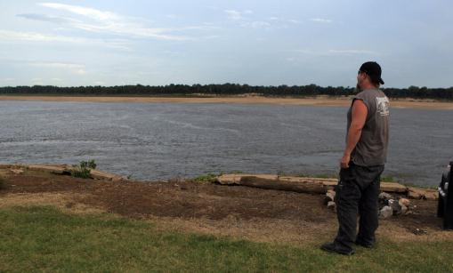
13 feet. The Mississippi River at Memphis is 13 feet
below normal, expected to drop another 2 1/2 feet by late August. Water
levels are down 55 feet from last spring's high water mark during the
spring floods of 2011. Details from theleafchronicle.com below. (AP
Photo/Nikki Boertman)
"
The price of corn has risen by 50 percent, to $8 a bushel, from where it was last month. And a U.S. Department of Agriculture report released today
suggests that consumers can expect to see the price of meat and dairy
products rise as feed for livestock becomes more expensive." - from a Live Science report below. Photo: madison.com.
“
We’ve got the ‘storm of the century’ every year now,” said Bill
Gausman, a senior vice president and a 38-year veteran at the Potomac
Electric Power Company, which took eight days to recover from the June
29 “derecho” storm
that raced from the Midwest to the Eastern Seaboard and knocked out
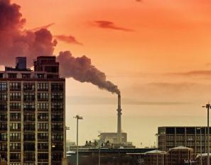
power for 4.3 million people in 10 states and the District of Columbia."
- from a New York Times story on the impact of extreme weather on
America's energy & transportation grid; details below. Photo: NASA.
"
So far, extreme heat is the
easiest to link to global warming after a research initiative led by
the U.S. National Oceanic and Atmospheric Administration and the
British Meteorological Office. "Heatwaves are easier to attribute than
heavy rainfall, and drought is very difficult given evidence for large
droughts in the past," said Gabriele Hegerl of the University of
Edinburgh." - from a Reuters story below.
"
We could only attribute as much as 30% [of the Arctic ice loss]
to the AMO," he said. "Which implies that the rest is due to something
else, and this is most likely going to be man-made global change." - from a story at The Guardian below.
"
Our atmosphere has a natural cooling capacity that keeps our
planet temperate and habitable. We are gumming it up with our
pollution. It's as if we had an expensive car, and we were dumping
wastewater into the radiator, and then ignoring the warning light that
was telling us our engine is overheating." - excerpt of a story from climate scientist Mark Boslough at Huffington Post; details below.
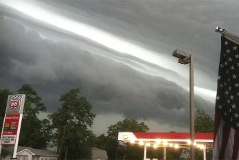
Photos Of Thursday's Severe Storms In The Northeast. Mashable.com
has 10 photos from people in the path of Thursday's violent
straight-line winds (no evidence that it was, in fact, a "derecho).
There were over 300 separate reports of damaging straight-line winds.
Details: "
When thunder and lightning strike, is your first thought
to find shelter — or take out your camera phone? If you answered the
latter, you’re not alone. As the East Coast was hit by an expectedly
severe storm on Thursday — an unusual straight-line windstorm known as a
Derecho — people took to Twitter and Instagram
to document the ominous skies. Some images showed the threatening side
of the storm, which has already cut power to 300,000 residents in the
north-east."
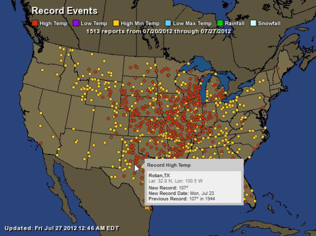
Anatomy Of A Heatwave. 1,513 hot weather records (daytime highs and warm nighttime lows) in just the last week. Interactive map courtesy of
Ham Weather.
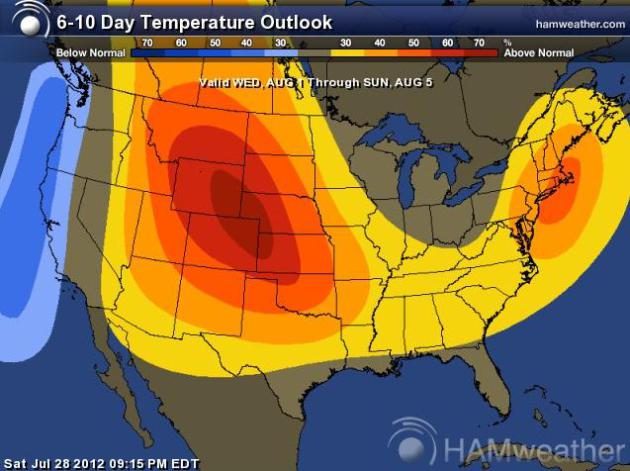
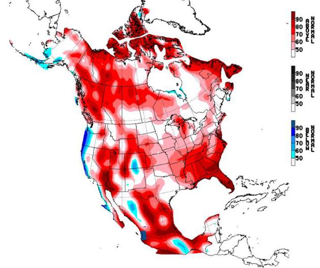
Temperature Anomalies: August 4-10. Long-range
guidance is hinting that the worst of the heat may break over the Plains
and Upper Midwest within 1-2 weeks, the core of the heat wave shifting
into the Mid South and Southeast. Map:
NOAA CPC.
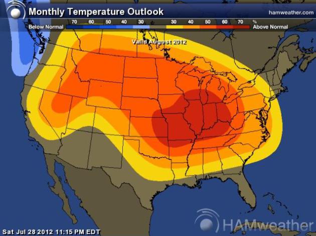
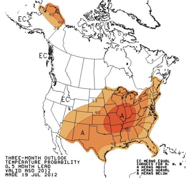
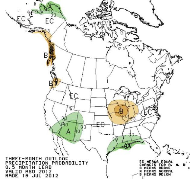
A Warm, Murky Crystal Ball. NOAA's
Climate Prediction Center
(CPC) shows a warm bias lingering for much of the USA east of the
Rockies from August into October, drier than normal conditions predicted
for much of the Midwest.
Drought Worsens Over Minnesota. The rough rule of
thumb during the summer months is 1" of water every week - anything less
and topsoil begins to dry out rapidly, especially when the pattern is
sunny and hot. Although the immediate Twin Cities metro area (and much
of central and northeastern Minnesota) is in pretty good shape from a
soil moisture standpoint, drought conditions are worsening over far
southern and northwestern counties. Last week 33.96% of Minnesota was in
a moderate drought - that has risen to 37.37%. 13% of the state is in a
severe drought, up from 7% last week. Details from the Drought Monitor
here.
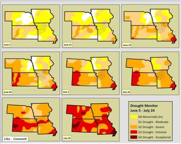
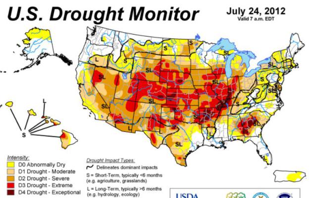
Drought Map Shows Widespread Intensification Over Central United States. Here's an update on the the growing drought from the
U.S. Drought Monitor: "
The
July 24 U.S. Drought Monitor showed widespread intensification of
drought through the middle of the country, according to the National
Drought Mitigation Center at the University of Nebraska-Lincoln. The map
also set a record for the fourth straight week for the area in
moderate drought or worse in the 12-year history of the U.S. Drought
Monitor. The July 24 map put 53.44 percent of the United States and
Puerto Rico in moderate drought or worse, up from 53.17 percent the
week before; 38.11 percent in severe drought or worse, compared with
35.32 a week earlier; 17.2 percent in extreme drought or worse,
compared with 11.32 percent the week before; and 1.99 percent in
exceptional drought, up from .83 percent the preceding week. “We’ve
seen tremendous intensification of drought through Illinois, Iowa,
Missouri, Indiana, Arkansas, Kansa and Nebraska, and into part of
Wyoming and South Dakota in the last week,” said Brian Fuchs, a
climatologist and U.S. Drought Monitor author. “The amount of D3
developing in the country has increased quite a bit for each of the
last several weeks.” Fuchs also noted that as of the July 24 U.S.
Drought Monitor, every state in the country had at least a small area
shown as abnormally dry or worse. “It’s such a broad footprint,” he
said."
Food Prices Could Rise 5 Percent In Next 5 Months. Details from
ABC News; here's an excerpt: "
The
cost of filling grocery carts in America is going up. The U.S.
Department of Agriculture announced today that it is projecting as much
as a 5 percent price hike for some food items over the next nine
months. “Of course I’m concerned,” said shopper Barbara Webb. “I’m
concerned for the people who can’t afford it.” Behind the expensive jump
is the drought, now covering 60 percent of the United States, pushing
up prices for feed that translate into higher prices for beef, pork and
chicken products."
Ongoing Drought Hits Crops Hard.
Live Science has the story - here's the introduction: "
The
drought affecting much of the continental United States — not to
mention the heat and dryness around the globe — has sent corn and wheat
prices skyrocketing, scientists said today (July 25). And the current
weather could be a taste of what to expect in future decades. "Global
warming helps make droughts hotter and drier
than they would be without human influence," said Heidi Cullen, the
chief climatologist for Climate Central, a non-profit organization
dedicated to communicating the science of climate change."
Photo credit above: "
Grain bins are silhouetted against
approaching storm clouds that unfortunately contain very little water
Thursday, July 26, 2012 in Pleasant Plains, Ill. The widest drought to
grip the United States in decades is getting worse with no signs of
abating. This week's U.S. Drought Monitor report highlights that the
drought's severity is rapidly expanding across the nation." (AP Photo/Seth Perlman)
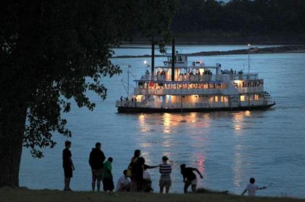
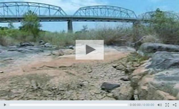
Mississippi River Level Dropping. What a difference a
year makes, a 55 FOOT drop on the Mississippi River at Memphis from the
high-water marks of last spring's flood? Unbelievable. Details from
theleafchronicle.com; here's an excerpt: "
The
Mississippi River’s water level keeps dropping, and the U.S. Army
Corps of Engineers in Memphis said Wednesday it is using survey boats
and dredges to maintain safe navigation. Meanwhile, river barge and tow
boat operators are continuing to lose money as they reduce the amount
of material they can safely carry on the river.The National Weather
Service said Wednesday that drought has dropped the river’s summer
level in Memphis to about 13 feet below normal, and it is forecast to
fall about 2 1/2 feet more by Aug. 22. That would be more than 55 feet
lower than the highest reading taken during last year's near-historic
flood."
Photo credit above: "
In this July 13, 2012 photo, the
Memphis Queen riverboat moves down the Mississippi River in Memphis,
Tenn. A year after nearly record floods, the Mississippi River level has
dropped so low that it's beginning to affect commercial operations.
Port managers worry that their passages to the river could fill up with
silt, and barge operators may have to lighten their loads." AP Photo: Nikki Boertman.
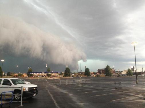
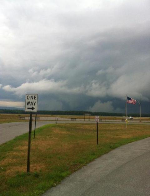
Shelf Cloud. Evidence of potentially violent straight-line winds near Marion, Illinois, courtesy of Mike Leuchtenberg.
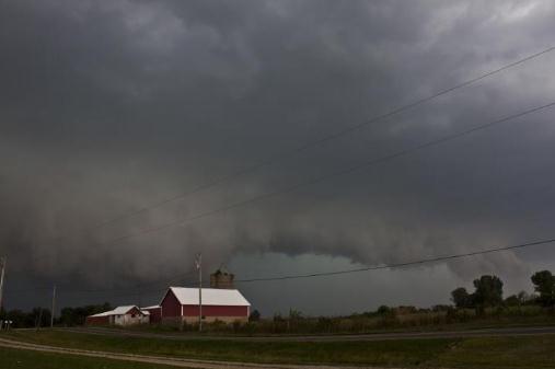
Threatening Sky. Michelle White-Eyman snapped this photo near Mechanicsburg, Ohio. Yep, I'd be heading for the nearest basement right about now.
Thursday Funnel - In New York State? Details via The Albany Examiner and
Facebook: "
Photo
of a wall cloud/possible funnel cloud in Saratoga county, just
northwest of Saratoga Springs around 7 PM this evening…confirmed by NWS
Albany with some weak rotation noted on radar at the time…(Photo by
Sean Organ)"
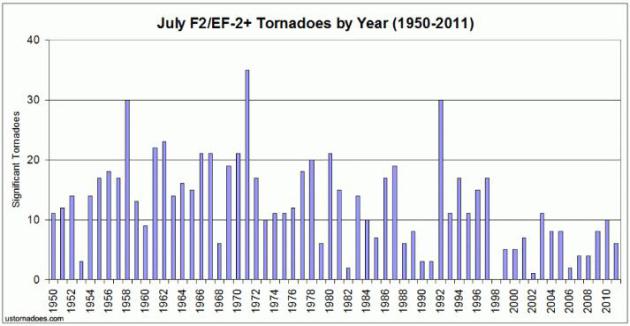
Significant July Tornadoes In The United States. Here are some interesting statistics from
ustornadoes.com: "
July continues the trend in recent months of a smaller ratio of significant tornadoes, or those F2/EF-2 and stronger, to overall tornadoes.
Only 13 percent of the months tornadoes from 1950-2011 reached this
strength. But, as throughout the year, these tornadoes make up in death
and destruction what they lack in numbers."
Farming Changes Can Limit Risk. Here's an timely excerpt of a
New York Times Op-Ed
from Jon Foley, director of the Institute on the Environment at the
University of the Minnesota, where he holds a McKnight Presidential
Chair in global environmental sustainability: "
Droughts happen.
They have happened in the past, and they will happen in the future.
Whether the odds of extreme droughts are changing is still an open
question, but signs point to shifting patterns of climate. No matter
the cause, droughts have a heavy impact on agriculture. This year,
American corn and soybean crops are being crippled by high temperatures
and low rainfall. Only a lucky few farmers will have a decent
harvest. Sadly, much of America’s commodity agriculture is especially
vulnerable to climatic extremes – whether droughts, floods, heat waves
or cold snaps. In particular, it is hard to imagine a system more
susceptible to bad weather than the American corn and soybean belt."
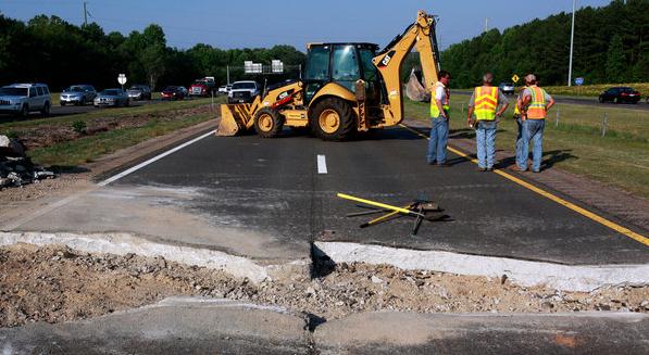
Weather Extremes Leave Parts Of U.S. Grid Buckling. Here's a snippet of a
New York Times article: "
From
highways in Texas to nuclear power plants in Illinois, the concrete,
steel and sophisticated engineering that undergird the nation’s
infrastructure are being taxed to worrisome degrees by heat, drought
and vicious storms....The frequency of extreme weather is up over the
past few years, and people who deal with infrastructure expect that to
continue. Leading climate models suggest that weather-sensitive parts
of the infrastructure will be seeing many more extreme episodes, along
with shifts in weather patterns and rising maximum (and minimum) temperatures."
Photo credit above: Travis Long/The News & Observer, via Associated Press. "
Emergency repairs on a highway that buckled in triple-digit temperatures last month near Cary, N.C."
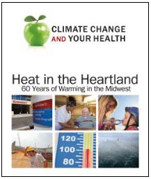
Heat In The Heartland: 60 Years Of Warming In The Midwest. Here's a
new study
released by UCS, the Union of Concerned Scientists, focused on
temperature trends in recent decades. A few highlights of the report: "
Deadly
heat waves have become more common in the Twin Cities because the
city's weather has changed; more hot, dry air masses from the American
Southwest and hot, humid air masses from the Gulf of Mexico and
Caribbean Sea are intruding and settling over the city," said Dr. Larry
Kalkstein, lead report author and University of Miami professor. "During
the past 60 years, these oppressive hot air masses have not only become
more frequent, they have warmed significantly, which can threaten human
health."
"
The Twin Cities went from having an average of 13 cool summer
days to 9, from 7 dangerously hot days to more than 11, and from 2 heat
waves to 3 each summer."
- Heat waves lasting three days or more have become more common
over the last six decades. St. Louis has approximately four more
three-day heat waves each year than it did in the 1940s.
- On average, hot humid days have increased more rapidly in
frequency, while hot dry days have increased in temperature more
rapidly across the Midwest since the 1940s and 1950s.
- The meteorological characteristics of these weather types are
also changing. In general, hot air masses have become hotter and more
humid during nighttime hours.
- In some cities, average nighttime temperatures within some air
mass types have increased as much as 4 to 5 degrees Fahrenheit (˚F)
over the six decades.
- Relief from heat is harder to find—all of the cities studied now have fewer cool, dry days in the summer.
- The results aren’t due solely to an urban heat island effect on
major cities. Less urban neighboring locations showed similar increases
in hot summer air masses.
* an Executive Summary of the UCS report (pdf) is
here.
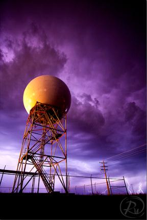
KMPX Upgrading To "Dual Polarization". As of August
20 the Twin Cities Doppler radar (based in Chanhassen) will be out of
commission for 2 weeks while the NWS upgrades to the latest generation
of Doppler: "dual pol".
Details:
"Beginning August 20, 2012, the Doppler radar at your National Weather
Service Forecast Office will undergo an upgrade to incorporate new
technology. While the work is being done, radar data will be unavailable
from NWS Minneapolis! The radar is scheduled to be unavailable for two
weeks during this upgrade. Recently, though, technicians have been
completing the upgrade in 5 to 6 days, and radar data will become
available as soon as the upgrade is complete.
The advantages of "dual pol"?
* Better estimation of total precipitation amounts.
* Better estimation of the size distribution of hydrometeors (raindrops, snowflakes, hailstones, drizzle).
* Much improved ability to identify areas of extremely heavy rainfall that are closely linked with flash floods.
* Improved detection and mitigation of non-weather related radar echoes (chaff, smoke plumes, ground clutter).
* Easier identification of the melting layer (helpful for identifying snow levels in higher terrain).
* Improved ability to classify precipitation type.
Photo above courtesy of Reid Wolcott.
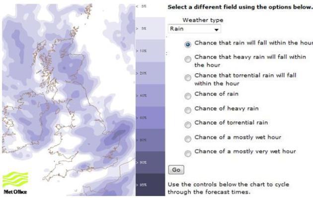
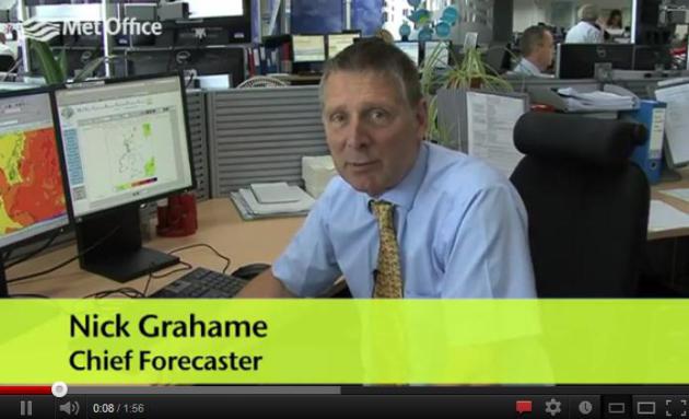
Olympic Weather Update. I love the British accent. Then again, we Yanks may be the ones with accents, come to think of it. Here's a great
YouTube update on expected weather in London, courtesy of the UK Met Office: "
Chief
Forecaster Nick Grahame explains the forecast for the London Olympic
opening ceremony. Keep up to date with the forecast during the Olympics
on our event pages http://www.metoffice.gov.uk/events/olympics."
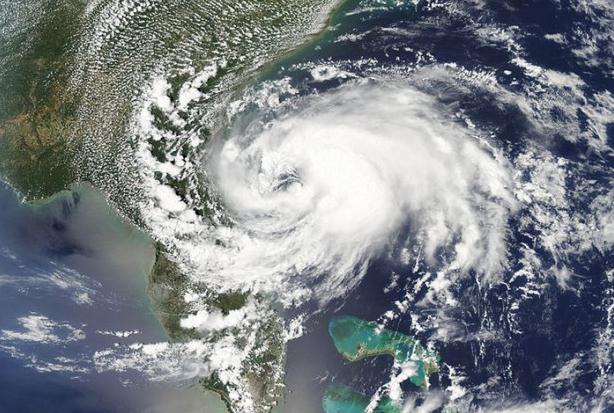
2012 Hurricane Predictions: Tranquil Or Tumultuous? Here's a clip from a story at
redorbit.com: "
The
2012 Atlantic Hurricane Season is now in full swing. However, it has
been fairly light after a vigorous start in May and then a very tranquil
time since then. The biggest reason for the quiet period we are seeing
now has to do with both the placement of the Bermuda High and also the
upper level winds across the Atlantic, which are still a tad
unfavorable for development in the region. The best and most favorable
spots right now are portions of the Gulf of Mexico. When it comes to
making forecasts for hurricanes it can be a very hard task at hand.
Here are a few things that make it hard to forecast for the hurricane
season."
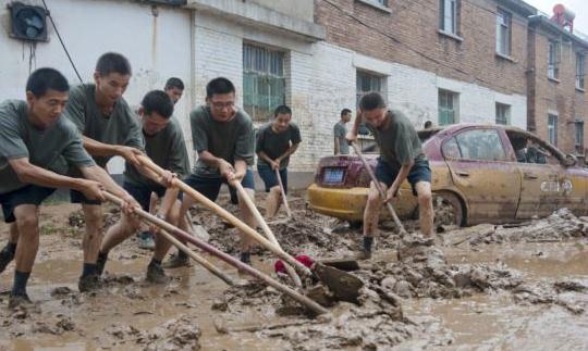
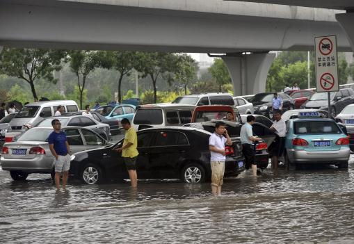
China Government Criticized For Downplaying Floods. Here's an update from
Voice of America: "
Online,
where news of last week’s floods trended high on microblog searches
since Saturday and witnesses posted pictures and videos to detail the
damages, the government’s management of the rains was the subject of
much criticism. “The death toll should have been zero,” one user says
noting that though the government cannot control nature, it is still
possible to warn people in advance, use some precautions, provide
emergency relief and deal with the aftermath properly. “We must not
again use people’s blood to mend the system,” he added. The biggest
rainstorm in 61 years hit China’s capital last Saturday, overwhelming
the city’s drainage system, flooding highways and, in rural areas
around the capital, triggering mudslides and river overflows. Beijing
authorities quickly categorized the flooding as a “natural disaster,” a
definition that is challenged by many users of China’s twitter-like
service Weibo."
Photo credit above: Reuters.
An Epic Downpour Wipes Away A Capital's Sheen. The New York Times has more on China's flooding (debacle)
here.
Photo credit above: "
Drivers and their vehicles are
stranded on a flood road following a heavy rain, in Tianjin, China
Thursday, July 26, 2012. Residents impatient for official updates
compiled their own death tolls Thursday for last weekend's massive
flooding in Beijing and snapped up survival gear following new
forecasts of rain, reflecting deep mistrust of the government's
handling of the disaster." (AP Photo)
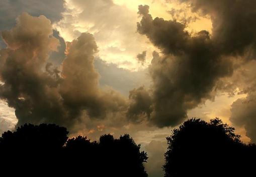
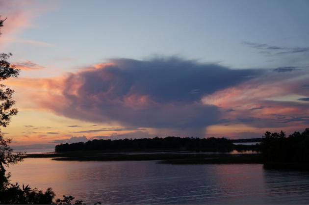
An Ominous Sky. Thanks to Brad Birkholz, who snapped this eerie-looking photo near Neenah, Wisconsin late Wednesday.
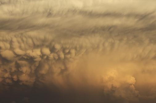
I Want My Mamma. Who writes this crap? Oh, I do.
Sorry. I've run out of photo headline ideas, but thanks go out to Mike
Lachendro, who took this photo of cumulonimbus mammatus on the underside
of a towering thunderhead anvil near Omaha, Nebraska.
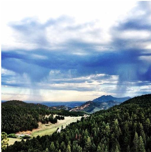
"Isolated Showers". Here's another terrific photo, taken in the Boulder, Colorado area by Jonathan Fields. Very nice.
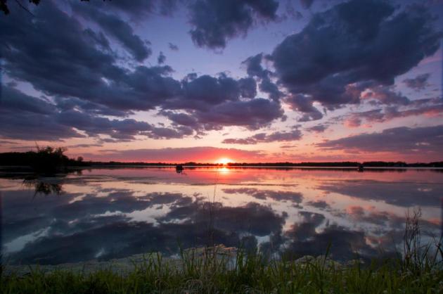
"Ask Paul". Weather-related Q&A
"
Hello Paul and everyone - attached should be a photo from
(Thursday night), looking north from Isle Bay on Mille Lacs Lake. I was
watching a Tyler Perry movie (his latest, really good), glanced over and
wow, ran out to the neighbor's deck for the best shot. Being Up North,
of course, had to make sure the dog didn't get her clock cleaned by a
tomcat that had killed a careless teenage robin in the bushes, and a
half hour later, watching the fading scene again from the house, a
stinky skunk walked under the window, fortunately Herself the Princess
dog was inside. Smelled a bear at the beach this morning too.
Just wanted to pass on some beauty and enjoyment of nature. It's
so easy to get down with the climate changing before our eyes. Keep up
the great work you guys."
Ruthann Nelson
Isle, MN
Ruthann - thanks for a spectacular photo (and I'm glad your dog is
OK). One of the things I love about Minnesota (one of many) is that we
get a free show in the sky every day. I see more (wild) cloud formations
here than any other spot in the USA. I'm amazed how every sky, every
sunset and sunrise, can look so different. "Sky Therapy" can drop your
blood pressure and help you get through a rough week. Appreciate the
note.
Wired For Wall To Wall Coverage. For the first time
ever cable and satellite TV subscribers are able to watch events (live)
online. NBC officials are holding their breath, hoping the real-time
availability of events/outcomes won't spoit the ratings for evening
viewership - it's a grand experiment in this new media world of instant
gratification. More details from
The New York Times (subscription may be required): "
LONDON
— “What we place on the shoulders of Dave each Olympics is enormous
growth,” said Gary Zenkel, the president of NBC Olympics. One year, he
said, there was the transition to high-definition; another year, the
addition of selected online streams. This year, for the first time,
every single event will be live-streamed on NBCOlympics.com,
and a handful will be shown in 3D on a special cable channel. The
volume of video — roughly 325 hours’ worth a day — must be carried to
the United States on a complex series of circuits that are diagramed on
a wall in NBC’s work space. “We call this the subway map,” Mazza said
proudly."
London: Cool And Partly-Soggy. After a spell of 80s
earlier this week more typical U.K. weather returns, just in time for
the Summer Olympics. Significant rain is expected Sunday (highs from
68-70 F). The sun makes a cameo appearance Monday and Tuesday before
more showers the latter half of the week. Excessive heat will not be an
issue for athletes or fans the next 7-10 days.
Has The iPhone 5 Been Smuggled Out Of The Factory Already? Pure rumor and conjecture - but Apple fanboys are hanging on every juicy nugget. Details from
Gizmodo: "
A Chinese case manufacturer is showing what looks to be an iPhone 5 in their product shots. It looks like the white 3D prototype
we published a while back—complete with its new 19-pin dock port. But
could this really be a unit smuggled out of Foxconn's factory?"
Maybe it is
"
The possibility is certainly there. After all, it wouldn't be
the first time that someone got their hands on an unreleased iPhone
model smuggled out of a factory."
"Twapple?" Apple Officials Said To Consider Stake In Twitter.
No, they're not really thinking of changing the name to Twapple. I just
wanted to see if you were paying attention. Apple taking a major stake
in Twitter? Very possibly, according to a story at
The New York Times (subscription may be required): "
Apple, which has stumbled in its efforts to get into social media, has talked with Twitter
in recent months about making a strategic investment in it, according
to people briefed on the matter. While Apple has been hugely
successful in selling phones and tablets, it has little traction in
social networking, which has become a major engine of activity on the
Web and on mobile devices. Social media are increasingly influencing
how people spend their time and money — an important consideration for
Apple, which also sells applications, games, music and movies."
TV Weather: Stormed By Multimedia. Many consumers,
especially younger people, are getting the bulk of their information
(including weather) on smart phones. Here's an excerpt of an
interesting article from Jim Willi at AR&D, Audience Research and Development: "
For
years, AR&D has been advising client TV stations to be multiple
platform news and information providers. Now, a recent online survey
shows that what is thought to be the last big driver of local TV
newscast viewing – the weather – is also being stormed by a multitude
of media. In fact, this survey in an East Coast market shows that the
number one source on normal weather days – is no choice. Fully one
quarter of all respondents answered “None/Don”t Know” when asked the
source they turn to during calm weather days. But perhaps more surprising was the #2 source – 22% said it was their smartphone or mobile device.
The favorite TV newscast in the market limped in 3rd receiving 14% of
the votes. This is a TV station with a 40-plus preference. The fourth
choice on normal weather days was Weather.com at 13%. The second
favorite TV station received only 6% of the votes for normal weather
days."
6 Tips To Sell Your Car. I know this is random (but
what isn't these days?) I have an old 1985 convertible I'm thinking of
selling, and I stumbled on a timely article from
beatthetraffic.com with some pretty good advice. Here's an excerpt:
"You decided to sell your car? Here are 6 simple tips that will help you turn your used car into cash.
- Know the market. Price your car competitively. Use Edmunds Appraisal tool or Kelley Blue Book to determine the fair value of your car. Ask for slightly more money than you are actually willing to accept.
- Evaluate your car.
Take it to a mechanic for a thorough inspection. If you choose to get
the car inspected first and disclose the findings, you’re being honest
and upfront.
- Give your car “curb appeal” by cleaning and detailing it."
Danish MECc EV Project Promises 500 Mile Range And "Refuel" Time Of Less Than Three Minutes. Breakthroughs with electrical vehicles (EV's) are coming fast and furious, as reported by
gizmag.com: "
A
collaborative project involving ECOmove, Insero E-Mobility and
Serenergy is aiming to produce a fuel cell range extender for battery
electric vehicles (BEVs) that should boost the distance between charges
to at least 497 miles (800 km). The first vehicle to receive the new
bio-methanol-based Modular Energy Carrier concept (MECc) cells will be
the QBEAK car we featured yesterday."
* photo above courtesy of the Key West, Florida office of the National Weather Service.
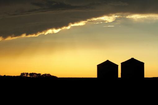
Summer to Remember
This is the summer where 80 F. became a "cool
front". It's felt like a Washington D.C. summer. D.C. was built on
swampland neither Virginia or Maryland wanted - some things never
change.
"This is just like an Atlanta summer" said Ham Weather developer Lee Huffman, shaking his head in wonder.
1602 warm weather records in the last week,
nationwide. 2012: 26,150 high temperature records, 21,427 records for
warmest nights; many of these records going back well over a century.
New research suggests that droughts may increase the chance of record warmth; the two obviously go hand in hand.
Minnesota's Red River Valley is running an 8
inch rainfall deficit, closer to 4-6" near the Iowa border. That's a bit
misleading, because during a drought soil becomes hard - almost
impenetrable. Most rain from T-storms runs off into streets and streams;
it doesn't sink into topsoil where it's needed.
Shocking news: another hot front is approaching,
capable of a few T-storms tonight. We top 90 F. Sunday; mid-90s
possible next midweek. Deja vu, all over again.
So, one more steamy, 90-degree week is shaping up - but long range guidance shows a REAL cool front after August 5.
We can only hope.
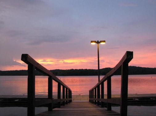
* photo above courtesy of Danny Kurily.
Climate Stories...
U.S. Drought Linked To Climate Change. Here's an excerpt of an article (and video) at
VOA, the Voice of America: " ...
James Bradbury, a climate scientist with the World Resources Institute, a global environmental think tank, explains that La Nina,
a natural weather pattern that periodically cools the Pacific Ocean,
helped trigger the drought by bringing warmer, dryer weather to the
American South, which has been hardest hit by the drought. “Time will
tell the extent to which rising temperatures and global climate change
contributed to this specific event and the severity of it," Bradbury
says. "I think there is a good likelihood that the temperatures that
we’re seeing and the heat wave that we’re seeing is all consistent with
a warmer world, that that's exacerbating these drought conditions."
Deny This: Contested Himalayan Glaciers Really Are Melting, And Doing So At A Rapid Pace - Kind Of Like Climate Change. Here's an excerpt from a blog post at
Scientific American: "
Remember when climate change contrarians professed outrage over a few errors
in the UN Intergovernmental Panel on Climate Change’s last report? One
of their favorite such mistakes involved an overestimation of the pace
at which glaciers would melt at the “Third Pole,” where the Indian
subcontinent crashes into Asia. Some contrarians back in 2010 proceeded
to deny that the glaciers of the Himalayas and associated mountain
ranges were melting at all. But now, using satellites and on-the-ground
surveys, scientists note that 82 glaciers in the Tibetan Plateau are
retreating, 15 glaciers have dwindled in mass, and 7,090 glaciers have shrunk in size."
Image above: NASA Earth Observatory.
Climate Change And Capitalism. Here's a snippet of an insightful story from climate scientist Lou Grinzo at the web site:
theenergycollective.com: "
....As
I’ve pointed out many times here, this notion that near zero
government intervention in markets is some sort of capitalist nirvana is
laughable; it’s nothing of the sort, as it would lead not to an
economy that hums along efficiently, delivering the needed and desired
goods and services, but one in which increasing concentrations of power
— far worse than what today’s already excessive situation — would lead
to monopolistic pricing (that’s higher) and all manner of abusive
market practices that further enrich large corporations at the expense
of small companies and individual consumers. It would not be nirvana,
but dog-eat-dog anarchy, with some of the biggest and hungriest dogs in
the fray being the fossil fuel companies. The only way we avoid that
nightmarish scenario and have the kind of economy consumers want is via
effective government intervention, in the form of laws and regulations
that prevent practices that are not in the best interest of the public
at large."
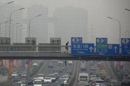
Analysis: Evidence For Climate Extremes, Costs, Gets More Local.
Reuters has the story - here's a clip: "
Scientists
are finding evidence that man-made climate change has raised the risks
of individual weather events, such as floods or heatwaves, marking a
big step towards pinpointing local costs and ways to adapt to freak
conditions. "We're seeing
a great deal of progress in attributing a human fingerprint to the
probability of particular events or series of events," said Christopher
Field, co-chairman of a U.N. report due in 2014 about the impacts of
climate change. Experts have long blamed
a build-up of greenhouse gas emissions for raising worldwide
temperatures and causing desertification, floods, droughts, heatwaves,
more powerful storms and rising sea levels."
Photo credit above: "
A pedestrian walks across a bridge above a main road on a day with high air pollution in Beijing June 6, 2012." Credit: Reuters/David Gray.
Hope On Climate Change: Young Evangelicals For Climate Action. Here's a snippet of an Op-Ed from Rev. Jim Ball at
Huffington Post: "
Extreme
drought. Extreme heat. Freakish storms with names I've never heard
of -- a "derecho" -- that knock out power for millions, leaving us
sweltering. If you want to know what living with climate change looks
like, look outside or keep abreast of current events. And as
temperatures continue to rise, things will get worse. Global emissions
need to peak during the next presidential term, yet neither candidate
is talking about what they will do to address the greatest moral
challenge of our time. Into this leadership vacuum steps a group of
young people -- young evangelicals to be more precise: Young Evangelicals for Climate Action or Y.E.C.A."
The Right To Radiate. Here's an excerpt of a
Huffington Post piece from climate scientist Mark Boslough: "
One
of the barriers to finding solutions to global warming is the
insistence of political conservatives and libertarians that their right
to burn as much fossil fuel as they want cannot be regulated. Since
nobody "owns" the atmosphere, we have always treated it as an open sewer
for our tailpipe and smokestack emissions. The sky seems infinite.
Carbon dioxide is odorless and colorless. Who is it hurting, and what
can they do about it? Would conservatives and libertarians have a
different opinion if they understood physics and realized that their
property rights were being taken without due process or just
compensation? There is a strong conservative/liberal split in acceptance
of the reality of human-caused global warming among the general
population with limited levels of scientific literacy. But within the
serious scientific community this political divide doesn't exist. There
is overwhelming agreement among scientists of all ideological stripes
that most, if not all, of the rapid heating is attributable to
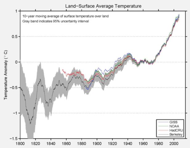
greenhouse gas pollution."
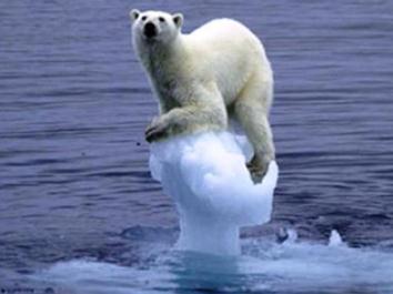
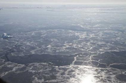
Loss Of Arctic Sea Ice "70% Man-Made". The Guardian has more details: "
The radical decline in sea ice around the Arctic is at least 70% due to human-induced climate change,
according to a new study, and may even be up to 95% down to humans –
rather higher than scientists had previously thought. The loss of ice
around the Arctic has adverse effects on wildlife and also opens up new
northern sea routes and opportunities to drill for oil and gas under
the newly accessible sea bed. The reduction has been accelerating since the 1990s
and many scientists believe the Arctic may become ice-free in the
summers later this century, possibly as early as the late 2020s." (photo: Jefferson Beck, NASA).
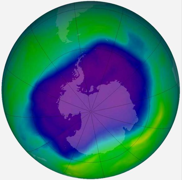
Summer Storms To Create New Ozone Holes As Earth Warms? This was a bit of a head-scratcher, but check out the
National Geographic article and try to connect the dots; here's an excerpt: "
Summer storms may create new holes in our protective ozone layer
as Earth heats up—bringing increased solar ultraviolet radiation to
densely populated areas, a new study says. What's more, if more sunlight
reaches Earth, skin cancer could become the new marquee risk of global warming. As the planet warms, some studies have suggested summer storms may become more frequent and intense. This would send more water vapor—a potent greenhouse gas—into
the stratosphere, the middle layer of Earth's atmosphere, which sits
between 9 and 22 miles (14 and 35 kilometers) above Earth's surface."
Photo credit above: "
A thunderstorm rumbles through Kansas (file picture)." Photograph by Joel Sartore, National Geographic
The Story Behind Record Ice Loss In Greenland. Here's a snippet of a
Climate Central story from meteorologist Andrew Freedman: "...
William Colgan, a research associate at the Cooperative Institute for Research in Environmental Sciences
at the University of Colorado, said the July melt event is extremely
rare, but not completely unheard of. He said an analysis of ice core
records from Greenland Summit station, which at 2 miles above sea level
is near the highest point on the ice sheet, shows that the high
elevation areas of Greenland have experienced melt about once every 150
years during the past 10,000 years. However, such a widespread melt
event is unprecedented in the observational record, which dates back to
about 1930."
Map credit above: "
In this chart you can see that a very
strong area of high pressure (in red shading surrounding Greenland) set
up shop over Greenland during July, providing warmer than average air
temperatures and clear skies to enhance surface melting." Credit: NOAA via Joe Witte.
A Carbon Tax Is More Viable Than Cap And Trade. Here's an excerpt from
theenergycollective.com: "
Pricing carbon
is the cornerstone of a blueprint to contain climate change as it
would provide both incentives and disincentives to reduce emissions. It
would also drive investment and research dollars into renewable energy
and efficiency. The best thing that governments can do to reduce
emissions is to implement a cap and trade scheme or failing that, a
carbon tax. Creating carbon markets is among the most expedient ways to
address climate change. Cap and trade rewards efficiency and punishes
polluters. It would also increase green jobs, lower electricity bills,
enhance competitiveness, and forestall a climate catastrophe."