61 F. predicted high for Saturday. Last 60+ day of 2011? A distinct possibility.

                    OLD CITY         SNOWFALL(IN)   RECORD/YEAR

WAUSAU                3.2                3.0       1896 & 1948
RHINELANDER           8.9                2.6          1926
Wisconsin Dumping. A band of 6 to 9 inches fell from the Waupaca area to Florence, Wisconsin. The highest amount measured by an official NWS observer was 9.2 inches near Long Lake in Florence County.
Preparations
- Make sure your vehicle is ready for the season. Throughout the winter, keep your gas tank at least half-full to avoid gas line freeze
- Carry a winter storm survival kit. The typical kit should include a large coffee can with plastic lid. Inside the can, pack high energy foods, spare batteries for a flashlight, a red bandana or cloth to tie on the antenna, and candles/matches/metal cup to melt snow for drinking water.
- Other bulky or heavy items which should be in the vehicle include a shovel, jumper cables, a bag of sand or salt for traction, basic tools, blankets or sleeping bags, a tow cable or chain, a flashlight, a first aid kit, and extra clothing
- Consider keeping a cell phone. If you dial 911 from a cell phone, remember that the dispatcher may not know your location, so you must provide it to them. However, most new cell phones do have GPS capability.
- Before increasing your speed, get a feel for the traction. Remember that bridges and overpasses can be more slippery than other parts of the road. Do not brake suddenly. If you have anti-lock brakes, apply steady and firm pressure to the pedal. Do not pump anti-lock brakes
- If you begin to skid, remain calm. Ease your foot off of the gas and turn the wheel in the direction you want the front of the car to go
- When driving near snowplows, remember: Stay Back, Stay Alive. Reduce your speed. Never drive into a snow cloud. An average snowplow weighs 17 times more than an average car. If you are in a collision with a snowplow, you will lose. Be patient; follow eight seconds behind snowplows.
- Check the latest weather information as you drive
- If severe winter weather is expected, consider postponing travel
- Avoid traveling alone during a winter storm
- Always fill the gas tank before entering open country, even for a short distance
- Stock your vehicle with a winter storm safety kit
- If the storm begins to be too much for you to handle, seek refuge
- Stay in your vehicle. Do not attempt to walk in a winter storm. You can easily become lost and disoriented in blowing and drifting snow. Staying in your car decreases your risk of frostbite and increases the chance of being rescued. make your vehicle visible to rescuers
- Beware of carbon monoxide. Run the engine a few minutes every hour, or every half hour in extreme cold. Keep one window slightly open. Make sure that snow does not block the exhaust pipe
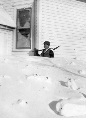
"I was living in Belle Plaine, Minn. There was no warning of the impending blizzard. Duck hunters were in their glory to have such a nice day. Cows were still grazing the local pastures."
- Donna Heath
"We got some ducks that day and about 9 a.m. we noticed it getting colder very fast. A strong wind started to blow from the northwest and heavy clouds moved in. We weren't dressed for cold weather so we started home. By the time we started to walk the half-mile to our home a freezing rain froze to our clothes and guns."
- Harold Kick
"The family, all six of us, got into the car and headed for my uncle's. Almost as soon as we left home, the sun went under the clouds, the wind started blowing, and the snow came down. It started so suddenly it took us all by surprise, but my dad kept driving. It got worse and worse."
- Ella Mae (Russell) Caroon
"Two flat bed trucks with crates to hold 500 live turkeys were to pick up our turkeys on Nov. 11. Because of the storm, the trucks never came."
- Stanley Teeman
"I was staying with my grandparents ... when the temperature suddenly dropped, and the snow began to pile up, my parents decided they had better drive the four miles to pick me up. After my father picked me up and we were headed back [home], the car got stuck in a snowdrift about one and a half miles from my grandparents' home. My father ... started to walk back to Norwood, carrying me in his left arm."
- JoAnn Mueller Trampe
* You can read more remarkable stories from Armistice Day survivors in the Pine City Pioneer.
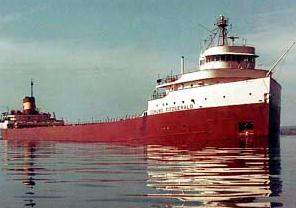
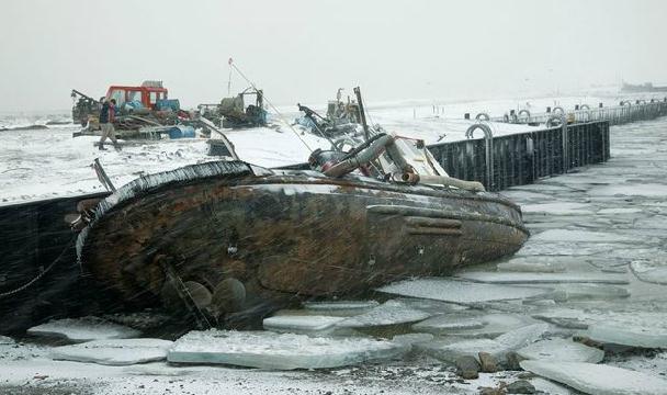
Originally the forecast for Nov. 9-10 was to be windier than normal, but after the Fitzgerald left port, heading from Superior, WI to Detroit, MI, the forecast was upgraded to a gale warning, then eventually a storm warning. Another ship, the Anderson, joined the Fitz on a similar route, heading to Gary, IN. After the ships parted ways, both captains changed course to head on a northerly track to avoid the storm. The Anderson lost contact with the Fitzgerald around 7:15 pm on November, 10th. It sank with all 29 men on board.
NOAA has a good overview of the meteorological events leading up to the disaster here.
Here is another paper, "Reexamination of the 9-10 November 1975 "Edmund Fitzgerald" Storm Using Today's Technology".
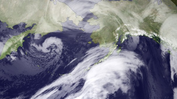
* Alaska "Snowicane". The Washington Post has more on the unusually severe storm that lashed Alaska. "A storm of historic intensity continues to pound the west coast of Alaska today. Twice the size of Texas, the storm is as deep as a category 3 hurricane. The National Weather Service is calling it a “life-threatening epic storm” due to its dangerous combination of towering waves (observed at 40 feet in the Bering Sea), winds over 100 mph, storm surge flooding, and blinding snow. The storm’s central pressure bottomed out at 943 mb this morning, comparable to the minimum pressure (942 mb) of hurricane Irene, which caused billions in damage along the East Coast in late August. From this point forward, the storm - essentially a snow hurricane (or snowicane) - is forecast to slowly weaken, but will continue battering the region into tonight."

Photo credit above: "Storm chasers caught up with one tornado during the Oklahoma outbreak.
Credit: Tornadovideosdotnet/YouTube"
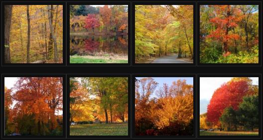
"In the second week of November 2011, the nature puts on a stunning and brilliant show of autumn colors in New Jersey, forest lights up with color, the leaves burst into romantic flames of reds, oranges, yellows, gold and blended combinations. It is a magical time of year with fantastic experience in New Jersey. I went out walking on the streets in Holmdel, New Jersey to enjoy the spectacular spectrum of autumn colors play out on nature’s grandest stages. It is nature and landscape photographer’s dream and prompted me to take several pictures along the streets. I have updated my Travelogue web page on “Autumn Foliage in Garden State” by adding several new pictures taken in last couple days in Holmdel. In the cloud, ready for slide show."
Winter Premonitions
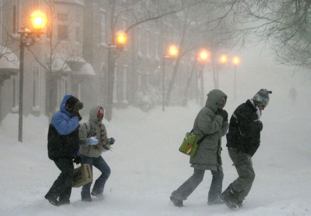
Most of us know how to drive in snow. It's not the snow I worry about - it's glaze ice. I've been telling people for years: all snowstorms are not created equal. 1" snow falling at 10 degrees is FAR more icy and dangerous than 6" snow falling at 25 F, when sand and chemicals can keep highway surfaces wet and slushy. Consider a winter survival kit; keep your gas tank at least 1/2 full to avoid gas line freeze. And keep a respectful distance from plows, which weigh 17 times more than the average vehicle.
Climate Stories...
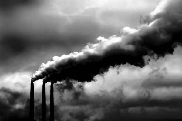
Greenhouse Gas Index Shows Sharp Increase. Details from the Miami Herald: "Greenhouse gases are building at a steep rate in the atmosphere, the nation's top climate agency reported, renewing concern that global warming may be accelerating. The National Oceanic and Atmospheric Administration's Annual Greenhouse Gas Index, which indexes the key gases known to trap heat in the Earth's atmosphere, rose 1.5 percent from 2009 to 2010, the agency reported. The reported rise came on top of an analysis by the Energy Department last week that said global emissions of carbon dioxide, a key, long-lived greenhouse gas, jumped in 2010 by the biggest increment on record. The figures showed a 6 percent increase from the year before, a steeper rise than worst-case scenarios that were laid out by climate experts four years earlier. The Annual Greenhouse Gas Index number, by contrast, looks small, but has big impact. The index is a measure of the combined heating effect of the top greenhouse gases during their life spans as the gases float around in the atmosphere. The number increased from 1.27 in 2009 to 1.29 in 2010. Since the index started in 1990, which the NOAA team chose as a baseline, the increase has been 29 percent." Photo credit: realclearenergy.org.
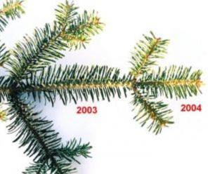
Forests Advance With Warming Climate. UPI.com has the story: "Evergreen trees at the edge of Alaska's tundra are growing faster, suggesting forests may be reacting and adapting to rapidly warming climate, researchers say. Scientists from Columbia University's Lamont-Doherty Earth Observatory said while forests elsewhere are thinning from wildfires, insect damage and droughts partially attributed to global warming, some white spruce trees in the far north of Alaska have grown more vigorously in the last hundred years, especially since 1950. "I was expecting to see trees stressed from the warmer temperatures," study lead author Laia Andreu-Hayles said. "What we found was a surprise."
Science Controversies Past And Present. Here's a fascinating paper (pdf) from Steven Sherwood, at the Climate Change Research Center at the University of New South Wales in Australia, that tracks the evolution of scientific skepticism over hundreds of years, paradigm shifts, backlash and politicization of science - a long but worthy read.