Happy Mother's Day
Our
cool and wet spring has certainly delayed Mother Nature from coming back
to life this May, but if you look closely, you can see a lot of
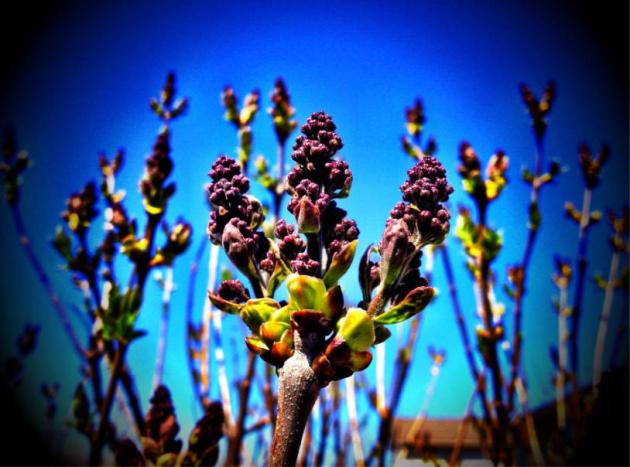
activity now in trees/plants/flowers near you! Here's a lovely lilac
bush that is showing spring buds/blooms now. Too bad they weren't in
bloom now, Mom could have had some home grown flowers!
Cold and Windy MN Fishing Opener
Only
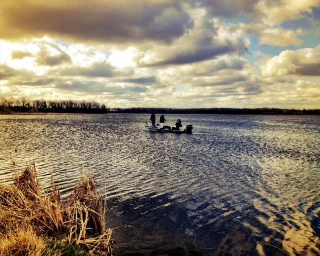
the bravest/hardiest were out yesterday on MN lakes (that weren't still
ice covered). Here's a picture from Sheena Nelson from a smaller lake
near Buffalo, MN (prior to the wind becoming annoyingly wild). There
were big white caps on most lakes/rivers by the afternoon with winds
gusting up close to 40mph!
From Frost to 80s and 90s in a Matter of Days!
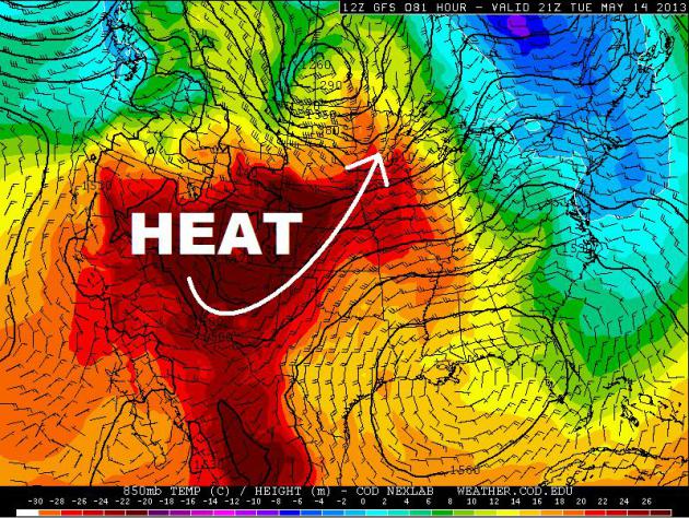
Folks
across the Midwest will go from patchy frost and freeze conditions
Sunday morning to 80s and 90s by Tuesday as a summer-like warm front
blows into town. My hunch is that your neighbors and colleagues will be
itching to say that it's too hot outside! Who will be the first one to
mention it? I've got $20 on Paul Douglas... Just kidding! :)
Summer-like Tuesday!
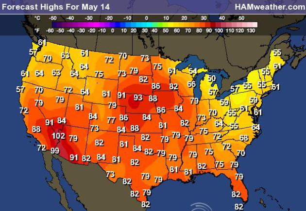
A warm
front will blow into town early this week with 80s and 90s not far
behind. Take a look at highs in the middle part of the country by
Tuesday. Get those shorts, t-shirts and flip-flops ready!
Precipitation Outlook
It
appears that there aren't any waterlogged storm systems in the near
future. Other than some heavier moisture in the extreme Northwest,
Northeast and South, the middle part of the country looks mostly dry
over the next few days.
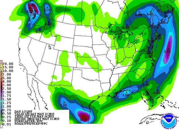
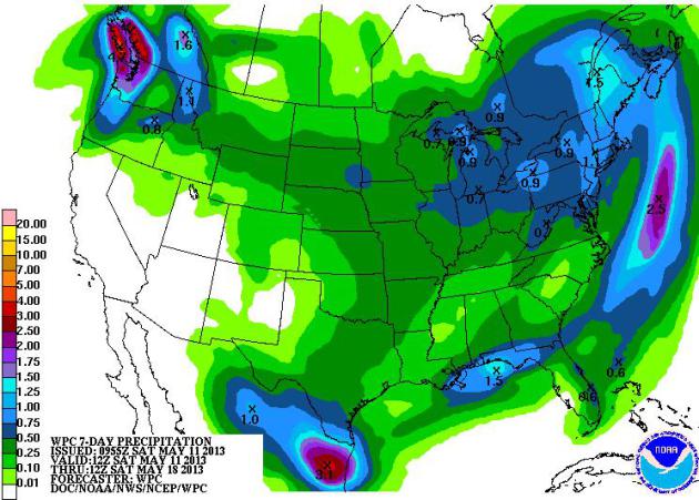
Precipitation
over the next week still looks a bit marginal through the middle part
of the country. Keep in mind that with the warm-up expected, some of the
moisture in the middle part of the country will be of the convective
nature, meaning some thunderstorm potential!
Severe Thunderstorm Potential
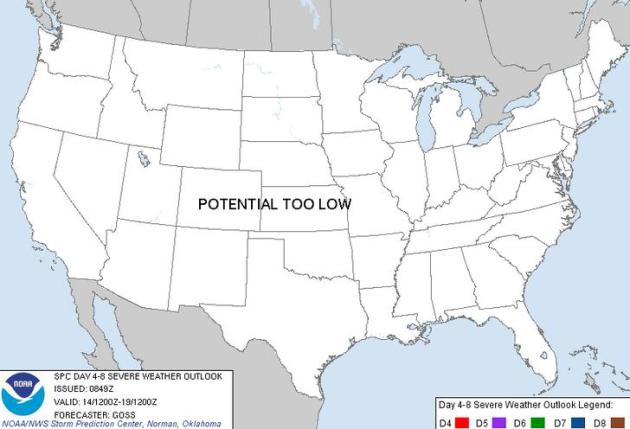
Even
though a little thunder is in the forecast, over the next several days
it still appears that a majority of the thunder activity will stay under
severe limits with an exception here or there.
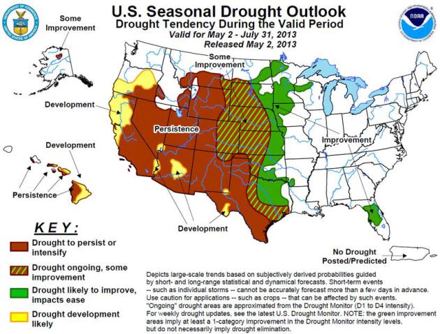
U.S. Drought Outlook
This
product comes from NOAA's Climate Prediction Center. It suggests that
the west will continue drought conditions, while there appears to be
some improvement in the middle part of the country.
"Latest Seasonal Assessment -
The Drought Outlook for May 2 - July 31, 2013 is based primarily on
short-, medium-, and long-range forecasts, initial conditions, and
climatology. Several inches of rain fell in the past two weeks across
portions of the Carolinas, Georgia, and parts of Florida eliminating
some of the remaining areas of drought. Improvement is indicated for
the continuing drought area in north-central Florida due to short-term
rainfall and the approaching onset of the rainy season. Improvement is
forecast across the upper Mississippi Valley and the lower Plains,
due to frontal activity and/or the seasonal upswing in nocturnal
thunderstorm activity. Limited drought improvement is anticipated
over much of the High Plains. Drought is forecast to either develop or
persist across the western contiguous U.S. as this region enters its
dry season. Some improvement is expected for the drought area across
northern Alaska, while areas of persistence and development of drought
are anticipated for the Hawaiian Islands."
Thanks for checking in, have a great rest of your weekend and week ahead!
Don't forget to follow me on Twitter @TNelsonWNTV
