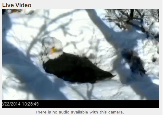
Thanks to the MNDNR for this live camera of a Bald Eagle that is currently sitting on Bald Eagle eggs in a nest! Thanks to the recent snowstorm, the nest is covered in white!.
See the LIVE feed HERE:
Eagle Insight
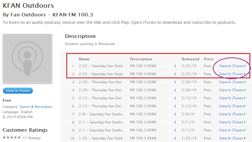
I had a chance to listen in on KFAN's FAN Outdoors radio show Saturday morning and one of their very knowledgeable guests, Naturalist Stan Tekiela (Twitter: @StanTekiela), talked about the eagles in great details at the end of the first hour. Check out the Podcast from Saturday, February 22nd, 2014 HERE: Not only is Stan an expert on eagles, but he seems to be an outdoor encyclopedia!
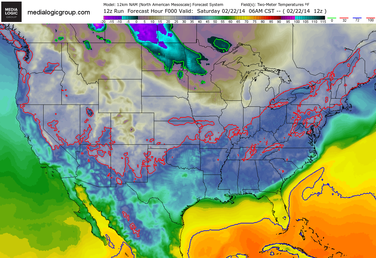
Cold Weather Returns
Looks at all the Arctic colors moving back in across the Lower 48. This forecast temperature loop brings us into early next week with the coldest of the cold from the High Plains to the Great Lakes Region. Keep in mind that much of the eastern two-thirds of the nation will be colder than average as head into next week.
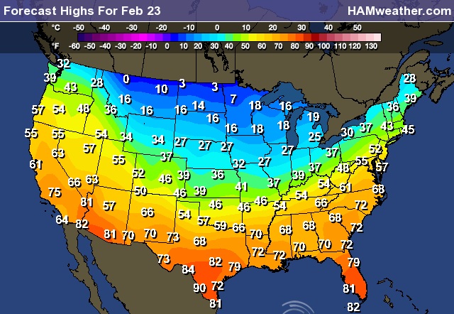
Temperature Breakdown
Here's a look at Arctic plunge through the week ahead. Sunday appears to be quite chilly, but look at how cold it will be by Thursday!
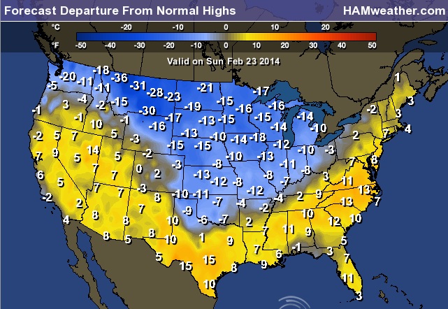
Sunday Highs
Sunday Highs From Normal
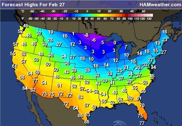
Thursday Highs
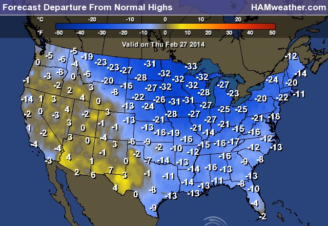
Thursday Highs From Normal
Continued Cold Through Early March
After the big snow and severe weather event we had late last week, temperatures across the eastern two-thirds of the nation look to take a nosedive through the early part of March. Here's the outlook from NOAA's Climate Prediction Center.

Weather Outlook
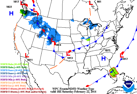
The weather outlook into early next week looks fairly quiet compared to what we ended last week with. As cold air spreads throughout the eastern two-thirds of the nation, clipper systems will make a comeback. Note the snow spreading into the Midwest from the Northwest. This will likely bring some light snow accumulations along its path.
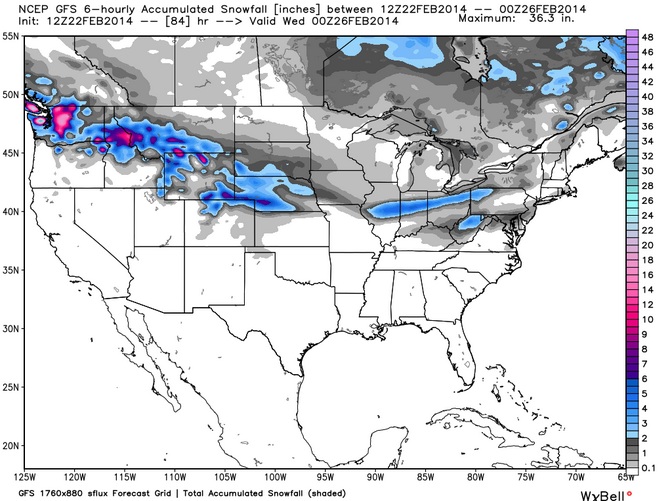
Snow Potential
Here's the snowfall potential through early next week as our next clipper system crosses the country. Note that snowfall amounts look much heavier in the Northwest than they do in the eastern part of the country. However, note the snow streak over across the Central Plains. Shovelable to Plowable snow is looking more and more likely for some folks there.
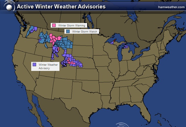
Winter Weather Headlines
The National Weather Service has issued winter weather headlines for areas shaded in color below. Mountain snow could near +12" by early next week, while snow in the Central Plains could near 6" by early next week.
Keep an eye on latest watches and warning from the National Weather Service HERE:
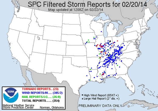
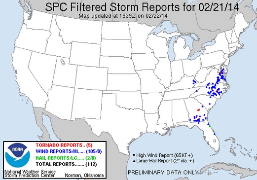
Recent Severe Outbreak
According to NOAA's Storm Prediction Center, there were 23 PRELIMINARY tornado reports on Thursday and 5 on Friday. Here are all the reports from that multi-day severe weather outbreak.
Thursday
One of the tornadoes in Missouri caused some injuries as a mobile home was overturned onto a vehicle in the town of Pemiscot, MO. There was also 1 fatality in Ringgold, IA as a strong wind gust blew over a 30ft. conveyor belt
Friday
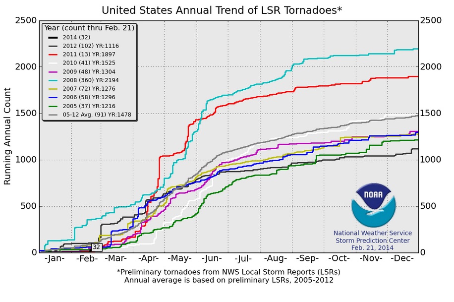
2014 Tornado Count
According to NOAA Storm Prediction Center, there have been 32 PRELIMINARY tornado reports so far in 2014. According to the 2005 to 2012 average, we are below average to date, which is 91. Note that getting off to a slow start doesn't always mean a quiet year. Take a look at 2011, through February 21st, there had only been 13 tornadoes, but the year ended up with nearly 1900 tornadoes!
Thanks for checking in and enjoy the rest of your weekend!
Don't forget to follow me on Twitter @TNelsonWNTV