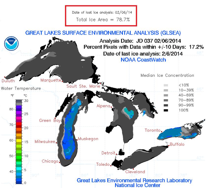
This is pretty impressive... As of February 6th, the Great Lakes ice coverage was nearing nearly 80%!
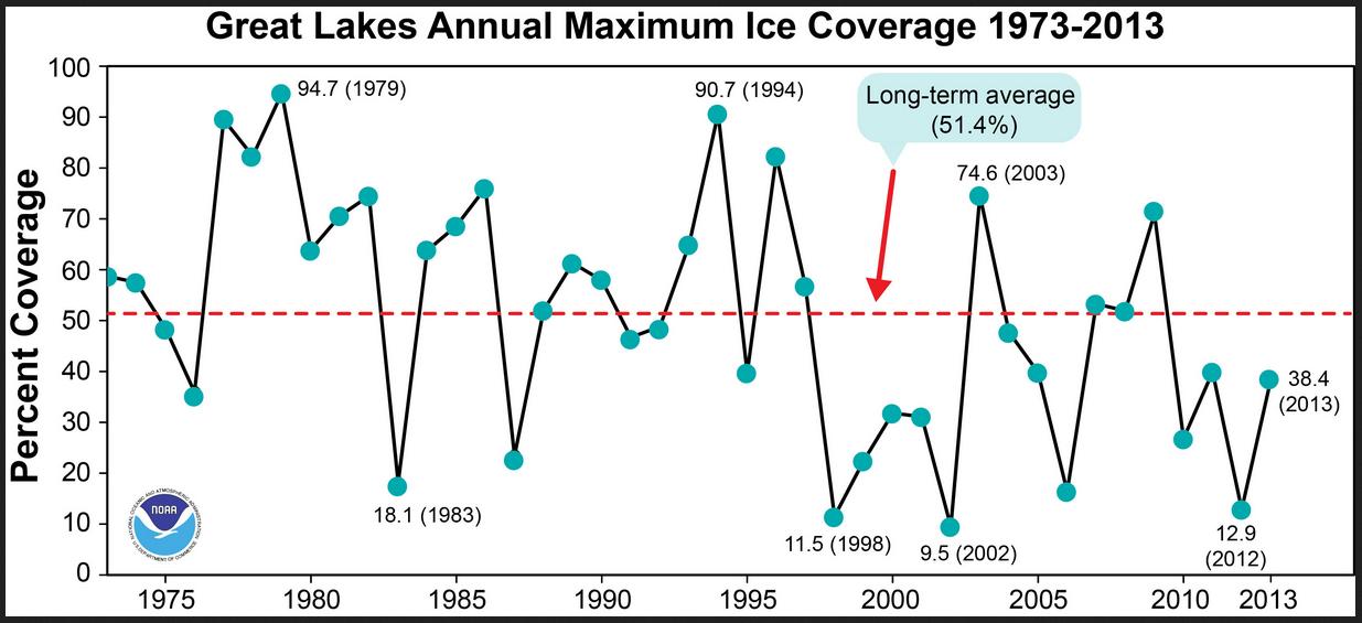
Here's an interesting graphic from NOAA's Great Lakes Environmental Research Laboratory that shows how our current Great Lakes Ice coverage compares to year's past. Note that this year's ice extent is still below the 2 peaks shows below from 1994 (90.7%) and 1979 (94.7%). It is however much greater than the past 4 years and the greatest since 1996!
National Snow Coverage
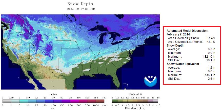
Well how about this, as of Friday, February 5th, the national snow coverage was up to 67.4%, which was the greatest national snow coverage of the winter season thus far!
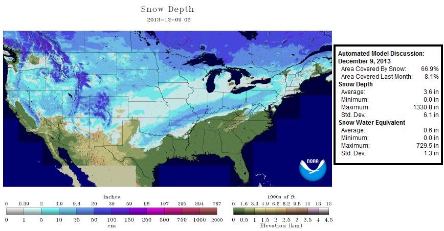
The December 9, 2013 national snow coverage of 66.9% was the previous high mark until Friday.
Wintry Weather Continues
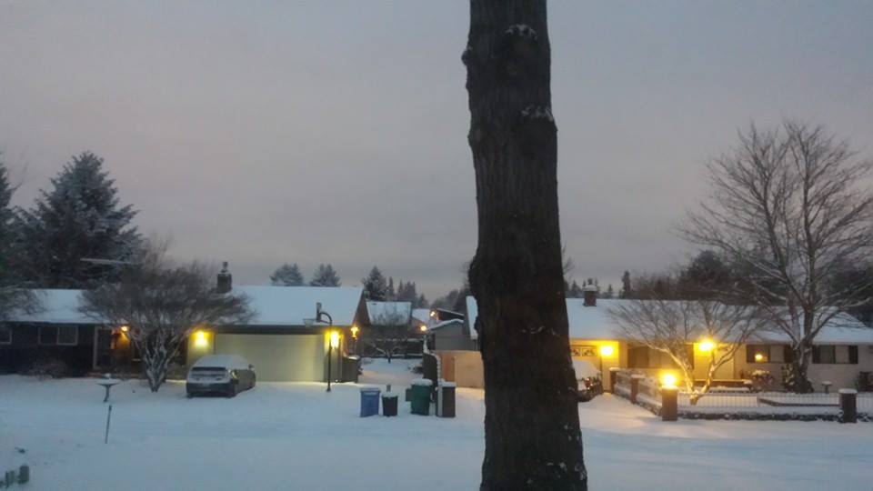
Thanks to Jeremy Hess out of Vancouver, WA for the picture below who woke up to nearly 5" of snow on Friday morning.
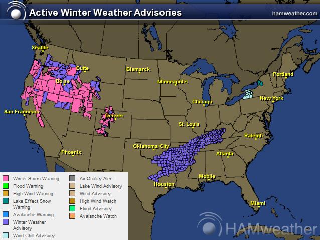
Winter Weather Concerns
Take a look at all the winter weather headlines that have been posted across the nation, most of which are in the western half of the country. It sure is nice to see moisture return to areas that have been so dry for so long!
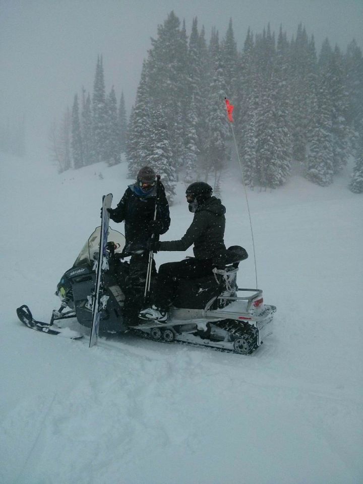
Fresh POW!
I guess that's the term for great snow! Skiers and snowboarders have been enjoying the recent snowfall at ski resorts in the western U.S.. Thanks to my friend Kim Johnson who actually had to be rescued at Powder Mountain in Ogden, UT after the ski lifts were shut down due to heavy snowfall! Looks like you had a great time Kim!
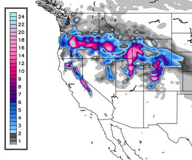
Western Snowfall
Here's the snowfall outlook through the weekend, which suggests 1ft to 2ft possible in some of the higher elevations from the Cascades to the Sierra Nevada.
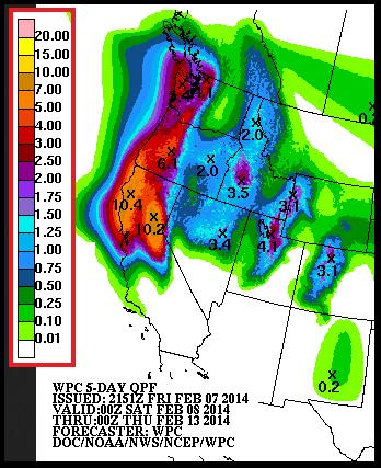
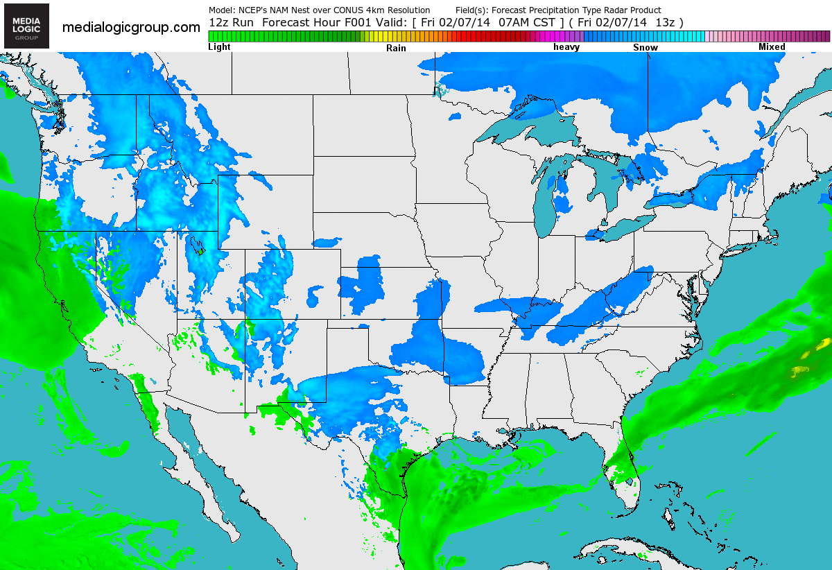
Western Precipitation Forecast Next 5 Days
This is promising! According to NOAA's HPC, the 5 day precipitation forecast suggests some fairly significant amounts in the higher elevations across northern California and the western portions of Oregon and Washington!
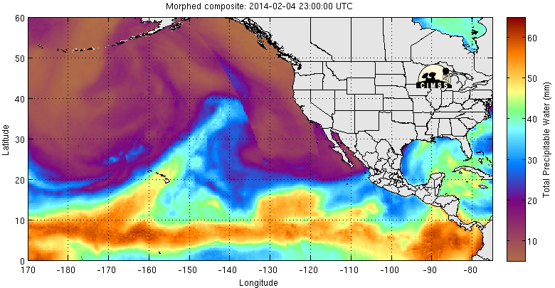
Why So Wet?
Thanks to the Atmospheric River or Pineapple Express, a continous feed of tropical moisture is feeding right into the western U.S. from Hawaii. Note the finger of more vibrant colors stretching from Hawaii to the West Coast, that's the feature responsible for our recent uptick in much needed precipitation!
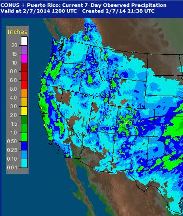
Precipitation Past 7 Days
Take a look at the precipiation over the past 7 days in the western part of the country. While it sure is nice to see moisture return, it's just a drop in the bucket.
California Moisture
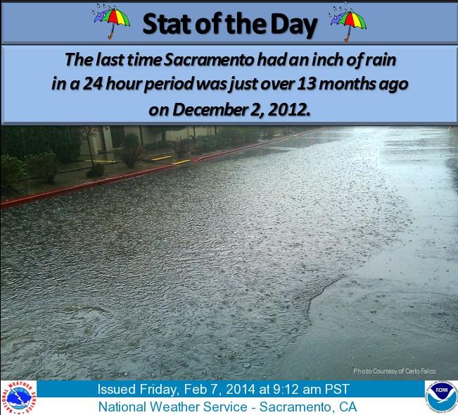
Here's a crazy stat from the national weather service out of Sacramento, CA. The last time Sacramento has seen over an inch of precipitation in one day was more than 13 months ago!
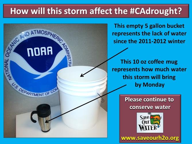
More Precipitation Needed!
Thanks to the NWS out of Sacramento for this perspective on the weekend precipitation. Although we're getting this much needed moisture, we still need A LOT more!
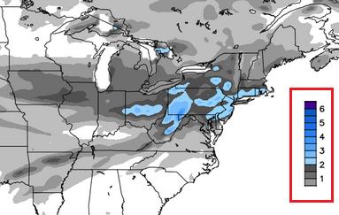
Weekend Snow in the East
Here's the FutureRadar through AM Sunday, which shows a batch of snow moving into the Northeast. Keep in mind that the snow chance over the weekend in the Northeast looks to come in waves. the first will be with us on Saturday, while the second will be with us in the late weekend timeframe.
Eastern Snowfall
The good news is that the much talked about 'potential' storm in the Northeast for much earlier in the week has tamed down considerably. There appears to be snow accumulations, but much lighter than it looked in some of the doom and gloom forecasts earlier this week.
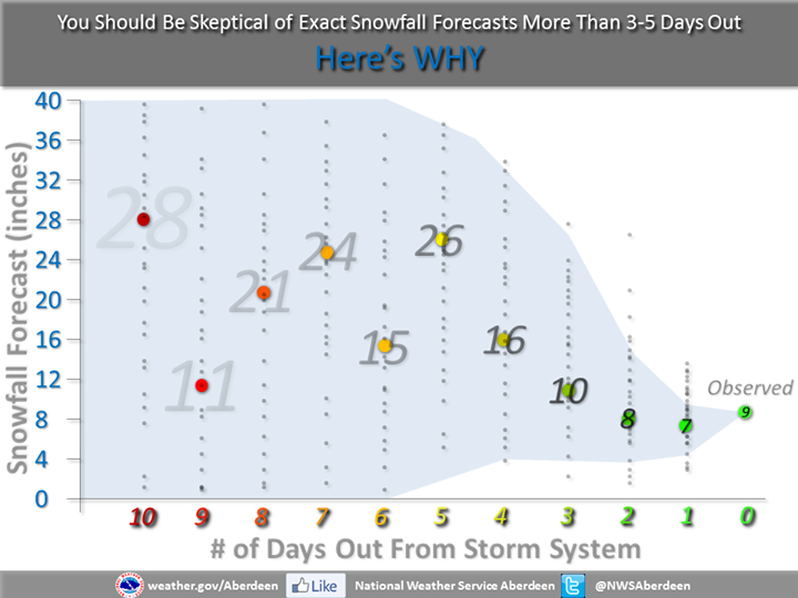
Food For Thought
Most of us are connected to social networking websites and at some point you've probably seen somebody post something weather related, right? If you're more connected to the weather community, you've probably seen extended weather tidbits on those social networking websites... here's a great write-up from the National Weather Service out of Sioux Falls, SD about that particular subject.
"Plain and simple, the uncertainty is just TOO GREAT this far out in time to give you an exact snowfall forecast for 10 days out. As you move right across the image, look at how the grey dots become more concentrated around the colored dots at days 3, 2, and 1. This represents a consensus that's being formed. So by the time we are inside of 3 days, we can start to put together a much more meaningful snowfall forecast."
See the full story HERE:
Thanks for checking in and have a great weekend ahead!
Don't forget to follow me on Twitter @TNelsonWNTV