Minnesota Ice
Here's
one thing I've discovered the hard way. Minnesota Nice quickly
evaporates when you try to share warm weather travel experiences in late
February. "Paul, you can (deleted) your (bleeped) and [censored] your
tropical weather patterns!"
Message received.
Now it's all
about collective suffering - and surviving long enough to take in any
kind of spring break. 10th coldest meteorological winter to date....and
counting. That makes this the coldest stretch since December 21 since
the brutal winter of 1978-1979, according to the
Minnesota Climatology Working Group.
Oh
yeah, on paper the 90 coldest days of the year, on average, should come
to an end Saturday. Uh huh. Old Man Winter doesn't seem to care. He's
stuck in a supernaturally persistent rut; the jet stream remains locked.
Natural atmospheric variability, the natural ebb & flow of warm and
cold, has been replaced by perpetually polar air - while much of the
rest of North America runs a low-grade fever.
Baffling.
Windchill
Advisories are in effect today; we may not climb above 0F with a chill
factor dipping to -30F. Blizzard Warnings are posted just west of MSP
for low visibility in blowing/drifting snow. Highly unusual for late
February. Then again, highly unusual is the new normal.
Models
hint at 30s by mid-March, but I've lost my faith in long-range models
this winter. So far it's been meteorological bait and switch. The honest
answer? It WILL warm up. I'm just not sure when.
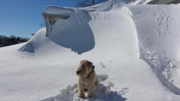
* Photo above of "Chewie" from Steve Erdahl at the Mtka Yacht Club House on February 23.
Record Territory.
Back in 1963 the Twin Cities endured 23 days worth of hours below zero.
We just passed 20 days worth of negative numbers (over 480 hours below
zero), according to
Daryl Herzmann at the Iowa Environmental Mesonet. Good grief. Make it stop.
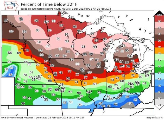
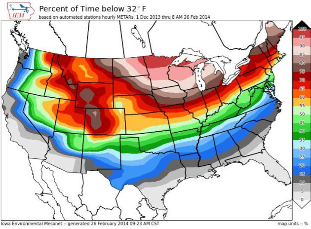
Percentage Of Time Below Freezing Since December 1.
I was feeling pretty blue about the Twin Cities being colder than 32F
for over 90% of the time since December 1, the start of Meteorological
Winter. And then I saw Grand Forks coming in at 99%. Thanks to
Iowa Environmental Mesonet for cheering us up.
National Percentage of Time Below 32F Since December 1. Not much of a break from the Upper Mississippi Valley and Great Lakes into much of New England.
Details here.
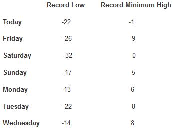
All-Time Records Next 7 Days (average high at MSP on February 27 is 33F, average low is 18F)
* Thanks to Aaron Shaffer at WeatherNation TV for tracking these down from the
Minnesota Climatology Working Group. I can't believe I'm still showing this stuff...
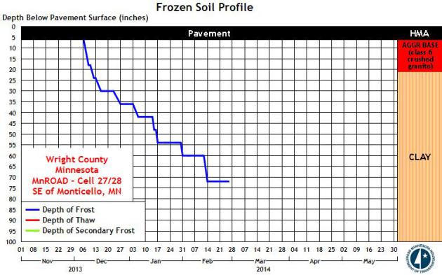
Deep Ground Frost.
I've had a few questions about the depth of the frost this
super-winter, concerns about wells freezing up, and how deep frost in
the ground might escalate run-off and flooding when it does finally
decide to warm up. According to MnDOT the depth of the frost near
Monticello is between 70-75", which is deeper than I can ever recall.
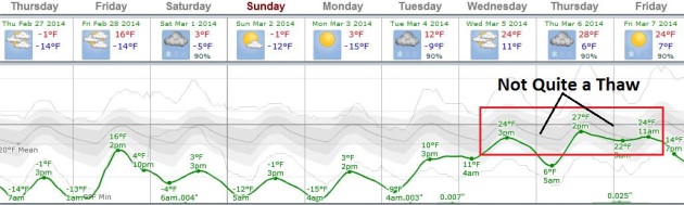
It May Warm Up A Little Next Week - Or Not.
This next wave of the Polar Vortex lingers into Monday, and then
temperatures try to recover next week, at least reaching 20s. Not quite a
thaw, but beggars can't be choosy. At this point we'll take what we can
get. ECMWF data shows 20s the latter half of next week. Graph:
Weatherspark.
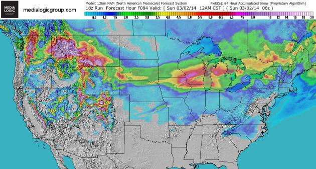
84 Hour Snowfall Prediction.
Here is NOAA's NAM snowfall prediction into Saturday night, showing
potentially plowable amounts of snow from the Midwest into the Great
Lakes, and portions of the northern Rockes and Cascade Range of
Washington State. Map: Ham Weather.