Digging Out
One
of my amazing meteorology producers, D.J. Kayser, checked the models
for next week, shaking his head. "At least the cold air will shut up the
atmosphere." Good point. One of the few advantages of flirting with
subzero weather? Cold Canadian invasions force the storm track too far
south to get heavy snow. We can still get clippers; a couple inches of
fluff here and there, but not the massive dumpings.
We're waking
up to more school cancellations and white-knuckle commutes - what may be
the biggest snow of the winter for many towns.
Snow shuts off
this morning; travel conditions slowly improving as the day goes on. The
sun stays out this weekend, highs stuck in the teens.
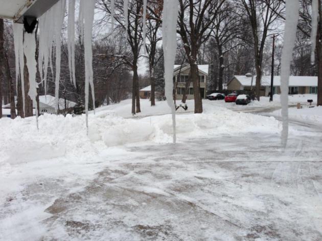
Maybe this cold surge will stop the ice dam leaking into my guest bedroom. Yes, meteorologists are impacted by the weather, too.
Long
range models show an almost January-like surge of bitter air 1 week
away: temperatures may have a tough time climbing above 0F next Thursday
thru Saturday, March 1; the start of meteorological spring.
Right.
Pete
Boulay at the Climate Office says this is the coldest winter since
1978-79; 9th coldest overall. 45 subzero nights so far in the Twin
Cities. Can I interest you in a grand total closer to 55?
Ugh.
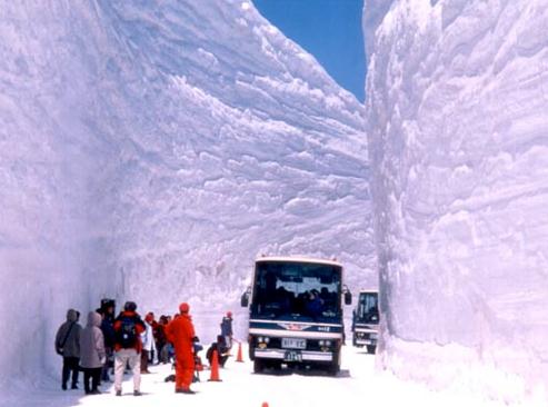
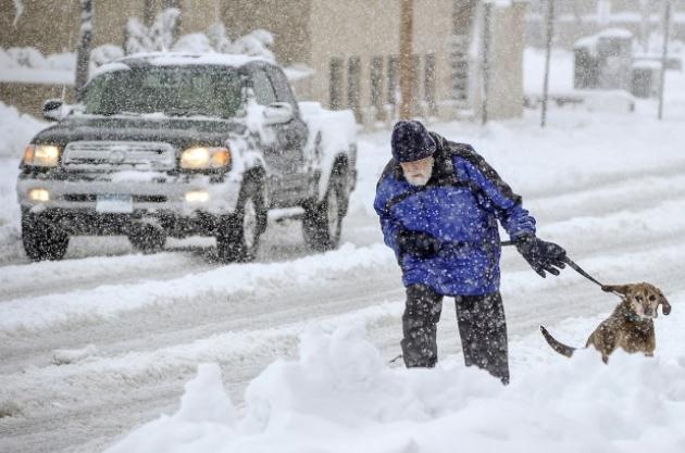
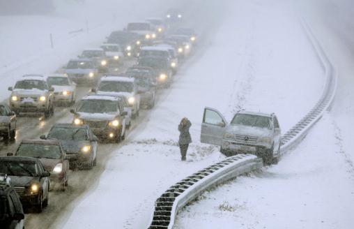
* as if I need to say this out loud, that's a file photo above. No, it's not that bad (yet).
9th Coldest Winter, To Date, In The Twin Cities. Here's an excerpt of an e-mail I received from Pete Boulay, at the Minnesota Climatology Working Group: "
As
of yesterday the Twin Cities are at 10 degrees for the mean temperature
of the winter, a tie for the 9th coldest, or the coldest winter since
1978-79:http://www.dnr.state.mn.us/climate/journal/coldest_winters.htmlWe'll
have to see how the rest of the month pans out! As for at or below zero
lows currently the Twin Cities is at 45, a tie for the 20th most at or
below zero lows or the most since the winter of 1981-82:
http://www.dnr.state.mn.us/climate/journal/at_or_below_zero_13_14.html
January Flashback?
It won't get quite that cold; I still don't expect any more
school-closing cold, but late next week may rival what we endured in
early February, with highs near 0F and lows dipping to -15F in the Twin
Cities metro, a chill factor dipping to -25F at times, based on latest
ECMWF guidance. Enjoy teens today into Monday, maybe 20F Wednesday
before a big tumble the latter half of next week. Graph: Weatherspark.
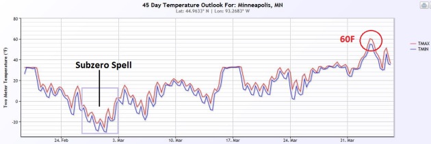
45 Day Wish-Cast.
NOAA's CFS (Climate Forecast System) shows the big dip late next week,
with a slow climb in March. Expect chirping birds, ringing church bells
and public weeping in early April as highs hit 60F. Confidence level:
low. But I thought might want to cling to a little long-range hope at
this point. Graphic: NOAA and Ham Weather.
The Polar Vortex Is Coming Back. Again. Here's an excerpt from Weather Underground uber-meteorologist Jeff Masters, as featured in a story at
The Atlantic Cities: "...
If anybody wants to shoot the messenger, although please don't, consult this prognostication yesterday from the Weather Underground's Jeff Masters. Here's part of it:
Temperatures
20°F below normal will likely invade the Upper Midwest on Sunday, and
gradually spread southeastwards during the week. The peak cold is
predicted to occur late next week, with temperatures 20 - 35° below
normal covering much of the eastern 2/3 of the country. As a result of
these new model runs, the natural gas market has been soaring ever since
early this morning, and is now approaching a five-year high of $6.
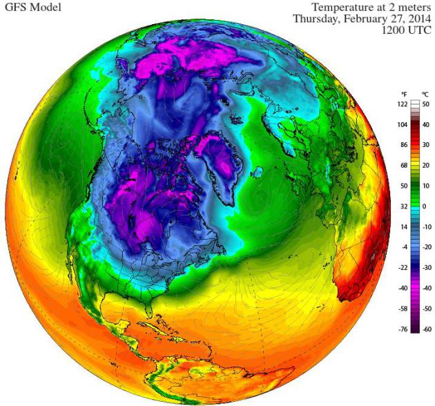
* Temperature anomalies next Thursday morning (departure from normal) courtesy of Climate Reanalyzer at the University of Maine.
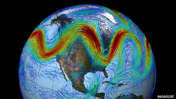
Is Polar Warming To Blame For America's And Britain's Bad Winter Weather?
What is natural variability, and is rapid warming of far northern
latitudes having a domino effect at mid latitudes? Something is going on
and I don't pretend to have the answer key, but the jet stream is
definitely misbehaving. We passed "normal" jet stream fluctuations a
long time ago. Here's an excerpt from a piece at
The Economist: "...
In
the same way that a mountain torrent runs straight down steep slopes,
while a slower river meanders across its plain, a weak, slow jet stream
should swing north and south more, taking its weather with it. That
meandering would also mean any weather fronts it propelled moved more
slowly than normal, leading to more persistent weather patterns. And it
would increase the likelihood of eddies splitting from the jet stream
and sitting in the sky blocking atmospheric movement. This would further
increase the persistence of weather patterns, and cause heatwaves, cold
snaps and droughts. That, at least, is the theory. And climate models
(mostly) agree with it..."
More Bite Left To Winter, But It Hasn't Been As Bad As You Think. Justin Gillis over at
The New York Times puts our (extreme) winter into historical perspective. Here's an excerpt: "...
On
a ranking of the coldest Januarys for the last 120 years, this one fell
right in the middle. January 2011, a mere three years ago, was colder.
No state had its coldest January on record. In fact, the oddest weather
in the country may have been related to heat, not cold. The temperature
in Alaska was nearly 15 degrees above average for the month, giving that
state its warmest January since 1985 and its third-warmest in 96 years
of records. One Alaska town hit 62 degrees, tying the highest January
reading ever recorded in the state. The cold in the East has been
balanced, in a sense, by those bizarrely warm temperatures in the West..."
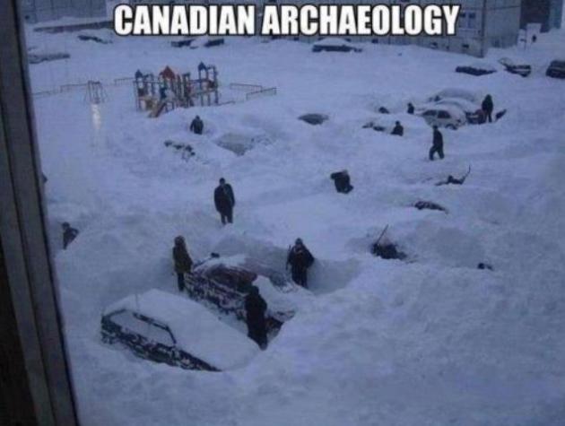
File photo above: AP.
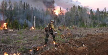
Western Wildfire Season "Likely To Set A Record".
In the midst of historic drought, and a wet season that never came,
come predictions of a rough year for wildfires. Here's an excerpt from
CNBC: "
Three years of severe drought have made plenty of misery for California
and other Western states. Now to make matters worse, the extremely dry
conditions are creating the potential for a devastating fire season.
"All the pieces are in place for a really bad season of wildfires," said
Malcolm North, a research ecologist with the U.S. Forest Service.
"We're likely to set a record for fires this year..."
File photo: Department of Natural Resources.
Breakthrough In Drought Tolerant Crop Research.
ABC7 in San Francisco has the story and video; here's an excerpt: "
A
three-year drought has farmers and food companies seeking new
strategies in securing a stable food supply. The work of a southern
California plant scientist could offer one solution in developing
drought tolerant crops. Long lab hours paid off at the University of
California, Riverside. Plant science research conducted here may one day
change the food industry. A plant cell biologist at UC Riverside has
made a major breakthrough in the development of drought resistant crops..."
Way Too Many Americans Go To Work Sick: Survey. No kidding.
Huffington Post has the details on something you already knew; here's a clip: "
Worried
about lost wages, a backlog of work or punishment from the boss, more
than one in four American workers recently surveyed said they show up to
work while ill, even though they could sicken their colleagues. In a
poll of more than a thousand U.S. adults in the midst of this year's flu
season, NSF International, a public-health testing group based in
Michigan, found that
a quarter of those who copped to working while sick said their boss
required them to. Thirty-seven percent said they needed the money, and
42 percent said too much work would pile up if they didn't clock in..."
Paralyzed Woman Walks Again With 3D-Printed Robotic Exo-skeleton. It sounds like science fiction ("Terminator") but it's scientific reality, as reported by
Gizmag. Here's an excerpt: "
3D
Systems, in collaboration with Ekso Bionics, has created a 3D-printed
robotic exoskeleton that has restored the ability to walk in a woman
paralyzed from the waist down. The Ekso-Suit was trialled and
demonstrated by Amanda Boxtel, who was told by her doctor that she'd
never walk again after a skiing accident in 1992..."
Climate Stories...
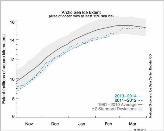
Arctic Sea Ice Sits At Record Low For Mid-February.
Climate Central has the story; here's the introduction: "
Arctic sea ice
growth has slowed dramatically in recent weeks, thanks in large part to
abnormally warm air and water temperatures. Sea ice now sits at record
low levels for mid-February. According to the National Snow and Ice Data Center,
as of February 18, sea ice covered about 14.36 million square miles in
the Arctic. The previous low on this date was 14.37 million square miles
in 2006. The main culprit -- in addition to the overall trend of global
warming -- is likely the rash of warm temperatures. With the polar vortex bringing cold air down to the U.S. this winter, warmer temperatures have been the norm in the Arctic..."
Graphic credit above: "
A
look at Arctic sea ice extent. The gray line is average for 1981-2010
and the dashed line shows the extent for 2011-12, the years when a
record-low summer minimum occurred. The blue line is this year through
February 18." Credit: National Snow and Ice Data Center.
Accounting For Global Warming Requires Looking At The Oceans. St. Thomas professor and climate scientist John Abraham has the story for
The Guardian; here's the intro: "
Separating
the human and natural influences on the climate is a tough task. On the
other hand, because it is exciting, scientists around the world are
working on it every day. One of the most active questions scientists are
trying to answer right now is, how much excess energy is the Earth
gaining? Quantifying this excess energy and where it ends up, often
called balancing the Earth's energy budget, is crucial for understanding
the future of the planet..."
Photo credit above: "It looks lovely offshore, but there are dangers over the horizon." Photograph: Alamy.
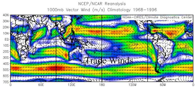
Global Warming "Hiatus" Is An Illusion, Study Finds. Stronger trade winds may be "burying" some of that excess heat in deep ocean water, especially in the Pacific.
The Street has a good summary - here's a clip: "...
Recently, in a study published in the most recent issue of Nature Climate Change,
a scientific peer-review journal, a team of scientists led by
Australian Matt England found that warmer surface water in the Pacific
is being pushed westward by equatorial trade winds that are much
stronger than expected. As the warmed surface water hits the western
continental shelf it is driven downward into the lower depths. The
action of the trade winds effectively cools the observable surface
temperature by mixing the heat into the deep water..."
Trees On The Move As Temperature Zones Shift 3.8 Feet A Day. Here's an excerpt of a fascinating piece at Krulwich Wonders on
NPR: "...
Something
is not right. And though you can't know this, there's a reason: The
whole planet is getting warmer, which means that temperature zones are
shifting. Warmer areas are expanding, pushing cooler zones closer to the
North and South Poles, so that the meadow, the forest, the tundra, the
desert, the plains — wherever you live — your ecosystem is beginning to
shift. Over the decades, the climate you prefer has started to migrate
away from you, which raises an intriguing question: "If I'm standing in a
landscape," asked Stanford ecologist a few years ago, "how far do I have to travel in order to change my temperature" – to get back to the climate that suits me?..."
