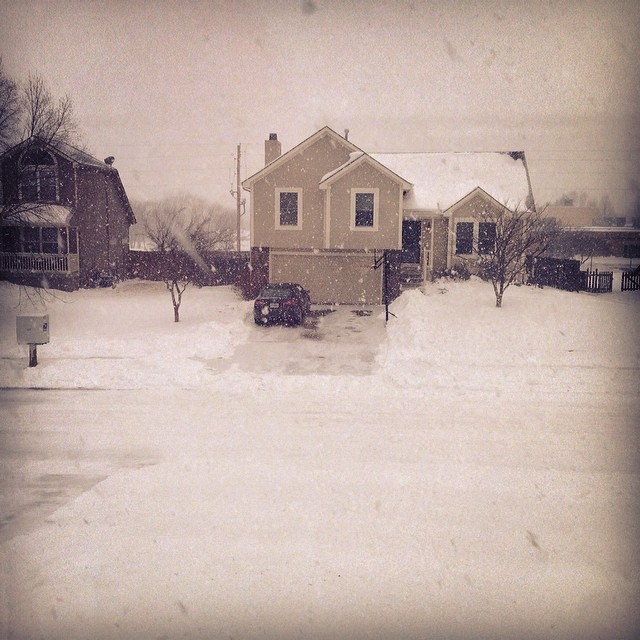
Thanks to my good friend Matt Dux for the picture below near Kansas City, MO where it snowed AGAIN over the weekend. Earlier last week, he picked up nearly 10" for a different storm.
Another Winter Storm For the Deep South
Take a look at the FutureRadar into the early week and note the fairly robust moisture moving across the central and eastern part of the country. Note also how far south this wintry precip is getting. The National Weather Service has issued a number of winter weather headlines into early this week for the potential of heavy snow and icing.
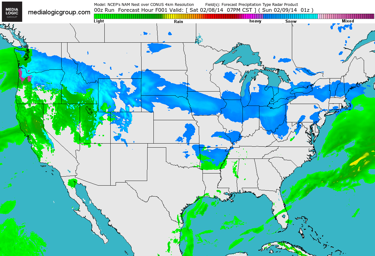
FutureRadar with Fronts
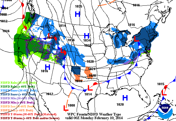
Here's a product from NOAA, which shows the precipitation potential along with the weather features. Note the developing low across the southeastern corner of the U.S. that will be responsible for all the wintry weather through the early part of the week.
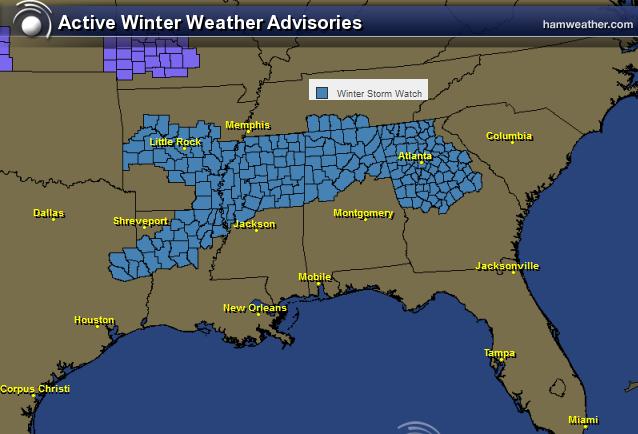
Winter Heads South AGAIN!
The active weather continues this February with yet again another winter storm for the Gulf Coast States. It wasn't that long ago that we were talking about major issues in Birmingham, AL and Atlanta, GA. Let's hope we don't have a repeat from a couple of weeks ago!
Here's a sample of the winter weather concerns from the National Weather Service out of Peachtree City, Ga:
...WINTER STORM WATCH REMAINS IN EFFECT FROM MONDAY EVENING THROUGH WEDNESDAY MORNING... * LOCATIONS...PORTIONS OF NORTH GEORGIA...MAINLY ALONG AND NORTH OF A LINE FROM CARROLLTON TO ATLANTA TO HOMER. * HAZARD TYPES...A MIX OF RAIN...SLEET AND SNOW MONDAY NIGHT... CHANGING BACK TO RAIN TUESDAY AFTERNOON...THEN A MIX OF FREEZING RAIN AND SLEET TUESDAY NIGHT WITH SNOW IN THE MOUNTAINS. * ACCUMULATIONS...THERE IS THE POTENTIAL FOR 1 TO 3 INCHES OF SNOWFALL ACROSS THE NORTHERN ATLANTA SUBURBS AND NORTHWEST GEORGIA. FOR THE NORTHEAST GEORGIA MOUNTAINS...THERE IS THE POTENTIAL FOR THREE TO SIX INCHES OF SNOW WITH LOCALLY HIGHER AMOUNTS.
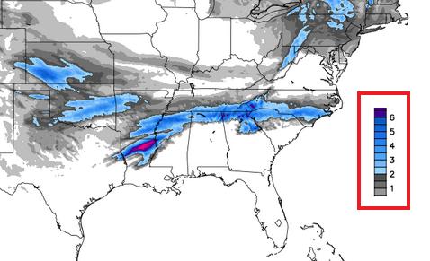
Southern Snow Potential
Here's a quick glance at snowfall potential, which suggests a narrow band of accumulating snow from the Central Plains to the Carolinas by Tuesday night.
(image credit: WeatherBell.com)
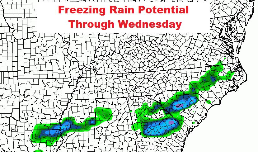
Southern Ice Potential
Unfortunately, we're also looking at an freezing rain threat again. Here's a glance at where some of the freezing rain could be positioned into the early week time frame.
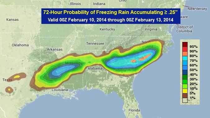
Freezing Rain Probability
Here's a NOAA product that shows the probability of 0.25" or more of freezing rain through midweek. The brighter blues indicate a 50% chance, while the pink color over parts of South Carolina suggests a near 80% chance!
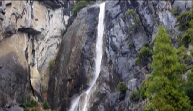
Water Falling in Yosemite
Keep it coming! Thanks to some much needed precipitation, the landscape looks a little different at Yosemite National Park lately. Here's the view from the Yosemite National Park Facebook Page:
"Rain is currently falling in Yosemite, giving new life to the waterfalls. Here's what Lower Yosemite Fall looked (and sounded) like earlier today. -cf"
See the video HERE:
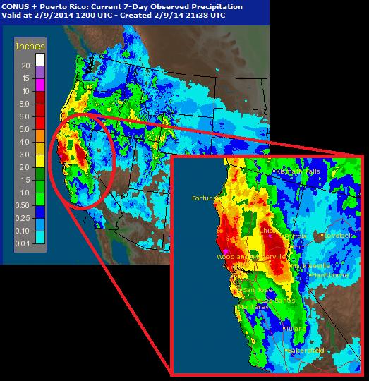
Western Precip Past 7 Days
According to radar estimates of precipitation over the past 7 days. Some spots across northern California have seen nearly 5" to 10"+ since last week!
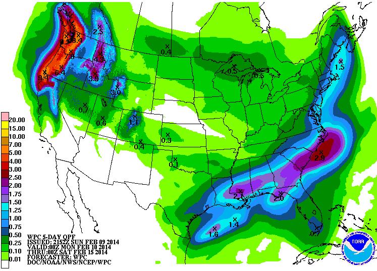
More Western Precipitation
According to NOAA's HPC, the 5 day precipitation forecast still suggests a fairly decent amount of precipitation for the western part of the country.
Thanks for checking in and have a great week ahead!
Don't forget to follow me on Twitter @TNelsonWNTV