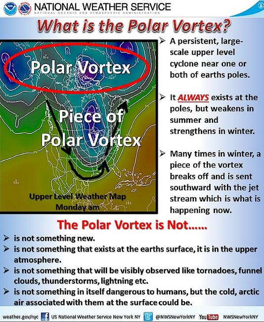
No not really... Yes, it's cold, but It's actually a piece of the Polar Vortex as explained by the National Weather Service out of New York, NY in a post from January 6th.
"***Please share this information to become more educated on what exactly the polar vortex is and is not*** You may have heard about a "polar vortex" in the news with regards to the cold air currently affecting the United States and soon to hit the Tri-State area. This is NOT a new atmospheric phenomena as a polar vortex ALWAYS exists at the polar regions of earth, but a piece of the main vortex has broken off and is being sent southward by the jet stream. What exactly is the polar vortex, what is it not? Check out this graphic for more information"
See more from the NWS New York HERE:
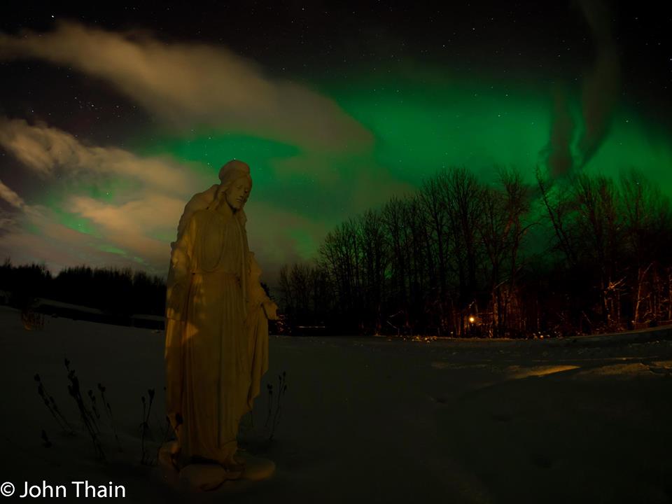
Alaskan Night Light
Thanks to my very talented and good friend John Thain for this picture out of Palmer, AK. It's a haunting picture of the northern lights at a cemetery, but pretty amazing! Good work, John!
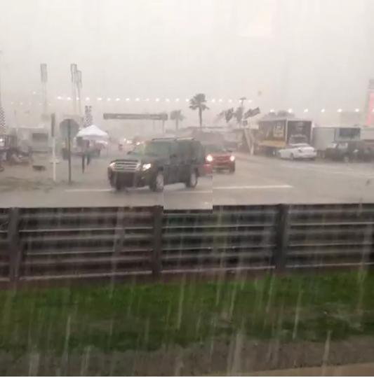
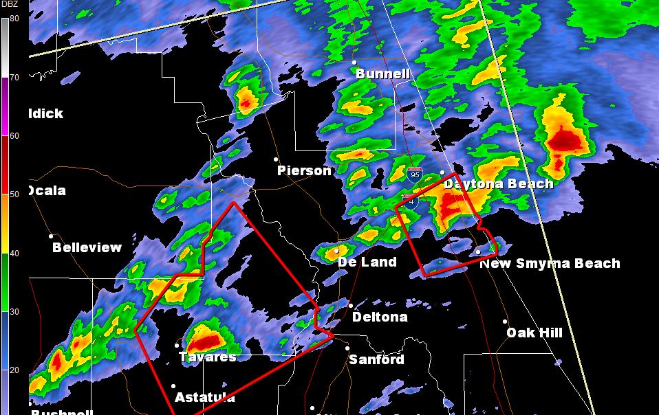
Daytona 500
If you were watching the the Daytona 500 yesterday, you may have noticed the inclement looking skies and the delay due to storms in the area. Take a look at this video from @ChelseaGatesUF from the Dayona 500 yesterday when it was really coming down!
See the video HERE:
Here was the radar just prior to 4pm EST Sunday with a several storms surrounding the Daytona Beach, FL area.
Weather Outlook
No big storm are in sight, but there will be some precipitation. A quick glancing blow of snow will filter into the Midwest from the Northwest, while rain spreads throughout the southeastern U.S.
Precipitation Outlook
Here's NOAA's HPC 7 day precipitation outlook. Note the significant increase in precipitation potential across California. This is great news!
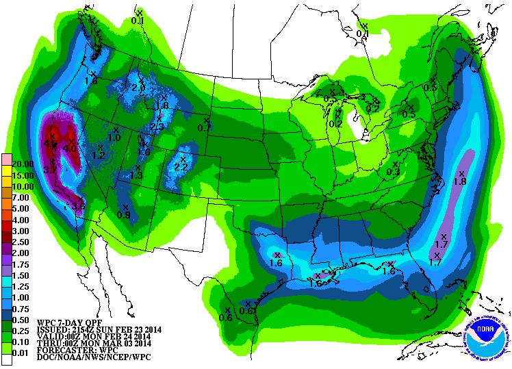
Atmospheric River Acting Up
Keep an eye on that "Atmospheric River" you heard about recently, it's acting up again. Note the plume of brighter colors nearing the West Coast. An increase in moisture is heading your way!
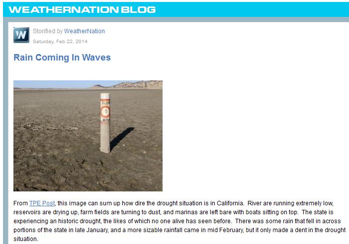
WeatherNation Blog
Read my good friend and colleague (Addison Green)'s blog about the western drough HERE:
Cold Cometh
Take a look at the temperature loop through early next week... it shows a big Arctic surge through the Upper Midwest, which will ripple through the eastern two-thirds of the nation.
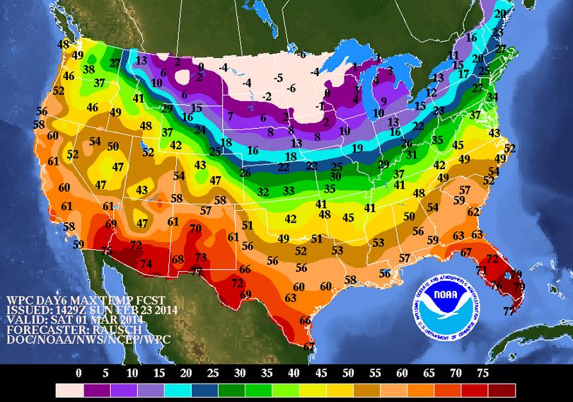
Cold Temps Ahead
Here's a look a look at temperatures into early next weekend. Note that highs across the Upper Mississippi Valley look quite cold for the start of Meteorological Spring.
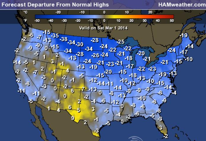
Highs From Normal Saturday
Not only does much of the work week ahead look colder than average, but it looks much colder than average through early next weekend too.
Thanks for checking in and have a great week ahead!
Don't forget to check me out on Twitter @TNelsonWNTV