(I filtered the photo using one of my favorite camera apps Camera+)

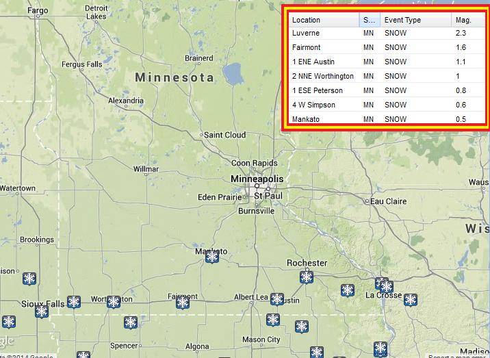
Southern Minnesota on Saturday
Reports of near whiteout conditions were coming in on Saturday across extreme southern Minnesota. A quick snow burst was responsible for nearly 1" to 2" in spots along I-90. Luverne, MN checked in at 2.3" while Mankato only saw 0.5"
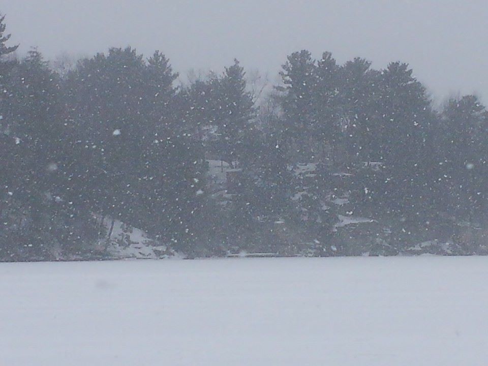
Reedsburg, WI
Thanks to Michael Lobenstein out of Reedsburg, WI for the picture below, which showed the snow associated with the clipper that moved right along the Minnesota/Iowa border and eventually into central and southern Wisconsin.
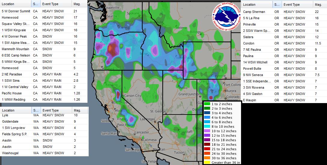
Western Snowfall
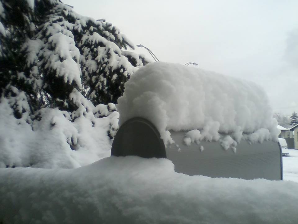
Thanks to Shelly Jones from Longview, WA for the picture below, where apparently there's no mail today... they were snowed in.
Western Snowfall
Take a look at some of the heavy snowfall/rainfall reports from Saturday across the western states! Not that some areas saw 1ft. to nearly 2ft.
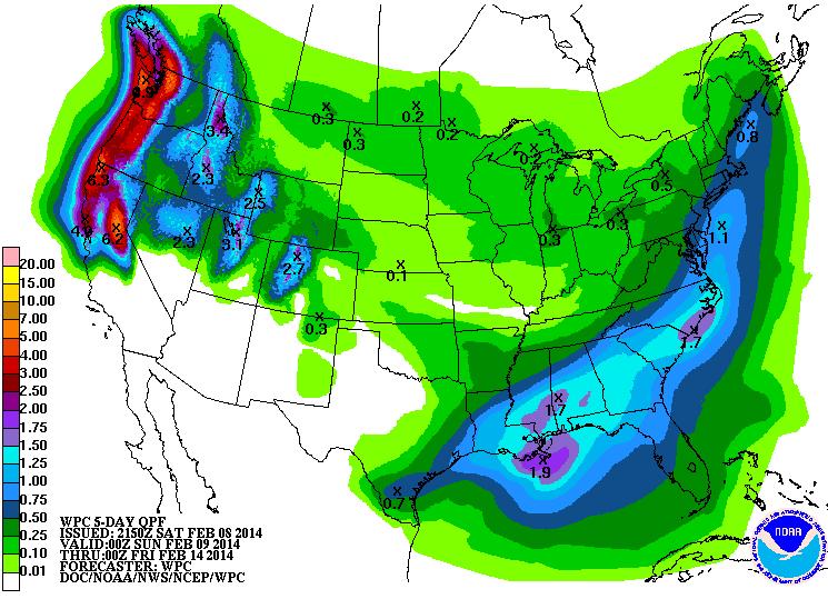
National Precipitation Forecast Next 5 Days
According to NOAA's HPC 5 day precipitation forecast, there's still quite a bit of precipitation potential for folks in the western U.S.. It sure is nice to see, but folks in the extreme southwestern U.S. are still staying dry.
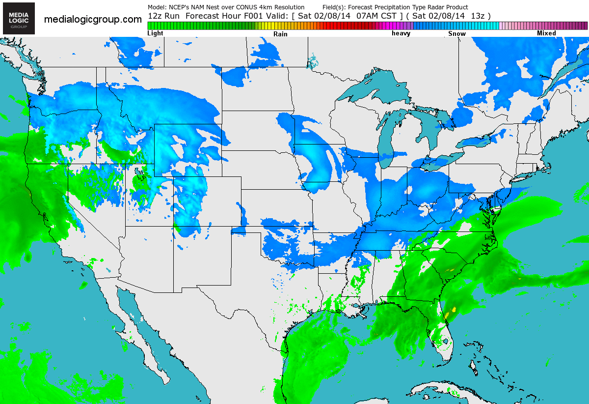
National FutureRadar
Look at how active it looks across the nation. From the Pacific to the East Coast, there's nearly a steady stream of moisture, which is great news for the western U.S., but the eastern U.S. is probably ready to call it quits with all the wintry weather as of late.
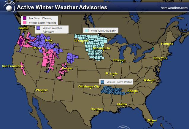
National Winter Concerns
Here's a look at the national winter weather headlines and note that the colors seem to match the steady stream of moisture from west to east. The light blue to the far north is a wind chill advisory for extreme cold. The extreme cold to the north is also helping to push the storm track farther south and that's why there's a void of precipitation across the Upper Mississippi Valley.
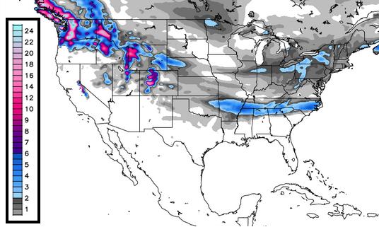
Snowfall Potential
Here's a quick glance at snowfall potential over the next few days. Note that the heavier snow will be possible in the high elevations in the western U.S., but there a fairly decent snow swath from the Central Plains to the Mid Atlantic region.
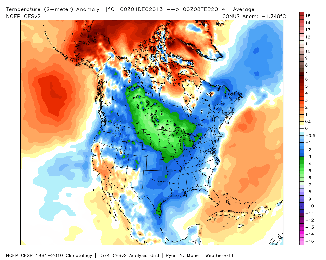
Meteorological Winter Temperature Anomaly So Far...
Here's an interesting image from WeatherBell.com - it's the temperature anomaly for meteorological winter so far. Meteorological winter, by the way, is the coldest three months (on average) for the Northern Hemisphere (December, January and February). Note how cold it has been this winter across much of the nation and especially for the Upper Midwest and the Canadian Prairie Provinces.
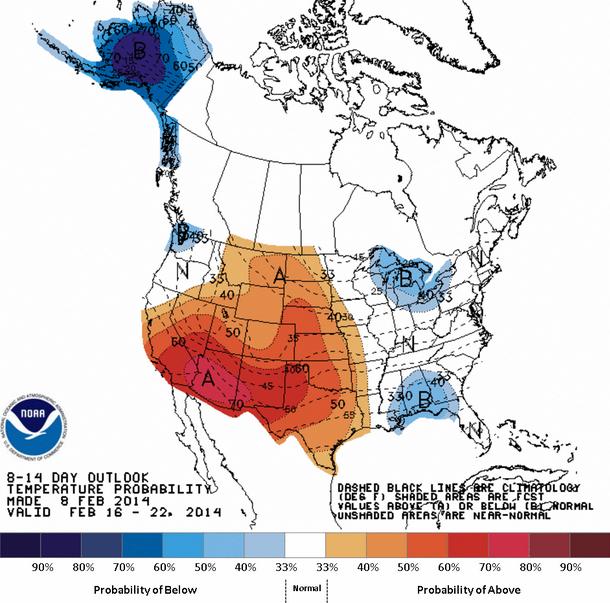
Warmer Weather Ahead?!
Well, well, well... what do we have here? A warmup in the offing? According to NOAA's Climate Prediction Center, the 8 to 14 day temperature outlook suggests a much warmer outlook as we get to the middle/end of February... Stay tuned! Note also that Alaska looks to finally be cooling down after record setting warm temperatures during the month of January.
Thanks for checking in and have a great rest of your weekend.
Don't forget to follow me on Twitter @TNelsonWNTV