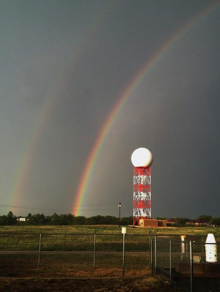
Thanks to the National Weather Service out of Abilene/San Agelo, TX for the picture below of a double rainbow behind their radar. There is a big dome of hot air across parts of the Southern Plains and Lower Mississippi Valley that is keeping thunderstorms on its outer periphery. Those thunderstorms have been rotating around the heat from West Texas to the Central Plains and into parts of the Gulf Coast States.
Too Hot to Thunder?
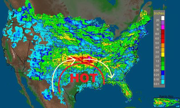
Often times when temperatures get too warm, thunderstorms won't develop. NOAA's 7 day radar estimates of rainfall show little to no rainfall in parts of Texas, Arkansas and Louisianna due to the extreme heat. However, take a look at all the rain that has tallied up around the outer periphery of that heat, especially in the Central Plains region! These thunderstorms have been continuously rotating clockwise around this dome of hot air.
More on the Central Plains Flooding
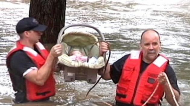
There were some incredibly sad stories after this recent bout of excessive rainfall.
Here's a little more from ABCNews:
"A storm front that arrived on Aug. 2 and stalled over the Plains has hit Missouri's Ozarks region the hardest, with parts of Arkansas, Tennessee and Oklahoma also experiencing persistent rain and spotty flooding, leading to at least four fatalities."
(Image below courtesy: ABCNEWS.com)
Flooding Spreads East
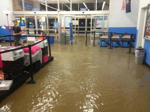
Part of that same front that stalled over the central part of the country was responsible for some excessive rainfall in parts of the Northeast.
Take a look at the image below from the National Weather Service in Binghamton, NY.
"Major flash flooding occurred last night just south of Cortland, NY in Cortlandville. This is what is looked like inside Walmart. Picture courtesy of Dustin Randall. Flooding also occurred in Ithaca and Pine Valley, NY. For more pictures, go here: http://on.fb.me/13nYHuk Do you have pictures to SHARE? Post them to our wall or just reply to this post. Be sure to include the location. -Erik"
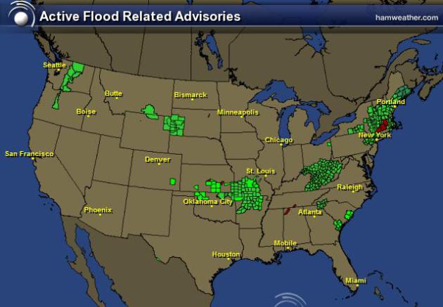
National Flood Concerns
The image below suggests all the areas that are still under flooding concerns.
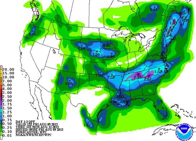
Weekend Rainfall Potential
NOAA's HPC weekend rainfall potential still shows rainfall potential of 1" to 3" east of the Mississippi River Valley from the Tennessee Valley into parts of the Northeast. With the ground as saturated as it is, any additional heavy rain could lead to more flash flooding, thus the flash flood watches.
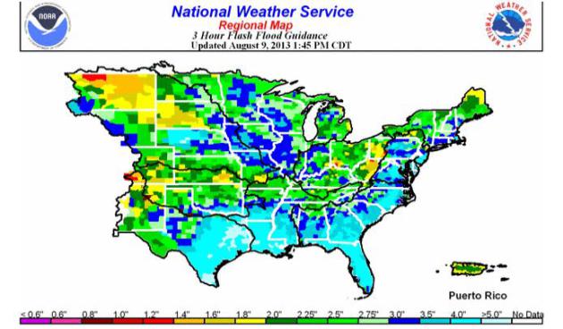
Flash Flood Guidance
This is also a very useful interactive map to look at... it's NOAA's 3 hour flash flood guidance map. It shows you how much rainfall is needed in 3 hours for flash flooding to occur. The image below shows brighter colors where less rain is needed in a 3 hours time for flash flooding to occur.
See the interactive map HERE:
Floods and Fires?
I thought this was interesting... parts of the Northwest are under Red Flag Warnings (high wildfire threats) and Flash Flood Watches at the same time! How can that be?
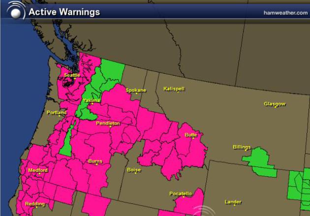
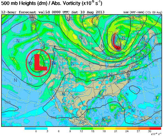
Slow Moving Western Low
A slow moving area of low pressure in the west is not only helping to bring a chance of much needed rainfall parts of the Northwest, but it is also helping to kick up the wind. This is not good news since it is so warm and dry in these ares. Interestingly, thunderstorms could bring heavy rainfall to wildfire burn scar areas through the weekend, which could lead to mudslides/debris flows.
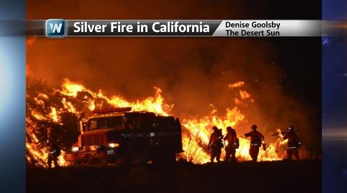
Silver Fire in Southern California
There are a number of wildfires ongoing in the western part of the country.
Here's a little more on the Silver Fire in southern California from USA Today
"The wildfire burning 90 miles east of Los Angeles in the San Jacinto Mountains since Wednesday has destroyed 26 homes and threatened more than 500 other residences, forcing about 1,800 people to flee.
An estimated 1,600 firefighters were on the lines, and seven retardant-dropping tankers joined eight helicopters in what Solomon termed a "very strong attack on this fire from the air.""
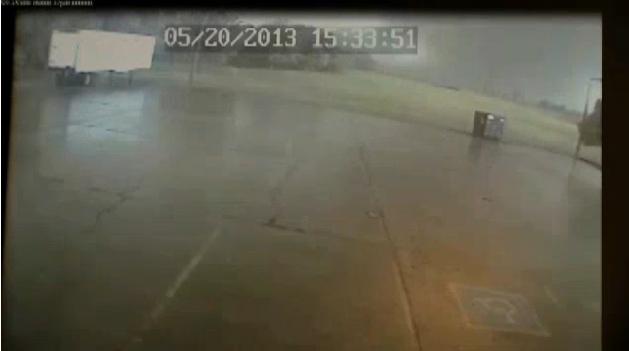
Surviellance Footage Captures May Moore, OK Tornado
Newly released surviellance footage of the May Moore, OK tornado shows the incredible power of the wind.
See the video from News9.com HERE:
Thanks for checking in, have a great weekend ahead!
Don't forget to check me out on Twitter @TNelsonWNTV