70 F. high on Saturday in the Twin Cities.
8 days above 70 F. this month in the cities, breaking the old record of 5 days in 1910. Source:
NOAA.
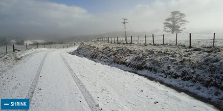
4" snow on the ground last year at this time in the metro.
Severe T-storms possible tomorrow over Minnesota's Red River Valley. Details below.
Frost likely statewide between April 5-8. Hold off on those annuals (another 6 weeks to be safe). A slight winter relapse is likely in less than 2 weeks.
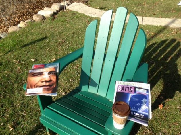
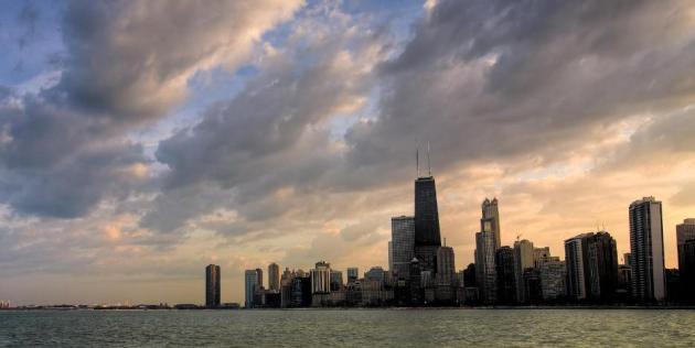
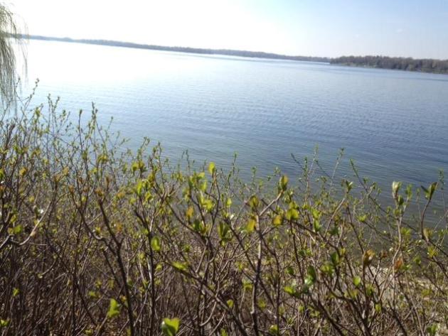
Definition Of A Good March Day. This is where I decompress: a fine Adirondack chair with a clear, unobstructed view of the setting sun, a stack of magazines, a jolt of caffeine. Preferably no wireless devices. Yesterday, with the sun out, 70 degrees, no bugs, no breeze, no buzzing boats on the lake, I wondered (out loud) how could it possibly be March 24? My neighbors think I'm nuts, by the way. They're right.
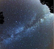
Observers on Earth's surface rotate around its axis at 40 meters/second.
Earth revolves around the sun at at rate of 30 kilometers/second.
Sun rotates around center of Milky Way Galaxy at 220 km/second.
Milky Way being "dragged in a stately gyre toward constellation Virgo at 370 km/second.
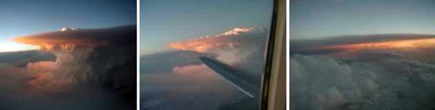
Feeling dizzy? Me too. Amazing stats courtesy of a Subaru BRZ auto review from Dan Neil at the
Wall Street Journal (subscription required, but - in my humble opinion - worth it). Milky Way/Perseid Meteor Photo above:
Wikipedia.
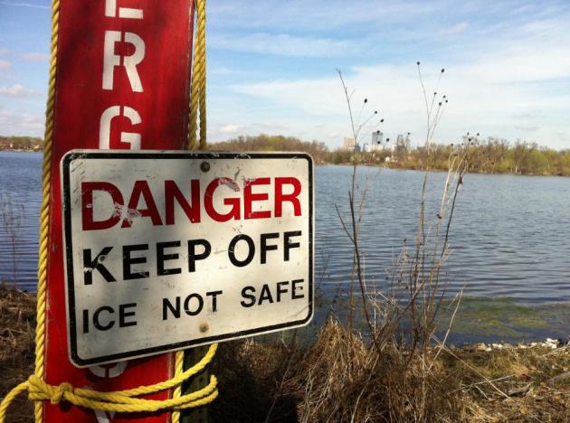
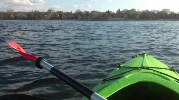
What March? Yes, please stay off Lake Calhoun, unless you're in a boat of some sort, or can walk on water. The photo in the upper left, warning of thin ice, was taken by Walt Kruhoeffer. Meteorologist Aaron Shaffer snapped the photo in the upper right (without tipping his kayak!) Be careful out there.
"
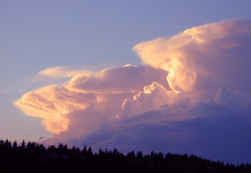
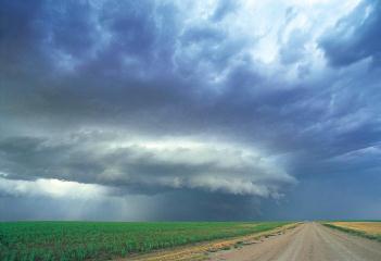
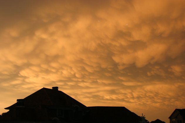
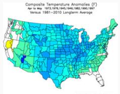
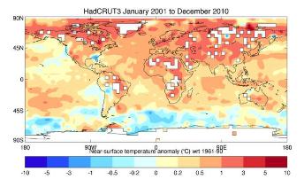
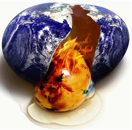
Increasingly destructive tornadoes, floods and other indicators of global warming are also occuring with heightened frequency around the world. The new study found extreme weather events increased from 2001 to 2010 at an alarming rate consistent with global climate change. Worldwide, this included an increase in floods by 63%, drought 43%, heat waves 43%, heavy rain 43%, fires 25%, and tropical cyclones 24%" - from the WMO, the World Meteorological Organization, in a story below the 7-Day. Photo above: "Restless Skies".
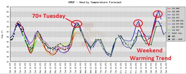
Temperature Roller Coaster. No more 80s in sight for a little while, but I suspect we'll top 70 Tuesday, as an intense storm drags warm air northward into Minnesota. We cool down Wednesday and Thursday, before warming back up to near 70 Friday, probably well into the 70s again next Saturday and Sunday. I wouldn't be shocked to see 80 again a week from today.
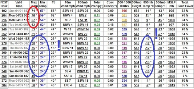
Why You Don't Want To Even Consider Planting Annuals Anytime Soon. I've seen a few runs in a row pointing to frosty weather from roughly April 4 to April 8 and my confidence level is growing that we'll have a few days in the 40s, nighttime lows in the mid to upper 20s. Not sure if this will kill off all those flowering shrubs, but I suspect we'll have 2, maybe 3 nights with lows in the 20s for the suburbs, probably close to freezing in the downtowns. I didn't think we'd skip into May with no more frosty nights, and although the maps don't show any accumulating snow, we will see more frost in early April.
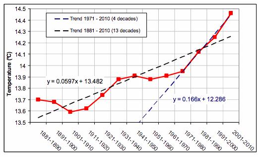
"Remarkable Trends". Here's a graph from the
WMO, the World Meteorological Organization, published at
Think Progress: "
The global temperature increase rate has been “remarkable” during the previous four decades, according to the preliminary summary. The global temperature has increased since 1971 at an average estimated rate of 0.166°C per decade compared to the average rate of 0.06 °C per decade computed over the full period 1881-2010."
+17.1 F. The first 23 days of March are running 16.5 degrees above normal in the Twin Cities.
50.5 F. average temperature during the last year. The preceding 365 days were the warmest on record, dating back to 1871, according to NOAA.
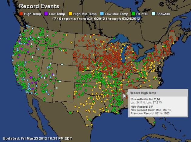
18 new daily maximum and minimum temperature records so far this month in the Twin Cities, all since March 10.
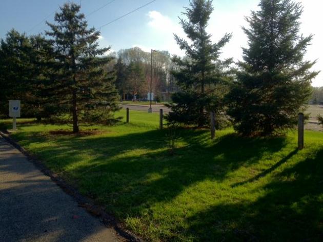
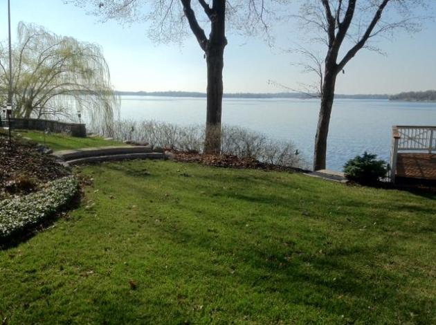
Meteorological Time Warp. If you were to look at these photos, and guess what time of year they were taken, would you really think March 24? Probably not. I can't believe how fast lawns are greening up, with recent rains, warmth and bright sun yesterday afternoon. Looks like we'll have an extra 6-8 weeks of lawn mowing this year. I'm not complaining.
U.S Heat "Unprecedented"; 7,000 Records Set Or Tied. The story from Reuters and
AlertNet: "
An "unprecedented" March heat wave in much of the continental United States has set or tied more than 7,000 high temperature records, and signals a warming climate, health and weather experts said on Friday. While natural climate variability plays a major role, it is the addition of human-spurred climate change that makes this particular hot spell extraordinary, the scientists said in a telephone and web briefing. "This heat wave is essentially unprecedented," said Heidi Cullen of the nonprofit science and communication organization Climate Central. "It's hard to grasp how massive and significant this is."
Early Wake-Up Call For Plants: from the same
Reuters/AlertNet article: "
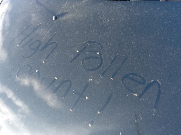
This early wake-up call for plants and animals can have disastrous health consequences, especially for children, said Dr. Aaron Bernstein of the Center for Health and the Global Environment at Harvard Medical School. Pollen counts are breaking records around the United States, Bernstein said, noting that allergies cost the U.S. economy between $6 billion and $12 billion annually."
Photo above courtesy of meteorologist David Neal in Birmingham, one of the cities most impacted by high pollen counts.
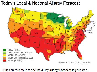
Read 'Em And Weep (Or Sneeze). Click here to see a current national map of pollen levels. Click on the interactive map to get a pollen forecast for your town, courtesy of
pollen.com.
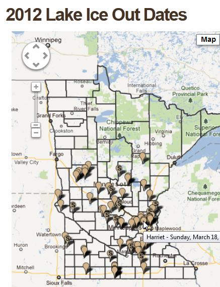
Minnesota - Or Northern Missouri? Ice-out dates have been running a good month ahead of schedule, as much as 5 weeks early over some central Minnesota lakes. Ice was off Lake Harriet a week ago, on March 18.
Click here to see an interactive map of actual ice-out dates in 2012, courtesy of the Minnesota DNR.
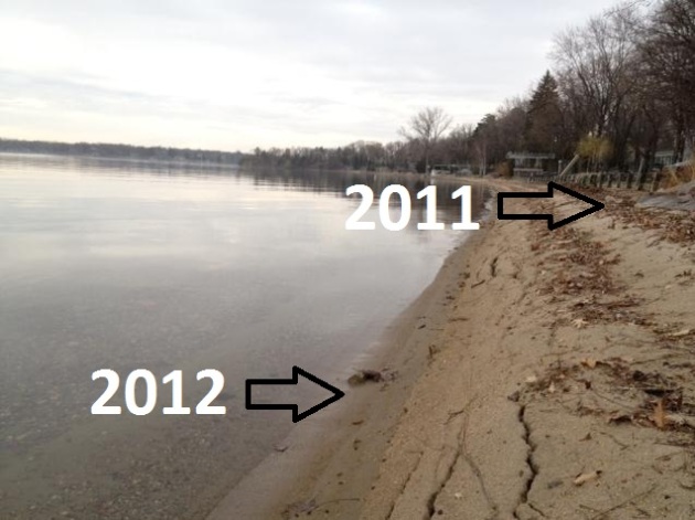
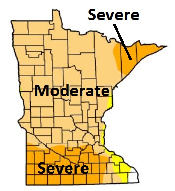
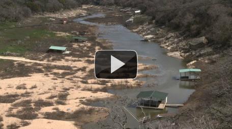
More Levee Than Lakeshore. I snapped this photo yesterday, showing lake water levels on Lake Minnetonka down as much as 2-3 feet from last year. We're still in a moderate to severe drought, the latest
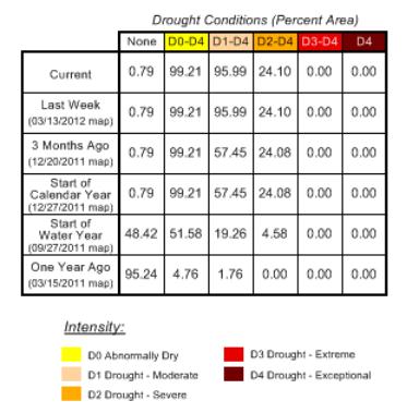
NOAA Drought Monitor update (March 20) for Minnesota in the upper right, showing the driest conditions over the southern quarter of Minnesota. We need 2-4" to recharge soil moisture and restore lake water levels. I don't see that amount of rain looking out 2 weeks - hopefully with La Nina fading we'll head into a wetter pattern from mid April onward, but my gut is still telling me that drought will be with us much of 2012. Hope I'm wrong.
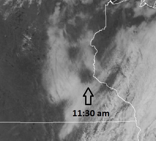
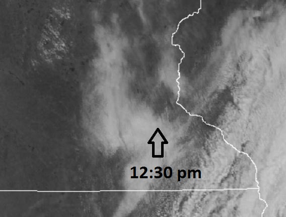
"Eye Of The...Stratus?" Maybe I'm just bored, or hallucinating? Yesterday I noticed that the fog and stratus began to break first over the immediate metro area. This may have been the result of the "urban heat island", warmer, drier conditions over the downtowns and close-in suburbs, running 2-3 degrees warmer than the surrounding suburbs, just warm enough to dissipate the stratus faster. So, is it sunnier over the downtowns than the 'burbs? Good question - there's a research project there somewhere.
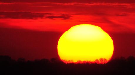
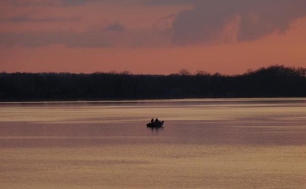
Fishing On March 23. I snapped a pic of these guys out on the Main Upper Lake of Minnetonka Friday evening, a smoldering sunset, not even a whisper of a breeze.
40 F. water temperature on Lake Erie at Buffalo; first 40 F. ever observed in March. Records go back to 1927.
"
The tulips are already in flower, weeks ahead of schedule. The apple tree has blossomed. The cherry trees have peaked and we’re only a couple of days past the equinox. And the birds are as chattery already as they usually are on the first of May. It’s a bloomin’ buzzin’ confusion of nature out there, and even if we cannot incontrovertibly ascribe this to climate change (the jet stream is the proximate cause), we can nod our heads when someone says that this is what climate change looks like." - from a Washington Post Op Ed below.
10 days. Spring comes an average of 10 days earlier than it did 20 years ago. Details below.
Remarkable Twin Cities Warm Weather Statistics. This is from the
Twin Cities NWS Office:
- As of March 24th, the maximum temperature in the Twin Cities has reached or exceeded 70 degrees on eight days, breaking the March record of 5 days set in 1910.
- The Twin Cities maximum temperature reached or exceeded 70 degrees for four consecutive days (March 16-19), breaking the previous record of three consecutive days, which occurred on March 23-25, 1939 and March 22-24, 1945.
- When the Twin Cities temperature reached 80 degrees on March 17, it was the first 80 degree temperature since October 9, 2011. The span without 80 degree temperatures was 159 days, the fewest consecutive number of days without 80 degrees in the modern record.
- March 23, 2011 through March 22, 2012 was the warmest 365 day period on record, back to 1871, with an average temperature of 50.5 degrees.
- Temperatures in the Twin Cities haven't dropped below the average high temperature since March 13.
"
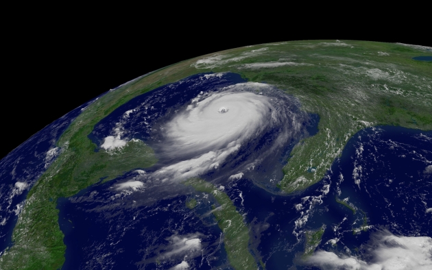
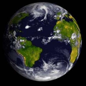
As to whether global warming might be contributing to the recent hot wave, Randall M. Dole, a deputy director of research at NOAA’s Earth System Research Laboratory (ESRL) in Boulder, Colo., said, "Absolutely. The planet as a whole is warming, the continents on average are warming faster than the oceans, so there is a great body of scientific evidence that would support such an interpretation. The question is how much.” - from an article at Climate Central below. Satellite image above: NOAA.
NOAA Announces Modifications To Hurricane Scale. A few tweaks to the Saffir-Simpson Scale for rating the destructive power of hurricanes in 2012, as explained by
The Cypress Times: "
As of May 15, 2012, Category 4 storms on the scale will be broadened by one mph at each end of the range, yielding a new range of 130-156 mph to resolve the issue. That change also affects the Category 3 and 5 wind speed thresholds. With this change, a 115-kt Category 4 hurricane will have its intensity properly converted to mph and rounded to the nearest 5 mph (130 mph) and remain within the Category 4 mph range." Hurricane Katrina 3-D image above courtesy of NOAA.
The Saffir-Simpson Hurricane Wind Scale will change as follows:
From:
Category 3: 111-130 mph (96-113 kt, 178-209 km/h)
Category 4: 131-155 mph (114-135 kt, 210-249 km/h)
Category 5: 156 mph or higher (136 kt or higher, 250 km/h or higher)
To:
Category 3: 111-129 mph (96-112 kt, 178-208 km/h)
Category 4: 130-156 mph (113-136 kt, 209-251 km/h)
Category 5: 157 mph or higher (137 kt or higher, 252 km/h or higher)
"
The Gulf of Mexico is warmer than normal since there was almost no winter weather down there this year," Gallus said. "With the water being warmer, winds can sweep larger amounts of moisture off the Gulf and bring it north, which creates more fuel for thunderstorms and tornadoes." - from an article at Iowa State Daily below.
"
Last year’s losses seem to be an escalation of a trend that began several years ago of increasingly frequent and more powerful storms. Tornadoes that once damaged a few homes now seem to level full city blocks." - from a Columbus Dispatch article focused on severe storms and insurance claims, details below.
"..
And let me say that I think that there is a campaign of disinformation going on about this, and there has been before. We saw it before with the attempts by the tobacco industry to throw cold water on the notion that there was a connection between cigarette smoking and cancer... if [conservatives] simply deny that there's any problem at all they have automatically opted out of the conversation about what the solutions to the problems are going to be". - MIT Professor Kerry Emmanuel in a Huffington Post article below on why the GOP is ignoring conservative climate scientists.
"Once In A Lifetime Temperature Records". Dr. Mark Seeley delves into our historic March heat in his weekly
WeatherTalk blog: "
March of 2012 is delivering once in a lifetime temperature records. It has surpassed June of 1933, July of 1936, and February of 1981 in the total number of warmest maximum and minimum daily temperature records set. At last count (as of March 23), the Twin Cities have seen 17 new daily record temperature values (both max and min) so far this month. Rochester and International Falls have seen 16 new record temperatures so far this month, while St Cloud reports 14 new temperature records. Even Duluth, which has a climate that is highly regulated by Lake Superior, has reported 10 new temperature records so far this month."
Record-Smashing Heat In Chicago. From the Chicago office of the National Weather Service: "Over the past nine days, Chicago has broke or tied daily high temperature records on all of them! Only one stretch of standing daily temperature records since 1871 is longer. During the ten day stretch from August 25th through September 3rd, all the record highs belong to 1953."
Soaring Into The 80s, Warm Weather Breaks Thousands Of Records. From an article at
MSNBC.com: "
Researcher David Barriopedro of the University of Lisbon in Portugal found that 2003 and 2010 were the warmest summers since 1500. But he cautioned against blaming the heat waves on climate change. "It's very difficult, if not impossible, to attribute a given extreme event, like the 2003 mega heat wave, to climate change," he told LiveScience. "What we can do is estimate what has been the contribution of humans to increase or decrease the likelihood of an analogue, an event like that."
* the last week's worth of records above, courtesy of NOAA and
Ham Weather.
| Total Records: | 1746 |
| Rainfall: | 514 |
| Snowfall: | 66 |
| High Temp: | 436 |
| Low Temp: | 29 |
| Low Max Temp: | 146 |
| High Min Temp: | 555 |
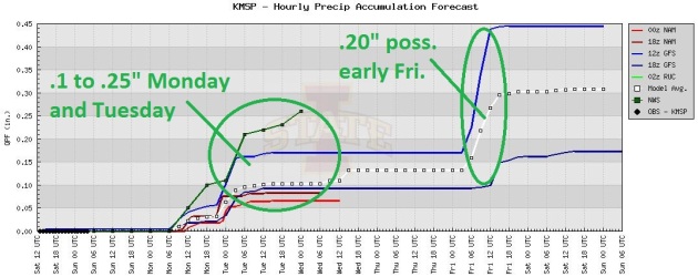
Couple Of (Minor) Free Lawn Waterings. The models print out light amounts of rain this week, one opportunity for rain Monday into Tuesday morning (even a few strong T-storms), another chance of .10 to .20" late Thursday into Friday morning as we begin to warm up again.
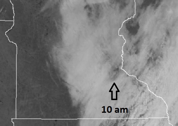
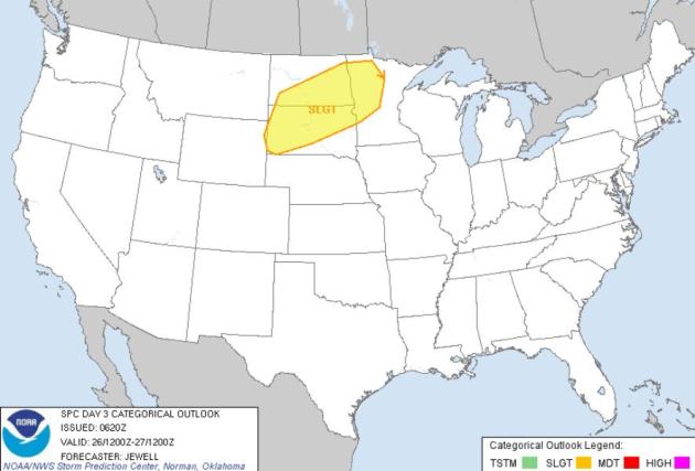
Monday Severe Threat. Strong warm advection coupled with vigorous wind shear, an approaching storm, and surface dew points near 60 may set off a few strong to potentially severe T-storms late Monday and Monday night, especially over western Minnesota and the Red River Valley. Source:
SPC.
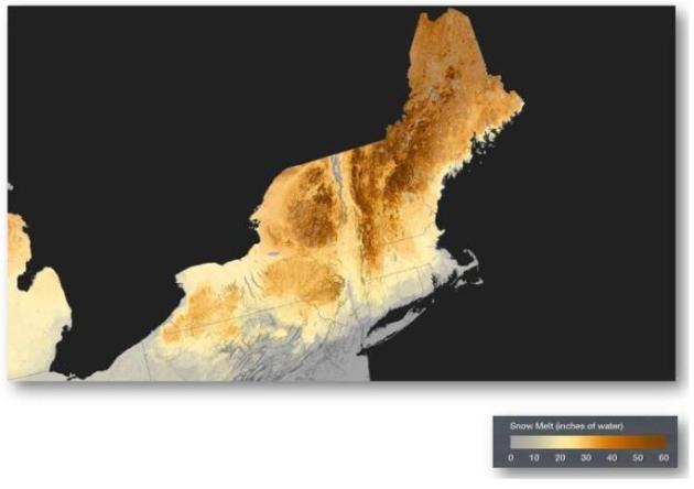
New England's "Fast Forward" Snow-Melt: March 1-21. From the
Boston office of the National Weather Service: "The rapid arrival of springtime temperatures throughout New England is causing an equally rapid melt of the snowpack throughout the Adirondack Mountains in New York, Vermont, New Hampshire, and Maine. This image shows the total snow melt from March 1-21, 2012, using data from the NOAA National Operational Hydrologic Remote Sensing Center."
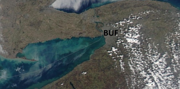
Lake Erie Water Temperature At Buffalo Is 40 F. From the Buffalo office of the NWS: "
The water temperature on Lake Erie at Buffalo reached 40 degrees this morning. This is the first time on record the lake temperature has hit 40 degrees in March. The previous record for the first 40 degree reading was on April 1st, 1998. Records for Lake Erie water temperature go back to 1927." Image: NASA "
MODIS", University of Wisconsin.
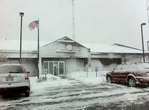
Ah, The Memories. A year ago (yesterday) it snowed over 4" in the Twin Cities, but parts of Wisconsin saw far more than that. Here are some good memories from the
Green Bay, Wisconsin office of the NWS: "
A late-season winter storm produced heavy, wet snow and occasional thundersnow across parts of central and northeast Wisconsin on March 22-23, 2011. During the two-day period, many locations reported over a foot of snow. Green Bay officially recorded 17.8 inches. That’s the highest snowstorm total in over 120 years of weather records; only two storms produced more snow (29.0″ in March 1888 and 23.1″ in January 1889). In addition, this storm is the third one this season to produce 10 inches or more of snow in Green Bay, the first time that’s ever happened during a winter season." Photo: GRB National Weather Service office.
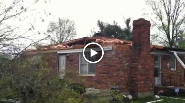
Tornado Damages About 7 Homes In Southeastern Louisville. Details from the
Courier Journal: "
An unexpectedly severe storm ripped through Jefferson County Friday afternoon, damaging six or seven homes in Fern Creek, Louisville police said. A Louisville police officer who was on a run in the area of Brook Chase Court and Independence School Road saw a funnel cloud pass through, said Maj. Mark Fox, a 7th Division commander. The National Weather Service confirmed there was a tornado, based on the damage east of McNeely Lake, said meterologist Andrea Schoettmer. The weather service was still trying to determine the strength of the tornado."
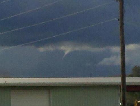
"Cold Air Funnels." This funnel was spotted just northwest of the Wichita, Kansas NWS office Friday evening. These brief, usually harmless funnels form in cooler air, where large, long-lasting, violent tornadoes are unlikely, but brief instability can trigger miniature funnels that can descend toward the ground. When they do touch down, on rare occasions, damage is usually minor. Here's more from the
Wichita, Kansas National Weather Service: "
Cold air funnels occur in a relatively “cold air mass” in a synoptic (or large scale) setting, quite different from conditions that favor tornadoes in “warm air masses”. In brief, they usually occur in the spring and fall under slow moving areas of low pressure in the upper atmosphere with the highest frequency during the mid-day hours. Radar signatures generally associated with tornadoes are not observed and the funnels are usually short-lived."
After An Early Wave Of Violent Storms, Insurers Wonder Whether 2012 Will Turn Into Another Year Of High Claims. Some interesting storm statistics from
The Columbus Dispatch: "This year is looking a lot like 2011 as far as the insurance industry is concerned, which is to say worrisome. Powerful, violent storms in the past few weeks already have claimed lives in the South and Midwest, including three in southern Ohio. Couple that with the recent unseasonably high temperatures, and it’s no wonder that insurance companies are feeling like 2012 is picking up right where the record-setting claims of 2011 left off. “It’s only the beginning of March, but Mother Nature looks to be repeating herself,” said Bob Hartwig, president of the Insurance Information Institute, who was in Columbus this month for a presentation at the Ohio Insurance Institute. Last year’s losses seem to be an escalation of a trend that began several years ago of increasingly frequent and more powerful storms. Tornadoes that once damaged a few homes now seem to level full city blocks.
Photo credit above: Fred Squillante, Dispatch.
"
In the meantime, it will be harder and harder to ignore the freakish weather patterns and impacts they are having like flooding, wild fires, and drought. After all, CO2 molecules do what they do and are not influenced by any skepticism on the right." - from a
Huffington Post article, details below the 7-Day Outlook.
Do Warm Winter And Record Warm March Mean Long Hot Summer? I feel a long, hot summer coming on, but that's based more on intuition and gut feel than solid science. Here's an excerpt of an interesting post from the Atlanta Weather Examiner,
meteorologist Kirk Melhuish: "
Does the warm winter mean a scorching summer and spring? Climatologic data shows surprisingly there is little correlation between the winter weather and the summer that follows. They are about evenly split in Georgia between staying warm or going in the opposite direction and being neutral. While neither a real hot nor real cold spring is forecast the summer outlook is too soon to call. The rest of spring is still expected to be warmer than normal when averaged over the 60-day period. The two-year La Nina in the Pacific Ocean (cooler than normal sea water) is expected to reverse to an El Nino (warmer than normal ocean temperatures) this fall and winter. In addition the Atlantic Ocean which has been on fire compared to normal is cooling to near normal levels and this trend is expected to continue, perhaps even going to cooler than normal in the years ahead." Graphic: NOAA's CPC, Climate Prediction Center.
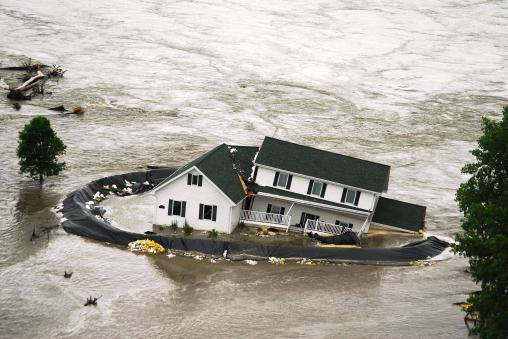
Missouri River Flood Risk Remains Normal. Some good news, after 2011's 7-month flood on the Missouri River and its tributaries. Here's an excerpt of a story from the
Yankton Press & Dakotan: "
The risk of flooding in the Missouri River Basin this spring is mostly at normal levels, officials said Friday. “The National Weather Service continues to project a normal risk of flooding for most areas within the Missouri Basin for this spring,” said Kevin Low, senior hydrologist for the Missouri Basin River Forecast Center, during a U.S. Army Corps of Engineers conference call. “The exception exists in the Dakotas where we expect a lower-than-normal risk for flooding.” A normal risk implies that, for those locations which typically experience flooding from year to year, a likelihood of flooding is expected this spring. For those locations that do not normally flood, the projections are that there will likely be no flooding this spring."
Photo credit above: "
A home breaks apart as it is engulfed by Missouri River flood waters, Wednesday, June, 22, 2011 in the Hoge Island area of Bismarck, N.D. (AP Photo/The Bismarck Tribune, Brian Gehring)."
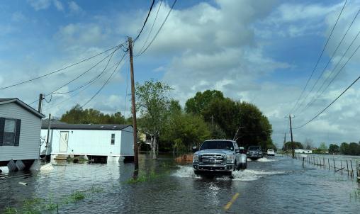
Floods Continue To Swamp Louisiana. An update from
USA Today: "NEW ORLEANS – Beauregard Parish sheriff's deputies and state wildlife agents took boats to Bundick's Lake on Thursday to rescue people who didn't hear or didn't heed warnings that storm runoff would raise it to dangerous heights. Three sheriff's office boats and one from the Department of Wildlife and Fisheries were at the lake, Chief Deputy Joe Toler said. On Wednesday, sheriff's office news releases had urged people there to take precautions against high water but did not require evacuation. Those rescues weren't the main problem, though, Toler said. "
Our biggest problem is people trying to make it through the water on the roads," he said.
Photo credit above: "
As residents of Carencro, La. cleanup after Mondays flooding, areas in the West of Lafayette Parish are still fighting flooding Tuesday, March 13, 2012. Trucks travel past flooded fields on Mills Street as the sun comes out. (AP Photo/The Advertiser, P.C. Piazza)."
Tornado Season Has Begun. Here's an excerpt from
Iowa State Daily: "
Tornadoes are highly unpredictable phenomena, so climatologists say it is hard to say exactly what lies ahead for the 2012 tornado season. However, there are some climatic factors that may suggest an increase in tornado activity this year. “The Gulf of Mexico is warmer than normal since there was almost no winter weather down there this year," Gallus said. "With the water being warmer, winds can sweep larger amounts of moisture off the Gulf and bring it north, which creates more fuel for thunderstorms and tornadoes." There is overwhelming evidence to suggest that Earth's climate is changing. Some scientists are wondering if global warming might lead to a dramatic increase in extreme weather events."
Thunderstorms And Flying. I keep reassuring my wife every time we fly that pilots want to live to see their grandkids too. They never (purposely) fly into T-storms, due to a very real risk of wind shear and damaging hail. A plane is designed to survive a direct lightning strike (this happens many times every year) but severe turbulence can cause a plane to lose lift, with potentially tragic results.
Flightaware.com has a good overview of the risks posed by thunderstorms: "
Aircraft must avoid thunderstorms as well as the surface conditions they produce. In terms of wind shear, pilots avoid both taking off and landing during such conditions. Often the passage of a storm near or over an airport causes operations to grind to a halt. For aircraft attempting to take off, a tarmac delay can result until the storm passes. Returning to the gate is not usually possible either, as ground personnel are not allowed on the ramp when lightning is present. That means there’s nobody available to marshal an airplane into the gate, let alone to retrieve baggage. For aircraft attempting to land, an airport closure results in aircraft holding pattern assignments. Of course flights can only hold for so long with fuel endurance becoming an issue. When holding is no longer possible, and the destination airport is still closed, the pilots are forced to divert to an alternate airport to refuel and wait out the storm. If you have a connecting flight, chances are your connecting aircraft is in the same situation and therefore there’s still hope that you won’t be stranded."
Protecting Your Horses (And Livestock) During Thunderstorms. Here's some great information from
The Daily Ardmoreite in Ardmore, Oklahoma: "
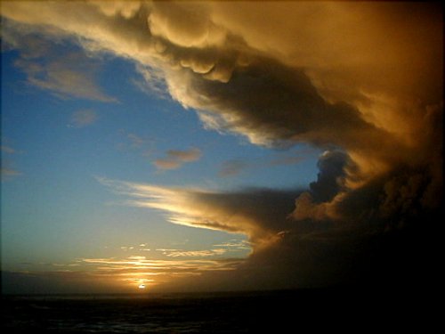
Severe weather can be a troubling event, especially when there are animals whose welfar and comfort is of concern as well. Small pets can usually take cover with their owners, but what precautions can an owner take for larger animals such as horses? "The first step in protecting your horses and other livestock from severe weather is to realize what the severe weather risks are in your area," said Dr. Brandon Dominguez, clinical assistant professor at the Texas A&M College of Veterinary Medicine & Biomedical Sciences, and member of the CVM Veterinary Emergency Team. "For many areas, springtime brings threats of severe thunderstorms, lightning, flash floods, and tornadoes." Photo credit: "Restless Skies".
Climate Change We Can Believe In. It's not what you may think - this article at
The Chicago Tribune focuses on "micoclimates", dramatic changes over the span of your back yard:
"Every spring, the magnolia growing on the side of our house is the first tree in the neighborhood to burst into bloom. Some years, it is a full two weeks ahead of trees just like it growing in yards nearby. The secret to its early bloom is not special attention paid to its care; on the contrary, I probably neglect it more than other trees in the yard. The reason this magnolia is the first to bloom is that it is growing in a microclimate. Microclimates are, as their name implies, small areas or locations affected by environmental factors that set them apart from the norm. Environmental influences such as radiant heat, protection from wind and sun, or nearby bodies of cold or warm water can all create microclimates. These areas may a few degrees warmer or a few degrees cooler than the surrounding environment, and that can make a marked difference for what kind of plant will grow there. In the magnolia's case, growing close to the southwest side of our home, it enjoys radiant heat from the house and is sheltered from any direct wind." Photo: Tricia Frostad, Chanhassen.
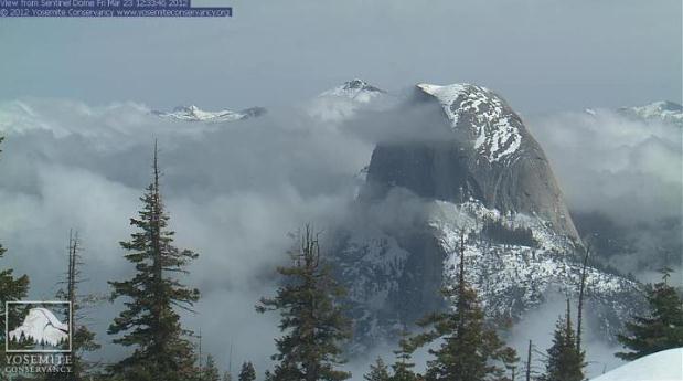
Half Dome. Check out this spectacular webcam shot on Friday: "Here’s a nice shot of Half Dome amidst the clouds from the Yosemite Conservancy’s Sentinel Dome webcam from a few minutes ago." Check out the Yosemite webcams for yourself at
The Yosemite Conservancy.
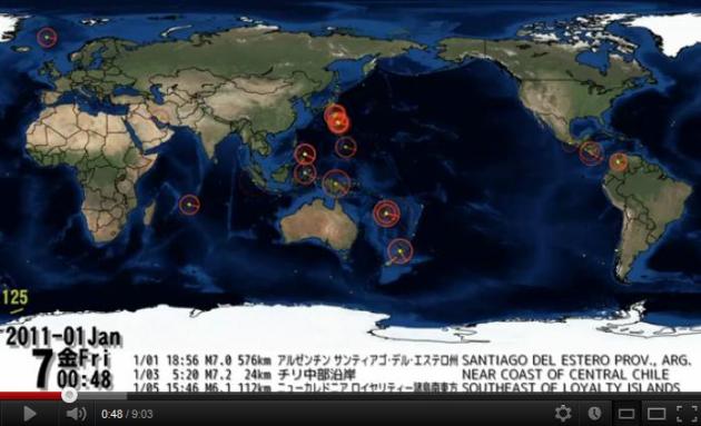
2011 Earthquakes Worldwide. Someone spent a fair amount of time aggregative quake data and plotting it in different formats - the
YouTube clip is definitely worth a look: "
This is truly profound to see --- the year of 2011 earthquakes plotted out on a orthographic (globe) map -- ANIMATED WITH SOUND INTENSITY for each earthquake!!"
German Lakeside Resort Features A Collection Of Floating Homes. Hey, if climate scientists are right (and I fear they are), many of us living on or near the coast may be inquiring about floating homes later this century. Details from
gizmag.com: "
Within the Lusatian Lake District in Germany, lies the unique Lausitz Geierswald Resort with its collection of floating residences. Designed by the German architectural firm Steeltec37, the floating village includes a collection of modular buildings designed to offer sustainable living and lakeside luxury."
10 Ways To Prevent Auto Theft.
Beat The Traffic has some good advice on how to lower your risk of being the victim of auto theft: "In the United States a vehicle is stolen an average of every 21 minutes. Not only does auto theft costs the victim time and money, but it cost society, because it drives insurance premiums up and many times stolen vehicles are used to commit other crimes. Below are some tips you can use to avoid being the victim of a car thief:
- Don’t leave your car unlocked. Approximately 50 percent of all vehicles stolen were left unlocked.
- Never leave your car running, even if you’ll only be gone for a minute. Vehicles are commonly stolen at convenience stores, gas stations, ATMs, etc. Many vehicles are also stolen on cold mornings when the owner leaves the vehicle running to warm up.
Boat 2.0: The "Wider 42": More Deckspace And Stability In 12 Seconds. Ah, in a perfect world. Sadly, it ain't. Highlights from those inspired techno-geeks over at
gizmag.com: "
One of the stars of the Palm Beach International Boat Show which began today is the Italian Wider 42 footer, with Wider being both an appropriate adjective and the master brand name. The Wider works ingeniously in that you can activate mobile extensions either side of the hull, double the deck area and give the boat complete stability, all at the press of a button."
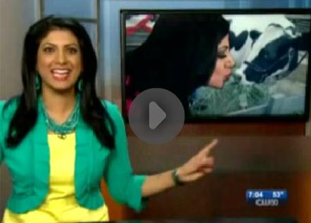
"Kissing A Cow"? This Must Be Local Television.
TVSpy.com has the compelling details. Are we in a ratings period? "The producers at Detroit CW-affiliate WKBD had a little fun with anchor
Syma Chowdhry yesterday morning. Chowdhry was reporting a story about a cow-kissing event when a photoshopped picture of
her kissing a cow appeared in an over-the-shoulder graphic. “I did not kiss a cow!” she exclaimed. “That cow looks a little disturbed, in that picture,” weather anchor
Jill Washburn remarked. “No it doesn’t,” Chowdhry said. “It’s smiling on the inside.”
Beyond The Statistics
If you live long enough you'll see everything, even a June-like March. I've had enough warm-weather statistics thank you. Let's just say it's historic, probably the warmest March since records were started, back in 1884. We're taking "record-breaking" to new heights; some towns from Minnesota to Michigan obliterating all-time records by 20-30 degrees. I'm seeing things on my weather maps I never thought I'd live to see.
"Paul, green lawns, budding trees, how early are we this year?" I'm no entomologist, but I suspect this is typical for about May 1, give or take; so 4-5 weeks early? One big downside to our light-switch spring: pollen. Allergy sufferers will grapple with a Memphis-like growing season this year.
The GFS is hints at frost April 4-7; keep a light jacket handy; hold off on the annuals another 5 weeks, at least.
We cool off a little today (only 16 degrees above average), showers Monday, even a slight severe risk for the Red River Valley. 70 returns Friday, maybe mid 70s & thunder by Saturday.
And to think, last year on this date we woke up to 18F, 4 inches snow on the ground, a wind chill of 10F.
I'm as baffled as everyone else by our unlikely spring break.
Climate Stories...
Warmer Planet Means More Severe Storms. The story from Phillip Duncan at
The New Zealand Herald News: "
Are we seeing the first serious signs of climate change? For decades scientists have been warning of a slowly warming planet. A few degrees doesn't sound like much, but if you have ever watched a tropical storm move over water that is just 2C warmer, you'll know it can make the difference between a slightly damaging category 1 storm and a catastrophic category 5. During the snow storm last August many people commented "so much for global warming". The thing is, a warmer planet means bigger snow storms. Winter temperatures will still fall below freezing but a couple of degrees more warmth in the air can lead to more moisture and that makes bigger snow storms." Photo: Kristin Hayes.
World Meteorological Organization Confirms Climate Change Accelerated In Past 10 Years; 2011 Was 11th Warmest On Record. An update from East County Magazine: "The United Nation's World Meteorological Organization, representing 183 member nations, issued its Annual Statement on the Status of the Global Climate today. The report concludes that climate change accelerated in the past decade and that 2011 was the 11th warmest year since records began in 1850. "
Increasingly destructive tornadoes, floods and other indicators of global warming are also occurring with heightened frequency around the world. The new study found extreme weather events increased from 2001 to 2010 at an alarming rate consistent with global climate change. Worldwide, this included an increase in floods by 63%, drought 43%, heat waves 43%, heavy rain 43%, fires 25%, and tropical cyclones 24%."
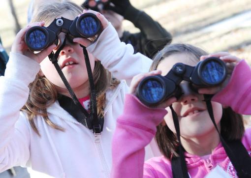
"Citizen Science" Fights Climate Change. Bird-lovers are helping scientists track a slowly warming climate, as described in this story from
wiscnews.com: “
Climate change is occurring and more and more birds are responding to it in the United States,” he said. Zuckerberg said much of his research focuses on the use of “citizen science” in monitoring projects like Project FeederWatch, a North American survey of the abundance and distribution of birds that visit feeders in winter. “It is truly a big data fest where we have regular people watch what type of birds visit their feeders,” he said. Zuckerberg said the specialized project focuses two-day counts separated by a week beginning in November and ending in April. He said from the data that has already been collected he has found the American robin is arriving earlier each year, which leaves him and others involved in research to examine winter temperatures."
Photo credit above: "
In this photo taken Saturday, Jan. 7, 2012, Shelby Eramo and Hannah Lewis spot a male Northern Cardinal on nature trails near Redings Mill, Mo. Eramo and Lewis were taking part in the third annual Christmas Bird Count for Kids organized by Ozark Gateway Audubon Chapter. (AP Photo/The Joplin Globe, Kellen Jenkins)."
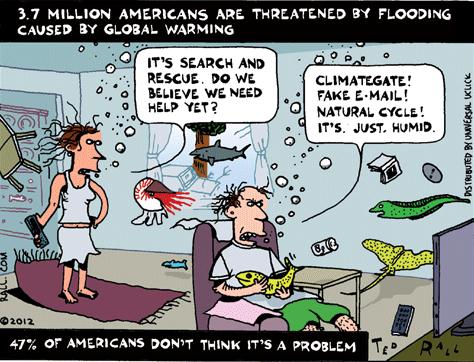
Thanks to Ted Rall and
gocomics.com for passing this one along...
Early Spring: A Not-So-Early Warning. A good summary from
The Huffington Post: "March used to come in like a lion and go out like a lamb. Now it comes in like a lamb and goes out like a mouse. Although the vernal equinox occurred last Tuesday, some parts of the country have been experiencing spring-like, even summer-like, temperatures for several weeks. In fact, March temperatures have shattered records across the Central and Eastern United States and much of Canada. Nearly 850 U.S. cities and towns notched record highs from March 15 through 22, according to
Hamweather. Chicago, which suffered a deadly heat wave in 1995, experienced record highs six days in a row, from March 14 through 19, with temperatures above 80 degrees. Climate scientists call this phenomenon "spring creep." For quite some time they've been projecting that man-made global warming would make spring arrive earlier than normal, and it is--
an average of 10 days compared with just 20 years ago."
Photo: Ron Edmonds/AP.
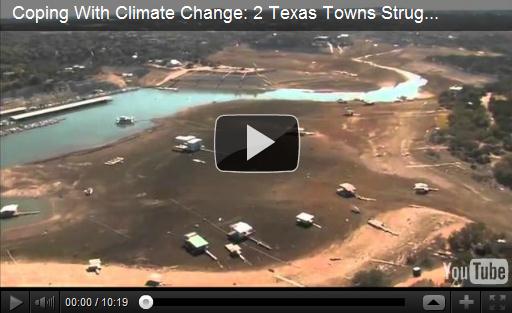
Coping With Climate Change: 2 Texas Towns Struggle For Water. The
PBS NewsHour has been running an excellent series on how climate change is making water shortages worse over time; highlighting the first Texas town to ever run out of water (they're digging an 11 mile pipe to pump in water from a nearby town). Here's an except of Thursday night's video segment: "
....But it did not rain enough. During last year's drought, the state only received 11 inches of rain. That's 16 inches less than normal. Large bodies of water are measured in what's known as acre feet. That's the amount of water it takes to cover an acre of ground in a foot of water. Lake E.V. Spence, when it's full, has 517,000 acre feet of water. Now it has less than 1,000. Robert Lee is not alone in feeling the heat. Nearly 1,000 public water systems in Texas restricted water last year. Even now, after some winter rains, 17 systems are projected to run out of water in six months or less. The 2011 drought was the most intense one-year drought in Texas since at least 1895, when statewide weather records began. Losses reached $10 billion in crops, livestock and timber. Without water, farmers and ranchers like Bartley Murray are scaling back."
Global Warming May Have Fueled March Heat Wave Odds. Is our March heat wave a symptom of a warming planet? Andrew Freedman from
Climate Central has a good explanation. Here's an excerpt: "
Gabi Hegerl, Chair of Climate System Science at the University of Edinburgh, said there is evidence that extreme heat events have become more common and more severe, including at the regional level in parts of the U.S. ”This is consistent with observing more and stronger heat waves,” she said. Hegerl said that in order to draw conclusions about global warming’s role in this particular heat wave, one would need to conduct modeling studies where you compare the odds of this event occurring with and without added greenhouse gases in the atmosphere, such as carbon dioxide, “to see how much the warming has changed the odds.” The reasoning behind such an approach is because both global-warming trends and shifts in atmospheric circulation may contribute to a certain event, so scientists need to observe the whole climate system at play to investigate how often an event with these extreme characteristics takes place under the two alternative scenarios."
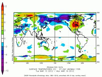
Map credit above: "
Surface temperature departures from average from march 13-19, showing the heat in the U.S. and Canada (in orange and red). Click on image for a larger version. Credit: NOAA/ESRL."
Weather Records Tumble By The Thousands As U.S. Swelters And Global Warming Gains Converts. Here's an article from the U.K.
Telegraph: "
Think the drought's getting bad? You should be in Spicewood, 35 miles northwest of Austin, Texas. In January it became the first town to run out of water in an acute dry spell in the state. Now a 7,000 gallon tanker has to roll into own each day to bring the stuff of life – there's a ration of just 50 gallons a day per household – and the regional water utility expects this to go on for months. A couple of hundred miles away, the town of Robert Lee is not much better off. The lake that supplies its sole source of water is now less than one per cent full. It has cut consumption by 80 per cent, but is still racing against the clock to construct a 12 mile long emergency pipeline to bring water from the nearby town of Bronte before it runs out altogether. In all some 17 towns in the state face their supplies drying up within six months if the drought continues. And 1,000 Texan towns and cities had their supplies restricted last year. Then, too, some towns – including Robert Lee – sweltered in 100 degree heat for more than 100 days."
U.S. Intel Says Water Scarcity, Floods A Source Of Instability In Coming Decades. Here's an overview of an important story from AP and
The Washington Post: "
WASHINGTON — Drought, floods and a lack of fresh water may cause significant global instability and conflict in the coming decades, as developing countries scramble to meet demand from exploding populations while dealing with the effects of climate change, U.S. intelligence agencies said in a report released Thursday. An assessment reflecting the joint judgment of federal intelligence agencies says the risk of water issues causing wars in the next 10 years is minimal even as they create tensions within and between states and threaten to disrupt national and global food markets. But beyond 2022, it says the use of water as a weapon of war or a tool of terrorism will become more likely, particularly in South Asia, the Middle East and North Africa."
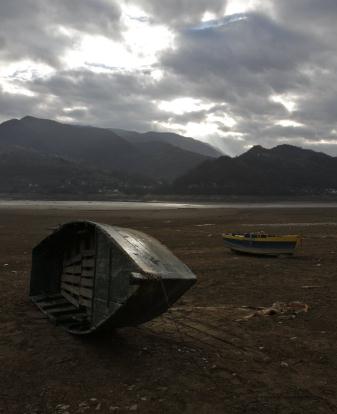
Photo credit above: "
Boats lay on a dried-up bed of the artificial lake on river Neretva near the Bosnian town of Konjic, 45 kms south of Sarajevo, Bosnia, on Friday, Dec. 2, 2011. A lack of rain has caused a drought across the region making water shortages in some parts of the country and difficulties in production of electric energy in hydropower plants. (AP Photo/Amel Emric)."
Do You Believe In Climate Change? To quote the
U.K. Guardian, "Climate change is not a matter of belief, but of emperical evidence." Here's an excerpt of a recent article: "
This may seem like an odd question for a climate scientist to ask, but it is one I am constantly asked now. The typical discussion starts: "I know that the climate is changing, but hasn't it always changed through natural cycles?" Then they will often give an example, such as the medieval warm period to prove their point. Those asking the question include a wide range of people I meet in the pub, friends, politicians and increasingly even some of those active in sustainable development and the renewable energy businesses. What I find interesting is that I have known many of these people for a long time and they never asked me this before. Recent studies show that public acceptance of the scientific evidence for man-made climate change has decreased. However, the change is not that great. The difference I find in talking to people is that they feel better able to express their doubts."
Photo credit above: Etsa/Corbis.
Is There A Single "Face" For Climate Change? Here's an excerpt from an article written by Bud Ward at
The Yale Forum On Climate Change And The Media: "
And, perhaps the toughest question of all: If not Al Gore … then who? Those serious about the climate issue need to do more than merely find fault with Gore as their most visible leader. They should also have to flag their alternative? So, who is it?
Let’s try a simple math equation, looking not so much to the past or even the present, but rather to the future:
Martin Luther King, Jr.
___________________ Civil Rights Movement
| =
| X
___________________ Climate Change
|
"
What’s your answer? Have you got one? Think back: You could change the equation to Ralph Nader is to auto safety in the 60s as “X” is to Climate Change in the second decade of this century. Or try even Michael Jordan is to professional basketball as “X” is to Climate Change, or Bill Gates is to Microsoft as “X” is to Climate Change."
Why Is The GOP Ignoring Its Own Climate Scientists About Climate Change? The story from
Huffington Post: "
According to a fascinating article by Katherine Bagley prosaically titled "GOP Not Listening to its Own Climate Scientists on Climate Change," a group of prominent conservative scientists, many of them evangelicals, approached conservative politicians to educate them on climate change and predictably the pols have not "warmed," shall we say, to their efforts. Although usually loath to announce their political leanings, these Republican-affiliated scientists thought conservatives may be receptive to scientists with conservative credentials. Who are these concerned scientists and how do they get conservative politicians to embrace climate change when many of them see the use of alternative energies as a step toward anarchy?"
Climate Change: The Spring Jailbreak Of 2012. Here's an excerpt of an Op-Ed in
The Washington Post: "
There is legitimate debate about what’s the best way to combat climate change, but it’s unfortunate that we spend so much time listening to people claim that there’s no such thing as global warming, that it’s some kind of hoax by nefarious scientists who think the way to get ahead in their profession is to make up a bunch of stuff that’s not true. What worries me is our inability to think long-term — and this gets back to what we were talking about just a few days ago. How can you take on a problem as daunting as climate change when you can’t solve a fundamentally easy problem like crafting a sensible federal budget?"
U.S. Inches Toward Goal Of Energy Independence. A story from
The New York Times: "
MIDLAND, Tex. — The desolate stretch of West Texas desert known as the Permian Basin is still the lonely domain of scurrying roadrunners by day and howling coyotes by night. But the roar of scores of new oil rigs and the distinctive acrid fumes of drilling equipment are unmistakable signs that crude is gushing again. And not just here. Across the country, the oil and gas industry is vastly increasing production, reversing two decades of decline. Using new technology and spurred by rising oil prices since the mid-2000s, the industry is extracting millions of barrels more a week, from the deepest waters of the Gulf of Mexico to the prairies of North Dakota." Photo: city of
Palm Desert.
20 Experts Who Say Drilling Won't Lower Gas Prices. A story from
Media Matters: "
In a pretty impressive act of journalism, the Associated Press recently conducted a "statistical analysis of 36 years of monthly, inflation-adjusted gasoline prices and U.S. domestic oil production." The result: "No statistical correlation between how much oil comes out of U.S. wells and the price at the pump." It's neat to see math cut through the talking points and get straight to thetruth of the matter -- which is that expanding drilling is a fundamentally ineffectual response to gas price spikes. Given that changes in U.S. oil production don't move gasoline prices, it should be clear that U.S. government policies related to drilling are of even smaller consequence. Indeed, 92 percent of economists surveyed by the Chicago Booth School of Business agreed this week that "changes in U.S. gasoline prices over the past 10 years have predominantly been due to market factors rather than U.S. federal economic or energy policies."