 Tuesday Record Highs:
82 F
Tuesday Record Highs:
82 F. record high at Pierre, South Dakota yesterday.
82 F. Joplin/Springfield, Missouri, a new record for March 13.
81 F. high at Sioux City, Iowa.
80 F. high in Washington D.C. Tuesday. That's the average high for June 2.
79 F. high at Sioux Falls, South Dakota, a new record for March 13.
70 F. high at Albany, New York.
55 F. high at International Falls, a new record.
* thanks to Fred Allen at EarthNetworks for sharing some of these records.
200+ record highs since Sunday, nationwide. Source: CNN.
"
About 3.7 million Americans live within a few feet of high tide and risk being hit by more frequent coastal flooding in coming decades because of the sea level rise caused by global warming, according to new research". - from an article at The New York Times, details after the 7-Day Outlook.
"
Many people believe the solution to global warming is suppressing economic activity, Scruggs says, but that's an unpopular view when the economy is struggling. "So it's easier for people to disbelieve in climate change than to accept that it is real, but little should be done about it right now," he says." - from an article at
physorg.com below.
"
Science does not know its debt to imagination." - Ralph Waldo Emerson
"
If global average temperatures reach 1.6 degrees C (2.9 degrees F.) above preindustrial levels, the iconic ice sheet probably will tip toward irreversible loss, a new study finds. With a rise already of 0.8 degrees C, global average temperatures already are halfway there." - from an article at
The Christian Science Monitor. Details below.
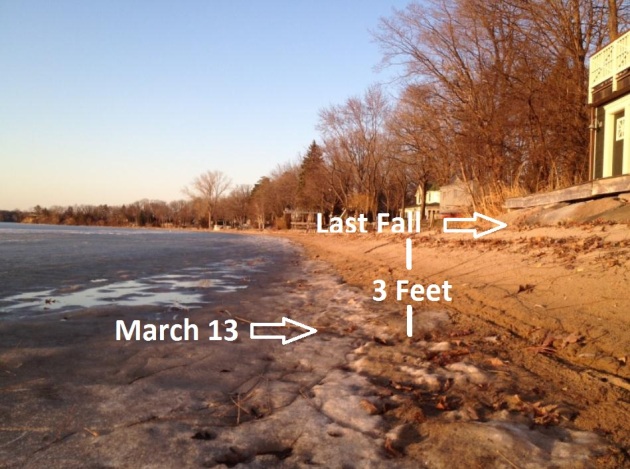
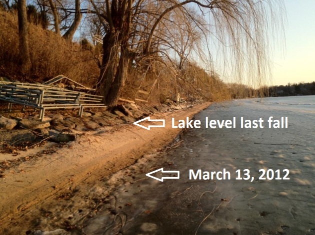
A Good Summer To Be In Propeller Repair? I wandered down on the shoreline of Lake Minnetonka yesterday and was shocked by how low water levels have fallen. Just a WAG: water levels are down anywhere from 2-3 feet from last fall. Not good. What makes me think it's going to be a long, hot (dry) summer?
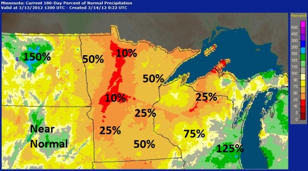
One Map That Sums It All Up. This is the "percentage of normal" precipitation for the last 6 months, since September 13, 2011. Precipitation from Alexandria and Wadena to Bemidji is only 10% of what it should have been - the rest of Minnesota slightly wetter (25 to 50% of normal). Not good. Moisture conditions are better over southern Wisconsin and portions of the Dakotas, but unless we get a few big rainstorms soon, Minnesota's farmers are going to be in bad shape for spring planting. Map courtesy of NOAA's
Advanced Hydrological Prediction Service.
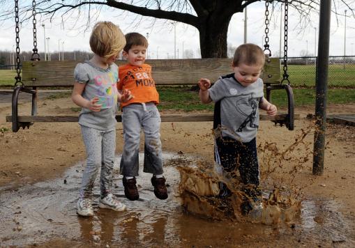
"It's Just Mud!" I love this photo - kind of sums up the joy of spring (and being a kid). Photo credit: "
Collin Corn, 2, right, explores a large mud puddle with his cousins, Izzy Ferrell, 4, left, and Isaac Ferrell, 2, center, during a trip to Wesselman Park in Evansville, Ind. with their grandmother, Lori Corn, not pictured, on Monday, March 12, 2012. "It's such a nice day, I had to bring them out," said Corn. (AP Photo/The Evansville Courier & Press, Molly Bartels)."
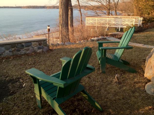
A New Personal Record. This is the earliest I've ever brushed the cobwebs off my Adirondack chairs and set them up. March 13? I'm black and blue from pinching myself.
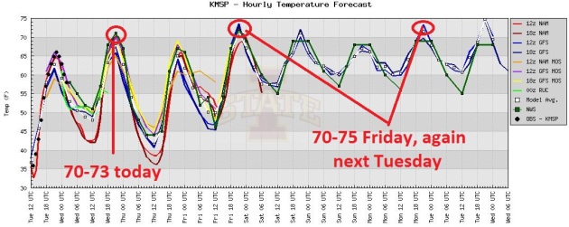
The ECMWF Was Right. A week ago, relying on the European ECMWF model, I went out on a limb and hinted at 70 for this week. A number of readers though I had lost my mind (a reasonable scenario these days), but there was method to my madness. The ECMWF has handled weather systems far better than the NAM, WRF or GFS all winter, so I put extra weight on the European prediction. Turns out it was right. These are predicted highs/weather for the Twin Cities through next Thursday, highs ranging from 67-75. Right now Monday and Tuesday look like the warmest days: highs possibly poking into the mid-70s. A handy Celsius to Fahrenheit conversion table is
here.
Who Turned Up The Thermostat? If you've been checking in regularly a). thank you, and b). you've probably noticed that every day the models nudge predicted highs up a couple more degrees. The trends are undeniable. We should top 70 today, easily breaking the old record of 64 F. set in 2010. The best chance of mid-70s? Friday, again Monday and Tuesday of next week; nearly 30-35 degrees above average.
Off-the-scale warm for mid-March. It's still March, right?
Remembering the Superstorm of '93. Details from WJLA-TV below.
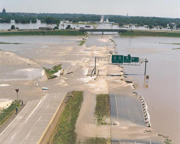
63% of flood-related deaths in 2011 happened in vehicles. Details below. Photo above: NOAA.
6" of moving water can cause a vehicle's tires to lose contact with the roadway surface. Source: NOAA.
6:1. February saw
6 times more record highs than record lows across the lower 48 states.
"
In a long-term trend that has been linked to global climate change, daily record-high temperatures are now outpacing daily record-lows records by an average of 2 to 1, and this imbalance is expected to grow as temperatures continue to warm. According to a 2009 study, if the climate were not warming, this ratio would be expected to be even." - from an article at Climate Central below. Image above courtesy of NOAA and the
Capital Weather Gang.
Record Warm Week Ahead East of Rockies. The story from Andrew Freedman at
Climate Central: "
The warm winter season is giving way to an even warmer early spring, with record temps spreading throughout the U.S. east of the Rocky Mountains this week. Records are likely to fall from Minneapolis to Maine and points southward starting today and lasting through at least the end of this week, possibly putting an end to the ski season in the Northeast and Mid-Atlantic. Here's a breakdown of the unusual warmth, which is more typical of May than March."
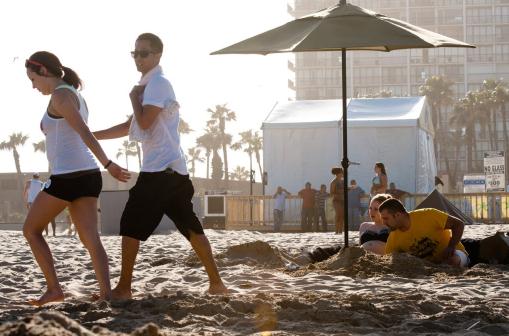
Spring Break Comes To Minnesota. Hey, why shell out hundreds or thousands of bucks to fly to Florida or Arizona (or Mexico) when you can stay put, for free, and enjoy 60s and 70s? Granted, you won't get much use out of Minnesota's pristine, sandy beaches, but a stay-cation is sounding better and better with each weather forecast. Photo credit: "
College students on spring break enjoy the warm weather as they visit the beach in South Padre Island, Texas, on Tuesday, March 6, 2012. (AP Photo/Valley Morning Star, Jesse Mendoza)."
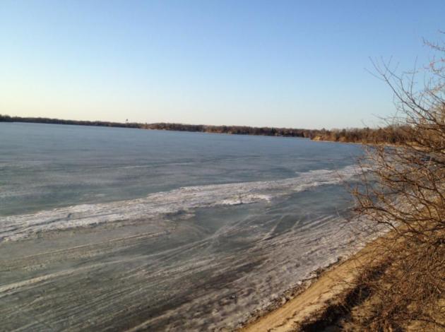
Blue Ice = Early Ice-Out. The average date for ice-out on Lake Minnetonka is April 13. It's April 12 on White Bear Lake, April 21 on Gull Lake, April 24 on Lake Mille Lacs and April 29 on Lake Vermilion. My hunch: ice-out on 'Tonka is 7-10 days away, possibly 3 weeks ahead of schedule this year. More on average and record/early ice-out dates from the
Minnesota DNR.
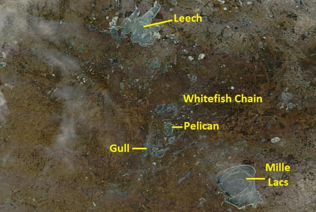
Very Unstable Ice. The image above was taken by NASA's low-orbiting
MODIS satellite at midday Tuesday, with a resolution of 250 meters. The ice on Mille Lacs is already very unstable - you can see some 15-20 mile long cracks, the dark blue on the western/southwestern shoreline suggesting the ice is extra-thin there. Be careful out there.
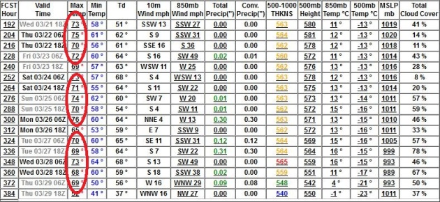
I Just Ran Out Of Adjectives. Unprecedented. Historic. Baffling. I'm not quite sure what word best sums up what I'm seeing on the weather maps. I'm happy about our instant-spring, genuinely thrilled to be able to wear shorts and t-shirts in mid-March. But at the same time this is all a bit unsettling. Look at these predicted (GFS) highs from March 21 to March 29: highs ranging from 69-76 F. Nighttime lows no cooler than 41 F. Where are we living again? This isn't the Minnesota I remember.
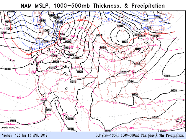 Small Chance Of Rain Next 84 Hours
. The latest NAM (above) shows a few spotty showers (thundershower?) Thursday night, along the leading edge of a May-like surge of warmth and humidity. I wouldn't rule it out, but any showers in the next 5-6 days will be the exception, not the rule. Meanwhile, a significant storm is whipping up 40-70 mph wind gusts for the Pacific Northwest, along with heavy valley rains and mountain snows. Great weather east of the Rockies, but the weather out west will be unusually cool, windy and stormy through the weekend.
Hey, What Happened To Winter. What Its Wimpiness Portends For Spring. An interesting story from
The Christian Science Monitor: "The winter of 2011-12 might well earn the title of "the winter that wasn't" in many parts of the
United States. The season has entered the books as the fourth warmest on record for the Lower 48, according to an analysis by the
National Climatic Data Center in
Asheville, N.C. In January, for instance, daily high-temperature records were broken across the northern Plains. Minot,
N.D., posted a 61 degree F. high on Jan. 5, eclipsing the previous record of 58 degrees set in 1906."
Photo credit above: "
Texas A&M University worker Rodney Fontenot sweeps water from campus walks. Texas was the exception to dry weather in the South. Storms helped moderate drought. Stuart Villanueva/Bryan-College Station Eagle/AP."
Trouble Ahead From The Warm Weather. Some words of warning from the
Illinois Climatologist: "
Illinois has just come off its third warmest winter on record. And the warm weather continues in March. The first 7 days have been 3.2 degrees above normal and the NWS forecast for the next 14 days shows high odds of above-normal temperatures. As a result, plants have begun to think spring is here. On the left are some daffodils in my yard in Champaign today. The blooms are just about to open. It’s the same story for the Magnolia tree at work (picture right). And this is central Illinois. Southern Illinois will be even farther along than here."
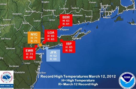
New York National Weather Service: Monday Record Highs At 5 Of 6 Climate Sites: From the New York City NWS: "
Record high temperatures were set today at 5 of our 6 climate sites (Central Park, NY, LaGuardia, NY, Newark, NJ, Islip, NY, and Bridgeport, CT). Kennedy, NY was the only site that did not set a record due to onshore winds. For more details on today’s high temperatures and records, see this graphic. For Tuesday, we are forecasting highs in the 60s to lower 70s. Records for March 13 were set in 1990 with temperatures in the 80s, so these records should not be broken."
Allergy Season Comes Early This Year Because Of The Unusually Mild Weather. Details from
The Washington Post: "
There were plenty of reasons to love this year’s “winter that wasn’t,” with its 60- and 70-degree days from November through February. But now it’s payback time — at least for those of us with allergies. While the spring allergy season normally gets underway toward the end of March or beginning of April, people in the Washington area have already been sniffling, sneezing and suffering with other symptoms for at least a month." Photo:
thenutritionpost.com.
Humidity And Precipitation May Trigger Children's Migraines And Headaches. I always thought there might be a link, a new story from
Health Central seems to confirm a correlation: "
One of the most important parts oof Migraine and headache management is trigger identification and management. We've know for some time now that changes in weather can be a very strong Migraine trigger for adults. It's been a general consensus that this applies to children as well, and it's certainly been reported anecdotally, but now a research study has verified that weather changes can trigger Migraine attacks in children too." Illustration above courtesy of healthcentral.com.
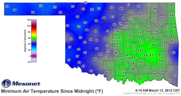
"Oh-Klahoma." Now that's a dry-line. Check out Tuesday morning's temperatures across the Sooner State, ranging from 61 in Oklahoma City to a brisk 32 over the Oklahoma Panhandle. Source:
Oklahoma Mesonet.
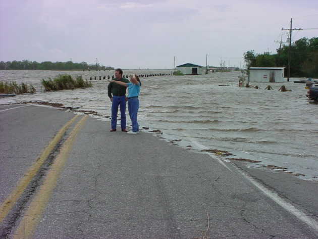
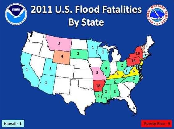
Flood Awareness Week. This is Flood Awareness Week in Arkansas (and Minnesota). A few facts: "
This is Flood Awareness Week in Arkansas. The graphic below was just released this afternoon. In 2011, Arkansas had more flood fatalities than any other state in the U.S. Of the 18 fatalities recorded in the state, 15 occurred when people drove into floodwaters. In many of these cases, the motorists drove around barricades or ignored “Road Closed” signs. The NWS slogan “Turn Around, Dont Drown” definitely applies here."
"Turn Around, Don't Drown." It's easy to remember, and statistically, it's true: the people who tempt fate "I HAVE to get home....I can make it....I'm driving a pick-up or SUV, I have enough clearance....water, no problem!" are the ones who often wind up becoming statistics. More details from the
Twin Cities NWS office: "63% of flood-related deaths in 2011 occurred in motor vehicles...when people attempt to drive through flooded roadways. Many people underestimate the power of flowing water across a road. Flooding can happen rapidly duue to an ice jam...ice and debris blocking a culvert or from very heavy thunderstorm rains. People tend to underestimate the power of water as it only takes 6" of water for a vehicle to lose contact with the road surface. Most vehicles can be swept away in 18-24" of water." Photo above: USGS.
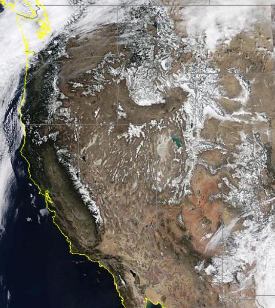
California Snow Not Disappearing Despite Drought.
EPonline.com has the story: "
During some winters a significant amount of snow falls on parts of California. During other winters — like this one (so far) — there is much less snow. But more than 130 years of snow data show that over time snowfall in California is neither increasing nor decreasing. The analysis of snowfall data from as far back as 1878 found no long-term trend in how much snow falls in the state, especially in the critical western slope of the Sierra Nevada mountains, said John Christy, director of the Earth System Science Center at The University of Alabama in Huntsville.
"There isn't a trend significantly different from zero for the whole period," Christy said. "I also looked at just the past 50 years and there is no trend over this recent stretch either." Image above courtesy of
NASA's MODIS page.
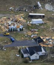
A Perfect Storm: Warm Winter Helped Spawn Deadly Tornado. The eye-opening article from
WeatherBug.com; here's an excerpt: "
March 07--HENRYVILLE -- The unbelievable destruction seen across Southern Indiana and Kentucky was the result of a perfect mix meteorological factors, according to the National Weather Service. "It was almost the perfect tornado maker," said Mike Callahan, hydrologist at the weather service. The jet stream was positioned perfectly. Winds were strong and moving in a different direction in the upper levels of the atmosphere than they were on the surface, creating directional shear. And a warm front had passed through the area earlier in the day. "We had this very dynamic atmosphere [and] we had this triggering mechanism that was the cold front," he said. When those factors came together it created two rare outcomes. First, it was only the second EF-4 tornado -- twisters that pack winds between 166 and 200 mph -- to hit Southern Indiana since 1974. The other clipped the corner of Orange County in 1990."
10 Ways To Survive A Tornado. Some very timely advice from
timesfreepress.com in Chattanooga, Tennessee: "
With more than 50 tornadoes striking this area in the last 10 months, any illusion of safety we ever had has been shattered. These tips from expert sources can help you be prepared if the next one comes your way.
DON'T STAY INSIDE A MOBILE HOME
If you're in a mobile home, get out. People are 15 times more likely to die in a mobile home during a tornado than in a permanent home; more than half of people killed in tornadoes in the last 50 years have died in mobile homes. Get out and go to a safer place.
BUY A WEATHER RADIO AND USE IT
TV and radio stations are a great source of information but they have to be turned on. A weather radio can sound an alarm if your county has a tornado warning, alerting you to the danger during the night."
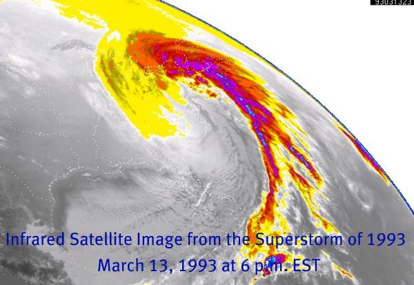
Remembering The Historic "Superstorm of '93". Here's a great article from Chad Merrill at
WJLA-TV in Washington D.C.: "
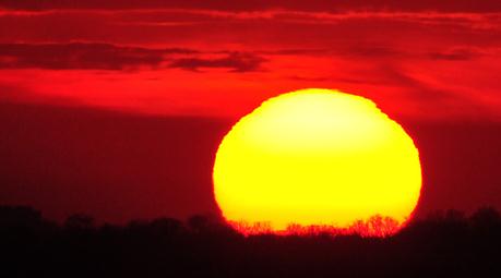
A strong high pressure building across the Atlantic will send the jet stream north all next week and temperatures will skyrocket from the 60s Monday to about 80 degrees by Friday! Record highs are even possible by Thursday! What a truly remarkable 360 from the weather conditions that unfolded in the East almost a quarter century ago! A storm system that developed in the Gulf of Mexico on March 12, 1993 and began to rapidly intensify as southern and northern stream jet energy phased. Destructive storms whipped through Florida while record wind and snow were driven up along the East Coast over the course of the next two days."
Natioanal WeatherService Facing Possible Budget Cuts. The story from
abcnews4.com in Charleston: "
NORTH CHARLESTON, S.C. (WCIV) -- The National Weather Service is facing a different kind of storm. It's not a hurricane or tornado, but instead a proposed budget cut of $39 million dollars. The government agency that issues daily forecasts, in addition to severe weather warnings, could have their budget cut by as much as four percent. National Weather Service offices across the country, including the one in Charleston, have had to gradually cut back on travel over the last four or five years. "It makes it difficult for conferences when we are trying to get technology and things going, but we cut back about 75 percent on travel, so we are pretty limited now in what we can do," said Frank Alsheimer, meteorologist at the National Weather Service."
Age Of Warning Satellite Causes Concern. The story from
UPI.com: "
WASHINGTON, March 9 (UPI) -- A U.S. satellite giving the only advance warning of incoming high-energy solar particles is getting old and is possibly on its last legs, researchers say. But a replacement for NASA's Advanced Composition Explorer, or ACE, satellite is at least two years away, they said. ACE provides the only advance notice of incoming high-energy particles from the sun which can wreak havoc on indispensable radio, GPS and satellite communications, researchers said. Launched in 1997, ACE gives the National Oceanographic and Atmospheric Administration's space weather forecasting arm advance notice if a storm is headed toward Earth, as it did with the solar storm that left the sun Tuesday." Image above courtesy of NASA.
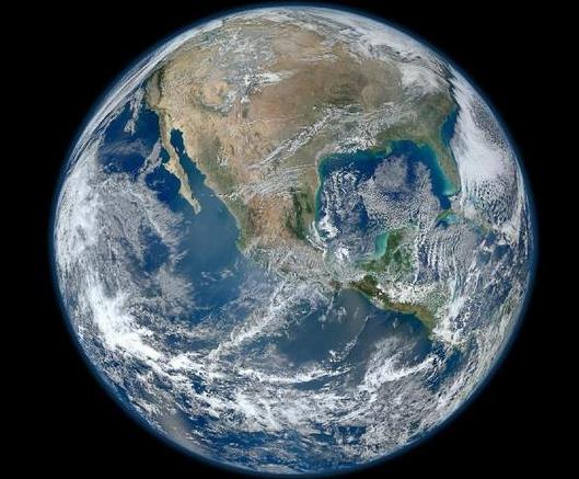
NASA's Blue Marble: 50 Years Of Earth Images. I don't know about you - but I find these images absolutely striking.
Techweb.com has more details: "
All five instruments on NASA's new Earth-observing satellite, Suomi NPP, are now operating, giving the space agency new capabilities for monitoring our planet and collecting data for weather forecasting. The data also has a secondary role: It's used to create highly detailed, composite images of the Earth. One such image released by NASA in January has been viewed nearly four million times on Flickr, making it one of that site's most-viewed images ever. Remarkable for its fine detail and beauty, the image is a manifestation of NASA's most advanced satellite imagery and visualization technologies. In fact, NASA released two images of the Earth early this year, one of the Western Hemisphere (pictured here) in January, and, a few weeks later, one of the Eastern Hemisphere. They're part of the space agency's "Blue Marble" series, named after a famous photo of the Earth taken by the Apollo 17 crew in 1972." Image above courtesy of NASA.
Paul's Links. Favorite weather-related web sites:
1).
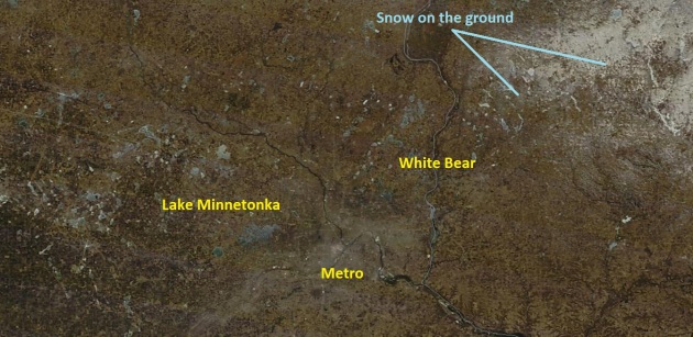
NASA "MODIS" Satellite Image. Unlike the GOES satellites, which snap a picture every 15 minutes (faster in rapid-scan mode during hurricanes and tornadoes) NASA's Aqua and Terra low-orbiting satellites (210 miles above the ground) snap only 1 picture every day, around midday. The upside: they are (without question) the best resolution images you can call up, without having an NSA I.D. badge. 250 meter resolution. Tuesday's image is above, showing the light gray of the Twin Cities metro, and a little lingering snowcover from Siren to Hayward, Wisconsin.
2).
NWS Hazards Assessment. O.K. Not the cleanest, most intuitive map I've ever seen, but NOAA does a good job of highlighting the regions of concern across the USA. Worth a look every now and then.
3).
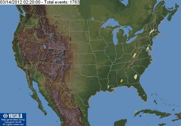
Vaisala Lightning Explorer. Looking for (free) lightning data on the web? Here's your site. The bad news: data is delayed by 30 minutes. Cloud to ground lightning strikes are NOT real-time, or even a few seconds old. If you're looking for near real-time lightning data check out the options at
Ham Weather and their new Aeris line of products for the web and mobile. Full disclosure: it's one of my companies. Depending on your specific needs (and the size of the area you need lightning data for) it may be more affordable than you think.
4).
Real-Time Temperatures. There are probably hundreds of web sites where you can track state-wide temperatures, but coolwx.com has one of the better displays.
 "Ask Paul"
. Weather-related Q&A:
This e-mail came into the Star Tribune last Thursday, March 8:
Greetings,
"The forecast by Paul for next Wednesday (today) is 70 degrees.
The Accu-Weather forecast for that day is 57 degrees.
The Weather channel forecast for that day is 47 degrees.
It seems unbelievable there could be a 23 degree difference in forecast for the same day 5 days out. How does one explain this?"
Terry Kerber
Excelsior, MN 55331
Terry - I can understand why you were skeptical last Thursday. Looking at the guidance I was equally skeptical. All I can say is that Accu-Weather and TWC probably relied on American guidance (the GFS model), which goes out 15+ days. But lately GFS accuracy has been pretty awful. I based my 70-degree forecast on the European (ECMWF) model, which has been doing a much better job the last few months with an extremely positive phase of the AO (Arctic Oscillation). It was hinting at upper 60s. I factored in a total lack of snow on the ground, and the fact that every model run kept ratcheting up temperatures over time, which made me (irrationally) go out on a limb and whisper 70. I try to be honest (with everyone) when I'm wrong - which is still more often than I'd like. But in this case the 6-day outlook was pretty good, and I can't take much credit. It was the ECMWF model which won the day. The "art" of weather forecasting is knowing which model to believe...when. Sometimes we blend the models, but in this case I tossed out the GFS and went with ECMWF. In 20/20 hindsight I'm glad I did.
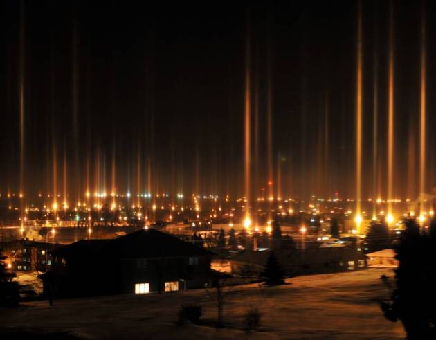
. Here's a spectacular example of "
moon pillars", taken by Tyler Tufte out in Valley City, North Dakota, during February of 2010.
"Juvet" Is A Striking "Landscape Hotel" In The Norwegian Wilderness. The story from
gizmag.com: "
Designed by Norwegian architects Jensen & Skodvin, Juvet is a nature retreat that blends seamlessly with its wild environment. It's a striking landscape hotel, featuring seven small wood cabins perched on a river bank and nestled amongst birch, aspen, pine and nature-sculpted boulders. Located outside the small town of Gudbrandsjuvet, Norway (approximately five hours drive north of Oslo), the hotel is positioned amid its main attraction - the pristine forest."
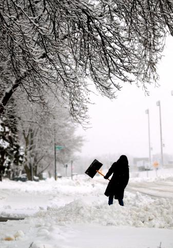
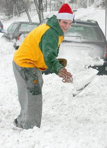
Ah, The Memories. It's hard to believe, but a year ago today MSP still had 6" snow on the ground; 11" up at Duluth. It's trite and cliche (I'm not above that), but "
what a difference a year makes."
Left photo credit: "
Yvette Corona removed snow from her driveway Wednesday, Feb. 29, 2012 on Dupont Avenue North in Brooklyn Center, Minn. The National Weather Service issued a winter storm warning for much of Minnesota through Wednesday evening. The heaviest snow is expected in the central region. (AP Photo/The Star Tribune,Jerry Holt)."
Right photo credit: "
University of Minnesota Duluth student Matt Uhen shovels out the end of his driveway along London Road on Wednesday, Feb. 29, 2012. The National Weather Service issued a winter storm warning for much of Minnesota through Wednesday evening. The heaviest snow is expected in the central region. (AP Photo/The Duluth News-Tribune,Steve Kuchera)."
"
Those who deny freedom to others deserve it not for themselves." - Abraham Lincoln. Photo credit
here.
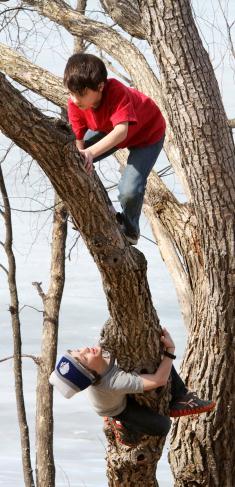
Good Day To Climb A Tree. Why not? 62 at Brainerd Tuesday afternoon, and all that pent up cabin fever had to get out - eventually. Photo credit: "
As temperatures eclipse 60 degrees Tuesday afternoon March 13, 2012, Noah Rushmeyer (top) and Sam Pikula take advantage of the warm weather to climb a tree at Brainerd, Minnesota's Lum Park. (AP Photo/Brainerd Dispatch, Kelly Humphrey)."
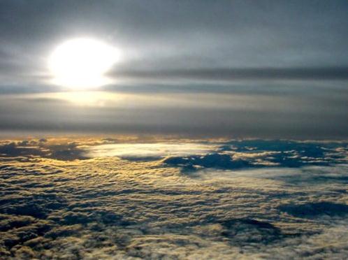
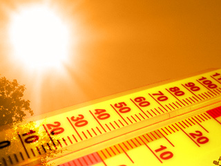
Warmest March Ever?
"May you live in interesting times" the proverb goes. Amen. Hey, I'm just as euphoric as the next guy about 70s in mid-March. But as happy as I am to dig out shorts and t-shirts 2 months early, it feels like a rare "too good to be true" moment. Like getting a check in the mail, from the cable company. Huh?
Minnesota has seen a deepening drought since September. Farmers are worried. Brushfires will be a growing concern until we a). green up, or b). see significant rain. A slow-moving cool front may squeeze out a half inch of rain next Thursday; that's the next chance of rain.
I should have gone into the propeller-repair business. Really. Lake water levels are down 1-3 feet. This might be a good summer to put your friend's "beater-boat" into the water.
The average ice-out date on 'Tonka is April 13, April 12 on White Bear, April 24 on Mille Lacs. At the rate we're going ice-out may come 2-3 weeks early this spring.
My gut: 10-12 days above 60, 4-6 days above 70 by March 31. In 1910 MSP enjoyed 5 days above 70. That nugget from Pete Boulay at the Minnesota Climatology Working Group. We may be living through the warmest March in modern-day history. We'll see.
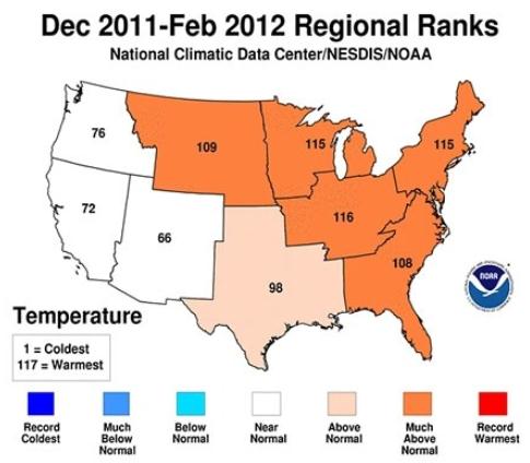
Nationwide February saw 6 times more record highs than lows. A trend in the making?
"The sun, the moon and the stars would have disappeared long ago...had they happened to be within the reach of predatory human hands." - Havelock Ellis, "The Dance Of Life", 1923
Climate stories....
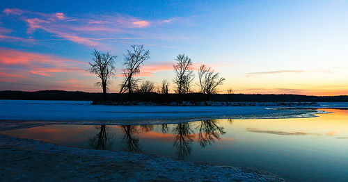
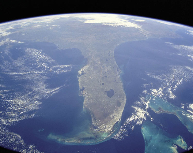 Rising Sea Levels A Growing Threat To Coastal U.S., Study Says
. I
tell friends looking for water-front real estate in Florida to consider buying something 2-3 blocks inland. And be patient. I say that only half tongue in cheek. Between hurricanes, escalating insurance premiums, and slowly rising sea levels, it might not be the best long-long term investment. Here's an excerpt of a story from
The New York Times: "
If the pace of the rise accelerates as much as expected, researchers found, coastal flooding at levels that were once exceedingly rare could become an every-few-years occurrence by the middle of this century. By far the most vulnerable state is Florida, the new analysis found, with roughly half of the nation’s at-risk population living near the coast on the porous, low-lying limestone shelf that constitutes much of that state. But Louisiana, California, New York and New Jersey are also particularly vulnerable, researchers found, and virtually the entire American coastline is at some degree of risk." Image courtesy of NASA.
* to see the relative risk of your home from rising sea levels plug your zip code into this "
Surging Seas" web site, courtesy of Climate Central.
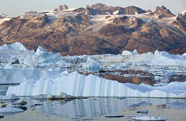
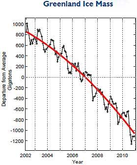
Photo credit above: "Bergs calved from Helheim glacier float in Sermilik Fjord on the south-eastern coast of Greenland in this 2009 photo. A new study confirms that the Greenland ice sheet is melting faster than previously estimated. Nick Cobbing/Greenpeace/Reuters/File."
Climate Change Denial Isn't About Science, Or Even Skepticism. An excerpt from David Suzuki at
desmogblog.com: "
Let's suppose the world's legitimate scientific institutions and academies, climate scientists, and most of the world's governments are wrong. Maybe, as some people have argued, they're involved in a massive conspiracy to impose a socialist world order. Maybe the money's just too damn good. It doesn't matter. Let's just imagine they're wrong, and that the polar ice caps aren't melting and the climate isn't changing. Or, if you prefer, that it's happening, but that it's a natural occurrence — nothing to do with seven billion people spewing carbon dioxide and other pollutants into the atmosphere. Would it still make sense to continue rapidly burning the world's diminishing supply of fossil fuels? Does it mean we shouldn't worry about pollution?"
 Global Warming Skepticism Climbs During Tough Economic Times
. The details from
phyorg.com: "
Lyle Scruggs, associate professor of political science in UConn's College of Liberal Arts and Sciences, says the public's belief in climate change dropped significantly as the economy dipped and unemployment climbed in the late 2000s. His research with UConn political science graduate student Salil Benegal found that popular alternative explanations -- partisan politics on the issue, accusations of biased media coverage, and weather fluctuations -- could not explain the suddenness and timing of the changing opinions."
Where's The Action On Climate Change? The story from
theenergycollective.com: "
There’s been a minor amount of coverage in the blogosphere about the passing of Sherwood Rowland, Nobel Prize-winning scientist: Rowland is one of the true scientific heroes of our time — both for his research and for what he did with it: Nearly 40 years ago, Rowland and post-doctoral student Mario Molina made a shocking discovery: a single chlorine atom byproduct from aerosol hair sprays, deodorants and other popular consumer products could chew up 100,000 ozone atoms in the stratosphere. The stratospheric ozone layer, 12 to 30 miles above Earth, protects life on the planet from harsh solar radiation."
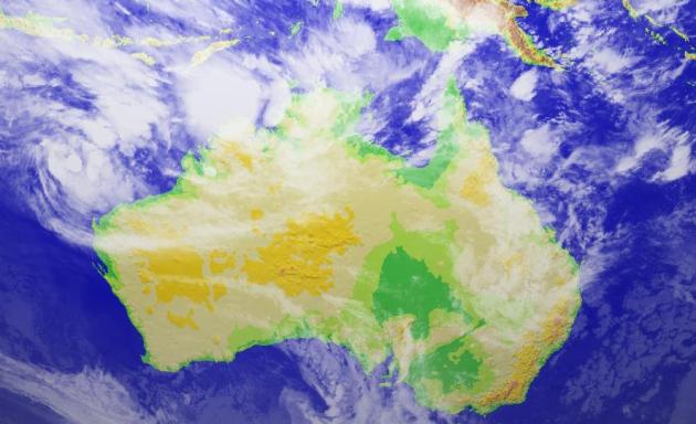
La Nina Brought Flooding, But Climate Change Not Off The Hook. Here's an excerpt of an article from Australia's
Sydney Morning Herald: "
Changes to the system are almost certainly due to human activity. The past two years have been Australia's wettest two-year period since at least 1900. Not surprisingly, people ask whether global warming caused the record rains and floods. The simple answer is ''no'' - the heavy rains and floods have been caused by back-to-back La Nina events. La Nina events and their ''dry'' brothers known as El Nino events are the extremes of a natural climate phenomenon called the El Nino Southern Oscillation, or ENSO, which has been producing Australia's ''droughts and flooding rains'' for thousands of years - since well before humans started pumping carbon dioxide into the atmosphere." Image above courtesy of
digital-typhoon.com."


