"
Weekends don't count unless you spend them doing something completely pointless." - Bill Watterson
7,000+ warm temperature records for the USA since March 12. Source:
obp.org.
"
Once In A Lifetime Warm Spell For March." I did a triple-take when I saw this statement from the Caribou, Maine office of the
National Weather Service: "
To put things in perspective...this was a once in a lifetime warm spell for March...and not just here but across much of the northern tier of the U.S."
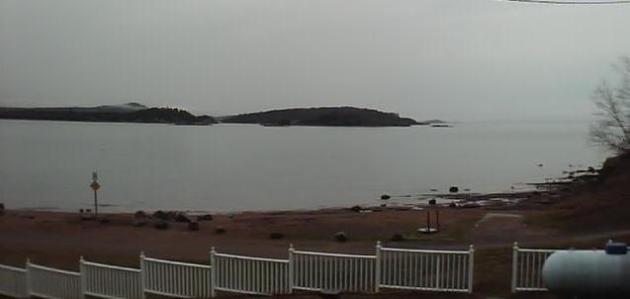
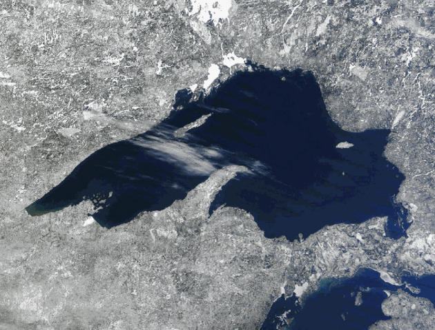
47" snow on the ground March 4 at Marquette, Michigan (most of the winter season). Less than 2 weeks later Marquette hits 81 F. Full details below. Marquette webcam courtesy of
ironbay.net.
8 days above 80 in Chicago? That sets an all-time 80-degree record....for April! "March-uly" continues...
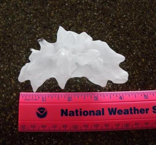
4 1/4" diameter hail reported in Hawaii on March 9, 2012 - a new state record. Details below.
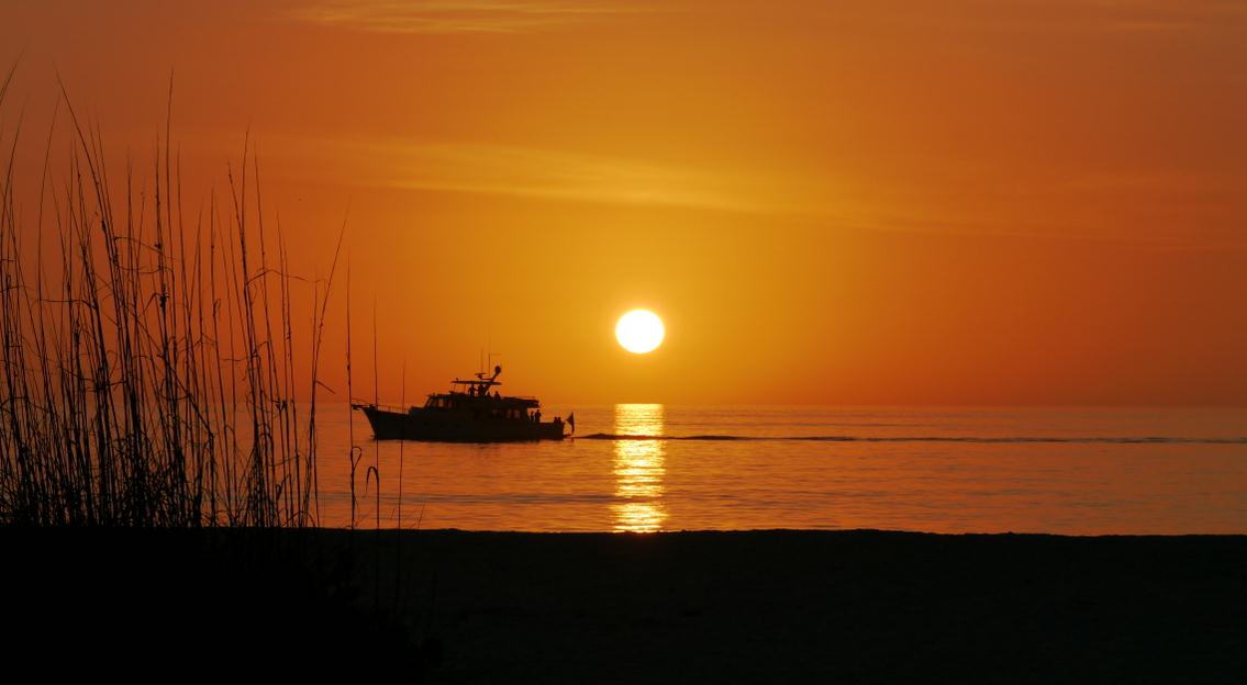
80 F. in Boston, the first March 80-degree reading since 1998! This is only the second time in recorded history that Boston has reached 80 before March 28 (the other time was March 21, 1921). File photo:
skyscraperpage.com.
"The analysis showed that Michigan experienced temperatures that were 4 - 5 climatological anomalies warmer than average (4-sigma to 5-sigma), the type of extreme that occurs between once every 43 years and once every 4779 years." - Weather Underground Founder Dr. Jeff Masters, in a Capital Weather Gang post below.
"
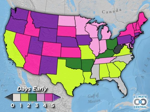
Nationwide, the date of “first leaf” has clearly shifted — arriving roughly 4 days earlier now on March 17th (1981-2010 average) from March 20th (1951-1980 average)." - from a Climate Central post below on spring trends in the USA. Photo: Scott Gatty, Eden Prairie.
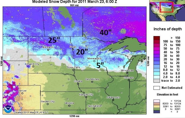
Trite, Cliche, And True: What A Difference A Year Makes. Look at the dramatic difference between March 23, 2012 (upper left) and 2011 (upper right). Hard to believe we're living in the same state. Details below.
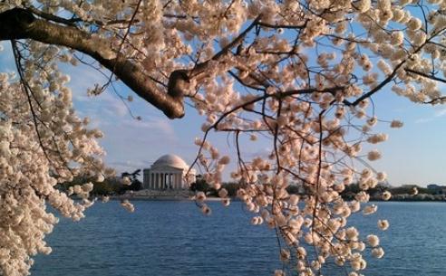
March 30 peak of cherry blossoms in Washington D.C. - third earliest date on record. Details from the
CWG below. Photo courtesy of Kevin Ambrose.
24 days of 32 F. or colder in Washington D.C. this past winter; fewest on record. Details below.
"
80° warmth is not very common even in April, let alone mid March. Chicago only averages about 1 day in the 80's in April each year. Only once in the 140 recorded years of weather observations has April produced as many 80° days as have been observed this March." from the
Chicago office of the National Weather Service.
"
According to the study, which was published last fall in the Journal of Geophysical Research, human activities – specifically aerosol pollution from cars, trucks, and power plants – can give thunderstorms a boost by altering the way that rain and hail forms, as well as the release of heat energy within a thunderstorm. This is mainly the case, they found, during the summer thunderstorm season in the eastern U.S." - from a story at Climate Central below.
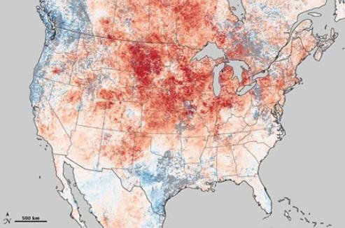
Exceptional March Heat Wave Re-Writing History In Midwest, Great Lakes And Northeast. Some eye-opening numbers, facts and figures from the
Capital Weather Gang: "
Warm weather records continue to mount at a feverish pace over the Eastern half of the U.S. Both the intensity and longevity of the summer-like warmth defy belief. From March 12-18, 3,550 record highs were set compared to just 18 record lows across the U.S. Here’s the latest round-up of records...
Chicago: Soared to 87 today, its eighth consecutive day of record warmth. That is the highest temperature so early in the season and just one degree shy of the all-time highest March temperature of 88. Chicago has hit 80 7 times in the last 8 days. It is now only one shy of the APRIL record for most 80+ days and could tie it Thursday. More information from the National Weather Service (NWS)."
Map credit above: "
MODIS instrument aboard NASA’s Terra satellite depicts temperatures March 8-15, 2012 compared to the same stretch averaged over 2000-2011. More information. (NASA)."
"Dazed And Amazed". Definition Of A Meltdown. The story in Marquette, Michigan is nothing short of staggering: 47" of snow on March 4, 81 F. just a couple of weeks later. Details from the Marquette, Michigan NWS office: "
In the wake of an early March winter storm we reached a maximum snow depth for the season of 47 inches here at the National Weather Service on the morning of March 4th. Exactly two weeks later on the morning of March 18th, in the grip of unprecedented record warm temperatures, our snow depth was reduced to little more than a trace. Surprisingly with the rapid snowmelt, no significant flooding has been reported thus far across west and central Upper Michigan. A big reason we escaped flooding was the lack of heavy rainfall which occurred during the rapid snowmelt."
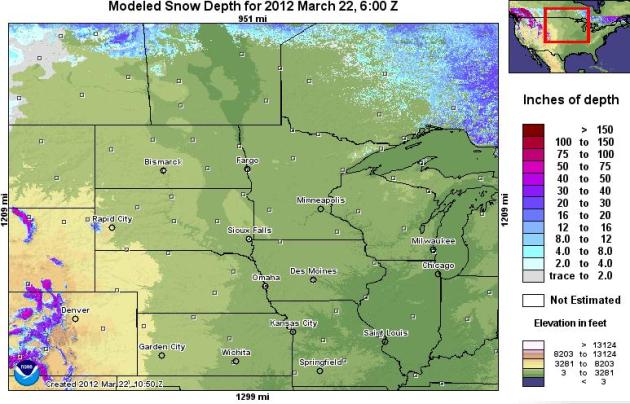
For My Next Magic Trick, I'll Make Snow Disappear. Pretty amazing, you have to drive up into central Manitoba or Ontario to find any snow on the ground. That's what 1-2 weeks in the 60s and 70s will do. A few piles of snow along the North Shore of Lake Superior, but that's pretty much it. See for yourself at NOAA's
NOHRSC site.
One Year Ago Today. It snowed over 4" a year ago today in the Twin Cities, 4" on the ground by March 24, 2011. But as much as 15-30" snow was still on the ground from North Dakota into much of central and northern Minnesota, setting the stage for more severe spring flooding. At least we won't have to worry about river flooding this year.
State By State Look At How Early Spring Has Arrived. Here's an excerpt of a
very interesting post from Climate Central: "
Nationwide, the date of “first leaf” has clearly shifted — arriving roughly 4 days earlier now on March 17th (1981-2010 average) from March 20th (1951-1980 average). This shift affects all sorts of biological processes that are triggered by warmer temperatures — not just flowering, but animal migration and giving birth and the shedding of winter coats and the emergence from cocoons. How much will an earlier spring disrupt the intricate natural balance between the tens of thousands of species that depend on each other for food, reproduction and ultimately, survival? No one really knows. The data behind the map comes from an index for the onset of spring developed by Mark D. Schwartz (University of Wisconsin-Milwaukee) and USA National Phenology Network colleagues."
Area Farmers Hit The Fields Early. Here's an excerpt of a story from the
postbulletin.com, serving Rochester and Austin: "
KENYON, Minn. — Unusually warm weather has led to the earliest planting date for oats in a long time on a farm south of Wanamingo. Gene Bang, his 25-year-old son, Adam, and Howard Quinby planted 30 acres of oats on March 19. Bang farms in partnership with Howard and his brother, Robert Quinby, at the Quinbys' farm. Records kept on their grain drill's cover date back to 1957 and show no earlier planting date. Most years, oats were planted on the farm around mid-April, making this year about a month ahead of schedule. "Things are changing," said Bang, who has worked on the farm since he was in high school. "It seems like things are getting earlier."
Photo credit above: "
Gene Bang is pictured with the seed drill he used Monday to plant oats on his farm near Kenyon Tuesday, March 20, 2012. The drill has a written record of the dates of seedings on the farm going back to 1957. Monday's seeding was the earliest recorded."
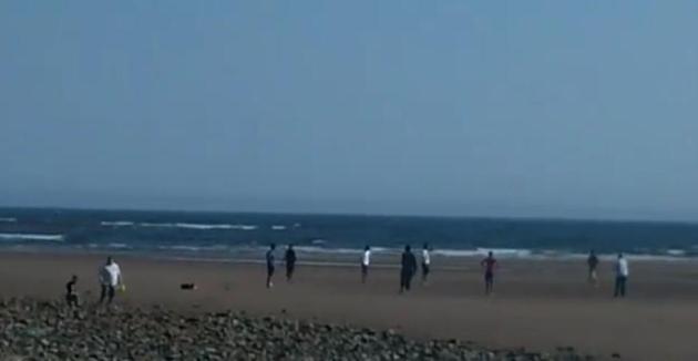
Nova Scotia Canada - In March? I'm rubbing my eyes in vague disbelief too. Details from the
YouTube clip: "
March Madness at Lawrencetown Beach - March 22 2012."
Water Landscape Trees Soon, But Go Easy On Lawns. Here's some helpful advice from the
University of Minnesota Extension: "
Homeowners still need to help their trees and lawns make up for a record soil moisture deficit to mitigate damage done by a dry fall and winter. This week's wet weather is providing much-needed moisture to parched soils, but it isn't enough to pull the state out of its moderate to severe drought classification, according to University of Minnesota Extension climatologist Mark Seeley. Water landscape trees as soon as ground is thawed: Drought conditions can lead to tree decline, pest problems, and permanent damage for young and old trees alike. "Dry soils get colder in the winter and freeze deeper, which can kill roots," explains Gary Johnson, Extension specialist in urban and community forestry. And dead roots make it hard for trees to take in water."
Warmest Astronomical Winter In Washington D.C. An update from meteorologist Jason Samenow at The Washington Post's
Capital Weather Gang: "The winter of 2011-2012, by the astronomical definition, was the warmest on record in Washington, D.C. according to the National Weather Service. The average temperature was 45.6 degrees, nearly two degrees above the previous record holder of 1989-90, when the average temperature was 43.7 degrees. Records have been maintained since 1871.
Remarkably, Washington only logged 24 days when temperatures reached 32 or lower, the fewest such days on record."
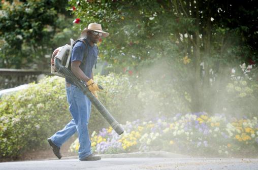
Early Spring Sets Much Of U.S. Awash In Color And Pollen Dust. Allergy sufferers are not amused, pollen levels (along with weird weather) off the scale. Here's an excerpt of a story at
The New York Times: "
ATLANTA — Spring, with its promise of flip-flops and daffodils, can have a dark side. Take this one, which hit so early in many parts of the nation that the headaches are outweighing the sunny benefits. High temperatures and a sudden bloom have turned what some call the Bible Belt into the Pollen Belt. Insects usually not seen for a month or two are out in full force in the Midwest and Rocky Mountains. Chicago is in its eighth day of 80-degree heat. And in New York, a string of days more than 20 degrees warmer than usual have sent baffled residents searching for sundresses and wondering if it is too soon to schedule a trip to the garden store."
Photo credit above: "
Tim Knight, with Knight's Lawn Service, kicks up a small cloud of pollen and tree debris while finishing a job in Atlanta, March 21, 2012. Spring has arrived early this year, causing changes such as pollen levels hitting record highs. (Rich Addicks/The New York Times)."
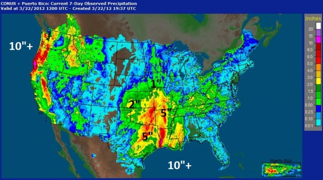
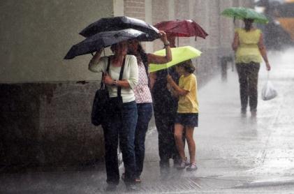
Arkansas Wheat, Corn Crops At Risk For Flood Damage. Some areas have picked up 5-10" rain in recent days.
Bloomberg BusinessWeek has the story; here's an excerpt: "
Southwestern Arkansas farmers who last year prayed to the sky for rain are lamenting the recent rainfall now pooled on their sodden fields, worrying it might kill off much of the first corn crop before it had a chance to grow. The National Weather Service issued flash flood warnings Wednesday morning for much of the state, including in areas that had received up to 6 inches of rain since Monday. Last year's drought left the soil in the southwest of the state parched, and they only recently recovered enough to begin retaining water."
* map above showing Doppler radar rainfall estimates for the last week courtesy of
NOAA.
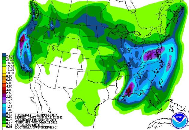
QPF: Soggy East And West, Relatively Dry Central USA. The latest NOAA 5-day rainfall prediction shows some 2"+ amounts from Washington to Mobile, another sloppy bullseye over northern California.
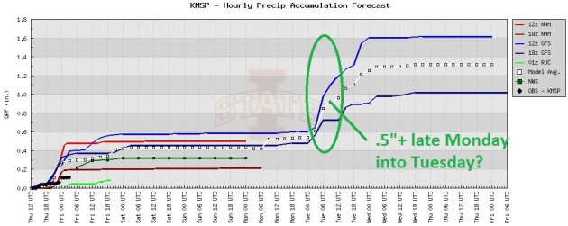
Good Timing: Dry Weekend, Tuesday Storms? The odds of dry weather for your weekend plans are pretty good, an eastbound cool front may spark heavy to potentially severe T-storms late Monday into Tuesday.
Cooler, But Not Cold. I'm still not entirely buying the GFS solution. The ECMWF is much warmer, and the way this month is going it pays to go with the flow. I suspect our warm bias will linger into early April, possibly longer.
 Japanese Tsunami Debris Offered Up As Explanation For Wildly Inaccurate Winter Forecast.
 O.K. I'm open to new ideas, but this one seems off-the-wall....um...odd. More from
The Chicago Tribune: "
A meteorologist for AccuWeather — the forecasting company that predicted a winter so bad, "people in Chicago are going to want to move" — has a theory for the recent Midwest heat wave: Japanese tsunami debris. AccuWeather.com made headlines last fall, you may recall, with breathlessly apocalyptic predictions for the season ahead. Five months later, winter 2011-12 is in the books as the ninth warmest on record, punctuated by a stretch of historically high temperatures over the last week, and the Chicago area remains remarkably populous." Computer simulation image above courtesy of NOAA and
kpix.com.
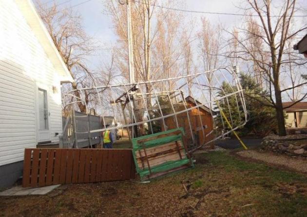
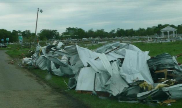
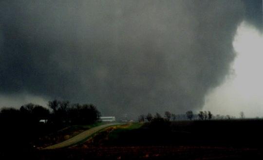
Weak March 19 Tornado Damage In Le Sueur County, Minnesota. From
Le Sueur County Emergency Management FB Page: "
On Monday, March 19th at approximately 6:38pm, a large thunderstorm entered Le Sueur County by way of Elysian. The Le Sueur County Emergency Management Team, along with Justin Lutterman of the Le Sueur County GIS, were invited to the City of Elysian to help deal with the destruction and debris left behind by Monday night’s storm, which caused damage to the property of 44 families. They were also joined by a team from the National Weather Service- Chanhassen, who felt that debris left behind by the storm that entered Elysian was an EF-O tornado which developed into a micro-burst- straight line winds of up to 90 miles per hour."
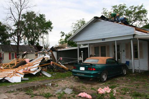
5 Tornadoes Confirmed (Wednesday) In Lake Charles, Louisiana Area. More details from the Lake Charles NWS: "
A total of 5 tornados were confirmed. An EF 1 in Lake Arthur, an EF 1 in Gueydan, an EF 1 in Abbeville, an EF 0 in Patterson and an EF 0 in Henry. There was one minor injury associated with the tornado in Gueydan."
Largest Hailstone In Hawaii Is Official.
Details from the National Weather Service in Honolulu: “
This is a photo of the largest hailstone that fell during the March 9th storm in Kaneohe, HI. We verified the 4.25″ diameter hail which has been confirmed by the state climate extremes committee and officially sets the state record for Hawaii. ”
Take Action Now; Prep House For Spring Storms. Some great information from
MarketWatch.com: "
Things to consider doing outside your home to protect it from severe weather damage:
-- Keep trees and shrubs trimmed. Weak branches could fall on your home or your neighbor’s.
-- Clear drains, gutters and downspouts of debris to prevent drains from breaking during heavy rains and water flooding into your home.
-- Extend and re-direct the downspouts close to your home to move the water away.
-- If storms are forecast, secure lawn furniture and other objects that could be moved by strong winds.
Things to consider doing inside your home to protect against flooding
-- Install a sump pump with a battery backup system."
Photo credit above: "
Crews work to temporarily repair Angela Wainright's roof after an EF-1 tornado peeled off parts of the tin roof early Wednesday, March 21, 2012 in Lake Arthur, La. The storm damaged more than 25 structures, including homes, barns and sheds along a two-mile path through the town. (AP Photo/The American Press, Doris Maricle)."
Missouri Launches New Web Site For Tornadoes, Severe Storm Alerts. Details from
eureka-patch.com: "
State Emergency Management Agency managers in Missouri Wednesday announced a new website to help inform and prepare Missourians for severe weather. Stormaware.mo.gov includes detailed videos on how to take shelter in specific types of buildings, important information about tornado sirens and weather alert radios, and links to severe weather texting services that can alert people across Missouri to upcoming severe weather."
* The new Missouri StormAware web site is
here.
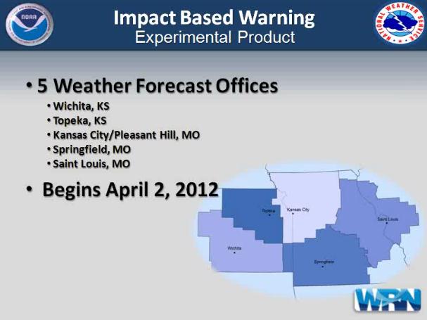
Impact-Based Warning Pilot Project. A number of NWS offices in the nation's midsection will begin a new pilot program, designed to further refine (and reinforce) severe storm and tornado warnings. The reason? Many consumers wait for confirmation before seeking shelter, in other words they need to hear the sirens, see it on TV, get a text or cell phone call before they take action. That can be dangerous, increasing the risk of injuries and fatalities. From the
Wichita office of the NWS: "
The main changes to the warnings will be the inclusions of tags at the very end of a warning and is considered supplemental data (generally not seen by the public). We will issue Severe thunderstorm warnings (SVR) as we have in the past and continue to add hail and wind tags at the very bottom of the warning as we have in the past. However, if we are anticipating the hail size to be 2.75 inches or larger and/or the winds to be 80 mph or greater, the follow up statement will include within the body of the warning "This is a very dangerous storm". These selections will not precipitate a new warning to be issued, therefore, it is not a tiered warning system. There are times in which a particular storm may have a small potential for a tornado (landspout, gustnado, QLCS) to occur and the forecasters confidence is to low to issue a tornado warning. Therefore, within the initial SVR warning or followup severe weather statement a "Tornado...possible" tag may be appended within the supplemental data at the very bottom of the warning. This replaces the phrase “Severe thunderstorms can and often do produce tornadoes with little or no warning” as mentioned above. This allows those in decision making positions an opportunity to follow that particular storm a bit closer and monitor for a potential upgrade to a tornado warning. This tag will not occur with every SVR warning issued."
*
click here for a brief video describing the new pilot warning system, from the NWS Central Headquarters.
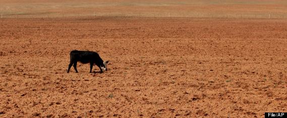
Texas Drought Cost $2 Billion More Than Previously Thought. An update from
Huffington Post: "HOUSTON -- Agriculture officials say losses from Texas' historic drought are more than $2 billion more than previously thought. The Texas AgriLife Extension Service now estimates crop and livestock losses at $7.62 billion for 2011. The extension service's preliminary estimate of $5.2 billion in August already topped the previous record of $4.1 billion in 2006." Photo above: AP.
Meet The Scientists Mining Big Data To Predict The Weather. Here's a fascinating story from
Forbes.com: "
In San Diego the palm trees sway in the warm winter’s breeze, and the sun shines a reliable 40% of the year. It’s an odd location for a startup that tries to predict weather extremes. But in an office on a hill above the Pacific Ocean, a small company called EarthRisk Technologies is doing just that: crunching through massive amounts of historical weather data to determine the odds of really bad heat waves and cold snaps, all to give its customers—utilities, power producers and energy traders – the edge they need in playing dice with Mother Nature."
Take The Conservation Minnesota Survey. Here's a Minnesota non-profit that a). not only cares about our environment, but b). is doing something about it. Consider taking their
survey - tell them what's important to you, what our legislators need to know and act on. From a recent Conservation Minnesota e-mail: "
So what were the survey results? There is absolutely no question that Minnesotans love our lakes, lands, and way of life. And you want to protect all of it! We asked about seven different issues, from renewable energy to recycling. The highest rated issue was protecting our water from agricultural runoff like pesticides, fertilizers and animal waste. A whopping 87% rated that as important or very important."
Photo credit above: Shawn G. Henry.
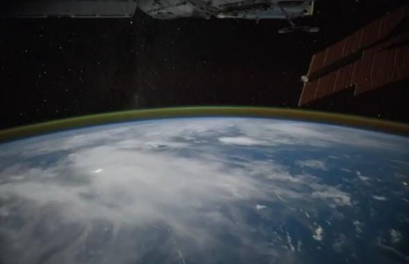
Kenya To The Aurora Australis, Courtesy Of NASA. Here's a great
YouTube video clip from our friends at NASA: "
This video was taken by the crew of Expedition 30 on board the International Space Station. The sequence of shots was taken March 3, 2012 from 17:59:48 to 18:16:25 GMT, on a pass from eastern Kenya, near the Indian Ocean, to the South Indian Ocean, east of the Kerguelen Islands. This video begins as the ISS travels southeast from eastern Africa over the Arabian Sea and the Indian Ocean. The first land we see is that of the Mauritius and Reunion Islands east of Madagascar. The pass continues over the Indian Ocean, where there are heavy clouds blocking the view of the water. Finally, the Aurora Australis begins to appear, as well as a faded view of the Milky Way."
"Ask Paul". Weather-related Q&A:
Paul,
"
We are a class at Lakeville North High School. We read your weather report every day. Last October we made snowfall predictions for the winter. We followed the snowfall totals in the newspaper. We were wondering what your final snowfall total was for the winter so we can declare a winner."
Thank you,
Lisa Meier's Class
Lisa, we are at 22.3" (and holding until further notice) for the entire winter season. We should have picked up 49.2" of snow as of March 23. Last year at this time we had already been buried under 80.2" Lessons to be learned? Don't trust any long-range forecast. Ever. Last October NOAA released a downright harrowing winter outlook, calling for "much colder and much snowier" for the northern tier states. Right. I can't pin this all on NOAA. La Nina cooling phases in the Pacific do correlate rather strongly with colder, snowier winters. And yet Minnesota (and the nation) just experienced the 4th warmest winter on record. Truly baffling, on many levels.
_________________________________________________________________________
Paul,
"It seems like a lot of records and other statistics look comparable to the March of 1910 when reading your blog. Can you do a piece that does make a direct comparison for the that time period and possible what the remainder of 1910 looked like."
Thanks,
Matt, we had 5 days above 70 in March of 1910, one day above 80. The following April was unusually warm (12 days above 70 and 3 days in the 80s). What happened that summer? 19 days above 90, 12 days well into the 90s from June 19 to July 1. That's not a prediction of the summer to come, but I suspect a continued bias toward warmer weather will spill over into summer. A typical MSP summer brings 14 days above 90. 1988 brought 44 scorching days in the 90s. I think we'll be somewhere in-between, possibly 17-20 days above 90. That's a WAG, btw. Place your bets.
Clintonville, Wisconsin Residents Demand Answers For Strange Sounds. Well this is a stumper. I hate strange sounds, especially "nagging", "rap" and "talk radio". The story and video clip from WTMJ in Milwaukee is at
news.gather.com: "
Hundreds of residents of Clintonville, Wisconsin, gathered at the local high school to demand answers from local officials about the strange, booming sounds heard and felt for three straight nights. The booming noises have even spread 80 miles south to Montello, WI, scaring citizens there who have reported the same problem, again striking in the wee hours of the morning. Citizens gathered in the normally laid-back town on Wednesday evening and expressed somewhat timid trepidation from town administrators who still admit they are baffled by the noises and tremors and have no reasonable explanation yet."
The New iPad's Disruptive Display. I'm such a geek. All week I've been logging onto the UPS site to track (stalk) my new iPad in it's journey from God-knows-where to Minnesota. I'm wondering if it's really as good as it's cracked up to be. Where can I see the benefits of the "Retina Display"? Will precious photos of my mother in law look that much better? Time will tell, but in the meantime here's an interesting article from
gizmag.com: "
The verdict is in: the new iPad has a brilliant display. Unsurprisingly, quadrupling the number of pixels on a display allows it to output crisper text and sharper images. Unfortunately, the rest of the hardware (and content creators) might be playing catch up for the next few years as Retina-caliber displays become cost effective to produce in larger sizes. Think about the relatively recent move from standard definition to high definition (HD). HDTVs were around for years before the rest of the ecosystem (hardware and content) caught up - HD game consoles didn't arrive until 2005, the format war between HD DVD and Blu-ray wasn't finished until 2008, and bandwidth is still an obstacle for streaming HD video."
"iPot". C'mon, don't tell me you haven't at least thought about it. I would hazard a rough guess that at least 3 out of 4 (males) have taken their iPads into the toilet, updating their brackets, taking a peek at scores on ESPN, composing eloquet tweets. We need to stay connected 24/7 (until the Implantable Cranial iChip comes in 2018). Women? Not so much. "That's gross." I have it on good authority that the new iPad is not waterproof. Be careful out there.
* photo above from an article about the toilet-worthiness of the iPad at
Gizmodo. I love the fact that they chose a weather app for the test. Makes sense to me.
"
All of the biggest technological inventions created by man - the airplane, the automobile, the computer - says little about his intelligence, but speaks volumes about his laziness." - Mark Kennedy
A Very Early Spring
For evidence of shifting patterns don't check your back yard thermometer. That's "weather". Take a longer look at your yard; the birds, plants, flowers, insects (and pests) showing up that weren't there a generation ago. Ask any gardener (or farmer). Spring's coming earlier than it did for your parents or grandparents. Climate Central says Minnesota springs arrive 3-4 days earlier than they did between 1951-1980.
Every meteorologist I've talked to is flabbergasted by the March heat wave gripping the eastern half of America. A "Bermuda High".....in March? What planet are we living on again?
Chicago has seen 8 records in a row, breaking APRIL records for most 80s! Chilly Saginaw, Michigan saw 87 F. on Wednesday, obliterating the old record of 49. Breaking a record by 10 degrees is a big deal, but 38 degrees? When we say this is unprecedented it's not hyperbole. March Meteorological Madness. A stray T-shower is possible today, but skies brighten up - a nicer day than Thursday.
Saturday looks like the milder day of the weekend; highs reaching the mid-70s. Sunday looks slightly cooler near 70. Yes, we're losing track of reality.
A few severe storms are possible Tuesday; maps hinting at a touch of frost up north by late next week.
"
Nature always strikes back. It takes all the running we can do to remain in the same place." - Rene Dubos, "Medical Utopias", 1961
Climate Stories...
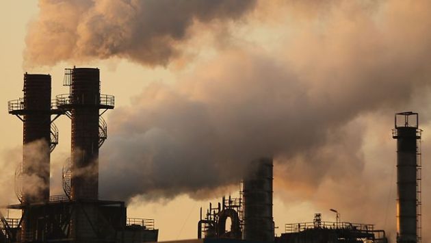
If We're Altering Rain, Hail, Any Doubts Left On Climate? A commentary from meteorologist Andrew Freedman at
Climate Central: "
One of the biggest hurdles to overcome when communicating climate science is the resistance many have to accepting the notion that human activities are capable of altering the earth’s climate system. After all, the planet is a pretty big place, and the climate was doing its thing long before humans arrived. To some, the abundant scientific evidence showing that manmade emissions of global warming gases, such as carbon dioxide, are likely the key driver behind recent global warming seems, well, kind of arrogant. To these folks, I say check out a recent study that had nothing to do with global warming. By showing that human activities can have measurable impacts on small-scale weather phenomena – in this case, thunderstorms that spawn tornadoes and hail – the report highlighted that we’re already able to influence weather on a daily basis."
ABC News Explains Warm Winter: "Wild Swings In Weather", Driven By Global Warming, Only Going To Get Worse. Joe Romm at
Think Progress has the post: "
Scientist: “The planet is getting warmer and it will continue to warm, on average, as we go into the future.” ABC News: “That means we are in for more extreme weather, more Snowmageddon type winters and torrential downpours that can flood entire towns.” Here’s the whole story from Wednesday night, which warns the public about “the wild swings in the weather we can expect in the future.” Kudos to ABC for talking to a climate scientist and explaining how warming drives the extreme weather we’re seeing. They seem to be doing some of the best reporting on this:
DoD And Navy Persist With Biofuels, Like It Or Not. Now some in the conservative media are coming down hard on the Navy and Deptartment of Defense, because they (apparently) want to hedge their bets, and not be totally dependent on crude oil, much of it from foreign sources?
DoDbuzz.com has the story: "
Just like a school of fish, the conservative media and message machine can turn with amazing quickness when it gets new tasking, or develops a consensus. If you watch carefully, for example, you can spot the same basic points appear over and over about the proposed Dwight D. Eisenhower National Memorial in Washington. Conservatives don’t like the design submitted by architect Frank Gehry. It’s been in the works for years, but for some reason, within the past few weeks, critics have attacked it from all sides, in blogs, columns and live events in Washington. The same goes for the Navy Department’s ambitions for biofuels and alternative energy. They’ve been on the books for years. Navy Secretary Ray Mabus has convened photo op after photo op with his counterparts in the Departments of Energy and Agriculture. Reporters have documented contract after contract in which the government has broken new records for the cost of fuel. And until recently, nobody cared."
 What Is "Global Weirding"?
 Some answers in an interview at
physorg.com. Here's a small excerpt: "
The culprit of the recent warm U.S. winter is most likely variations in a climate phenomenon known as the North Atlantic Oscillation (NAO). The positioning of this year’s jet stream has resulted in warmer temperatures and lower precipitation because of fewer incidences of clashing warm and cold fronts. The NAO, which influences the jet-stream air current, has experienced unusually low pressure this year. What caused the pressure drop in the NAO this year? Some speculate that global-warming-related loss of Arctic sea ice may be the driver."
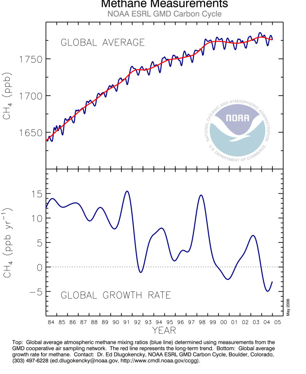
Global Warming: Researchers Develop Technology To Reduce Methane Gas Emissions From Oceans. An interesting story (showing America's can-do spirit of innovation - something we're going to need to keep powering up our economy while cutting down on carbon emissions) in
thestar.com: "
For Stephen Salter and John Latham, there is nothing more deadly than the creation and emission of methane gas. “It’s 200 times worse than CO2 (carbon dioxide),” Salter, who is emeritus professor of engineering at the University of Edinburgh, said in an interview with the Star. “It has a quick and serious effect,” Salter said, likening methane to a kind of “crack cocaine” for the atmosphere. Salter, who works out of the Engineering Design Institute for Energy Systems at the university, was recently in front of a British House of Commons committee on climate change, pleading his case against methane gas. He described its highly destructive impact as it is released from the ocean into the atmosphere, significantly contributing to global warming and the melting of Arctic ice." Graphic courtesy of
NOAA.
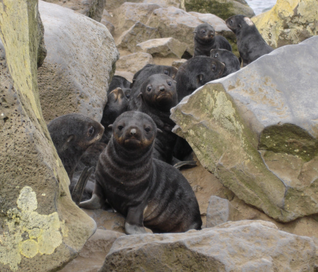
Seal Pups Face Climate Change Woes. The story from
Discovery News: "
The newborn Antarctic fur seal is especially vulnerable in its first few months of life, new research suggests. It has high energy requirements, which may be harder to meet as climate changes mean they need to use more energy to keep warm. By studying the energy requirements of Antarctic fur seals, researchers discovered that, despite climate models showing an increase in temperature, the windier and wetter conditions predicted for Antarctica may lead to lower survival rates for the seal pups. Essentially, the pups may have to allocate more energy to staying warm and less to growth and, ultimately, their survival." Photo credit:
NOAA.