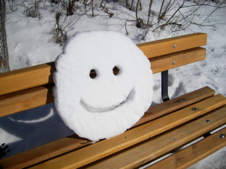
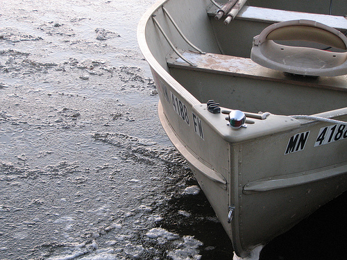
Twin Cities Averages (data from the MN State Climate Office and NOAA). Photo courtesy of the Star Tribune.
First 32 F. at MSP: October 7.
First Flurries: October 16.
First coating (1/10th of an inch): November 6.
First 1" snowfall: November 18.
First "plowable" 4"+ snowfall: December 20.
First "Trace" Of Snow (flurries) In The Metro Area:
2010: October 27
2009: October 10
2008: October 26
2007: November 5 (latest)
2006: October 11
2005: October 6 (earliest)
2004: October 17
61.3" rain at Williamsport, PA - wettest year on record (weather records date back to 1895).
Tropical Storm Lee dropped an estimated 29 trillion gallons of water -- that's approximately twice as much water as generated by Hurricane Irene.
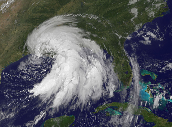
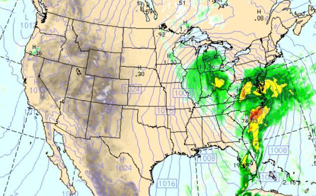
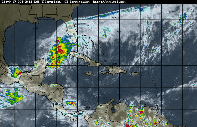 Gulf of Mexico Soaker
. A tropical wave in the Gulf of Mexico has already spawned 30-40 mph winds and 10 foot seas in the central Gulf, more than 10" of rain reported over the Florida Keys. NHC says there's only a 30% probability this area of disturbed weather will strengthen into Tropical Storm Rina in the next 48 hours (too much dry air and wind shear aloft). Some of this moisture will spike the storm forecast to track up the east coast by Wednesday, resulting in some very impressive rainfall amounts.
 Wednesday: Major East Coast Storm
. The WRF model spins up an impressive coastal storm over the Carolinas, a classic nor'easter, with a second area of low pressure hanging back over Ohio - impacting wind circulations over the eastern HALF of the USA. Models print out a little light precipitation over the Twin Cities metro Wednesday morning - by that time the atmosphere may be cold enough for sprinkles and flurries.
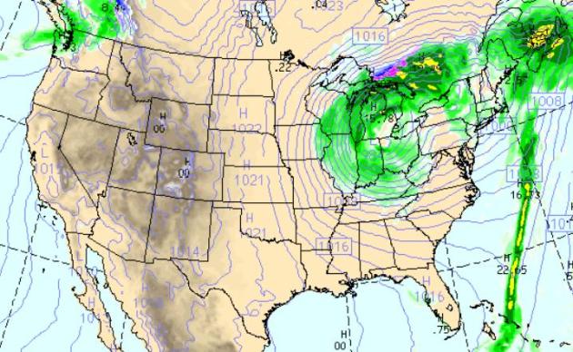 Thursday: Gales Of November Come Early
. By Thursday morning models print out an extremely intense storm near Detroit, a tight pressure gradient (contrast in atmospheric pressure)
whipping up 30-45 mph winds over the Great Lakes and the Upper Midwest as a cold rain mixes with wet snow over the U.P. of Michigan.
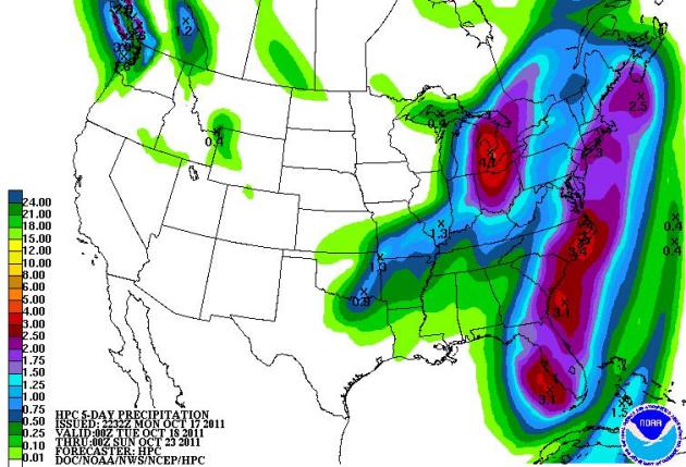 Major Rain-Maker.
 NOAA's 5-Day QPF (quantitative precipitation analysis) prints out some 4" rainfall amounts for Cleveland, Toledo and Detroit, 3" or more from Florida into the Carolinas, some 1-2" amoutns for New York, Providence and Boston.
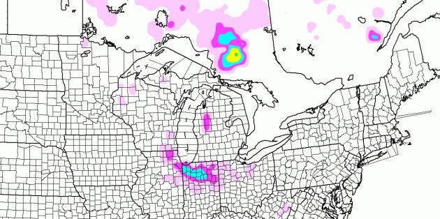
Predicted Snowfall. Let's see - I think this is the first time I've shown this map in over 6 months. Like seeing an old, needy (unwanted) friend showing up at your front door. A few flurries may mix in with rain showers from the MN Arrowhead across Wisconsin - the NAM model hinting at a couple inches of slushy snow near Chicago, Gardy and South Bend, Indiana over the next 84 hours. Here we go...
Coating Of Slush. Check out the
webcam from Sioux Lookout, Ontario. This snapshot was taken Monday morning around 9:45 am - more light snow and flurry activity is likely across Ontario in the coming days, a few flakes possibly brushing the Minnesota Arrowhead, the U.P. of Michigan, and portions of Wisconsin.
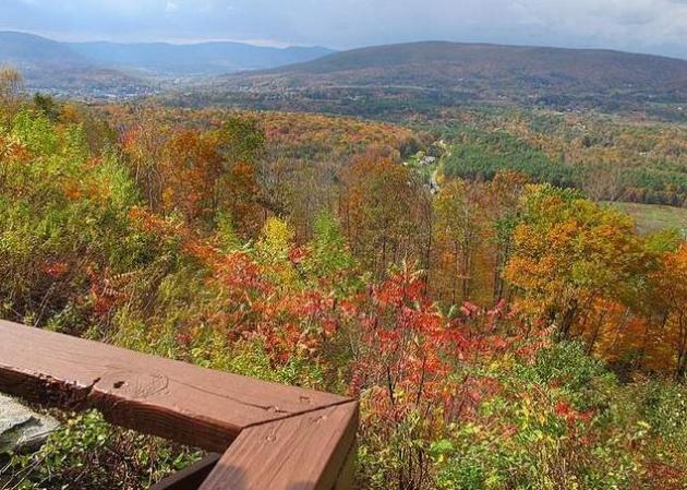
Hurricane Irene Mutes Fall Colors Out East (Still Remarkable). Ellen Creager from the
Detroit Free Press links Irene's torrential rains with New England fall colors that are slightly off this autumn: "
Six weeks ago, Hurricane Irene hit sections of northwestern Massachusetts and Vermont with massive flooding and winds. Here’s a report from Route 2, near the border between the two states, the scenic Mohawk Trail. NORTH ADAMS, Mass. – If you can find your way around the 7-mile washed-out stretch on the Mohawk Trail (Route 2), there’s a big treat on the western edge of the route. Descend from the 2,200-foot Whitcomb Summit to the Hairpin Turn. The road bends back on itself. Below is a sweeping vista of Mt. Greylock and the Hoosac Valley. Midway down the Hairpin Turn, most cars stop at the Golden Eagle restaurant to get a better view. From here, you can see that this fall, New England’s glorious colors are sober and muted. Color is rusty, not brilliant. Because of the constant rain and the hurricane six weeks ago, many leaves went from green straight to brown."
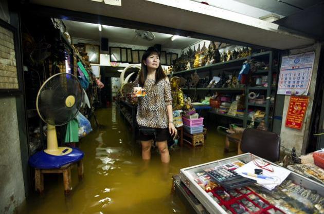 Bangkok's Governor Calls For Sandbags As Floods Besiege Thailand's Capital
. It seems that Bangkok isn't quite out of the woods just yet, as reported by
Bloomberg: "
Bangkok Governor Sukhumbhand Paribatra appealed for more than a million sandbags to prevent flooding in the Thai capital as a “huge amount” of water from northern dams threatens to deluge inner parts of the city. “Every minute is critical from now on,” he told a televised press briefing late yesterday in which he asked for 1.2 million sandbags. “We urge the government to give those bags now. Otherwise, it will be too late.” Water broke into Navanakorn Pcl’s industrial zone in Pathum Thani on Bangkok’s outskirts, inundating 10 more factories, according to Wim Roongwatanachinda, a spokesman for the Flood Relief Operation Command. The disaster has killed more than 300 people and swamped at least 930 plants employing more than 300,000 workers, according to government data. Prime Minister Yingluck Shinawatra is seeking to spare Bangkok from the country’s worst flooding in 50 years after heavy monsoon rains forced officials to release large amounts of water from northern dams."
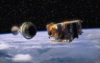
New NASA NPP Satellite Will Improve Severe Weather And Extended Forecasts. Tony Pann,
Baltimore Weather Examiner, has a very interesting article about improvements in polar-orbiting satellites, and what that means for consumers: "
These weather satellites provide the data that enables meteorologists to forecast severe weather and warn the public. Did you know …
- Polar-orbiting weather satellites provide 93 percent of the data used in National Weather Service forecast models?
- Nearly 90 percent of all Presidentially-declared disasters are weather and water-related?
- Polar-orbiting satellites provide critical data for 2-10 day long-term forecasts, which are imperative for troop deployments and planning operations?
- Without data from polar-orbiting satellites, 2-5 day advance warnings of extreme events as well as everyday forecasts for highs, lows, precipitation, etc., would be significantly diminished?
- Without data from NOAA’s polar afternoon orbit, the “snowmageddon” event in Feb. 2010 would have been under-forecast by at least 10 inches?
Without polar-orbiting satellites, the country would have to rely on technology dating back to the 1920s and 30s putting thousands of Americans lives at risk? "
* photo courtesy of
Flickr.
Climate Stories...
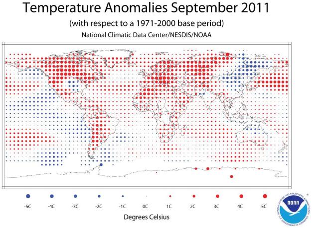
September Global Temperatures 8th Warmest On Record. More from
NOAA: "
The Earth experienced its eighth warmest September since record keeping began in 1880. The annual minimum Arctic sea ice extent was reached on September 9 and ranked as the second smallest extent since satellite records began in 1979.
- The combined global land and ocean average surface temperature for September was the eighth warmest on record at 59.95˚F (15.53˚C), which is 0.95˚F (0.53˚C) above the 20th century average of 59.0˚F (15.0˚C). The margin of error associated with this temperature is +/- 0.20˚F (0.11˚C).
- Separately, the global land surface temperature was 1.57˚F (0.87˚C) above the 20th century average of 53.6˚F (12.0˚C), making this the fourth warmest September on record. The margin of error is +/- 0.43˚F (0.24˚C). Warmer-than-average conditions occurred across Europe, northern and western Africa, western Russia, the western and northeastern United States, Canada, and Mexico. Cooler-than-average regions included much of eastern Asia, and part of the central United States."
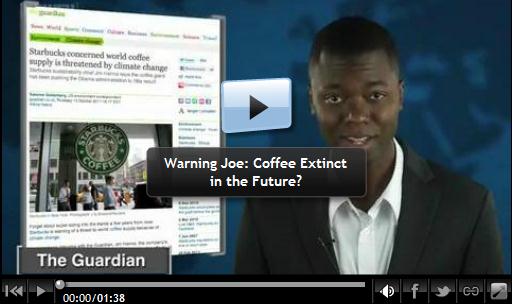
Starbucks Fears Climate Change Could Harm World's Coffee Supply. Please, for the love of everything holy....don't mess with my coffee hobby/habit/addiction.
Huffington Post has the details: "
Starbucks lovers, beware. It looks like your precious coffee could be on the endangered list thanks to climate change. "What we are really seeing as a company as we look 10, 20, 30 years down the road - if conditions continue as they are - is a potentially significant risk to our supply chain, which is the Arabica coffee bean," said Starbucks Sustainability Director Jim Hanna in a phone interview with the Guardian. In addition to Central America's farmers already feeling the effects of global warming on their crops, Hanna told the Guardian of his plans to visit Washington to speak to members of Congress at a Union of Concerned Scientists event to speak about climate change and coffee. The move comes after rumors circulated this week that Starbucks might be considering juice bars. Though there's no formal confirmation of switching from coffee to juice, this could symbolize the coffee chain's attempt to secure its future business in the face of unpredictable weather, by varying its offerings and looking beyond coffee."
Climate Change Is Making Many Plants And Animals Smaller: Study.
Rawstory.com has more information: "
PARIS — Climate change is reducing the body size of many animal and plant species, including some which supply vital nutrition for more than a billion people already living near hunger’s threshold, according to a study released Sunday. From micro-organisms to top predators, nearly 45 percent of species for which data was reviewed grew smaller over multiple generations due to climate change, researchers found. The impact of rapidly climbing temperatures and shifts in rainfall patterns on body size could have unpredictable and possible severe consequences, they warned. Previous work established that recent climate change has led to sharp shifts in habitat and the timing of reproductive cycles. But impact on the size of plants and animals has received far less attention."
Texas Officials Censored Climate Change Report. Here's a story from
newscientist.com: "
Officials at the state environmental agency in Texas have altered a scientific report they commissioned on Galveston bay, deleting mentions of human-induced climate change and rising sea levels. The 2010 State of the Bay report has been delayed for a year by disputes between the Texas Commission on Environmental Quality (TCEQ) and scientists at the Houston Advanced Research Center, who are contracted to provide the state with regular reports on the bay. John Anderson, an oceanographer at Rice University in Houston, Texas, who wrote the chapter of the report that was apparently edited by TCEQ management, told British newspaper The Guardian that the cuts reflected what he called "denial" throughout the state of Texas about the effects of global warming. The TCEQ is headed by Bryan Shaw, known for saying that scientific arguments that human activities are changing the climate are a hoax. He was appointed by Texas governor Rick Perry, who has publicly said that such science is inconclusive. "They just simply went through and summarily struck out any reference to climate change, any reference to sea level rise, any reference to human influence - it was edited or eliminated," Anderson told The Guardian. "That's not scientific review, that's just straightforward censorship."