"...Improved data gathering, computer modeling and scientific analysis have made seven-day forecasts of broad weather patterns as accurate as five-day forecasts were 20 to 25 years ago, and five-day forecasts as accurate as three-day forecasts were then, says David B. Parsons, director of the school of meteorology at the University of Oklahoma in Norman." - from a Wall Street Journal article below on the "art" of weather forecasting.
"...All of the storms are being formed in an environment that is warmer and wetter than before," said Trenberth. "The main thing that has happened with climate change is that you have changed the environment." Specifically, the waters are about one degree Fahrenheit warmer than pre-1970 values, leading to air that's four percent wetter. All that additional moisture and heat in the air feeds storms. "That's the climate change kicker. It's the extra nudge that indeed makes you break records." - from a Science Daily article on extreme weather and climate change below.
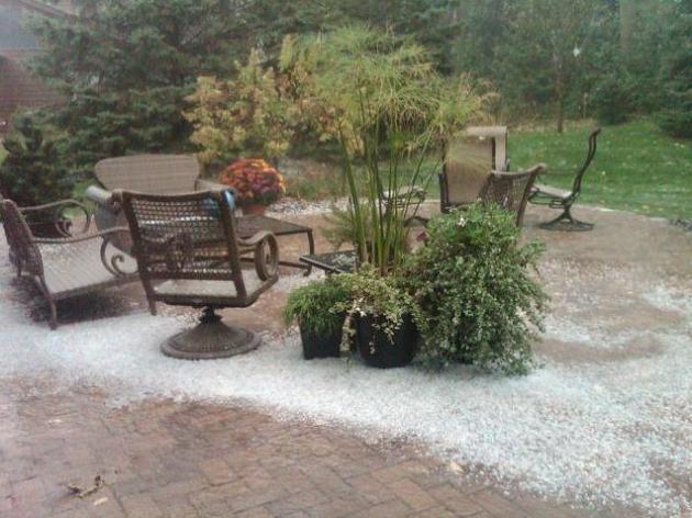
October "Hailer". No, it wasn't sleet, which is a winter-weather phenomenon, triggered by rain drops freezing through a layer of cold air near the ground into ice pellets. Hail is triggered by thunderstorm updrafts and downdrafts, each cycle through a storm adding a concentric layer of water/ice to the growing hailstone until gravity pulls the little ball of ice to the ground. Thanks to weather-spotter Sharon Bertrand who lives in Mendota Heights for sending in this photo of her back yard. Hail on October 12 is unusual, but not unprecedented.
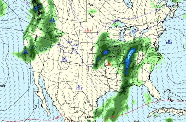
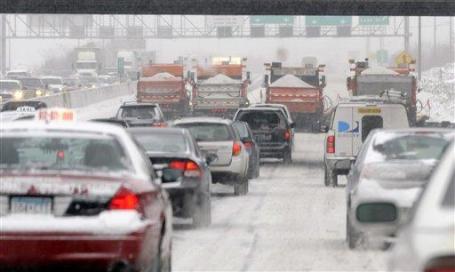
Gales Of November Coming Early To Chicago? From the Windy City office of the NWS:
URGENT - MARINE WEATHER MESSAGE
NATIONAL WEATHER SERVICE CHICAGO IL
235 PM CDT WED OCT 12 2011

...NORTHWEST GALES POSSIBLE FRIDAY THROUGH SATURDAY MORNING...

.LOW PRESSURE WILL BE DEEPENING AS IT MOVES ACROSS SOUTHERN LAKE
MICHIGAN THURSDAY AFTERNOON AND NIGHT. THIS LOW WILL CONTINUE TO
STRENGTHEN FRIDAY AND FRIDAY NIGHT AS IT MOVES NORTHEAST TO
WESTERN QUEBEC. MUCH COOLER AIR CURRENTLY ACROSS NORTHERN CANADA
WILL BE SWEPT SOUTH EASTWARD ACROSS THE UPPER GREAT LAKES REGION
IN THE WAKE OF THE LOW.
* photo credit above here.

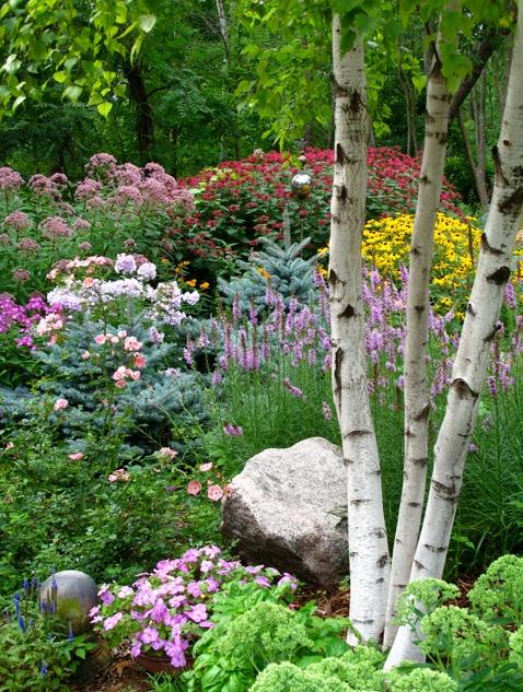
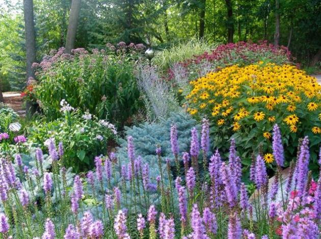
Fall Gardening Tips. My thanks to good friend and Master Gardener Tricia Frostad, who has created an incredible, one-of-a-kind garden. She provided the following information to me via e-mail. I wanted to know what we should be doing in our yards to prepare for winter, especially in light of the unusually dry spell we're going through now - a growing statewide drought. Here is Tricia's advice:
Folks who have tender bulbs planted such as Cannas, Tuberous Begonias or Gladiolas should begin lifting those as soon as the foliage has died back.
Also, refrain from doing any pruning of woody plants. They don’t have time to heal properly before winter...
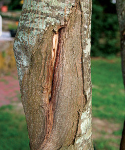
Sun scald is characterized by elongated, sunken, dried, or cracked areas of dead bark, usually on the south or southwest side of a tree. On cold winter days, the sun can heat up bark to the point where cambial activity is stimulated. When the sun is blocked by a cloud, hill, or building, bark temperature drops rapidly, killing the active tissue. Young trees, newly planted trees, and thin-barked trees (cherry, crabapple, honey locust, linden, maple, mountain ash, plum) are most susceptible to sun scald. Trees that have been pruned to raise the lower branches, or transplanted from a shady to a sunny location are also sensitive because the lower trunk is no longer shaded. Older trees are less subject to sun scald because the thicker bark can insulate dormant tissue from the sun's heat ensuring the tissue will remain dormant and cold hardy.
Sun scald can be prevented by wrapping the trunk with a commercial tree wrap, plastic tree guards, or any other light-colored material. The wrap will reflect the sun and keep the bark at a more constant temperature. Put the wrap on in the fall and remove it in the spring after the last frost. Newly planted trees should be wrapped for at least two winters and thin-barked species up to five winters or more.
* more information on sun scald from finegardening.com.
FIRSTS
Average date of the first inch snowfall – November 18th
Average date of the first two inch snowfall – November 29th
Average date of the first four inch snowfall – December 20th
Average date of the first inch of snow cover – November 22nd
Average date of the last inch of snow cover – April 2nd
Average date of the last inch of snow cover – April 2nd
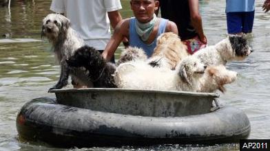
"AYUTTHAYA, Thailand-- The lucky ones traverse this flood-submerged Thai city in navy boats and motorized canoes. The rest float on whatever they can find -- inner tubes, swan-shaped pedal boats, huge chunks of muddied white plastic foam. With large sections of Ayutthaya buried under a sea of one-story high water, rescue workers and volunteers are still crisscrossing town to pluck stranded residents from the ruins. Others are staying to protect what's left. One boy donned a snorkeling mask to inspect his house, its corrugated roof faintly visible below the murky brown waves. "Nobody ever thought the water would rise this high," 54-year-old Pathumwan Choichuichai told The Associated Press in this city of ancient temples just north of Bangkok, minutes after a Thai navy team snatched her family from an apartment building where they were stranded for five days."
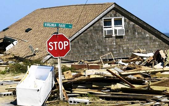
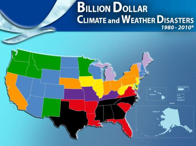
In Weather Forecasting, Expect High Pressure. I thought this was an excellent article that captures the difficulty of weather prediction. Here's a brief excerpt of the Wall Street Journal article: "This year has already seen 10 weather disasters each costing more than $1 billion in damage, making it the most costly since the government started keeping records in 1980. And it has been one of the toughest years in memory for meteorologists. The technology used for forecasting has improved, and forecasts are more accurate compared with the past. But the job of the meteorologist is still both an art and a science....Improved data gathering, computer modeling and scientific analysis have made seven-day forecasts of broad weather patterns as accurate as five-day forecasts were 20 to 25 years ago, and five-day forecasts as accurate as three-day forecasts were then, says David B. Parsons, director of the school of meteorology at the University of Oklahoma in Norman."
Good Calls, Bad Calls: a Recent History
Some recent meteorological high points and low points, based on input from weather experts:GOOD CALLS
- Hurricanes Irene (2011) and Isabel (2003): Thanks to computer modeling and on-target analysis, government advisories days in advance predicted the storms' likely courses with unusual accuracy.
- Super outbreak (2011): In April, residents in the Southeast were alerted several days before hundreds of tornados devastated parts of Alabama, Arkansas, Mississippi and other states.
- Snowmageddon (2010): Forecasters started raising warning flags nearly a week before record snowfall hit Virginia, Pennsylvania, Maryland and Washington, D.C., enabling officials to order emergency preparations and retailers to stock up with storm merchandise.
Timely Gardening Tips
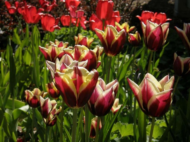
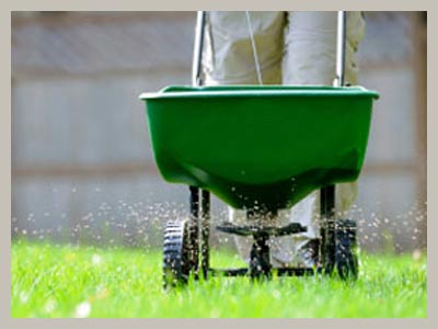
It's way too dry out there, and I suspect Minnesota's drought will get worse before conditions improve. Tricia Frostad is a friend and Master Gardener who lives in Chanhassen, a suburb of Minneapolis. What should people be doing right now? "Woody shrubs and newly planted trees still need to be irrigated, to prevent damage over the winter. Water perennials to prepare for their winter shut-down, and soak evergreens now to help ward off winter burn," she told me. It sounds like you can't water enough right now. "We need to continue watering until the ground freezes." A sign of hope: now is the time to plant tulips and other spring bulbs. It's also a good time to apply fertilizer on your lawn.
Climate Stories...
Laying the Blame For Extreme Weather. Here's a timely story from sciencedaily.com: "Floods, tornadoes, droughts and wildfires: They are all weather-related, but blaming the latest meteorological disaster on climate change has always been a tricky matter that climate scientists have been shy to do. After all, how can you point to a specific and local event, such as a tornado or dry spell, and say it is caused by something as long-term and huge as global warming? .... "All of the storms are being formed in an environment that is warmer and wetter than before," said Trenberth. "The main thing that has happened with climate change is that you have changed the environment." Specifically, the waters are about one degree Fahrenheit warmer than pre-1970 values, leading to air that's four percent wetter. All that additional moisture and heat in the air feeds storms. "That's the climate change kicker. It's the extra nudge that indeed makes you break records." Another way of looking at it is in terms of the odds of extreme weather events. Extreme weather is always possible, after all. But with warmer oceans, such events are easier to create. "We're loading the dice in favor of extreme weather events," said Trenberth."