Take a look at the two different webcams from midday Wednesday. Note that Boston, MA looked fairly quiet (other than very strong winds), while places in the southeastern part of Massachusetts were getting slammed!
Southeast Massachusetts
Here's a closer view of the southeastern part of Massachusetts around midday Wednesday, when near hurricane force wind gusts and horizontal winds were blasting through!
Martha's Vineyard
It's hard to grasp how crazy the weather was from these particular webcams, but the wind was strong enough to knock power out to several thousand customers during the storm!
Strongest Wind Gusts
Here were some of the strongest wind gusts that had been observed from midday Wednesday in Massachusetts, mainly along the coastal communities.
100mph+ Wind Gust?
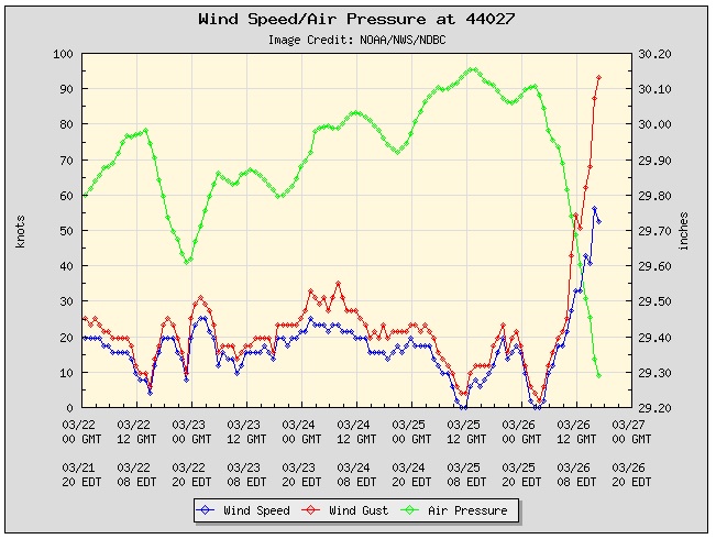
Take a look at the buoy data here from just south of coastal Maine. First note the green line (pressure tendency) and look at how fast the pressure dropped from Tuesday evening to midday Wednesday! The red line indicates wind gusts (in knots), which was recorded to be near ~95knots midday Wednesday. Conservatively, 90knots converts to 103mph!
Buoy Location
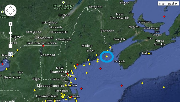
This is the buoy that recorded the 103mph wind gust midday Wednesday as the center of the massive storm raced north.
Meteorological Specimen
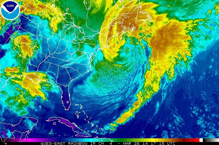
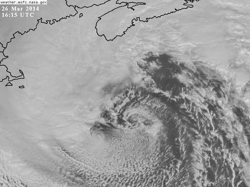
Take a look at some of the images I captured from various sources during the day Wednesday of the massive storm. From satellites to radar to wind flow, the more I looked, the more I was amazed... enjoy!
Water Vapor
IR Satellite
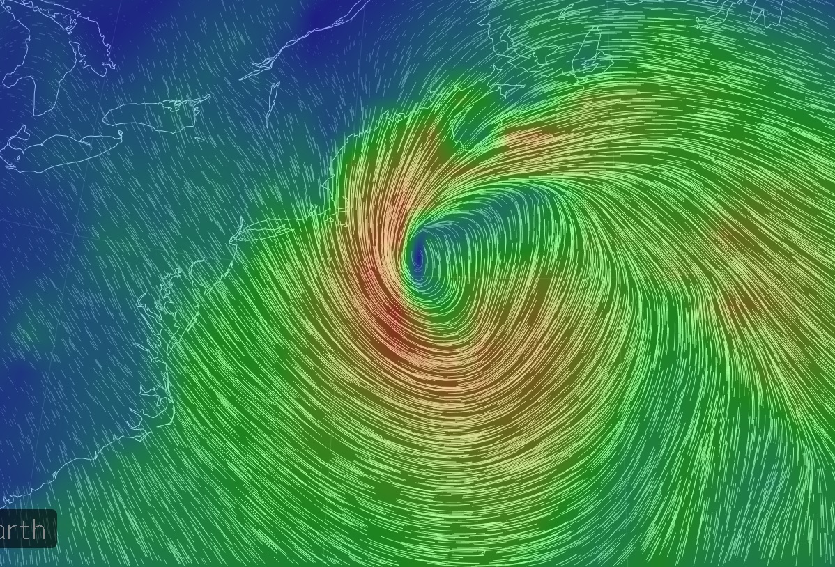
Wind Flow Midday Wednesday
Satellite & Radar Midday Wednesday
Wind Flow Midday Wednesday
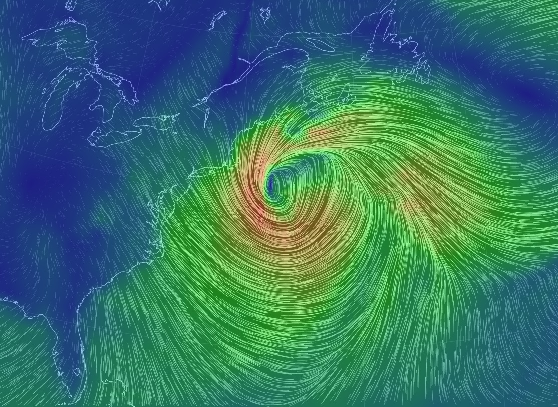
At this point in the day, the central pressure was estimated to be around 964mb, which had dropped from near 1009mb 24hours previous to that report.
Visible Satellite of Storm Center Midday Wednesday
Wind Flow Midday Wednesday
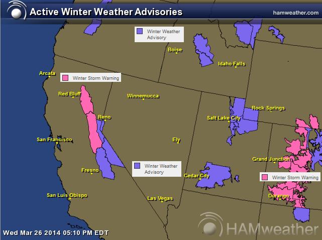
Western Snow
This is a nice sight! The webcam from Yosemite National Park on Wednesday showed reduced visibility from snow!
Sierra Snow Pack
I though this was interesting. This is the modeled snow coverage on March 26th, 2014 vs March 26th, 2012. Note how much more snow coverage there was two years ago at this time!
Additional Snow on the Way
The good news is that additional snow is on the way for the high elevations in the western part of the country. Snow amount could top out at 1ft. to 2ft. in parts of the Sierra Nevada range by midday Tuesday! Snow in the Colorado Rockies could approach 1ft. to 2ft as well by the end of the week.
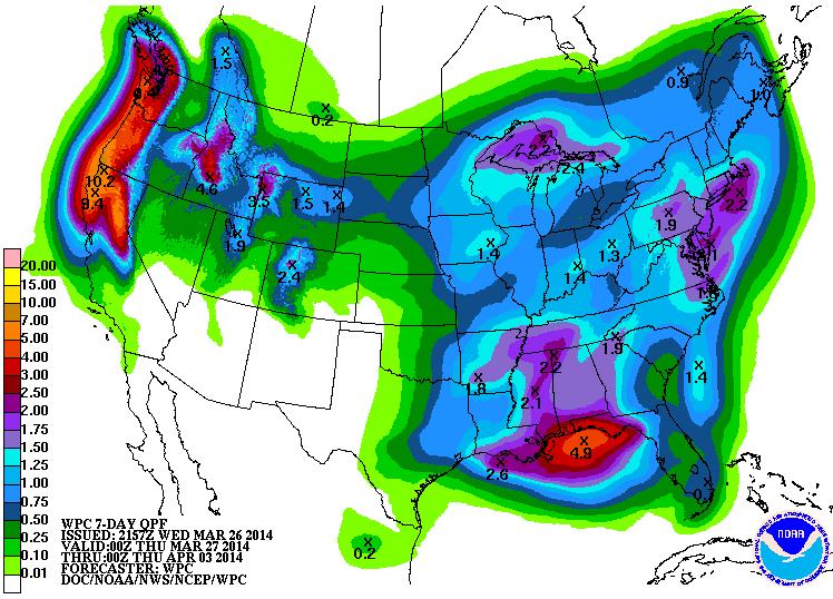
Precipitation Next 7 Days
According to NOAA HPC 7 day precipitation, some of the heaviest moisture looks to fall across the western part of the country. Sure it's good news for areas dealing with drought, but recent heavy moisture is part of the reason for that devastating mudslide near Oso, Washington. Additional heavy precipitation in these areas may not be great news.
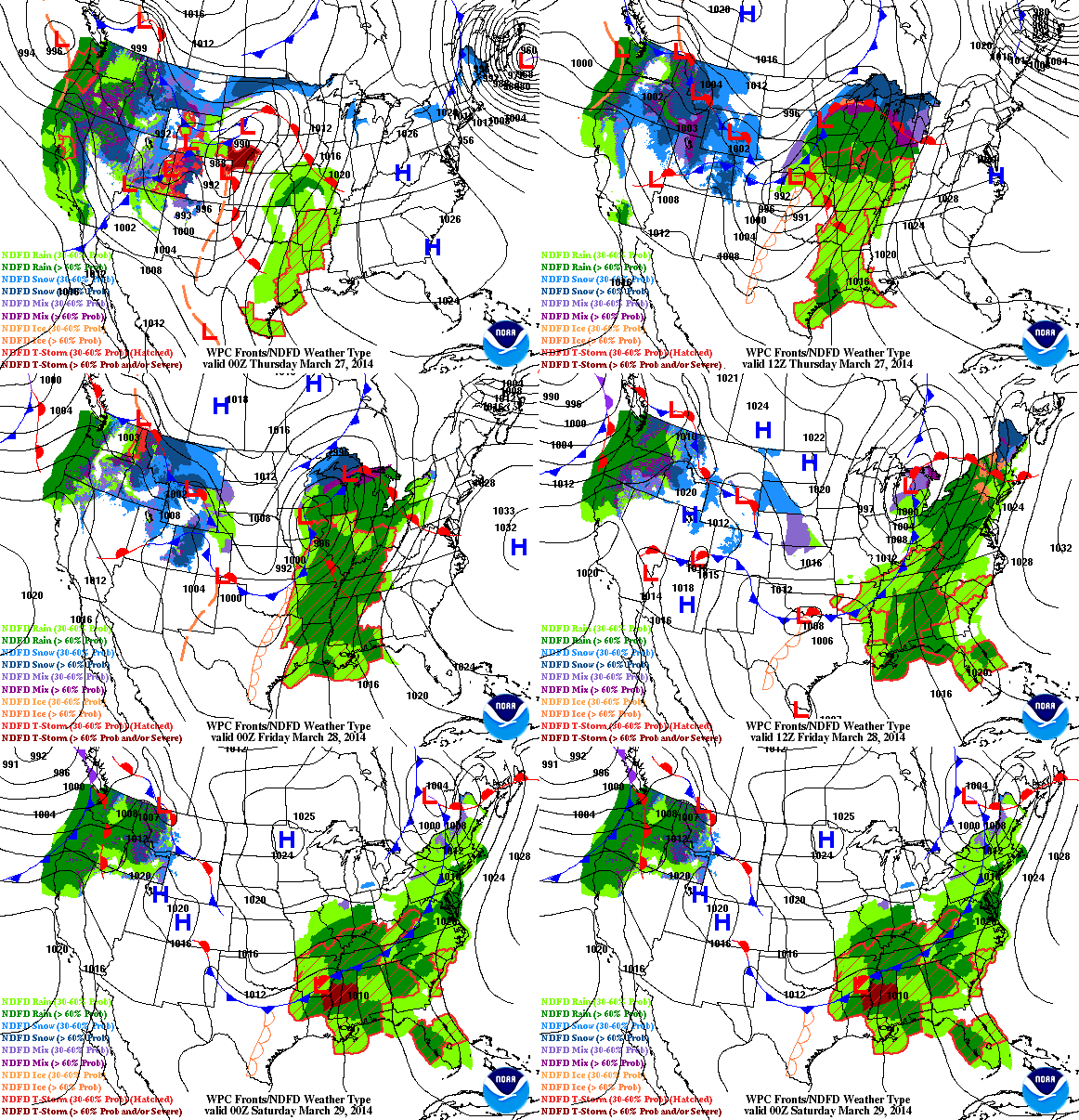
Storm System Moves East
A piece of energy from the Pacific will eventually find itself in the middle part of the country by late week. This storm will be responsible for widespread moisture from the Mississippi River Valley on east. Snow will be found across the international border, while strong to severe storms may be found a little farther south.
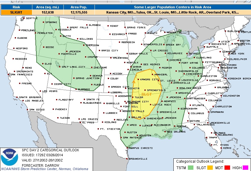
Severe Thunderstorm Threats Ahead
Thursday's Outlook from the SPC
"STRONG DEEP LAYER SHEAR FAVORS SUPERCELL DEVELOPMENT. SUPERCELLS THAT DEVELOP SWD TOWARD THE ARKLATEX WILL FORM WITHIN A MORE MOIST ENVIRONMENT WHERE SFC DEW POINTS MAY RISE INTO THE LOWER 60S. WHILE MUCAPE MAY NOT EXCEED 1500 J/KG AHEAD OF THE DRY LINE FORECAST SOUNDINGS WOULD SEEM TO SUPPORT THE POSSIBILITY OF VERY LARGE HAIL AND POSSIBLY TORNADOES...ESPECIALLY WITH DISCRETE ACTIVITY FROM SWRN MO SWD TO THE RED RIVER. HAVE INCREASED THE PROBABILITY OF SIG SEVERE ALONG THE DRY LINE TO INCLUDE THIS ENHANCED RISK. SEVERE THREAT WILL LESSEN DURING THE OVERNIGHT HOURS AS CONVECTION SPREADS INTO MORE STABLE ENVIRONMENT NEAR THE MS RIVER."
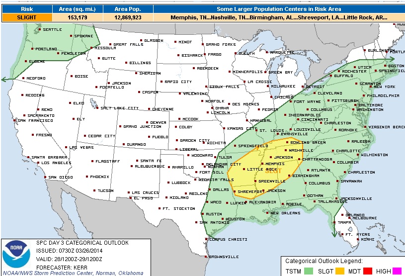
Friday's Outlook from the SPC
LARGE HAIL SHOULD BE THE PRIMARY SEVERE THREAT INITIALLY...BUT UPSCALE GROWTH INTO A FORWARD PROPAGATING MESOSCALE CONVECTIVE SYSTEM SEEMS A DISTINCT POSSIBILITY AS ACTIVITY SPREADS EASTWARD TOWARD THE TENNESSEE VALLEY FRIDAY NIGHT. THIS MAY BE AIDED BY A 40-50+ KT LOWER/MID TROPOSPHERIC SPEED MAXIMUM...WHICH WILL CONTRIBUTE TO THE RISK FOR SEVERE WIND GUSTS.
Smoke Vortex
Can't say I've ever seen one of these before. A grass fire along with gusty winds near Weatherford, OK led to this big smoke vortex. Thanks to @westernokchaser for the image!
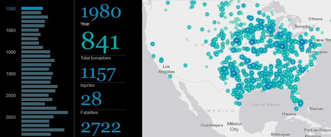
Massive Tornado Database
This is unreal! It's an interactive tornado database of every recorded tornado since 1980.
It was put together by Smithsonian.com, see more HERE:
Thanks for checking in and have a great rest of your week! Don't forget to follow me on Twitter @TNelsonWNTV
