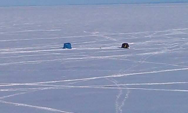
Now this seems a little strange to see ice anglers still at it on Lake Superior in Late March! In fact, I can't remember the last time I saw this! Thanks to my good friend Jeremy Frazier for the picture below from Duluth, MN who is enjoying a weekend with family!
Lake Superior Ice Coverage
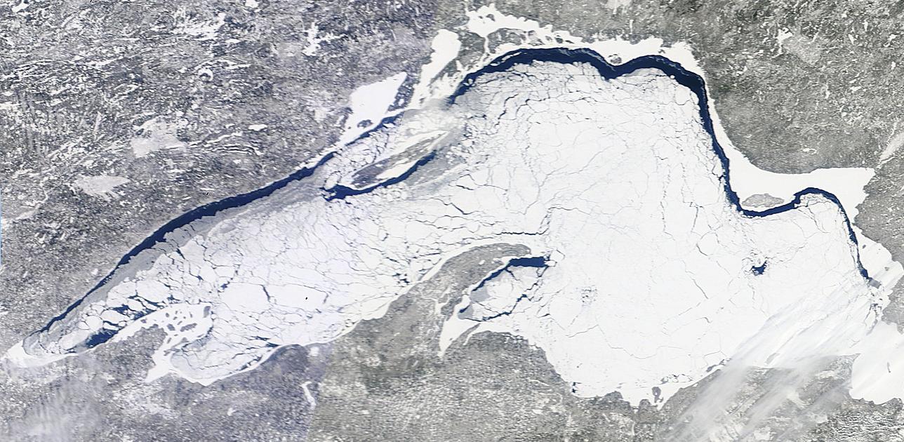
WOW! Here was impressive view of Lake Superior on a sunny Saturday, March 29th. Interestingly, the lake was still nearly 91% ice covered as of yesterday!
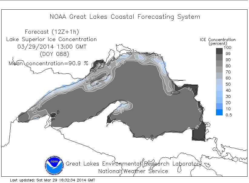
According to NOAA's GLERL, Lake Superior was officially 90.9% ice covered as of Saturday, March 29th
Great Lakes Ice Coverage
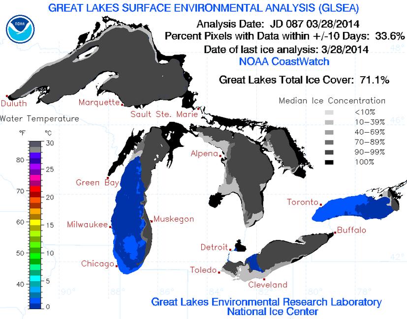
According to NOAA's GLERL, the Great Lakes ice coverage was down 71.1% as of March 28th, which is down from the 2013-2014 peak of 92.2% on March 6th (the most since 1979). The record Great Lakes ice coverage was 94.7% set in 1979.
Soggy Saturday in Florida
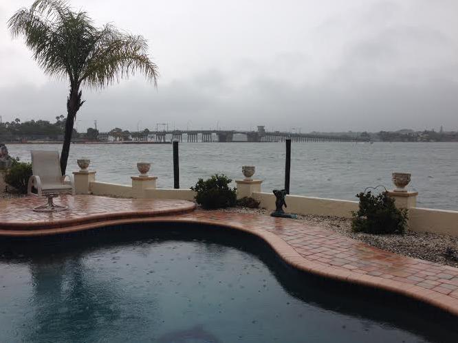
Thanks to my good friend Todd Frostad for the picture below out of Sarasota, FL where rain made for a somewhat soggy Saturday.
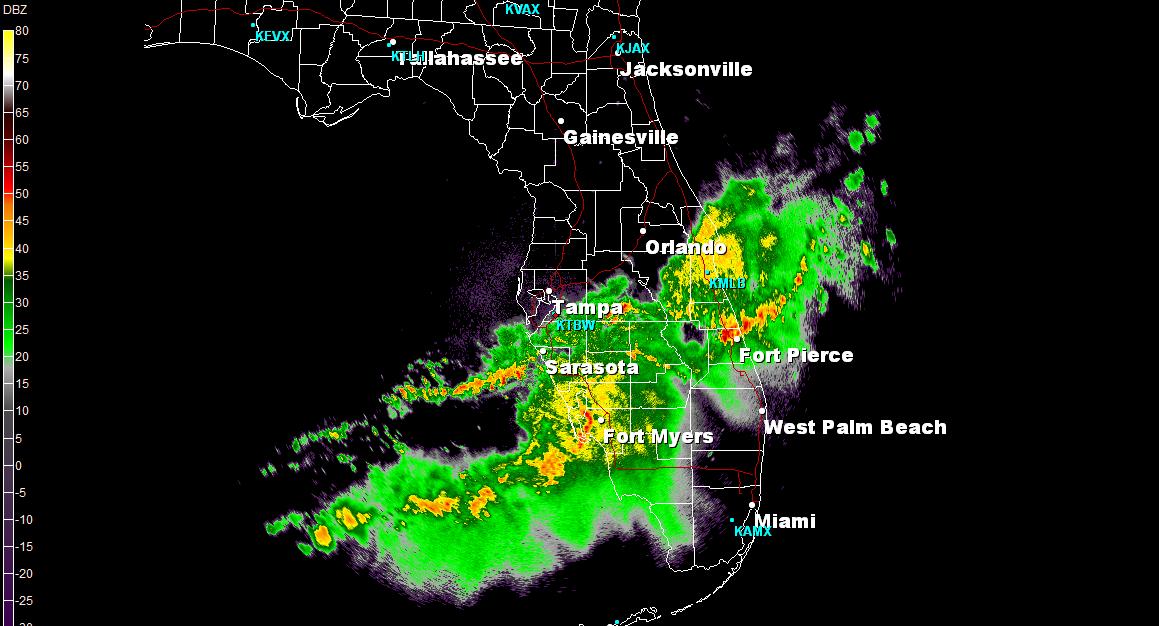
Stormy Saturday in Florida
This was the radar picture from around 4pm EDT Saturday. Quiet a few showers and storms rumbled across the state making for more of an indoor day. The good news is that weather conditions will improve into Sunday/early next week!
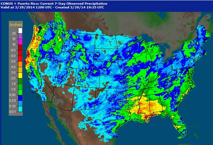
Precipitation Last 7 Days
Thanks to a more active jet stream, weather conditions across the country have been quite a bit more soggy. Take a look at how much precipitation we've seen from coast to coast in the last 7 days! Other than the Desert Southwest, just about every location has seen some type of precipitation since last weekend.
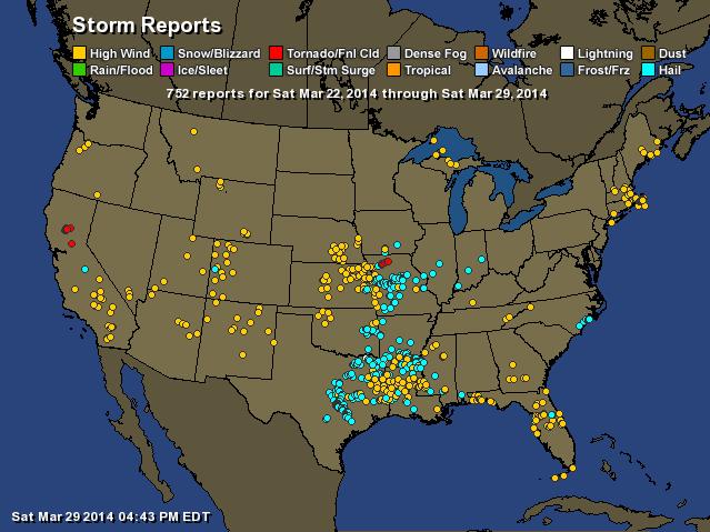
Storm Reports Past Week
Not only have we had quite a bit of moisture over the last week, but there has also a fairly significant uptick in the severe weather as of late. Note that we've had severe weather reports from coast to coast over the last 7 days!
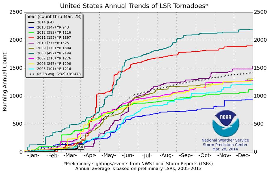
2014 Tornado Count
As of March 28th, the 2014 PRELIMINARY tornado count was only 64 across the nation. Interestingly, at this time last year, we had 147 tornado reports through this time, while in the year 2008, we had nearly 500 tornado reports through this time! The average (2005-2013) through now is 232, so needless to say, we are well behind where we typically are by this time of the year.
Active Weather Continues
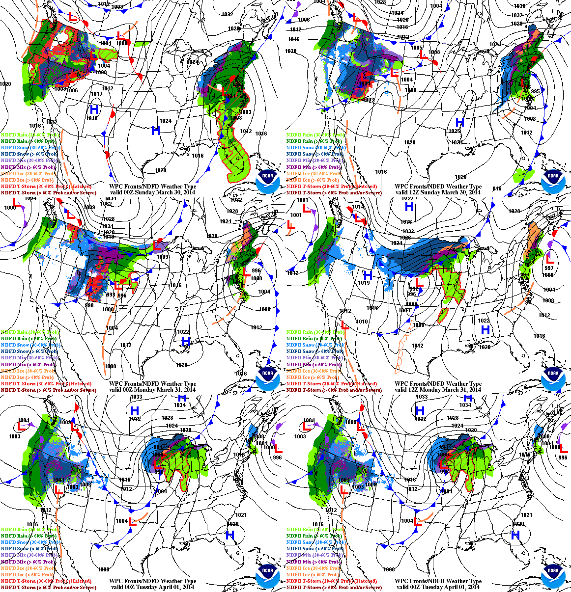
The active weather pattern looks to continue across the country into next week as another piece of energy from the Pacific traverses the Rockies and into the Midwest by Monday and Tuesday. This particular system will not only dump copious amount of moisture in the western part of the country, but it will also be responsible for another heavy snow chance from the High Plains to the international border across the Upper Midwest.
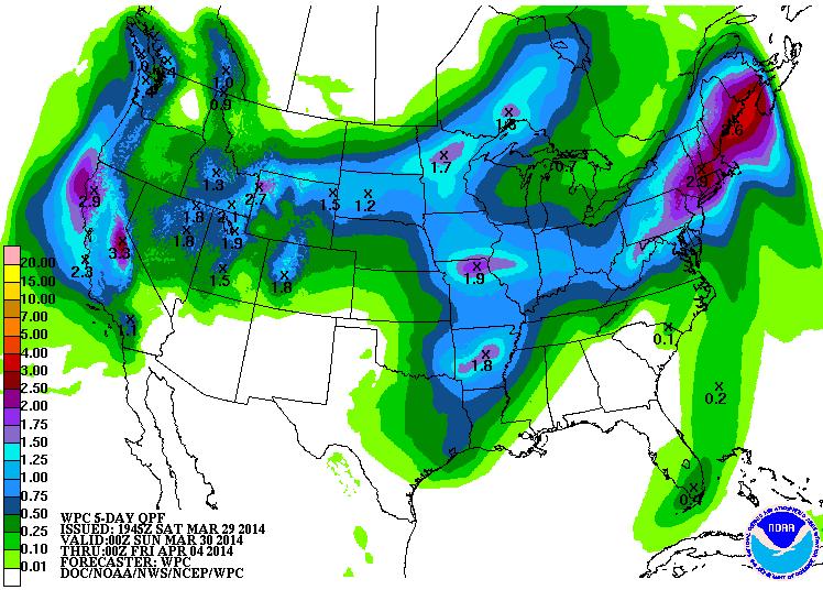
Precipitation Outlook Next 5 Days
The precipitation outlook over the next 5 days certainly looks from the West Coast to the central part of the country as our next storm system takes shape. Note that the higher elevations in the western part of the country look to pick up snow, while those from the Dakotas to the far northern reaches of the Upper Midwest will see some too.
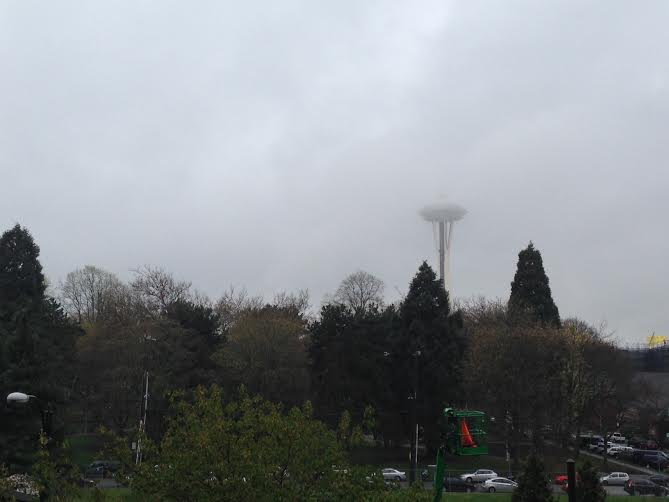
Wettest March on Record for Seattle, WA!
As of Friday, Seattle has seen 8.89" of precipitation for the month, which is officially the wettest March in recorded history! Thanks to my good friend Nicholas Shipes for sending this picture who snapped this earlier last week on one of their soggy days.
Winter Weather Ahead
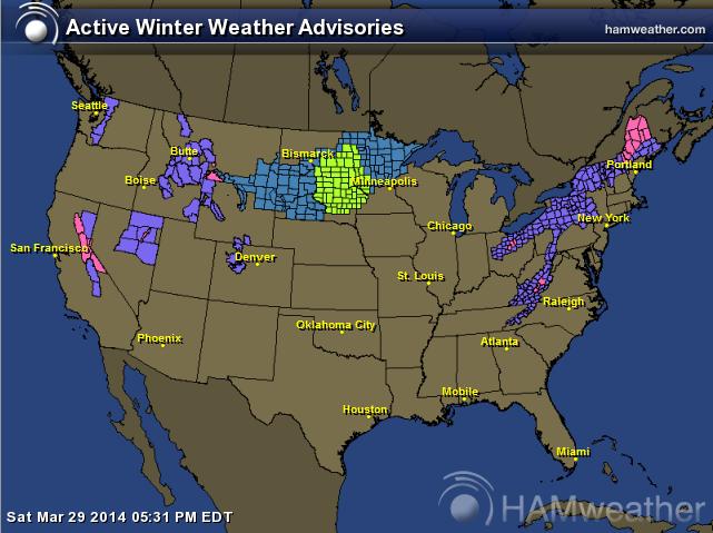
Here are all of the winter weather headlines that have been posted across the nation. Note that not only are places in the higher elevations out west and the places in the Midwest under winter weather headlines, but lingering winter weather headlines are hanging on the Northeast through the end of the weekend.
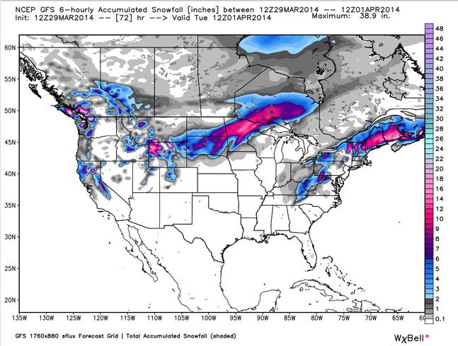
U.S. Snowfall Potential
Snowy swaths. Here's the snow potential through AM Tuesday across the nation. Note the snow blobs across the Midwest and the Northeast. Apparently winter is hanging...
Thanks for checking in and have a great rest of your weekend! Don't forget to follow me on Twitter @TNelsonWNTV
