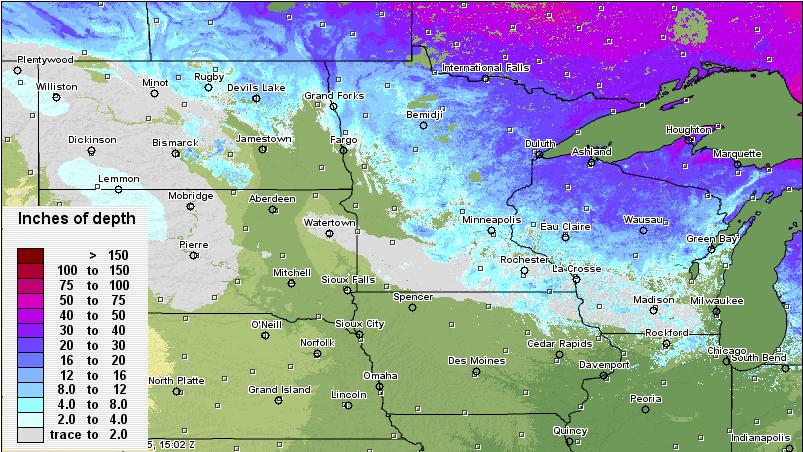
Slowly, but surely the snowpack is shrinking. This is a look at the snow cover as of Saturday.
Growing Snow Potential
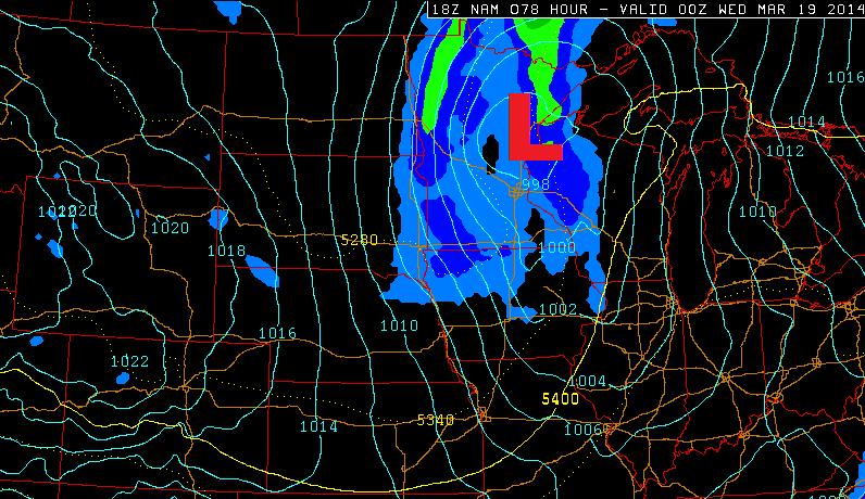
Weather maps continue to suggests a storm system moving through the Upper Midwest by early next week. The storm will wrap warmer air in on it's southeastern side, so snow amounts there should be lighter. Snow accumulations on the western and northern side could be decent... stay tuned! The image below shows the storm position by PM Tuesday.
Picture of the Day
One of my good friends snapped this picture in a recent flight into La Guardia this week. Nice picture!

Weather Ahead
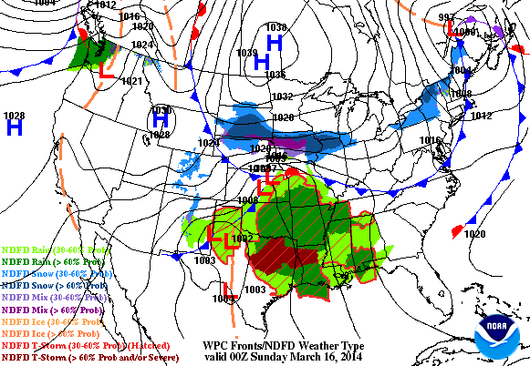
It's going to be pretty active through early next week. There are two storm systems that will push through the country. The first of which is sitting in the Lower Mississippi Valley and heading for the Eastern Seaboard through early next week. Heavy rain and strong thunderstorms will be found across the Gulf Coast States, while wintry precipitation will be found from the Middle Mississippi Valley to the Mid-Atlantic Region.
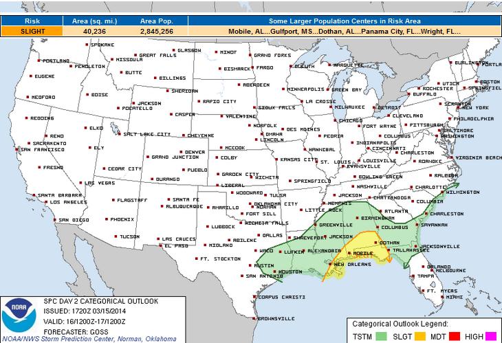
Sunday Severe Threat
The severe threat for Sunday doesn't look exceptionally significant, but there is a chance that some of the storms could be strong to severe.
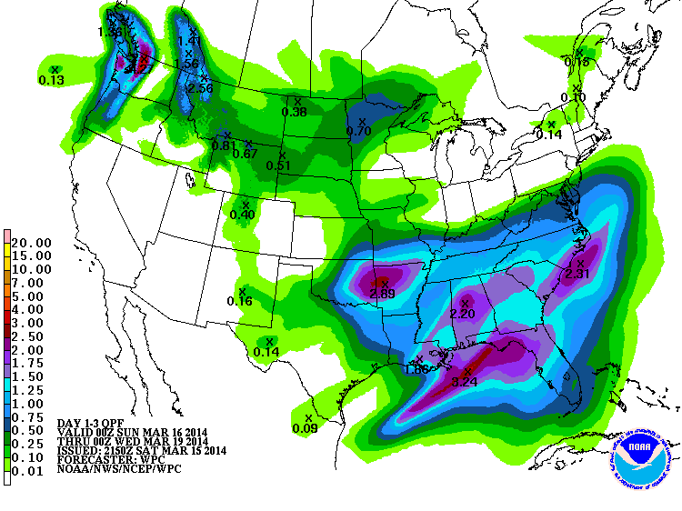
Precipitation Outlook
Here's NOAA's HPC 3 day precipitation outlook through PM Tuesday. Note the two blobs of heavier moisture; one in the Southeastern part of the country, while the second is located in the Upper Midwest. The southern severe threat looks be fairly weak across the Gulf Coast states with storm system number one, but the wintry precipitation on the northern flank this system look to be pretty substantial.
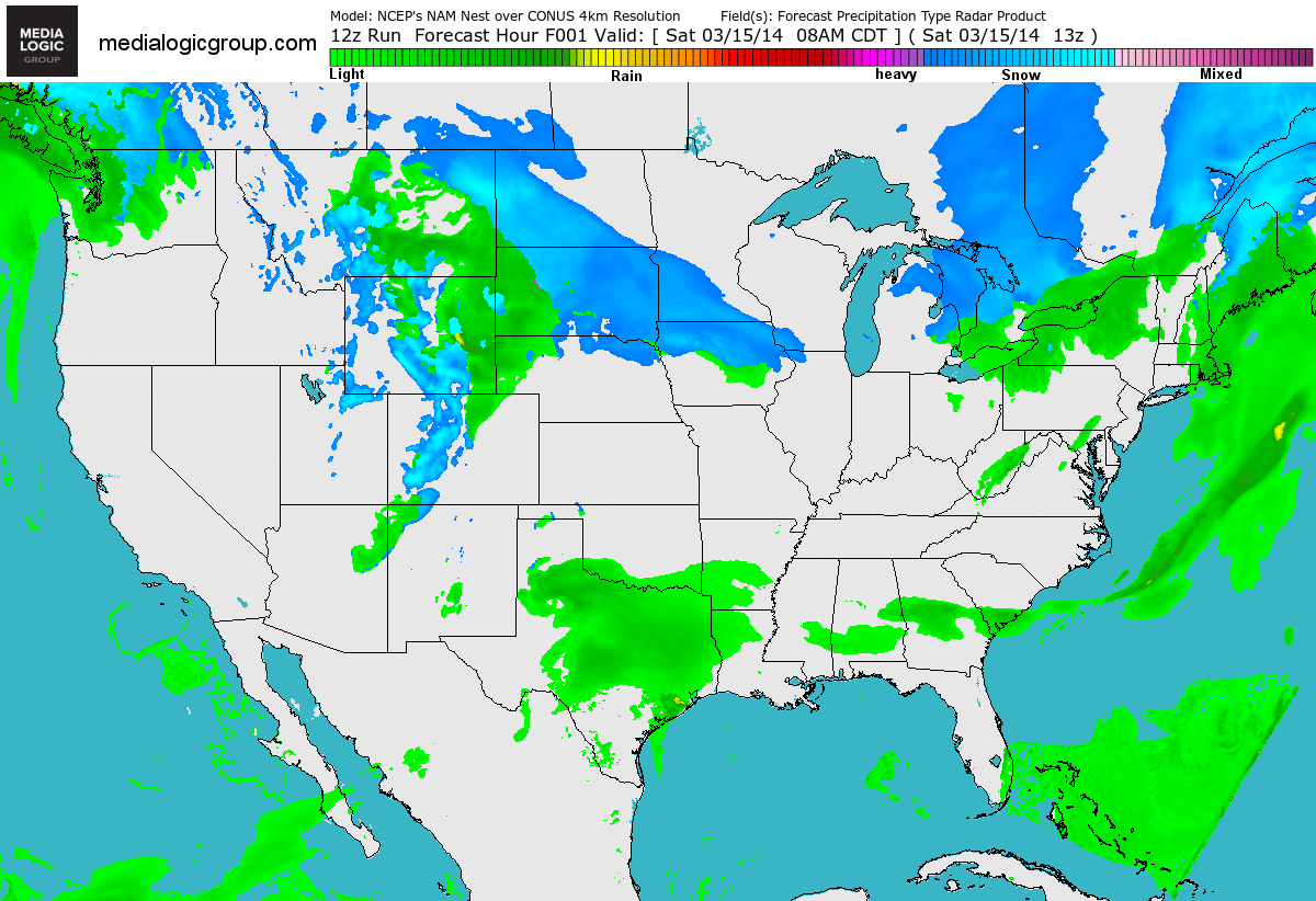
National Radar Forecast
Here's a higher resolution look at the southern storm as it intensifies over the Gulf Coast States. Note the heavier snowfall potential on the northern flank of the storm.
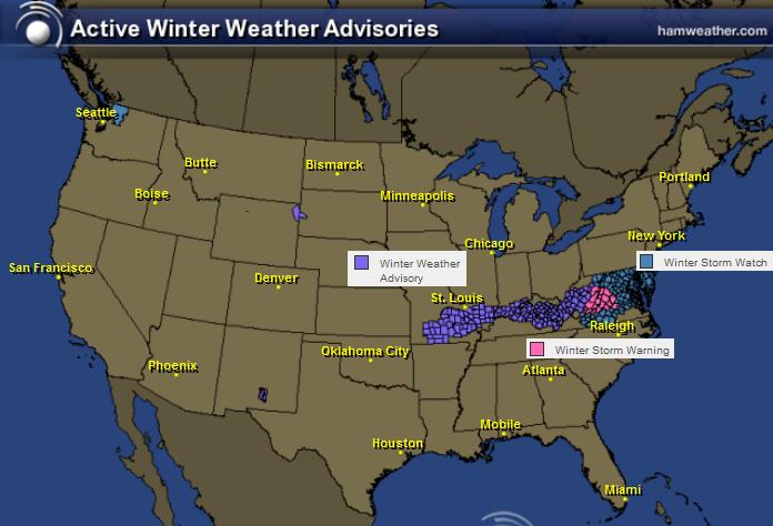
Wintry Weather Ahead
The National Weather Service has issued several winter weather headlines from the Middle Mississippi Valley to the Mid-Atlantic region. Snowfall amount could potentially be as much as 6" to 12" along and just east of the Appalachians.
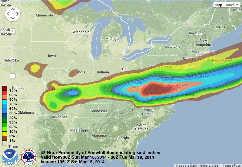
Probability of 4" of Snow
According to NOAA's WPC, the probability of at least 4" of snow or more is quite high from the Appalachians to the Eastern Seaboard.
Probability of 8" of Snow
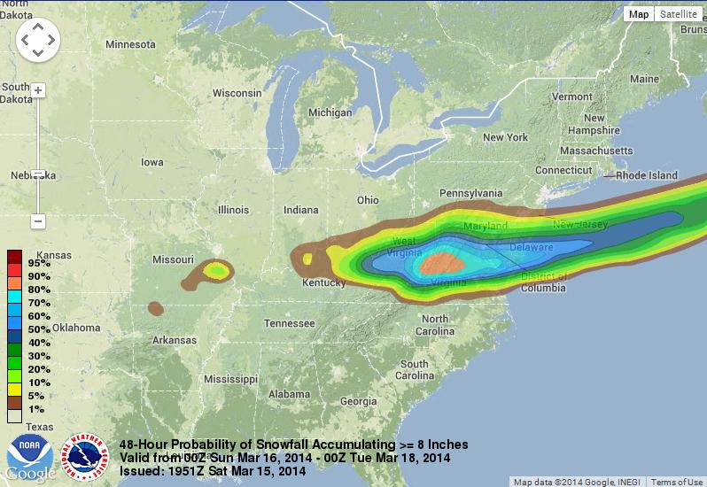
Even the probability of at least 8" of snow or more is quite high near the Appalachians.
Thanks for checking in and have a great rest of your weekend! Don't forget to check me out on Twitter @TNelsonWNTV