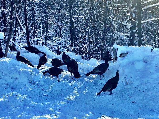
I came across a large group of turkeys the other day on my way home and was wondering what the group was called. I've always thought it was considered a "Flock", but I've also heard it called a "Rafter". Anyway, it was a pretty good show at a fairly close range.
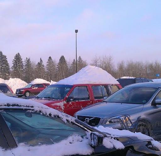
SnowHawk?
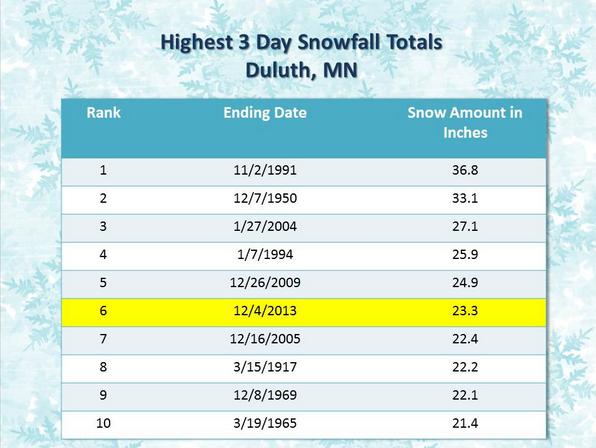
I've never heard of this before... A "SnowHawk"? I guess it's the latest craze in Northeastern MN. Somewhat of a car fashion statement. Thanks to my good friend, Amanda Granning for this picture out of Duluth, MN where they picked up 23.3" over a 3 day period earlier this week. That was good enough for the 6th heaviest 3 day snowfall event in recorded history. The heaviest 3 day snowfall event was 36.8" set in 1991; the "Halloween Blizzard".
Record Duluth, MN Snow
The golden snow shovel award winner was near Two Harbors, MN where nearly 3ft. of snow fell during that 3 day snowfall event!
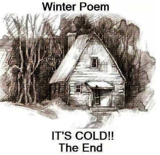
My Favorite Winter Poem...
I'd like to share one of my favorite poems with you... see below:
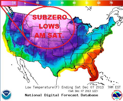
Arctic Temperatures
This is a look at some of the coldest readings for Saturday. Note that a large chunk of the Northcentral part of the U.S. is sub-zero!
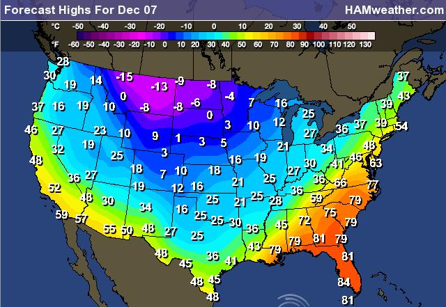
Cold Temps Continue
The forecast high temps for Saturday look quite cold across much of the nation. This is quite uncommon for this time of the year... This is a little more like mid January, wouldn't you say?
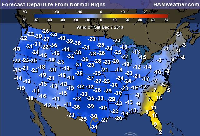
Highs From Normal Saturday
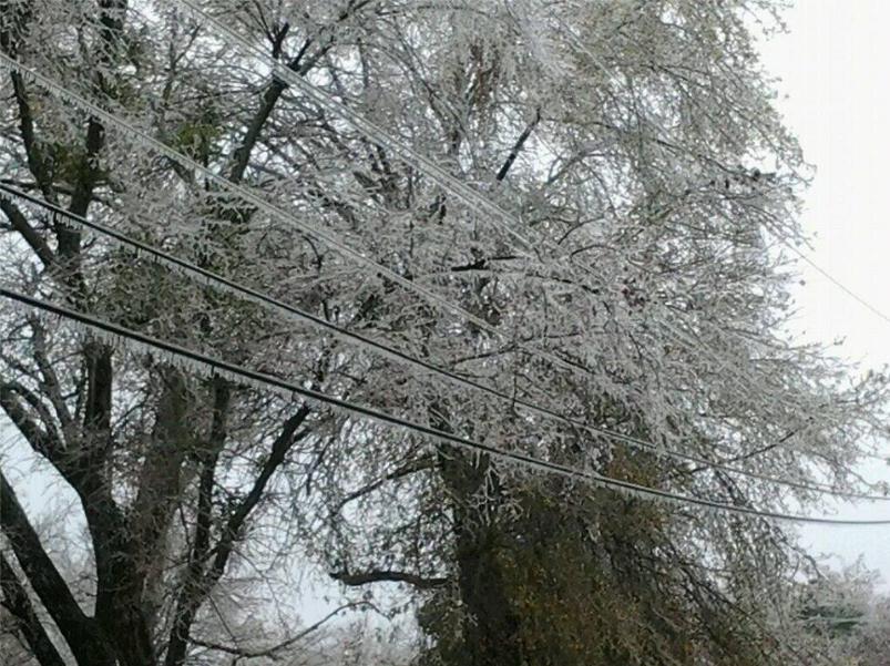
Major Concerns in the Central U.S.
Unfortunately, the colder temps have had a big impact on weather conditions in the central U.S. as of late. A mixed bag of wintry precipitation has left several areas in a big mess. Take a look at the icy scenario in Greenwood, Arkansas! Thanks to @deandeanm33 for the picture! By the way, it only takes 1/2" of ice to add nearly 500lbs. of extra weight to power lines that span pole to pole! No wonder why power outages are so common during ice storms.
More on the Ice Storm
Here's the latest on the major winter storm from CNN:
"A winter storm spread a frigid combination of ice, sleet and snow from Texas to Tennessee on Friday, shutting down schools and businesses, backing up interstate traffic for miles and knocking out power for hundreds of thousands.
At least four people were killed in storm-related incidents, including a man who died when an ice-covered tree fell on his camper in Arkansas.
Dallas/Fort Worth took the hardest hit. It was colder in the Big D (26 degrees) than in Anchorage, Alaska (34 degrees), prompting the cancellation of the Dallas Marathon and spurring Dallas/Fort Worth International Airport to cancel almost 700 flights, about 80% of those scheduled."
Read more HERE:
Here's another picture from Greenwood, AR from the National Weather Service in Little Rock, AR:

National Snow Depth
This is interesting... According to NOAA as of Friday, nearly 46% of the nation was covered in snow! This is the greatest snow coverage the U.S. has seen so far this season.
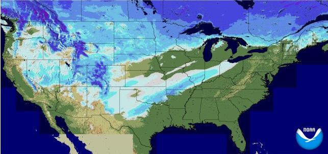
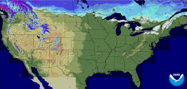
Snow Cover in 2012
At this time last year, only 6% of the nation was covered in snow.
Active Weather Continues
Take a look at the national watches/warnings/advisories map from PM Friday... note how active it was across the country with 2 storm systems on either side of the country and extreme cold to boot! Our 1st winter storm by midday Saturday will be mostly done with, but our next winter storm will be cranking up! Note also how many winter weather headlines that have been posted in the western U.S.
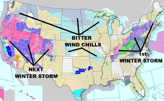
Next Winter Storm
Our next winter storm will have big impacts across much of the nation through the weekend ahead. From the West Coast to the East Coast, there will be another mixed bag of wintry precipitation.
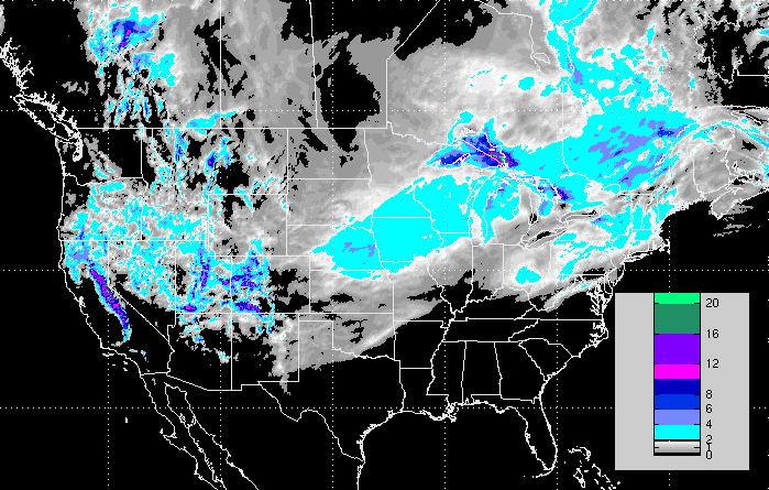
Snowfall Potential Next 3 Days
Here's the snowfall potential over the next 3 days as our 2nd storm system quickly heads east. The biggest impact in terms of snowfall appears to be in the western part of the country where 1ft. or more of snow could fall in the mountains! The light blue coloring over the Midwest suggests some nuisance to shoveling types of snows by late weekend. There will also be a wintry mix on the southern flank of this snow, which could once again make for some travel headaches.
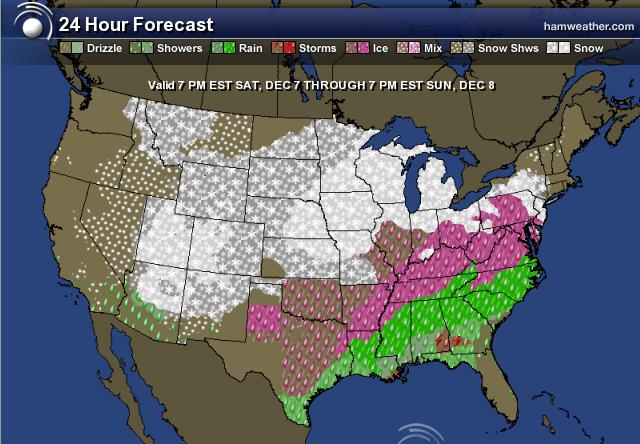
Weekend Precipitation
This is what the weekend precipitation potential looks like across the nation. More rain, freezing rain, sleet and snow may be possible as this system quickly slides east... stay tuned to local forecast if you plan on traveling.
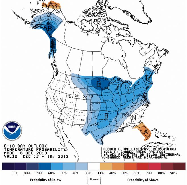
Looking Ahead
According to NOAA, the 6 to 10 day temperature outlook still looks quite chilly for much of the nation. Granted, it won't be quite as cold, but it still looks plenty chilly through the eastern half the the country.
Thanks for checking in and have a great weekend ahead.
Don't forget to follow me on Twitter @TNelsonWNTV