Thinking Warm Thoughts!
After the recent blast of Arctic air, I think we all need a little reminder that warm air still exists somewhere around the globe!
Here's a nice warm view from my good friend Megan Gehrke who arrived in St. Lucia in the eastern Caribbean this weekend!

Here's another one from the warm tropical beaches, where another one of my good friends Jennie Moren also has the right idea!

And one more from the National Weather Service out of Miami, Florida on Sunday morning. What a stunning sunrise!

Back to Reality
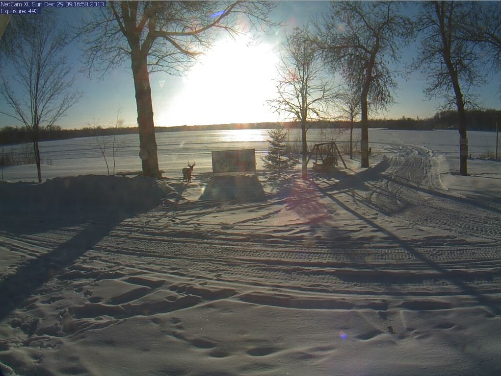
Some of the coldest air across the entire nation was located across the Upper Midwest on Sunday morning, where air temperatures dipped into the -10s and -20s (nearing -30F across the far north). Here's a shot from Pimushe Resort located in central/northern Minnesota (near Bemidji) where temperatures dropped to the -20s and wind chills values neared -40F on Sunday morning!
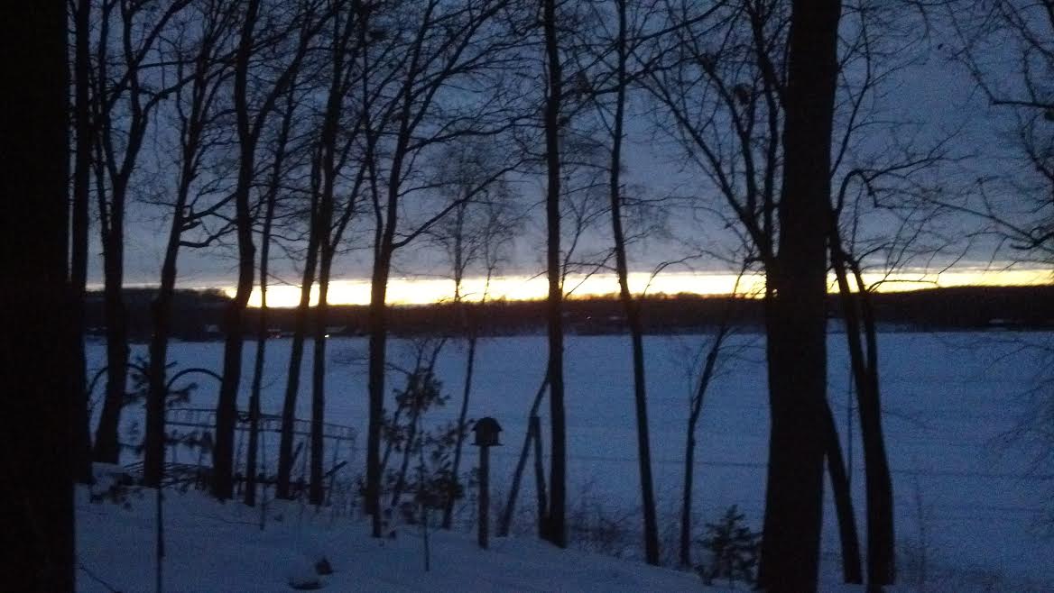
Here's another cold shot from my aunt Marsha, who braved the cold early Sunday morning for this sunrise photo near Crosby, MN! BTW, she said she also heard the rumble Friday night from the Midwest meteorite I mentioned in Sunday's weather blog... pretty cool!
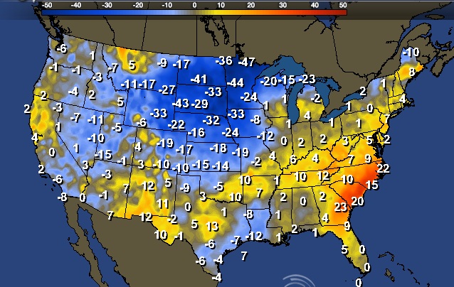
BIG Change!
This is an amazing map, which shows the power of the front. Note the near 50F swing from Saturday to Sunday.
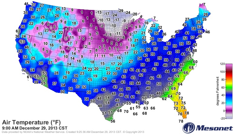
Sunday Morning Temperatures
Here's the national temperature map from Sunday morning. Note that there are near -30F temperature readings across the far north! YIKES!!
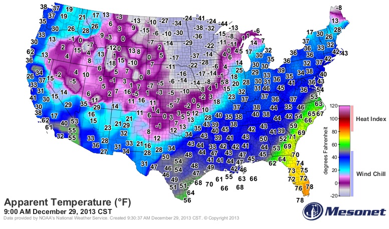
Sunday Morning Wind Chills
When you factor in the wind, it felt MUCH colder...
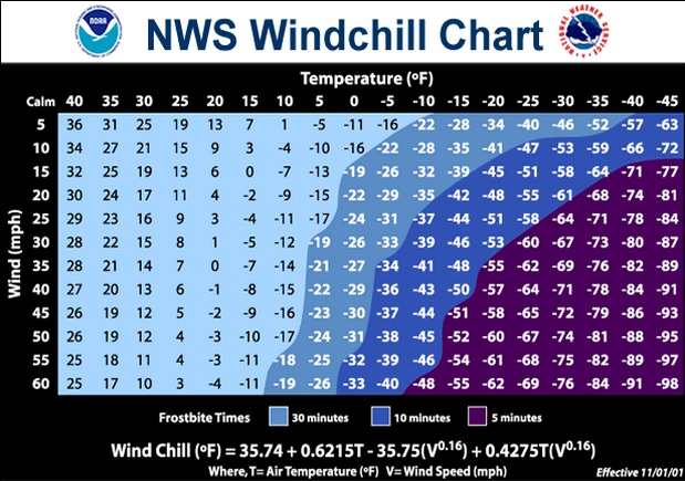
Wind Chill Concerns
Dangerous wind chills will be in place through early this week as bitter cold continues to lodge itself into the Lower 48. Wind chill values could be as low as the -40s across the far north!
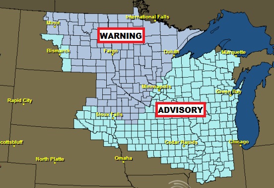
It is important to keep in mind that if you plan on spending ANY time outdoors, dress appropriately! With temperatures as cold as they are/will be, frost bite can occur within a matter of minutes!
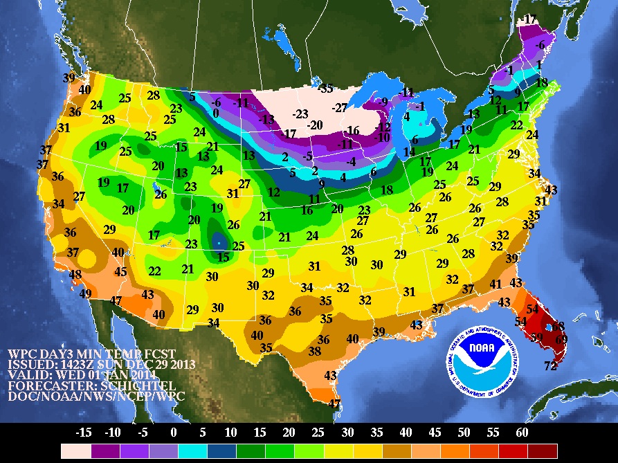
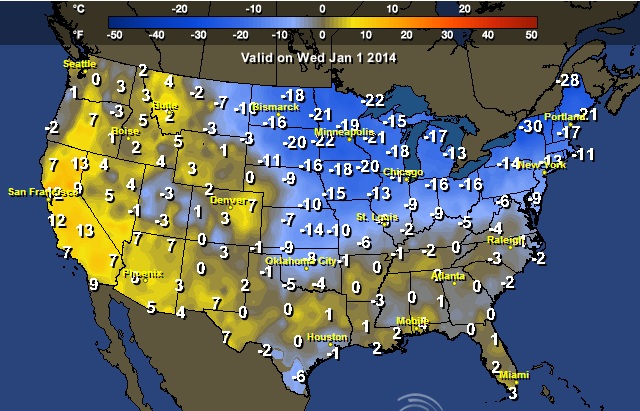
Cold Into the New Year
As we ring in the new year, the cold air is here to stay. If you have plans for New Year's Eve, here are the expected low temperatures by AM Wednesday, which look mighty cold across the far north.
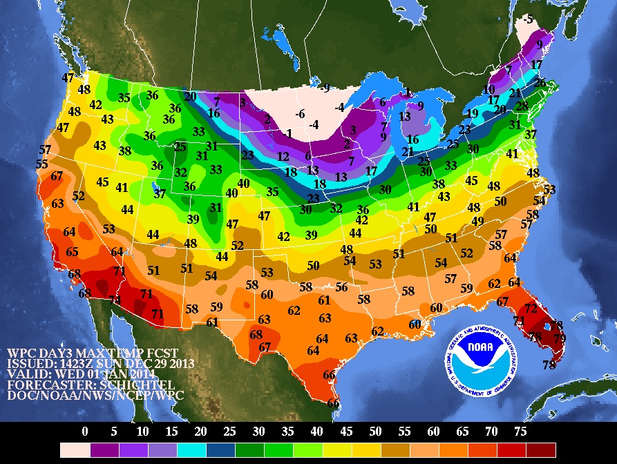
Forecast Highs Wednesday (New Year's Day)
Here are the chilly high temperatures forecast for New Year's Day on Wednesday, which will still be sub-zero across the far north and into the northern New England States.
Highs From Normal New Year's Day (Wednesday)
High temperatures from normal and Wednesday (New Year's Day) will still be well below the norm across much of the eastern two-thirds of the nation.
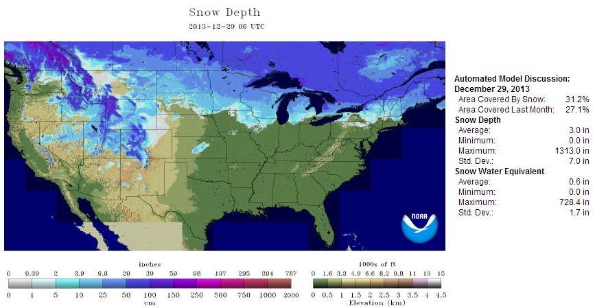
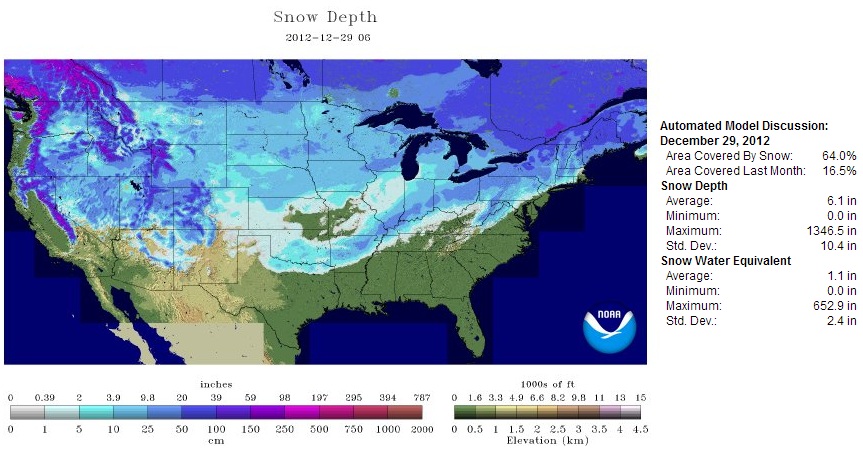
U.S. Snow Cover 2013
According to NOAA's NOHRSC, nearly 31% of the nation is covered in snow.
Interestingly, by this time last year there was nearly double the amount of U.S. snow coverage (64%).
Early Week Forecast
We say goodbye to a very soggy weekend across the eastern third of the nation, but colder air and more precipitation will continue into the early week ahead. Clipper systems with light snow accumulations will dive in from Canada, while continued rain chances will continue across the deep south from southern Texas to the Mid-Atlantic Region.
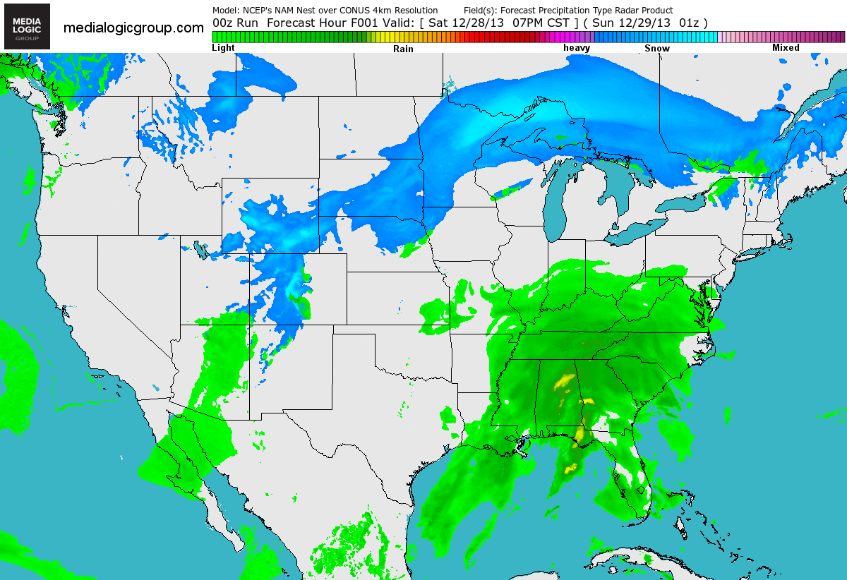
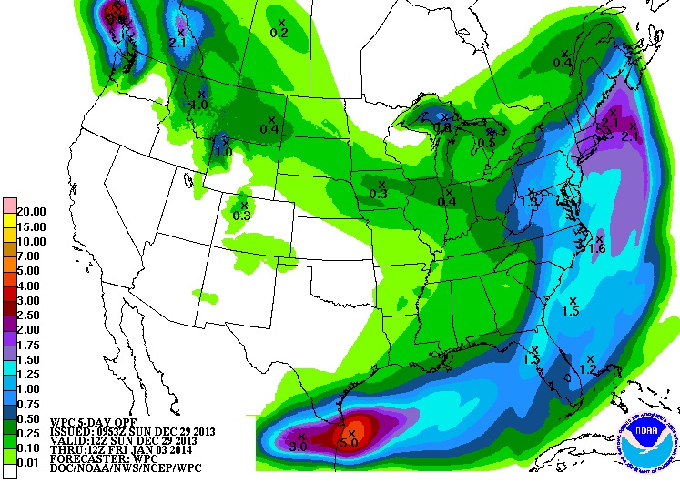
This Week's Precipitation Forecast
The upcoming week ahead looks soggy once again for folks from southern Texas to the Mid-Atlantic region. The southern tier of the nation will be warm enough for rain, but the precipitation across the northern tier of the nation will be cold enough for some snow accumulations
Somewhat Snowy Outlook
Looking ahead through early next week, clipper systems will help to freshen up the snow cover from the High Plains to the Great Lakes and the Northeast. Notice the narrow band of snow cover these clipper system will provide over the coming days.

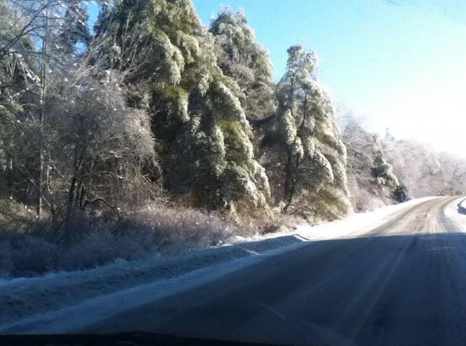
More Wintry Weather
Interestingly, some of the heavier snow (thru Monday) will be found across parts of Maine, where some folks are still without power after the major ice storm blew through places from Michigan to Maine nearly 1.5 weeks ago!
Here's a story from the HuffingtonPost.com:
"Michigan bore the brunt of the storm as nearly 600,000 homes and businesses lost power, and as of Friday afternoon, about 60,000 customers remained in the dark. Maine reported almost 12,000 outages and in eastern Canada, nearly 62,000 still hadn't had their power restored, including 33,000 in Toronto."
(photo courtesy: @lisa51966 from Litchefield, ME)
Thanks for checking in and have a great week ahead!
Don't forget to follow me on Twitter @TNelsonWNTV