Too Much of a Good Thing?
I snapped this
picture Sunday morning of standing water in a farmer's field.
Interesting how we can be so dry, then so wet in a matter of days.
Several rounds of heavy rain has many smaller bodies of water, open
fields and low lying areas filled with water. It's good to see, but we
sure a running into rotten luck with the weekend weather.

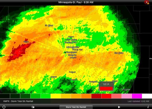
Heavy Rain Saturday Night
This is a look at RadarScope Storm Total Rainfall from Saturday night, which shows anywhere from 1" to 5" of rain across the area. The heaviest was out west near Willmar down to Marshall, where nearly 4" to
6" fell... Flood Warnings go into effect this week for the Redwood and
the Cotonwood Rivers as the swell to minor flood stage.
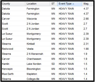
Heavy Rain Reports
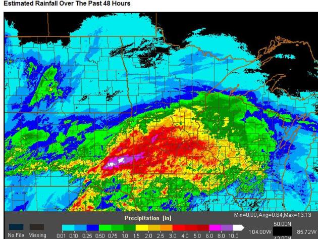
NWS Radar Estimated Rainfall Over the Weekend
This is quiet impressive, note the deep reds (3.0"+) across much of the
southern half of the state, especially across the southwestern corner of
the state.
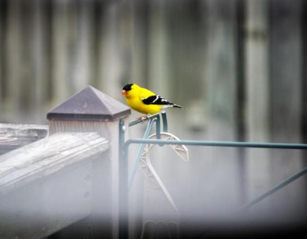
American Gold Finch
Nice to see these little guys at the bird feeder again!
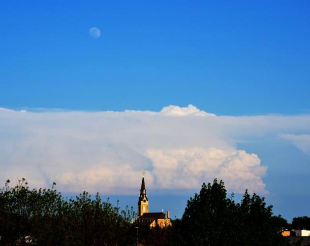
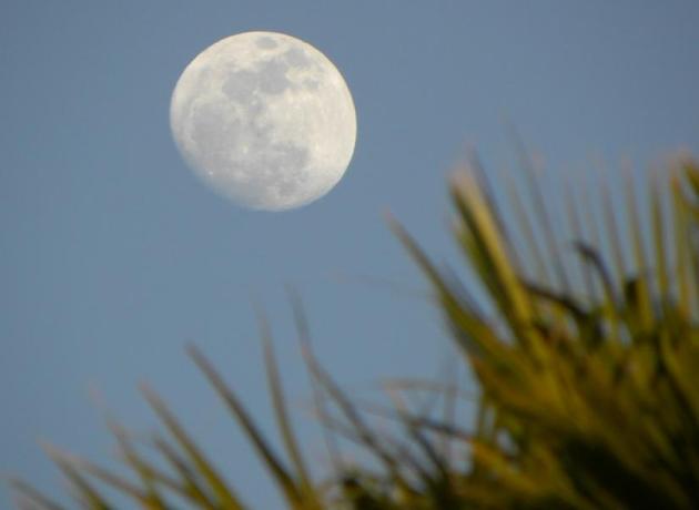
Stormy Supermoon
I snapped this picture Thursday evening the
near supermoon rose in the eastern sky with thunderstorms across parts
of Southeastern Minnesota.
MCS Fest
Mesoscale Convective systems typically
form summer when heat and humidity are high. Several of these MCS's have
been developing on the outer edge of the extreme heat and humidity,
which has been sitting to our south. These storm complexes generally
form in the late afternoon/evening and continue all night. One of the
more interesing MCS's (Derecho) that pushed through Minnesota was the
Boundary Waters Blowdown in early July of 1999, read more HERE
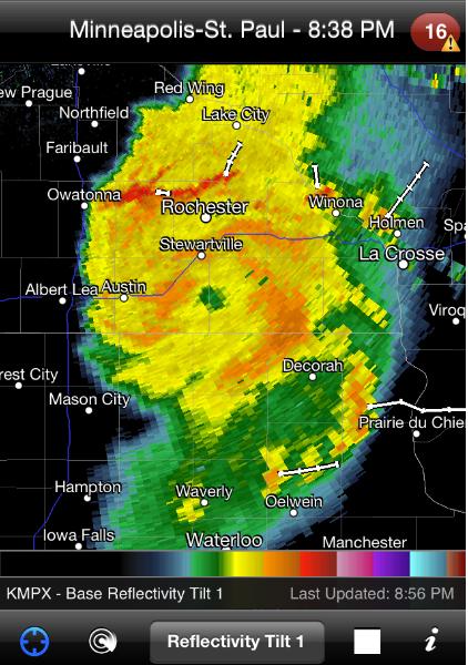
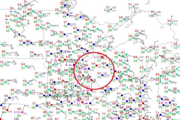
Within these MCS's, small areas of low pressure develop, called meso-lows. These small areas of circulation (range from the size of a thunderstorms to several to many tens of miles) are typically are associated with a long-live squall line with damaging winds. I
captured two meso-lows this weekend, here is one from from Saturday
that tracked across southern Minnesota and was responsible for tornado
reports near Lakefield, Worthington and Kiester MN before it became more
of a squall line producing more wind damage. Note the circular shape to
the radar signature below, it almost looks like an inland hurricane,
doesn't it? That's the result of the strong counter-clockwise spin
associated with the meso-low.
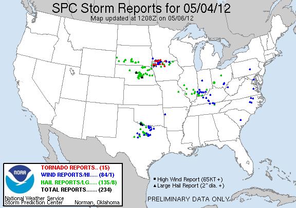
Storm Reports From Friday
The complex of storms was also responsible for several storm reports, see more HERE:
Another Meso-Low on Saturday
This is the other complex of storms that pushed through on Saturday that
produced a meso-low. It's harder to see the circulation, but it's
there, the surface map below the radar shows the small area of
circulation.
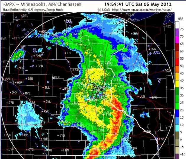
Surface Map on Saturday around 3pm
Not long after the radar capture above,
you can see the small circulation in the wind field moving into
west-central Wisconsin. The MSP also reported a sharp pressure drop and rise in a short period of time as the low moved through the Twin Cities... Neat huh!?!
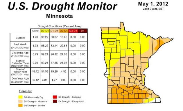
Recent Heavy Expected to Help Drought
This was the US Drought
Monitor last Thursday, before all the heavy rain came through. I expect
a marked improvement across southern Minnesota before the next updated
on Thursday, May 10th.
Paul Douglas' Blog Entry
Light Switch Spring
No, you're not imagining it. This isn't your grandfather's
weather anymore. Call it Weather 2.0. Increasingly weather patterns are getting
"stuck". Heat is either on or off. The same with moisture: drought or
flood. Why? The Arctic is warming twice as fast as Minnesota. That may be
affecting the north-south temperature gradient, slowing jet stream winds by 14
percent, accelerating heat, drought and stalling storms, meaning more floods.
Friday and Saturday waves of low pressure rippled along a
stalled front, resulting in some 2-5 inch amounts, putting a serious dent in
our drought. 2.31 inches of rain fell Sunday morning; over 5" of badly
needed rain the first 6 days of May. At this rate lake water levels may come up
a bit.
No big storms in sight; a PM shower tomorrow - a clap of thunder
Friday.
Miraculously, Fishing Opener weather looks stunning: 60s north,
near 70 metro; low 70s on Mother's Day with blue sky and chirping robins. I
don't blame you for being skeptical. So am I.
No sign of a Canadian relapse either - 60s and 70s into late
May. A rare Sunshine Alert is now in effect. Please proceed outside. Sunscreen advised.
Remember not to stare at the sun. Good luck.
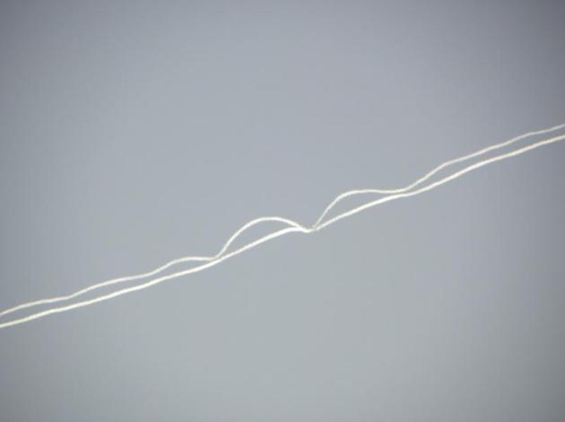
Contrail Disruption
Thanks to my good
friend, Rich Koivisto, from Duluth MN. He is still enjoying the Arizona
heat and snapped this shot of jet contrails that were being disrupted by
interesting winds aloft... kinda neat! Thanks Rich!
Here's Another, Near Supermoon
Upcoming Rain Chances
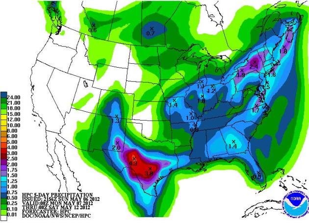
Chances are, you
probably won't be needing any lawn waterings soon with the heavy rain,
we've picked up recently, but there are still a couple of rain chances
this week; Tuesday and Friday. Rainfall amounts through the week look much lighter than what we had over the weekend.
Minnesota Fishing Opener
At this point, the
weather looks decent for the upcoming fishing opener, no deluges. In
fact, there appears to be some sun with temperatures at or slightly
above average!

Mother's Day
Don't worry Mom, I didn't forget about you! You're forecast looks pretty good too :)
Some sunshine and temps close to 70F in the Twin Cities, stay tuned.
Thanks for checking in and have a great week ahead.
Don't forget to check me out on Twitter @TNelsonWNTV
-Meteorologist Todd Nelson-