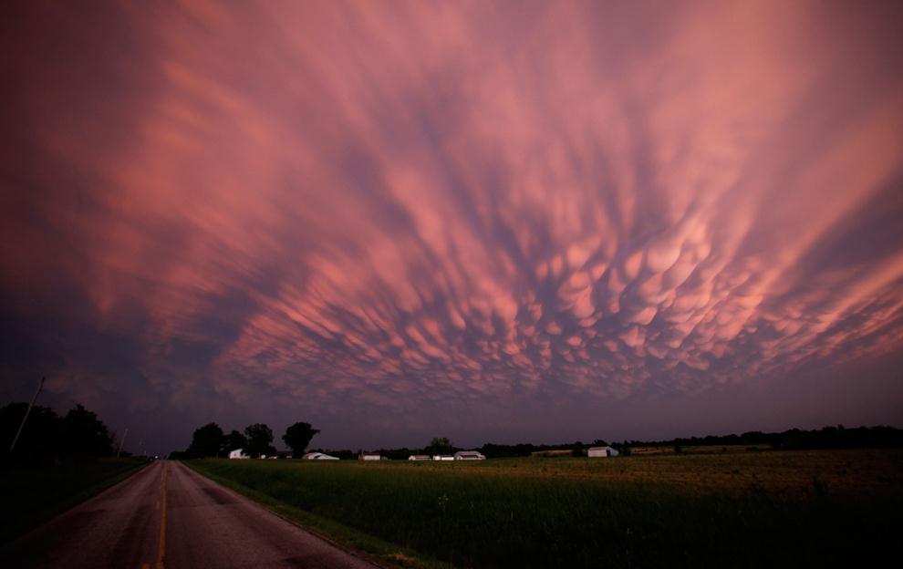
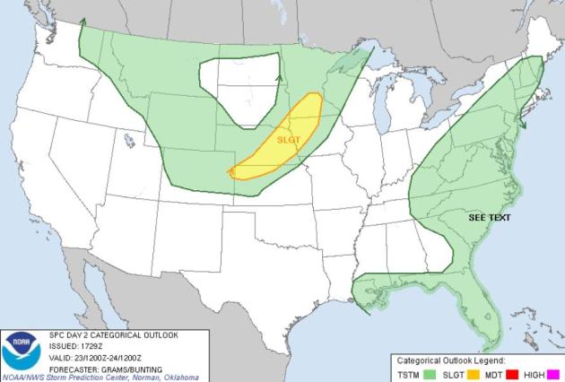
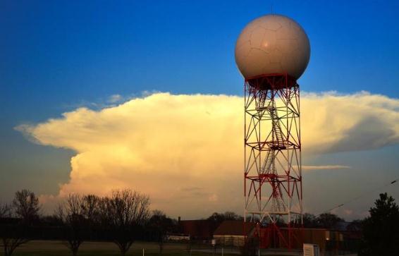
Slight Severe Storm Risk.
SPC
is predicting an enhanced risk of hail, damaging winds, even a few
isolated tornadoes later today from teh Twin Cities and Mankato to Omaha
and northern Kansas. The best chance of unruly T-storms: between 3 pm
and 9 pm this evening.
16% of all boating deaths in 2011 were alcohol-related. "
The
effects of alcohol can be even more hazardous on the water than on
land. Boating Under the Influence, or BUI, affects judgment, vision,
balance and coordination. These impairments can increase the risk of
being involved in a boating accident - for both passengers and boat
operators. Alcohol is a contributing factor in about a third of all
recreational boating fatalities." - from NOAA. More on National Safe Boating Week
here.
"
Given all the advances that have been made, the high death toll
in Joplin has prompted many in the meteorological and emergency
management communities to rethink how they issue tornado warnings. One
of the major lessons stemming from Joplin is that more attention needs to be paid to ensuring that tornado warnings encourage people to take protective action." - from a Capital Weather Gang story about lessons learned from last year's EF-5 Joplin tornado.
"
We need to understand how and why some thunderstorms produce
tornadoes and some don't," said Paul Schlatter, a severe weather and
radar expert with NOAA’s National Weather Service. "I wish that we could
say that 30 minutes out or more, this storm is going to produce a
tornado." - from a story at knoxnews.com below.
"
On Oct. 2, 1858, a Category 1 hurricane with winds of 74-95 mph
hit San Diego. This storm had been forgotten until Michael Chenoweth, a
hurricane historian, and Chris Landsea, who is now science and
operations officer at the National Hurricane Center, published their
study of the storm in the November 2004 issue of the Bulletin of the
American Meteorological Society (BAMS)." - from a Washington Post article below. Photo above: NASA.
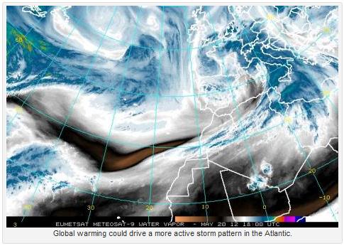
“
If the observed warming trend in the sea-surface temperatures
continues, this result suggests that future La Niña events are more
likely to produce extreme precipitation and flooding than is present in
the historical record,” said Dr. Jason Evans, of the University of New South Wales Climate Change Research Centre." - from a Climate Central story about climate change and extreme weather.
10% of the world's species have disappeared in just the last century. Details in a Huffington Post article below.
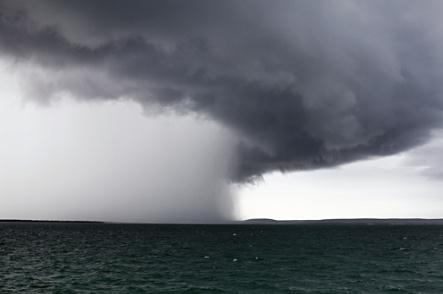
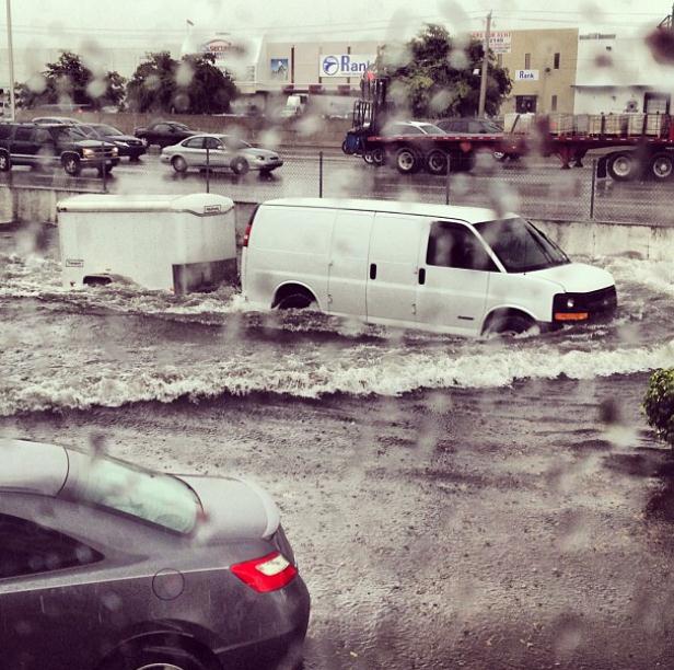
Miami Deluge. Thanks to "nikmartinezzz" (and
Instagram) for sharing this remarkable photo from Miami late Tuesday.
the Miami area picked up a record 5.54" of rain yesterday afternoon
(4.4" of that in ONE HOUR!) The definition of a tropical deluge.
* more details on the record rains and subsequent flooding from
nbcmiami.com.
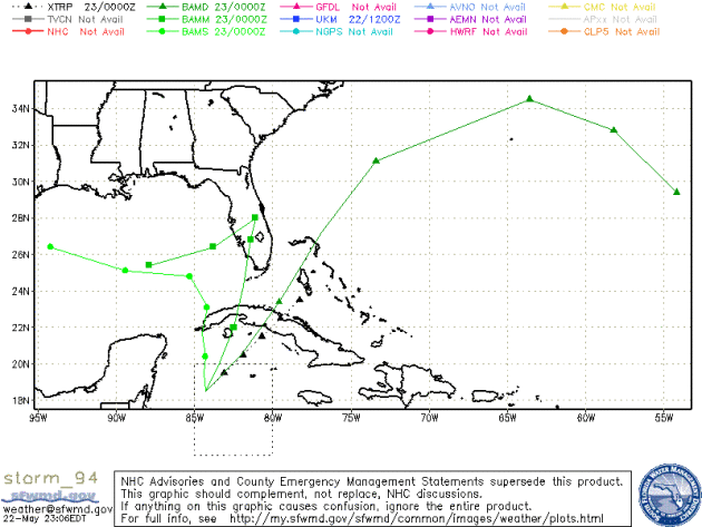
Tropical Storm Beryl Brewing? NHC is calling it "
Invest 94",
an area of disturbed weather south of Cuba, at least partially
responsible for soaking, flooding rains across south Florida. Two of the
solutions bring this storm into the Gulf of Mexico - further
strengthening possible in the days ahead; residents of Florida and the
Gulf Coast should stay alert.
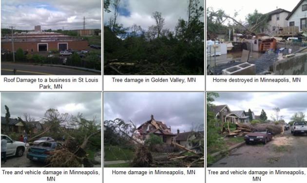
Thoughts About The May 22, 2011 Minneapolis Tornado. I asked my friend, Todd Krause, at the local Twin Cities
National Weather Service, for a few thoughts about last year's historic tornado. Here is what he wrote:
"There are three things that stand out:
a). Some storms take their time to intensify and produce a
tornado, while others ramp up rapidly and produce a tornado very
quickly. This was one of those rapidly developing situations. It was a
low-topped supercell that had little indication just ten minutes prior
that it was going to produce a tornado. It became a possibility only a
few minutes before touchdown. The decision to warn was made at 2:08 pm
or 2:09 pm, and we got the warning out at 2:10 pm and heard about the
touchdowns at 2:15 pm. It would be nice if tornadoes always gave 30
minutes notice, and some storms do, but other develop extremely quickly,
in which case it's hard to get a warning out more than a few minutes
beforehand.
b). The great value of SKYWARN. A HAM radio operator was at one
of the large stores just south of I-394 and Park Place, looking to his
east, saw a funnel with debris underneath, and reported it via
HAM radio. This was our first report at about 2:13 pm. Having a
confirmed tornado gave important credence to our tornado warning. Once
we heard the report, we notified law enforcement right away and then
broadcast meteorologists immediately thereafter. We had many great
reports relayed to us as the tornado continued on its path.
c). As bad as it was, and even though this tornado was a killer
(and we especially remember the family of the man who perished), it
could have been so much worse. When I look at the pictures from the
security footage of a couple of video cameras, the cloud base was low,
the tornado wide, and I'm amazed the winds were not stronger than EF-1."
Todd Krause
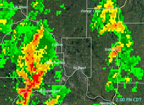
"Supercell." Here is a Doppler radar (reflectivity) loop from May 22, 2011, courtesy of the Twin Cities
National Weather Service.
No classic "hook shape" that jumps out at you - what's remarkable is
how quickly the cell intensified over Golden Valley, leaving little time
to issue a timely warning.
"Ask Paul". Weather-related questions, comments (and threats).
Good morning!
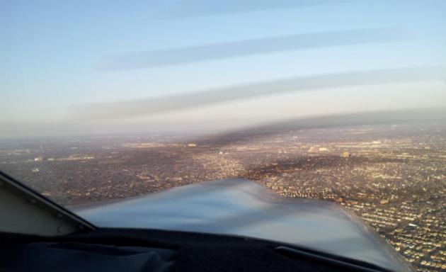
"I saw Paul's post this morning looking back at
the North Minneapolis tornado. While flying with a friend last winter,
we realized that we were flying NNE along the tornado track, and caught
an interesting shot through the city. The picture is taken approximately
over 394 and Hwy 100, looking northeast. We're 1000 feet off the
ground. The wavy lines through the image are artifact from the
propeller.
I thought you guys might find it interesting.
For me, it demonstrated the impact of the tornado that you can't really
get a feel for from satellite photos."
Sincerely,
Barry Park
Apple Valley
Thanks Barry - appreciate you sharing this photo
with me and my readers. The tornado "scar" on the ground below is
clearly visible, no question. What was highly unusual was to have a 1/2
mile wide tornado ranked only an EF-1. For a weaker tornado, the
Minneapolis tornado produced a disproportionate amount of damage and
heartache, due to the fact that it traveled over densely populated
suburbs on its way to North Minneapolis.
_______________________________________________________________________
Paul,
"At my aged lake cabin near Brainerd the
choices are few when the tornado warning sounds: no real basement, so
crawl into the dirt hole, or huddle in the car behind the cabin? Help!"
Carla Waldemar
Carla - please climb out of the dirt hole. No need
to take such drastic action. The odds of an EF-4 or EF-5 tornado capable
of sweeping your cabin off its foundation in the Brainerd area are very
small. I have a similar situation at my cabin on Pelican Lake - no
basement, slab foundation. I'll tell you what I've told my wife: avoid
outer walls and windows, seek shelter in a closet or bathroom. If you
have a bathtub on the ground floor that's probably the safest place to
ride out a tornadic storm. Surround yourself with pillows, blankets,
even a mattress from the bed to add further insulation and protection.
Remember, the greatest risk is flying debris. Keep your head low, near
the floor, and resist the urge to look out the window!
_______________________________________________________________________________
Paul,
"What are the 2 best storm alerts apps for iPhone in your opinion?"
Thanks..
Tim Quarberg
Minnetonka
My vote for 2 best storm alerting apps are iMapWeather Radio and
My-Cast Weather Radar. They cost a few bucks, but they provide
tremendous peace of mind. You can input favorite locations ("home",
"office", "cabin", etc) and the My-Cast app can even track your current
GPS location - but I would call up the app early in the day to make sure
it has your present position in the database to be absolutely sure).
Full disclosure: My-Cast Weather Radar was created by Digital Cyclone,
the company I sold to Garmin back in 2007. I have no affiliation with
DCI (based in Chanhassen) and no, I don't get a commission. But I
strongly believe that smartphone apps should be part of your family's
severe storm safety net, which includes TV, radio, Internet, e-mail
alerts, smartphone apps, NOAA Weather Radio (!) and the sirens. I put
sirens last for a reason. If you depend on the sirens you'll be setting
yourself up for trouble.
___________________________________________________________________________
Paul,
"I was told there was some large hail in St. Paul. Trying to figure out which general area, can you help?
Thank you."
Dan Anderson
Integrated Security Consultant
Dan - two good resources come to mind.
NOAA has
a (free) web site that allows you to call up storm reports from the
past, for hail, straight-line winds, tornadoes, flooding, etc. Click
here, enter the date in question, and you'll get a graphical
representation (you can zoom into the Twin Cities using the Google Map
and then click on each event to get more information).
SPC has a
site that allows you to plug in a date and see all severe reports across the USA. I called up data for last Saturday (
here)
and saw evidence of 1.75" diamter hail in St. Paul at 6:34 pm Saturday.
Anything larger than 1" diametre qualifies as severe. Hope that helps.
______________________________________________________________________________
Paul,
"Hi. I get migraines that seem to be weather
related. Friday, May 18, was the worst I have had in quite a while. Can
you explain what happened with
the barometric pressure that day? Also, can you suggest a good website
or device for predicting barometric pressure changes? Thanks so much."
Janine Deters
Janine - I sympathize; I get severe headaches too, and I'm convinced
that rapid changes in barometric pressure, especially around a frontal
passage, can trigger these. It makes sense, since most of our body is
water. Just like the moon has a tug on the world's seas, creating tides,
it makes a certain amount of sense that rapid changes in pressure might
affect some of us. Dr. Jerry Swanson has an informative post at
The Mayo Clinic,
linking changes in pressure and sunlight with migraines and other
maladies. Germany has pioneered the study of biometeorology; how
seemingly small changes in temperature, pressure, even wind, can impact
organisms (and people). Here's a good overview on the field from
Wikipedia;
I would encourage you to do more research (Google is a great place to
start), possibly see a specialist who can help you with medication and
other possible remedies. A lack of sunlight can impact hormone levels
(women are more vulnerable than men); it makes sense, at least to me,
that some of us are more sensitive to changes in the ocean of air
overhead. Good luck.
_____________________________________________________________________________
Paul.
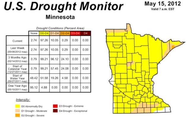
"
Mark Seeley noted that annual precipitation in parts of south
central and southeast Minnesota has increased up to 15 percent in recent
years; normal annual rainfall for the Twin Cities is 4.25" greater than
it was in the 1980s. Statwide, Minnesota's average rainfall topped 34
inches in 2011 for the first time in 121 years of record-keeping. The
Upper Midwest saw a 31% increase in "intense" rainfalls - the
statistical 1 percent events - from 1858 to 2007, over previous decades,
according to the National Climactic Data Center.
Yet we continue to read how we are in a drought.
Is this because of the distribution of the precipitation over the year? Or some other technical reason?"
Thanks.
Jonathan Rogoff
Stillwater
Jonathan - your point is a good one. 2010 was the wettest year in
Minnesota history (most tornadoes in the nation too - 145, a new state
record, there's probably a link). But you were correct when you brought
up distribution. Most of 2011's precipitation was "front-loaded" into
the first half of the year. After August we went off a cliff in the
rainfall department, and precipitation was consistently below avereage
from September 2011 through March, 2012. Another factor, our warm,
snowless winter (22" in the Twin Cities). We rely on snowmelt to
recharge soil moisture, streams, rivers and lakes, and there was
precious little snow to melt. Yet another factor: record warmth: a
warmer atmosphere leads to increased levels of evaporation of soil
moisture. All these factors converged to create severe to extreme
drought conditions in early spring, but with recent heavy rains the
drought has eased over most of the state. Last Tuesday's
Drought Monitor
(above) shows dry conditions lingering over much of Minnesota, with
only a small area of moderate drought near Albert Lea. I suspect that
this week's Drought Monitor will show a continued easing of the drought.
It would be ironic if we went from drought to flood in the span of 2
months. Stranger things have happened. Thanks for a great question.
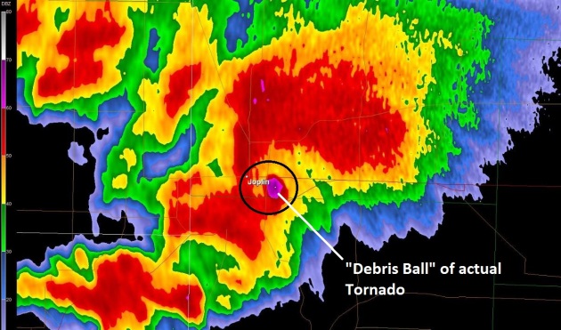
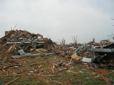
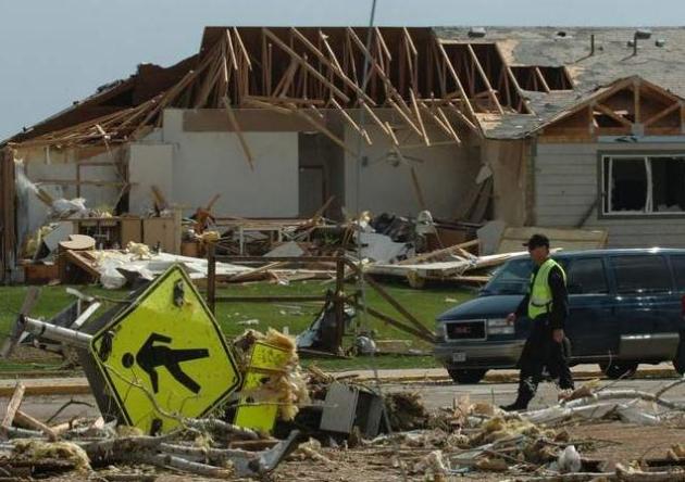
Joplin Tornado Anniversary: Remembering The Destruction Wrought On Missouri. Huffington Post has the details: "
One year ago, an EF-5
tornado tore through Joplin, Missouri, killing 161 people and causing
nearly $3 billion in damage. The tornado, which was the deadliest in
six decades, was also the costliest "since at least 1950,"
according to the Associated Press. In the year since the tornado,
residents and volunteers have worked tirelessly to clear debris and
rebuild a community shaken by the violent storm. Over 600 permits for
new homes and nearly 3,000 for "residential repairs and rebuilding projects"
had been issued by late April, according to AP. Students at the local
high school have attended class in a converted big-box retailer, as a
new school is not scheduled to open until 2014." Aerial photo of Joplin after the tornado courtesy of NOAA.
The Joplin Tornado: One Year Later. Where Does It Rank? Here's a great summary of the Joplin tornado, and some perspective, from the
Capital Weather Gang's Andrew Freedman: "
The
ferocious tornado that tore the city of Joplin, Mo., apart exactly one
year ago today stunned the nation with its tragic death toll and
staggering damage. The twister’s winds were estimated to be more than
200 mph, making the tornado an EF-5 on the Enhanced Fujita Scale,
which measures a tornado’s intensity. It devastated the city of
50,000, killing 161 and injuring more than 1,000. The Joplin tornado
was the first single tornado in the U.S. to result in more than 100
fatalities since a tornado struck Flint, Mich., in 1953."
Photo credit above: National Weather Service.
On The Edge Of Tornado Alley. Here's a worthwhile story from the
coloradoan.com: "
The
wind wasn’t just blowing, it was twisting. Joann Ochsner and her
husband James rushed to their basement in disbelief that anything
resembling a severe tornado could plow a path of destruction through
Windsor. “We all went to the basement,” Ochsner said. “We had no idea
what was going on upstairs. We didn’t hear a thing.” When she and her
family emerged from the basement, the kitchen window had been blown in,
the dishes that had been set on the kitchen table lay scattered in
shards all over the floor and five 100-foot-tall pine trees her mother
had planted decades earlier were blown entirely away."
Photo credit above: "
A police officer walks through a devastated neighborhood in southeast Windor after a tornado struck that community May 22, 2008". LCL:STF.
Let's Talk About: New Satellites To Improve Tornado Warnings. Here's an interesting nugget from the
Pittsburgh Post-Gazette: "....
The
next generation of Geostationary Operational Environmental Satellites
is scheduled to begin launching late in 2015. The "GOES-R series"
weather satellites will have state-of-the-art instruments for improved
scouting and tracking of these killer storms, even at night. With
lightning detection from orbit and clearer pictures of cloud height,
moisture and movement, the GOES-R satellites will improve
meteorologists' ability to assess conditions that spawn tornadoes, and
they are expected to give upward of 20 minutes lead time in tornado
warnings."
Graphic above courtesy of NOAA, which has more information on the GOES-R satellite system
here.
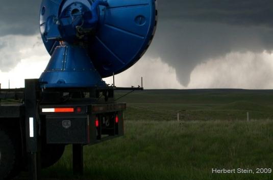
Storm Chasers: Study Aims To Go Inside Tornadoes. Here's a terrific article from
Yahoo News: "
Come tornado season, meteorologist Joshua Wurman spends his life on the road, zooming down highways in search of thunderstorms. This summer, he and his colleagues
will turn nomad to launch a first-of-its-kind program aimed at
exploring tornado winds — not from the outside but from deep within the tornado vortex. "Our goal is a much more integrated picture of the tornado," Wurman, president of the Center for Severe Weather Research based in Boulder, Colo., told OurAmazingPlanet. And that's a picture that could reveal how tornadoes deal their damage and save lives, he added."
Photo credit: Herbert Stein, 2009.
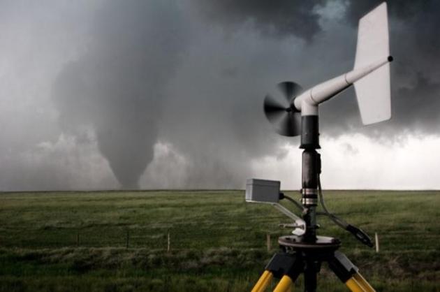
Creating Action-Inspiring Tornado Warnings. More
than ever local NWS offices choose their wording with great care,
especially when a tornado is on the ground, reflecting the sense of
urgency and life-threatening conditions.
Knoxnews.com has more details: "
One
year ago this week, 158 people died when a tornado with winds greater
than 200 mph struck Joplin, Mo. Even though the National Oceanic and
Atmospheric Administration issued tornado warnings and activated siren
alerts ahead of time, it was clear that some people ignored,
disregarded or waited too long to react to them. As meteorologists
continue to learn more about tornado formation and improve their
forecasting, they are also working to improve how warnings are
communicated to and received by the public. When meteorologists
recognize atmospheric conditions that can spawn a tornado, a severe
thunderstorm and tornado watch are issued. But that information can be
frustratingly vague for the audience."
Photo above courtesy of Ryan McGinnis.
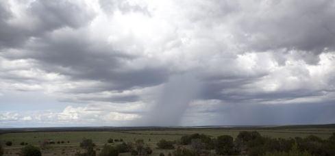
Desert Dust Intensifies Summer Rainfall In U.S. Southwest. I thought this was a fascinating read, courtesy of
phys.org: "
As
the climate warms, more regions of the world will be affected by
drought. Increased desert regions and dry land produce more dust that
gets lofted into the atmosphere. These dust particles absorb sunlight and act as a heat pump,
attracting moisture from nearby oceans and increasing seasonal
rainfall. PNNL researchers are the first to investigate this effect in a
dry region of the United States where water resources are limited.
Understanding how dust contributes to atmospheric heating is important
for predicting drought and rainfall patterns in this region and others in the world with rising populations."
Photo credit above: "
This rainstorm in Eastern New Mexico,
as part of the North American Monsoon, gets moisture from the Gulf of
Mexico and Gulf of California during the late summer. Scientists have
found that desert dust increases the monsoon effect in this region." Credit: Wikimedia Commons
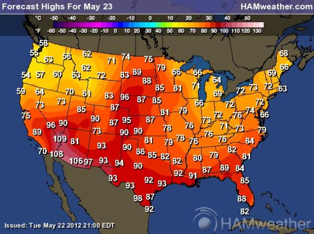
Southern Heat, Western Wildfires May Dominate Southwest Summer. Here's a clip from a story at
Bloomberg Businessweek: "
The
southern U.S. will probably be warmer than normal from June to August
while the West may have major outbreaks of wildfires, government
forecasters said. Temperatures are expected to be above normal for the
next three months from interior portions of California to the East Coast
and from southern New Jersey to Florida, according to the U.S. Climate
Prediction Center in Camp Springs, Maryland. There are too many
conflicting signals for an accurate forecast for the Northeast,
including New York City, said Jon Gottschalck, a forecaster at the
climate center. For that region, the chances that the summer will be
hotter, cooler or just normal are all equal, Gottschalck said."
Today's forecast highs (above) courtesy of NOAA and
Ham Weather.
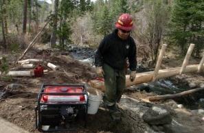
Deadly Fire: Blackwater Blaze In Wyoming Remembered 75 Years Later. Here's an excerpt from a story at
trib.com: "
WAPITI
RANGER STATION — Over the past 40 years, Dave Sisk has jumped from
planes as a smokejumper and managed fires big and small throughout the
Northern Rockies. Standing in a mountain meadow above Blackwater Creek
in the Shoshone National Forest, it’s easy for Sisk to imagine what
happened here on a hot August day 75 years ago, when a seemingly routine
fire turned deadly. He managed a wildfire here in 2003, and thoughts
of the 1937 Blackwater blowup were never far away. “Any time you’re in
fire, especially if you’re in charge of a fire, that potential is
always in the back of your mind,” Sisk said. “These guys in 1937 knew
how to fight fire. What they didn’t know was that a cold front was off
to the west heading in this direction.”
Photo credit above:
MARTIN KIDSTON/The Billings Gazette. "Fire
crews with the Shoshone National Forest make improvements to the
Blackwater National Recreation Trail ahead of this summer’s 75th
anniversary of the deadly 1937 Blackwater fire."
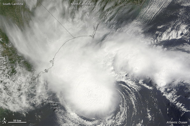
Alberto Provides An Early Reminder. Here's some timely advice for residents of "Hurricane Alley" from Jacksonville's
jdnews.com: "...
Although
there’s nothing anyone can do to stop a hurricane from forming or
influence its path, there’s plenty that those who live in its possible
path can do to mitigate its potential for disruption. We should all
stock up on the things we need to be prepared for the arrival of a
hurricane on our shores — from gallons of water to a battery-operated
radio to nonperishable foods. We should have an evacuation plan and
watch for orders telling us it’s time to get out, and then do as we’re
told. We should prepare our homes, businesses and other properties for a
hurricane’s arrival by removing items that can turn into projectiles
when heavy winds hit. And we should remember to think ahead where our
pets and those who are less capable of helping themselves, such as the
elderly, are concerned."
Satellite image above courtesy of NASA's
Earth Observatory.
California Hurricane Odds Extremely Low, But Not Zero.
Yes, southern California has been hit by (rare) hurricanes in year's
past. Jack Williams takes a look at a hurricane scenario for California
in this
Washington Post article; here's an excerpt: "
The May 15-November 30 eastern Pacific hurricane season is well underway with the National Hurricane Center forecasting that Tropical Depression TWO-E
should become Tropical Storm Bud later today. The Center says it could
hit southwestern Mexico near the resort city of Manzillo as a Category
2 hurricane on Friday. Aletta, this year’s first eastern Pacific
tropical storm formed on May 14 and died on May 19 without ever
threatening land. Prevailing easterly winds usually push most eastern
Pacific tropical storms and hurricanes away from North America, which
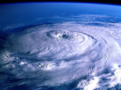
is why these storms usually attract little public attention." Hurricane image above courtesy of NASA.
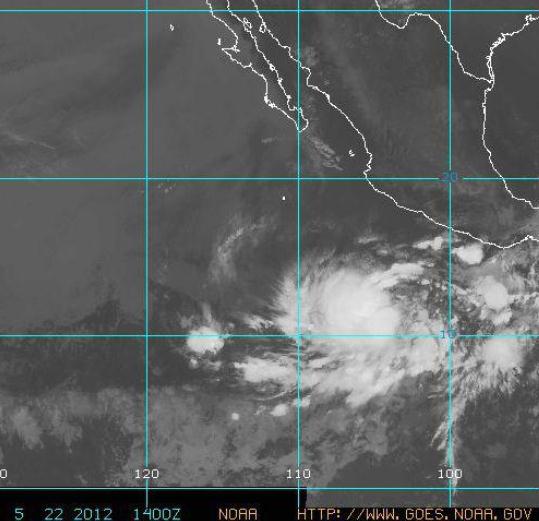
"I'll Have A Bud, Please". Is it me or is a tropical
storm by the name of "Bud" somewhat reassuring? Not to residents of
Mexico - some of the models strengthen Bud into a hurricane, possibly
recurving northeast and hitting coastal Mexico within 72 hours. More
from NHC: "
Tropical Storm Bud continues to churn over the eastern
North Pacific Ocean at midday Tuesday, centered almost 550 miles south
of Manzanillo, Mexico. Maximum sustained winds are 40 mph, but further
strengthening is expected, and Bud may become a hurricane by Wednesday
Night. Its west-northwest movement will become northwest later today
and north by Thursday."
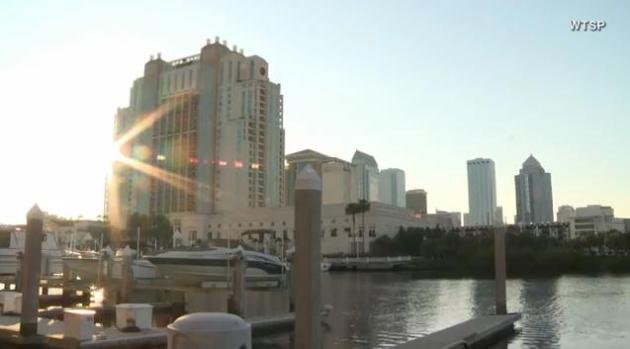
GOP Convention Nightmare: Hurricane In Tampa. Don't
laugh - there's a pretty good chance that we'll be tracking a tropical
storm or hurricane somewhere in the Gulf, Atlantic or Caribbean by early
August - approaching prime time for tropical systems. WTSP-TV and
firstcoastnews.com have the story (and video); here's an excerpt: "
TAMPA,
Fla. -- Images of palm trees and the waterfront convention center
might be what helped attract the Republican National Convention to
Tampa. The event is scheduled for the final week of August, a time that
happens to also be very near the height of hurricane season. The idea,
along with an estimated 50,000 visitors -- most without transportation
-- has emergency planners contemplating the worst. "We're looking at
what could happen here in Hillsborough County and the actions that we
would need to take," said Preston Cook, Hillsborough County's new
Emergency Management director."
Zippered-Vent Sleeping Bag Adds A Dose Of Flexibility To The Camping Equation. If you're a die-hard camper, here's one innovation you may want to consider, courtesy of
gizmag.com: "
While
a good quality sleeping bag is a solid investment for keeping the
crisp night air at bay, said bag can quickly become an oven when the
ambient temperature heads northwards. Add to this the cramped nature of
snoozing in a sack and you get a recipe for discomfort that some of us
find hard to bear. The Zippered Vents Sleeping Bag aims to overcome
these issues with a design that brings a little versatility to the
equation."
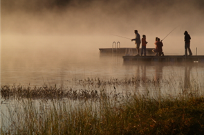
Safe Boating
The other day I saw a guy boating and texting.
Not smart when you're cruising through a narrow channel. Here's a
harrowing statistic: according to NOAA 16 percent of all boating deaths
in 2011 were alcohol-related.
"It is illegal to operate any boat or watercraft
while under the influence of alcohol or drugs in every state. Penalties
can include fines, suspension or revocation of your drivers license and
even jail time" according to NOAA. OK. That's good enough for me.
This is National Safe Boating Week. Details on
the blog, where I've included comments on last May's Minneapolis tornado
from Todd Krause at the local NWS office.
The average tornado lead-time nationwide is 12
minutes. That's an average. Last year's EF-1 tornado developed suddenly.
"It would be nice if tornadoes always gave 30 minutes notice, and some
storms do, but others develop extremely quickly, in which case it's hard
to get a warning out more than a few minutes beforehand" Krause told me
in an e-mail. The NWS got a 5 minute jump, helping to avoid a major
disaster.
A few storms today may turn severe, 1-2" rain tonight & Thursday.
Heavy T-storms are likely Saturday, again Memorial Day. Sunday still looks like the warmest, driest day.
Climate Stories...
More Evidence That Global Warming Drives Extreme Weather. Here's a snippet of a story from
Climate Central: "
There’s
been a lot of discussion recently about how TV weather forecasters
handle the issue of global warming — to the point that a watchdog group
— ForecastTheFacts.org
— has started singling out what it sees as the worst offenders in the
forecasting community. Some of those high-profile weathermen in big
market cities have a responsibility to tell viewers more about the
emerging science that shows how a warming planet will affect day-to-day
weather, including the potential for more frequent and severe storms,
extended periods of drought and other extremes."
1,000 Years Of Climate Data Confirms Australia's Warming. The story from
phys.org; here's an excerpt: "
The
study led by researchers at the University of Melbourne, used a range
of natural indicators including tree rings, corals and ice cores to
study Australasian temperatures over the past millennium. They then
compared these with climate model simulations. Dr. Stephen Phipps, a
researcher with UNSW’s Climate Change
Research Centre and the Centre of Excellence for Climate System
Science led the climate model simulation research. He said the results
showed there were no other warm periods in the past 1,000 years that
match the warming experienced in Australasia since 1950. “Our study
revealed that recent warming in a 1,000-year context is highly unusual
and cannot be explained by natural factors alone, suggesting a strong
influence of human-caused climate change in the Australasian region,”
Dr. Phipps said."
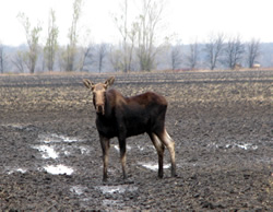
Rapid Climate Change Turns Minnesota's North Woods Into Moose Graveyard. The story from
eenews.net; here's an excerpt: "
ALONG
THE GUNFLINT TRAIL, Minn. -- If moose disappear from the boreal forest
of northern Minnesota, as some biologists predict, they will not exit
with a thunderous crash. Climate extinctions come quietly, even when
they involve 1,000-pound herbivores. Experts who have studied the
Northwestern moose -- Alces alces andersoni -- believe they are
witnessing one of the most precipitous nonhunting declines of a major
species in the modern era, yet few outside Minnesota fully appreciate
the loss." Photo credit:
University of Minnesota.
Climate Change This Week: Vanishing Hawaii Beaches, Mexican Wind Boom And More. Here's a clip from a story at
The Huffington Post: "
Aloha to aloha land: Hawaii's beaches are going bye-bye,
says the US Geological Service, reports Cornelia Dean at the New York
Times. About 10% have vanished over the past century, and rising sea
levels from climate change are likely to hasten the process, making it
truly a loha land (Sorry, folks, I couldn't resist...) What happens
when you build up deadwood by suppressing fires in Canada's boreal
forest and couple it with climate change, which has made the forests
drier and created longer, warmer, drier seasons? Disastrous wildfires
like the one that burned up much of the town Slave Lake in 2011.
Expect more, scientists are now saying, reports Graham Thomson at
Postmedia News."
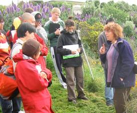
Digging Into Climate Change, U.S. Scientists Find More Than Science. Here's an excerpt from an interesting story at
Scientific American: "
BERLIN,
Md.—Fifth grader Aman Shahzad looked closely at the level attached to
the plumb line. "Lower, lower," she called out. "OK! The bubble is in
the middle." Her classmate, holding the wooden surveyor's pole, read
the measurement: 14 centimeters. The two students were from Pemberton
Elementary School in nearby Salisbury, Md., the first to participate in
a new, three-month interdisciplinary unit called "Investigating
Climate Science" that spans science, math, economics and government. On
this spring day on Maryland's eastern shore, they were on a field trip
to Assateague Island, measuring the slope of the beach as the first
step in a lesson on sea-level rise."
Photo credit above:
flickr/Jon Sullivan
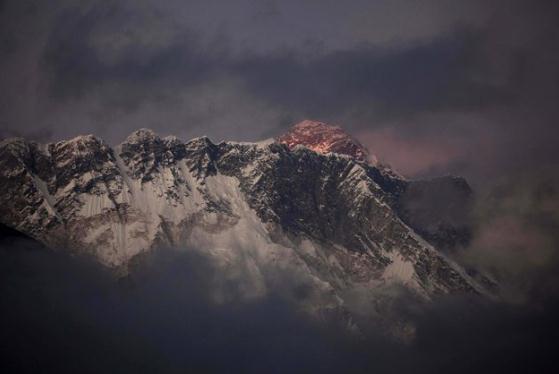
Everest Weekend Death Toll Reaches 4. Climate change is making a climb of Mt. Everest even more perilous, as reported by
Yahoo News: "
Some
climbers and environmentalists have expressed concern that climbing
conditions on Everest are worsening each year, possibly due to climate
change. An unusually light snowfall this year has added to the danger,
renowned Everest climber Conrad Anker said. "Because there is little
fresh snow, icy surfaces on the slopes make climbing more difficult and
dangerous," Anker said, adding that "the snow acts as glue, stopping
rocks from falling on the climbers."
Photo credit above: "
In this Oct. 27, 2011 file photo, the
last light of the day sets on Mt. Everest as it rises behind Mount
Nuptse as seen from Tengboche, in the Himalaya's Khumbu region, Nepal.
Mountaineering Department official Gyandendra Shrestha said Monday, May
21, 2012, that a German, a Nepal-born Canadian and a Korean died
Saturday while descending from the 8,850-meter (29,035) summit." AP Photo/Kevin Frayer, File.
The Earth Is The Lord's: Our Responsibility For God's Creation. From
Huffington Post: "
Here
we go again. Another election cycle in which climate science is being
debated by high ranking elected officials, party activists and interest
groups with the power to sway what our candidates say they believe and
how they act in office. It seems inconceivable that at a moment when
there is virtual scientific consensus
that climate change is happening, and is significantly affected by
human behavior, that there are those who persist in denying the single
greatest threat to life as we know it. Of the eight major Republican
Party Presidential candidates this past year, five (Perry, Paul,
Bachmann, Cain, Santorum) expressed outright climate change denial. Jon Huntsman
was the only candidate who unequivocally affirmed the scientific
consensus on climate change. And after previously holding positions that
climate change was real and pressing, both Newt Gingrich and candidate-elect Mitt Romney have retreated to expressing varying degrees of skepticism on the subject."


