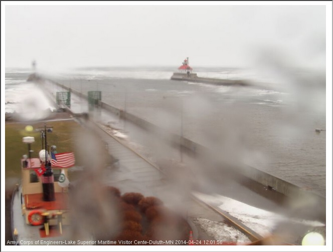
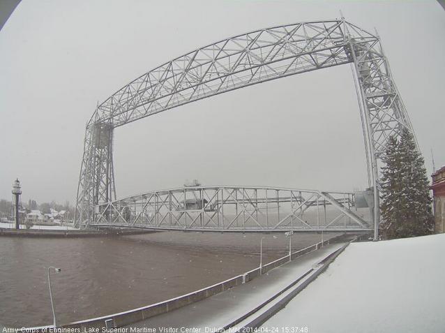
The view from Park Point in downtown Duluth, MN around midday Thursday showed snow falling - AGAIN! As of Wednesday, April 23rd, Duluth had seen 125.3" of snow this season (+40.5" above normal), which is so far the 5th snowiest season on record!
Last season 2012-2013 saw 129.4" and was the 3rd snowiest season on record. The snowiest season on record is 135.4" set in 1995-1996.
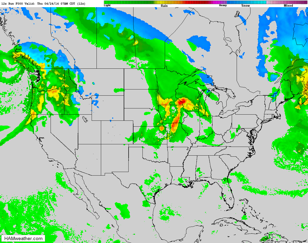
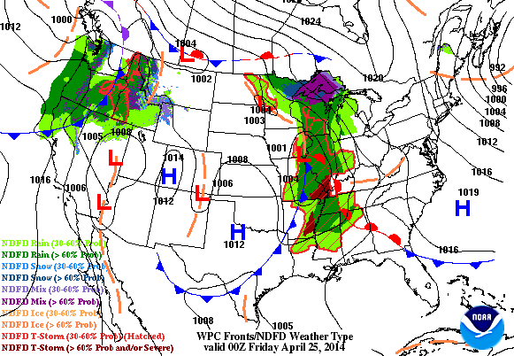
Weather OutlookThe loop below from AM Thursday through PM Sunday shows one storm exiting the on Friday, while another fairly potent storm system takes its place over the weekend. Not only will heavy rain be an issue, but severe weather will also be a concern. The severe threat looks to be an ongoing issue into early next week.
Severe Threat Friday
The severe threat for Friday will be confined to the extreme eastern part of the country. Portions of North Carolina and Virginia could see some stronger storm later Friday with hail and high wind the primary threat.
...SERN VA SWD ACROSS THE ERN NC VICINITY... AFTERNOON HEATING OF A RELATIVELY MOIST BOUNDARY LAYER WILL CONTRIBUTE TO INCREASING CAPE DEVELOPMENT ACROSS ERN NC AND VICINITY...AHEAD OF THE ADVANCING COLD FRONT AND ASSOCIATED UPPER VORT MAX. AS THIS OCCURS...A DIURNAL INCREASE IN AFTERNOON CONVECTIVE COVERAGE/INTENSITY IS EXPECTED...WITH UPDRAFT ORGANIZATION AIDED BY AMPLE SHEAR ON ACCOUNT OF 40 TO 50 KT WLYS AT MID-LEVELS SPREADING ACROSS THIS REGION ON THE SRN FRINGE OF THE UPPER SYSTEM. ALONG WITH RISK FOR HAIL WITH STRONGER CELLS...LOCALLY DAMAGING WINDS WILL ALSO BE POSSIBLE -- PARTICULARLY IF SOME UPSCALE GROWTH INTO SMALL LINES/CLUSTERS CAN OCCUR -- AS APPEARS POSSIBLE ATTM. THE SEVERE RISK WILL DIMINISH THROUGH THE EVENING...AS THE AIRMASS GRADUALLY STABILIZES AND CONVECTION MOVES OFFSHORE.
Next Pacific Storm
Take a look at the big storm system moving into the western part of the country. This potent storm looks to bring quite a bit of moisture to the western part of the country over the next few days, some of which will be in the form of high elevation snow prior to moving into the middle part of the country with severe weather chances.
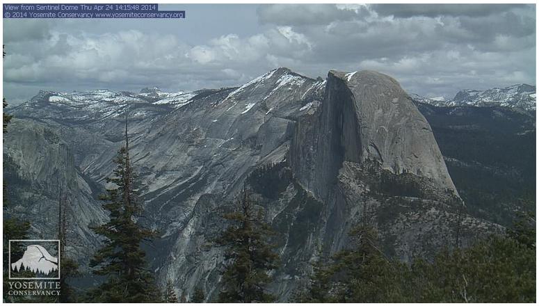
Snow For Yosemite National Park
This was the view from Yosemite National Park on Thursday afternoon. Note the dark clouds gathering as the storm system was moving in.
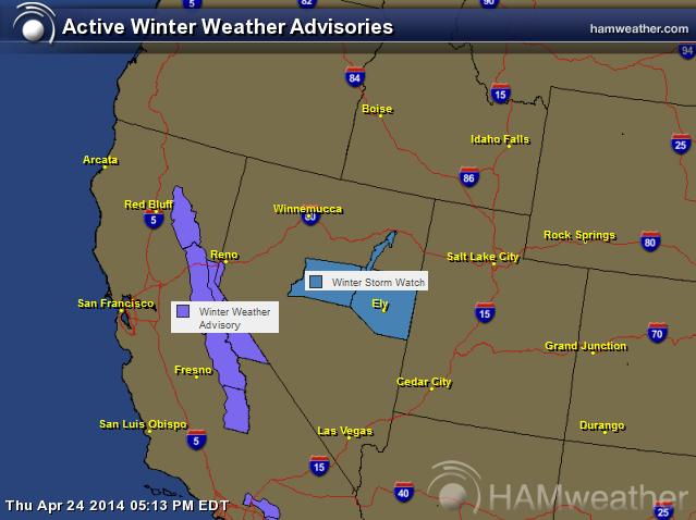
Winter Returns to the West
The Pacific storm system moving into the western part of the country will bring wind, rain and heavy snow. Yosemite National Park in the Sierra Nevada Range could see 6" to 12" of snow by AM Saturday.
...WINTER WEATHER ADVISORY REMAINS IN EFFECT FROM 5 AM FRIDAY TO 5 AM PDT SATURDAY ABOVE 6000 FEET...
A WINTER WEATHER ADVISORY ABOVE 6000 FEET REMAINS IN EFFECT FROM 5 AM FRIDAY TO 5 AM PDT SATURDAY FOR THE HIGHER ELEVATIONS OF THE SOUTHERN SIERRA NEVADA. THE NEXT IN A SERIES OF FAST MOVING PACIFIC STORMS WILL AFFECT THE SIERRA BEGINNING EARLY FRIDAY MORNING.
* SNOW ACCUMULATIONS: UP TO 12 INCHES AROUND AND IN YOSEMITE PARK. 6 TO 9 INCHES IN AND NEAR SEQUOIA AND KINGS CANYON PARKS.
* ELEVATION: ABOVE 6000 FEET.
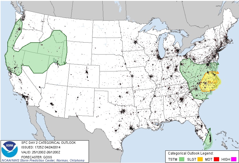
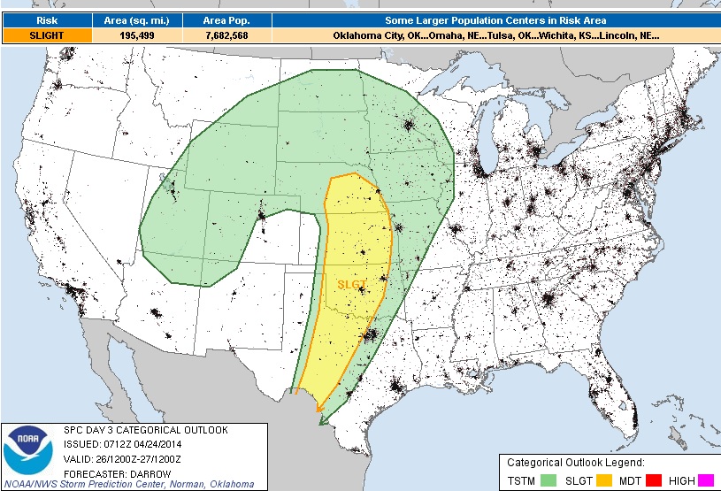
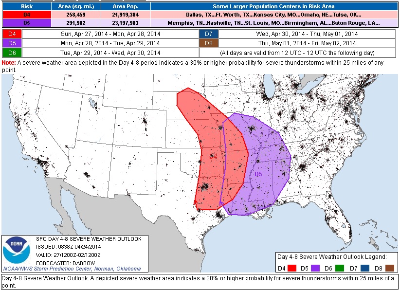
Severe Threat Saturday
Our next big event unfolds this weekend. The first day of the potential multi-day severe weather threat moves in on Saturday ahead of a deepening low pressure system. The Storm Prediction Center has issued an highlighted risk area across the Plains, where hail, high winds and tornadoes may be possible by PM Saturday.
Extended Severe Threat
The potential multi-day severe weather threat looks to continue into Sunday and Monday as the storm system slowly wobbles eastward. Note that from Saturday through Monday, the threat shifts east only slightly as the storm looks to deepen enough to nearly cut itself off from the upper level winds.
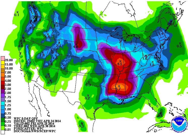
Precipitation Outlook
According to NOAA's 5 day precipitation outlook, there appears to be some widespread heavy moisture on the way over the weekend/next week. Flooding could certainly be an issue as thunderstorm development could bring several round of heavy rain to places in the midsection of the nation over the days ahead.
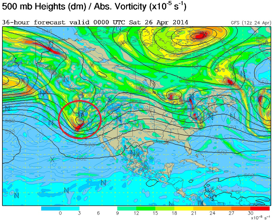
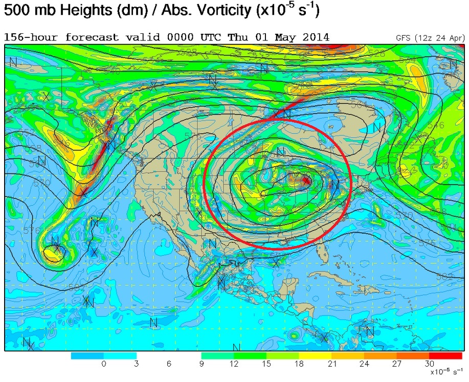
Developing a Cut-Off Low
Take a look at the series of images below. The 500mb vorticity (spin) map from PM Friday through PM Wednesday shows the progression of this potent Pacific disturbance as it moves into the central part of the country and becomes "Cut-Off" or detached from the upper level winds. This particular weather feature will be the cause for stagnant weather next week.
Friday
Saturday
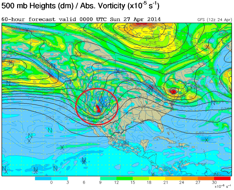
Sunday
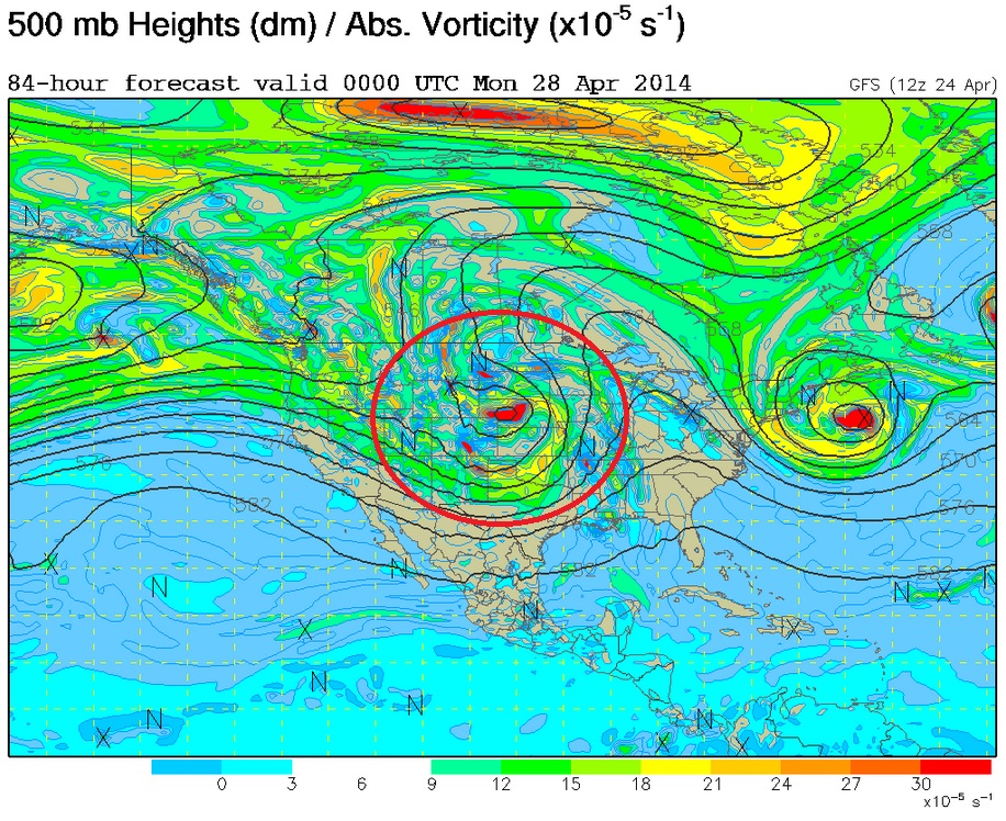
Monday
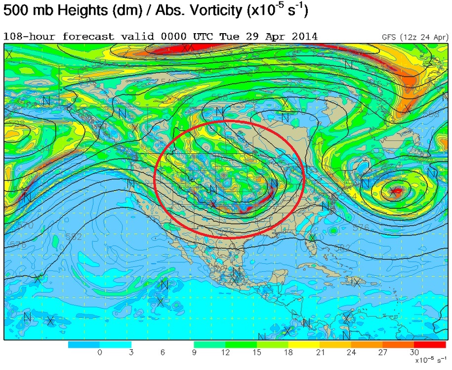
Tuesday
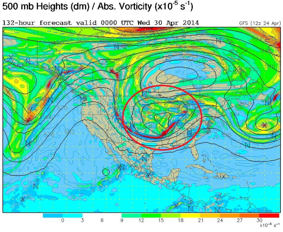
Wednesday
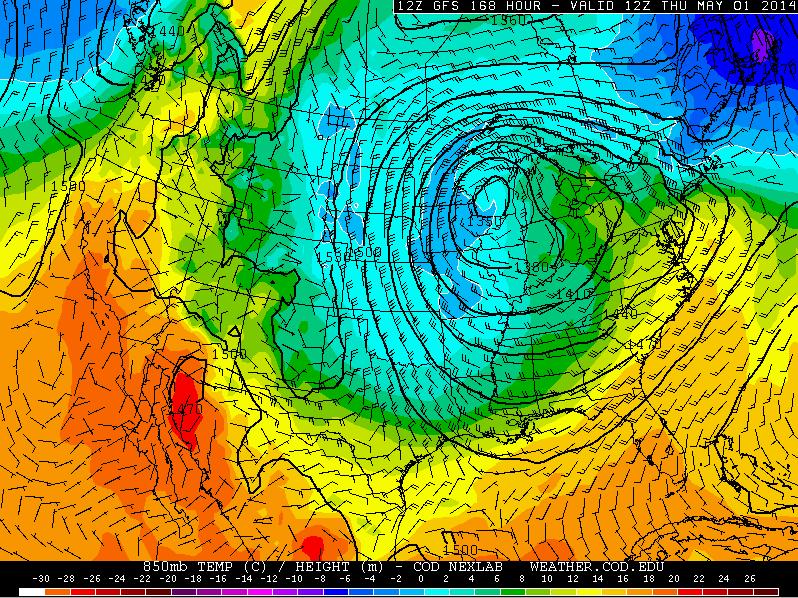
Memories of March
Look at the big cold blob below. This is what the forecast is saying into the middle part of next week as the low pressure system gets cut-off from the upper level winds. If the forecast holds, temperatures could certainly be well below average for much of next week in the eastern two-thirds of the nation.
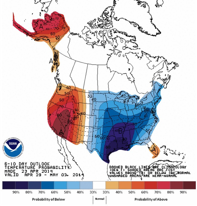
Temperature Outlook
According to NOAA's Climate Prediction Center, the temperature outlook into next week looks quite chilly in the eastern two-thirds of the nation due to the cut-off low developing in the central part of the country. Unfortunately, it looks like this colder than normal weather will stick around for a bit due to the stubbornly slow movement of this weather feature.
Thanks for checking in and have a great rest of your week and weekend ahead! Don't forget to follow me on twitter @TNelsonWNTV
