
I'm starting to wonder out loud if it's too late to find a sports gig in town. Something a little less controversial than babbling about Minnesota's increasingly manic weather.
Just when I thought I'd seen everything along comes Monday's lion-like departure to March. 70s. Tornadoes. Blizzards. On the same day - in the same state.
A state of severe atmospheric confusion.
Folks up in Thief River Falls can be excused for being extra-cranky: 18 inches of new snow fell.
Dazed robins in my yard are chirping a melancholy tune, because they must sense what's coming. It's still too early to opine about snowfall totals, but both ECMWF and GFS models suggest plowable, shovelable amounts of snow here Thursday; wet, heavy, slushy, gloppy "heart attack" snow. Freeways may stay wet and mushy, but Friday may wind up testing your character, resolve and stoic sense of humor. A Winter Storm Watch has been posted - details below.
Skies clear Saturday; long-range guidance showing a Pacific puff of 50-degree air the latter half of next week.
There's a good chance El Nino will return by May, a warm stain of Pacific Ocean water that usually results in warmer than average temperatures, nationwide. We'll see.
Expect 40s Opening Day at Target Field.

Alerts Broadcaster Briefing: Issued Tuesday night, April 1, 2014.
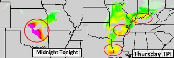
* Slight severe risk Wednesday (especially PM hours) from near Kansas City and Little Rock to Tulsa, Dallas and Shreveport - a few tornadoes are likely, and I expect Tornado Watches to be issued by NOAA SPC by early afternoon.
* Severe risk shifts east on Thursday, with a potential for tornadic supercell T-storms from St. Louis and Little Rock to Evansville, Bowling Green, Kentucky and Memphis, Tennessee. A few large, violent tornadoes can't be ruled out, especially Middle Mississippi River Valley Thursday afternoon and evening, with a squall line containing hail and damaging straight line winds pushing into the Ohio Valley by Thursday night.
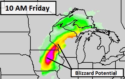
* It sounds like a cruel April Fool's joke, but the weather maps look more like early March than early April across the Upper Midwest. Significant, plowable snows are possible from northern Iowa and the southeastern half of Minnesota into much of Wisconsin late Thursday into Friday. Significant travel delays are expected from Des Moines, Rochester and the Twin Cities to Eau Claire, La Crosse and Wausau, Wisconsin, with Friday being the worst travel day.
On the cold side of the storm winter is still very much alive and well:
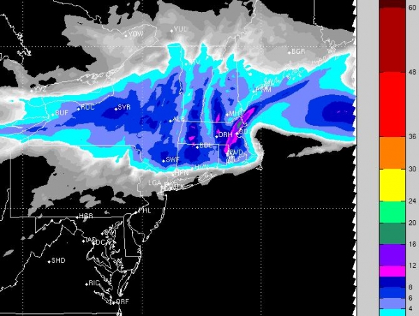
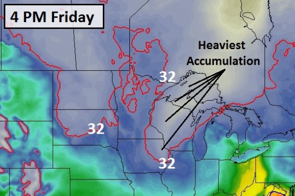
* The heavy, wet nature of this upcoming snowfall may increase the risk of sporadic power outages late Friday night into Saturday. Some ice will be mixed in with the snow, especially Thursday, changing to mostly snow on Friday as colder air wraps around the storm.
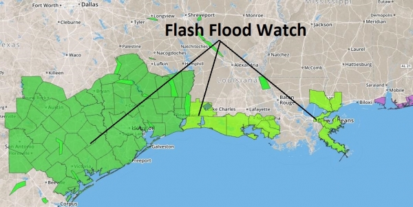
Summary: I'm already seeing some (very early) evidence of a brewing El Nino warming phase in the Pacific, which tends to strengthen the southern branch of the jet stream, invigorating storms over the central and southern USA. I suspect this trend will continue into early summer, with cooler weather over the northern states, and rapid warming in the south setting the stage for more tornadoes and severe weather in general than we experienced in 2013. Severe thunderstorms capable of isolated tornadoes are likely Wednesday afternoon into Thursday night from the central and southern Plains into the Mississippi and Ohio River Valleys. Staff should be alert for potentially violent storms capable of large hail, damaging straight line winds in excess of 70 mph, and a few tornadoes capable of more widespread and significant damage. On the cold side of the storm another major snow event is brewing from Iowa and Minnesota into Wisconsin from Thursday PM into Friday. If it's any consolation (doubtful) long-range model guidance shows 50s and 60s returning for this same region for the latter half of next week. A rapid thaw may increase the potential for mostly minor river flooding, but the slow melt of recent weeks has helped to ease the overall risk, especially in the Red River Valley, where the threat was greatest. We'll continue to monitor conditions and have an update Wednesday.

A Hopeful Extended Outlook. As we hear the sirens sounding, the weather threat upgraded to Defcon 2, preparing to ride out the next slushy slop-storm in our bunkers, keep in mind that it is (in theory) spring, and at some point that higher sun angle will start to make a real difference. ECMWF guidance shows 50s returning next week, maybe 60s by Thursday. Whatever snow winds up in your yard Thursday and Friday will be gone by early next week. That's the "beauty" of an April snowfall. Graphic: Weatherspark.

70F By Mid-April? No, I wouldn't bet much money on that prediction, but if you believe the GFS we may come close to 70 within 2 weeks (give or take a month). Notice the significant precipitation amounts by mid-month into the third week of April; the atmosphere warm enough for mostly rain. I think.
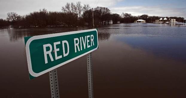
File Photo credit: "The Red River out of its banks just south of Moorhead in 2009." Photo: Marlin Levison, Star Tribune.
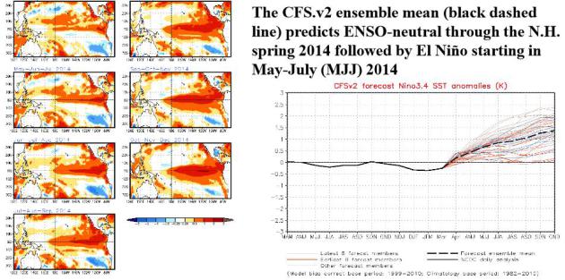
Photo credit above: "The U.S.S. New Mexico broke through the ice 150 miles north of the North Slope of Alaska to pick up some passengers." Credit Joshua Davies Communication Specialist 2nd Class/U.S. Navy Photo.


16 Airline Secrets That Will Change How You Feel About Flying. Great. Some things I wanted to remain blissfully ignorant about, but this story at Huffington Post changed all that; here's an excerpt: "...We've added a few of our own world-rocking facts to the list, and we've gotta tip our hat to Viral Quake for posting some of the Reddit thread's most startling secrets. We should also mention the validity of individual Reddit comments can't be completely confirmed.That being said, we're already thinking about flying from a whole new perspective.
Dim lights are meant to prepare you for evacuation, not sleep.
"When a plane is landing at night, they dim the interior lights incase you need to evacuate upon landing... your eyes are already adjusted to the darkness so you'll be able to see better once outside the plane." --@bonestamp


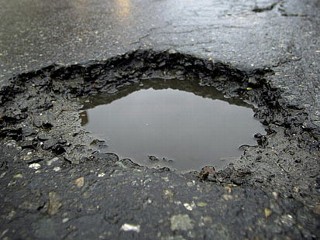
Climate Stories...
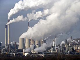
Climate Signals, Growing Louder. Here's an excerpt of an Op-Ed from the Editorial Board at The New York Times: "Perhaps now the deniers will cease their attacks on the science of climate change, and the American public will, at last, fully accept that global warming is a danger now and an even graver threat to future generations. On Monday, the Intergovernmental Panel on Climate Change, a United Nations group that since 1990 has been issuing increasingly grim warnings about the consequences of a warming planet, released its most powerful and sobering assessment so far. Even now, it said, ice caps are melting, droughts and floods are getting worse, coral reefs are dying..."
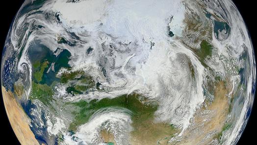
Warming World Threatens Us All, Warns U.N. Report. Time Magazine has an overview of the latest IPCC report; here's a clip: "...So the report predicts with high confidence that the negative impacts of warming on crop yields will outweigh any potential positive impacts; that violent conflict will exacerbate the effects of global warming; that glaciers will continue to shrink as the climate warms, which has major impacts for downstream water supplies; that species on land and in the sea are shifting their range in response to warming and that some will face an increased risk of extinction; that health impacts will be felt from heat waves and from floods in low-lying areas; that the seas will continue to acidify, destroying coral reefs..." (Image: NASA).
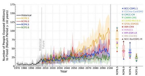
Climate Change Impacts In Pictures: 8 Stark IPCC Images. Here's an excerpt from a post at Climate Central: "100-year floods: More
extreme precipitation, expected with climate change, means that major
flood events could happen more often and thus more people are likely to
be impacted. By 2100, hundreds of millions of people per year are
projected to have to deal with the challenges flooding poses, the IPCC
shows in the above graph. That graph even keeps population steady at
2005 levels, meaning even more people will be under threat with
population rise. Averaged
globally, annual flood exposure increases 4-14 times over the course of
the 21st century compared to the 20th century. Using a moderate
population growth estimate increases that risk by 7-25 times..."

Exxon: Highly Unlikely World Limits Fossil Fuels.
We know it's bad for us, long-term, but in the short term we can't live
without it, right? Give Exxon Mobil some credit for acknowledging the
obvious: climate change is real. Here's an excerpt from a report at ABC News: "...The
report, the first detailed response to these concerns by a major oil
company, acknowledges the need to adopt policies to address climate
change. But it concludes that because oil and gas are so critical to
global development and economic growth, governments are "highly
unlikely" to adopt policies that cut emissions so sharply that fossil
fuel consumption would be severely restricted. "We know enough based on
the research and science that the risk (of climate change) is real and
appropriate steps should be taken to address that risk," Ken Cohen,
Exxon's government affairs chief, said in an interview Monday. "But
given the essential role that energy plays in everyone's lives, those
steps need to be taken in context with other realities we face,
including lifting much of the world's population out of poverty..."
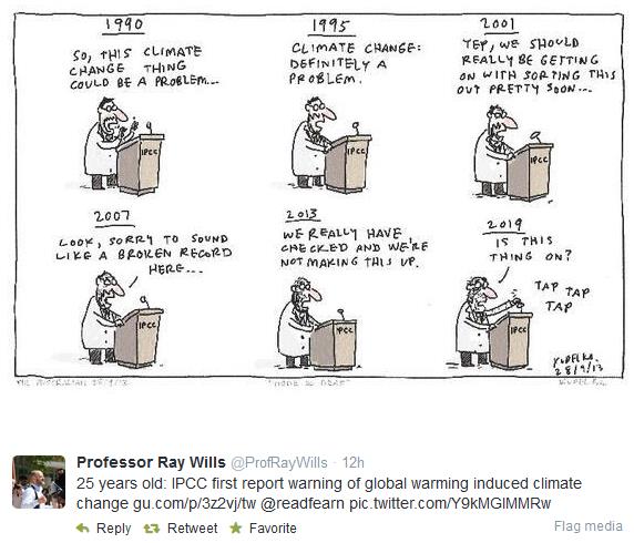
** Twitter cartoon credit here.

Panel's Warning On Climate Risk: Worst Is Yet To Come. Justin Gillis has a good summary of the latest IPCC report in The New York Times; here's an excerpt: "...The
scientists emphasized that climate change is not just some problem of
the distant future, but is happening now. For instance, in much of the
American West, mountain snowpack is declining, threatening water
supplies for the region, the scientists reported. And the snow that does
fall is melting earlier in the year, which means there is less
meltwater to ease the parched summers. In Alaska, the collapse of sea
ice is allowing huge waves to strike the coast, causing erosion so rapid
that it is already forcing entire communities to relocate. “Now we are
at the point where there is so much information, so much evidence, that
we can no longer plead ignorance,” said Michel Jarraud, secretary
general of the World Meteorological Organization..."

MIT Scientist Responds On Disaster Costs And Climate Change. FiveThirtyEight has an article from hurricane expert Kerry Emanuel from MIT; here's an excerpt: "...The
increasing normalized trends in the U.S. were evident in convective
storms, winter storms, flooding events and high temperature-related
losses, and were almost statistically significant for hurricanes at the
conventional 95 percent confidence level.3
In view of data like this, it’s very hard to accept Pielke’s confident
assertion that “[n]o matter what President Obama and British Prime
Minister David Cameron say, recent costly disasters are not part of a
trend driven by climate change...”

Wake Up To The Reality Of Climate Change. Here's an excerpt of an Op-Ed at CNN that caught my eye, from former (Republican) Governor of New Mexico and U.S. Energy Secretary Bill Richardson: "...We are now witnessing how it is changing our world: The past winter was the eighth-warmest on record. For 348 consecutive months -- 29 years
-- global temperatures have been above average. The latest IPCC report
finds that impacts from climate change are "widespread and
consequential" and they are being felt on every continent and in our
oceans. The world last year experienced 41 weather-related disasters
that caused damages totaling at least $1 billion. Over the past decade,
the western United States experienced seven times more large-scale wildfires than it did in the 1970s. Climate change has made it much more likely that we will suffer severe droughts like the one that recently swept across Texas and my home state of New Mexico..."

North America: Shifting Water. New Scientist examines how climate change will impact specific regions around the world. Here's an excerpt focused on North America: "...Rain and storms will move northwards, flooding areas north of New York and leaving southern areas short of water.
Mexicans will have to do everything they can to preserve water and
escape the heat. Adapting to water deficits is not too hard: the key is
increased efficiency. But extra flooding is more problematic, with total
costs expected to increase tenfold this century. The US has the
capacity to adapt, but is struggling with misinformation and a lack of
political will..." (Photo: ThinkStock).
* The Telegraph has a continent by continent breakdown of the risks and options related to a warming atmosphere and oceans.
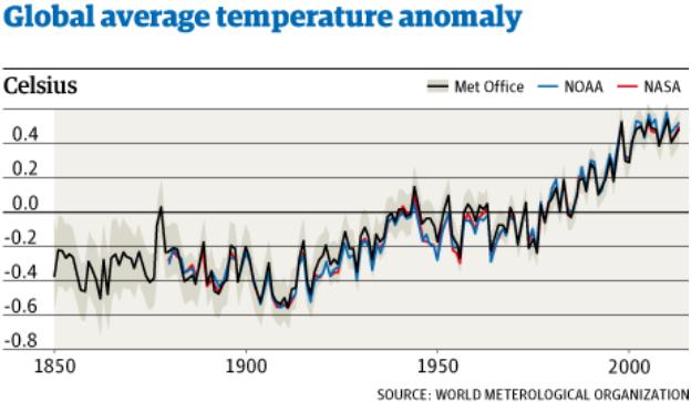
Graphic credit: WMO (World Meteorological Organization) and The Guardian.
* A link to the latest IPCC WG2 Climate Summary is here.
