
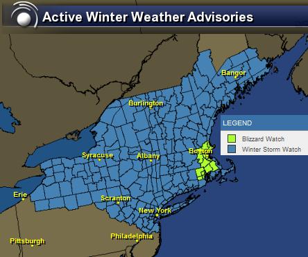
Weather Headlines
The National Weather Service has issued a number of weather headlines for the Northeast including BLIZZARD WATCHES! Expect additional headlines to be issued and upgraded as the end of the week nears.
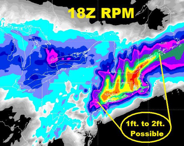
Snow Potentail
Not sure I've ever seen colors like this before! The RPM model from Wednesday was suggesting totals of 1ft. to 2ft. This is what is posted on the NWS Boston Weather Service site:
...A POTENTIAL HISTORIC WINTER STORM AND BLIZZARD IS EXPECTED TO
DROP 1 TO 2 FEET OF SNOW ACROSS MUCH OF THE REGION FRIDAY INTO
SATURDAY...
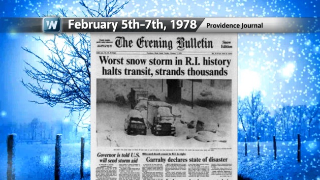
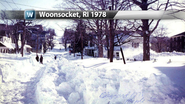
Remembering the "Northeastern Blizzard of 1978"
Interestingly, we had another massive storm back in 1978 that dumped over 30" of snow in parts of the Northeast from February 5th-7th, 1978. The front page of "The Evening Bullentin" called it the "Worst snow storm in R.I. history" - Providence, R.I. had it's all-time record snowfall of 27.6"

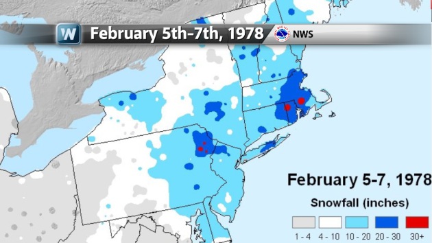
February 5th-7th, 1978 Snowfall Map
The map below comes from the National Weather Service. Note the darker blue (20" to 30") across parts of CT, RI, MA... there were even a few spots that had 30"+ !!! WOW! Providence, RI had 27.6" - Boston, MA had 27.1" - Atlantic City, NJ had 20.1"
Keep in mind that there was another massive snow storm that hit the Ohio Valley and the Great Lakes region (The Great Blizzard of 1978) 2 weeks prior this!
The Proverbial "Calm Before the Storm" ?
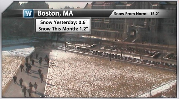
Take a look at the webcam from Boston College earlier Wednesday. Note still a little snow on the ground from Tuesday's 0.6" - shortly after this was taken, most of the snow had melted! Through Tuesday, Boston had only seend 1.2" of snow this February, -15.2" below the normal snowfall for the season!
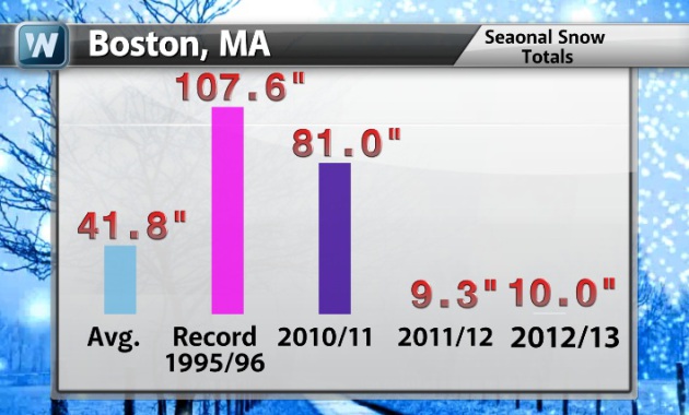
Boston Seasonal Snow Tallies
Bostonians may remember the lackluster winter of 2011-12 when only 9.3" of snow fell! We're doing a little better than that this year. The last BIG snowfall season was 2010-2011, but was quite a bit below the record of 107.6" set in 1995-96. BTW, an average season sees nearly 42"
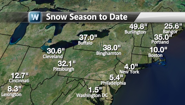
Snowfall Season to Date
Take a look at the snowfall season to date (numbers updated thru Tuesday, February 5th) - note the measly 1.5" there in Washington DC!
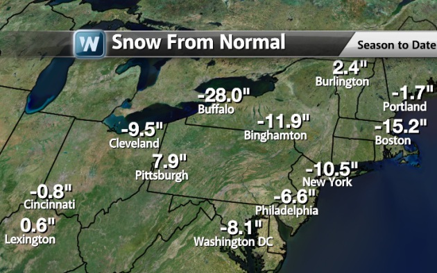
Seasonal Snow From Normal
Here are some of the other
seasonal snow deficits from across the region. If current forecasts
hold, some could actually be on the positive side by Saturday!
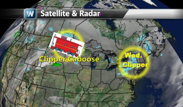
Clipper Train & Clipper Caboose
Since late last week, we've been dealing with those pesky "clipper systems" you've probably heard too much about lately. Well, the last car in the clipper train (Clipper Caboose) rolled through Minnesota on Wednesday. That was the last one before a potential winter storm moves in late weekend/early next week.
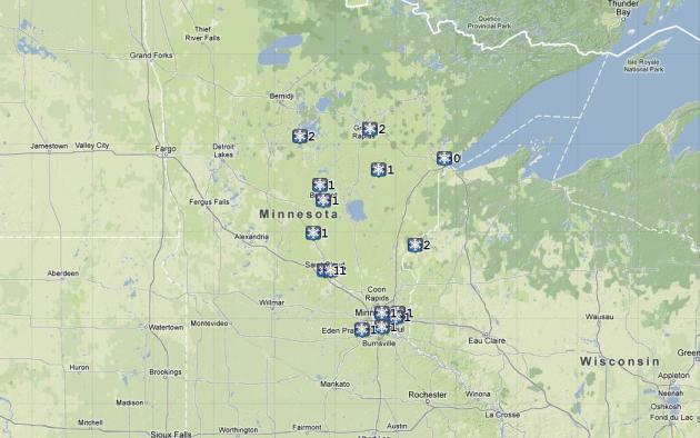
Minnesota Snow Reports
The "Clipper Caboose" was responsible for another 1" to 2" across parts of Minnesota.
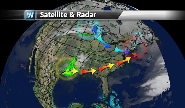
2 Storms Collide... Create 1 BIG storm!
The two ingredients responsible for the end of the week Nor'Easter are highlighted below. A fast moving clipper across the Great Lakes Region will combine with a developing low pressure system across the Lower Mississippi Valley.
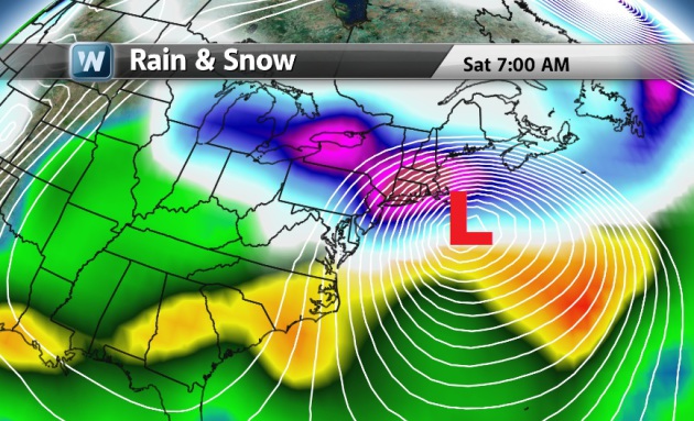
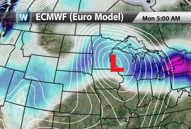
End of Week Nor'Easter
The image below shows the end result of the two mergings storms. The pink colors indicate HEAVY snow potential across some of the large cities in the Northeast. Note also the white lines, those are isobars or lines of equal air pressure. The more tightly packed those guys are, the stronger the winds blow! This has the potential to be a real doozy!
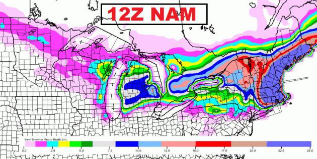
EARLY Look at Snowfall Potentail
Here's an EARLY look at snowfall potential. THIS FORECAST WILL LIKELY CHANGE as the storms merge and more of the fine details storm coming together (i.e. storm track, speed and temperatures). However, the EARLY looks suggests up to 1ft. OR MORE in some spots!
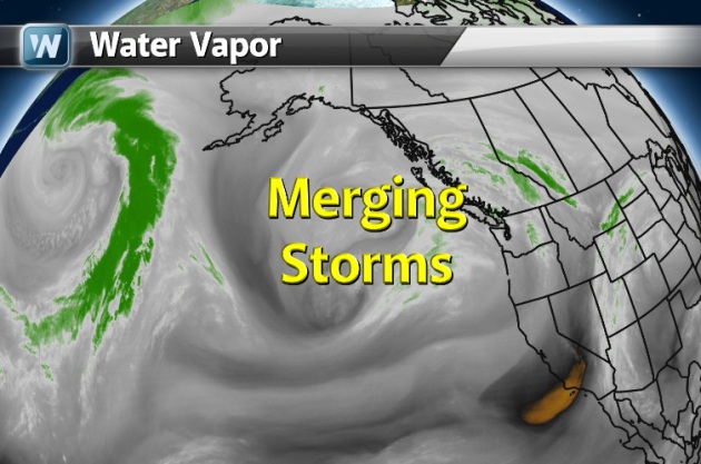
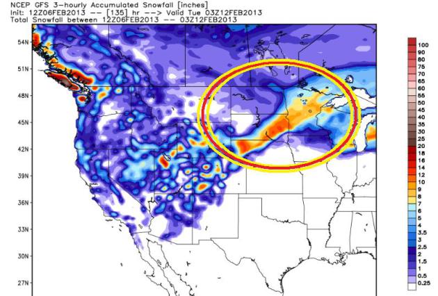
Another Developing Snow Storm?
We've also been watching a developing storm system over the Pacific, which was two idividual lows that have merged and are on the way into the Southwestern corner of the nation!
Weekend Snow Event...
It appears that this will move through the mid-section of the nation over the weekend/early next week time frame. We're still on track for some accumuluating snow across parts of the Central Plains into the Upper Midwest through Monday.
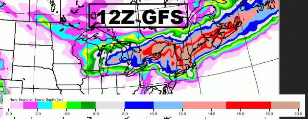
GFS Snow Totals
This too is an early look at snowfall potentail over the weekend/early next week. The track on this system is still a bit uncertain, so this forecast will likely change as well. Keep in mind that the storm we're talking about here as of Wednesday, hadn't even moved over the contiguous 48 yet. Weather models tend to get a little more accurate when there is MORE DATA from the system being injected into the model equations (i.e. storm system over land vs. water).
Thanks for checking in and have a great rest of your week!
Don't forget to follow me on Twitter @TNelsonWNTV