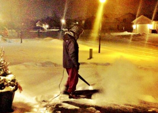
I can honestly say I've never tried snow removal with a leaf blower until Friday! Temperature near 0F made for a VERY fluffy 2" - Not sure if my neighbors thought I was weird or not, but it seemed like a GREAT idea at the time!
Watch my video HERE:
Clipper-Fest
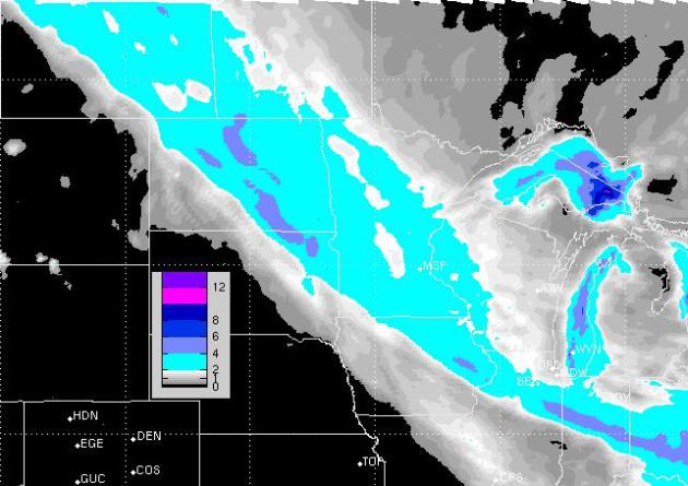
A series of fast moving clipper systems will sail through our neck of the woods almost daily until Thursday of next week. Each one will bring a chance of light snow to the area, but it appears the track of each succeeding clipper will be a little farther north. The image below is the snow forecast through AM Tuesday. Light blue indicates the potential of at least 2"
Snow Meteogram
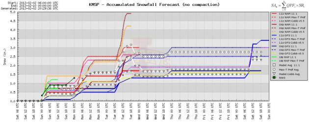
The image below suggests the amount of snow possible with each passing clipper. Note the frequecy of each light snow accumulation. It won't be a terrible amount with any specific one, but it could add up in the end!
Temperature Meteogram
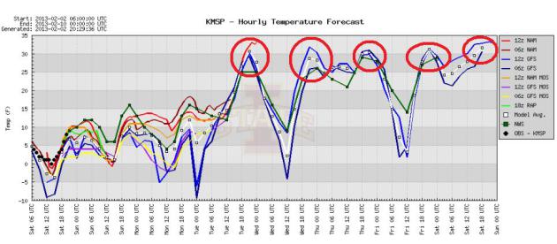
Colder air is exptected to stick around through the early week, but note the significant jump in highs by the middle/end of the week. High temperatures may consistently be around 30F if not above the freezing mark!
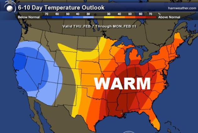
6 to 10 Day Temperature Outlook
After a chilly start to February, it appears that warmer air will settled in to the eastern half of the country over the next 6 to 10 days. The blue out west is in response to a developing low pressure system that could bring more active weather to the central part of the country by next weekend.
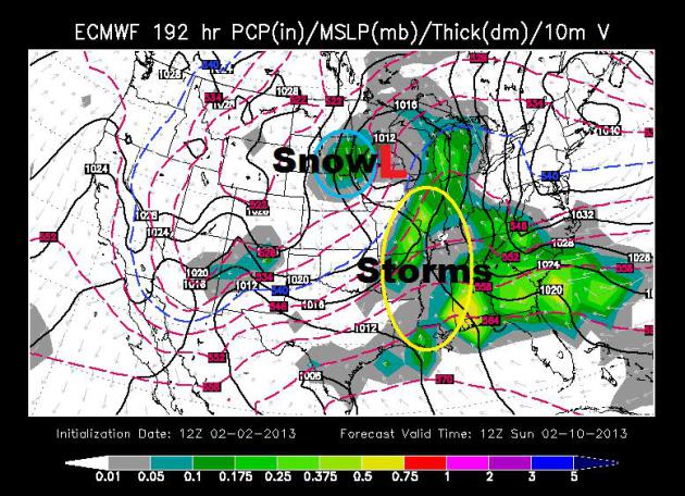
Next Week Storm System
The ECMWF (Euro) model suggests a more robust system moving into the mid-section of the nation by next weekend. This may result in a few storms across the Lower Mississippi Valley and snow across the far north. Stay tunded for more!
Thanks for checking in and have a good rest of your weekend!
Don't forget to follow me on Twitter @TNelsonWNTV