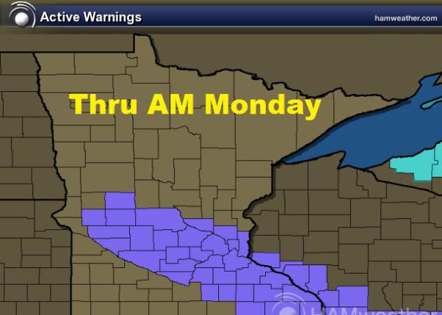
Wintry Weather Early Monday
A fast moving clipper system will roll through Minnesota PM Sunday - AM Monday with more light snow. The fluff will make for an interesting AM Monday commute.
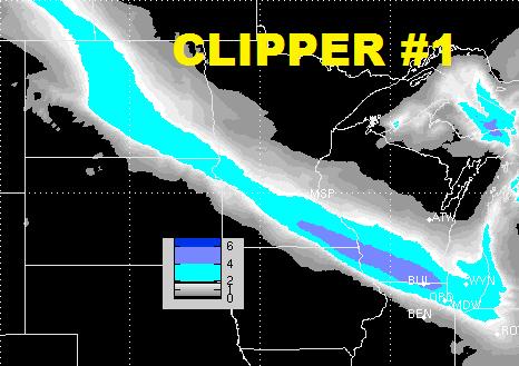
Clipper #1 Thru Early AM Monday
The image below (Clipper #1) will actually be clipper #3 since last Friday. Snowfall amount with the said system are expected to be a little higher thru Monday from La Crosse, WI to Chicago, IL. Isolated 3" to 6" can't be ruled out there! This system will keep your AM Monday commute could be a little on the icy side!
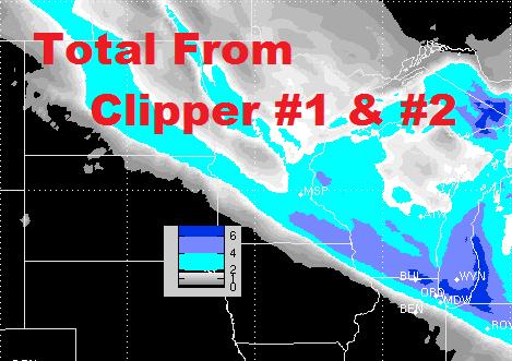
Clipper #2 PM Monday Thru Tuesday
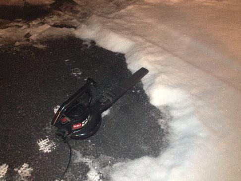
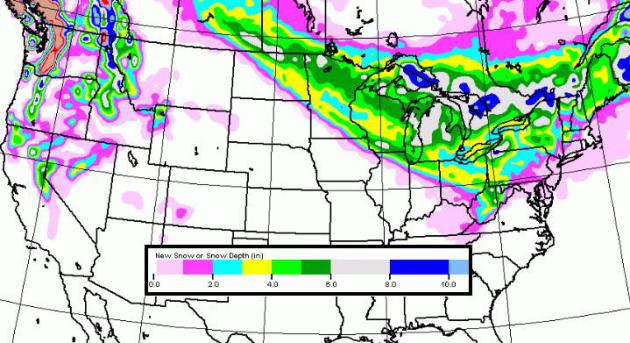
I feel like I'm living the movie "Groundhog Day" - it has snowed every day since Friday and I don't see it stopping (potentially) until Friday! Clipper #2 will move in late Monday and wrap up sometime Tuesday with another shot of light snow accumulations across central Minnesota. The potential total from both clippers is reflected in the image below. Don't put away the shovels or leaf blowers just yet!
(yes that's my leaf blower and yes I cleaned driveway with it Friday... probably the highlight of 2013!)
Extended Snow Potential
Here is the 5 day snow potential from the GFS. While it may not show the most accurate amounts, it shows where snow will be limited to. A persistent northwesterly (colder) flow will keep the snow threat around the Great Lakes through much of the week.
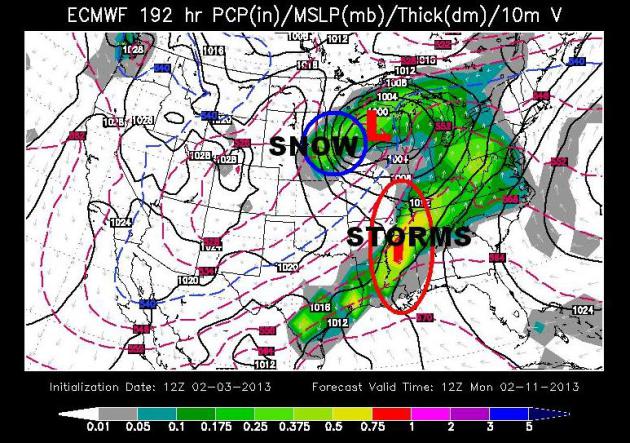
Bigger System Next Weekend
The storm system late next weekend is one that we'll have to watch. Not only for the potential of heavier snow accumulations across the Upper Midwest, but also for the potential of severe weather. The image below is the ECMWF (Euro) model for late next weekend/early nextt week.
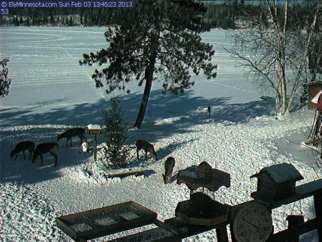
Bambi Cam ?
I happened to stumble on this near realtime webcam out of Ely, MN on Sunday. I couldn't believe it when I saw 5 deer hanging out at the watercooler!
See the webcam HERE:
Thanks for checking in and have a great week ahead!
Don't forget to follow me on Twitter @TNelsonWNTV