Typhoon Phailin
Here's a post from WeatherNation's Facebook from earlier Saturday on Phailin
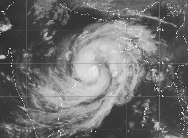
"According to the India Meteorological Department, Cyclone #Phailin made landfall around 8:22 PM local time near Gopalpur, India. IMD Director General LS Rathore said the storm had winds of 200 km/h, or the equivalent of a strong Category 3 hurricane. Here's a satellite image from CIMSS around the time of landfall."
India Today: Prime Minister Manmohan Singh directs government agencies to extend all possible help to Odisha, Andhra Pradesh
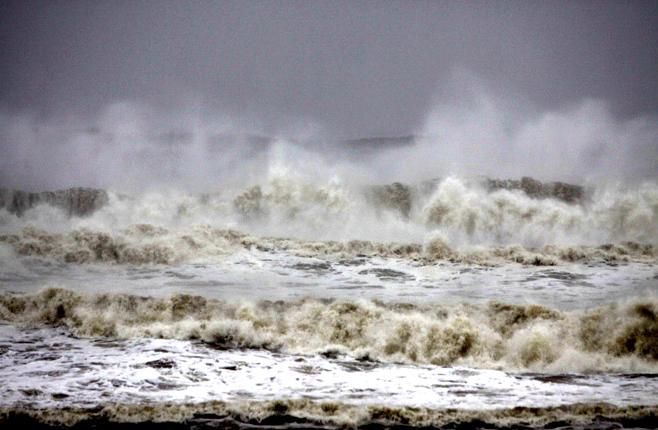
"Phailin the Super Cyclone hit the coast at about 8.20 pm on Saturday evening, but with a much reduced force than what was feared. At a windspeed of just about 200 km per hour, the eye of the storm made landfall just a few kilometres southeast of Gopalpur, the beach holiday town. The town reported six deaths even before the real gale force hit it. Mostly because of falling trees. Very heavy rains are pounding the area and this is not going to stop for the next 6 to 10 hours."
(Image courtesy: AP Photo/Biswaranjan Rout)
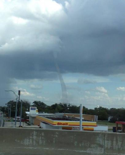
Texas Landspout
This is a neat picture from @Reilly_Williams; It's a landspout from Sanger, TX. What's the difference between a landspout and tornado? TornadoAlleyLive.com has a good write-up:
"The term "landspout" is slang for the non-supercell tornado. They typically form when a thunderstorm is in its development stage where the upward motion of the developing cloud is strongest. If there is circulation on the ground beneath this storm associated with a low level boundary, the growing updraft will pull the circulation from the ground up to the cloud. The storm itself often will not have any mesocyclone circulation, thus they are considered non-supercell tornadoes."
Read more HERE:
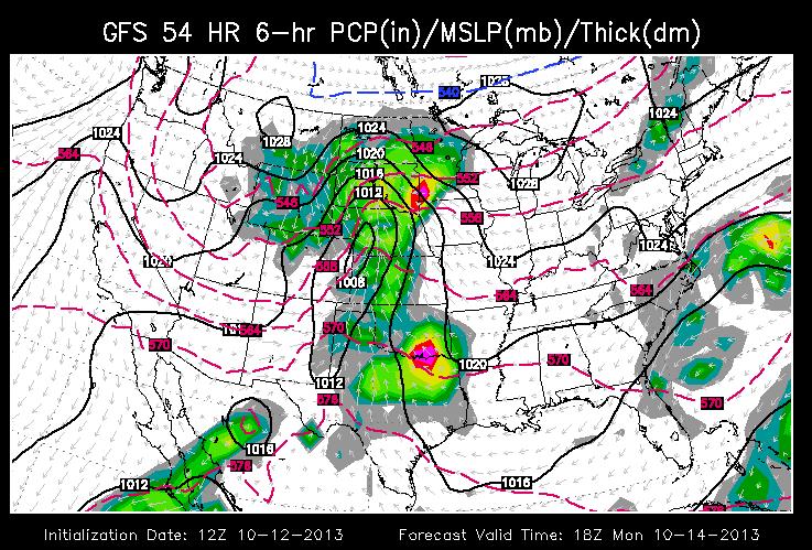
Eying Up Our Next Storm System
Models are still suggesting a more substantial system rolling through the middle part through the early part of next week. Here's the GFS (American Model) solution for Monday, which shows the storm gathering strength across the Plains. One thing I'm noting is that the storm system doesn't look as strong as it did just a couple of days ago. Sure, it'll bring decent rain/moisture across parts of the Midwest, but the intensity of the storm doesn't look as doom and gloom as it did. Stay tuned!
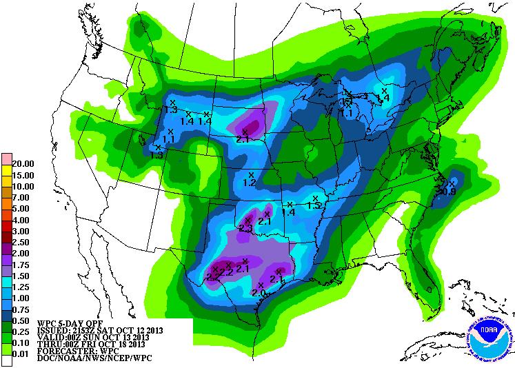
National Precipitation Forecast
The national precipitation forecast for the next 5 days suggests a fairly decent amount across much of the middle part of the country. As much as 1" to 2"+ may be possible from the Rockies to the eastern part of the country as the storm slides east this upcoming week.
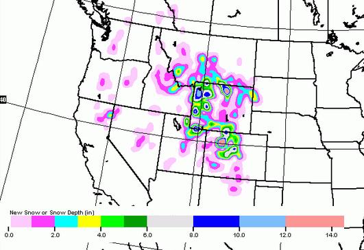
More Mountain Snow
I believe this will be the 4th consecutive week that we'll have snow falling in the high elevations out west. This next storm system will help to bring another shovelable amount of snow for folks that dwell in higher altitudes.
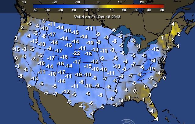
Cooler Week Ahead
After such a warm week last week, this week may come as a shock to many across the nation as temperatures tumble to more November-like temps for some.
Highs by Friday

Here's how much cooler than average it could be by the end of next week
Thanks for checking in, have a great rest of your weekend.
Don't forget to follow me on Twitter @TNelsonWNTV