I had to work the early shift on Sunday, so the drive into work at 4am wasn't the greatest... in fact, it was a bit nerve wracking. I wasn't a big fan of driving on the highway with extremely low visibility. It was almost hypnotic, staring into the abyss, watching the white lines whizz past. I snapped this shot earlier Sunday... the low fog layer opened up enough to get a quick glimpse of the near full moon.

Sunday Sunshine or No Sunshine
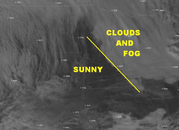
Look at how close the clearing line was to the Twin Cities Sunday afternoon... If you were northeast of the yellow through the day Sunday, you more than likely had a pretty gloomy day. Southwest of that line, the sun popped out and temperatures warmed close to 60F... remind me what month it is again.
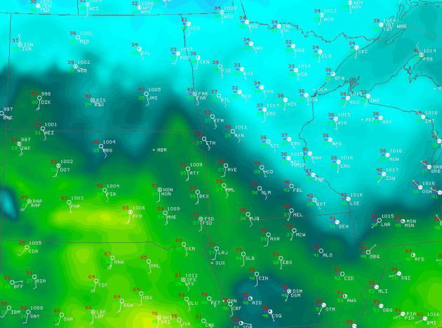
Sunday Afternoon Temperatures
It's hard to see in the map below, but temperatures across southwest Minnesota on Sunday afternoon warmed into the low 60s. Marshall, MN reported a 61F temp by 2pm, while temperatures in the Twin Cities were only in the 30s.
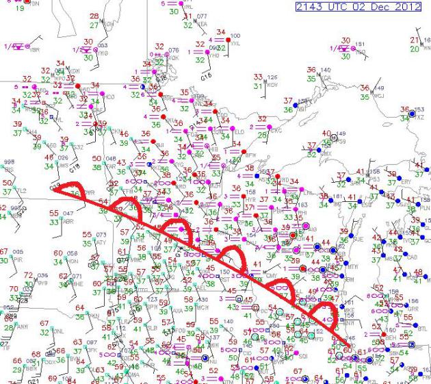
Classic Warm Front
This is a pretty classic warm
front setup... cool, cloudy and foggy north of the warm front and
warm/sunny south of the warm front. Unfortunately that setup right over
the Twin Cities so folks in the metro didn't see much sun.
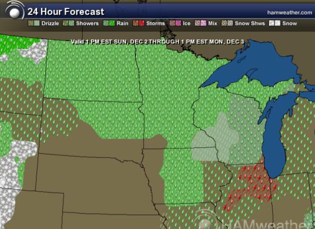
December Rain?
As a storm system slides
along/north of the international border today, it'll drag Pacific
moisture along with it. Doesn't it seem weird to be talking about the
potential for rain on the 3rd of December? Even though the graphic below
looks pretty wild, Monday isn't expected to be a washout. However,
there could be a few isolated t-storms near Chicago, which could beef up
rainfall just a little bit.
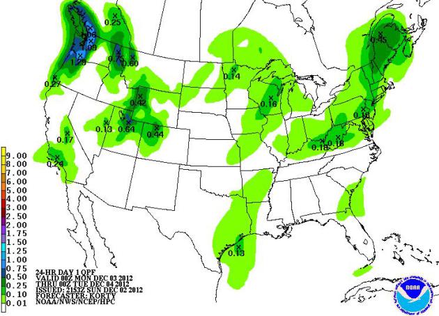
Monday Rainfall Potential
NOAA's HPC 1 day precipitation
across the nation shows this weak disturbance across the Upper
Mississippi Valley with light precipitation potential, but it also shows
addtional precipitation potential across the West Coast.
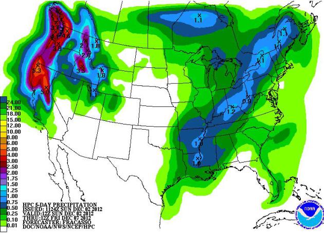
5 Day Precipitation Forecast
For those along the West Coast,
the constant barrage of heavy Pacific moisture isn't over just yet. The 5
day precipitation forecst brings in another +5" for some... some of
which may be in the form of snow across the higher elevations.
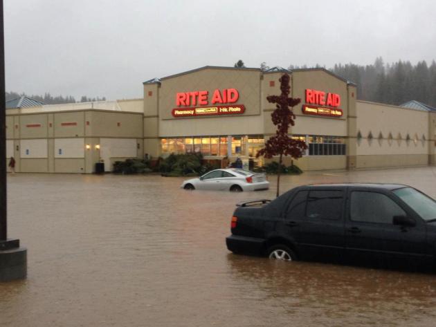
Heavy California Rain
Take a look at this shot from the National Weather Service out of Sacramento California... Good grief!
"Grass Valley, Brunswick Basin. The area was formerly known as Olympia Lake. Photo by Daniel Swartzendruber"
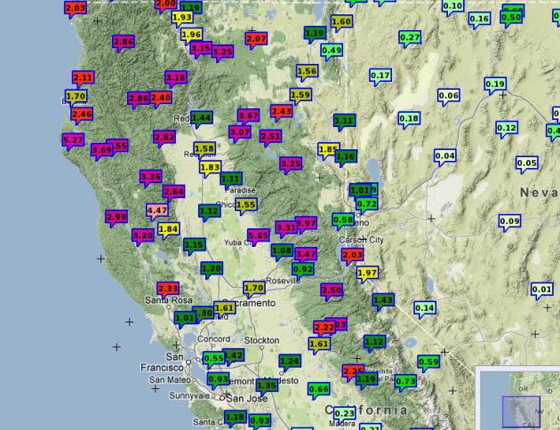
California Rainfall Totals
Here are some of the NWS Mesonet observations of precipitation totals over northern California. See more HERE:
Atmospheric River - California Flooding?
This is kind of a timely story from scientificamerican.com, read more HERE:
"DROWNED: A 43-day
atmospheric-river storm in 1861 turned California’s Central Valley
region into an inland sea, simulated here on a current-day map."
"Geologic evidence shows
that truly massive floods, caused by rainfall alone, have occurred in
California about every 200 years. The most recent was in 1861, and it
bankrupted the state.
Such floods were most likely caused by atmospheric rivers: narrow bands of water vapor about a mile above the ocean that extend for thousands of miles. Much smaller forms of these rivers regularly hit California, as well as the western coasts of other countries."
Such floods were most likely caused by atmospheric rivers: narrow bands of water vapor about a mile above the ocean that extend for thousands of miles. Much smaller forms of these rivers regularly hit California, as well as the western coasts of other countries."
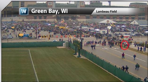
Vikings Lose at Lambeau
WNTV meteorologist Bryan Karrick
made his annual trip to Lambeau field for the "Border Battle" (Vikings
vs. Packers) on Sunday. We happened to corrdinate and capture Bryan on
the Lambeau tailgate webcam.
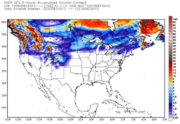
Extended Snowfall Potential
The long range "192 hour
fantasyland" GFS forecast suggests a better potential of light snow
accumulations by some point late week/weekend.
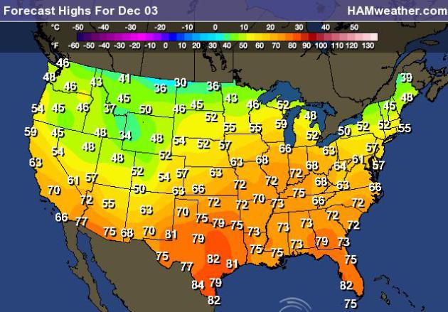
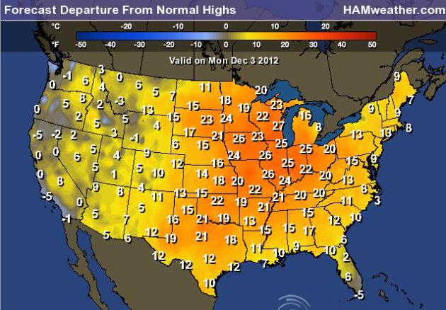
Highs Monday - Very Warm December 3rd
Take a look at the forecast
highs across the nation on Monday.... much of the central part of the
country will be nearly 15F to 25F warmer than normal and near records in
spots!
Highs From Normal Monday
It's pretty remarkable to see much of the nation well above average...
Thanks for checking in, have a great week ahead.
Don't forget to follow me on Twitter @TNelsonWNTV