Winter Weather Concerns
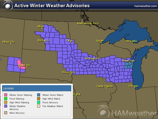
The National Weather Service continues winter weather headlines from the Dakotas to the Great Lakes Region through PM Tuesday.
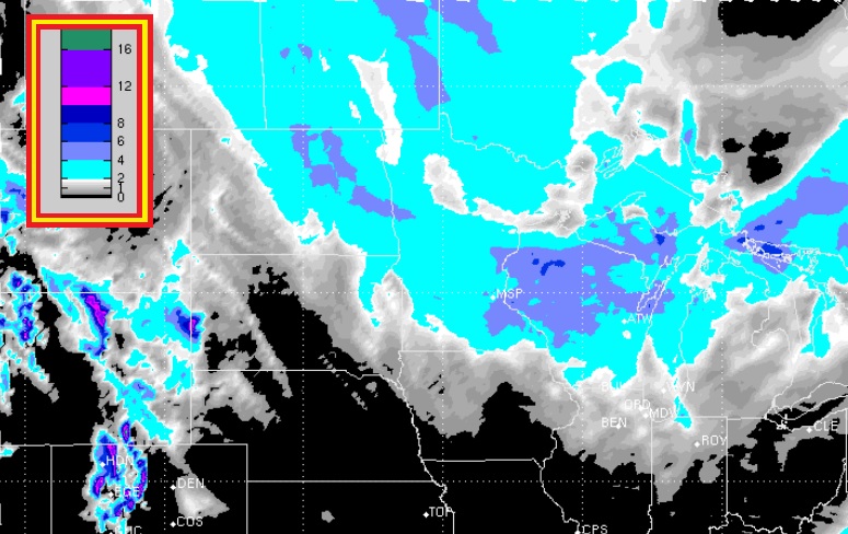
Midwest Snow Potential
Here's the Midwest snow potential from AM Monday - AM Thursday, which includes two clippers through midweek. The biggest snow threat moves through the Midwest PM Monday - PM Tuesday.
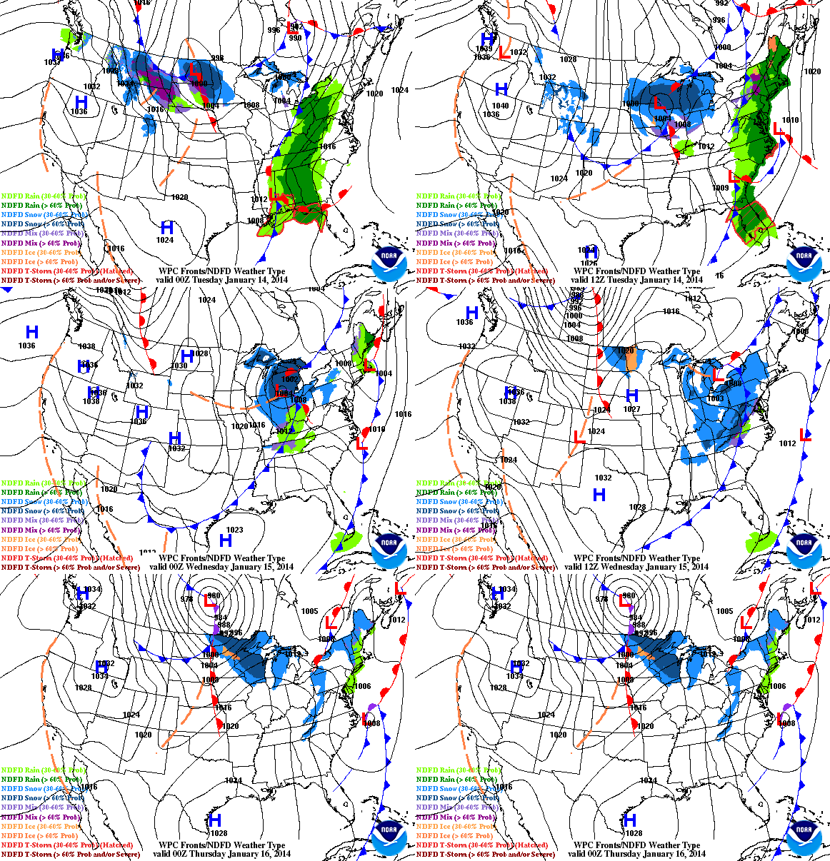
Clipper-Fest Returns
Now that the extremely cold weather has subsided a bit, the storm track has lifted a little farther north. This will allow several clipper systems to roll through the Midwest/Great Lakes Region over the coming days; each one posing a threat for light snow accumulations, strong winds and a sharp temp drop. The loop below shows 2 such systems moving through the Upper Midwest/Great Lakes through Wednesday.
Blowing Snow Potential
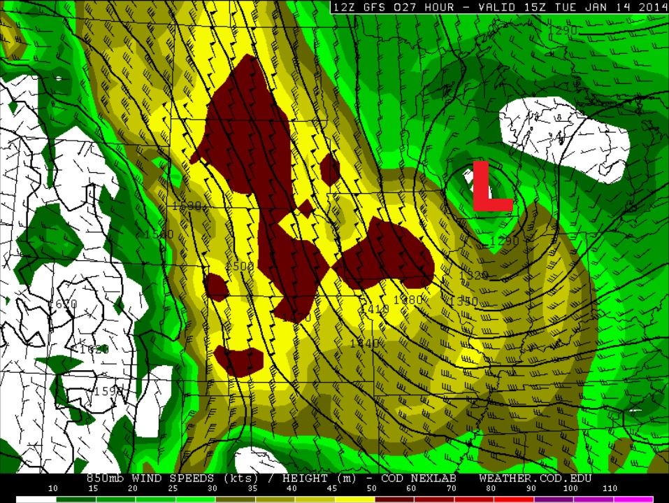
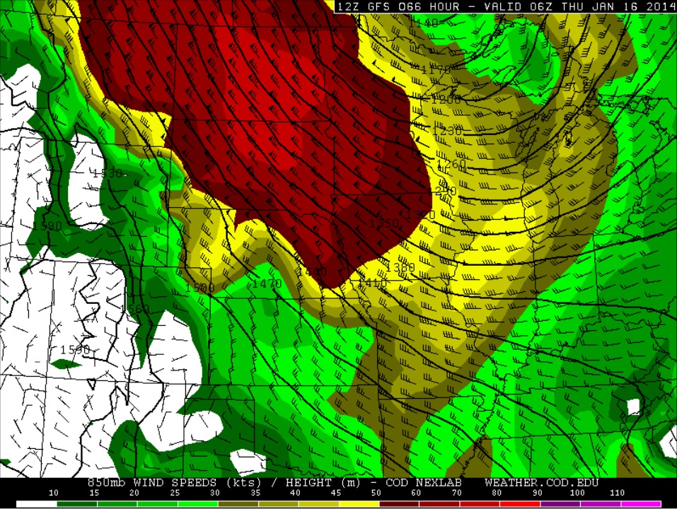
Keep in mind that fresh snow will be blowing around quite a bit with strong winds on the backside of each passing clipper this week. Here are the wind fields surrounding the two clipper systems this week.
AM Tuesday
Winds a few thousand feet off the ground by Tuesday morning look quite impressive as this first clipper system rolls through. As the strong wind mixes down to the surface, all of our fresh snow from clipper #1 will likely be blowing around making for some difficult traveling, especially in rural areas.
PM Wednesday/AM Thursday
Here's our secondary clipper system set to move through the Midwest by midweek. The wind field surrounding this one looks even more impressive, which could lead to even more blowing snow issues across the Dakotas into parts of Minnesota and eventually into Wisconsin through the day Thursday.
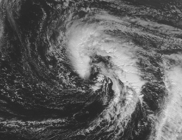
Subtropical Storm Arthur?
WOW! How about this... as of early Monday, there was a storm brewing east of Bermuda that could intensify enough to become the first named storm of 2014 in the Atlantic basin! Weird huh?
Thanks to the Capital Weather Gange for the info below:
"On average, about 97% of tropical cyclone activity falls within the official hurricane season, while the remaining 3% is spread out among the six off-season months. Looking back to 1851, only two known storms have formed during January: Hurricane #1 in 1938 (formed January 3), and Subtropical Storm #1 in 1978 (formed on January 18)."
Read more from the WashingtonPost.com HERE:
More on the Arctic Blast Last Week
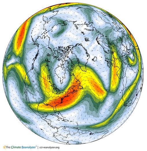
The main reason for the extreme temperature dip in the eastern part of the country was because of a large dip in the jet stream or strong upper level wind. The jet stream typically blows from west to east in the northern hemisphere with little kinks in it here and there. Every so often there will be a big kink in that wind field, which sends warm air north or cold air south depending on the direction of the kink. Take a look in the large dip in the jet stream across the eastern U.S. last week. This resulted in a significant drop in temps, one that brought record cold to places as far south as the Gulf Coast States.
See the current atmosphere HERE:
Jet Stream From January 7th, 2014
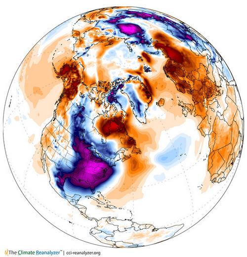
Temperature Anomaly From January 7th, 2014
The large purple blob over the eastern U.S. suggests WELL below normal temperatures for that date.
FutureTemps
Falling temperature are expected this week as several impulses of energy slide into the Midwest. The good news is that it doesn't look nearly as cold as it was last week.
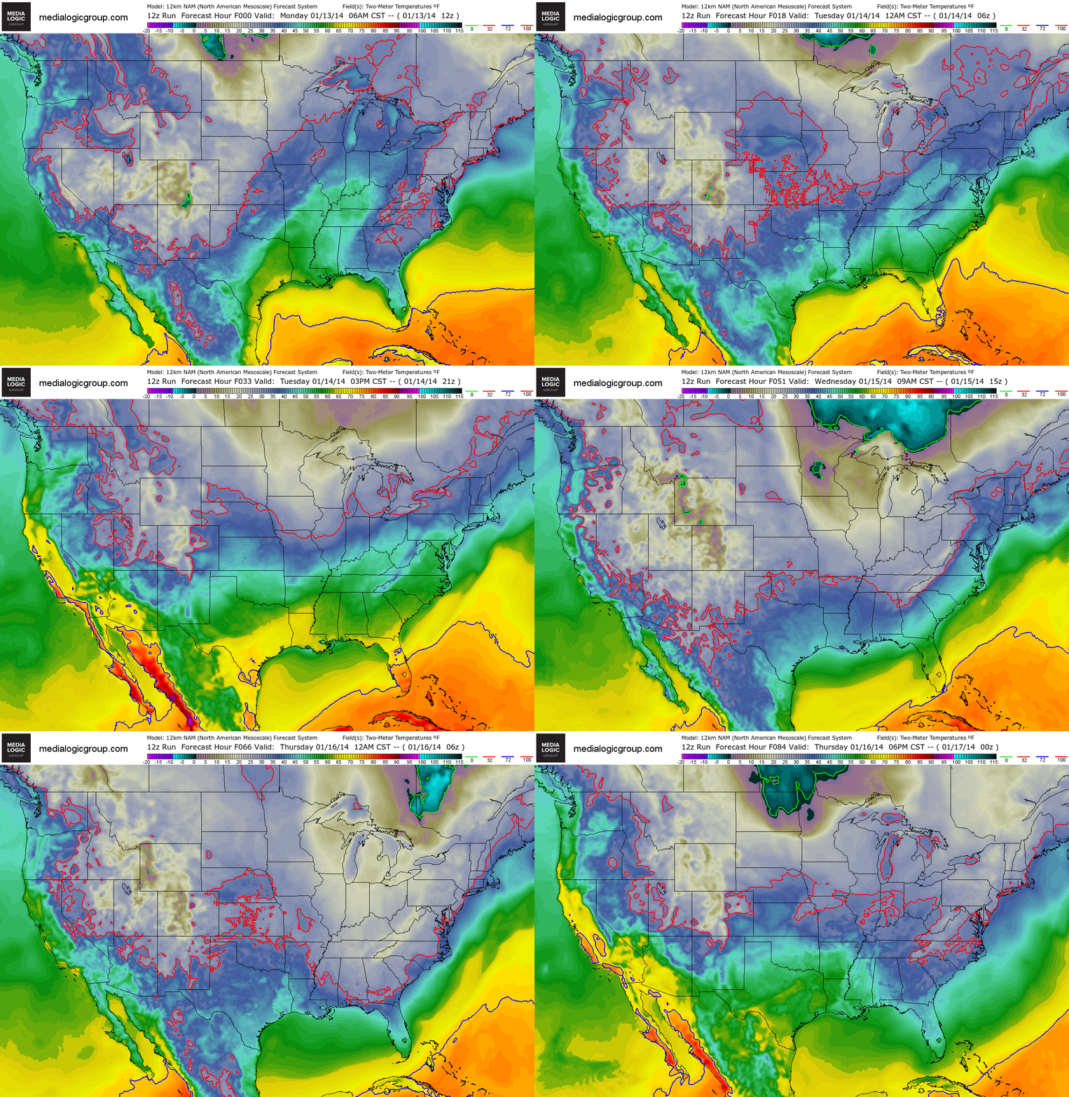
Cooler By Wednesday
High temperatures across the eastern half the nation look quite a bit cooler than earlier this week. It's interesting to see the nation so divided. The western part of the country looks to remain well above normal while the eastern part of the country will be cooler than average.
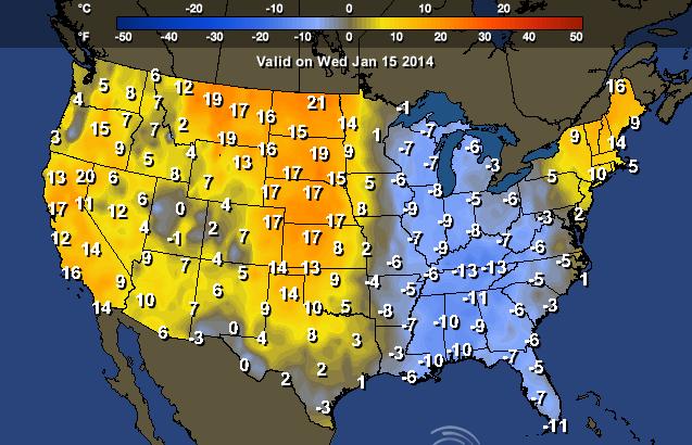
Highs Wednesday
Note also how warm temps look to be in the southwestern part of the country by midweek! 80s can't be ruled out for folks in southwestern California!
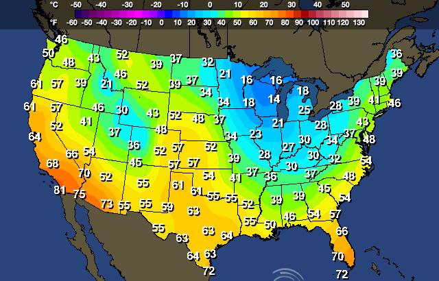
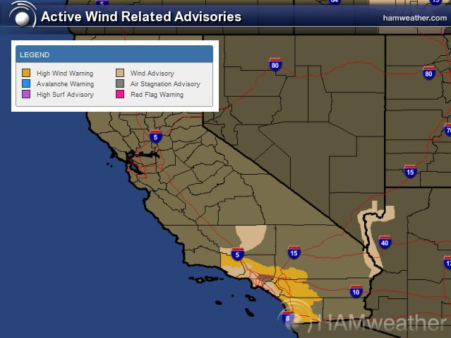
Santa Ana Winds
Another Santa Ana wind event is underway. Due to an area of high pressure across the western part of the country, strong winds will gust up close to 50mph to 60mph through midday Wednesday. Not only will these be warm winds, but they will also be dry winds. With the current dry situation across California, fire danger will be an issue too!
Thanks for checking in and have a great week ahead! Don't forget to follow me on Twitter @TNelsonWNTV
