"Summer 2013 weather extremes tied to extraordinarily unusual polar jet stream"
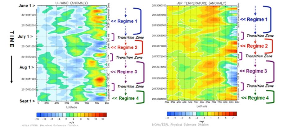
"For at least the past one or two decades the adjective extreme has increasingly become used in describing unusual weather. It’s virtually impossible now to escape news of extreme drought, excessive rainfall and floods, record breaking heat waves, cool spells and severe weather outbreaks, etc. which seem to recur year after year around the Northern Hemisphere. This summer was no different except that the behavior and configuration of the polar jet stream, the river of high altitude winds marking the divide between warm and cool air, were rare and mind-boggling."
Sunrise Surprise
Thanks to my good friend Matt Dux for the picture below, who got quite a start from this little guy. He said that it was only 8 hours between drive times, so spiderman made quite a web it that short time!

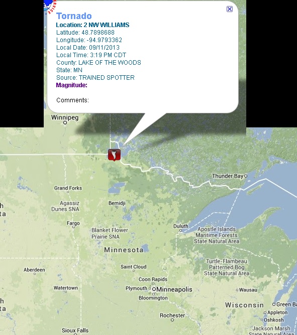
Weather Whiplash
Talk about weather whiplash... how about this. PM Wednesday, there was a report of a tornado in northern MN near Lake of the Woods and on Thursday night/AM Friday, there were FROST/FREEZE headlines in place!
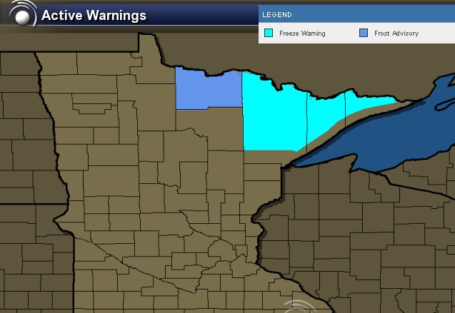
Weather Whiplash Continued...
After strong to severe thunderstorms across northern Minnesota on Wednesday, frost and freeze headlines were posted for PM Thursday/AM Friday for temperatures expected to dip into the upper 20s in some cases! Time of cover those tomatoes!!
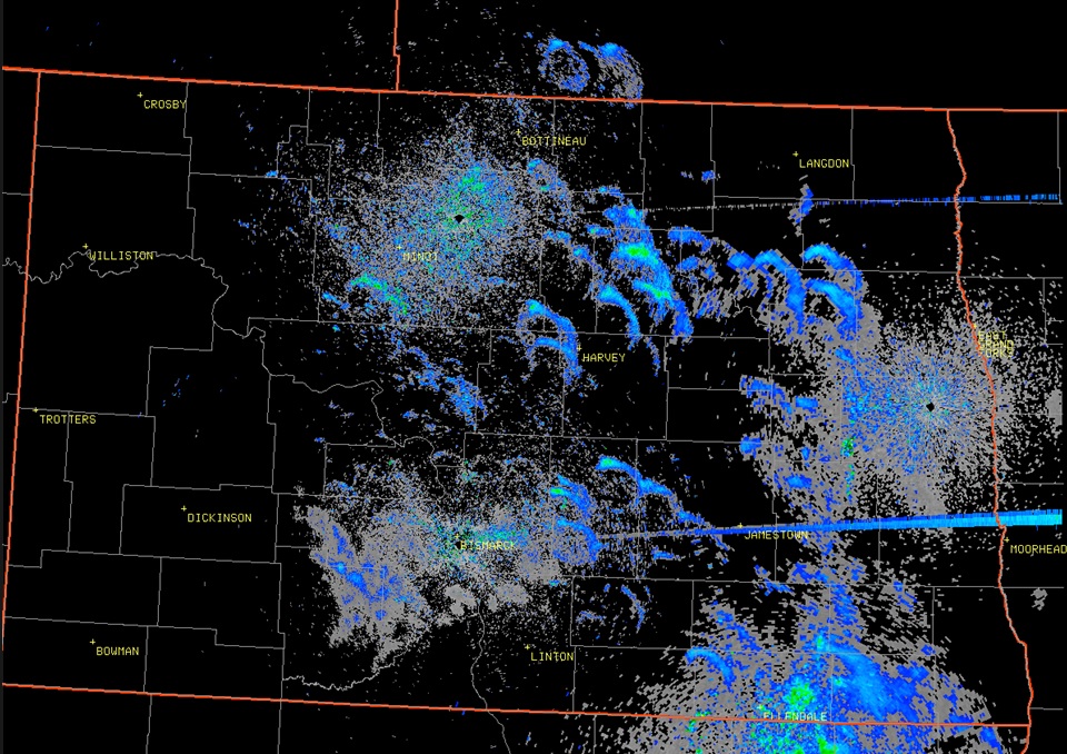
Signs of Fall
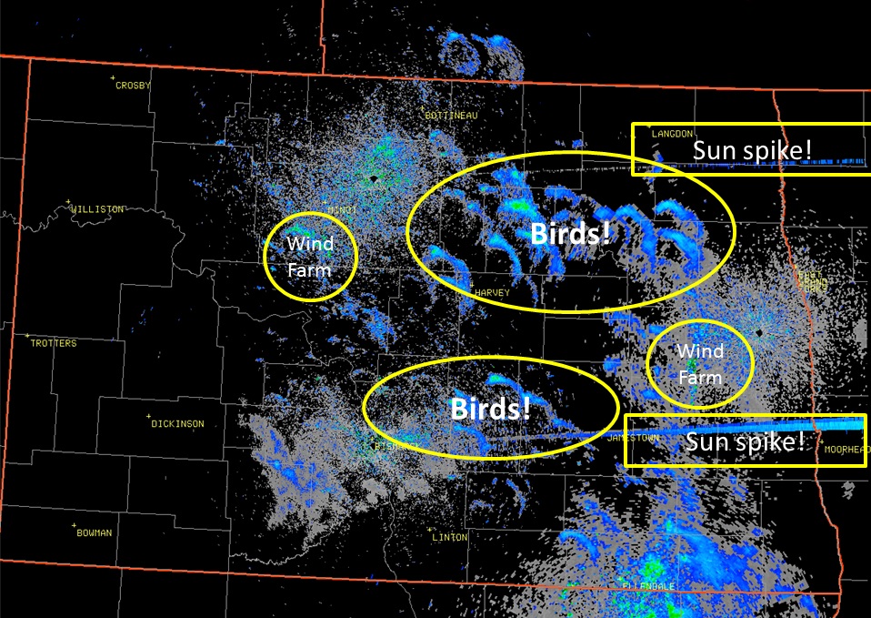
I don't know about you, but it feels like it's too early for Fall to be settling in, doesn't it? Thanks to the National Weather Service out of Bismarck, ND for the image below, which shows "Roost Rings" or birds leaving early in the morning in search of food. They tend to spread out in rings, which can be picked up on radar. Note how many "Roost Rings" there are! This is one sure sign of fall!!
Heading South of Winter
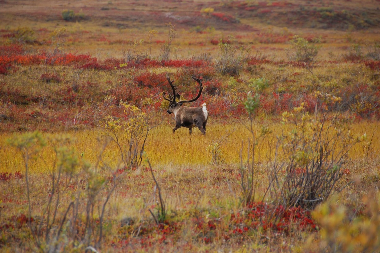
Here's another sign of fall, maybe even winter! This comes from Gates of the Arctic National Park and Preserve, where caribou have been spotted heading south for winter!
See more HERE:
Major Flooding
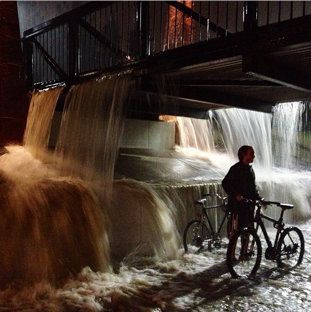
Significant rainfall and major flooding took place late Wednesday night into Thursday. Rainfall reports of up to 8"+ came in over a short amount of time with other reports of 15ft. to 20ft. walls of water roaring down canyons. The image below is from instagram user @brandish in Boulder, CO, where significant flooding took place.
Significant Rainfall Reports
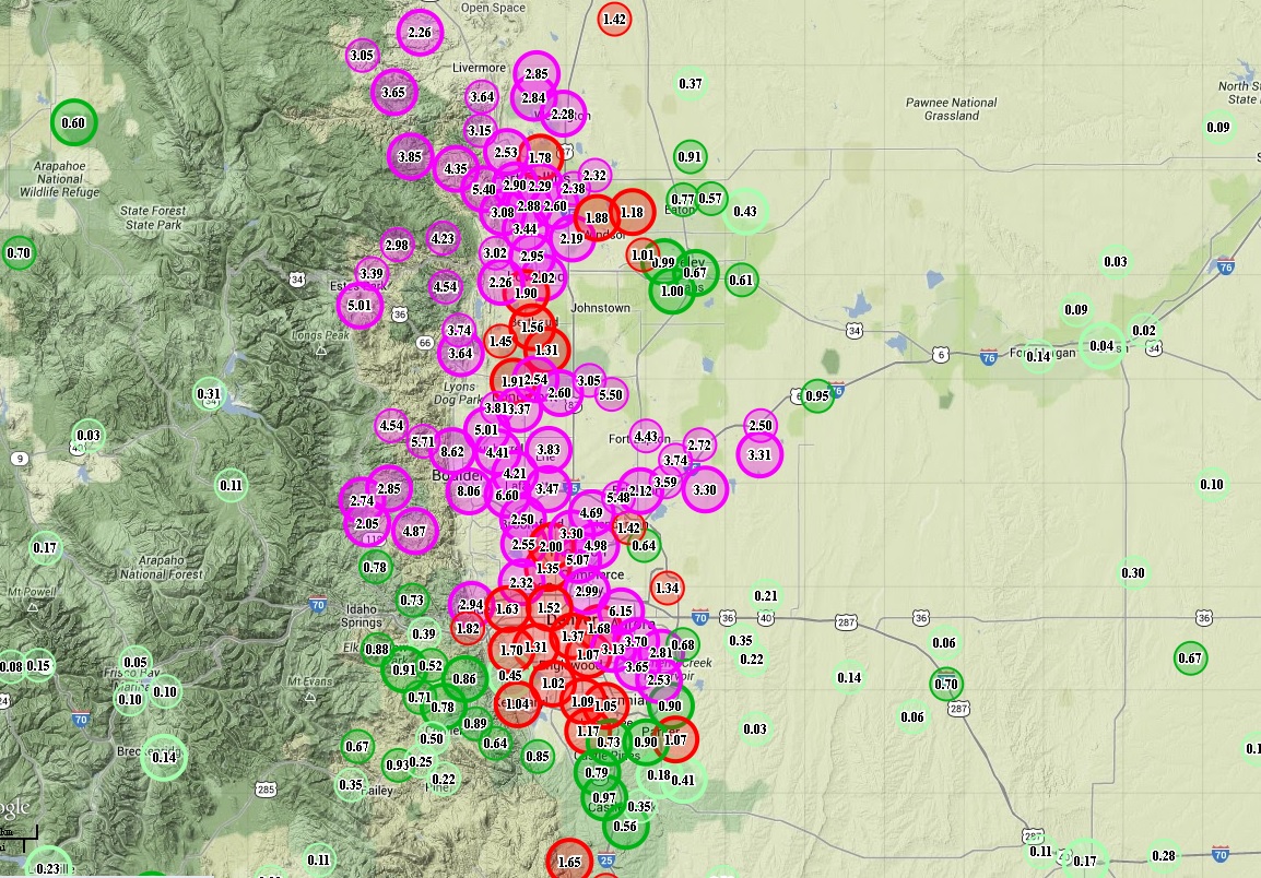
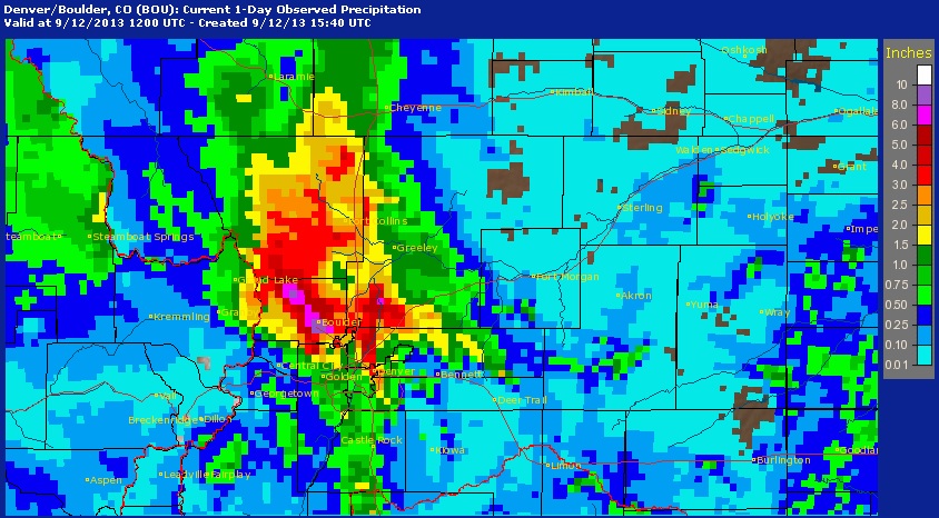
The NWS has an amazing network of CoCoRaHS reporters across the nation and several of those users reported significant rainfall from PM Wednesday to AM Thursday along the Front Range of the Rockies near Denver and Boulder, CO. The pink/purple circles indicate the more significant amount, wich near 8"+ in a few spots!
Read more about CoCoRaHS HERE:
Even the radar estimated rainfall suggests 4" to 8"+ across parts of northcentral Colorado! Note the deep red color over Boulder, where nearly 8" to 9" of rain was reported.
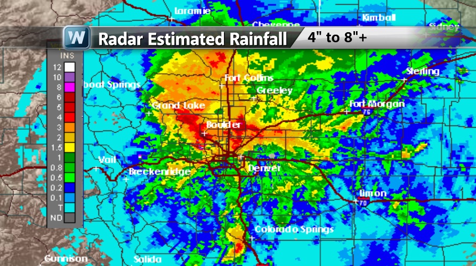
"A flash flood emergency Colorado killed at least three people, prompted evacuations and destroyed several roads and highways."
Read more on the flooding from 9 NEWS out of Denver, CO HERE:
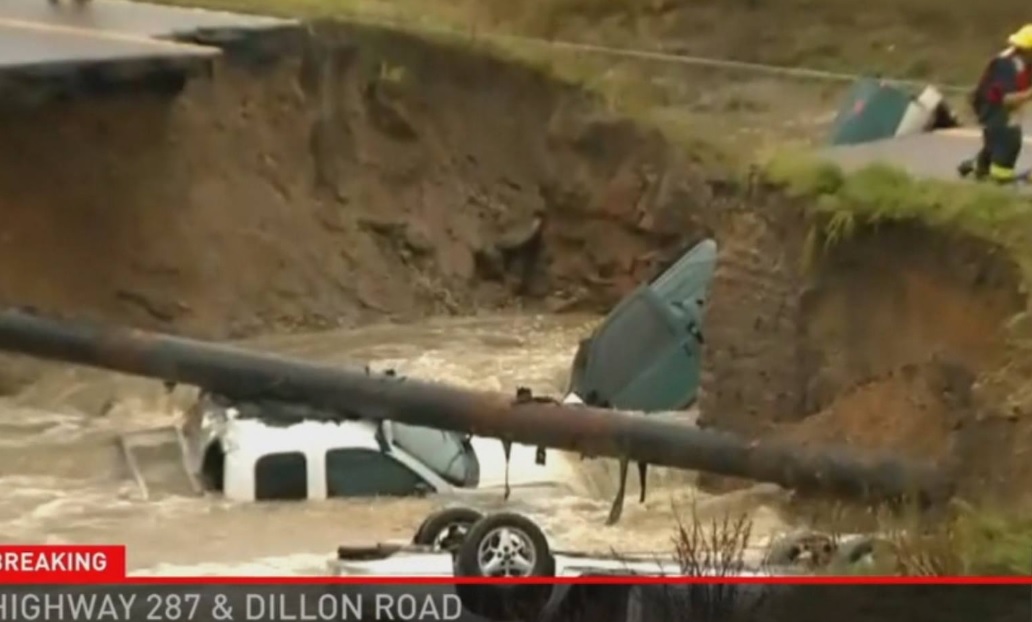
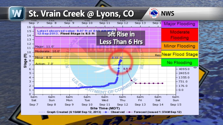
Example of Rapidly Rising Flood Waters
This is just one example of why flash flooding can be so deadly. Take a look at the river rise at the St. Vrain Creek at Lyons, CO. In less than 6 hours, there was nearly a 5 foot jump in water levels.
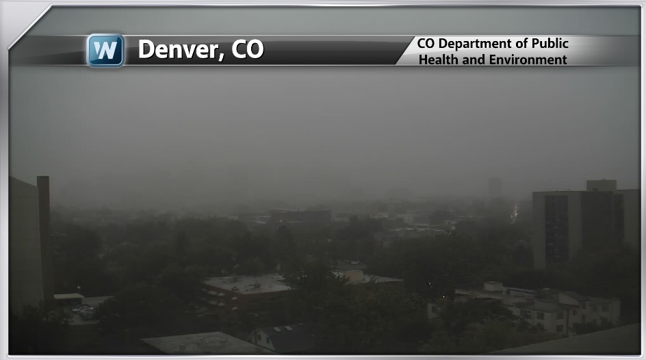
Denver Webcam
Denver didn't see quite as much rain as folks north and west of town, but low visibility made for an interesting day there.
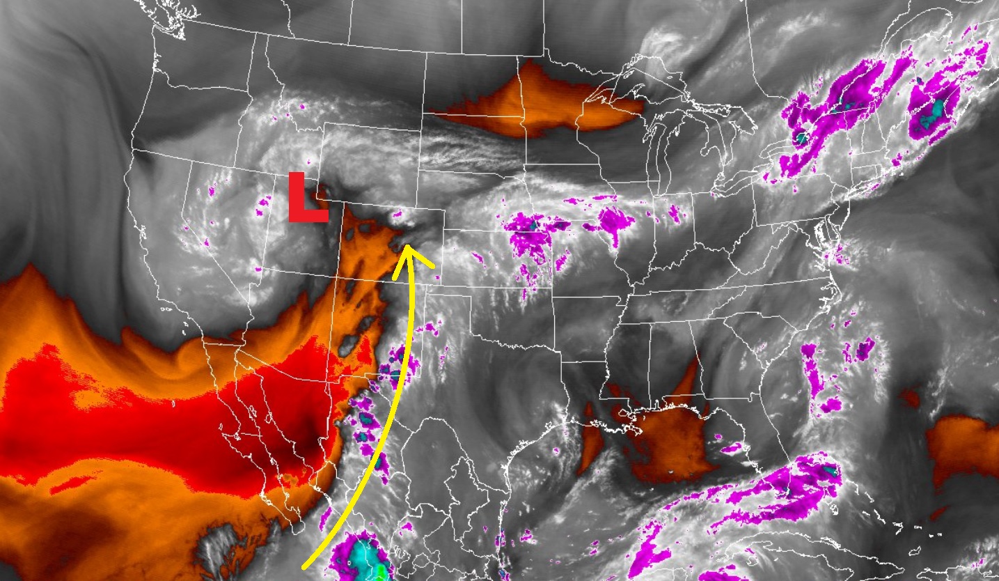
Why Such Heavy Rain?
Take a look at the water vapor imagery below from Thursday. Thanks to a slow moving upper level low pressure system over the Southwest, tropical moisture has been streaming up along its eastern periphery. The training thunderstorm activity, unfortunately, is responsible for the significant flooding reports.
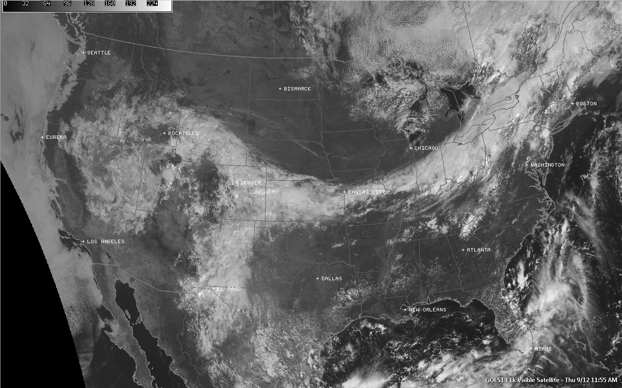
Here's another satellite image of the storm below. Interestingly, two storms appear to be connected. The storm in the Southwest was squeezing out significant rains along the Front Range, while strong to severe thunderstorms were breaking out in the Northeast.
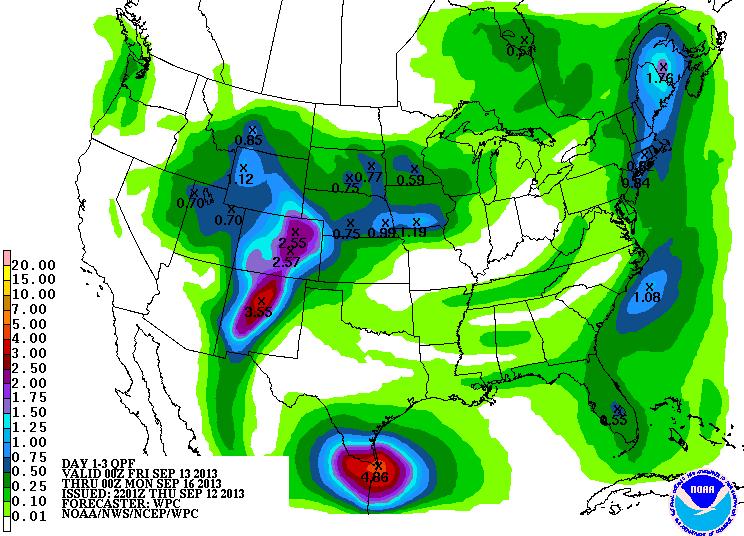
Additional Rainfall
There's more heavy rain on the way for folks along the Front Range of the Rockies. According to NOAA's HPC 3 day rainfall forecast, an additional 1" to 3"+ can be expected through PM Sunday.
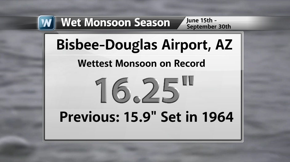
Monsoon Season Continues...
Pockets of heavy rainfall aren't all that uncommon during monsoon season, but this year, it is record breaking for the Bisbee-Douglas area in southeastern Arizona. 16.25" of rain has fallen so far this monsoon (June 15 - September 30) and we're not even done yet! The previous record was 15.9" set in 1964.
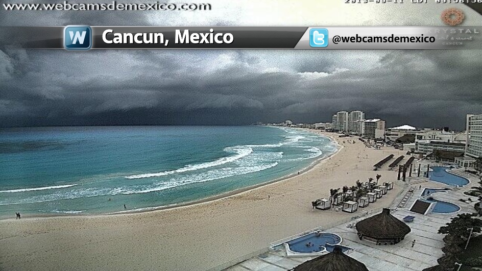
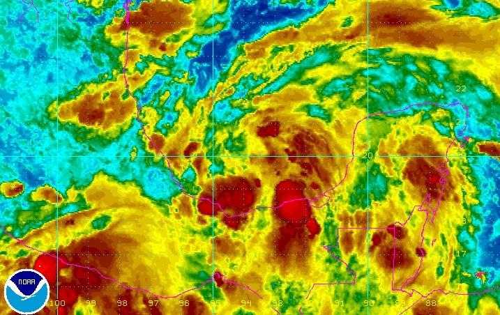
Watching the Tropics
Our 1st hurricane of the 2013 Atlantic hurricane season developed earlier this week and was only 3 hours short of becoming the latest 1st hurricane on record. Humberto will be a "Fish Storm" meaning it'll only be an issue for ships and slow moving whales, but there's another wave near the Yucatan Peninsula, which could become a little more interesting over the next several days in the Gulf of Mexico/Bay of Campeche.
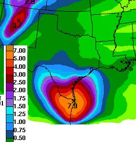
Texas Rainfall
One thing that this storm may bring is healthy rainfall to southern Texas. Extended rainfall forecasts suggest appreciative rainfall amounts possible through early next week. We'll cross our fingers that some of this beneficial rainfall moves in!
Thanks for checking in and have a great weekend ahead!
Don't forget to follow me on Twitter @TNelsonWNTV