Atlantic Hurricane Forecast
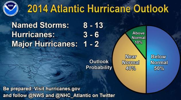
NOAA Predicts Near-Normal or Below-Normal 2014 Hurricane Season. A big factor to consider is El Nino, which usually increases wind shear over the tropics, reducing the potential for tropical development somewhat. Then again, all it takes is one. Here's an excerpt of Thursday's official NOAA NHC hurricane prediction for the upcoming season: "...The main driver of this year’s outlook is the anticipated development of El Niño this summer. El Niño causes stronger wind shear, which reduces the number and intensity of tropical storms and hurricanes. El Niño can also strengthen the trade winds and increase the atmospheric stability across the tropical Atlantic, making it more difficult for cloud systems coming off of Africa to intensify into tropical storms. The outlook calls for a 50 percent chance of a below-normal season, a 40 percent chance of a near-normal season, and only a 10 percent chance of an above-normal season. For the six-month hurricane season, which begins June 1, NOAA predicts a 70 percent likelihood of 8 to 13 named storms (winds of 39 mph or higher), of which 3 to 6 could become hurricanes (winds of 74 mph or higher), including 1 to 2 major hurricanes (Category 3, 4 or 5; winds of 111 mph or higher)..."
* The Orlando Sentinel reminds us that it's not the sheer number of hurricanes and tropical storms that matter - but where they go, and how intense they become before landfall.
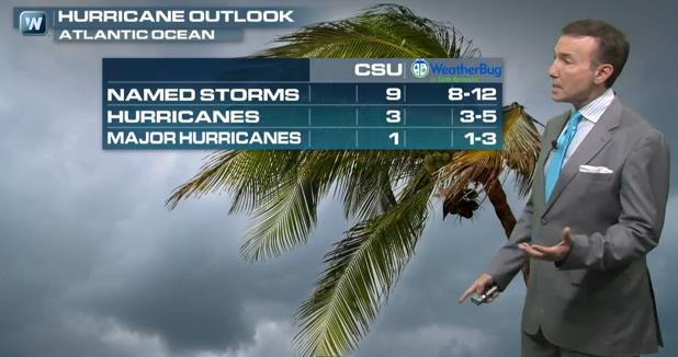
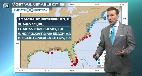
More Background on NOAA's 2014 Hurricane Outlook. El Nino is a factor in this year's prediction of fewer hurricanes, along with cooler water in the Atlantic. But there is lingering concern about complacency. All it takes is one hurricane, coming at the wrong time and place, to cause serious problems. In today's Climate Matters segments we look at the Hurricane Outlook from NOAA, Colorado State and WeatherBug, and how rising seas and land subsidence are leaving some metro areas more vulnerable to tropical storm surge flooding than others.
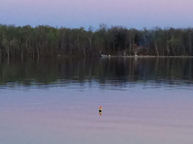
GONE FISHING
Sorry for such a short blog today... but I'm busy fishing!!
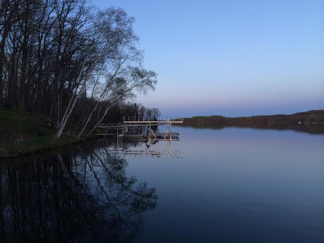
Thanks for checking in and have a great holiday weekend! Don't forget to follow me on Twitter @TNelsonWNTV