Saturday Sunset
Can't complain about the sunset last
night... really was something to marvel at. Had a chance to chat with a
couple enjoying the weather on the outdoor patio of a local restaraunt;
good conversation. Somebody mentioned that it was a little hot or almost
too humid, but I said I'd take this over 30 below wind chill ANY day!
Summers are short, enjoy them!

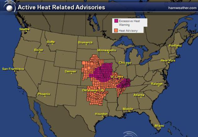
Extreme Heat Continues
The National Weather Service continues
excessive heat headlines for many locations in the central part of the
country. In some locations, afternoon heat index values could top out
around 110F... YIKES!
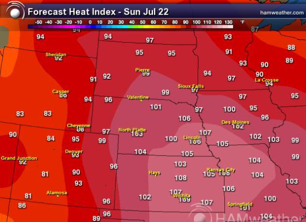
Afternoon Heat Index
Maximum heat index values on Sunday in the central part of the country are listed below...
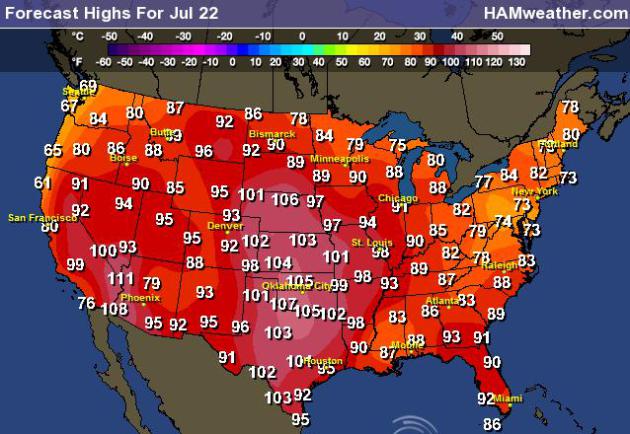
High Temperature Forecast for Sunday
Actual air temperatures on Sunday will be in the 90s and 100s once again with some nearing record highs.
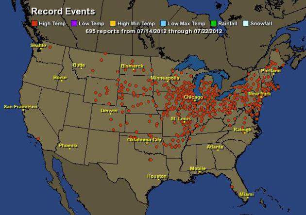
Record Highs Continue to Fall
According to Hamweather.com there have been nearly 700 record high temperatures either tied or broken.
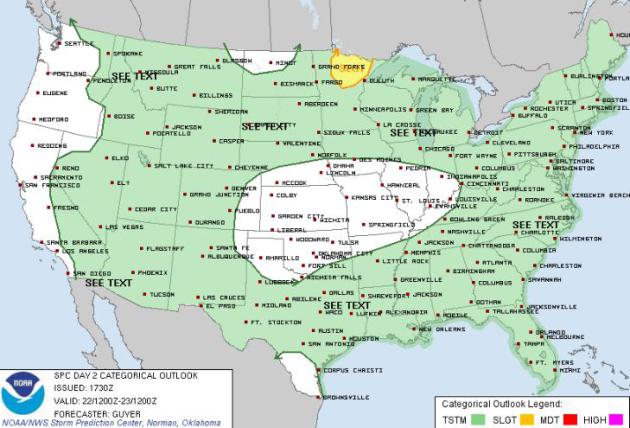
Sunday Storm Threat
The Storm Prediction Center has a SLIGHT RISK of severe weather across far northern Minnesota of Sunday.
However, showers and isolated thunderstorms will continue to rotate
around the center of extreme heat, so areas shaded in green will have a
slight chance at seeing a few strong thunderstorms during the day
Sunday.
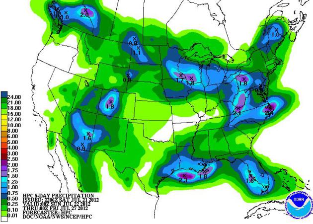
5 Day Rainfall Forecast
NOAAs
HPC 5 day rainfall forecast shows several pockets of heavy rainfall,
but still mostly dry in drought stricken areas of the mid-section of the
country.
Thanks for checking in, have a great rest of your weekend!
Don't forget to follow me on Twitter @TNelsonWNTV