Twin Cities Superstorm of 1987: 25 Years Later
"25 years ago, the largest flash
flood in Twin Cities history began on July 23, and ended during the
early morning hours of July 24. Known locally as the “Superstorm”, the
storm caused damage to 9,000 homes and killed two people. Value of
the damage was estimated at $27 million. This storm was voted the eighth most significant weather event in the state of Minnesota during the 20th century."
(Flooded Interstate 494 at East Bush Lake Road in Bloomington. Photo courtesy of KARE11)

More Superstorm Coverage
Take a look at some of the coverage of the massive flooding from KARE 11 and WCCO.
Thanks to Tom Oszman for sending these links over:
Super Storm Coverage
KARE-TV Sunrise (with Paul Douglas)
http://tcmedianow.com/video/
KARE-TV Evening Coverage (with Paul Douglas)
http://tcmedianow.com/video/
WCCO's Debbie Ely in standing flood water night of the storm
http://tcmedianow.com/video/
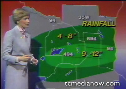
(Rainfall totals - KARE News11 Sunrise from July 24, 1987)
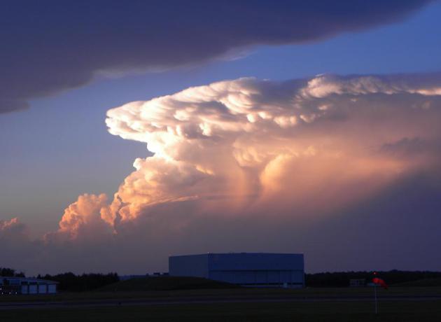
Summer Thunder
Thanks to my good friend, Rich Koivisto,
from Duluth, MN for the picture below. Spotty showers and thunderstorms
have been bubbling up on the northern periphery of the extreme heat
setting up to the south. We'll have a few more of these storms across
the region this week and the core of the extreme heat continues to our
south.
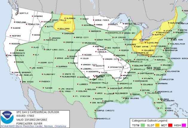
Severe Thunderstorm Threat
The Storm Prediction Center has issued a
SLIGHT RISK of severe weather in a couple of locations shaded in yellow
for Monday. Hail and high winds would be the primary threat for any of
the more vigorous storms that would develop.
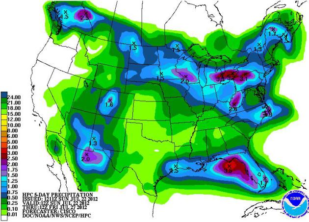
5 Day Rainfall Forecast
NOAAs HPC 5 day rainfall forecast shows
pockets of heavy rainfall potential around the extreme heat in the
central part of the country. It still apears that heavy rainfall is not
expected in the drought stricken areas of the middle part of the country
where drought conditions will likely continue to worsen.
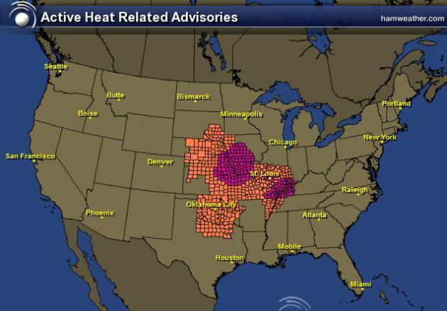
Heat Headlines
Excessive Heat Warnings and Heat
Advisories continue once again for a large chunk of the middle part of
the country where heat index values will top the century mark. In fact,
afternoon heat index values could be as high as 110F!
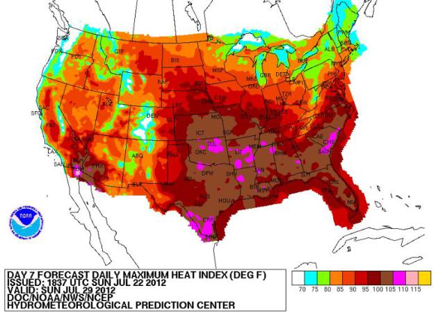
Subsiding Heat?
NOAAs HPC maximum heat index for next
Sunday shows a slight reprieve from the heat, mainly across the Great
Lakes region. The excessive heat with afternoon heat index values
approaching 110F look to be sagging south just a bit.
Hot Weather to Continue
US forecast: Hot, dry weather to linger into fall
WASHINGTON (AP) — The unusually hot dry weather that has gripped the nation will not let up its stranglehold over the next few months, federal weather forecasters said Thursday.And that means the heartland's "flash drought" will linger at least until around Halloween and even spread a bit farther north and east.
The National Oceanic and Atmospheric Administration's outlook for August through October shows that nearly every state likely will have hotter than normal temperatures. Much of the Midwest is likely to be drier than normal, too."

Thanks for checking in, have a great week ahead!
Don't forget to follow me on Twitter @TNelsonWNTV