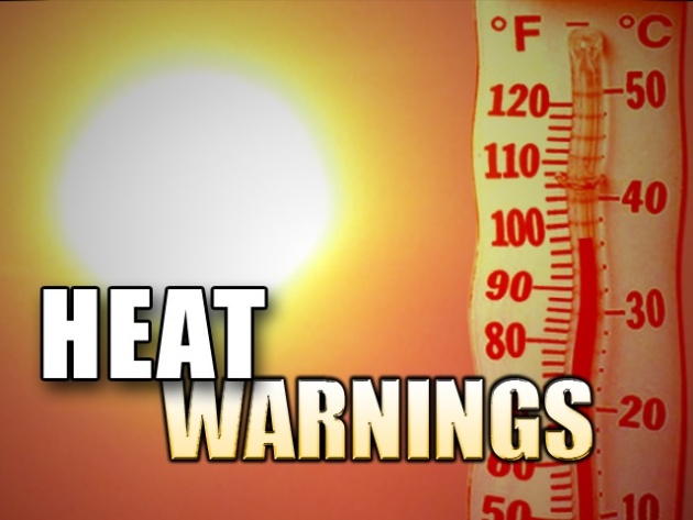
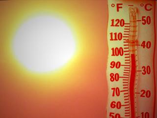
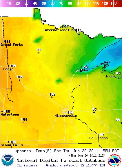
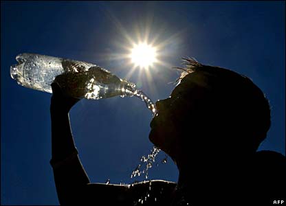
95 yesterday in the Twin Cities, Heat Index as high as 108
98: predicted high today from the Twin Cities metro area to Chicago, some thermometers may brush 100 before winds shift to the west/northwest by evening and temperatures start to fall. Heat index by early afternoon: 105-110.
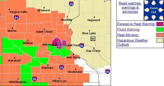
Excessive Heat Warning in effect from the Twin Cities southward to Missouri today.
124 Degree Heat Index: Atlantic, Iowa Thursday afternoon. 99 degree temperature + 82 degree dew point = 124 H.I.
Soaking rains again across Florida: some 1-2" rainfall amounts possible, helping to ease the drought.
Seattle: 296th day/row without seeing an 80-degree high. All-time record is 313 days.
"...The damage this spring broke records. Last week, a report from Aon Benfield, a re-insurance company, estimated $21 or $22 billion in damage from severe weather so far this year...The damage total reported by Aon does not include damage from flooding, drought and wildfire. " - article on losses suffered due to extreme weather in 2011, details below.
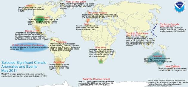
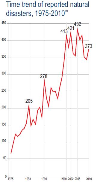
2010: 874 weather and climate-related disasters resulted in 68,000 deaths and $99 billion in damages worldwide. (Pew Center White Paper, details below).
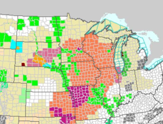
Blazing Saddles. A Heat Advisory is in effect for much of central/southern Minnesota, almost all of Wisconsin, southward to Missouri, where Excessive Heat Warnings are posted (purple counties). An Excessive Heat Warning is also posted for Hennepin and Ramsey county, where the "urban heat island" (more asphalt/industry) will boost temperatures by another 5+ degrees. The NOAA watch/warning map for the USA is here.
Dangerously Hot On Thursday in the Twin Cities. Data below from the local Twin Cities NWS office:
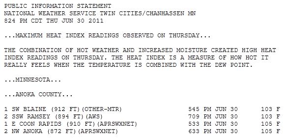
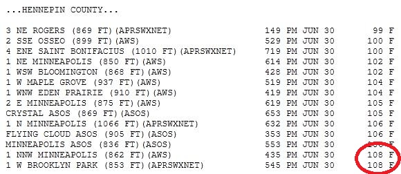
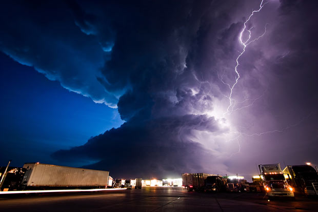
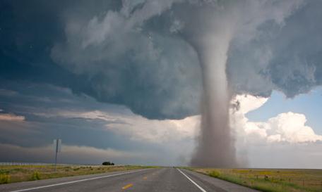
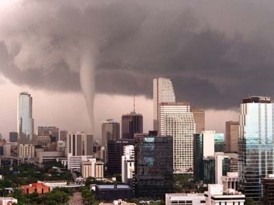
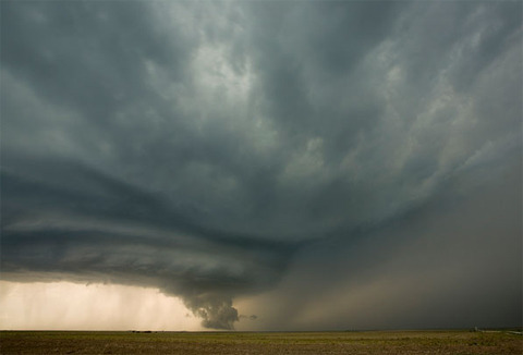
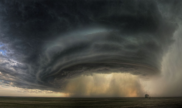
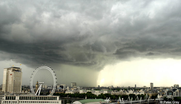
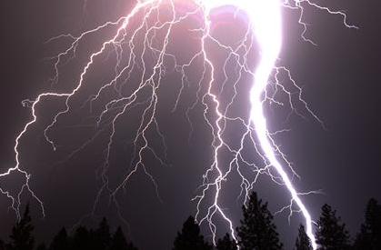
Photo Of The Day. This may be one of the most spectacular photos I've ever seen, in this case a tornadic supercell approaching a truck stop in Nebraska. Details from The Telegraph: "A stormchaser has turned his hobby into a job, driving tens of thousands of miles every year to take spectacular photographs of extreme weather. Mike Hollingshead jumps in his car and races after storm warnings in the hope of capturing shots of tornadoes. He follows about 40 storms each year, clocking up around 20,000 miles. June 17, 2009. Mike says, "this photograph was taken at the end of the day after seeing 3 tornadoes from the storm. The supercell is moving towards the York, Nebraska truck stop." Remarkable.
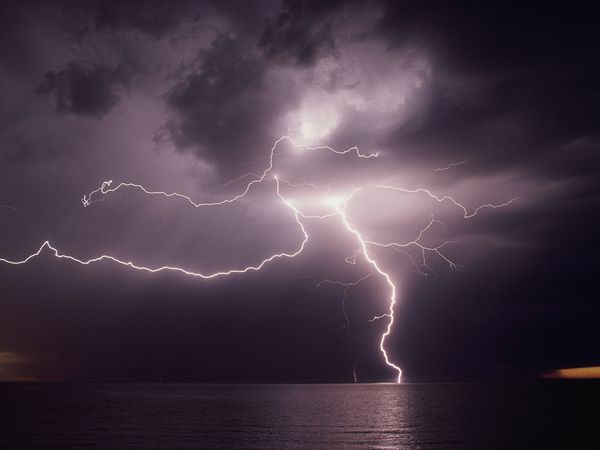
Arrival Of Cooler Air May Set Off A Few Severe Storms...
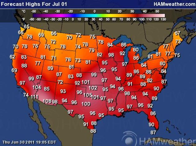
Friday Highs. Much of America will sizzle today, highs topping 100 in as many as 10 states. Predicted highs range from 98 in the Twin Cities to 97 in Chicago, close to 100 at Kansas City, low 100s in Oklahoma City and Dallas. Seattle will experience the 295th day in a row without seeing 80 degrees. The all-time record is 313 days. Map courtesy of Ham Weather, a division of WeatherNation.
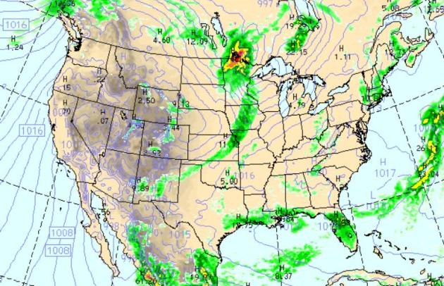
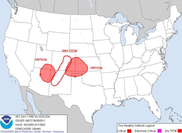
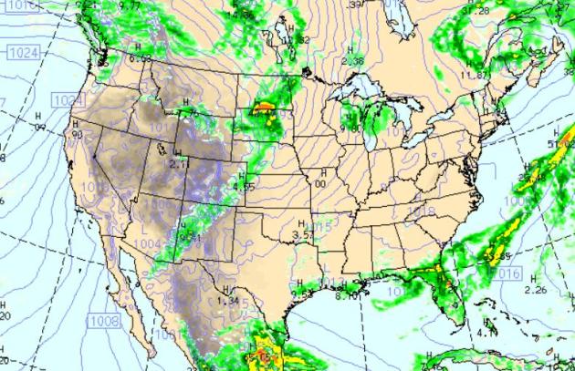
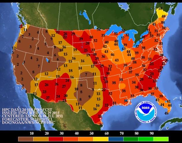
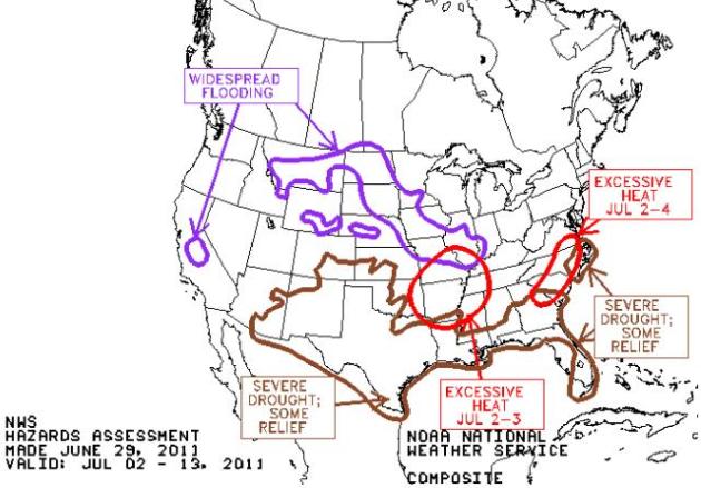
Friday Precipitation Outlook. The latest NAM/WRF model predicts strong/severe storms from Minnesota southward to Missouri, along the leading edge of cooler, drier, more comfortable Canadian air. More heavy T-storms will help to ease the drought across Florida, a few spotty showers over interior New England and along the Gulf Coast. The west looks dry, still cool over the Pacific Northwest, seasonably warm for the southwestern USA. Map above valid at 7 pm, showing expected precipitation for the previous 6 hours.
...RECORD NUMBER OF DAYS WITH TEMPERATURES 90 DEGREES OR GREATER IN
JUNE SET AT FORT SMITH AND TULSA...
TEMPERATURES AT TULSA OK AND FORT SMITH AR EXCEEDED 90 DEGREES
AGAIN TODAY...SETTING NEW RECORDS FOR THE GREATEST NUMBER OF DAYS
WITH TEMPERATURES AT OR ABOVE 90 DEGREES FAHRENHEIT IN THE MONTH
OF JUNE.
FORT SMITH ARKANSAS...SET NEW RECORD
RANK NUMBER OF DAYS YEAR
1 30 2011
2 29 1953
3 28 1914
4 27 2010...1952
5 26 1934...1925...1911
RECORDS BEGAN IN 1882
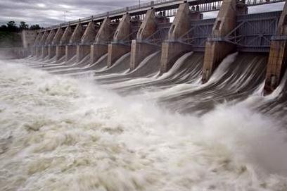
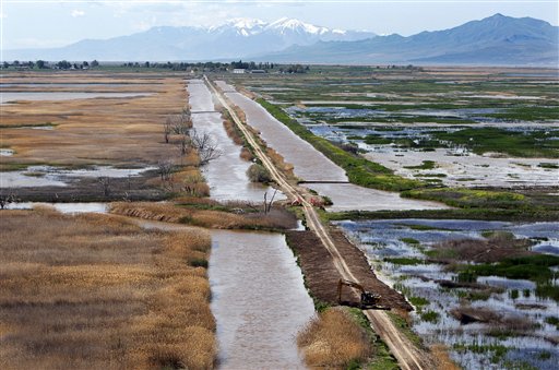
Nuke Query: What If Dam Breaks? A chilling throught, with a low probability of taking place, but omaha.com has a look at what a massive failure of dams located upstream of Omaha might mean for the nuclear power plants on the Missouri River: "The Nuclear Regulatory Commission is asking for an explanation of the flooding that would occur should a dam break upstream of two Nebraska nuclear plants it monitors. Combined, the six U.S. Army Corps of Engineers dams on the flood-swollen Missouri River comprise one of the largest reservoir systems in the country. The dams are releasing historic amounts of water during what will be a summer of managed flooding in the Missouri River valley. On Wednesday, the NRC regional office that oversees Nebraska sent an official request to the corps for its 2009 and 2010 analyses of what would happen if a dam fails. Fort Calhoun Nuclear Station, 19 miles north of Omaha, has been taken offline because of the flooding. The river surrounds the plant to a depth of about two feet. About 70 miles south of Omaha, Cooper Nuclear Station remains online. On Thursday, the river was about three feet below the level that would require the plant to shut down. Anton Vegel, director of the division of reactor safety for the Arlington, Tex., office of the Nuclear Regulatory Commission made the request to Col. Robert J. Ruch, commander of the Omaha District of the corps. The Omaha district oversees the dams. The dams themselves have had some issues, according to the corps, but nothing that affects their integrity, said John Bertino, head of dam safety for the Omaha district. While the amount of water being released from them is a record, the amount of water being held behind the is not, he said."
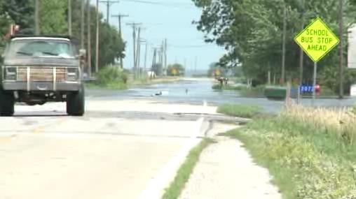
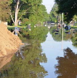
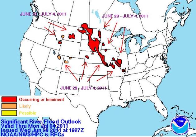
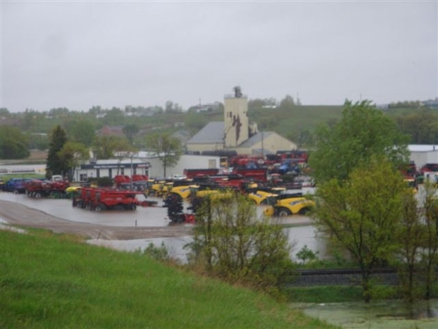
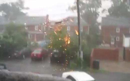
Flood Evacuation In Percival, Iowa After Levee Breach. Here is raw footage of the evacuation from WHO-TV in Des Moines.
* "Taking shelter at home. An essential part of tornado safety is knowing where to go when it's time to take shelter. If your home has a basement, you should go down into it. If possible, go under a sturdy table and/or cover yourself with something that will protect you from falling debris, such as a mattress or a sleeping bag. Think about where heavy objects are on the floor above you and do not position yourself under them. If your home does not have a basement, go to a small, windowless room or a stairwell positioned in the center of the ground floor of your house. Cover yourself with a mattress or other protection from falling debris and crouch as low to the floor as possible, covering your head with your hands.
* Taking shelter on the road. Driving during a tornado is dangerous, but if you are on the road when the warning is issued or a storm is sighted, it's important to know what to do. Whenever possible, pull over safely and seek shelter in a sturdy building. If there are no buildings around, pull over to the side of the road and go to low ground well away from vehicles. Lie flat, face down and protect your head with your arms. Avoid seeking shelter under bridges, which can cause traffic hazards."
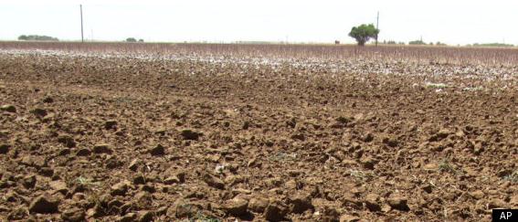
“We are currently ranked as the third-worst drought on record in Texas. But each passing day moves us closer to the number one year. It is a true calamity. The impact is heartbreaking,” says Staples. “We’ve had over two million acres of dry land cotton being declared 100% abandoned. We have livestock producers that are liquidating their herds, something they’ve spent their entire lifetime building up. It’s just a dreadful set of circumstances.”
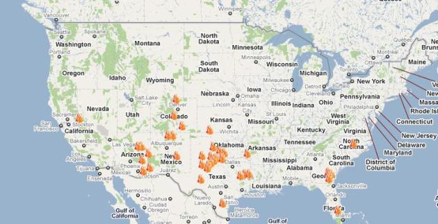
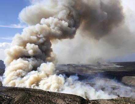
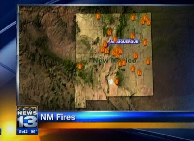
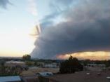
Airplane Deployed To Monitor Air Over New Mexico Fire. The concern is radioactive materials being stored at the Los Alamos Nuclear Lab, but so far there are no indications that any of these 55 gallon drums have been compromised by the wildfire. USA Today has the latest: "LOS ALAMOS, N.M. (AP) — The government sent a plane equipped with radiation monitors over the Los Alamos nuclear laboratory Wednesday as a 125-square-mile wildfire burned at its doorstep, putting thousands of scientific experiments on hold for days. Lab authorities described the monitoring as a precaution, and they, along with outside experts on nuclear engineering, expressed confidence that the blaze would not scatter radioactive material, as some in surrounding communities feared. "Our facilities, our nuclear materials are all safe, they're accounted for and they're protected," said lab director Charles McMillan. After firefighters spent Wednesday setting fires to create a burned out area west and south of the lab, Los Alamos County Fire Chief Doug Tucker said he is confident that the fire won't spread onto the facility. "It's looking real good right now," Tucker said Wednesday night. "By having that buffer I'm pretty confident that we'd be able to stop any spot fires from coming into the lab." A 10-mile fire line along a highway has held since Monday, save for a one acre spot fire that started on lab grounds that was quickly extinguished."
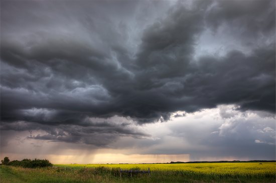
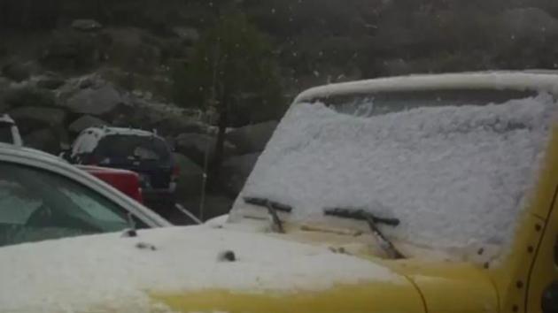
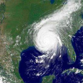
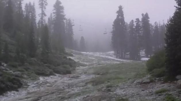
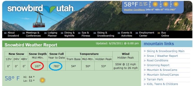
Freakish Weather Out West...
Airplanes Found To Trigger Rain, Snow. An intriguing story from CBS News and AP: "WASHINGTON - Airplanes flying through super-cooled clouds around airports can cause condensation that results in more snow and rain nearby, according to a new study. The correct conditions for this inadvertent weather modification occur about 5 percent of the time - but 10-to-15 percent in winter - according to Andrew J. Heymsfield of the National Center for Atmospheric Research in Boulder, Colo., lead author of the study appearing in Friday's edition of the journal Science. Aircraft take off into the wind, he noted, so if they are generating extra ice particles upwind of an airport, the result can be snow right on the airport. That might mean planes will require more de-icing, he said, though other researchers weren't so sure. The team was investigating holes or canals that are sometimes seen drilled in clouds after an airplane has passed through. Studying six commercial airports, they found that increased snow and rainfall occurs in areas where the unusual cloud holes appear, usually within 60 miles (100 kilometers) of the airport. Places farther away from an airport are more likely to be at higher altitudes, above the clouds. The added rain or snowfall occurred when conditions in the clouds were super-cooled. That means the clouds were made up of water droplets that were colder than freezing, but which had not yet frozen. Water in the atmosphere can remain liquid at temperatures below freezing if it doesn't have any type of nucleus to freeze onto, such as bits of dust or salt. It will freeze without a nucleus when it gets very cold, however - about minus 40 degrees(minus 15 Celsius). It turns out, when an airplane passes through one of these clouds the movement of air around the tips of the propeller, or over the wings of a jet, causes a sudden cooling of the air, sometimes down to the critical point where the droplets freeze. They then can fall to earth as snow or rain, depending on whether or not the air is warm enough to melt them on the way down."


Climate Stories...
Extreme Weather And Climate Change: Understanding The Link, Managing The Risk. Here is the Pew Center White Paper, written by Dan Huber and Jay Gulledge: "Munich Re, the world’s largest reinsurance company, began compiling global disaster data in 1980. In that data set, 2010 had the second-largest (after 2007) number of recorded natural disasters and the fifth-greatest economic losses.4 Although there were far more deaths from geological disasters—almost entirely from the Haiti earthquake—more than 90 percent of all disasters and 65 percent of associated economic damages were weather and climate related (i.e. high winds, flooding, heavy snowfall, heat waves, droughts, wildfires). In all, 874 weather and climate-related disasters resulted in 68,000 deaths and $99 billion in damages worldwide. The fact that 2010 was one of the warmest years on record as well as one of the most disastrous, begs the question: Is global warming causing more extreme weather? The short and simple answer is yes, at least for heat waves and heavy precipitation.5 But much of the public discussion of this relationship obscures the link behind a misplaced focus on causation of individual weather events. The questions we ask of science are critical: When we ask whether climate change “caused” a particular event, we pose a fundamentally unanswerable question (see box). This fallacy assures that we will often fail to draw connections between individual weather events and climate change, leading us to disregard the real risks of more extreme weather due to global warming."
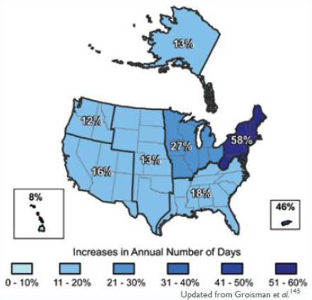
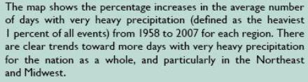
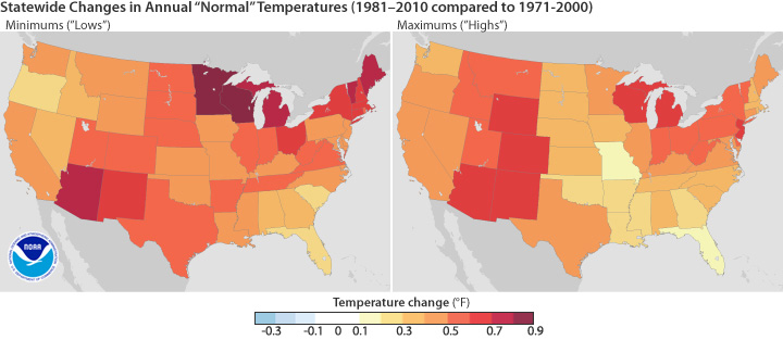
Increases In The Number Of Days With Very Heavy Precipitation: 1958-2007. From the Pew Center White Paper referenced above:


