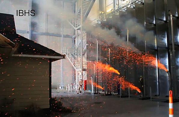
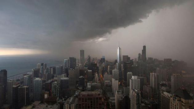
Orange Cone Alert
All this road construction almost makes me look forward to winter.
Almost.
I
know - our highways don't repair themselves. MnDOT crews have a job to
do, and they do it very well. Yesterday a quick 15 minute drive turned
into an epic, 2-hour scavenger hunt. At least the sun was out.
When
it comes to all things atmospheric I take NOTHING for granted. On
September 24, 1985 half an inch of snow cheered up Twin Cities
residents. Nearly 2 inches fell on September 26, 1942. No, I don't take
70s and low 80s in late September for granted.
NOAA's Climate
Prediction Center is forecasting a milder than average October for
Minnesota and much of the USA. Spring was chilly, snowy and wet - maybe
autumn will balance things out.
I don't see any frost risk for the Twin Cities metro looking out thru October 10.
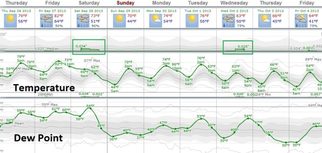
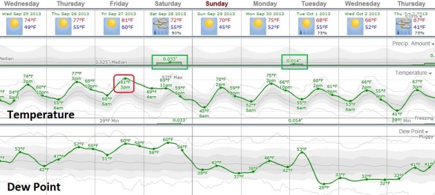
Temperatures
warm into Friday (low 80s!) before an eastbound cool front sparks
showers and T-storms on Saturday. Have a Plan B. Skies clear Sunday with
highs in the upper 60s, closer to average.
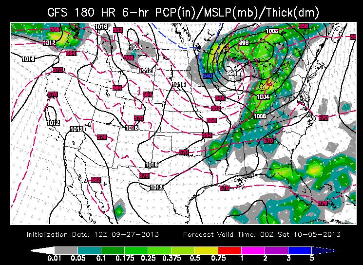
The same tropical
swirl responsible for flooding rains over Florida may spin up into a
formidable Nor'easter, soaking New England early next week.
While we enjoy the best week of autumn.
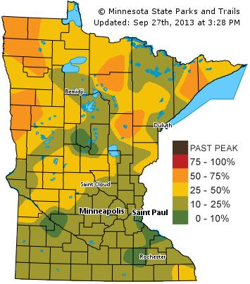
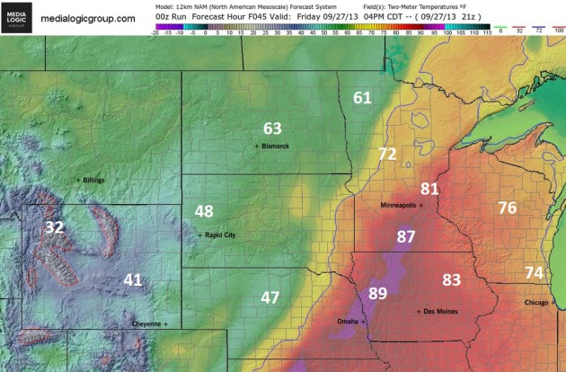
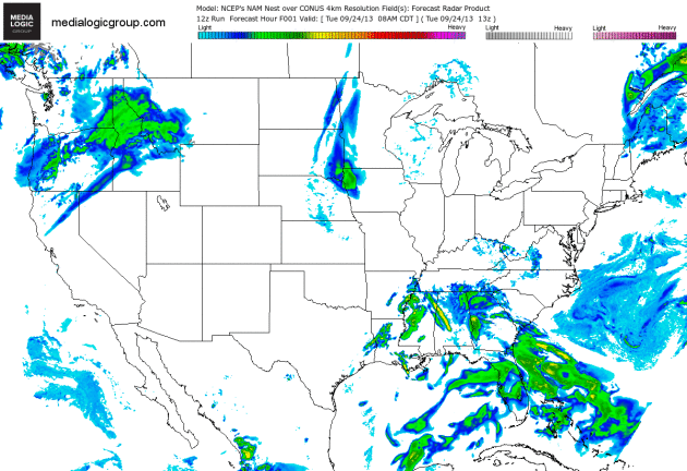
Shades Of Summer.
NAM predicted highs nudge 80F in the Twin Cities, maybe some mid to
upper 80s over southern Minnesota, while temperatures hold in the 50s
and 60s north and west of Alexandria and Brainerd. Not bad for late
September. Map above: Ham Weather.
Mild Bias Continues.
80F or beyond Friday, a few more 70s the first half of next week? Not
too shabby considering the sun is as high in the sky as it was in
mid-March. ECMWF guidance shows only a small chance of (light) showers
Saturday, again early Tuesday.
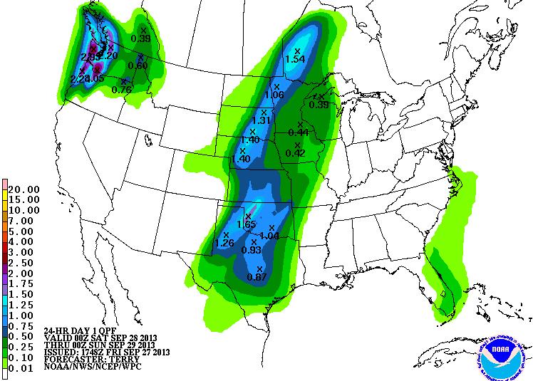
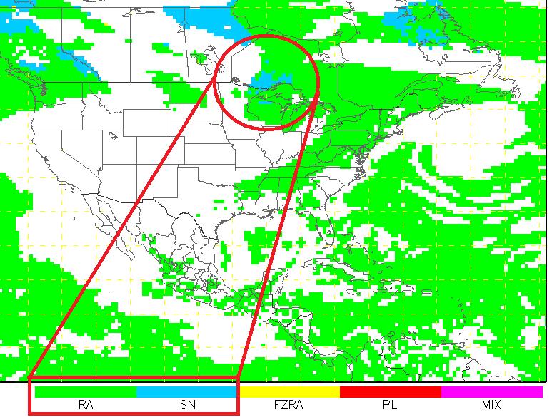
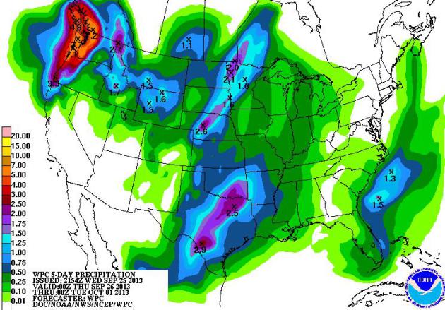
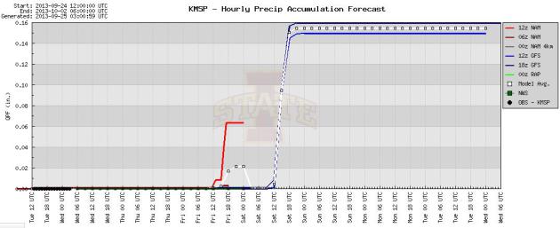
When In A Drought - Don't Predict Rain.
Latest models show only light showers, possibly less than .10 or .20"
rain late Friday into Saturday as a (slightly) cooler front approaches.
Graphic: Iowa State.
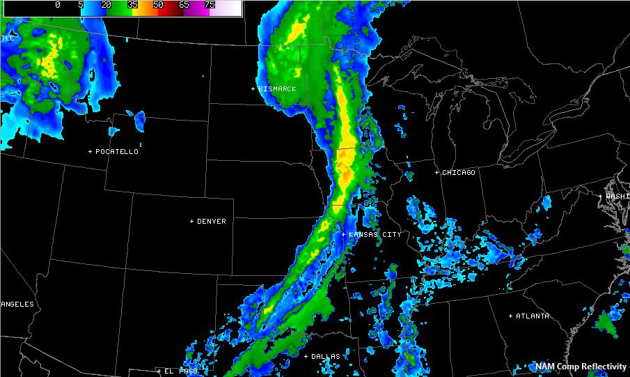
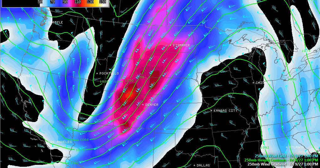
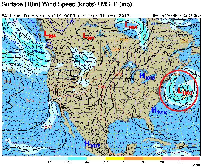
NAM Solution.
The 84-hour NAM shows a potentially significant storm brewing over the
Southeast, while showers and T-storms push across the northern Rockies -
most of the USA dry into Friday. Animation: Ham Weather.
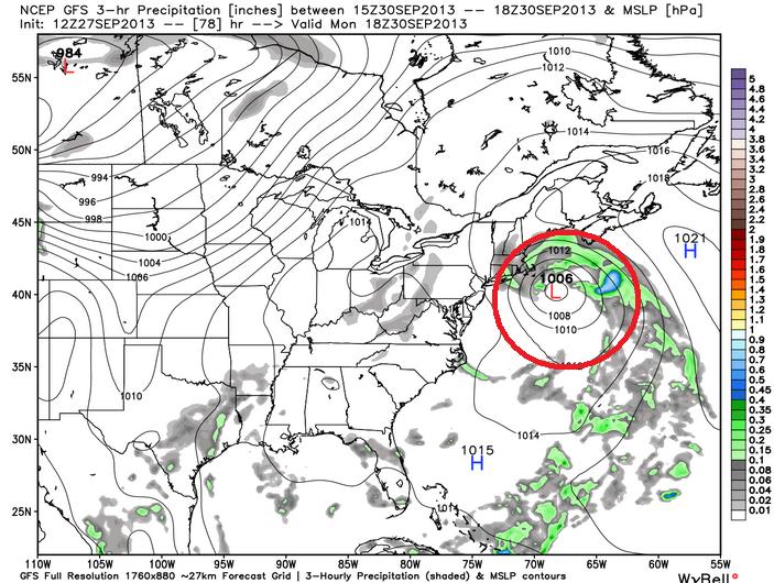
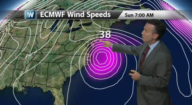
Another "Hybrid" Nor'Easter?
It's still early, but the same model that gave us an 8 day jump on
"Sandy" last October is suggesting a robust East Coast storm early next
week, possibly a mash-up of extra-tropical low pressure system and
tropical storm, spiked with extra levels of moisture. Florida has seen
soaking rains, and this tropical-depression-like system may mutate into
something more as it hooks toward New England late Sunday and Monday.
More details in today's edition of
Climate Matters: "
WeatherNationTV
Chief Meteorologist Paul Douglas shows what some of the models are
hinting at for the northeast. Nothing as bad as Sandy, but it is looking
like a "hybrid storm" that we are beginning to see."
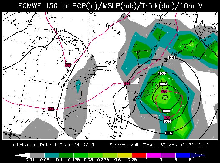
Significant Coastal Storm?
Here is the ECMWF solution, valid midday Monday, showing a deep area of
low pressure capable of some level of coastal flooding and potential
beach erosion - heaviest rains from Long Island into coastal New
England. We'll see. Graphic: WSI.
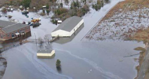
Nebraska Is Diverting Flood Water From Colorado. Details from
KWGN-TV; here's the intro: "
The
Nebraska Department of Natural Resources, local natural resources
districts, and irrigation districts in the Platte River Basin have taken
steps to divert floodwaters out of the river as they moved into
Nebraska from Colorado. These efforts consisted of developing agreements
and coordinating the timing of the diversions of this flow in an
attempt to attenuate the peak flood flows. The diversion of these
floodwaters will have the added benefit of recharging the aquifer as
these waters seep into the ground beneath the canals and lakes along the
South Platte, North Platte, and Platte Rivers..."
Flood Insurance: Costs Rising, Claims "Confusing".
Many Americans are discovering, for the first time, that they now live
in a flood zone. An apparent uptick in historic, 1 in 500 and 1 in 1,000
year floods is causing many to reexamine their coverage.
CNBC has the story - here's a clip: "
More homes and businesses In the U.S. are feeling the devastating impact of flooding, as was dramatically demonstrated in Colorado. But most households remain without flood insurance—and obtaining it may become more difficult. Only 18 percent of Americans have any kind of flood insurance coverage.
For those who might want it, the price is about to go up. That's
because subsidies to policyholders for the federal government's flood
insurance program—the National Flood Insurance Program, which is nearly the sole provider of flood insurance—are to end Oct. 1..." (Image above: NOAA).
* Record June flooding in Alberta, Canada damage toll reaches $6 billion (Canadian). Details from
Bloomberg.
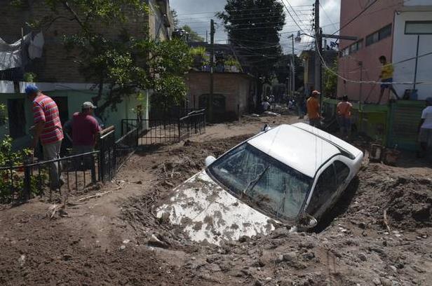
Survivors Recount Horror Of Twin Storms In Mexico; Death Toll Rises To 97.
Here's an update on the two tropical systems that moved slowly enough
to drop excessive rainfall amounts, capable of producing historic
flooding. AP and
The Dallas Morning News have the story - here's a clip: "
With
a low, rumbling roar, an arc of dirt, rock and mud tumbled down the
hillside in the remote mountain village of La Pintada, sweeping houses
in its path, burying half the hamlet and leaving 68 people missing in
its mad race to the river bed below. It was the biggest known tragedy
caused by twin weekend storms that struck Mexico, creating floods and
landslides across the nation and killing at least 97 people as of
Thursday — not counting those missing in La Pintada..."
Photo credit above: Alejandrino Gonzalez/The Associated Press. "
A
car lays buried in mud after flooding triggered by Tropical Storm
Manuel as residents try to clean up their neighborhood in Chilpancingo,
Mexico, on Thursday. Manuel, the same storm that devastated Acapulco,
gained hurricane force and rolled into the northern state of Sinaloa on
Thursday before starting to weaken."
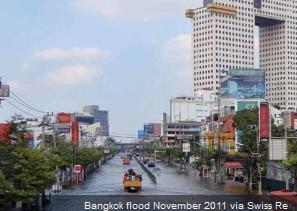
Which Cities Are Most At Risk For A Natural Disaster? This is one Top 10 List you don't want to be on, as explained at
earthsky.org; here's a clip: "
Swiss
Re – the world’s second-largest reinsurance company, with headquarters
in Zurich – has released results of a new study that looks at the human
and economic risks from natural disasters faced by over 600 cities
around the globe. The report is called Mind the risk: A global ranking of cities under threat from natural disasters,
and it’s based on Swiss Re’s risk models and detailed available hazard
data. Los Angeles is the only city in the U.S. that makes the top 10
list for “most people potentially affected” (aggregate risk of five
perils including earthquakes, tsunamis, storms, storm surge and river
flooding). After all, it has a large and densely packed population,
located along the earthquake-prone Ring of Fire,
on a coast. When you look at “working days lost,” however, San
Francisco, New York, Paris and Amsterdam-Rotterdam also make the top 10
list..." (Image above: Swiss Re).
* the full 36 page PDF from Swiss Re is
here.
Typhoon, Hurricane Or Cyclone: What's The Difference? Here's an excerpt of a good explainer from
National Geographic: "...
If
you've never lived in Asia, you might be wondering what it feels like
to experience a typhoon. But if you've ever survived a hurricane or
cyclone, you already know the answer. That's because hurricanes,
cyclones, and typhoons are all the same weather phenomenon. Scientists
just call these storms different things depending on where they occur.
In the Atlantic and northern Pacific, the storms are called
"hurricanes," after the Caribbean god of evil, named Hurrican. In the
northwestern Pacific, the same powerful storms are called "typhoons." In
the southeastern Indian Ocean and southwestern Pacific, they are called
"severe tropical cyclones..."

New Financial Umbrellas Keep Companies Dry When It Rains On Their Earnings.
When in doubt blame the weather, right? But now companies can hedge
their bets against inclement, potentially disrupting weather. Here is an
excerpt from an interesting story at
Quartz: "
It
has become more widely accepted that volatile weather is having an
increased impact on corporate performance in a variety of global
industries from retail and entertainment to agriculture and energy. For
example, recent retail and beverage earnings reports from Zara, Target, and Coca-Cola
highlight cold and rainy weather as two key factors that contributed to
decreased customer demand for springtime goods. More broadly, a study from the National Center of Atmospheric Research
estimates that in the US alone, economic activity can swing plus or
minus $240 billion annually due to routine (as opposed to catastrophic)
weather variability, depending upon whether or not the observed weather
was favorable for business operations. However, despite the clear
relationship between weather and profits, the majority of
weather-exposed businesses continue to retain weather risk rather than
mitigate it...."
Photo credit above: "Sunny skies on the horizon." Reuters/Juan Medina.
Nasty Weather Plaguing NFL. Suddenly those domed stadiums are looking like a pretty good return on investment, as reported by
NPR; here's an excerpt: "...
Already,
three games, including two in prime time, have been disrupted by
weather issues, mostly lightning. Kickoff for the Ravens-Broncos opener
to the season on Sept. 5 in Denver was delayed for 33 minutes. On
Sunday, New Orleans' visit to Tampa Bay was interrupted for 69 minutes.
And the showcase matchup of San Francisco at Seattle went through a
one-hour delay in the first quarter Sunday night. Hardly ideal — for the
teams, the fans, or the folks watching on TV. But necessary..."
How The NFL Fleeces Taxpayers.
Hey, I'm just as excited about a new Vikings stadium providing an
economic jolt of excitement in the heart of Minneapolis as the next guy,
but this article at The Atlantic and
BeyondChron
made me do a double-take, with one hand on my wallet. Wait, the NFL is a
tax-exempt "non-profit?" Yes, and I'm an aspiring Russian ballerina.
Here's an excerpt: "...
In Minnesota, the Vikings wanted a new
stadium, and were vaguely threatening to decamp to another state if they
didn’t get it. The Minnesota legislature, facing a $1.1 billion budget
deficit, extracted $506 million from taxpayers as a gift to the team,
covering roughly half the cost of the new facility. Some legislators
argued that the Vikings should reveal their finances: privately held,
the team is not required to disclose operating data, despite the public
subsidies it receives. In the end, the Minnesota legislature folded,
giving away public money without the Vikings’ disclosing information in
return..."
Your Phone's Battery Can Tell You Site-Specific Weather. Great, about to be replaced by a smartphone battery. That's the good news. Media Bistro has the details (and video clip): "We first brought you OpenSignal’s crowdsourced weather data from Weather Signal in May,
but since then, the team have discovered that there was a correlation
between your phone’s battery and the weather outside. It’s not black
magic after all!..."

All I Want For Christmas Is A Shiny, New....Jetpack?
Move over Buck Rogers - science fiction becomes reality (if the price
is right and you have an extra 100K in your pockets). Details from
Time Magazine: "...
It
doesn’t look much like a jetpack, does it? More like some far flung
future mini-jet plane, the rounded nose pointed skyward, twin
turbine-like 200hp engines strapped to either side, and you secured
below, hanging out like the payload. It’s relatively small (and thus
easy to deploy if you need to get in and out of small spaces), has an
auto-hover feature, and includes both flotation capabilities and a
ballistic recovery parachute that auto-deploys if the engines go kaput.
It’ll probably cruise at 35 m.p.h. (with a top speed around 45 m.p.h.)
and be able to travel a little under 20 miles (or 30 minutes) a shot..."
Photo credit above: Martin Aircraft.
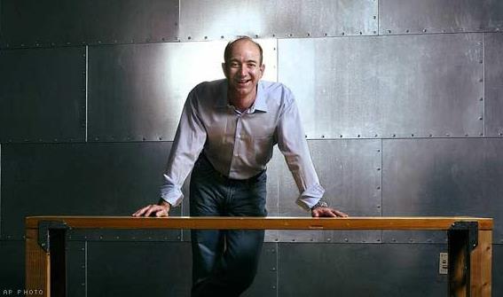
The 20 Smartest Things Jeff Bezos Has Ever Said. The founder of Amazon has way with business....and words. Here's an excerpt from
The Motley Fool: "...
Thank
Amazon's quirky CEO, Jeff Bezos, for this success. He created a culture
that's not only different from, but often totally at odds with, how
most business leaders think. He's also quite quotable. Here are 20 smart
things Bezos has said over the years. 1. "All businesses need to be young forever. If your customer base ages with you, you're Woolworth's."
2.
"There are two kinds of companies: Those that work to try to charge
more and those that work to charge less. We will be the second."
3. "Your margin is my opportunity..."
Photo credit above: AP.
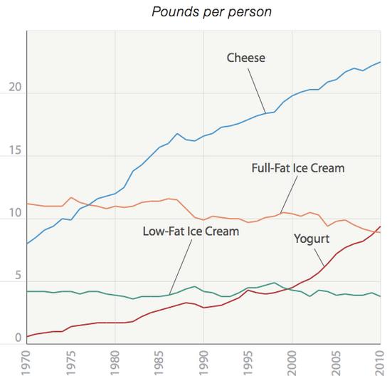
The Average American Eats Almost 3 Times As Much Cheese Today As In 1970. Let them eat...cheese? 23 pounds of cheese in 2013? That sounds about right. Here's an excerpt of an eye-opening article at
The Atlantic: "
Yesterday the Center for Science in the Public Interest released a "report card" on U.S. eating habits, entitled "The Changing American Diet." In The New York Times, Jane Brody called our performance therein a disappointment. That depends how you feel about D-pluses, I suppose, and cheese..."
Graphic credit above: Center for Science in the Public Interest.
Average Person Forgets 4 Things A Day: Study. Now this is in the UK, I'm sure our memories are much better over here in the states. Uh huh. Where am I again?
The Indian Express has the details: "
An
average person forgets four key facts, chores or events every day,
while trying to keep up with the demands of a hectic lifestyle, a new UK
study has found. On average, people forget things on 1,460 occasions
every year, according to the research. Researchers charted 50 of the
most commonly forgotten things after polling 2,000 adults in the UK..."
Photo credit above: "
On average, people forget things on 1,460 occasions every year, according to research." (Reuters).
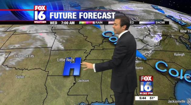
Local Weathermen Arrested After Fight Breaks Out Over Rain Chances For This Weekend. O.K. This is a
parody, a local version of The Onion, but I thought
Rock City Times did a masterful job. Let's hope it never comes to this: "
Local
Weathermen Jeff Baskin of Fox 16 and Keith Monahan of KARK were
arrested along with several members of their news stations late last
night after a fight broke out between the two outside of their studio on
Capitol Ave. Witnesses say the disagreement began during show prep for
Baskin’s weather segment on the 9 o’clock newscast for Fox16. Monahan
entered the weather center the two stations share while Baskin was
reviewing his forecast and having mascara applied. Monahan reportedly
asked Baskin what he was going to show for the rain chances on Saturday.
Baskin replied that he thought the rain would hold off and move in on
Sunday. The two exchanged a few further remarks and walked away..."
Climate Stories....
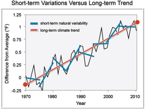
What 95% Certainty Of Warming Means To Scientists. Here's a clip from an AP story at
ABC News: "
Top
scientists from a variety of fields say they are about as certain that
global warming is a real, man-made threat as they are that cigarettes
kill. They are as sure about climate change as they are about the age of
the universe. They say they are more certain about climate change than
they are that vitamins make you healthy or that dioxin in Superfund
sites is dangerous. They'll even put a number on how certain they are
about climate change. But that number isn't 100 percent. It's 95
percent. And for some non-scientists, that's just not good enough..."
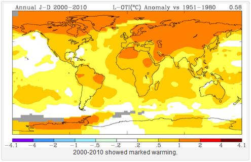
Graphic credit:
2000-2010 global temperature anomalies (compared to 1951-1980 averages)
courtesy of WMO, The World Meteorological Organization.
Settled Science. Here's the intro to a story from Jeff Nesbit at
U.S. News: "
The
debate is over. On Friday, an international panel of hundreds of
scientists will issue its fifth (and perhaps final) comprehensive
scientific assessment of what we now know about climate change. Its
central conclusion will be certain and unequivocal – human beings are
altering the climate, with impacts starting to occur now. Yes, there are
still a handful of scientists who like to take slightly contrarian
positions, which allows them to be quoted in media stories. And, yes,
scientists are still trying to determine how much things like La Nina,
excess water vapor and ocean sinks (the ability of the oceans to store
carbon dioxide and warming) mask the extent of how rapidly the planet is
warming from greenhouse gases..."
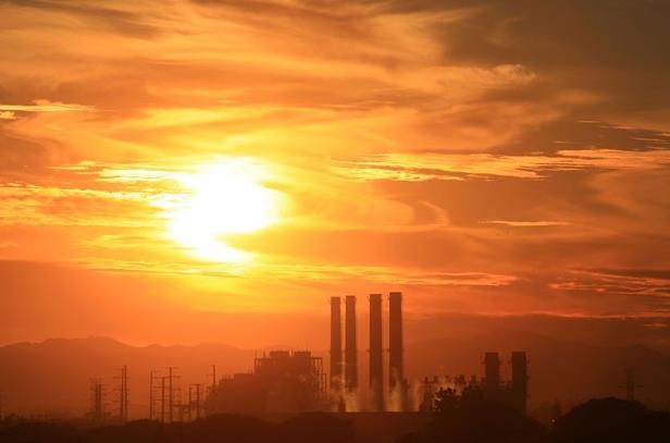
Photo credit: "
A
new Intergovernmental Panel on Climate Change report, its first in six
years, will be released Friday with the unequivocal conclusion that
human beings are altering the climate."
Study Sees A Higher Risk Of Storms On The Horizon.
The New York Times has a good overview; here's the introduction: "
The
eastern and central United States likely will see a greater risk of
severe weather by the middle of this century as rising temperatures
trigger atmospheric changes that favor storms, a new study
by climate scientists from Stanford and Purdue universities concludes.
By the century’s final 30 years, the study forecasts, the eastern United
States could experience severe thunderstorms an average of nearly 7.5
spring days, an increase of almost 42 percent. A 15 percent increase is
forecast during June, July and August..."
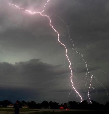
Photo credit above: Gene Blevins/Reuters. "
Thunderstorms are forecast to increase in the eastern and central United States."
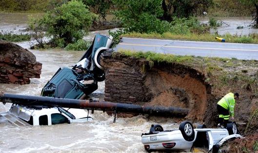
What Is The Climate Change Context Behind The Colorado Floods? Scientific American has the article - here's a clip: "...
The
science of linking extreme events to climate change is relatively
young. Practitioners in this field, called attribution science, work to
understand whether any part of an event like a flood, drought or heat
wave can be attributed to climate change. Martin Hoerling, a research
meteorologist at the National Oceanic and Atmospheric Administration's
Earth System Research Laboratory in Boulder, has been one of the leaders
in the field of attribution research. Asked how the Boulder flood could
be put into a climate change context, Hoerling first listed some
statistics highlighting the extreme nature of the event..."
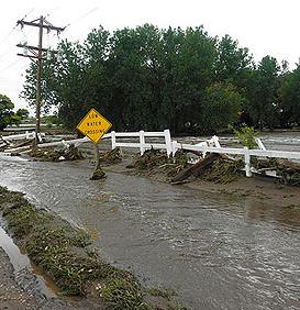
Photo credit above: "
Is
Climate Change to Blame? Although it is still relatively young,
practitioners in the field of attribution science are looking at the
relationship between climate change and extreme weather events such as
the recent Colorado flooding." Image: Nurpu/Flickr.
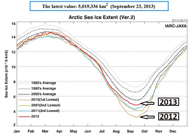
Arctic Sea Ice Minimum In 2013 Is Sixth Lowest On Record. More details from
Tucson News Now; here's an excerpt: "
After
an unusually cold summer in the northernmost latitudes, Arctic sea ice
appears to have reached its annual minimum summer extent for 2013 on
Sept. 13, the NASA-supported National Snow and Ice Data Center (NSIDC)
at the University of Colorado in Boulder has reported. Analysis of
satellite data by NSIDC and NASA showed that the sea ice extent shrunk
to 1.97 million square miles (5.10 million square kilometers). This
year's sea ice extent is substantially higher than last year's record
low minimum. On Sept.16, 2012, Arctic sea ice reached its smallest
extent ever recorded by satellites at 1.32 million square miles (3.41
million square kilometers). That is about half the size of the average
minimum extent from 1981 to 2010..."
Graph above:
Arctic Sea-Ice Monitor.
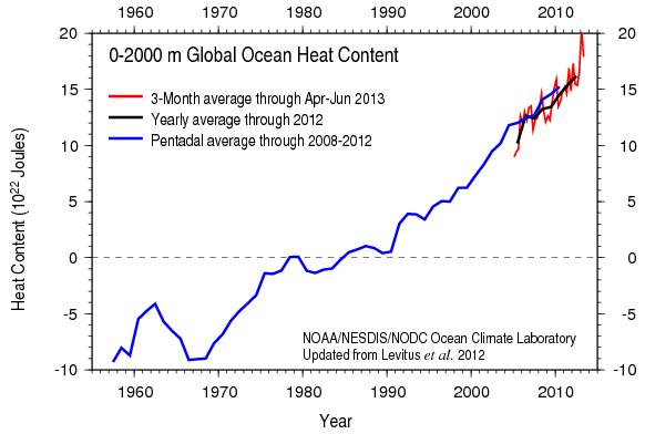
Rising Oceans Set Off Alarms.
Additional sea level rise is already in the pipeline - the question is:
how much, and how quickly? Here's a snippet of a story at
The Daily Astorian: "...
With
a constant level of greenhouse gases, the upper ocean will warm 0.6
degree C by 2100 to balance between heat in and heat out, Thompson said.
Sea levels will continue to rise for centuries because the entire ocean
needs to warm up for the energy budget to balance. Ben Strauss, vice
president for Climate Impacts and director of the Program on Sea Level
Rise at Climate Central, has described the phenomenon as a “long-term
commitment,” that rising sea levels have been locked in, whatever
changes are made in emissions. “It appears that the amount of carbon
pollution to date has already locked in more than 4 feet of sea level
rise past today’s levels. That is enough, at high tide, to submerge more
than half of today’s population in 316 coastal cities and towns, home
to 3.6 million, in the lower 48 states...” (Image above: NASA).
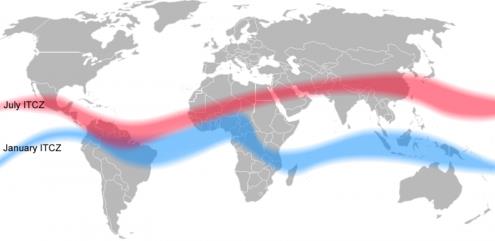
Wind And Rain Belts To Shift North As Planet Warms, Research Says.
Phy.org has the article - here's an excerpt: "
As
humans continue to heat the planet, a northward shift of Earth's wind
and rain belts could make a broad swath of regions drier, including the
Middle East, American West and Amazonia, while making Monsoon Asia and
equatorial Africa wetter, says a new study in Proceedings of the
National Academy of Sciences. The story authors base their predictions
on the warming that brought Earth out of the last ice age, some 15,000
years ago..."
Image credit above: "
During boreal
summer, Earth's tropicla rain belt migrates north. A similar but
prolonged shift could happen if the north continues to heat faster than
the south, disrupting global rainfall patterns." Credit: Mats Halldin.
Register Guard: Acidification Complicates Fishing.
Much of the warming is going into the world's oceans, which are
becoming more acidic (higher PH levels) over time - which isn't great
news for fish or other aquatic life, as reported at
OPB.org: "...
Scientists
— including many at Oregon State University — are beginning to define
the cause of these events. They call it ocean acidification and hypoxia.
Wind, currents and ocean chemistry conspire to create pools of
corrosive waters that can be lethal to key commercial species in
Northwest waters — and favorable to some nuisance species, such
as jellyfish. The die-off of coral reefs has been publicized everywhere
from Australia to the Indian Ocean to the Caribbean. But less well known
are the problems surfacing on the West Coast of North America — where
people may have more cause to worry. “Scientists are learning that ocean
acidification is hitting waters off the West Coast earlier and harder
than elsewhere on the planet,” Oregon Gov. John Kitzhaber said recently..." (Image: NASA).
Methane Reserves: Does Size Really Matter?
Will a slowly thawing permafrost and Arctic release vast quantities of
methane, compounding future warming? The jury is still out, but the
concern is valid.
The Carbon Brief takes a look - here's a clip: "
Size isn't everything when it comes to the stores of methane locked up in the earth. A recent paper warns
a sudden release of these resources could exact a terrible economic and
humanitarian cost. But while vast stores of the potent greenhouse gas
exist, scientists do not have sufficient evidence to believe they will
be suddenly released into the atmosphere, methane expert Dr Vincent Gauci
explains."
A Quick 'N Dirty Guide To Falsifying AGW. Here's an excerpt from a post at
Our Changing Climate: "
Have
you ever heard of Newton’s theory of gravity? Well, it’s all made-up
nonsense. You’ve been fooled. The reasoning goes as follows:
- According to the theory of gravity, objects should fall to the Earth’ surface.
- That bird in the sky remains there, without falling.
- Theory of gravity is wrong.
This
reasoning bears a lot of resemblance to the following, equally strong
reasoning that falsifies the theory of anthropogenic global warming
(AGW):
- According to AGW, CO2 controls the climate.
- For the past 10 years, global temperature remained more or less steady whereas CO2 levels went up.
- AGW theory is wrong..."
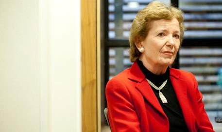
Major Fossil Fuel Reserves Must Be Left In The Ground, Senior Diplomat Warns. I'm pretty sure ExxonMobile will be OK with this. Here's a clip from a story at
The Guardian: "
World
governments must get used to the idea of leaving fossil fuel reserves
in the ground unexploited and unburned, one of the world's most senior
diplomats has said, ahead of a landmark report on climate science to be
unveiled this Friday by the Intergovernmental Panel on Climate Change
(IPCC). The former Irish president and UN high commissioner for human
rights, Mary Robinson, is to spearhead a new international push aimed at
breaking the climate talks deadlock and silencing sceptics, with a
group of senior diplomats and politicians from around the world. Climate
sceptics are "not based in reality" and parts of the business community
are "trying to cloud and distort the science", she said, adding that
strong political leadership was needed to counter them..."
Photo credit above: "
The
former Irish president and UN high commissioner, Mary Robinson, is to
spearhead a new international push aimed at breaking the climate talks
deadlock and silencing sceptics." Photograph: Martin Argles for the Guardian.
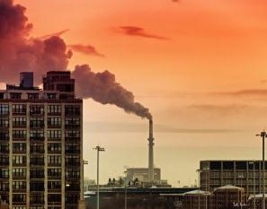
One Failed Project, Another Over Budget, Hint At Carbon-Capture Challenges Under EPA Rules.
Grist has the story - here's a snippet: "...
Despite an abundance of underground storage space where CO2 could conceivably be stashed, only a dozen or so carbon-capture
projects are operating or under construction worldwide. And in a bad
sign for any coal barons who might still be optimistic about the future
of coal burning in the U.S., one of the world’s most ambitious
carbon-capture efforts has just been abandoned in Norway. That
development coincides with news of nearly billion-dollar cost overruns
at another CCS project in Mississippi..."


