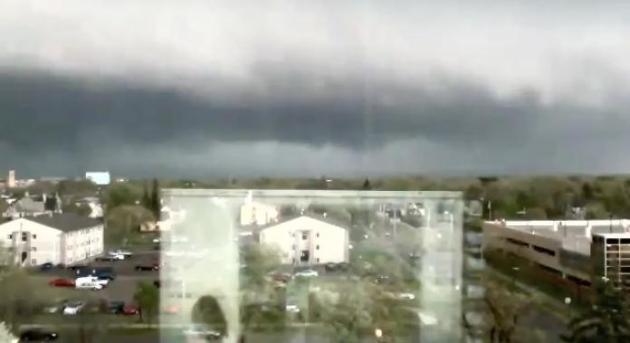
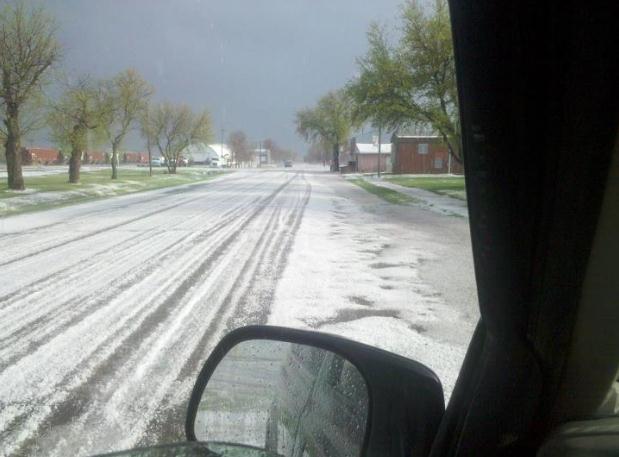
2.5" diameter hail reported at Sauk Rapids at 7 pm yesterday. Source: trained spotter for
NOAA.
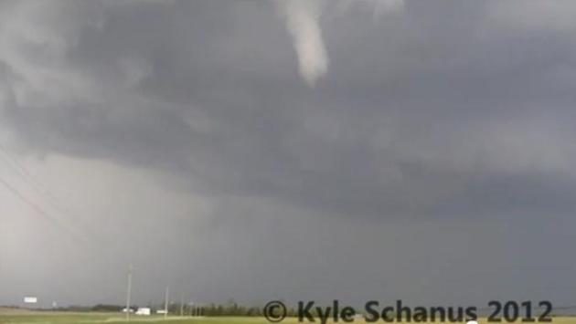
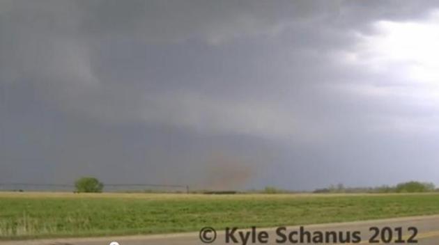
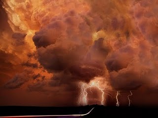
"Supercell". Thanks to "weathriver" for providing
some amazing pics and footage to WeatherNation TV - this was the
supercell thunderstorm that dropped a few tornadoes and 2"+ diameter
hail on Stearns County late Tuesday afternoon. Wall cloud visible upper
right; the "tail cloud" upper left is a tip-off of a severe updraft and
violently rising air into this rotating thunderstorm.
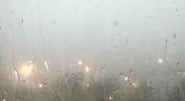
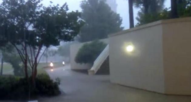
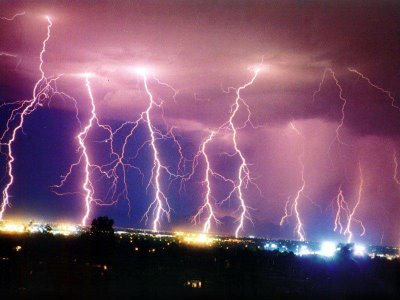
A Wild Lightning Display.
WeatherNation TV
meteorologist Addison Green captured some of the amazing cloud to cloud
and cloud to ground lightning last night. The storms weakened to below
severe threshholds as they pushed across the Twin Cities metro Tuesday
night, but they dropped torrential rains - much needed rain at that.
"A Multi-Million Dollar Rainfall." These are Doppler
radar estimates (NWS Dopplers) showing streaks of 1-3" rainfall amounts
over parts of central and southwestern Minnesota. The same "supercell"
that spawned a few tornadoes from Brooton to Becker also dumped out 2-3"
rain, 2" amounts near Glencoe and 2-3" amounts south of Marshall and
Redwood Falls. Doppler estimates as of 10:30 pm last night.
Tuesday Storm Reports. The "supercell" thunderstorm
that swept across central Minnesota produced at least 3 tornado
touchdowns (near Brooton) with funnel clouds spottered at Becker,
reports of 2"+ diameter hail heavy enough to cover the ground and break
car windshields from Sauk Centre, to Freeport to St. Joseph. Click
here to see an interactive map of Minnesota storm damage, courtesy of NOAA and Ham Weather.
National Damage Reports. 284 reports of tornadoes,
funnel clouds, hail and damaging straight-line winds as of 9 pm Tuesday,
a single day's worth of severe weather. Interactive map courtesy of
Ham Weather.
Wednesday Severe Threat. According to SPC there is a
risk of severe storms from central Nebraska eastward across Iowa and
southern Minnesota into Wisconsin, the Chicago and Detroit area, to
Cleveland, Pittsburgh and Washington D.C. - along the leading edge of
tropical, 80-degree air. Map: SPC and
Ham Weather.
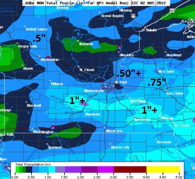
Another (Big) Dent In The Drought? I'm not convinced
(yet) that it will be enough rain to end the drought altogether, but
we're making significant progress. A stalled, east-west frontal boundary
will spark more heavy showers and T-storms later today and Thursday. A
"train-echo" effect is possible. Just like the cars in a train pass over
the same section of track, storms may keep redeveloping over the same
counties, especially tonight, when minor flooding can't be ruled out.
The NAM model (above) is hinting at some 2-3" rainfall amounts over the
southern and eastern suburbs of the Twin Cities.
Fast-Forward Spring For Corn Farmers. Check out this update from the
Midwestern Regional Climate Center: “
Weather
conditions for planting crops in the Midwest have been ideal this
year, resulting in all nine states planting well above the 2007-2011
average for April 29th. The states that are furthest along in planting
are Kentucky, with 86% of its corn planted, and Illinois, with 79%
planted. All states are also much further along in planting corn when
compared to last year’s late planting (last column). For instance, on
April 29th of this year, Indiana has already planted 70% of its corn,
which is substantially higher than the 2% that was planted in Indiana
by April 29th, 2011.”
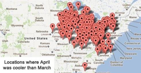
Only 330 Warm Weather Records Tied or Broken In April Across USA. That compares with over 15,000 warm weather records in March. NOAA's NCDC has more details, by way of
Facebook.
4th Least Snow On Record For Salt Lake City. Check out the details from the
SLC office of The National Weather Service. No, skiers and snowboarders didn't have much to celebrate this past "winter".
"..
It's like you're moving into a new house and the roof is on
fire and the basement is flooded, their's gas in the kitchen and there's
a dog in the backyard. The question is, how do you make this house
livable?" - quote from the (remarkable) 4 part PBS series, "
Money, Power and Wall Street",
recalling President Obama's arrival at the White House in early 2008,
on the cusp of a banking failure, international banking contagion and
the brink of a global depression. It's a 2-hour documentary about what
really happened in 2008, risks that remain in the banking community, and
Wall Street power, greed, and corruption. It may be the most important
thing you watch on TV this year.
Scientists Try To Figure Out What Makes Some Storms Spawn Deadly Tornadoes. Here's an excerpt of a fascinating article at
The Washington Post: "
While
violent, rotating thunderstorms spawn almost all of the most powerful
tornadoes, most of them produce only weak twisters — or none at all.
Unfortunately, meteorologists can’t predict which of these swirling
storms, known as supercells, will spin out damaging and deadly
tornadoes, such as those that devastated Birmingham, Ala., and Joplin,
Mo., last year. To understand what causes one storm to be devastating
and another to fizzle — and to enable forecasters to give earlier
warnings when a deadly twister is on the way — a federally funded
program known as VORTEX2 was
launched several years ago. About 1,300 tornadoes hit the United
States in an average year; about a quarter of them are classified as
particularly deadly, with winds of at least 118 mph."
Photo credit above: "
Ryan McGinnis - An anemometer measures winds near a tornado in Goshen County, Wyo., in 2009."
Do Tornadoes Have A Favorite Path? Or Are Repeat Victims Just Unlucky? Details from
al.com: "
HUNTSVILLE,
Alabama -- Is it just bad luck that at least a dozen of the same homes
on Yarbrough Road in Harvest have been hit twice by tornadoes in 10
months? Or is the science just stacked against them? Yarbrough Road seems
just like any other road in western Madison County - other than the
fact it was hit by both an April 27, 2011, tornado and a March 2
tornado. Same homes, same victims. Spooky? Unbelievable coincidence? Or
is there a scientific reason for the double damage?"
Photo credit above: "
The
trailer overturned during the March 2, 2012 tornado was the makeshift
home for a family while they rebuilt their house damaged in the April
27, 2011 tornado. (The Huntsville Times photo/Eric Schultz)."
Study: Most Victims Knew Alabama Tornadoes Were Coming. Details from
WeatherBug: "
ATLANTA
- Most of the victims of last year`s epic tornado outbreak in Alabama
had at least one thing in common: They knew the storm was coming. A
year after the onslaught of dozens of twisters killed at least 250
people in Alabama and more elsewhere in the South, federal researchers
are completing a study of who died and where they were when it
happened. Among the conclusions so far: Nearly half of the people who
died had been advised to take shelter. Indeed, most of them did. But
many of the tornadoes were so fierce that few structures were able to
withstand them. "These were catastrophic winds that could destroy
pretty much anything in its path," Cindy Chiu, an epidemic intelligence
service officer, said in reporting preliminary findings this month at a
Centers for Disease Control and Prevention conference in Atlanta."
Tornado Scientists Are Surprised To See "Ribbon" In Thunderstorm Data.
There is still so much about tornadoes we don't understand, in spite of
Doppler radar and numerous experiments literally out in the field (with
the "Vortex" projects). Here's an excerpt of a curious story at
The Washington Post: "
Examination
of VORTEX2 radar data uncovered a supercell mystery no one noticed when
the data were being recorded. When taking a second look at the data to
trace the genesis of a tornado, scientists observed that there was an
area of light rain and small raindrops inside the thunderstorm
supercell that spawned the tornado. Normally supercells are filled with
heavy rain and ice."
Graphic credit above: "
(CENTER FOR SEVERE WEATHER RESEARCH) - An oval marks an area of light rain and small raindrops inside a thunderstorm."
New NASA Satellite Sees Tornadoes Like Never Before.
I'm impressed with some of the articles local stations and local
meteorologists are doing - here's an excerpt of a must-read article from
NASA and
WDBJ7.com: "
On Jan. 22 and 23, 2012, more than 37 tornadoes
struck the southern USA. Ten of them tore across the Lower Mississippi
Valley into Alabama. Worst hit were St. Clair and Jefferson County,
Ala., where 2 people were killed, about 100 others injured, and at
least $30 million in damage was done. It was a chilling reminder of the
April 2011 onslaught of deadly tornadoes that took a staggering toll
across southern and Midwestern states. In southern parts of the USA,
tornado season tends to peak in springtime. Yet January 2012 produced
73 winter tornadoes -- third most of any January in recorded history.
Most of them struck southern states. And since over a quarter of the
incredible 1,688 twisters confirmed across the US in 2011 occurred in
the four-state region of Alabama, Georgia, Mississippi and Tennessee,
residents there are becoming ever more wary of darkening skies."
Tornado Rooms Could Save Lives. Some good information and a video from
WDTN.com: "
WASHINGTON
TOWNSHIP, Ohio (WDTN) - A tornado room currently comes standard for
new home owners at one Washington Township development. The room, which
is available in homes at Scarborough Village off State Route 48, is
designed to protect you in case of a violent storm. "Part of their
concern was living in the ranch with the weather conditions so we offer
this tornado room to give them a little more comfort," says Rick
Cherubini, with Crosstown Properties, which builds the homes. The
tornado room doesn't look like much. It's not even enough to make a
closet jealous. But it's what you don't see that matters."
*
Tornado Sirens: An Old Technology That's Still Saving Lives. USA Today has the story
here.
Learning The Behavior Of The Tsunami. One of the few things Minnesotans don't have to worry about;
scienceray.com has the story - here's an excerpt: "
Loud audible alarm sounds. From the distance came the sound of water
thundering closer. The higher the waves and tossed a house of wood and
concrete. Simulation of tsunami waves in the laboratories of the Port
and Airport Research Institute of Japan that makes hair stand on end.
Japanese disaster researchers believe the prediction that the
tsunami, which in Japanese means “harbor wave”, will only come at the
same location once every 100 years. However, a series of simulation
studies and the impact of the tsunami still routinely done by studying
the character of the tsunami that occurred in various countries." Photo: NOAA.
Hotel Company Sues Government Over Tennessee Flooding.
The NWS has never been found "guilty" for an incorrect forecast. It's
an "act of God", and everyone realizes the limitations of weather
forecasting. You can be held negligent for not maintaining equipment,
which can lead to injury or death, but a "bad forecast"? It'll be
interesting to see how this plays out in the courts - as usual, the only
winners will be the legal teams involved.
Boston.com has the story; here's an excerpt: "
NASHVILLE, Tenn.—Gaylord
Entertainment Co. filed a lawsuit Monday accusing the National Weather
Service and the U.S. Army Corps of Engineers of negligence that
heavily damaged its luxury hotel in Nashville and the famous Grand Ole
Opry House during flooding in 2010. The company says it sustained more
than $250 million in damages at several of its businesses from
flooding of the Cumberland River that could have been avoided had the
Corps of Engineers opened up a spillway sooner to relieve a swollen
reservoir. The historic flooding left 26 people dead, including 11 in
Nashville, and caused an estimated $2 billion worth of damage when it
rained 13.5 inches over two days."
File photo from 2010 flood courtesy of
people.com.
Can An Algorithm Write A Better Story Than A Human Reporter? I sure hope not - but at the rate we're going nothing would surprise me. The story from
wired.com: "
Had Narrative Science
— a company that trains computers to write news stories—created this
piece, it probably would not mention that the company’s Chicago
headquarters lie only a long baseball toss from the Tribune
newspaper building. Nor would it dwell on the fact that this
potentially job-killing technology was incubated in part at
Northwestern’s Medill School
of Journalism, Media, Integrated Marketing Communications. Those
ironies are obvious to a human. But not to a computer. At least not yet.
For now consider this: Every 30 seconds or so, the algorithmic bull
pen of Narrative Science, a 30-person company occupying a large room on
the fringes of the Chicago Loop, extrudes a story whose very byline is a
question of philosophical inquiry."
How Tech's Giants Want To Reinvent Journalism. Here's another eye-opening story from
paidcontentorg: "
Some
of Silicon Valley’s biggest technology companies reject suggestions
they are now news organisations. But they nevertheless think they have
the prescription for what news media must do next… First, the
disclosures: “We’re not a news company,” Google’s head of news products
and Google+ programming Richard Gingras told media executives at the Paley Center’s international council of media executives in Madrid on Thursday. “We’re a platform,” Facebook’s journalism manager Vadim Lavrusik duly followed."
The New Pay Phone And What It Knows About You. You've
heard it before, but it's true: if the product or service is "free" -
you're the product. Your personal information is being tracked and
harvested, for a variety of reasons and clients, everything from
advertising to direct marketing. Here's an interesting read from
The New York Times:
"The term pay phone has a new meaning today. For consumers who wish to
ditch their wallets, paying through a mobile phone can be awfully
convenient. Those same consumers can also, often unwittingly, give up
valuable information about themselves to merchants that want to sell
them things. A new survey by law professors at
the University of California, Berkeley, suggests that most Americans
are uneasy with the idea that their phones could divulge behavioral and
personal information, like phone numbers and in-store browsing habits.
The survey was created by Chris Hoofnagle and Jennifer Urban, who study
digital privacy issues, and financed by Nokia, which makes cellphones.
The survey posed a variety of questions by phone to 1,200 people
nationwide. It had a margin of error of plus or minus 3.4 percentage
points."
"More Than A Number". I'm a little biased on this
one - Jordan's brother, Ryan Jakubov, works with one of my companies.
But this is a terrific story about overcoming adversity - definitely
worth a look. The complete video can be found at
kuathletics.com: "
Coming back from one Tommy John surgery is tough, but two is nearly unheard of. Jordan Jakubov's story is highlighted in this "More than a Number" video."
“
Consider it pure joy, my brothers, whenever you face trials of
many kinds, because you know that the testing of your faith develops
perseverance.” – James 1:2-3
Severe Weather Hype?
"Why is the TV meteorologist ruining "The Voice"
with stupid tornado warnings? I don't even know where that county is." I
hear this every spring. "You're just doing it for ratings, hyping the
'dang weather!" People have a slightly different reaction when an EF-3
tornado is approaching their neighborhood. "Why weren't you on
the air? Why didn't you knock on my door and lead me by the hand to my
basement, Paul?" It's a lose-lose proposition.
In a perfect world (it ain't) your GPS-aware
smart phone would send out an audible shriek if a tornado, or any
threat, was approaching your house. This is the future. It's coming.
Until then we make do with the multitude of options that currently
exist, good options ranging from TV to radio, NOAA Weather Radio,
e-mails and smart phone apps. I guess I should list sirens too, but only
for outdoor use. Depending on the sirens is a one-way ticket to
trouble.
Meteorologists talk about situational awareness
and "multiple safety nets"; the more sources of information the better.
You never know where you'll be, and which device could make the
difference between getting the warning, and being caught unprepared.
Like every other meteorologist I'd rather be
harangued for being on the air, trampling "Dancing With The Stars", then
hear "where were you when my home got leveled?"
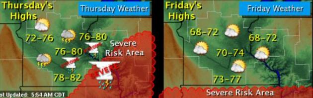
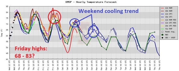
A nagging severe threat lingers into Thursday;
if the sun comes out today and tomorrow (likely) we should top 80,
sparking a very unstable sky. But most of us will NOT see anything
severe. Locally heavy rains are possible tonight, especially southern
Minnesota. A surge of cooler air arrives Friday with partial clearing
and highs returning to the 60s to near 70. Another wave of low pressure
passing to our south may spark a shower Saturday; heavier, steadier rain
may fall on Sunday. Another partly-puddly weekend. Ugh. Sorry. In
unison: "we need the rain." If only we could time it for weekdays. At
night. Non-commuting hours. We're working on that.
Cooler, drier weather returns next week.
Climate Stories...
Tim McCarver Isn't Crazy: The Home Run And Global Warming Connection.
It may seem counterintuitive, but as moisture levels go up, as humidity
and dew point rises, air density drops, and (yes) a ball can travel
farther through the air, all other things being equal. Meteorologist
Jason Samenow at The Washington Post's
Capital Weather Gang has more: "
Over
the weekend, baseball announcer Tim McCarver became the source of
ridicule when he blamed global warming as a reason for the increase in
home run totals in recent years. But it was the criticism of McCarver
rather than McCarver’s comment that was over the top. “There have been
climactic changes over the last 50 years in the world, and I think
that’s one of the reasons that balls are carrying much better now than I
remember,” McCarver said. Deadspin called McCarver’s statement “one of the most insane things ever asserted by a professional broadcaster.”
Graph credit above: "
Temperatures
compared to a 1951-1980 baseline since 1880 and the average home runs
per team per game since 1880. (Temperature data from NASA GISS; home run data from Baseball-Reference.com )."
Clouds' Effect On Climate Change Is Last Bastion For Dissenters.
The argument goes something like this: "don't worry about a warming
atmosphere - a spike in temperature will evaporate more water in the
world's oceans, producing more clouds, which will have a net cooling
effect!" Details from
The New York Times: "
LAMONT, Okla. — For decades, a small group of scientific dissenters has been trying to shoot holes in the prevailing science of climate change,
offering one reason after another why the outlook simply must be
wrong. Over time, nearly every one of their arguments has been
knocked down by accumulating evidence, and polls say 97 percent of
working climate scientists now see global warming as a serious risk.
Yet in recent years, the climate change skeptics have seized on one last
argument that cannot be so readily dismissed. Their theory is that
clouds will save us."
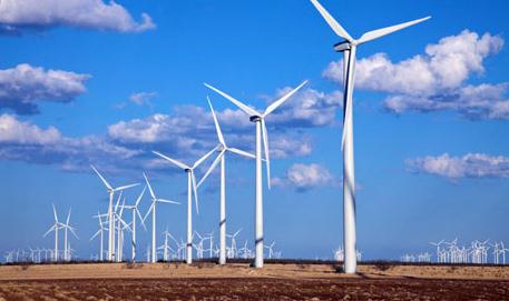
No, Wind Farms Are Not Causing Global Warming. Here's a snippet of an article from
The Washington Post: "
Scientific
studies are misrepresented all the time. But now and again the
distortions get particularly bad. That was the case Monday, when Fox
News ran the headline,
“New Research Shows Wind Farms Cause Global Warming.” A number of
other media outlets did the same thing. And it’s... not true at all. The frenzy started after Liming Zhou, a scientist at the University of Albany, published a short study
in Nature Climate Change. Zhou’s team analyzed satellite data for a
handful of large wind farms in west-central Texas. And he found that,
between 2003 and 2011, the surface temperature in the immediate
vicinity of Texas’ wind farms had heated up a fair bit, especially
during the night hours, as the wind turbines pulled warmer air from the
atmosphere down closer to the ground."
Photo credit above: George Frey, Bloomberg.
Don't Believe The Headlines. Wind Farms Do Not Cause "Global" Warming. Another perspective from
The Christian Science Monitor; here's an excerpt: "
All energy technologies have nuances and drawbacks. New research published in Nature Climate Change
found that wind farms are no exception.....If it were true that the
spinning blades of wind turbines increased the overall temperature of
the planet, as opposed to simply redistributing thermal energy, we
would have to rewrite some basic laws of physics, particularly the 2nd law of thermodynamics. This
is an important distinction from the burning of fossil fuels, which
produces gas that increases how much of the sun's energy the Earth
retains. In this respect, this process contributes to a globally
warming climate because the source of energy (the sun) is apart from
the system that is warmed (the Earth.)"
Photo credit above: "
Cattle graze beneath turbines at the
Penascal Wind Power Project in Kenedy County, Texas. A new study
indicates that large wind farms can cause local temperature increases.
Business Wire."
Offering A Conservative Perspective On Climate Change.
This one hit close to home, as someone who leans to the right,
politically, here is another lonely conservative voice in the
climate-wilderness, an excerpt of an Op-Ed at the
press-citizen.com: "
As
a conservative Republican who very much understands the need to reduce
and control our spending, it may seem strange that I understand and
accept that climate change is impacting my home, state and country. It
is beyond comprehension that my party would so adamantly avoid dealing
with the fact that we now are facing historical events on such a regular
basis that it is impacting our state and national budgets in the
hundreds of billions of dollars annually. Why do we continue to miss
the chance to address proactively the adverse impacts of our past and
current actions? Why is it that we have not connected the dots between
climate change and real life events that have occurred in our own
backyards?"
Water Crisis Looms For A Thirsty Planet.
Underscoring my theory that water, not oil, will be the most valuable
natural resource of the 21st century, here's an excerpt from
NPR: "
Twelve years ago, I was an intern working with the American Museum of Natural History
on marine protected areas. One afternoon, after reading mountains of
articles that documented the declining state of fisheries and reefs, I
naively proclaimed that ocean conservation must be the most depressing
field in the world of science. "Not at all," countered my mentor. "It's
the freshwater scientists that have it the worst." He was right. At
first this notion seems counterintuitive. Earth is covered in H2O,
after all. Yet, in reality, only 2.5 percent of it is fresh and
two-thirds of that happens to be frozen." Photo: ThinkStock.
Ford Powers Into Electric Car Business. Here's an excerpt from an article at
AOL.com: "
If it's true that it takes a crisis to force change then the US car manufacturing sector
understands this better than anyone. Detroit has undergone a
renaissance in the wake of the global economic and financial meltdown,
broadening their offerings to include more fuel efficient passenger vehicles, hybrid models and electric cars. "We are experiencing technological changes in automobiles that I have not seen in my lifetime," said Ford Motor Company Chairman Bill Ford at a recent reception to promote Ford's partnership with sustainability innovator SHFT.com. AOL Huffington Post is also a founding partner of the site." Photo: Ford.
IBM's Lithium-Air Battery Tech: The 500-Mile Electric Car? The story from
Motor Authority: "
The
only certainty of electric car technology is that nobody is really
certain of our future path. Dozens of different battery technologies are
under development all around the world to fix the common battery
limitations--limited energy density, heavy weight, long recharging
times--and one such path is that of lithium-air batteries. Computer and
technology company IBM is taking the lithium-air route, and explains
the workings of the battery in the video above."
Ocean Acidity Increasing At Unprecedented Rate. An important story from
mathaba.net; here's an excerpt: "
In a new study marine scientists have warned that the rate of ocean acidification presently occurring is unprecedented in the last 300 million years.
This is due to dissolving carbon dioxide from the atmosphere, much of
which human activity has contributed over the last 200 years through
the use of fossil fuels. The extent and rate of acidification enhances the prospect for a mass marine extinction event this century. Research in paleoclimatology and oceanography has revealed that anthropogenic climate change is driving Ocean Acidification threatening marine ecosystems."
Graphic credit above: "
Correlation of CO2 in atmosphere, seawater and seawater pH (acidity)."
An Underground Fossil Forest Offers Clues About Climate Change. Details from
The New York Times; here's an excerpt: "
In the clammy depths of a southern Illinois coal
mine lies the largest fossil forest ever discovered, at least 50 times
as extensive as the previous contender. Scientists are exploring
dripping passages by the light of headlamps, mapping out an ecosystem
from 307 million years ago, just before the world’s first great forests
were wiped out by global warming.
This vast prehistoric landscape may shed new light on climate change
today. Dating from the Pennsylvanian period of the Carboniferous era,
the forest lies entombed in a series of eight active mines. They burrow
through the rich seams of the Springfield Coal, a nationally important
energy resource that underlies much of Illinois and two neighboring
states and has been heavily mined for decades."
Obama's Big Greenwash. Here's an excerpt from an article at
Huffington Post: "
The United Nations climate chief, Christiana Figueres, has warned
that a Republican win in the U.S. presidential election would
jeopardize action against climate change and that America would risk
falling behind China and Europe in clean technologies. She urges
American voters not to vote for a Republican candidate. In effect, Ms.
Figueres is plumping for President Obama. The head of a UN body
meddling in U.S. politics is not only impolitic, it also calls into
question the president's own stance on clean energy. While Mr. Obama
embraced it initially, allocating over $40 billion to the sector
through the American Recovery and Reinvestment Act of 2009, he took a
near about-turn in his 2012 State of the Union address by strongly supporting shale gas and oil, while backpedaling on renewables."
Climate Change This Week: Weird British Weather, An Intensifying Water Cycle, And More. Details from
The Huffington Post: "
U.S. corn will be cut
dramatically by climate change in coming years, and our biofuels
policy might weaken farmers' attempts to adapt, a new Stanford study
says. Add to Britain's winter drought, flooding,
as unusual April torrential showers flow over the dried compact soil,
failing to refill aquifers, reports Paul Cahalan from the UK's
Independent. Get ready for fiercer droughts
and storms, folks -- the salt of the sea is telling the world that
climate change is intensifying the global water cycle twice as fast as
originally thought, a new study in the journal Science shows, according
to Michael Lemonick at Climate Central."