Tuesday, March 6, 2012

March 7: April-Like Warmth Sweeps Into Great Lakes, Northeast

60 F. high in the Twin Cities Tuesday.
0" snow depth at KMSP as of 7 pm yesterday.
22.1" winter snowfall, to date.
78.3" snowfall last winter as of March 6 (source: NOAA).

How Warm? All Bets Are Off. Now that MSP has lost much of its snow (I realize there's still a few inches northern and western 'burbs) the sun's energy will be able to go into heating up the air, not melting snow. The ECMWF brings the mercury into the mid 50s Saturday, slightly cooler Sunday (best chance of rain east of MSP over Wisconsin), before taking off into the mid 50s Monday, upper 50s Tuesday, and an almost incomprehensible 22 C next Wednesday. That's 71.6 F. I know, I don't believe it either, but at the rate we're surging into an early spring? I wouldn't rule anything out.


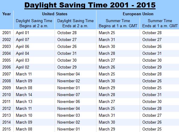
"Spring Forward". We all lose an hour of sleep this weekend. Daylight Saving Time kicks off at 2 am Sunday morning. Don't forget to set your clocks ahead one hour before going to be Saturday night. Another sure-fire sign of spring!

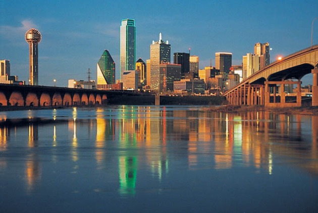
14 freezes for Dallas this past winter, a record for fewest on record. Photo credit here.
12.41" rain for Dallas this winter, second wettest La Nina winter on record.
54 mph wind gusts in Chicago on Tuesday.
68 F. high at O'Hare Airport, 2 degrees away from a record. 25 degrees above average. Warmest since Nov. 13.

$2 billion. Estimated cost of last Friday's tornado outbreak (source: Eqecat).

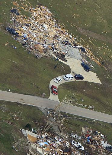
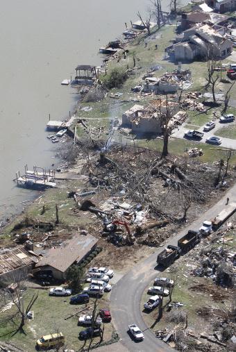
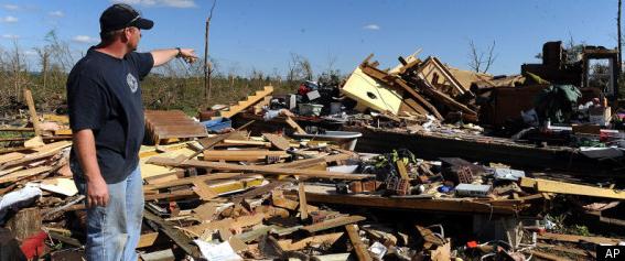
Photo credit above: EF-4 strength tornadoes are capable of "scraping well-constructed brick/stone/timber homes down to bare foundation". Such was the case in Henryville, Indiana. Details: "In this aerial photo, people inspect a demolished home Saturday, March 3, 2012, near Henryville, Ind., after a tornado swept through the town Friday. A string of violent storms demolished small towns in Indiana and cut off rural communities in Kentucky as an early season tornado outbreak killed more than 30 people, and the death toll rose as daylight broke on Saturday's search for survivors.(AP Photo/Al Behrman)."

  "According to some climate scientists, such earlier-than-normal outbreaks of tornadoes, which typically peak in the spring, will become the norm as the planet warms. "As spring moves up a week or two, tornado season will start in February instead of waiting for April," said climatologist Kevin Trenberth of the National Center for Atmospheric Research. - from an article below focused on climate change's possible impact on tornado season.

"The entire United States network of 160 radar sites, including Alaska, Hawaii, Puerto Rico and Guam will be upgraded by early 2013 at a cost of about $50 million." - from an article on "dual-polarization" Doppler radar upgrades underway at NWS sites around the USA; details below.


U.N. Says 2011 Disasters Were The Costliest In History, With A Minimum Pricetag Of $380 Billion. The Washington Post has more details: "The economic cost of disasters in 2011 was the highest in history — with a pricetag of at least $380 billion, mainly due to earthquakes in Japan and New Zealand, a U.N. envoy said Monday. Margareta Wahlstrom, the secretary-general’s special representative for disaster risk reduction, said the figure was two-thirds higher than the previous record in 2005 when Hurricane Katrina struck the southern United States. In addition to the earthquakes, Wahlstrom said major floods in Thailand and other countries caused extensive damage. “The main message is that this is an increasing — very rapidly increasing trend with increasing economic losses,” Wahlstrom said."
 
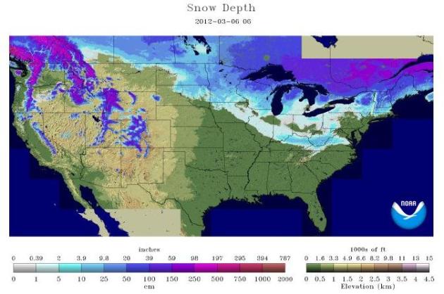
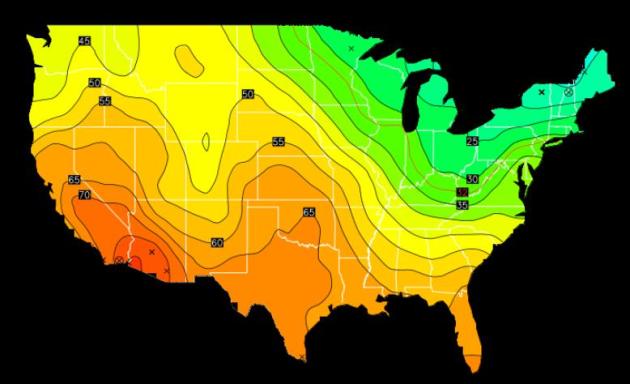
Going Fast. If you like snow you may want to get out there and roll around in it sooner, rather than later. There won't be much left by next weekend, except for northern Minnesota, Wisconsin, the U.P. of Michigan, the snow belts downwind of the Great Lakes, and northern New England. Map above courtesy of NOAA.
 
 
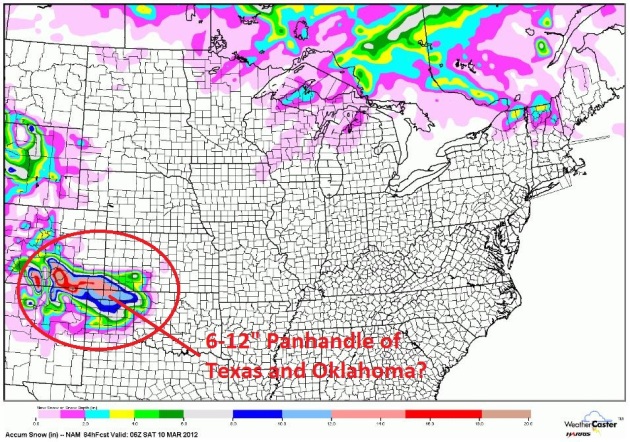
A Parallel Weather Universe? No significant snow close to home anytime soon, at least looking out 2 weeks (a little lake effect snow for the U.P. of Michigan). No, for substantial snow you have to drive to the panhandle of Oklahoma or Texas, where some 6-12" snowfall amounts are possible. 50+ here on Saturday, while north Texas digs out from a freak snowstorm. Go figure.
 
 
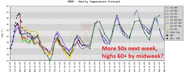
Seasonably Cool Through Friday, Then More April. We cool down today, temperatures still a few degrees above average Thursday annd Friday. I suspect we'll top 50 Saturday and Sunday, maybe climb close to 60 by the middle of next week. The ECMWF shoots the mercury above 70 by Wednesday of next week. That may be a bit extreme, but the ECMWF has been doing a pretty good job this "winter".


Daylight Saving Time This Weekend. Man, that was fast! We "spring forward" one hour late Saturday night (2 am Sunday morning). NASA has more than you ever wanted to know about DST here: "Benjamin Franklin is credited with the concept of Daylight Saving Time. The basic idea is to make the best use of daylight hours by shifting the clock forward in the Spring and backward in the Fall. Daylight Saving Time has been in use throughout much of the United States, Canada and Europe since World War I. In 1966, President Lyndon Johnson signed an act into law whereby Daylight Saving Time begins on the last Sunday of April and ends on the last Sunday of October each year. However, any State can opt out of Daylight Saving Time by passing a State law. Hawaii does not observe Daylight Saving Time and neither does Arizona (although the Navajo Nation, in northeastern Arizona, does). For many years, most of Indiana did not observe Daylight Saving Time with the exception of 10 counties. Beginning in 2006, all of Indiana now observes Daylight Saving Time. However, the state remains divided in two time zones. Seventy-four counties (including state capital Indianapolis) are in the Eastern Time Zone. The 18 remaining counties are in the Central Time Zone (see: Indiana Time Zones)."


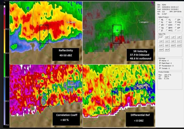
The Advantages Of "Dual-Pol". The National Weather Service is retrofitting all NWS Doppler radars around the USA to be dual-polarization, sending out pulses of energy in the vertical, as well as the horizontal axis. This allows meteorologists to do a better job estimating raindrop/hailstone sizes, and also allows forecasters for the first time to see debris kicked up by tornadoes on the ground. Here is more, from the Facebook page of the Nashville Office of the NWS: "Here is an example of a TDS or Tornado Debris Signature indicated by our new Dual-Pol Radar. The four-panel display allows us to see many different radar variables at one time. In the upper left panel we have our traditional reflectivity, upper right is Storm Relative Velocity, lower left is Correlation Coefficient, and lower right is Differential Reflectivity. In order to detect a TDS we look for very low Correlation Coefficient values near the tornadic signature on Storm Relative Velocity, if reflectivity values are above 30 dBZ and Differential Reflectivity is low 0."
 
 
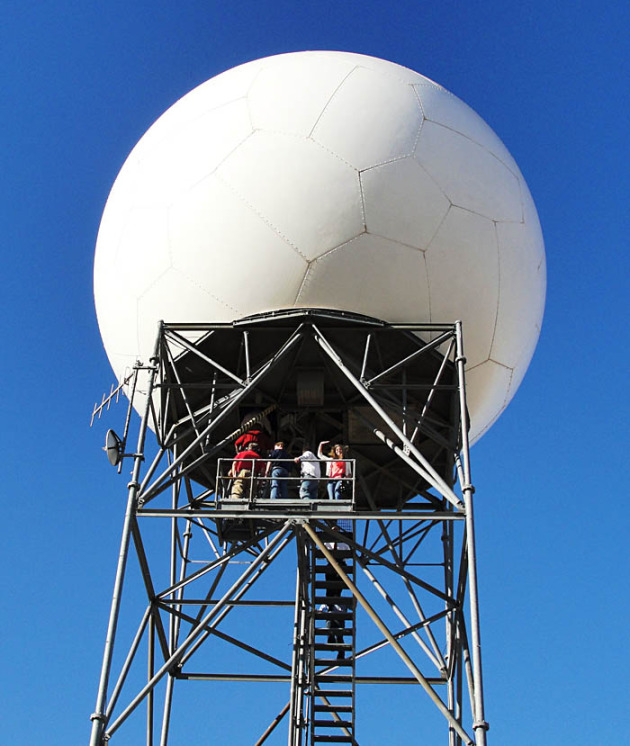
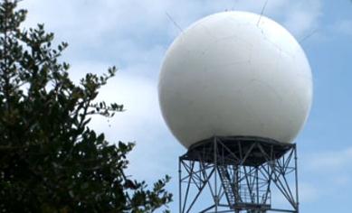
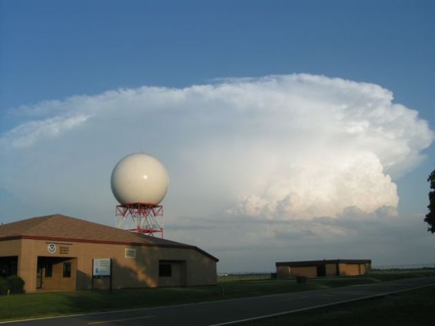
Coming Soon To A Weather Service Office Near You. More on the merits of "dual-polarization" Doppler Radar. Here's an excerpt of a story at abcnews4.com in Charleston: "Technology advances quickly. Take for instance, iPads or iPhones.  On average the new model comes out every eight months to a year, making older models a bit outdated. Let's just say the same goes for weather forecasting. Twenty years is way past time to update. "The National Weather Service WSR 88-D radar for the Charleston area was commissioned in Grays, S.C., northern Jasper County in 1992," said Steve Taylor,  a meteorologist with the Charleston office of the National Weather Service. The current radar output is serviceable and continues to detect rain, but a newer more advanced dual-polarization radar technology is available and will be installed later this year. "The entire United States network of 160 radar sites, including Alaska, Hawaii, Puerto Rico and Guam will be upgraded by early 2013 at a cost of about $50 million," Taylor said." Photo above courtesy of NOAA.

 
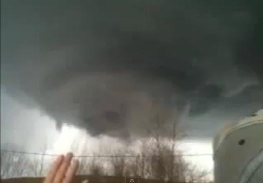
Close Encounter With A Kentucky Tornado. Hey, I'd be praying (out loud) too, if an EF-3 tornado was approaching my home. There's a reason why this YouTube clip has over 43,000 views. Details: "Dramatic video as a funnel cloud approaches a woman's home in Ezel, near West Liberty, Kentucky and she "prays" the tornado/funnel cloud away from her home."
 

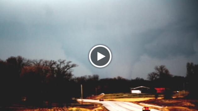
Storm Chasers: "It Was A Very Fast Evolution." The story (and amazing video) from jconline.com: "Two Purdue University storm chasers watched Friday's deadly twister form and hit the ground in just four minutes. As Ph.D. students in the Severe Weather Research Group, Mallie Toth and Eric Robinson have chased many violent storms in recent years. But the tornado that tore through southern Indiana will be remembered for its speed and strength. The funnel cloud came right at them while they were parked on Indiana 135 between the towns of Salem and Palmyra in Washington County. "We were directly in the path," Toth said Saturday. "It was a very fast evolution."
 
 
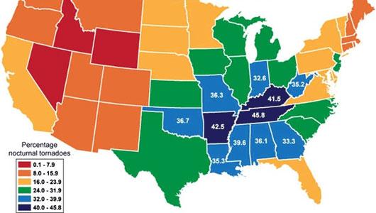
Watch Out For Deadly Nighttime Tornadoes This Winter. Some interesting statistics and trends in this story from MNN, Mother Nature Network: "As recent tornado outbreaks around the country have shown, severe weather is getting a jump on the spring season. The main tornado season may still be weeks away, but the twisters of winter pack an extra threat. The odds of a killer tornado are greatest at night, and the shorter daylight hours of winter increase the chance of nighttime tornadoes. Nocturnal tornadoes are more than twice as likely to kill people than daytime tornadoes, researchers have found. So far, the largest tornado outbreak of the year — 45 twisters — came on Jan. 22. Feb. 24 was the second busiest day for severe weather of the year to date."
 
Photo credit above: "NIGHT SPIRALS: A graph showing the percentages of nocturnal tornadoes by state from 1950 to 2005. (Image: OurAmazingPlanet)."
 
 
Early Tornadoes Not Predictors For Future Twisters. The story from CNN and ozarksfirst.com: "When a powerful jet stream bringing in cold northern air collided with a large mass of warm, moist air from the south, the conditions were right for the tornadoes that have left at least 45 dead this week. Two powerful storm systems in the Midwest and South spawned the tornadoes that damaged and destroyed homes and businesses from Kansas to Ohio. There is not a defined tornado season like there is for hurricanes, but this year the first major tornadoes came earlier than usual. Last year, the most powerful tornadoes were not seen until April."


Severe Weather Preparedness Week In Illinois. Some good information from WREX-TV: "There are many indications that this could be an active - and early - severe weather season in Illinois. Severe weather has already impacted parts of Illinois and neighboring states. 2011 was a devastating year for tornadoes in the United States. There were more than 1700 tornadoes nationwide, including 59 killer tornadoes which claimed 550 lives. It was the deadliest year for tornadoes since 1925.

· Tornadoes are the most destructive storms that occur in Illinois. Being prepared for a tornado can save your life.
· A tornado watch means severe thunderstorms and tornadoes are possible in your area over the next few hours. Be prepared.
· A tornado warning means a tornado has been sighted by a trained storm spotter, or intense rotation that will likely produce a tornado has been detected by Doppler radar. Get to a place of safety immediately."

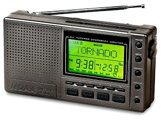
Weather Service Urges Radios For Storm Readiness. WLS-TV in Chicago has the story: "Despite the tornado sirens sounding in downstate Harrisburg Wednesday morning, a lot of people stayed asleep and did not hear them. According to advice from the National Weather Service, there is a simple way to make sure when that there is a severe weather alert, you get it. In recent years there have been major improvements in tornado forecasting allowing for earlier warning lead times. They now average 13 minutes, but when it comes to receiving those warnings, many people are still relying on 20th century technology."


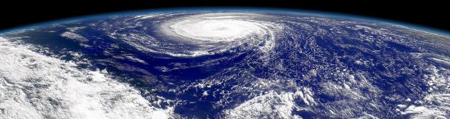
Forecasters Will Be Able To Reliably Predict Where A Hurricane Will Be A Week Ahead Of Time. This may be a little optimistic, but there's little doubt that NHC is having very good luck (skill, really) predicting hurricane tracks, with significant improvement in accuracy every year. Predicting intensity of hurricanes is much more difficult. NJ.com has an interesting story: "CHARLESTON, S.C. — National Hurricane Center Director Bill Read said Monday that science will improve to the point where forecasters can reliably issue forecasts showing where a hurricane will be a week ahead of time. "We're two to five years from a seven-day forecast," Read told reporters while attending a conference with representatives of other federal agencies to discuss hurricane forecasting and warning. He noted the National Weather Service now issues regular daily weather forecasts a week out — but not yet for hurricanes."
 
 
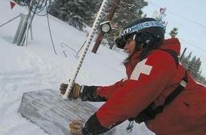
The Inexact Science Of Snow Reporting. Yes, predicting snow, down to the inch for specific locations, is as much a black art as it is a science. The Aspen Times has an article that caught my eye, capturing some of the nuance (and hair-pulling difficulties) of forecasting snow: "VAIL, Colo. — When a ski resort that covers 5,289 acres — the largest in the United States — reports the snowfall that has occurred over the last 24 hours, there is and will always be areas of the mountain that don't match up to what's reported. Some areas might have less snow, and other areas might have more. In the case of last week's snow reporting debacle, in which Vail reported 12 inches the morning of Feb. 23 and later retracted that report and changed it to 2 inches, the reading of the mountain's snow measuring stake was simply inaccurate because high winds had blown in too much snow, the resort reported. Getting a snow measurement before 5 a.m., which is when the operator in the Vail Communications Center at the base of the mountain does the reading, can be tricky business. The situation last week was simply an anomaly, though, said Bob Norris, manager of Vail Mountain security. "
 
Photo credit above: "Vail ski patroller Jennifer Silva clears off the snow stake after confirming the snowfall reading from the stake at 7 a.m. for the past 24 hours Wednesday on Vail Mountain. Dominique Taylor / Vail Daily."
 
 
Thousands Flee In Australia Floods. MSNBC.com has the latest: " Floods across eastern Australia forced more than 13,000 people to evacuate their homes on Tuesday after record-high summer rains drenched three states over the past week, swelling rivers and forcing dams to overflow. In the worst-hit state of New South Wales, authorities ordered 8,000 people to leave their homes in the inland city of Wagga Wagga, where flood waters were expected to breach an 11-metre levee and swamp houses and the main business district."
 
 
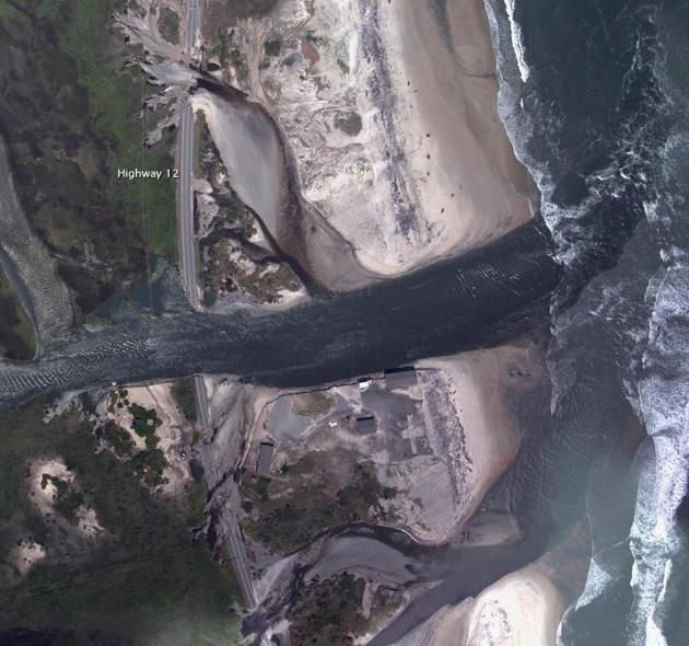
A North Carolina Lifeline Built On Shifting Sands. I've spent some time on the Outer Banks of North Carolina - gorgeous country, but very vulnerable to hurricanes. Those barrier islands and dunes were designed to migrate over time. Paving them over with roads and parking lots hasn't stopped that migration of sand, which becomes all too apparent every hurricane season (or even during winter with strong nor'easters). The New York Times has the story: "RODANTHE, N.C. — Last August, when Hurricane Irene sliced across the Outer Banks, it cut Highway 12, Hatteras Island’s lifeline, in two places. Engineers rushed to repair the damage, filling and repaving a washed-out stretch of roadway here and building a bridge over a newly formed inlet a few miles to the north. The road reopened on Oct. 11, to the cheers of anglers, would-be vacationers and the innkeepers, restaurateurs and merchants whose livelihoods had taken a huge blow. But the winds and waves that shape the coast were already gnawing at the new bridge."Photo above courtesy of NASA's Earth Observatory.
 
 
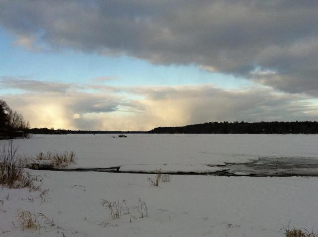
Photo Of The Day. Thanks to Tim Wright from Sauk Rapids for passing this one along - a beautiful example of lake effect snow showers and squalls. He writes: "My son Drew and I were just finishing up a long day of snowmobile riding in the late afternoon (5 pm) in my hometown of Solon Springs, Wisconsin when I took this photo on Sunday March 4.  It is looking north on Lake St. Croix (where the St. Croix river begins) toward Lake Superior (appox 25 miles to the north).  It was a pretty picture of the sun’s angle striking the side of the clouds that were continuously forming over the western end of Lake Superior that day creating continuous lake effect snow. You can see the moisture from the clouds with the naked eye better than my Iphone photo, but I thought I would share.  I love the Star Tribune Blog!!"
 
Thanks Tim (and Drew). I'm genuinely amazed at the quality of photos you can get from today's smartphones. Keep up the great work with that iPhone! Good to have you as a loyal reader - I take nothing for granted. Thank you.

Paul's Links. Weather-Related Q&A.

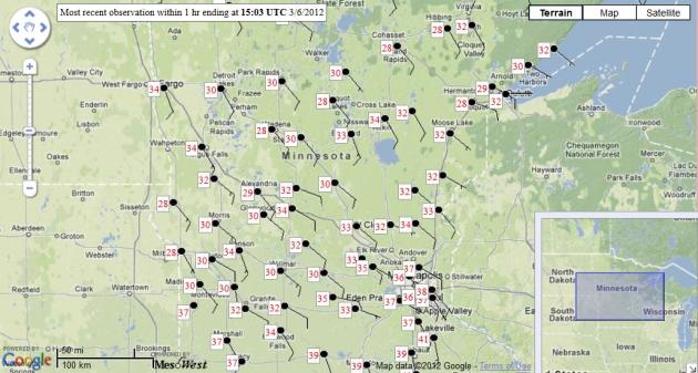
1). Current Conditions From MesoWest. This is a good site that visualizes current weather, for the metro, Minnesota, or anywhere in the USA. Using a Google Map you can zoom in/out, pan, and call up various meteorological parameters like temps, highs, lows, precip, etc. Definitely worth a look.


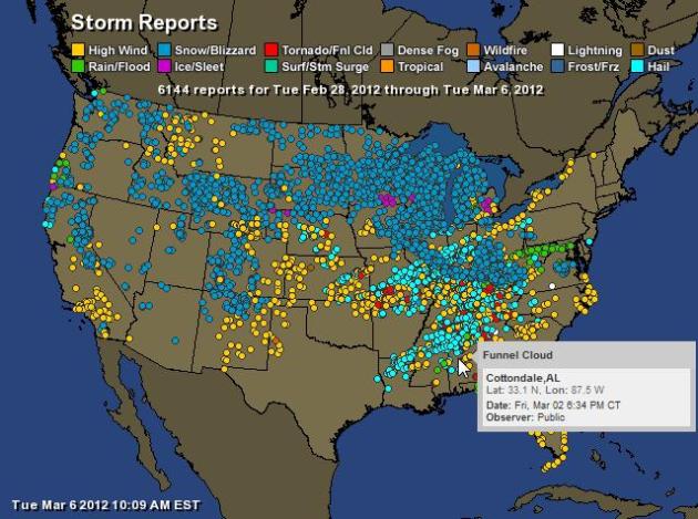
2). Storm Reports From Ham Weather. Full disclosure: Ham Weather is a subsidiary of Media Logic LLC, but these maps are free to access for general consumers. This map shows NWS storm damage reports for the last 4 hours, 24 hours, or even a week's worth of storm reports (above). You can separate out tornado reports from flooding, high winds, hail, etc - and it's interactive. Hover your cursor over the dot and you pull up more details.  I'm biased, but it's pretty cool.

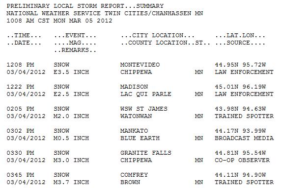
3). National Weather Service Public Information Statements. This is a handy site to pull up the latest snowfall/rainfall reports for Minnesota and Wisconsin, as well as storm report details.

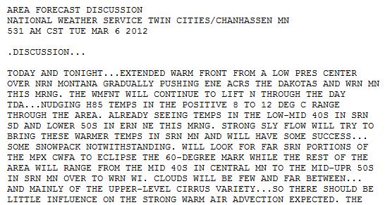
4). National Weather Service Forecast Discussions. This specific link is more technical, but if you want to know what NWS meteorologists in Chanhassen (and Duluth) are really thinking, and why the NWS forecast is what it is, check this sight for more insight into the how's and why's of the weather floating overhead.


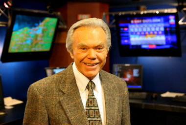
Long Career From Long-Range Forecasts. TVNewsCheck.com takes a look at the distinguished TV career of meteorologist Dick Goddard in Cleveland: "In 1961, a young Dick Goddard, with five years of experience as a meteorologist for the weather bureau at the Akron-Canton Airport and zero experience in television, made his debut on KYW, then the Westinghouse NBC affiliate in Cleveland. To some, the idea of a weather expert seemed a bit much. On Goddard’s debut newscast, the sports anchor wryly alerted viewers: “Dick Goddard, the first meteorologist on Cleveland television, will be here with his first rumor in two minutes.” That debut turned into history. last year Goddard celebrated 50 years on television, most of it at Cleveland’s Local TV LLC Fox affiliate, WJW. The city named a street in his honor. In Cleveland, he’s as synonymous with weather as rock salt." Photo: cleveland.com.

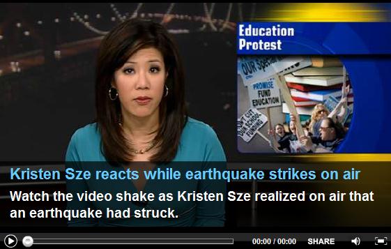
Earthquake Shakes KGO-TV During Morning Newscast. TVSpy.com has the story (and video): "Most San Francisco residents were asleep yesterday when a pair of earthquakes struck the Bay Area around 5:30 a.m. But Kristen Sze and Eric Thomas, the co-anchors of the early morning newscast on KGO, were wide awake. “I believe we’re feeling an earthquake right now,” Sze said, interrupting a report on an education rally (video above). “In fact, a pretty big earthquake. The studio is shaking.” “Good jolt, lasted for a few seconds,” Thomas responded. “In fact, it might have felt like what appeared to be two jolts, a smaller one and then a larger one. The lights were shaking pretty good in here.”


As New iPad Debut Nears, Some See Decline Of PC's. An article from The New York Times (subscription required): "The chief executive of Apple, Timothy D. Cook, has a prediction: the day will come when tablet devices like the Apple iPad outsell traditional personal computers. His forecast has backing from a growing number of analysts and veteran technology industry executives, who contend that the torrid growth rates of the iPad, combined with tablet competition from the likes of Amazon.com and Microsoft, make a changing of the guard a question of when, not if. " Photo: ipad3interesting.com.


Ford Teams With Facebook To Create "Social" Car. Hey, I'm all for social media and staying connected, even when I'm on vacation, spending quality time in the bathroom, sleeping, and (of course!) driving. Because when I'm hurtling down I-394 I absolutely want to know what my Facebook friends are thinking/saying. Gizmag.com has the horrifying details: "Automakers have begun slowly integrating social networking into vehicles via advanced infotainment systems that provide voice-activated social functions. In a recent collaboration with Facebook called "Hackathon," Ford gave the world a glimpse of what in-car social networking 2.0 might look like. It's scary and intriguing at the same time."

The $500,000 788 BHP Brabus Bullit Stealth Coupe - The Ultimate Sleeper. Politically incorrect? Absolutely. Gizmag.com has more details: "It's the ultimate sleeper! Brabus' matte-black stealth coupe has no outward pizzazz whatsoever (at least to the untrained eye), but with a 788 bhp twin-turbo V12 under the hood, it can hit 100 km/h in 3.7 seconds, 200 km/h in 9.8 seconds, 300 km/h (186 mph) in 23.8 seconds on its way to a top speed of more than 370 km/h (230 mph)."


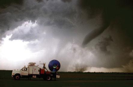
"Supercell". Thanks to the Wichita office of the National Weather Service for sharing this amazing image.


Doppler Radar Upgrade

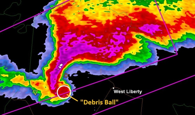
160 National Weather Service U.S. Doppler radars are getting an upgrade. Dual-Polarization hardware and software will allow not only push out a horizontal pulse of energy, but a vertical wave. Who cares?

Todd Krause, from the local NWS office, explained why this matters in an e-mail Tuesday. "The purpose of dual pol is to get a better handle on the hydrometeors, which will help with rainfall estimates, hail, and freezing/frozen precipitation." Tornadoes are usually much too small to show up on Doppler - we look for rapidly rotating parent thunderstorms, called "supercells", that often go on to spawn large hail and twisters. With "Dual-Pol", if a tornado is on the ground within 50-75 miles of Chanhassen, radar may be able to see the "debris ball", the actual debris being kicked up by a tornado on the ground. Over time this may result in fewer (rotation-based) false alarms. Here at MSP the upgrade is scheduled for September, Krause told me.

A cooler front kicks up a rain shower or or two today, but 50s return over the weekend. A little rain is possible late Sunday, mainly over Wisconsin. The ECMWF (European) model hints at 60s, even 70F the middle of next week. May-like? Yep.

Climate Stories....


Climate Change May Make Early Tornadoes The Norm: Scientists. The story from timescolonist.com: "According to some climate scientists, such earlier-than-normal outbreaks of tornadoes, which typically peak in the spring, will become the norm as the planet warms. "As spring moves up a week or two, tornado season will start in February instead of waiting for April," said climatologist Kevin Trenberth of the National Center for Atmospheric Research. Whether climate change will also affect the frequency or severity of tornadoes, however, remains an open question, and one that has received little study. "There are only a handful of papers, even to this day," said atmospheric scientist Robert Trapp of Purdue University, who led a pioneering 2007 study of tornadoes and climate change." Photo: AP.

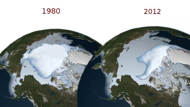
NASA Finds Thickest Part Of Ice Cap Melting Faster. The story from PR-USA.net: "A new NASA study revealed that the oldest and thickest Arctic sea ice is disappearing at a faster rate than the younger and thinner ice at the edges of the Arctic Ocean's floating ice cap. The thicker ice, known as multi-year ice, survives through the cyclical summer melt season, when young ice that has formed over winter just as quickly melts again. The rapid disappearance of older ice makes Arctic sea ice even more vulnerable to further decline in the summer, said Joey Comiso, senior scientist at NASA Goddard Space Flight Center, Greenbelt, Md., and author of the study, which was recently published in Journal of Climate. The new research takes a closer look at how multi-year ice, ice that has made it through at least two summers, has diminished with each passing winter over the last three decades. Multi-year ice "extent" – which includes all areas of the Arctic Ocean where multi-year ice covers at least 15 percent of the ocean surface – is diminishing at a rate of -15.1 percent per decade, the study found." Photo credit: NASA.

GM Funding Of Climate Change - Denying Heartland Institute Creates Outrage With Environmentalists. The story from The Huffington Post: "The recent disclosure that General Motors' charitable arm has funded a think tank skeptical of climate change fueled an outcry among environmentalists. Now, an environmental group says it has collected 10,000 signatures urging the automaker to stop funding the Chicago-based Heartland Institute. Internal documents leaked in February show that the General Motors Foundation -- which the automaker says is funded separately from business operations -- donated to the institute $15,000 in both 2010 and 2011, with another $15,00 expected in 2012." Photo courtesy of AP.


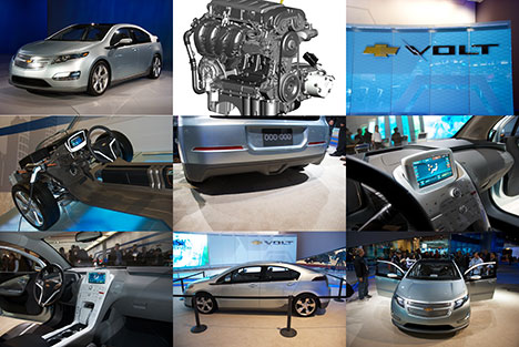
Electric Cars And The Liberal War With Science. The Washington Post has more: "President Obama boasted at a United Auto Workers conference last week that General Motors was back in business, producing cutting-edge vehicles like the plug-in electric Chevrolet Volt. He even promised to buy one when his time in office ends “five years from now.” Whoops! Just three days later, GM announced that it would suspend Volt production for five weeks this spring, idling 1,300 workers at a Hamtramck, Mich., factory. Alas, Obama’s endorsements notwithstanding, there’s not much of a market for this little bitty car, at least not at the price of almost $32,000 — after a $7,500 federal tax rebate." Photo credit: treehugger.com.

Conservative White Men Lead Climate-Change Deniers. The story from the Orange County Register: "Conservative white men are almost twice as likely as other U.S. adults to say that man is not the primary cause of global warming, according to an analysis of Gallup polling data by sociologists Riley E. Dunlap and Aaron M. McCright called, "Cool dudes: The denial of climate change among conservative white males in the United States." I came across the 2011 study while researching my story, "Ideology, not facts, often drives political beliefs," It explores how voters from both major parties arrive at their positions not based on science so much as predilections."

Climate Change Is A Geo-Political "Threat Multiplier", UK Climate Envoy Says. The story from KPCC Radio: "A senior official in the British Royal Navy came to Southern California last week with a message about how climate change can affect political stability. Rear Admiral Neil Morisetti is climate and energy security envoy for the United Kingdom. He said most people think about a warming climate solely as an environmental problem. “We haven't really in the past thought of it as a potential security issue,” Morisetti said. But he added that he observes that changing. He's traveling with a counterpart from the U.S. Navy to colleges and military bases to make the case that global warming deserves attention as a military and political issue. Climate change, he said, “can act as a threat multiplier in those parts of the world where tree's already stresses — food, water, health, and demographic challenges, often in countries where governments don't have the capacity and resilience to look after their citizens. And it can act as a catalyst for conflict and therefore increase the risk of instability.”

Photo credit above: "Rear Admiral Neil Morisetti, the UK's special envoy for climate and energy security, with Nancy Sutley, chair of the Council on Environmental Quality. ECSP/Flickr."


Ocean Renewable Power Company To Install Maine Tidal Energy System. Details from Huffington Post: "PORTLAND, Maine (AP) — With its federal license in hand, a Maine-based tidal energy company is ready to install its underwater power system for the first time on the floor of the ocean. Ocean Renewable Power Co. aims to begin installation of its first grid-connected power unit in mid-March at a 60-acre site in Cobscook Bay at the nation's easternmost tip. The first unit capable of powering 20 to 25 homes will be hooked up to the grid this summer, and four more units will be installed next year at a total cost of $21 million for the project, said Chris Sauer, president and chief executive officer of the Portland-based company." Photo above: inhabitat.com.

Monday, March 5, 2012

March 6: Calendar Says March, Maps Look Like Mid April

2" snow on the ground as of Monday evening in the Twin Cities. 9" snow on the ground last year at this time, March 5, 2011.


50 F. predicted high for today in the Twin Cities. Upper 50s possible in southern MN (where there is little snow to cool the air from below).

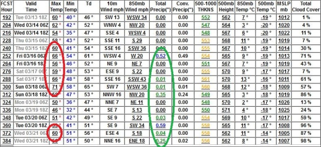
71 F. predicted high for March 17 (GFS).

1.88" rain predicted between March 16-21.


Another Sign Of Spring? The 39th Annual Auto Show kicks off at the Minneapolis Convention Center on Thursday, and continues through March 18. Even if you're just going to tire-kick and stretch you legs, it's a good excuse to turn off the tube, disconnect your Facebook account, and check out some new wheels.


"In my career I have never seen this many tornadoes or this many fatalities," said Joshua Wurman, the lead tornado researcher and president of the Center for Severe Weather Research." - from a Huffington Post article on last Friday's historic tornado outbreak below.


"The most prolific 5-day period of tornado activity on record for so early in the year?" - story below on Friday's extreme tornado outbreak and whether climate change was a factor.
 
Photo credit above: "Harrison residents work to salvage from their residences on Monday, March 5, 2012, after an F-3 tornado touched down in the waterfront Chattanooga, Tenn., suburb on Friday, March 2. (AP Photo/Chattanooga Times Free Press, Dan Henry)."

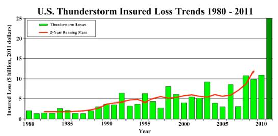
"Insured losses due to thunderstorms and tornadoes in the U.S. in 2011 dollars. Data and image from Property Claims Service, Munich Re." Full story below from Think Progress.
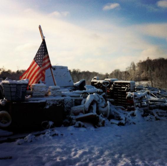

An Unwavering Spirit. You have to admire the residents of Henryville, Indiana. EF-4 tornado on a Friday, 4" snow on a Monday, and yet survivors are still determined to pick up the pieces, start over, rebuild their American Dream. I can't even begin to imagine what these people must be feeling right now.
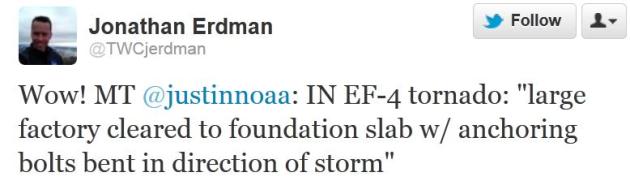


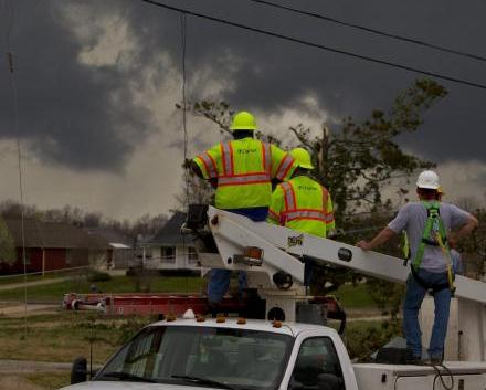
Tornado Forecasts Saved Countless Lives. USA Today has a good article highlighting the countless lives saved by NWS warnings and local TV broadcasters providing continuous coverage: "HENRYVILLE, Ind. – At the 103-year-old dream home on a hill that Roger Ledbetter had restored, Sunday was burial day. The house had been knocked off its foundation and ruined by killer twisters. A neighbor worked a backhoe to carve open a grave for three of Ledbetter's seven horses, so badly injured they had to be put down. Shep the dog had already been buried. A search was underway for the family cat, Miss Beasley. Yet for all the tears and tragedy that weather delivered along the miles of winding country road here, Ledbetter says, it could have been far worse." Graphic above courtesy of NOAA and USA Today.
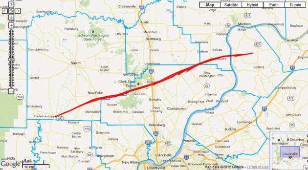

Southern Indiana EF-4 Tornado Was On The Ground 49 Miles. From the Louisville, Kentucky office of the National Weather Service: "The red track is the EF-4 tornado; 49 miles, from 2:50 pm EST to 3:39 pm EST."


Warm Winter Helped Fuel Tornado Outbreak. More details from USA Today: "The USA's freakishly warm winter may have played a role in the ferocity of last week's early-season tornado outbreaks. "This year's unusually mild winter has led to ocean temperatures across the Gulf of Mexico that are approximately 1 degrees C (1.8 degrees F) above average," says meteorologist Jeff Masters of the Weather Underground. This places it among the top ten warmest values on record for this time of year, going back to the 1800s, he says. "Friday's tornado outbreak was fueled, in part, by unusually warm, moist air flowing north from the Gulf of Mexico due to the high water temperatures there," Masters says."

Photo credit above: Butch Dill, AP and USA Today.
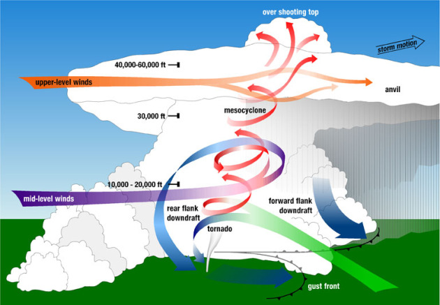

Global Warming Will Bring Violent Storms And Tornadoes, NASA Predicts. This scientific screed, from those tree-hugging, left-leaning, Al-Gore-loving rocket scientists over at NASA, published this way back in 2007. Might be worth another look, considering the extreme tornado count (and intensities) of the last few years. Here's an excerpt from the article at Science Daily: "NASA scientists have developed a new climate model that indicates that the most violent severe storms and tornadoes may become more common as Earth's climate warms. Previous climate model studies have shown that heavy rainstorms will be more common in a warmer climate, but few global models have attempted to simulate the strength of updrafts in these storms. The model developed at NASA's Goddard Institute for Space Studies by researchers Tony Del Genio, Mao-Sung Yao, and Jeff Jonas is the first to successfully simulate the observed difference in strength between land and ocean storms and is the first to estimate how the strength will change in a warming climate, including "severe thunderstorms" that also occur with significant wind shear and produce damaging winds at the ground." Photo above: NOAA NSSL.

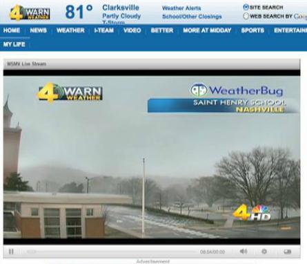
How Local TV Stations Covered March 3 Tornadoes. Al Tomkins has some good information at aimfortheheart.com: "I monitored live coverage from Louisville, Nashville, Lexington, Evansville, Paducah, Huntsville and Birmingham as storms roared through the country’s midsection Friday February 2, 2012.  I have no doubt that local TV and radio along with cable and network  broadcasters saved lives. The coverage was simply remarkable. While I watched online, I turned on my screen-capture program so I could share some clips with you. Consider this a sampling, not an exhaustive roundup. WSMV in Nashville was pounded by a hailstorm as a big cell passed right over the station on Knob Hill. The hail was so strong that the sound of it pinging off the roof overwhelmed the weathercaster’s voice on the air. The station cleared the studio but the warnings went on despite it all."


Will Tornado Season Be As Bad As Last Year? Meteorologist Paul Yeager has some observations and predictions at Huffington Post: "Frequent and intense tornado outbreaks resulted in 552 tornado-related deaths in 2011, the second deadliest year on record, from 1,709 tornadoes. The over three dozen of tornado-related deaths in the past week, along with 165 preliminary reports of tornadoes, is raising fears that this will be another devastating year for tornadoes. Overall atmospheric conditions in the coming months will not be as conducive for tornadoes as they were last year -- but an active season is a possibility. It was the combination of unseasonably warm air in the southern part of the country, cooler-than-normal air in the northern tier of the country, and an active spring and early summer storm track fueled by an ongoing La Niña that set the stage for the devastating season last year. These are factors that were anticipated by forecasters."

Kentucky Statewide Tornado Drill Scheduled For Today Cancelled. More from NOAA:

...KENTUCKY TORNADO DRILL SCHEDULED FOR TUESDAY MARCH 6 HAS BEEN
POSTPONED....SEVERE WEATHER AWARENESS CAMPAIGNS FOR OUR REGION...
EACH MARCH STATEWIDE SEVERE WEATHER CAMPAIGNS ARE HELD IN OUR REGION
TO RAISE THE PUBLIC`S AWARENESS OF THE THREAT SEVERE WEATHER EVENTS
CAN HAVE ON OUR LIVES...AND TO EDUCATE AND PREPARE EVERYONE FOR
TORNADOES...LARGE HAIL...DAMAGING THUNDERSTORM WINDS AND FLASH
FLOODING. THESE EVENTS INCREASE IN FREQUENCY AND SOMETIMES
MAGNITUDE IN THE EARLY SPRING. APRIL AND MAY ARE OUR PEAK MONTHS
FOR SEVERE THUNDERSTORMS. THE SEVERE WEATHER PREPAREDNESS
CAMPAIGNS WILL PROVIDE A FOCUSED EFFORT TO BETTER PREPARE EVERYONE
FOR THE UPCOMING SEVERE WEATHER SEASON. A MAJOR PART OF EACH
STATEWIDE CAMPAIGN IS THE TORNADO DRILL. THE TORNADO DRILL IS A
TIME THAT EVERYONE...INCLUDING PEOPLE AT HOME...BUSINESSES...
HOSPITALS AND SCHOOLS SHOULD EXECUTE THEIR TORNADO PLANS OF ACTION
TO ENSURE TIMELY AND PROPER ACTION DURING AN ACTUAL TORNADO.

FEMA Activates Regional Offices In Wake Of Severe Storms. More information from gsnmagazine.com: "President Obama and Secretary of Homeland Security Janet Napolitano called the governors of states hard hit by tornadoes the week of Feb. 27 to offer condolences and help, as FEMA activated regional offices in relief support in the affected areas. An outbreak of at least 74 tornadoes in the mid west and south killed 39 people in 10 states during the week. Kentucky, with 21 fatalities and Indiana with 13 fatalities, were the hardest hit. Ohio, Alabama and Georgia also suffered fatalities. Kentucky Governor Steve Beshear asked for federal disaster relief on March 4."


What March? When I say the maps look more like April I'm not exaggerating. Here is the extended GFS Outlook from March 13-21. Granted, I wouldn't sell the farm based on a 1-2 week outlook, but it usually does a pretty good job spotting overall trends. In this case we've had a few days/runs in a row with the GFS pulling warm, Gulf air northward, with highs topping 60 between March 15 to about the 18th, when the mercury could even rise above 70. It's too early to talk about severe weather, but if (in fact) we do see 60s and 70s, with dew points reaching the 50s, I wouldn't be surprised to see an early round of March T-storms in here by the third week of March. The GFS also prints out 1.88" rain (warm enough aloft for all rain at this point) between March 16-21. Hope that forecast verifies - we still have some serious catching up to do in the moisture department.
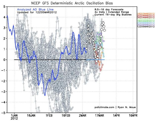

Arctic Oscillation: Positive Phase. As has been the case most of the winter, the Arctic Oscillation is forecast to remain strongly positive through the 3rd week of March, meaning unusually strong west winds howling above North America, and a small chance of (bitter/subzero) air penetrating southward into the Lower 40 States. Graphic courtesy of policlimate.com.

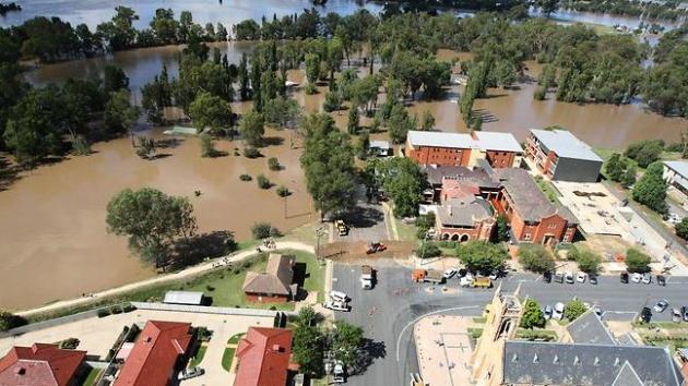
Flood Threat Forces Mass Evacuation Of Wagga Wagga. An update on severe flooding from The Australian: "A MASS evacuation was under way in Wagga Wagga last night after new forecasts that the Murrumbidgee River would breach the southern NSW city's levee system. The shock warning came at 9.30pm, only a few hours after the State Emergency Service had dismissed rumours sweeping through Wagga Wagga that the rapidly rising river level could go as high as 11m, well above the 10.7m levee height. The inundation of Wagga Wagga's CBD would cause the flood damages bill -- estimated earlier yesterday by the National Farmers Federation at much more than $1 billion -- to blow out further."

Photo credit above: "The flooded Murrumbidgee River near the NSW town of Wagga Wagga. Picture: Stuart McEvoy Source: The Australian."

Paul's Links. "Bookmark-Worthy" URL's and Links.

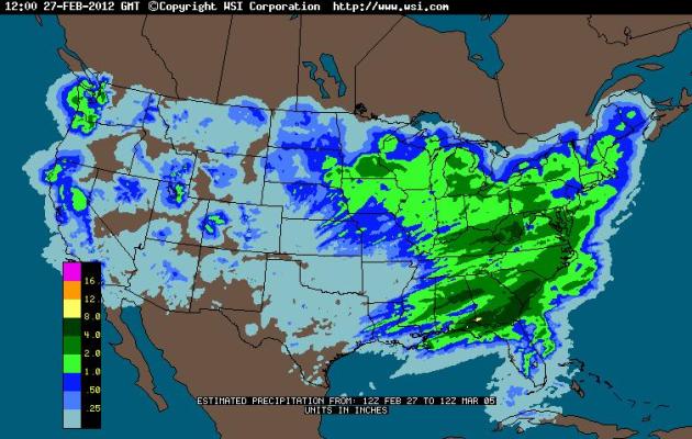
1). Weekly Precipitation Across The USA. Here's a useful map from WSI's "Intellicast" that shows NWS Doppler Radar rainfall estimates from coast to coast.

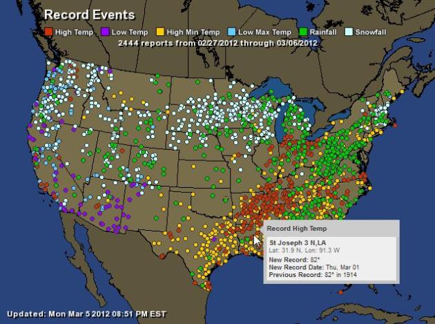
2). Interactive USA Records. O.K. Here's a remarkable site - Ham Weather, one of our family of companies within the Media Logic Group. I'm a little biased, but we have some amazing developers who are experts at parsing and visualizing weather data. You can track records (highs, lows, snowfall, precipitation, etc) for the last day, the last week - and you'll see other useful maps when you click on this site. The best part: absolutely free...and no ads either!

3). Current Conditions - Minnesota "Hourlies". To be able to predict the weather you need to know what's happening right now, in Minnesota, and nationwide (worldwide if you want to look beyond 3 days or so). NOAA has a great site that tracks weather at the top of every hour for scores of towns around Minnesota and nearby states. Most of these are from nearby airports, some manned, some automated "ASOS" sites. Hit refresh on your browser for the latest "obs".

4). Current USA Temperatures. If you want to check out current temps, barometric pressure and cloudcover for the nation check out the very latest conditions, courtesy of coolwx.com.

5). State Data For All 50 States. This is a great site, data available from NOAA in text or graphical form, for any state in the nation.

"Ask Paul". Weather-related Q&A:

Hi Paul –
"We’ve heard a lot about the importance of early warning when a tornado hits over the last several weeks and was wondering if you could get us any advice on which apps are best for our android phone? Thanks for any help you can give us."
Tom and Jenny Gamble

Dear Tom and Jenny,
At one point I was walking around with an iPhone and a Droid phone. My wife thought I was nuts (she's right) and cut off my Android data plan, so (in all honesty) I'm not quite as up on Android as I am about IOS and iPhone apps. That said, I did some research and found what I believe to be some of the best Android weather apps: RadarScope (for tracking high-res NWS Doppler Radars around the USA, and TorWarn, which sends out watches/warnings when the NWS pulls the trigger for your particular town. In addition, I've included 2 (free) apps that one of my companies created for Polaris, targeting snowmobilers and motorcycle enthusiasts who need personalized weather for their rides.

RadarScope. It's a little bit spendy (one time charge of $9.99) but once you see how well it operates you'll understand why I keep singing it's praises. You can see various Doppler products, warning polygons, even read the full text of NWS warnings and watches. For more information click here.

TorWarn Weather Alerts. I haven't used this personally, but I see some pretty good reviews and ratings in the Android Market. It's free (can't go wrong with that), and certainly worth a try. From the company: "With TorWarn you will have access to Tornado Warnings, Severe Thunderstorm Warnings, Tornado Watches, and Severe Thunderstorm Watches as soon as they become available. This application Uploads your position to our server which then searches the National Weather Service instantly for Warnings / Watches / Alerts in your area. If you are in a Warning or Watch your phone will be alerted and you can take the necessary actions to protect life and property."

Polaris Snow Trails. Full disclosure: one of my companies, Ham Weather, created this fine app (which works on Android and IOS/Apple smartphones). If you're a snowmobiler (tough season, I know...sorry) you need this app. Not only does it have updated snowfall amounts around the USA, it has GPS-specific snowfall predictions for any trail in the USA. And (wait for it), you can see where you are on any and all snowmobile trails in the USA, complete with nearby restaurants, hotels and bars. Best of all, it's free. More from Polaris: "Created by the devoted snow enthusiasts at Polaris, Polaris Snow Trails is a must-have app for the snowmobile rider. With this app, everything you need for your snowmobile adventures is only the touch of your finger away."

Included features:
- display your current location
- view maps of US snowmobile trails
- view snow cover, weather conditions and advisories for any location
- find and contact Polaris dealers
- local services search with integrated direct dialing, including gas stations, restaurants, and lodging
- save waypoints along your route
- track and save multiple snowmobile routes
- automatic map caching so maps can still be viewed while on the trail and outside of data coverage areas*
- share saved routes to Twitter or Facebook
- export route data in GPX or CSV format

Victory Rides. If you're a biker or motorcycle enthusiast you should check out this (free) app, available for Android or iPhones. Call up "layers" of weather data for your town, your state, your ride, including radar, temperatures and winds. You can even save and share your favorite rides. Full disclosure: we created this app for Polaris as well. It's free - with no ad clutter to get in your way.
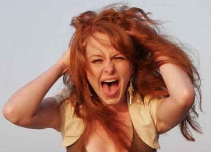

Redheads Feel A Different Kind Of Pain. Yes, we always new fiery redheads were different, right? ScienceNordic.com has the head-scratching details: "An increasing number of studies show that redheads are differently constituted in terms of pain perception and body reactions. Research reveals that redheads:
  • are more sensitive to cold
  • are less responsive to subcutaneously administered anaesthetics [under the skin]
  • suffer more from toothaches and are more frightened of dentists
  • are at greater risk of developing sclerosis and endometriosis"
Photo credit above: "Redheads have a reputation for being feistier than others, and there may be some truth in this. Scientists are gradually piecing together a picture which seems to indicate that redheads are constituted differently to other people. (Photo: schmidt-z)."
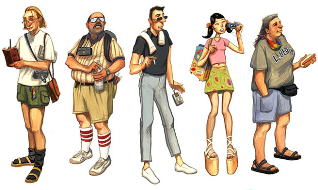
World's Worst Tourists: Americans Top List In New Survey. Why am I not shocked. Yes, you can always tell the American in the international crowd: tennis shoes (sneakers) and jeans, shirt tucked out, maybe a fanny pack for good measure. Huffington Post has the list no country wants to be #1 on: "It seems Americans might just be their own worst enemy when it comes to traveling abroad. That is, according to the findings of a new survey seeking to uncover the world's worst tourists, USA Today reports. Carried out by LivingSocial and Mandala Research, the survey polled 5,600 respondents from five countries, explains Biz Journal. Not only did Americans rank their own countrymen as the worst tourists; Australians and Canadians also ranked U.S. number one. Across the pond, the Irish singled out the British, while the Brits fingered Germans for their rude behavior, calling them the world's worst." Photo credit above: amazingdata.com.
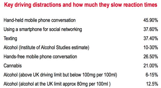

Using Facebook While Driving More Dangerous Than Drinking, Texting or Using Marijuana. The story from gizmag.com: "New research released today by the Institute of Advanced Motorists in the UK doesn't tell us much we didn't know before, but it does put it in context. The smartphone is headed for ubiquitous usage, and the wonderful real-time communications and information services it offers are making the roads considerably LESS safe."


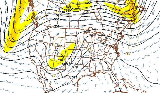
Maps Look Like April

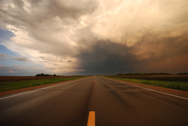
Talk about a meteorological disconnect. The calendar insists that it's March 6. Then why do the weather maps look like something out of mid-April? Factoring in warmth (4th warmest meteorological winter) and meager snowfall rations (22" so far) it's been the easiest, tamest winter for the Twin Cities in 81 years. Will it snow again? Count on it. But snow in late March or April is a fleeting affair, melting within 24 hours, give or take. I strongly suspect the worst of winter, a Kansas City winter, is behind us.

Dwindling snow on the ground may prevent us from seeing mid-50s today, but we should easily hit 50, the average high for April 1. The GFS is hinting at 60s from March 16-20, the atmosphere not even close to being cold enough for snow anytime soon. Our fast-forward spring limps on.

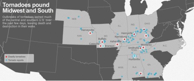
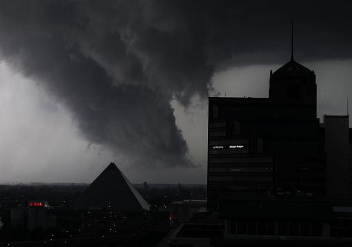
SPC now reports 128 (preliminary) tornadoes during last Friday's historic tornado outbreak. Was climate change a factor? We don't know, but some climate scientists suspect it may have been one of many factors, including La Nina, which often energizes/increases jet stream winds over the nation's midsection this time of year. Dr. Jeff Masters reports water temperatures in the Gulf of Mexico 2 degrees above average, symptoms of a mild winter. Record heat in the southeast fueled huge temperature contrasts last week, setting the stage for a horrific May-like tornado outbreak.

* GFS forecast map above valid March 20. At a glance it looks more like a jet stream configuration for April 20.

2011 Tornadoes: Is Climate Change To Blame For Devastating Weather? Here's an update from Huffington Post: "The tornadoes that tore through the southeast United States on Wednesday were cumulatively the deadliest twister disaster since 1932, with the death toll at 318 people and still rising. "In my career I have never seen this many tornadoes or this many fatalities," said Joshua Wurman, the lead tornado researcher and president of the Center for Severe Weather Research. He is more widely known for his role as the scientist on the Discovery Channel's "Storm Chasers" show. April has already shattered the benchmark for the number of tornadoes in a single month by a long shot. Meteorologists estimate that close to 600 tornadoes have formed thus far in April. That's nearly four times the average of 160, and twice the amount of the previous April record, 267 twisters in 1974." Photo courtesy of AP.

Wacky Winter Weather May Be Global Weirding. Richard Wiles has the story at Climate Central: "Its been a weird wacky winter across most of the country, with crazy hot temperatures smashing hundreds of records, and snow droughts in large swaths of the northeast, mid-Atlantic, the California Sierra, Colorado and Utah. Is this climate change? Global warming? Perhaps global weirding? “Too soon to tell” is what my staff scientists and PhDs tell me. “You can’t cry global warming every time you have a warm year” Really? What do you call it then? Or maybe I should ask, when? When will we have enough goofy weather in a row so that we can start calling it climate change? I guess they’ll get back to me on that one. “Limitations with the climate models, blah, blah, blah . . . “ Luckily, we have more information than just the models (don’t get me wrong, we love climate models here at Climate Central; they just have their limits, like anything else with a million zillion moving parts)."

Tornadoes, Extreme Weather And Climate Change, Revisited. The story from Think Progress: "The unexpectedly fierce and fast tornado outbreak so early in the season has folks asking again about a possible link to climate change. Climatologist Dr. Kevin Trenberth emailed me that, because of climate change, “there is every expectation that the [tornado] season will move up in time.  The warm winter in the US is perhaps an indicator of the nature of the changes to be expected.” The former head of the Climate Analysis Section of the National Center for Atmospheric Research stands by his 2011 statement, “It is irresponsible not to mention climate change in stories that presume to say something about why all these storms and tornadoes are happening.”

Paying More Attention To Global Weather. An interesting perspective from Huffington Post: "Are the several tornadoes that recently hit the United States an indication of what is to come? Perhaps 2012 will make the hurricanes, tornadoes, earthquakes, torrential rains, wildfires, and the record-breaking heat wave of 2011 seem ordinary. Were all the extreme weather occurrences of last year a product of global warming or just a coincidental string of events? I'm not a scientist but my interest in global warming has led me to do extensive research and meet with leading climatologists doing research in ozone depletion. Thus, I've become convinced that further investigation into global weather patterns could allow us to make better-informed predictions that ultimately save lives."
Global Warming: A Communist Plot? Of course it is! The Business Spectator has the story: “For the extreme left it [the existence of climate change] provides the opportunity to do what they've always wanted to do, to sort of de-industrialise the western world. You know the collapse of communism was a disaster for the left...and really they embraced environmentalism as their new religion.” – Nick Minchin, Liberal Senator and former Australian Government Minister."
"I happen to think carbon dioxide re-radiates energy within the infrared spectrum. I also believe combustion of a million years of fossilised carbon within the space of a year, as well as deforestation of large tracts of the world’s forests, is likely to lead to a material increase in carbon dioxide within the atmosphere. All other things being equal, I think this is likely to lead the Earth’s atmosphere to trap greater amounts of the sun’s energy, leading to an increase in global temperature. I also think that if we make emitting carbon dioxide more expensive and harder to do, we’ll reduce the amount of carbon dioxide we emit and moderate temperature rises."
Study Finds Climate Change Link To Region's Recent Wild Weather. The story from recordonline.com: "A new report by an environmental advocacy group shows our region has been particularly vulnerable to extreme weather events — driven by what it believes is climate change. The report, compiled by Environment New York Research and Policy Center, shows our nook of the Northeast has had a high number of federal disaster declarations since 2006. Numbers from the Federal Emergency Management Agency show Ulster County has had six weather-related federal disaster declarations in the last five years, while Orange County has had five and Sullivan County, four. "Catskill, Hudson Valley, and Mohawk River Valley residents have endured extreme weather beyond the usual cold winters during the last five years," David VanLuven, director of the Center, said in a statement."

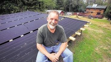
Photo credit above: “People are concerned” about climate change and want to do something about it, says Patrick Gallagher of Gallagher Solar Thermal in Warwick. He's been selling more solar panels, like those behind him.MICHELE HASKELL/Times Herald-Record."

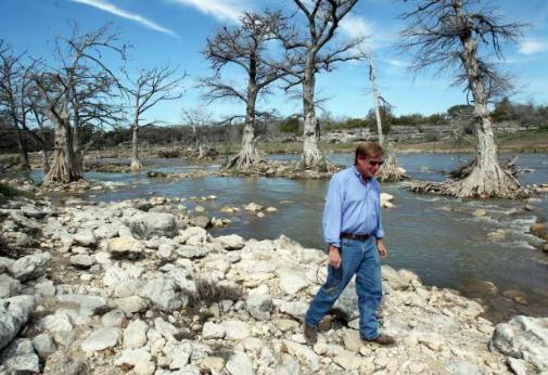
Climate Change Made The Drought Worse, Scientists Say. Mysanantonio.com has more details: "Several scientists at NASA and the state climatologist say the record-setting heat and drought of last summer in Texas was made worse by climate change. More than just providing bragging rights that Texas now holds the record for hottest summer ever recorded in the United States, that conclusion adds another layer of uncertainty for water planners. James Hansen of the NASA Goddard Institute for Space Studies and Columbia University's Earth Institute titled his still unpublished climate analysis, “Perceptions of Climate Change: The New Climate Dice.” “We conclude that extreme heat waves, such as that in Texas and Oklahoma in 2011 and Moscow in 2010, were ‘caused' by global warming, because their likelihood was negligible prior to the recent rapid global warming,” he wrote in the paper that is still undergoing peer review."

Photo credit above: "Bret Barnett, who owns property along the Guadalupe River, walks in late February in an area upstream from Canyon Lake where the river stopped flowing last year. Photo: TOM REEL, San Antonio Express-News / San Antonio Express-News."

In Climate Wars, Radicalization Of Researchers Brings Risks. The Washington Post has the story: "Everybody talks about the weather, Mark Twain famously wrote, but nobody does anything about it. Many climate researchers are no longer following Twain’s adage, noted Michael McPhaden, president of the American Geophysical Union. “Scientists today, they don’t just want to talk about it. They want to do something about it,” he said in an interview. “We’re the trustees of information which, in many ways, is of critical benefit to society. Some researchers are taking on a greater public-advocacy role to confront what many of them consider an existential crisis."