Sunday, March 4, 2012

March 5: Maps Look Like April (more on Friday's deadly tornado outbreak)

 
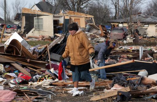
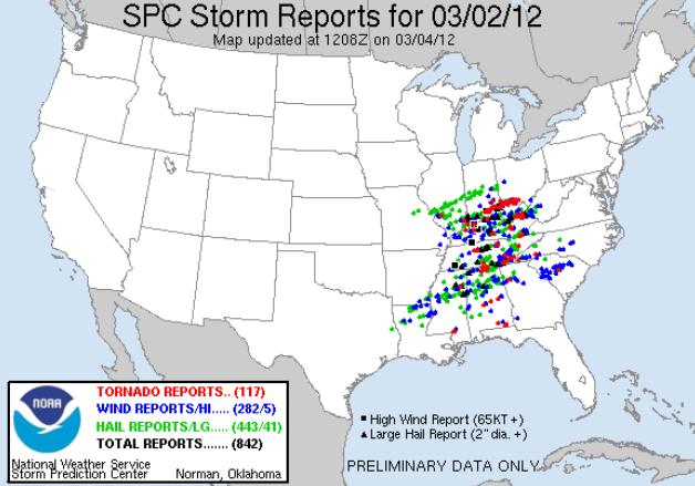
117. Preliminary number of confirmed tornadoes that touched down last Friday. Source: NOAA's SPC.
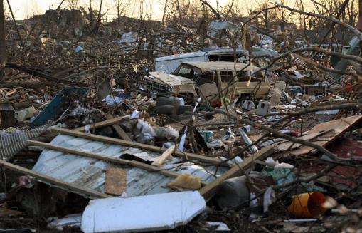
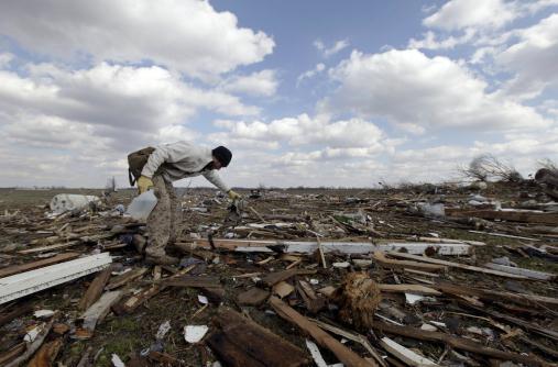
Photo credit above: "Unidentified women search through debris of Ted and Brenda Tolbert's Holton, Ind. home Sunday, March 4, 2012. A string of violent storms scratched away small towns in Indiana and cut off rural communities in Kentucky as an early-season tornado outbreak killed at least 37 people on Saturday. The Tolberts are in the hospital after their house fell on them during the storms. (AP Photo/Ernest Coleman)."

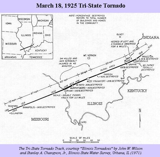
219 miles. Path-length of March 18, 1925 "Tri-State Tornado", that killed 695 people in Missouri, Illinois and Indiana. Details below.


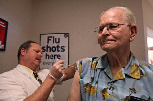
  12,000. Average number of influenza (flu) deaths every year in the USA. So far this winter: "a few hundred". Source: New York Times. Details below. Photo credit: AP Photo/Odessa American, Heather Leiphart.

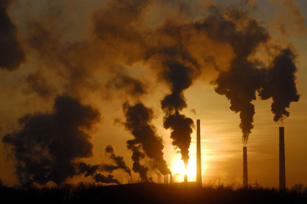
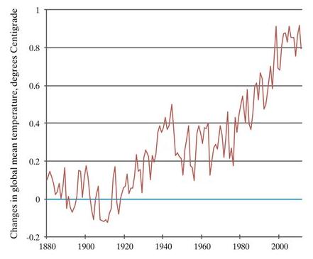
"Last month the International Energy Agency (hardly an alarmist body of scientists) announced a record annual increase in atmospheric carbon and further warned that without bold action in the next five years, the Earth's temperature will push beyond the 2 degrees Celsius that climate scientists consider an ominous tipping point." - from a story at kentucky.com.

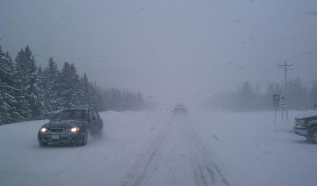
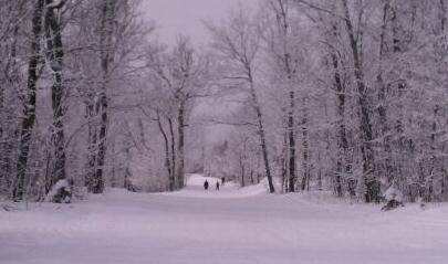
Winter's Last Stand Up North? Broadcast Weather meteorologist Todd Nelson snapped this photo between Two Harbors and Goosebury Falls Sunday, a light snow falling on show-covered highways - plenty of slick spots. Much of the snow will be gone from the Twin Cities metro on south by Tuesday, snow lingering a few more weeks up north, where a cool 1 to 2 feet of snow is on the ground.


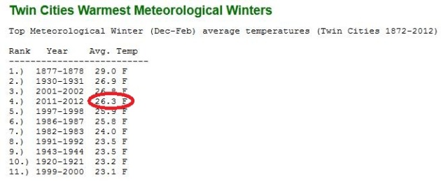
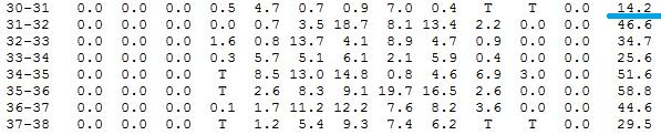
Easiest Winter In 81 Years. You have to go back to the Winter of 1930-31 to find a Twin Cities winter so warm (and snow-free). As you can see from MN State Climate data above this is the 4th warmest meteorological winter on record. 2001-2002 was warmer, but 66" snow fell. To find a comparable winter of unusual warmth AND lack of snow you have to go back to 1930-31 snowfall records (see graph below, data from the MN State Climate Office).


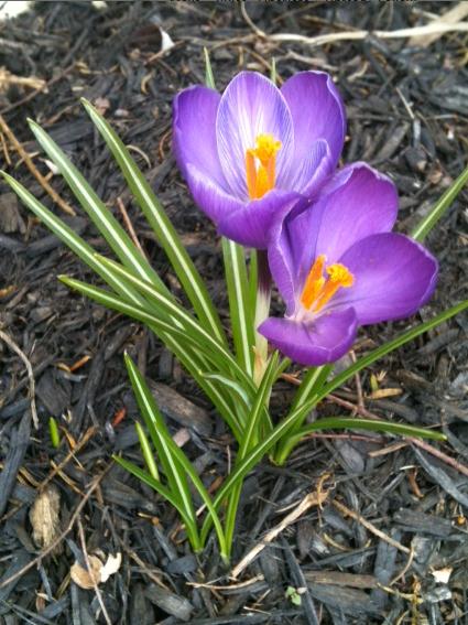
Crocus Alert. Yes, spring is coming early to much of the USA, including Lancaster, Pennsylvania, where Joan Kruhoeffer snapped this photo of emerging crocus in her garden.

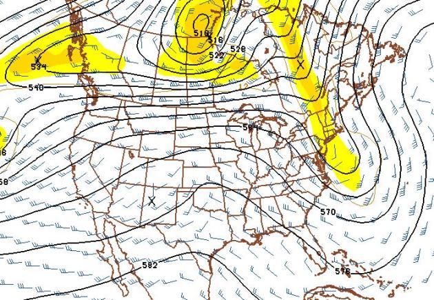
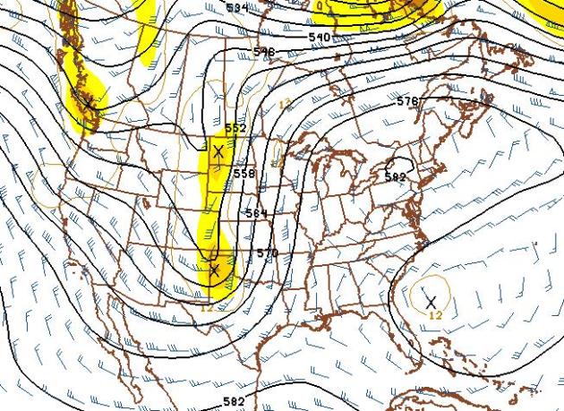
Winter: Missing In Action. The 500mb map above (GFS) is valid March 20. Funny, it looks like something out of April or early May, the main core of jet stream winds lifting into southern Canada. This implies 50s, even a few 60s by mid March. Our fast-forward spring rolls on...

Mind-Numbing Numbers. As of midday Sunday the tornado count from Friday's (unusual) early-season outbreak was up to 117, according to SPC. The most tornadoes in a 24 hour period? April 3-4, 1974, when 148 tornadoes touched down on 13 states.

* EverythingWX has a list of all the confirmed tornadoes from last Friday.

The 1925 Tornado Was Worse, But That's Little Comfort To People In Harrisburg. Here's an insightful article about historical perspective and the recent (devastating) tornado that hit Harrisburg, Illinois, from the Evansville Courier and Press: "In Illinois, the tornado of March 18, 1925, is the one to which all others are compared. Known as the Tri-State Tornado, this twister traveled 219 miles from near Ellington, Mo., across Southern Illinois to near Princeton, Ind. A total of 695 people were killed across the three states with more than 2,000 injured. In Illinois alone — during the first 120 mile stretch of the storm's path — 541 people lost their lives. The fact that the Tri-State Tornado of 1925 remains the single most devastating storm in Illinois history is no comfort to the families in Harrisburg, Ill., who lost a loved one in Wednesday's EF-4 tornado. For the 100 or more injured in the storm, their scars will be just as painful, just as deep and will last just as long as those who survived the '25 twister."

Photo credit above: "Looking east from Brady Street where five of six people were killed by a tornado in Harrisburg, Illinois, Thursday, March 1, 2012. (Abel Uribe/Chicago Tribune/MCT)."

* for more on the Tri-State Tornado of 1925, click here - data courtesy of Wikipedia.

The Tornado Outbreak Of March 2 In A Historical Context. H. Michael Mogil, an expert of tornado climatology and historical perspective, has some timely thoughts on last Friday's outbreak in this Examiner post.

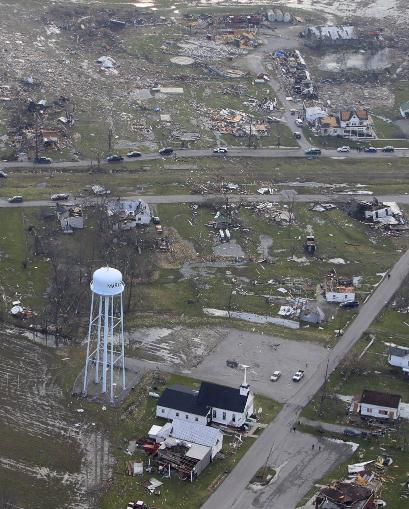
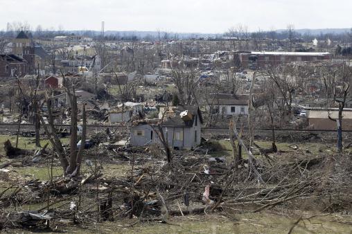
Photo credit above: "In this aerial photo, debris is strewn about, Saturday, March 3, 2012, in Marysville, Indiana, after a tornado swept through the area Friday. A string of violent storms demolished small towns in Indiana and cut off rural communities in Kentucky as an early season tornado outbreak killed more than 30 people, and the death toll rose as daylight broke on Saturday's search for survivors.(AP Photo/Al Behrman)."


“The Henryville, Indiana tornado (Clark County) rated an EF4 Major Tornado – just spoke with the NWS office in Louisville. The damage surveys for other areas including Chelsea and Marysville will be tomorrow.” - Indianapolis WTHR-TV meteorologist (and friend) Chikage Windler in a Sunday tweet.

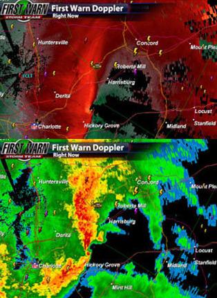
Meteorologist: "It's The Type Of Storm We Struggle With The Most". When it comes to tornadoes everyone (NWS, local officials, meteorologists) want to err on the side of caution and safety. It's better to issue a tornado warning and have nothing materialize than to cross your fingers, and have a tornado unexpectantly roar through a heavily-developed area. The Charlotte Observer describes the quandary forecasters face when threatening-looking signatures and circulations show up on Doppler: "A thin line of thunderstorms was racing toward the Charlotte area at 60 mph early Saturday, about to produce a quick-hitting but strong tornado. And the people in its path, along a 3.8-mile stretch of Mecklenburg and Cabarrus counties, had no warning. On Saturday, a meteorologist at the National Weather Service's office in Greer, S.C., said forecasters never saw it coming. "It's the type of storm that we struggle with the most," meteorologist Harry Gerapetritis said of the EF2 twister that produced winds of up to 135 mph and damaged or destroyed about 90 homes, injuring three. "But we didn't get it right," he added."

Graphic credit above: "Posted by Brad Panovich WCNC @wxbrad: Heads up Cabarrus Co don't like this storm."

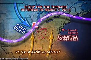
The Science Behind The Tornado Outbreak. Andy Mussoline at AccuWeather does a good job tracing the chronology of last Friday's deadly weather recipe: "Friday, March 2, 2012 may be known as one of the worst tornado outbreak for early March on record. Eighty sightings of tornadoes were reported between 10 a.m. and 9 p.m. Friday. Friday's outbreak could include more tornadoes in one day than typically occur over the entire month of March in the United States."

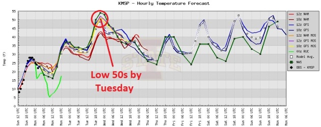
Wave Goodbye To The Snow In Your Yard. We'll come close to 40 later today, a good chance of topping 50 Tuesday afternoon, followed by a slight cooling trend later in the week (but still a few degrees above average). Highs may reach 50 again by the weekend, Saturday probably the drier, nicer day. A little light rain may arrive by Sunday.

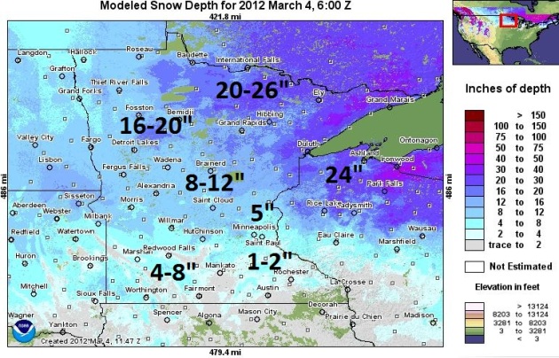
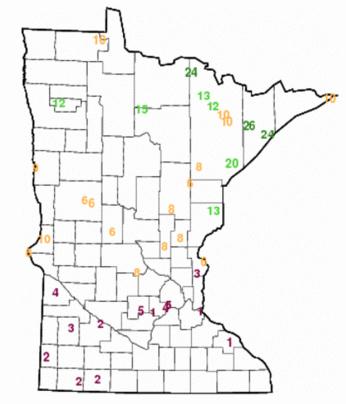
Latest Snowcover. NOAA's NOHRSC map shows a couple inches of snow in the metro (a lot more north metro), with 8-12" in the Brainerd Lakes area, as much as 20-30" over far northern Minnesota and Lake Superior's North Shore. By the end of this week snowfall amounts will be roughly half what they are right now.

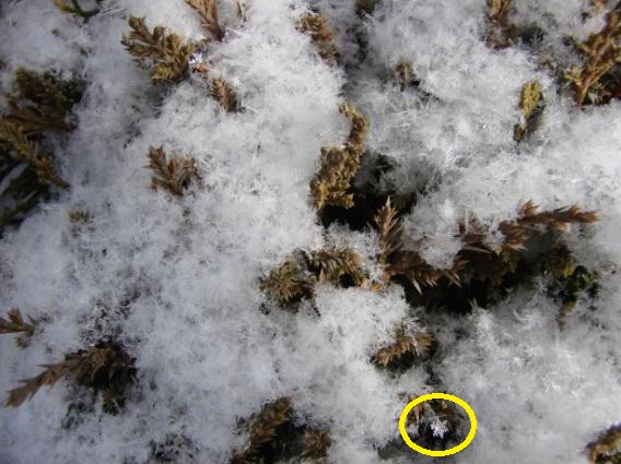
Snowflakes 401. From the La Crosse office of the National Weather Service: "Can you find two snow flakes which are alike? Many of the snow flakes that fell across the area today are called stellar dendrites (the type of snowflakes that you normally see on Christmas cards). They form when the temperatures aloft are around 5F (-15C). The snowflake by itself on the bottom to the right is great example of what a stellar dendrite looks like."

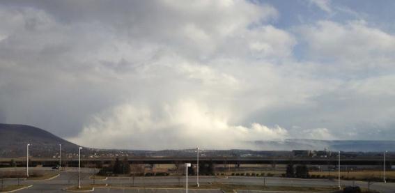
Snow Squall. From the State College, Pennsylvania office of the National Weather Service: "a snow squall obscures our view of Tussey Mountain and Boalsburg on Sunday afternoon."


Read more here: http://www.charlotteobserver.com/2012/03/03/3066447/meteorologist-its-the-type-of.html#storylink=cpy

Read more here: http://www.charlotteobserver.com/2012/03/03/3066447/meteorologist-its-the-type-of.html#storylink=cpy


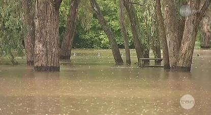
A Record Wrecker For Rainfall. Australia's theage.com documents extreme rainfall amounts Down Under: "RAINFALL across Victoria's north-east over the past week has smashed hundred-year highs, with most locations having their wettest seven days on record. Corryong's 312 millimetres of rain doubled the previous weekly record set 119 years ago. The Bureau of Meteorology said Wodonga had 256 millimetres, topping its record set in 1893, and Mount Buffalo had 525 millimetres, beating its record of 483 millimetres set in 1956."

Paul's Links. Here are a few more of the URL's I rely on from day to day. Hope you can use a few of these for your meteorological needs down the road.

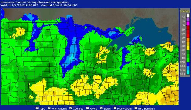
1). Advanced Hydrological Prediction Service. NOAA's AHPS site is a terrific resource to track (Doppler estimated) precipitation amounts for Minnesota, the Upper Midwest, or the entire USA, looking back 24 hours, or 180 days. In addition to tracking observed amounts, you can see how it compares to normal precipitation values, allowing some true perspective. Good information for farmers, gardeners - anyone who needs to keep tabs on precipitation.

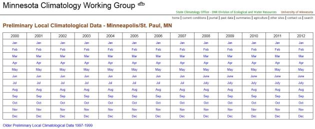
2). Preliminary Local Climatological Data. Minnesota's State Climate Office (Minnesota Climatology Working Group) does an excellent job updating data for the Twin Cities (or any other large Minnesota town) at this site. Need to know how much snow fell on a certain day in 2008, or what the high was on August 23 of last year? This site will tell you everything you need to know.

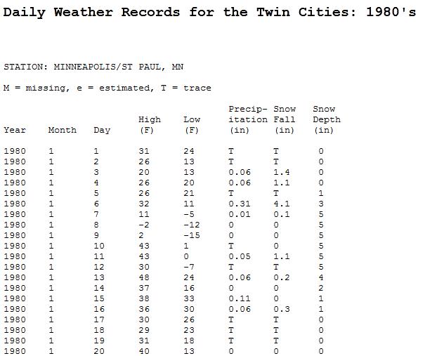
3). Twin Cities Weather, Decade By Decade. Speaking of the Minnesota Climatology Working Group, this is a good site for researching specific weather on a specific day going back before 2000. If you want to look at data for the 90s, just chance the URL from msp1980's.htm to msp1990's.htm and the new data will pop up. One note: January shows up as "1", as in first month of the year, the next column is the day of the month, followed by high, low, precip, snowfall and snow depth. Pretty intuitive.

Ask Paul. Weather-Related Q&A.

Paul
"As one that has always been interested in weather, its been my observation that when our  local media meteorologists  say the SPC has put us in a slight risk area for severe storms, some sort of severe storms seems to fire off even though we were only in a slight risk.  

That has caused me to look more deeply into the different type of products put out by the SPC, and I was alarmed to learn that my understanding of a slight risk area was grossly underestimated.  That has since lead me to learn as much about weather and forecasting as I can, and to recognize storm structure and become a spotter for the NWS.  

I am one that believes a well informed public is an aware and prepared public,  statements like, stay sky....or keep in ear on ....just doesn't cut in my opinion.
So here is my question....

Paul could you please describe in detail the meaning of the Storm Predictions Convective Outlook pages?  I see Categorical  and Probabilistic products listed but would like a better understanding of them.
Thank you."

Randy Peterson

 Randy - your question is a good one, and especially timely in light of Friday's tornado catastrophe. Every morning SPC, the Storm Prediction Center, a division of NOAA, issues "convective outlooks" that try to specify the aerial coverage and intensity of severe storms later in the day. The forecasts look at dozens of atmosphere variables, including the potential for low-level wind shear (which gives severe, rotating "supercell" thunderstorms their spin), instability, low-level moisture and dry air in the mid layers of the atmosphere. Most days between now and August will have a "slight" risk somewhere in the USA. This is fairly typical, and implies a good chance of Severe Thunderstorm Watches being issued later in the day. When you see a "moderate risk" from SPC it means a much better chance of tornadic storms. Expect Tornado Watches and Tornado Warnings later that day for the specified area. A (rare) "high risk" implies an extreme risk of tornadoes, especially large, long-lasting, potentially violent EF2-4 tornadoes. SPC meteorologists do a very good job, but tornadoes often fall outside a moderate or high risk area - even days with only a "slight risk", as  you point out, can spawn tornadoes. It's a guide, and these forecasts get a little bit better every year. An estimated 70% of all tornadoes in the USA touch down in an area that has been placed under a Tornado Watch. It's a fine line: you don't want to overwarn people (they become complacent and believe forecasters are merely "crying wolf"). But you certainly don't want to under-warn people either - if anything you want to err on the side of safety and caution. Better to overwarn than underwarn.

Here are more details from SPC: "A SLGT risk implies that well-organized severe thunderstorms are expected but in relatively small numbers/coverage, or a small chance of a more significant severe event. Not all severe storm events will be covered with a SLGT risk, especially during the summer when short-lived, "pulse-type" severe storms are relatively common during the afternoon. A MDT risk implies a greater concentration of severe thunderstorms, and in most situations, greater magnitude of severe weather and greater forecaster confidence compared to a SLGT risk. A MDT risk is usually reserved for days with substantial severe storm coverage, or an enhanced chance for a significant severe storm outbreak. Typical MDT risk days include multiple tornadic supercells with very large hail, or intense squall lines with widespread damaging winds. The HIGH risk implies that a major severe weather outbreak is expected, with large coverage of severe weather and the likelihood of extreme severe (i.e., violent tornadoes or very damaging convective wind events). The HIGH risk category is reserved for the most extreme events with the least forecast uncertainty, and is only used a few times each year. The outlook categories are related to the specific tornado, damaging wind, and large hail probability forecast graphics on Day 1, and the total severe storm probabilities for the Day 2 and Day 3 outlooks."

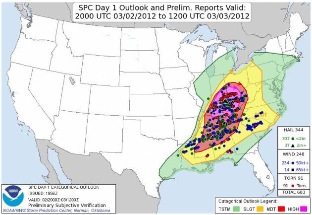
Verification. Here was the convective outlook issued by SPC last Friday morning (slight risk is yellow, moderate risk is red, high threat is purple). The red dots (which are tough to see) are actual tornado touchdowns. As you can see SPC really nailed the area that experienced the most tornadoes and reports of large, damaging hail.

The system isn't perfect, but America has the best weather service in the world, bar none. The death toll last Friday could have been well into the hundreds - but between SPC, local NWS offices and local TV meteorologists people living in these risky zones had plenty of warning. if they were (awake) they knew that it was going to be a very rough afternoon and evening. Many schools and businesses even let out early on Friday, so people could be home with their families. Thanks for a great question Randy. I have a hunch it's going to be another very busy severe storm season for Minnesota meteorologists.

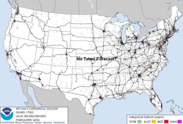
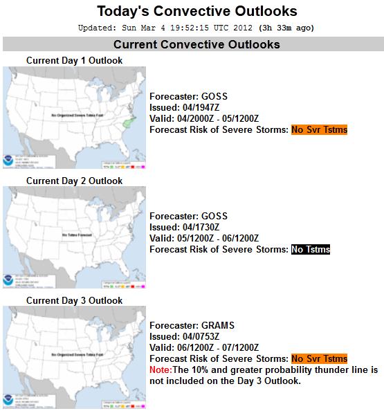
Convective Outlooks. Here's a good summary of the anticipated severe threat for the next few days, courtesy of SPC. Little or no risk of severe storms for the USA. The next chance of severe storms probably won't come until Thursday and Friday, from Texas to Tennessee.

U.S. Smartphone Ownership Eclipses Feature Phones. The story from gigaom.com: "The U.S. is now officially a smartphone nation, with 53 percent of all adult cell phone owners claiming ownership of a smartphone, according to a new report by the Pew Internet & American Life Project. It’s the first time that smartphone penetration has been reported to eclipse feature phones in the U.S. though the milestone has been predicted for some time. Pew found that smartphone ownership in February 2012 has jumped to 46 percent of all adults from 35 percent in May of 2011 while feature phone ownership has slipped from 48 percent to 41 percent over the same period. A slim 12 percent of adults said they still don’t own any phone at all."

Is This The iPad 3? Mashable.com (courtesy of MIC Gadget) has video of what may be the new iPad 3, scheduled to be formally announced on Wednesday. If you have an iPad itch that a scratch won't reach, read on: "Itching to see what the iPad 3 looks like and don’t want to wait until Wednesday? Tech blog MIC Gadget has reportedly obtained parts of the next-generation iPad. If this is real, it’s the closest look yet at the new tablet from Apple. In line with industry speculation, the clip reveals that the iPad 3 touts a larger camera lens and a slightly thicker shell. In addition, it will once again include a home button, disputing rumors that the touchscreen itself could serve as the home button. Apple announced last week it will be holding a press event on Wednesday, March 7 in San Francisco to unveil something to “see” and “touch.” Flurries of speculation have since circulated the Web with many looking for clues about the highly-anticipated launch of the iPad 3."

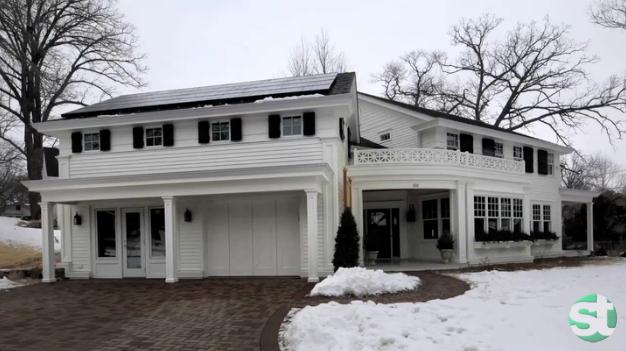
Parade Of Homes: Don Shelby's Green Dream. The Star Tribune has a nice article (and video) focusing on Don's new, energy-efficient green home in Excelsior. He's trying to walk the talk, and create a new home that has a minimal carbon footprint, while creating a new dwelling that will save considerable money on energy in the years ahead. Check out his new pad in this year's Parade of Homes - another sign of spring! "Don Shelby was raised to be frugal as a kid growing up in Muncie, Ind. "My mom would always tell us to shut the door when we left the room," said the recently retired WCCO-TV news anchor. "And she cooked one big meal a week, and the rest of the week we ate leftovers." His dad's stamp and coin collections taught Shelby that objects had value no matter how old they were. Later, as a journalist, he covered environmental issues and launched WCCO's Project Energy Series. "The more I reported on this breaking wave of technology, the more I became interested in incorporating it in my lifestyle," he said. "I wanted to walk the talk." So when Shelby and his wife, Barbara, had the opportunity to build a home exactly the way they wanted, their mission was to go green, incorporating the latest technologies, as well as recycled and repurposed materials."


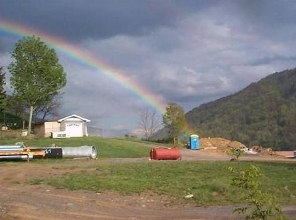
End Of The Rainbow. Not to be a cynic or anything, but if anyone asks, at the end of the rainbow is...an outhouse? Spread the word. I have a hunch this was Photoshopped. Just a hunch.


Easiest Twin Cities Winter Since 1930-31

Winter is, for all intents and purposes, over. Of course we'll see more flurries, a few minor "slush events" - don't pack away the heavy jackets just yet. But subzero weather is behind us now. Only 3 night below zero, btw. Second fewest on record. By mid-March we'll see 60s - 70 still not out of the question, as moisture surges north out of the Gulf.

Silver lining: we're heading into a wetter pattern: 1-2" rain by mid-month. With the warmth & moisture may come an early start to severe storm season.

No arctic fronts. A few more dribs and drabs of snow. Even if we do see snow in late March it'll melt in 24 hours. Winter over on March 5? I must be lost. We're still living in "Minne-snowda", right?
Welcome to the easiest winter since 1930-31. Although the 4th warmest since 1872 it's the combination of mild and snow-free that's so unusual. 2001-2002 was warmer, but we saw 66 inches of snow. A bit more than the 22 inches this winter. 1931 was warmer with less snow; only 14 inches fell
It looks much too warm aloft for snow through the 3rd week of March. 50s sweep in Tuesday, again next weekend.

Take a nice photo of the snow in your yard. It'll be mostly-gone within 48 hours.

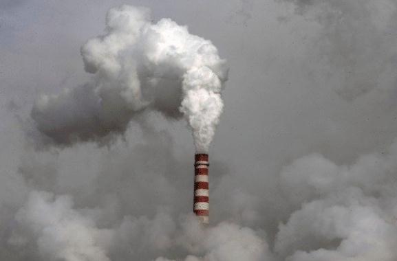
Cigarette's Lessons For Climate Change. The story from the L.A. Times. Here's a snippet: "There are limits to the parallels between smoking and climate change, of course. People can live quite well without smoking, while society does need to consume energy — even if not in the amounts it now does or from such damaging sources. But there are nevertheless ways in which our experience with tobacco can help us grapple with the overwhelming problem of climate change. First, let's examine some of the ironies here. As Naomi Oreskes and Erik Conway point out in their book "The Merchants of Doubt," the fossil fuel industry and the hard right have used the same tactics as the tobacco industry to seed doubt about the danger of climate change."

Photo credit above: "The cooling tower of a coal-fired power plant in Dadong, Shanxi province, China, is seen on Dec. 3, 2009. (Andy Wong/AP Photo / March 2, 2012)."

Denial Of Climate Change Dangerous Political Stand. Here's an excerpt of an Op-Ed at kentucky.com: "What gets lost in this murky sauce of minor factors is a simple truth: The Earth's fluctuating temperature has always risen and fallen according to the amount of carbon dioxide in the atmosphere. The level of carbon dioxide in the atmosphere has risen from the pre-industrial number of 280 parts per million to 383 parts per million in 2007. Never have CO2 levels spiked like that in the 600,000 years we can measure with ice core sampling, and therefore, only the burning of coal, oil and gas by human beings could account for that rise."

Read more here: http://www.kentucky.com/2012/03/04/2094514/ky-voices-denial-of-climate-change.html#storylink=cpy
The Best Part Of Global Warming. One big silver lining to one of the mildest winters on record for most of the USA? Fewer cases of flu. More details in The New York Times: "The long-term troubles this sort of weather predicts are alarming. In the short term, however, our warm winter may have one unforeseen and felicitous consequence: a drastic reduction in the incidence of influenza. Flu seasons can begin as early as October, and end when the number of positive tests for the virus approaches zero, generally sometime in March or April. There has been a wide variation in the number of deaths attributable to influenza in past seasons — it has reached as high as 49,000 — but the average is around 12,000."


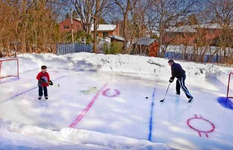
Final Periods For Old-Time Shinny On Natural Ice, Climate Scientists Say. The story from The Vancouver Sun: "A team of Canadian climate scientists is predicting the widespread disappearance of outdoor hockey rinks across the country in the next 50 years due to global warming — with some regions of the sport’s spiritual birthplace likely to witness an even earlier eclipse of old-time shinny on natural ice. “The ability to skate and play hockey outdoors is a critical component of Canadian identity and culture,” three researchers from Montreal’s McGill and Concordia universities write in the latest issue of the U.K.-based scholarly journal Environmental Research Letters. “Wayne Gretzky learned to skate on a backyard skating rink; our results imply that such opportunities may not be available to future generations of Canadian children.”

Photo credit above: "Fred Fizet and his son Olivier play hockey on the backyard rink at their home in Baie d'Urfe outside Montreal. Photograph: John Mahoney , The Gazette."


Read more here: http://www.kentucky.com/2012/03/04/2094514/ky-voices-denial-of-climate-change.html#storylink=cpy
 
 
Take The Subway. An insightful look at (undeniable) trends from St. Louis Park's very own Thomas Friedman, reporting for The New York Times: "But you better believe this: The planet is getting flatter and more crowded. There will be two billion more people here by 2050, and they will all want to live and drive just like us. And when they do, there is going to be one monster traffic jam and pollution cloud, unless we learn how to get more mobility, lighting, heating and cooling from less energy and with less waste — with so many more people. We can’t let the climate wars continue to derail efforts to have an energy policy that puts in place rising efficiency standards, for buildings, windows, traffic, housing, packaging and appliances, that will drive innovation — which is our strength — in what has to be the next great global industry: energy and resource efficiency."

Global Warming: Multiple California Bird Species At Risk. Here's an excerpt from the Summit County Citzens Voice: "More than 100 of California’s bird species are vulnerable to global warming impacts, including 21 of the state’s 29 threatened and endangered bird species that will be further impacted by climate change, increasing their risk of extinction. At-risk birds include wetland birds like the California black rail, California and Yuma clapper rails and three species of song sparrow found only in the tidal marshes of San Francisco Bay. Species that make a living at sea or near-shore waters and that nest on islands or rocky shores are also highly vulnerable, including species like the Cassin’s auklet, common murre, black oystercatcher and the iconic white and brown pelicans, according to scientists with the Point Reyes Bird Observatory and the California Department of Fish and Game."

Saturday, March 3, 2012

March 4: On Track For A New Yearly Tornado Record In The USA?


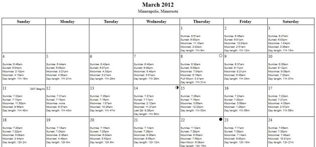
2:32. Today the sun will be out 2 hours and 32 minutes longer than it was back on December 21.
11 hours, 18 minutes of daylight today.
6:46 am sunrise in the Twin Cities. Sunset is 6:04 pm.
October 8. Today the sun overhead will be as high in the sky as it was on October 8.

101 tornadoes Friday from Mississippi to Ohio. Source: SPC, NOAA's Storm Prediction Center. Photo of tornado damage in Marysville, Indiana courtesy of Nam Y. Huh/AP).

791 separate reports of severe weather Friday (hail, straight-line winds and tornadoes).

38 tornado-related fatalities from Friday's storms. 19 in Kentucky, 14 Indiana, 1 each in Alabama and Georgia. Source: AP.

“The Henryville, Indiana tornado (Clark County) rated an EF-4 Major Tornado – just spoke with the NWS office in Louisville. The damage surveys for other areas including Chelsea and Marysville will be tomorrow.” - Chikage Windler

"Everyone talks about the weather, but no one does anything about it." - Mark Twain.


Sunrise-Sunset Calculator. For any city, any day of the year. I'll even throw in moonrise for now extra money. Be the envy of your friends! Details below, along with 3 other sites, part of "Paul's Links".

2nd warmest meteorological winter on record for New York City; warmest February on record. Source: NOAA. Photo: Mark Lennihan/AP.

4 out of 5 of all Americans live in areas that have been declared Federal Disaster Areas at some point since 2006.

99 Federal Disasters declared in 2011, a new USA record.

"Public discourse has been polluted now for decades by corporate-funded disinformation – not just with climate change but with a host of health, environmental and societal threats. The implications for the planet are grim." - climate scientist Michael Mann, in a Guardian story below.

"A warming climate will only add to this trend of increasing losses, which is why action is needed now," said Mark Way, head of Swiss Re's sustainability and climate change activities in the Americas, who spoke at yesterday's press conference". - from a Huffington Post article below.

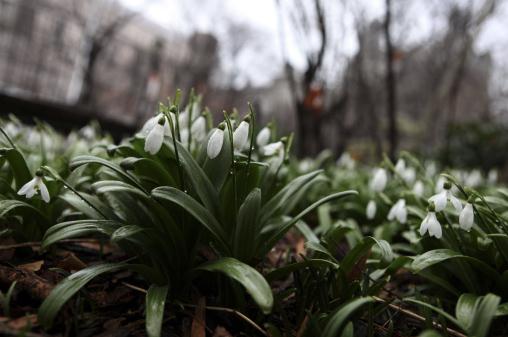
In Full Bloom, 30-45 Days Early. "Snow drops in Central Park in New York, Feb. 24, 2012. Horticulturalists in the Bronx call it the global-warming garden, and in a winter notable for its consistent mildness, it is hardly unusual. (Suzanne DeChillo/The New York Times)."

2011-2012: New York's Second Warmest Winter In History; Warmest February Ever. The Huffington Post has more specifics: "Yup, it's official: February was the warmest New York February since people started keeping track back in 1870. At a balmy average of 40.9 degrees, this February ties the 1984 record and caps off a remarkably warm three months, the "second warmest climatological winter on record, trailing only 2001-02," according to Gothamist. By contrast, the coldest February occurred in 1934, when temperatures averaged only 19.9 degrees, a staggering 21 degree difference."

324 months in a row. February was the 324th consecutive month of global temperatures above the 20th century average. Source: NOAA NCDC.

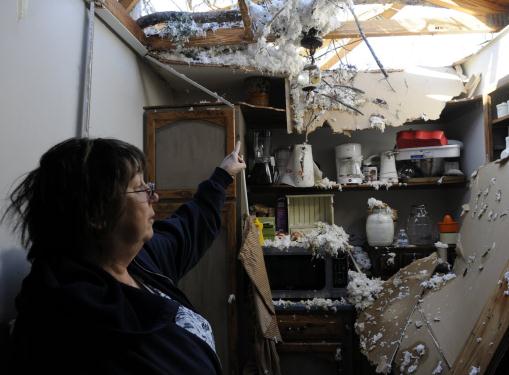
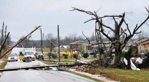
Incomprehensible Damage. Tens of thousands of Americans were impacted by Friday's severe storms: "Janet Elliott stands in her damaged kitchen after a tornado struck her home in Harrison, Tenn. on Saturday, March 3, 2012. Massive thunderstorms, predicted by forecasters for days, threw off dozens of tornadoes as they raced Friday from the Gulf Coast to the Great Lakes. Twisters crushed blocks of homes, knocked out cellphones and landlines, ripped power lines from broken poles and tossed cars, school buses and tractor-trailers onto roads made impassable by debris. (AP Photo/Billy Weeks)."

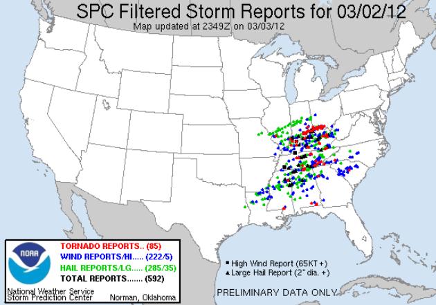
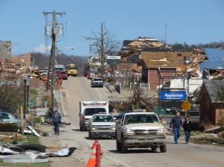
Amazing Tornado Outbreak For Early March. At last count (still a preliminary number) SPC counted 101 separate tornadoes on Friday from southern Mississippi to southwestern Ohio, a few of these were undoubtedly large, EF-3 and EF-4 tornadoes. This is somewhat typical for mid April or early May, but unusual for an outbreak of this size, aerial extent and ferocity coming in early March.


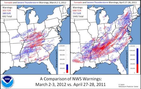
Eerily Similar. Check out the remarkable similarities between the tornado warnings (red) and severe storm warnings (blue) from Friday's outbreak with the deadly outbreak on April 27-28, 2011. I keep saying that Friday's outbreak was more typical for late April, and this comparison seems to prove that claim. Graphic courtesy of SPC.


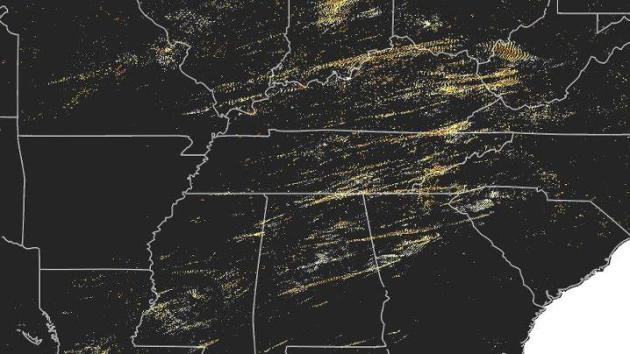
Swarms Of Storms. NSSL, the National Severe Storms Lab in Norman, Oklahoma, created a map that summarizes the tracks of Friday's supercell, tornado-producing thunderstorms. This was done using an algorithm to calculate 2-D rotation tracks. What stands out to me is the "clumping" of tracks - many locations being hit by multiple, rotating, mesocyclones capable of tornadoes.


Toddler Found In Field 10 Miles Away From Family's Home After Tornado. CBS Cleveland has the story of what can only be called a modern-day miracle. The child is still in critical condition; a lot of people praying very hard for a full recovery. "A hospital spokeswoman says a 2-year-old girl found alive in an Indiana field after violent storms is the sole survivor of her immediate family. Cis Gruebbel is a spokeswoman for Kosair Children’s Hospital in Louisville, Ky. She said Saturday that the girl’s mother, father, 2-month-old sister and 3-year-old brother all died Friday when the storms devastated southern Indiana. Gruebbel says the toddler is in critical condition. She would not identify the child and says she could not provide details on the child’s ordeal. She says extended family members are at the hospital with the child."


            2012 (229) *                                     2011 (1709)                            2010 (1282)
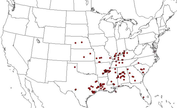
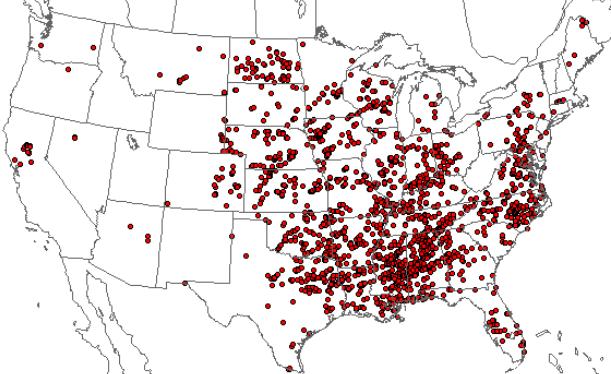
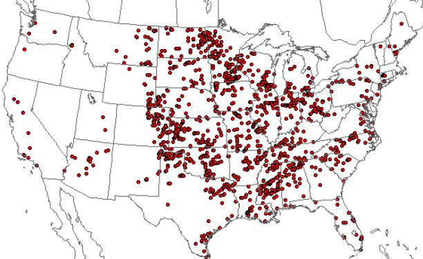
Tornado Nation. America experiences more tornadoes than any other nation on Earth. Why? It's a function of our geography. The same features that make our nation spectacularly beautiful can result in extreme contrasts in temperature and moisture. Throw in an unstable airmass and high winds howling high overhead, and you can brew up the atmospheric ingredients necessary for tornadoes. The Storm Prediction Center maps above show locations of tornado touchdowns for 2010, 2011 and 2012 (as of February 29). The map in the upper left does not reflect Friday's major outbreak. According to SPC the 3-year average for tornado touchdowns in the USA is 1382; the long-term average is closer to 1,000 tornadoes/year. Are we really seeing more tornadoes, or doing a better job of spotting the tornadoes that have always been there. Or both? There is some controversy in the meteorological community, but my perception is that, even though we have new and better tools to spot and track tornadoes (including Dual Polarization Doppler and well-trained storm spotters and chasers) something else is going on - that we may be, in fact, experiencing an uptick in tornadoes.

* preliminary number.


"Like A Bomb Dropped From The Sky". Thanks to photographer Greg Pursifull from CN2, who sent back this photo from Morgan County, Kentucky.


Red Cross Launches Huge Tornado Relief Effort. From the Red Cross: "Friday night, the Red Cross opened or supported 22 shelters in Missouri, Illinois, Kentucky, Oklahoma, North Carolina, Alabama, Indiana, Ohio, Tennessee, Virginia and West Virginia. Across the affected states, trained Red Cross disaster workers are mobilizing to begin feeding operations and distribution of relief supplies. Red Cross health services and mental health workers also will be out in neighborhoods help people cope with what they’ve seen and experienced. And damage assessment teams will also help the Red Cross and our partners discover the full scope of the damage."


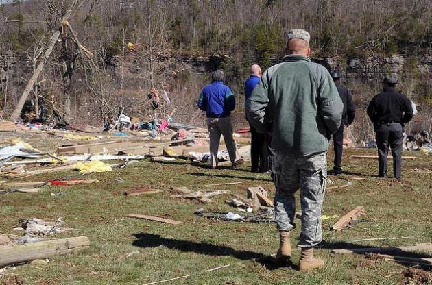
Huge Mobilization Effort. Click here to see the Kentucky National Guard's photostream, courtesy of Flickr, and get a greater appreciation for the clean-up effort now underway: "Kentucky Guardsman Staff Sgt. Joshua Matlock, with the Charlie Battery, 1st Battalion, 623rd Field Artillery (HIMARS), accompanies Kentucky's Lt. Gov. Jerry Abramson as they view the debris that covered the area of East Bernstadt Ky. Mar. 3. (Photo by Spc. Brandy Mort, 133rd Mobile Public Affairs Detachment)."

March The Way It Was Meant To Be? Call me crazy, but I still find snow in early March reasurring. Meteorologist Todd Nelson snapped this shot up at Lutsen on Saturday - still plenty of snow for skiing and snowboarding up north.
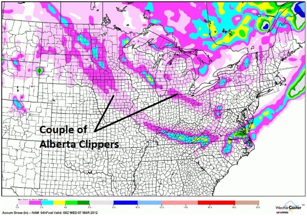

Couple of Feeble Clippers. The pattern isn't ripe for accumulating snow anytime soon (looking out 2 weeks). A weak clipper may squeeze out a dusting or coating of flurries today in the metro, a better chance of a quick inch, maybe 2", over southwestern Minnesota.
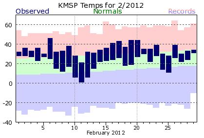

February: What Happened To "Normal". The normal high/low range is the green-shaded area above. As you can see, February temperatures were consistently warmer than average in the Twin Cities. Only 5 nights saw lows colder than average. More from the local office of the National Weather Service: "February of 2012 continued one trend that has been in place since this past summer and that is continued above normal temperatures. As with December and January, February featured yet another month this winter where the entire area saw temperatures between 4 and 8 degrees above normal. One trend that did end (in February) was that of experiencing below normal precipitation. A very wet storm at the end of the month saw most locations nearly double the normal precipitation observed in February in just 2 days. However, much of the precipitation that did fall (last) month came in the form of rain, which resulted in February having below normal snowfall for all but northern sections of the Chanhassen forecast area (central MN and northwest WI). February marked the first time since July that the Twin Cities had above normal precipitation for a month.
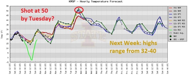

Outlook: Rapid Meltdown. If you like snow (and who among us doesn't?) get out and take a few photos - it'll be pretty much gone by next Tuesday as highs surge into the 40s to near 50. Nothing approximating a "cold front" in sight.

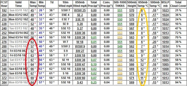
Third Week Of March: 60s, Shot At 70? Well, we won't be seeing any significant snow anytime soon. For that to happen 850 mb temperatures (4,000 feet) need to be colder than 0 C. (32 F). Those (GFS) temperatures are forecast to be +6 C to +12 C from March 11-19.

First Severe Outbreak For Minnesota? Pure speculation this far out - but long-range GFS guidance shows upper level winds (finally) howling form Texas by February 19 (pictured above), which could translate into significant rain, even T-storms, a few of which could be severe close to home by the 3rd week of March. I stand by my hunch: severe storm season will come to Minnesota a few weeks earlier than usual this year.

Paul's Links. I've gotten a number of request to share some of my (super-secret) web sites, the trusted sources I turn to for raw weather data, current conditions, weather models, etc. So for the next few weeks (until I run out) I'm going to go down my Firefox browser list, in no particular order. I hope a few of these are bookmark-worthy:

1). Minnesota Climate Summary. This is the go-to URL for climate information for MSP and every other reporting station in Minnesota. Click on "CLIMSP" to get Twin Cities data, but all other major Minnesota cities are included. Data courtesy of NOAA.

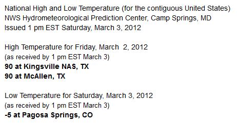
2). National High and Low Temperatures. If you're looking for that day's extremes this is the site to check out, courtesy of NOAA NCEP. The latest data usually arrives by 7 pm every day.

3). Recent Snowfall and Snow Depth Maps. NOAA has a wealth of information online, including this site that shows recent snowfall for the last 24 hours, or up to 7 days in the past. OK. I'll try to remember to post 3 new sites every day until I run out of ammunition. How much time do you have?


Sunrise - Sunset - Moonrise Times. If you're serious about fishing (and a few Minnesotans are), or just need a specific time to calculate your sunset wedding come June, check out sunrisesunset.com. All your celestial needs in one handy site.

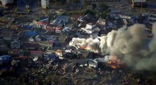
Frontline: Inside Japan's Nuclear Meltdown. Parts of Japan are uninhabitable, and will be for decades, the result of last year's severe earthquake and tsunami, that claimed over 20,000 lives. An incredible PBS Frontline documentary reveals the stark truth: the world came very close to a total meltdown of 6 reactors and 7 nuclear fuel pools that would have forced the evacuation of Tokyo (and 90,000 Americans and their dependents). The (former) Prime Minister of Japan, in a very bold move, ordered TEPCO nuclear workers not to evacuate the Fukushima Nuclear Plant. They remained on-site, forcing water onto the smoldering ruins of the reactors, preventing a total meltdown in the process. This runs 53 minutes, but it's a compelling look at just how close we came to the world's worst nuclear catastrophe.

Apple's TV Dream Revealed: Embarrass Hardware Makers, Stiff Content Providers, Destroy Cable Companies. Not sure how much of this is real, but businessinsider.com has a potentially revealing peek at iScreen, or iTV, or iWhatever: Over the last several months, Apple's vision for television has become clearer. Thanks to work by Wall Street analyst Gene Munster on the hardware side and the New York Post's Claire Atkinson on the content and cable side, we now have a pretty good picture of what Apple wants to do:
  • Build a TV set that is much cooler and easier to use than anything else out there
  • Charge twice as much for it
  • Assemble a "virtual cable company" with boatloads of great content by cutting deals with content providers

Where Do Good Ideas Comes From?  I don't know, goodideas.com? I give up. Steve Johnson has some intriguing ideas in his new book, highlighted at this link, courtesy of brainpickings.org: "We’re big fans of the RSA. Their latest gem animates one of the most important questions in creative culture: Where do good ideas come from? Steven Johnson tackles the grand question with insights from his latest book and a historical perspective on innovation throughout human civilization."


Taking The Long View: How Amazon's Jeff Bezos Owes Much Of His Success To His Ability To Look Beyond The Short-Term View Of Things. A fascinating article from The Economist: "INSIDE a remote mountain in Texas, a gargantuan clock is being pieced together, capable of telling the time for the next 10,000 years. Once the clock is finished, people willing to make the difficult trek will be able to visit the vast chamber housing it, along with displays marking various anniversaries of its operation. On a website set up to track the progress of this “10,000-year clock”, Jeff Bezos, who has invested $42m of his own money in the project, describes this impressive feat of engineering as “an icon for long-term thinking”. Photo above courtesy of zimbio.com.



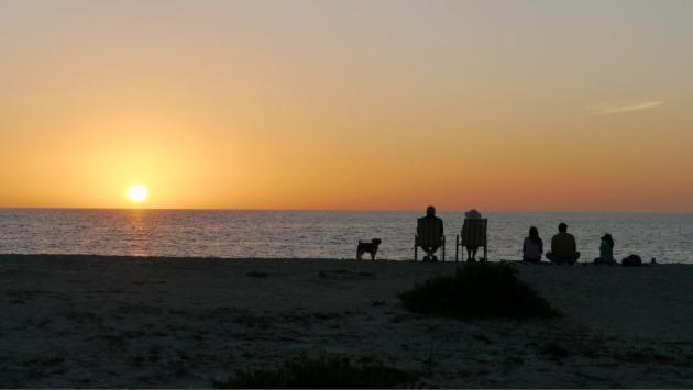
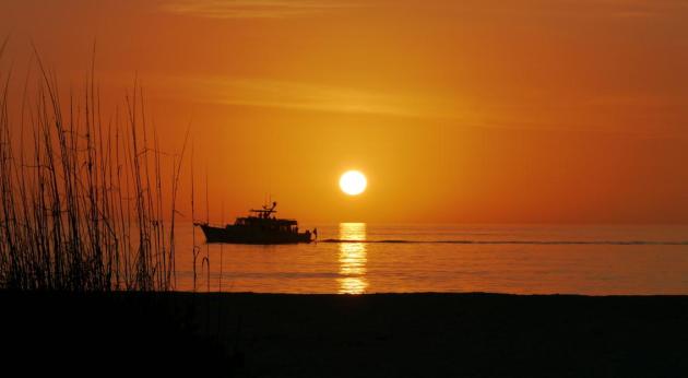
Daydreaming Of Summer. Yep, many of us are dreaming of spring break, a quick getaway, getting a little vitamin D into our bodies. My wife of 28 years and I just got back from a wonderful week at Boca Grande, Florida, on a barrier island about 1 hour south of Sarasota. You pay a $5 toll and cross a causeway from the mainland, over 3 little bridges, onto this lush peninsula of land between the Intercoastal Waterway and the Gulf of Mexico. It was pretty incredible: deep sea fishing (tarpon), dophin-watching and (reluctant) shopping in a relaxing little village with no traffic lights, not even a gas station, and some of the most incredible, picture-perfect Technicolor Sunsets I've ever witnessed in my 53 years on this planet. White sugar sand, as good as Lido Beach or Siesta Key in my humble opinion. I snapped the photo above on Thursday, when the high was a balmy 85, unusually warm for early March, even in Florida.

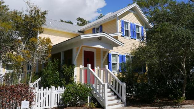
Seaside, Florida: Cars Optional - Walking/Biking Encouraged. The week before I was studying tropical weather patterns at Seaside, a "new urbanist" village on the Florida Panhandle, between Destin and Panama City Beach. Cars were truly optional: small cottages close together, with the ability to walk to shops and restaurants. This was the town featured in the Jim Carrey movie, "The Truman Show". Equally charming, with plenty to explore (the town of Rosemary Beach would have looked right at home in France or Belgium). Again, great beaches, more nightlife than Boca Grande (if I was 30 years younger that might be relevant), but also 10-20 degrees cooler. That's the thing about The Emerald Coast of the Florida Panhandle: it's terrific, but you can't count on warm, sun-drenched weather in late February, like you usually can in Sarasota, Ft. Myers or Naples. Then again traffic is a lot easier too - not nearly as much stop and go driving to worry about.

* photo above is from Boca Grande, where we rented a place at vrbo.com (where I have never been disappointed). It must be nice to actually own a place in Florida, but not having to worry about renters, taxes, insurance (and hurricanes) counts for something.No, the sun hasn't gone to my head - the weather blog isn't mutating into a tired travelogue. My wife and I set out to find two quiet (sane), relatively affordable and undiscovered areas of Florida that might appeal to us. Is there a "perfect spot" left in Florida that hasn't been overdeveloped or condominium-ized? My (highly subjective) conclusion: Seaside and the Florida Panhandle was more interesting - more stuff to do and see, but Boca Grande was more relaxing, more isolated and private. Sarasota was nearby (if you wanted to brave traffic and explore shopping and night life), but I can't imagine a better Florida retreat. If you really want to get off the grid and sink your toes into hot, white (perfect) sugar sand for a few days you might want to check out "Boca" one of these days. You won't regret it. And no, I don't get a spiff from the Chamber of Commerce. I should be so lucky...

Save 40-60% On Car Rentals. I'm starting to sound like the Geico gecko, but I found a very helpful web site that searches for the lowest car rental rates available, sort of like kayak.com for cars. It's called autoslash.com. I rented a car for 2 weeks in Florida and spent 40% of what I would have spent going directly to one of the Big 3 car rental agencies. It works, and if you're serious about saving money on your next vacation you might want to check it out.


What Is Going On?

I'm temporarily speechless. A speechless meteorologist? Oxymoron. I'm watching tornado coverage on CNN, scanning the SPC web site. 101 tornadoes on Friday. Unusual, even for late April.

If I didn't know better I'd say Mother Nature is having a loud, violent nervous breakdown. America's weather has always been severe but this is awe-inspiring, and very sad. The Symphony of Seasons is playing wildly out of tune; a Beethoven Concerto with a rap-funk beat. Not. Right.

Suddenly the weather maps make no sense. Mile-wide tornadoes, epic floods, drought; flowers already in bloom in New England? We'll see 50 by Tuesday here in the Twin Cities metro; the GFS hints at highs near 70 by mid-March. We seem to have skipped a month. Maybe two.

A warmer atmosphere holds more water, more fuel for storms. 2010 was Minnesota's wettest year on record. We also saw 145 tornadoes. Coincidence? I don't think so.

Uh oh, I feel a climate change lecture coming on. Spare us a Sunday Sermon, Paul. Why remind us? Because, after looking at the data and listening very carefully to peer-reviewed climate scientists (not blustery radio talk show hosts) climate change will almost certainly be one of the 3 big stories of the 21st century. Because someday your grandkids may come up and ask what you knew....when... and what you did about it.

Outbreaks of bizarre weather are a symptom - our atmosphere is running a slight, low-grade fever. If you're not at all concerned you're not paying attention.

Photo credit above: "Debris from homes and trees litter the path of Friday's tornado in Henryville, Ind. on Saturday, March 3, 2012. Severe storms, predicted by forecasters for days, killed dozens of people in five states - Alabama, Georgia, Indiana, Kentucky and Ohio. (AP Photo/Michael Conroy)."

Climate Stories...

Americans Get It: Global Warming Is Poisoning Our Weather.  Poison is a strong word - I still prefer the "weather on steroids" metaphor. We've always had severe storms, but having a warmer, wetter atmosphere floating overhead increases the fundamental odds of wild weather. The story from Think Progress: "Killer tornadoes are marking the transition from a freakishly warm winter into yet another freakishly dangerous spring. The multi-billion-dollar drought in Texas and Oklahoma is expected to continue into the indefinite future. Planting seasons, maple syrup seasons, and cherry blossom festivals are starting at weirder and weirder times. Torrential rains and record heat waves are becoming commonplace. Migrating birds are straying from their normal path, insect pests are multiplying, and trees are dying. Americans are starting to trust the evidence of their own senses about the growing impacts of climate change, instead of the barrage of misinformation and confusion that comes from media sources."
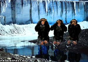
Why The Global Warming Skeptics Are Wrong. If you read one story about the (manufactured) controversy over climate change, read this essay from William Nordhaus at the New York Review Of Books. Here's an excerpt: "One might argue that there are many uncertainties here, and we should wait until the uncertainties are resolved. Yes, there are many uncertainties. That does not imply that action should be delayed. Indeed, my experience in studying this subject for many years is that we have discovered more puzzles and greater uncertainties as researchers dig deeper into the field. There are continuing major questions about the future of the great ice sheets of Greenland and West Antarctica; the thawing of vast deposits of frozen methane; changes in the circulation patterns of the North Atlantic; the potential for runaway warming; and the impacts of ocean carbonization and acidification. Moreover, our economic models have great difficulties incorporating these major geophysical changes and their impacts in a reliable manner. Policies implemented today serve as a hedge against unsuspected future dangers that suddenly emerge to threaten our economies or environment. So, if anything, the uncertainties would point to a more rather than less forceful policy—and one starting sooner rather than later—to slow climate change."
Insurers Brace For Stormy Weather As World Warms. Huffington Post has the article; here's an excerpt: "Perhaps no industry better understands the impact of global warming than the insurance industry whose job it is to analyze risk," Sanders said. "I am pleased leaders in that industry are speaking out about the need to reverse global warming." Added Whitehouse, "Extreme weather events, like Rhode Island's historic floods in 2010, can result in the loss of homes, livelihoods, and even lives. These extreme events fit a pattern predicted by climate scientists, and we should take action now to minimize the damage that carbon pollution is causing to our country and our world."
Death Threats, Intimidation And Abuse: Climate Scientist Michael Mann Counts The Costs Of Honesty. The U.K. Guardian has the story: "Among the tactics used against Mann were the theft and publication, in 2009, of emails he had exchanged with climate scientist Professor Phil Jones of East Anglia University. Selected, distorted versions of these emails were then published on the internet in order to undermine UN climate talks due to begin in Copenhagen a few weeks later. These negotiations ended in failure. The use of those emails to kill off the climate talks was "a crime against humanity, a crime against the planet," says Mann, a scientist at Penn State University. Mann became a target of climate deniers' hate because his research revealed there has been a recent increase of almost 1°C across the globe, a rise that was unprecedented "during at least the last 1,000 years" and which has been linked to rising emissions of carbon dioxide from cars, factories and power plants."