Friday, March 2, 2012

March 3: 80-100 Tornadoes Friday (on track for another record tornado season?)


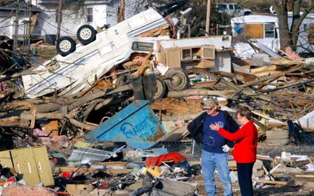
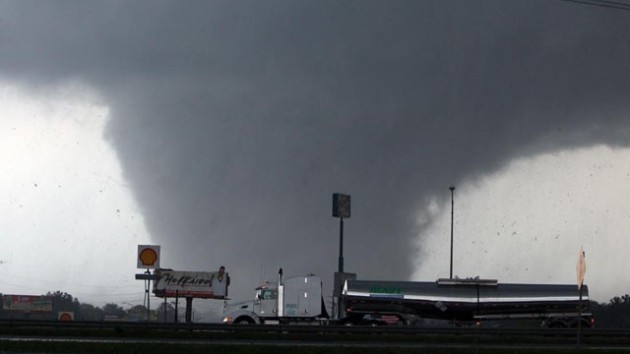
81 separate tornadoes on Friday (as of 7 pm yesterday) from Alabama to Ohio. Details below. Photo: AP Photo/The Huntsville Times, Dave Dieter.

29 tornadoes on the ground - simultaneously - at one point Friday afternoon. Source: CNN.

196 tornado warnings, 240 severe thunderstorm warnings, 432 severe storm reports as of 7 pm central on Friday (source: Alabama TV meteorologist James Spann).

2 small tornadoes were reported near Stapleton and Greeley, Nebraska on February 29 - the first February tornadoes ever reported in Nebraska. Source: WOWT-TV.


Cincinnati/Northern Kentucky International Airport (CVG) was closed as of Mar 02 at 04:30 PM EST “Due to FOD ON RWY, the Cincinnati/Northern Kentucky International Airport (CVG) was closed as of Mar 02 at 04:30 PM EST.  The date/time when the airport is expected to reopen is not known.” Tornado debris?
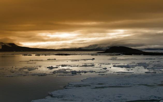

300 million years. The world's oceans are thought to be acidifying faster than any time in the last 300 million years. Full article below.

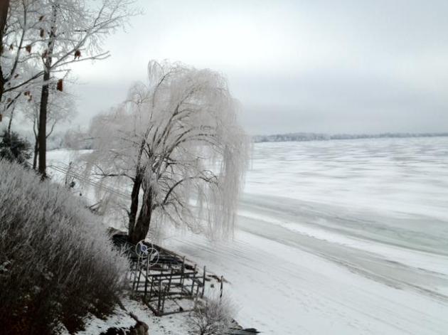
“The good Lord gave you a body that can stand most anything. It's your mind you have to convince.” - Vince Lombardi


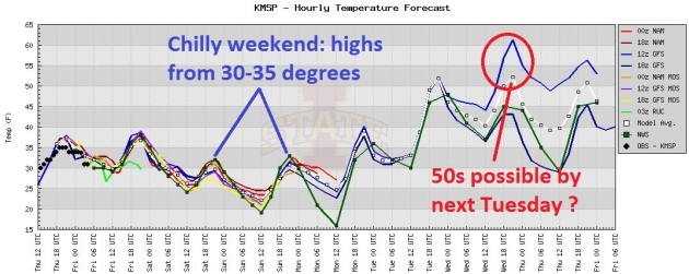
Last Best Hope For Snow Lovers? I can't stress this enough - if you like snow, and want one more weekend to play in the snow (sledding, snowmobiling, cross country skiing) this weekend is probably your best bet, possibly for the rest of the winter season. Considering long-range guidance brings 40s and 50s into central and southern Minnesota as early as next week - I wouldn't be surprised to see 60 here by mid March - you might want to take advantage of chilly temperatures and excellent snow conditions this weekend. See the raw NOAA data for yourself here.
 A 6 Month "Warm Bias". Dr. Mark Seeley has more on our growing number of warmer than average months in his weekly WeatherTalk blog: "February's climate kept up the trend of the past six months delivering above normal temperatures to the state. Most observers reported average monthly temperatures that were 4 to 9 degrees F above normal, with the highest departures in the north (International Falls was 9.2 degrees F above normal). February 2012 ranks 10th warmest statewide historically. Extremes for the month ranged from 55 degrees F at Milan, Montevideo, Marshall, and Lamberton on February 2nd to -20 degrees F at Fosston on February 11th. Despite the warmer than normal month, Minnesota reported the coldest temperature in the 48 contiguous states 7 times during the month."


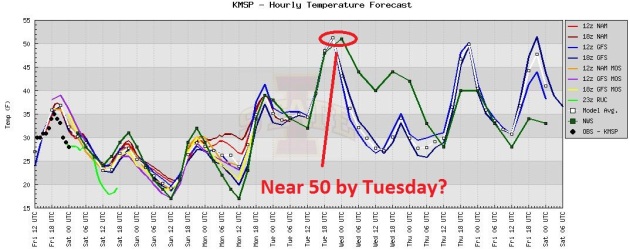
Chilly Weekend - Hints of April By Tuesday. All the models show a significant warming trend next week; there's a good chance we'll see low 50s by Tuesday afternoon, followed by slightly cooler weather the latter half of next week. No bitter fronts - certainly nothing subzero brewing looking out through March 20 or so.
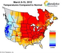
March 2012: Hints of April? Here's an excerpt from the weather firm Planalytics, focusing on the next couple of weeks and an overall bias toward much warmer than average temperatures east of the Rockies: "But as we move into this next time period, businesses should prepare for overall warmer than normal conditions. Many locations in the Northeast, Great Lakes, and Canada will experience temperatures up to +15F. above normal. While the potential for storms and brief periods of cooler temperatures are possible, next week will continue the trend of warmer than nnormal for most locations, and warm enough to dive additional lift in seasonal demand."


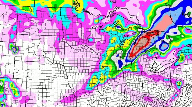
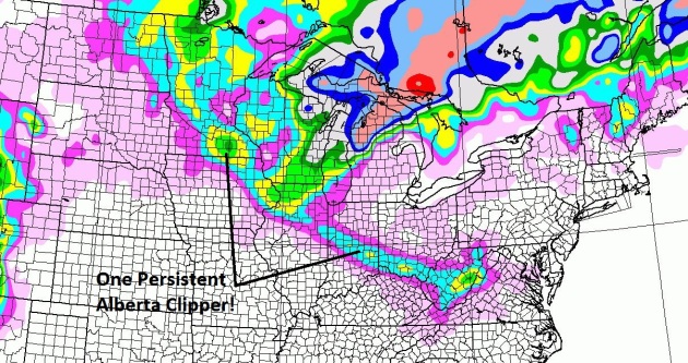
No Major Storms (of any flavor) Brewing. A very persistent Alberta Clipper, putting down a narrow, 900-mile wide carpet of a couple of inches, may drop an inch of snow today, another coating of flurries on Sunday. That's about it in the snowfall department until further notice. 84 hour NAM snowfall prediction courtesy of NOAA and WeatherCaster.
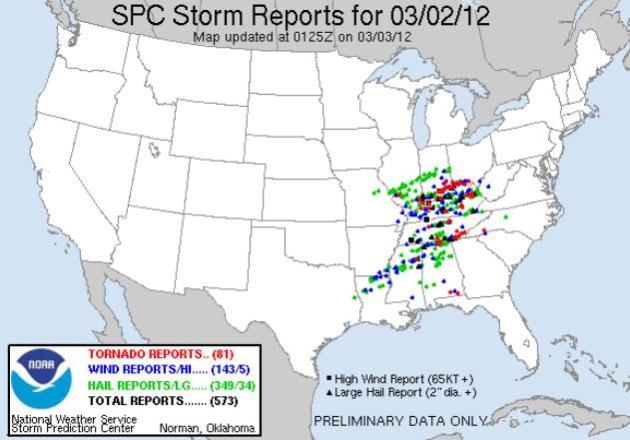

A Deadly Friday. When I posted this update Friday evening 81 separate tornadoes had touched down from southern Alabama into southern Indiana and southern Ohio - a few of these were probably large, violent, long-lasting EF-3 and EF-4 tornadoes, possibly more than 1/2 mile wide. The latest count from SPC, NOAA's Storm Prediction Center here.
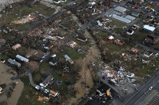

Weather Carnage. Friday was one of the most damaging and deadly days since April 27 of last year. A handful of small towns from southern Illinois and southern Indiana into Kentucky were literally wiped right off the map: "Damage is seen from above the Henryville, Ind., area, Friday, March 2, 2012. Powerful storms stretching from the U.S. Gulf Coast to the Great Lakes in the north wrecked two small towns, killed at least three people and bred anxiety across a wide swath of the country on Friday, in the second deadly tornado outbreak this week. (AP Photo/The Courier-Journal, Michael Clevenger)."

* Indiana Town "Completely Gone" After Tornado Kills At Least 3, Official Says. The Chicago Sun Times has more details on the destruction of Henryville, Indiana here.

** WISH-TV reports that schools in Henryville let out 20 minutes before the tornado struck.


Atmospheric Battering Ram. Weatherbug meteorologist Ben Michalak captured this photo in Indiana during a cross-country drive from Chicago to D.C.
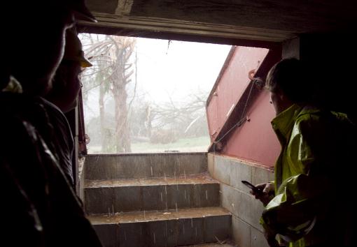

Waiting Out The Storm. In a hurricane you want to get up, as high as possible, at least third or fourth floor of a well-constructed building (if you can't evacuate safely inland). In a hurricane the main concern is not the wind, but the storm surge, a sudden rise in tide levels in a matter of minutes. In a tornado the goal is to get below grade, under ground, to avoid flying debris, which is the biggest cause of death and injury: "Police, rescue workers, and other local media gather in a storm shelter to ride out another threatening storm as it approaches areas already damaged by an earlier tornado on Friday, March. 2, 2012, in Athens, Ala. Powerful storms stretching from the U.S. Gulf Coast to the Great Lakes in the north wrecked two small towns, killed at least three people and bred anxiety across a wide swath of the country on Friday, in the second deadly tornado outbreak this week. (AP Photo/Butch Dill)."
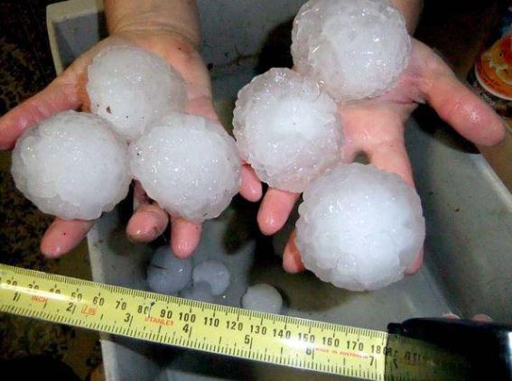

Evidence Of Severe Upward Motion. I start to get nervous when I see golfball size hail or larger - it means that a thunderstorm updraft is especially intense. The larger the hail, the stronger the updraft, and potentially the greater the risk of a tornado. Here are some examples of baseball-size hail in southern Indiana, courtesy of Antranik Askander.
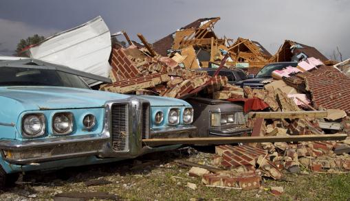
Mind-Numbing Damage. Two deadly days of tornados in just one week. It's true that early March is prime time for tornadoes across much of the Deep South, but to have such widespread tornado outbreaks (Florida to West Virginia) on March 2 is a bit unusual: "A tornado left a path of destruction as it passed through Friday, March 2, 2012, in Athens, Ala. Powerful storms stretching from the Gulf Coast to the Great Lakes flattened buildings in several states, wrecked two Indiana towns and bred anxiety across a wide swath of the country in the second powerful tornado outbreak this week. (AP Photo/Butch Dill)."
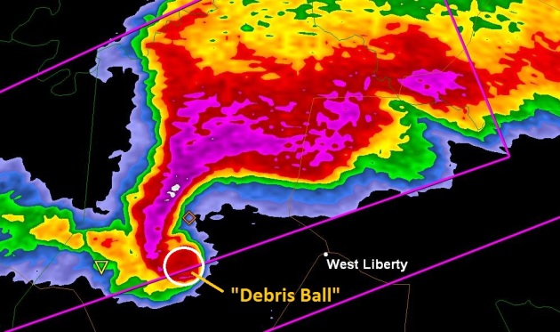
Confirmation Of A Tornado On The Ground: A "Debris Ball". The new dual-polarization Doppler Radar from the National Weather Service sends out a vertical as well as a horizontal pulse of energy, making it easier to differentiate raindrop size, whether a storm is capable of rain, ice or snow, and even more important: these sweeping pulses of energy can detect actual debris being thrown up by a tornado circulation on the ground. Before now we had to rely on Skywarn spotters and law enforcement for confirmation. Now, with "dual pol" radar, it's possible to see the actual tornado structure itself. Over time this should result in even greater confidence for meteorologists, hopefully leading to fewer false alarms. The debris ball associated with a possible EF-4 tornado (above) tore into West Liberty, Kentucky late afternoon yesterday.
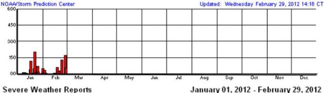
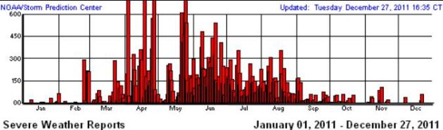
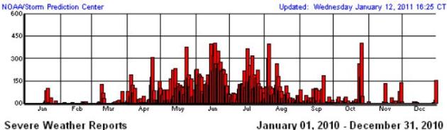
An Early, Violent Start To Tornado Season. Last year an incredible 1,709 tornadoes were reported across the USA, according to SPC. Last year tornado season came on strong during late February, peaking in April and May. By comparison 2012 brought more tornadoes earlier (top graph), and many meteorologists I respect believe 2012 could set a new record for tornadoes, at the rate we're going. La Nina springs tend to be severe, stronger jet stream winds howling overhead, more wind shear available to spin up the rotating "supercell" storms that can go on to spin up tornadoes. There's little doubt that we are on track for another very violent spring across the USA.

USA Tornado Count (courtesy of SPC)

2012: 211 (preliminary)
2011: 1709
2010: 1282
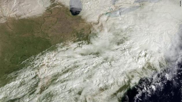
NASA, NOAA Team Up For Satellite To Increase Tornado Warning Times. Here's a timely post from CNN's Light Years blog: "After this week's massive storm system, which spawned tornadoes that killed 12 people, you might appreciate this: NASA and NOAA (the National Oceanic and Atmospheric Administration) have teamed up to launch a new GOES weather monitoring satellite: the GOES-R series, which will help warn people about severe weather sooner. GOES stands for Geostationary Operational Environmental Satellite. As they orbit Earth, the satellites monitor atmospheric conditions. They're basically fixed in place over a single spot on the planet, with a wide-angle view, collecting data around the clock. This lets meteorologists identify triggers for severe weather like hurricanes, flash floods, hailstorms and tornadoes."

Photo credit above: "This image, from the GOES-13 satellite, shows a massive storm system moving across the eastern U.S. on Wednesday." Courtesy NOAA, CNN.
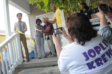
Joplin Tornado Survivors Seek Hurricane Katrina Lessons. The story from nola.com in New Orleans: "The group came to help rebuild a city still struggling to find its way more than six years after Hurricane Katrina, and to learn some disaster recovery lessons they can take back to their own storm-ravaged Missouri community. A 14-hour bus ride and 715 miles from home, the bleary-eyed bank executives, hospital administrators and church workers from Joplin, Mo., spent much of Thursday wielding paint brushes, sledgehammers and crowbars."

Photo credit above: "Volunteer Laura Veri from Rebuild Joplin, right, takes photos during St. Bernard Project's dedication of a newly renovated home that was destroyed by Katrina in New Orleans, Thursday, March 1, 2012. Nearly two dozen volunteers from Rebuild Joplin partnered with The St. Bernard Project, which renovates Katrina-devastated homes in the New Orleans area. (AP Photo/Cheryl Gerber)."
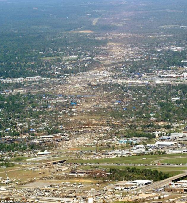

Ask Paul. Weather-Related Q&A.
"Hi. I have a question about weather radios. The tornadoes down south this past few days have reminded me to prepare for the "season" coming soon, and I am interested in getting a weather radio this year. I would like one with AM/FM and possibly a clock alarm. Do you have any particular advice or recommendations? Thanks for your time. I appreciate it."

Joyce
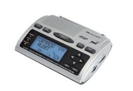
Joyce - thanks for a timely question. For years now I've been extolling the virtues (and utter necessity) of NOAA Weather Radio. It's not enough to rely on the sirens, or even local TV and radio and the Internet, as good as those sources are. Who/what is going to wake you up if there's a tornado warning for your county at 3 am? Only a NOAA Weather Radio will do that - set off an audio alert that wakes you up if a warning is issued for your county. Make sure you buy one with "SAME Technology", so you can program in only your county - or you'll go nuts with the radio going off all the time. Here's one I found from Midland on Amazon for $35, which seems like a lot of bang for the buck, the Midland WR300:

"Automatic alert warns you of hazardous conditions Perfect bedside alarm clock AM/FM radio with 6 memory channels Add or remove alerts S.A.M.E. localized reception Color coded alert indicators Alarm clock with snooze Event expiration indicator Add or remove alerts Programmable siren level Silent programming 10 reviewable alerts 7 preset weather channels Receives over 60 alerts."

Do a Google Search for NOAA Weather Radio, AM/FM and Clock Radio and you'll see scores of options, ranging in price from $25 to over $75. I hate to sound like a NOAA Preacher, but every home, office, school, nursing home and hospital should have at least one. It's the ultimate safety net.
__________________________________________________________________________
Hi Paul,

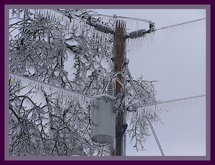
"I am curious about something I saw on February 28th late night into February 29th midnight. I saw two bursts of green light illuminate the sky. This was during the snowstorm when there was ice and snow on the trees and on the ground. Was this lightening during a snowstorm? There was no sound. Just a low hum like a motor running. It was the weirdest thing I have ever seen. I know there was no powerline down since the power was up and there was no flicker in the lights.
Any answers would be much appreciated.

Thanks,"

Priya

Dear Priya - I appreciate your note. My hunch is the green flashes of light were from high tension lines or possibly transformers, responding to a slow build-up of freezing rain (glaze ice), which can wreak havoc on electrical systems. This would also account for the strange humming noise. Of course you want to give downed power lines a wide berth when they come down - they can still be "hot", capable of electrocuting anyone who steps onto one of these. Be careful out there!                - Paul
__________________________________________________________________________

Paul,

"When will your son graduate from the Naval Academy? I know this isn't a weather question, but you periodically comment on your son at the USN Academy. Graduation from a military academy is a great family experience. Our youngest son graduated from the US Air Force Academy a few years back and it was a super time. Several of my close retired friends graduated from the Naval Academy and they were outstanding men and leaders."

Very Respectfully//Fraine C. Zeitler, Colonel.USAF Ret

Colonel Zeitler - thank you for writing and inquiring about my youngest son, who graduates from USNA  in Annapolis in May. His plans are to fly fixed wing jets or helicopters for the Navy - although, as you probably well realise, he has no idea where he'll wind up or what (specifically) he'll be doing. Semper Gumbi (be flexible) right? I'm incredibly proud of him (and appreciative to Jim Ramstad for teeing up his nomination to the Naval Academy). He's heading to Pensacola this summer and my wife and I will probably be looking for excuses to study tropical weather patterns on the Florida Panhandle. Thanks for asking, and thank you for your service. My congratulations to your aviator son!             - Paul

Apple Prepares To Pull Down "Evi" From App Store. Did It Slap Down Siri? Uh oh, Siri may have company, and she/it is not too happy about that, from what I read. Techcrunch.com has the story: "Last month we reported on the launch of Evi, a new iPhone (iTunes link) and Android app (link) which was very Siri-like in its capabilities. Maybe it was too good at acting like Siri? Yes, Evi can’t do Siri’s trick of adding things to your iPhone Calendar or hook into reminders. But, ask “How do I make apple pie?” and Evi provides a list of recipes with web links. Siri can’t give you a direct answer and just asks whether you want to search the web. Perhaps it’s the fact that Evi is pretty damn good, and doesn’t look a million miles away from Siri, that Apple has told True Knowledge that it is going to pull Evi from the App Store. Wait, what?"

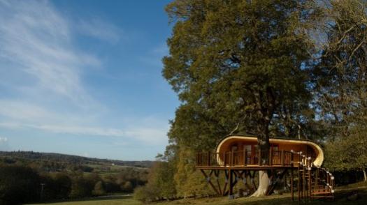
"Eco-Perch" Is The Rolls Royce Of Treehouses. Just in case you're thinking of spending way too much money on a treehouse, here's a story excerpt from gizmag.com: "While we love the dangling treetop retreats located at Sweden's Treehotel, and the House Arc had us yearning for a private backyard hideaway, the eco-PERCH has to be the Rolls Royce of modern modular tree-houses. This eco-lodge concept was created by the UK architectural firm Blue Forest, which has a background in the design and construction of luxury treehouses and lodges."

WHNT Offering Viewers Money To Be Meteorologist's Facebook Friend. Wow - it's come to this? I'm sure Jason is a good guy, and might even be your FB pal for free, but the notion of winning at $519 gift card might just make me hit the "like" button. Repeatedly. But why stop there? Maybe $2 for every favorable tweet? Talk about a slippery slope. TVSpy.com has the unsavory details: "Just in case his extensive coverage of tornadoes sweeping through Alabama wasn’t enough to entice viewers to Like WHNT chief meteorologist Jason Simpson on Facebook, the Huntsville CBS-affiliate is now offering $519 to be his friend. WHNT, channel 19, has posted a big promotion on Simpson’s Facebook page, offering viewers a chance to win an American Express gift card if they Like the veteran meteorologist."

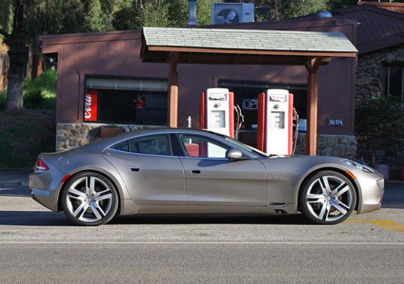
Happy Birthday Justin! A Look At Bieber's $100,000 Electric Car. From the Los Angeles Times: "Justin Bieber turned 18 on Thursday and to celebrate, his manager surprised him with a Fisker Karma -- a $100,000 electric car whose sporty physique belies its eco-friendliness. Bieber's manager, Scott Braun, presented the Canadian pop star with the car on the "Ellen DeGeneres Show," of all places. "We wanted to make sure, since you love cars, that when you're on the road you are always looking environmentally friendly," Braun said as DeGeneres beamed in the background. "And we decided to get you a car that would make you stand out. I think you know where I'm going, and you're kind of freaking out right now. That's a Fisker Karma."

Photo credit above: "Justin Bieber's new wheels: The Fisker Karma. The car was presented to Bieber by manager Scott Braun on the "Ellen DeGeneres Show." (David Undercoffler / Los Angeles Times)."
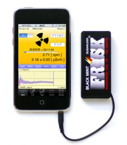
"Pocket Geiger": The $46 iPhone Geiger Counter. Here's one app I'll bet you don't have. Hopefully you'll never have a need for this, but just in case - more details from our tech-savvy friends over at gizmag.com: "In what seems to be a response to public fears about radiation levels following the Fukushima crisis, a Japanese organization called Radiation Watch has launched Pocket Geiger, a Geiger counter iPhone peripheral and accompanying app aimed at concerned individuals."


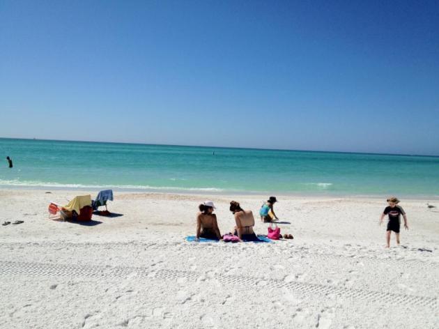
Instant Summer. Much of Florida has experienced record warmth in recent days with highs in the mid to upper 80s, typical weather for late April. Record highs have been set in Ft. Myers, Sarasota and Tampa. Photo above is from Lido Beach, in the Sarasota area.


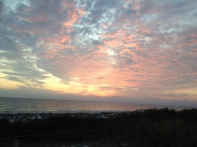
Florida Might Be Nice. Thanks to Karen Wagner for this fine photo from Panama City, Florida.


Fast Forward Spring

I'm not clairvoyant. That's one skill that would come in handy for a weather guy. But the trends are pretty obvious by now: the atmosphere is on "fast-forward" - the maps look more like early April than early March.

According to Dr. Mark Seeley February was the 10th warmest in Minnesota's modern history; the last 6 months in a row have been (significantly) warmer than average, statewide. 21.8 inches of snow, the least since 2004-05, when only 25.5" fell the entire winter. Will we see more snow? Probably, but I don't see anything brewing through mid-March. Too dry, and too warm. We'll see 50s by Tuesday; the GFS hinting at 60 by mid-March.

This is still Minnesota right? February was the first above-average month for precipitation since August, but I'm still worried about drought. 96% of Minnesota is in a moderate drought.

And at the rate we're going a fading La Nina coupled with a strangely-energized jet stream may favor an early start to severe storm season. Great.

A coating to 1" flurries may fall today. 40 will feel good Monday; a shot at low 50s Tuesday. Is winter over? Starting to wonder.

Climate Stories...
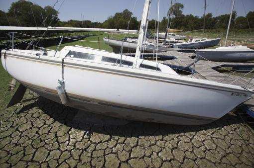
An Eye On The Sky For Texas. The New York Times (subscription required) has a story about the busy, sometimes-controversial work of the State Climatologist for the state of Texas: "Climate change is a hot-button subject nationally, and state climatologists have sometimes gotten caught in the cross-fire, Dr. Foster said. Dr. Nielsen-Gammon said he has received no political pushback, even though he believes humans contribute to climate change. Still, he said Texans occasionally ask him questions like: “You don’t believe in all this global warming nonsense, do you?” He said he does not believe in all the nonsense, but he added that temperatures are rising globally and greenhouse gases are the biggest driver of the trend, and “if things keep going like this there will be serious consequences.”

Photo credit above: "In this Tuesday, Aug. 16, 2011 photo, docked sailboats sit high and dry at a marina on Benbrook Lake in the Fort Worth suburb of Benbrook, Texas. A wet winter across Texas has surprised weather experts who aren't sure when the drought-stricken state will get longterm relief. Some forecasters say the La Nina weather phenomenom may end just in time to allow for spring rains. But nothing short of massive storms, 200 to 500 percent of normal rainfall for three months, will end the severe drought, according to weather data. (AP Photo/LM Otero)."
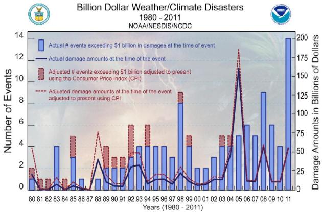
Houston Insurance Claims Lawyer Says 2011 Natural Disasters Can Lead To 2012 Disputes. Here's an excerpt from The Houston Chronicle: “We escaped the wrath of hurricanes and had fewer tornadoes, but the lack of rainfall extended the drought in many areas of the state” in 2011, said Mark Hanna, a spokesman for the Insurance Council of Texas. “That led to record wildfires, which I don’t think we will soon forget.” Six of the top 10 largest fires in Texas history all occurred in April 2011, according to the Insurance Council. The costliest wildfire in Texas history erupted on Labor Day weekend in Bastrop County, the Council said. It resulted in two deaths and 1,600 homes destroyed by fire. Insured losses were set at $325 million." Graphic above courtesy of NCDC.

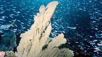
Ocean Acidification Worst For 300 Million Years. TGDaily.com has the story: "The world's oceans appear to be acidifying faster than at any time in the last 300 million years, and sea life may well be unable to adapt. The last time acidification took place anywhere near this fast was during the Paleocene-Eocene Thermal Maximum, or PETM. In the last hundred years, rising carbon dioxide from human activities has lowered ocean pH by 0.1 unit, and the Intergovernmental Panel on Climate Change (IPCC) predicts that pH will fall another 0.2 units by 2100, raising the possibility that we may soon see the same sort of ocean changes as those observed during the PETM."

Climate Change Could Impact On Polar Ecosystems. Here's an excerpt of a story from physorg.com: "Researchers studied cyanobacteria - the found in almost every body of water - in samples taken from the and Antarctic. "Blooms of these tiny microbes - known as cyanobacteria mats – can form in waters where there is an abundance of nutrients.  These can often be seen on the surface of lakes, ponds, streams and other stretches of water. Cyanobacteria are hugely important because of their role in 'carbon-fixing' - absorbing carbon dioxide from the atmosphere and helping maintain healthy oxygen levels while turning the carbon into food for other organisms. However, some cyanobacteria can also contain toxins which can be potentially harmful for other organisms, especially animals."

Thursday, March 1, 2012

March 2: Potential For Major Tornado Outbreak (5-8" snow for Chicago)

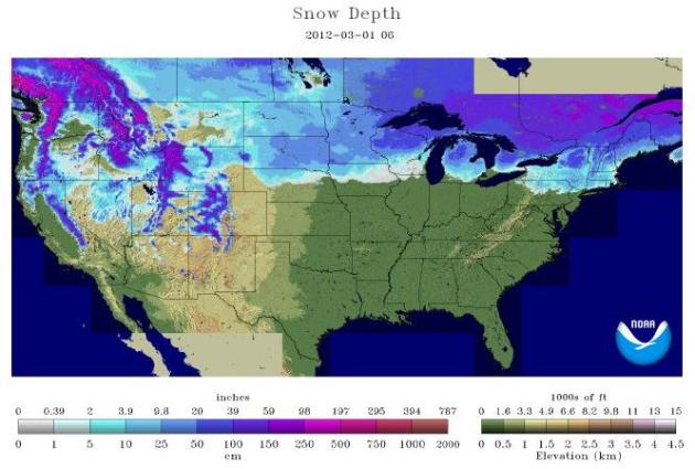
36.2% of America (lower 48 states) covered in snow as of March 1, 2012.
19.2% of America covered in snow on February 1, 2012. Source: NOAA.
80 F. high at Raleigh/Durham Thursday. Normal high for March 1 is 59 F.
50 days above 40 F. in Chicago since December 1. 19.5" snow, no days below zero. Coldest temp: 5 F. Source: Bill Bellis, Hootsuite.

Major Tornado Outbreak Today for the nation's midsection, Ohio Valley and Mid South, possibly rivaling the deadly outbreak of May, 2011. Some are comparing this to the "Super Outbreak" of 1974, when 148 tornadoes touched down in 13 states.

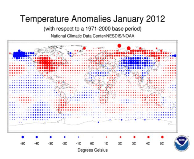
January: 19th Warmest Worldwide. NOAA's NCDC division has more details.

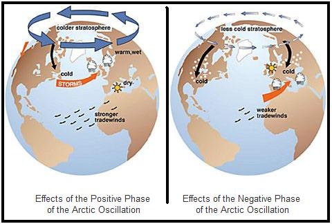
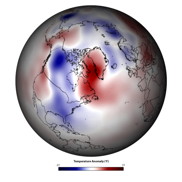
"However, most climate models predict more positive AOs (like this winter) in the future. The IPCC hypothesizes that this could be because a warmer lower atmosphere and a cooler upper atmosphere, both products of human-produced greenhouse gases, cause the polar vortex to strengthen. Stronger polar winds mean cold Arctic air stays up north. That equals more bad snow conditions for the U.S. even without the influence of a warmer planet." - from an article at Huffington Post below. Graphic courtesy of Real Science.

“If there is a dramatic loss of Arctic sea ice, the westerly winds that blow across the North Pacific and North Atlantic oceans are weakened,” lead author Jiping Liu, a senior research scientist at the Georgia Institute of Technology, told Climatewire. “This means we will have a wavier jet stream.” The loss of ice and warmer temperatures mean that there is much more evaporation from the Arctic Ocean, leading to a higher moisture content in the polar air that is pulled south. That means that intense snowfall is more likely, especially as the polar air collides with warm, moist air from the south. In 1999, Kevin Trenberth explained how global warming would lead to more intense precipitation events, including snow storms." - from an article from Think Progress and Renew Economy; details below.

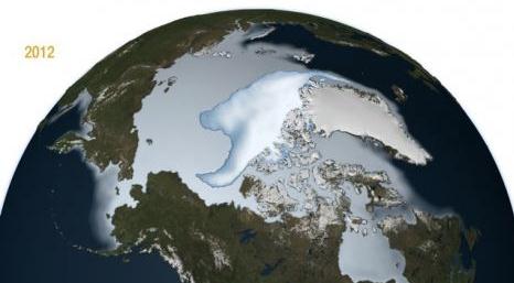
"Along with the steady decline (3.2 percent per decade) in overall Arctic sea ice extent, a new NASA study shows that the oldest and thickest multi-year ice is melting at a much faster pace — about 15 percent per decade — than the thin ice that forms anew each year." - from an article at Summit County Citizens Voice; details below.

"One major issue, she said, is that when we text, email or post to a social networking site, we’re able to project ourselves as we want to be seen. “We get to edit, we get to delete, and that means we get to retouch.” Inversely, Turkle notes that a face-to-face conversation “takes place in real time and you can’t control what you’re going to say.” - from a mashable.com article below.


Seasonably Chilly Weekend: Hints Of April Next Week? Long-range guidance shows 40s, even some 50s possible by the middle of next week. Like snow? Get out this weekend and make the most of it, because (at least in the metro) our snow will be gone by Tuesday of next week. Graphic above courtesy of Iowa State's meteorology department. Go Cyclones!


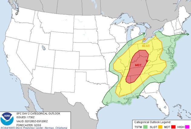
Significant Tornado Potential. Much of the Ohio Valley and Mid South is under a "moderate risk" of severe storms. There's a chance this may be upgraded to a (very rare) "high risk" later today. More from SPC, NOAA's Storm Prediction Center:

"WITH STORM MODE LIKELY TO BECOME A MIX OF SUPERCELLS AND COMPLEX LINE SEGMENTS...THREATS FOR BOTH DAMAGING WINDS AND SEVERAL TORNADOES APPEARS EVIDENT...ACCOMPANYING THE LIKELIHOOD FOR LARGE HAIL. A COUPLE OF STRONG TORNADOES WILL ALSO BE POSSIBLE -- MAINLY DURING THE MID TO LATE AFTERNOON HOURS IN AND NEAR THE MODERATE RISK AREA."

Major Severe Weather Episode Looking More Likely For Ohio Valley And Mid South. The maps are not looking good, in fact some meteorologists (I admire and trust) are comparing some of the parameters to the "Super-Outbreak of 1974", when over 120 tornadoes touched down in one 24 hour period from the USA into Ontario, Canada. That's the unprecedented severe weather event that got my attention as an aspiring 16 year old weather nerd. It was beyond my comprehension that so many (large/violent/deadly) tornadoes could touch down on a single day: April 3, 1974. Here are some details from a post by the Northern Illinois Storm Chaser site: "Our expectation is that convection will initiate by early afternoon southeast of the favored triple point, with the best chance for a chase able tornadic supercell INVO of the warm front, southeast of the surface low, across S IL or far SE MO (i.e., K1H2 – KFWA).  A massive QLCS is likely to erupt by late afternoon and early evening, extending from SE IL into SC AL and points ENE.  All modes of severe weather are possible, though the threat for tornadic supercells, especially those embedded within QLCS structures, will remain a bona fide threat given the directional shear profiles found across the region.  Wind damage is also a threat, along with some large hail.  Given the impressive speed shear profiles, some substantial wind damage appears likely; consequently, assuming that the instability profiles materialize, and it looks as if they will, this is going to be a very dangerous situation for anyone residing in the middle and lower Mississippi River valleys, extending eastward across the Ohio River Valley."

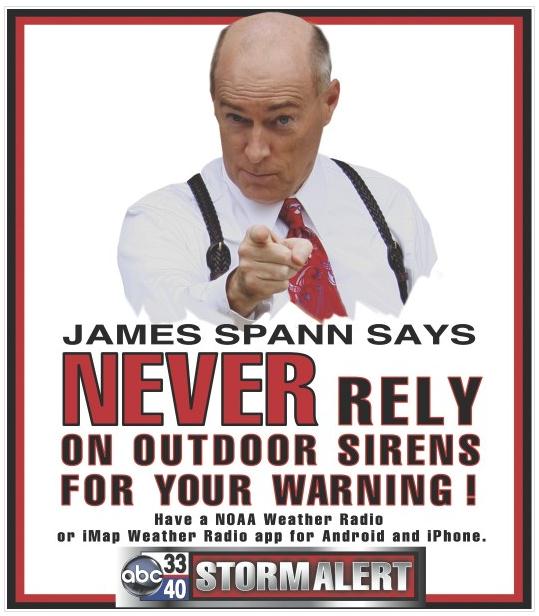
Sound Advice. I couldn't agree more - never rely on the emergency outdoor sirens. They were designed for outdoor use only. The more sources of warning information, the better: NOAA Weather Radio, local TV, radio, e-mail, apps, etc. Alabama weather legend James Spann has more good advice in his blog.

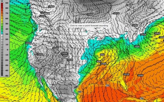
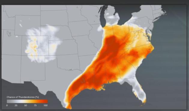
Potentially Violent Friday. The dark-red shaded area indicates an 80-100% probability of thunderstorms later today - many will be severe; some capable of large hail, damaging straight-line winds and potentially large, violent, long-lasting tornadoes. More from NOAA's Environmental Visualization Laboratory.

Severe Storms And Tornadoes Tear Through The Heartland. Leap Day, 2012 will never be forgotten in the town of Harrisburg, Illinois. Pjstar.com has some unforgettable photos of the carnage left behind from EF-4 tornadoes: "Leap Day was not a good one for thousands of people in the Midwest and Southern United States as severe storms and tornadoes left a trail of destruction in Illinois, Missouri, Kansas, Arkansas, Oklahoma, Kentucky, and Tennessee. Waves of strong storms devastated small communities and damaged the country music resort town of Branson, Missouri. But none faced the wrath of Mother Nature like the southern Illinois town of Harrisburg. A massive 200-yard wide EF4 twister, the second worst type, smashed into the small town of 9,000 with 170 mph winds, killing 6 and injuring hundreds more."

Photo credit above: "People try to salvage what they can after a tornado destroyed homes in their neighborhood Wednesday, Feb. 29, 2012, in Harrisburg, Ill. The tornado that blasted Harrisburg, killing six, was an EF4, the second-highest rating given to twisters based on damage. Scientists said it was 200 yards wide with winds up to 170 mph. (AP Photo/Seth Perlman)."
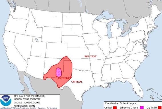
Critical Fire Threat. From NOAA's Facebook page: "An extremely critical fire weather threat is forecast today across parts of southeastern New Mexico surrounded by a critical fire weather threat over much of the southern High Plains."
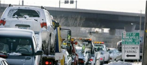
A Tale Of Tow Cities (Mpls/St. Paul) After Recent Snowfall. The Star Tribune's Bill McAuliffe takes a look at how both metro areas approached out recent mega-snow (a whopping 2.8"), just enough snow to torment some poor residents who parked in the wrong spot at the wrong time: "Owners of 1,085 vehicles felt the pain of the season's first snow emergency in St. Paul Wednesday and Thursday, getting their vehicles towed for violating parking restrictions. They were some of the 3,890 who also received tickets. The totals from Minneapolis: zero, and zero. That's because Minneapolis did not declare a snow emergency, pointing out another of the subtle ways in which the Twin Cities can differ. Snow emergencies can launch in St. Paul when 3 inches or more of snow falls, but the threshold in Minneapolis is 4. The official snowfall in the Twin Cities from Tuesday night into Wednesday, measured at Minneapolis-St. Paul International Airport, was 2.8."
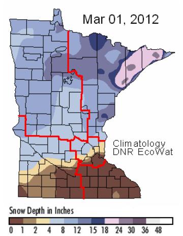
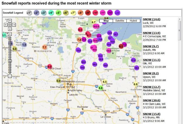
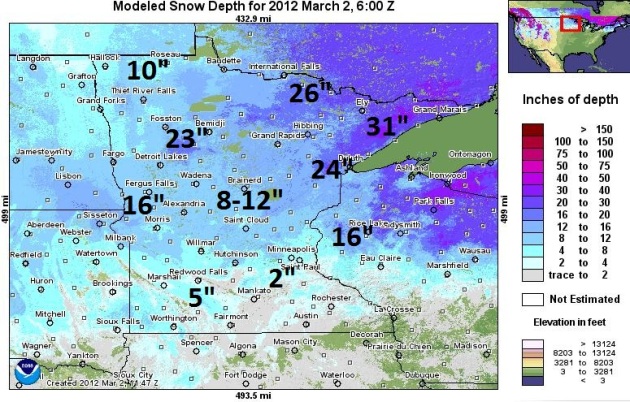
Most Snow Of The Winter - In Meteorological Spring? As far as the atmosphere is concerned, Thursday marked the first day of (true) spring, "meteorological spring". What is historically the 90 coldest day stretch of the winter ended on February 29. So it's more than a bit odd that the map above displays the most snow we've seen during the entire winter season. I stand by my prediction that this upcoming weekend will be the best weekend of the "winter" for snowmobiling and cross country skiing up north. More trail details from the Minnesota DNR here.

Significant Snow Up North. The local NWS office has a great URL (on a zoomable Google map) that shows how much snow is on the ground. There's no doubt in my mind that this weekend may be the last chance to zip north and check out some great snow conditions. If the forecast verifies and we do see 40s (and even some 50s) next week this snow will quickly turn to slop, and be mostly-gone within a week. Don't procrastinate...

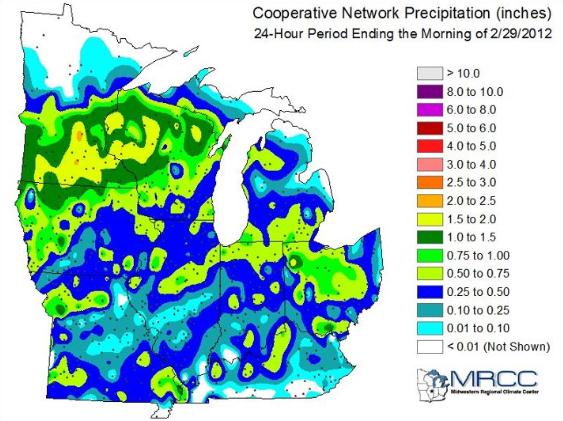
Much-Needed Precipitation. It wasn't nearly enough snow for winter enthusiasts (at least in the Twin Cities metro area), but the storm that hit Tuesday-Wednesday did dump significant precipitation on much of central and southern Minnesota, some 1-2" amounts. It doesn't erase the drought, since much of this moisture will eventually run off of frozen ground - but it helped a little. More from the Twin Cities NWS: "The winter storm on February 28th and 29th brought much needed precipitation to the region. The area has been in a drought since late summer 2011. Heres a map showing 24 hour precipitation amounts, ending around 7AM on February 29th. More precipitation fell in the Twin Cities from this storm than has fallen in any one event since August 16, 2011. In addition, February was the first month since July of 2011 that the precipitation was above normal in the Twin Cities."


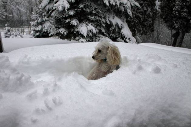
It's Official - The Snow Was "One Poodle Deep". Thanks to my friend and fellow weather enthusiast Pete Schenck, who lives up in Herbster, Wisconsin, on the banks of mighty Lake Superior, where a cool 12" snow piled up from Wednesday's storm.


The Better End Of Today's Storm. Yes, snow can be disruptive, but at least it won't sweep your home off the foundation. Chicago and Milwaukee may pick up 6-8" of snow today, well over a foot for northern Lower Michigan, just a coating of snow expected for parts of central and northern Minnesota looking out 84 hours. NAM forecast above courtesy of NOAA and WeatherCaster.


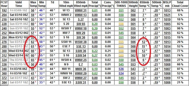
70 By Mid March? At this point nothing would surprise me - it's been a winter of shock and awe. The GFS is showing highs in the mid 60s by March 14-15, with 850 mb temperatures reaching +12 C. Then again the GFS has been especially erratic in recent months, so my confidence level is lower than usual. Then again, our weather has been on fast-forward since late January. No more subzero weather (only 3 nights below zero all winter), so 60s in mid March makes sense. We'll see.


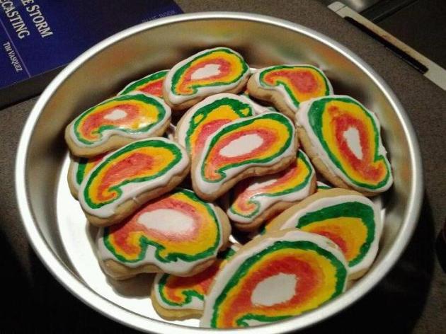
"Hook Echo Cookies?" O.K. This may not be the best day to be sharing this photo, but there are a lot of storm chasers out there that just can't get enough of hook echoes. Now I've officially seen everything. Thanks to Susie Martin for sharing this sweet pic.

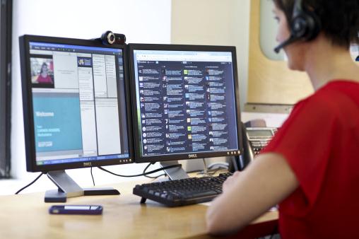
Is Social Media Actually Making Us Less Connected? An article at mashable.com caught my eye: "LONG BEACH, Calif. – Checking email during meetings. Shopping on your smartphone in the middle of class. Texting at funerals. These are a few of the examples that MIT professor Sherry Turkle offered during her TEDTalk on Thursday, in which she argued that “technology is taking us places we don’t want to go.” Turkle, a psychologist who leads MIT’s Initiative on Technology and Self, believes that while our constant communication and social media engagement does make us more connected, it’s coming at the sacrifice of real conversation. And she thinks that will have some serious consequences for our relationships, our self-perceptions and our emotions."

Photo credit above: "Carmen Scheidel, of Mediabistro, conducts an online class as part of a social media marketing boot camp in New York, Feb. 16, 2012. For midcareer executives, knowing how to use Twitter, update your timeline on Facebook, pin on Pinterest, check in on Foursquare and upload images on Instagram are among the digital skills some employers expect in a job candidate. (Fred R. Conrad/The New York Times)."

Your Life, Broadcast Live. The New York Times (subscription may be required) details an amazing new innovation (threat?) that allows you to wear a device that streams live video and audio from wherever you might happen to be, into the ubiqitous "cloud". Oh boy - we're not safe anywhere now. "When Looxcie, the tiny video camera that fits over the ear, came out in 2010, it gave navel gazers an opportunity to record and share the minutiae of their daily lives. Looxcie records in a continuous five-hour loop, allowing users to capture events in their lives, both unexpected and mundane, without lugging around a video camera. An Instant Clip button on the gadget lets videographers send a clip of the last 30 seconds to a social network with a single click."


8 Qualities Of Remarkable Employees. This article from inc.com and LinkedIn.com caught my eye: "Great employees are reliable, dependable, proactive, diligent, great leaders and great followers... they possess a wide range of easily-defined—but hard to find—qualities. A few hit the next level. Some employees are remarkable, possessing qualities that may not appear on performance appraisals but nonetheless make a major impact on performance. Here are eight qualities of remarkable employees:

1. They ignore job descriptions. The smaller the company, the more important it is that employees can think on their feet, adapt quickly to shifting priorities, and do whatever it takes, regardless of role or position, to get things done."


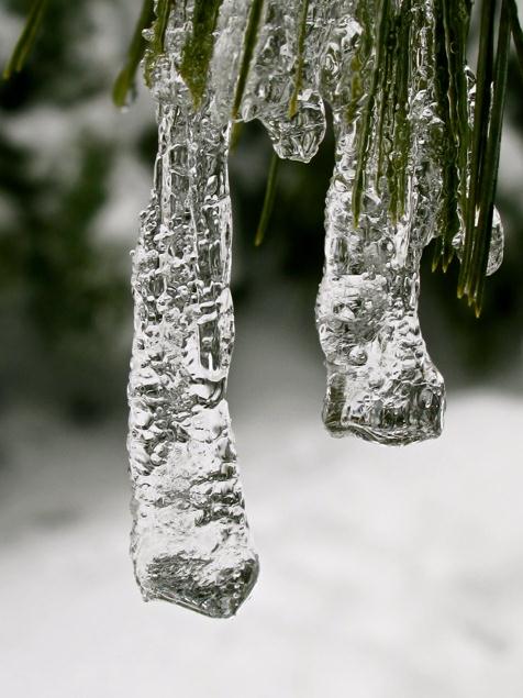
Freezing Rain. This terrific example of freezing rain, rain freezing on contact with cold surfaces (sometimes called glaze ice) was shot by Tricia Frostad in Chanhassen.


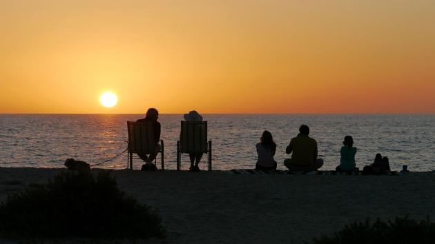
Dreaming Of Spring Break. Here's a photo of one very contented family down in Boca Grande, on a barrier island south of Sarasota, Florida.


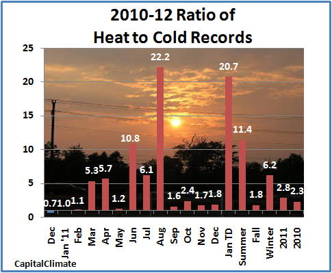
More Warm Records Than Cold Records. Last year there were nearly 3 times more record highs than record lows across the USA. Source: CapitalClimate and Think Progress.

Writing On The Wall

No, this hasn't been your grandfather's winter. And we shouldn't be too shocked: NASA says 10 of the 11 warmest years on record have taken place since 2000.

A new poll suggest nearly 2 out of 3 Americans now believe that climate change is real. It may have little to do with believing the science and more to do with looking out the window. Some are mistaking "weather" for "climate", but there is no mistaking an apparent uptick in extreme weather.
A tornado outbreak over the nation's midsection later today may rival major outbreaks, like the "Super Outbreak" of 1974. La Nina springs are often more severe than normal.

Ironically, a loss of arctic sea ice may be increasing the potential for heavier U.S. winter snows, in spite of warming winters. Details on my blog.

My weatherwise friend over at Minneapolis/St. Paul Magazine, Adam Platt, writes: "I have been able to see grass in my backyard all but about 5 days before Thanksgiving. This is truly amazing. And I am not complaining." You're not alone.

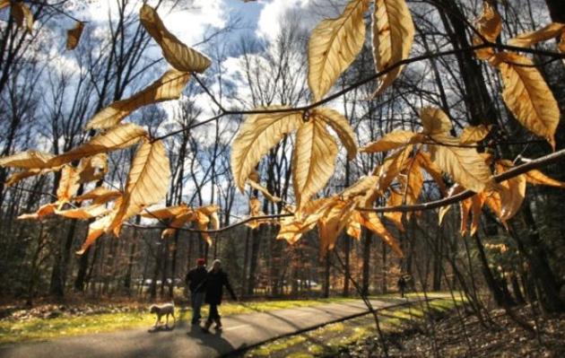
A cool, flakey weekend gives way to an April fling; 50s possible by Tuesday. More bare lawns within 96 hours.

Climate Stories...


Global Warming's Critical Role In "Snowpocalypse Winters". Australia's Renew Economy has the story: "Scientists have tied the rapid decline of Arctic sea ice, caused by global warming pollution, to the recent extreme winters that hit the United States last year and Europe this year. In “Impact of declining Arctic sea ice on winter snowfall,” a new report published by the Proceedings of the National Academy of Sciences, researchers find that the loss of polar ice has changed atmospheric circulation and increased atmospheric water vapor, driving the popularly-dubbed “snowpocalypse” conditions: “We conclude that the recent decline of Arctic sea ice has played a critical role in recent cold and snowy winters.”

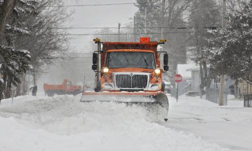
Photo credit above: "St. Cloud, Minn., city snowplows clear city streets of about 8 inches of wet, heavy snow Wednesday, Feb. 29, 2012. (AP Photos/The St. Cloud Times, Dave Schwarz)."

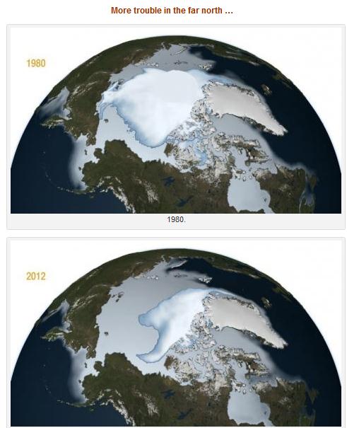
Global Warming: Thick, Multi-year Arctic Ice Melting Faster. Some vaguely troubling developments documented by the Summit County Citizen's Voice: "Along with the steady decline (3.2 percent per decade) in overall Arctic sea ice extent, a new NASA study shows that the oldest and thickest multi-year ice is melting at a much faster pace — about 15 percent per decade — than the thin ice that forms anew each year. The rapid decline of older ice makes the Arctic Ocean’s floating ice cap even more vulnerable to further decline in the summer, according to Joey Comiso, a senior scientist at NASA Goddard Space Flight Center. “The average thickness of the Arctic sea ice cover is declining because it is rapidly losing its thick component, the multi-year ice. At the same time, the surface temperature in the Arctic is going up, which results in a shorter ice-forming season,” Comiso said. “It would take a persistent cold spell for most multi-year sea ice and other ice types to grow thick enough in the winter to survive the summer melt season and reverse the trend.”

Graphic credit above: "The bright white central mass shows the perennial sea ice while the larger light blue area shows the full extent of the winter sea ice including the average annual sea ice during the months of November, December and January. The data shown here were compiled by NASA senior research scientist Josefino Comiso from NASA's Nimbus-7 satellite and the U.S. Department of Defense's Defense Meteorological Satellite Program. Credit: NASA/Goddard Scientific Visualization Studio." Courtesy: Summit County Citizens Voice.

Poll: 62% Of Americans Believe Earth Is Getting Warmer. Details at Huffington Post: "WASHINGTON (AP) — Americans' belief in global warming is on the rise, along with temperatures and surprising weather changes, according to a new university poll. The survey by the University of Michigan and Muhlenberg College says 62 percent of those asked last December think the Earth is getting warmer. That's up from 55 percent in the spring of that year and 58 percent in December 2010. It is the highest proportion in two years. Nearly half the people who say they believe in global warming base that on personal observations of the weather. Climate researchers say that's reaching the correct conclusion for reasons that aren't quite right."

Photo credit above: "A Japanese flowering apricot tree at New York Botanical Garden, Feb. 22, 2012. Horticulturalists in the Bronx call it the global-warming garden, and in a winter notable for its consistent mildness, it is hardly unusual. (Suzanne DeChillo/The New York Times)."

University Survey Links Americans' Growing Belief In Global Warming With Higher Temperatures Outside. Details from The Washington Post: "Nearly half the people who say they believe in global warming base that on personal observations of the weather. Climate researchers say that’s reaching the correct conclusion for reasons that aren’t quite right. When asked an open-ended question about why they thought the Earth was warming, one-quarter of those surveyed pointed to temperatures they experience and another quarter cited other weather changes."

Photo credit above: "(Amy Sancetta, File/Associated Press) - FILE - In this Feb. 5, 2012 file photo, people walk in the South Chagrin Reservation Metropark on a sunny and mild afternoon in Bentleyville, Ohio". Courtesy: Washington Post.
Where's All My Snow? Here's an excerpt from the full article at Huffington Post: "I live in Truckee, CA, at about 6000 feet in the Sierras, a part of the country known for getting hit with a lot of snow. As I write, however, the snowpack depth in my backyard is precisely 0 feet 0 inches. Higher up in the mountains, it's more like 2 feet. In terms of overall water stored in the snowpack, that's about 30% of normal. On top of that, I love to ski, as do most people who live in Truckee. This year, people are freaking out about our lack of snow. At first it was a joke, but then as weeks stretch into months, the possibility of snow has become a taboo subject. "Something looks possible this weekend," said one fellow skier to me last week, "but I didn't tell you that." "Nope," I said. "I didn't hear a thing."

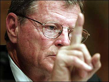
Climate Control: A Moral Issue. From The Hill's Congress Blog: "It is the winter of 2012, but it feels like spring. And our gut tells us that that is not a good thing. But before we get up the courage to link this lovely, but eerie, weather to the steady warnings coming from climate scientists – who’ve been telling us for decades about the dire consequences of climate change if we continue our unbridled use of fossil fuels - Senator Inhofe looks to provide the mind- and heart-numbing relief he believes we long for in the form of a misguided book.  He tells us we have nothing to worry about.
And we just might believe him – except that, in the winter-that-feels-like-spring of 2012, another voice is calling to us, from a higher place."

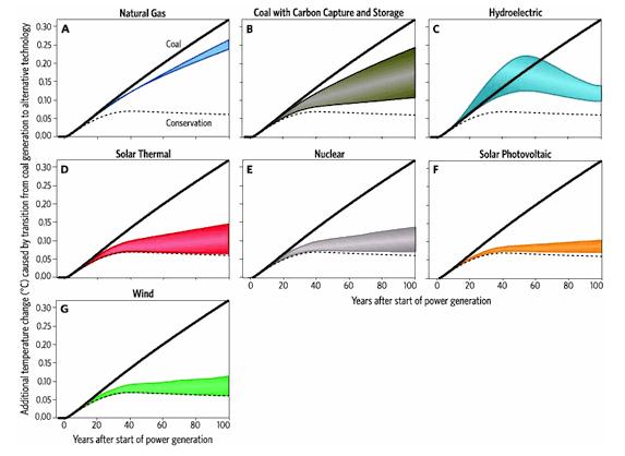
Bombshell: You Can't Slow Projected Warming With Gas, You Need "Rapid And Massive Deployment" Of Zero-Carbon Power. The story from Think Progress: "A must-read new study by climatologist Ken Caldeira and tech guru Nathan Myhrvold (!) makes clear the world’s only plausible hope to avert catastrophic temperature rise this century is aggressive deployment of zero-carbon technologies and conservation. The Institute of Physics news release explains:
… technologies that offer only modest reductions in greenhouse gases, such as the use of natural gas and perhaps carbon capture and storage, cannot substantially reduce climate risk in the next 100 years.
Delaying the rollout of the technologies is not an option however; the risks of environmental harm will be much greater in the second half of the century and beyond if we continue to rely on coal-based technologies."

The Big Fracking Bubble: The Scam Behind The Gas Boom. I have no doubt we should be using all of America's energy resources to grow our economy, while planting (big) seeds in zero-carbon technology for the future. Is "fracking" the miracle cure our nation is looking for? I'm keeping an open mind, but there is growing concern about the environmental impact of this method for extracting natural gas. Here's an excerpt from a recent Rolling Stone article: ".....According to Arthur Berman, a respected energy consultant in Texas who has spent years studying the industry, Chesapeake and its lesser competitors resemble a Ponzi scheme, overhyping the promise of shale gas in an effort to recoup their huge investments in leases and drilling. When the wells don't pay off, the firms wind up scrambling to mask their financial troubles with convoluted off-book accounting methods. "This is an industry that is caught in the grip of magical thinking," Berman says. "In fact, when you look at the level of debt some of these companies are carrying, and the questionable value of their gas reserves, there is a lot in common with the subprime mortgage market just before it melted down." Like generations of energy kingpins before him, it would seem, McClendon's primary goal is not to solve America's energy problems, but to build a pipeline directly from your wallet into his."

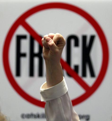
Photo credit above: "Gillie Waddington of Enfield, N.Y., raises a fist during rally against hydraulic fracturing of natural gas wells at the Legislative Office Building in Albany, N.Y., on Monday, Jan. 23, 2012. About 600 people registered to lobby lawmakers Monday on various bills related to the technology known as "fracking." Many are pushing a bill that would ban fracking, which stimulates gas production by using chemically treated water to fracture shale. Others are supporting a bill putting a moratorium on shale gas development. (AP Photo/Mike Groll)."