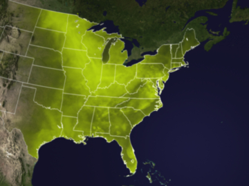
Tuesday, August 2, 2011

August 3: Hottest Day on Record For Oklahoma City? ("Emily" may threaten Florida by Saturday)

5th warmest July on record for Minnesota (source: MN State Climate Office).

Warmest July in 50 years for the continental USA (source: Planalytics).

27 days above 100 in Oklahoma City during July.

"...The highest recorded temperature in Oklahoma City history is 113 degrees, set Aug. 11, 1936. Wednesday's predicted high is 111 degrees. The highest temperature so far in 2011 was 110 degrees on July 9." - article in The Oklahoman.


32 days in a row above 100 at Dallas (second longest streak on record). All-time record for consecutive 100-degree days at DFW: 42 days in 1980. We may come very close to that mark in 2011.


Close Encounter. Tropical Storm Emily is passing just south of Puerto Rico - some of the outer bands of the storm capable of heavy showers and storms, but the roughest surf (and heaviest rain squalls) are passing 50-125 miles south of San Juan. Radar loop courtesy of the Bio-Optical Oceanography Laboratory in Puerto Rico.

753. According to SPC the number of April, 2011 tornadoes has been revised to 753. The old April record was 267, in 1974. Almost THREE TIMES more than the previous record. The tornado record for any month was 542, set in 2003.


"...Since the 1970s, there has been no upward trend in the sun’s brightness." - article on the role of the sun in climate change from Yale's Environment 360. More details below.

"...Last month we set a record for the highest dew point ever recorded at the Minneapolis-St. Paul International Airport. Chicago recorded the very same thing. Yesterday, the news came that there is more land in the United States in extreme drought than in the history of the country. And it has been wet, too. In Alexandria, for instance, folks can't raise their docks any higher, so many people are simply pulling them out. Of course, Australia and Pakistan have seen more rain in the last five months than they've seen in their history. The Horn of Africa is in a drought worse than the one currently hammering Texas. Is this just weather? Or, is it climate?" - Op-Ed from Don Shelby at Minnpost.com, details below.

Minnesota's Monsoon Season. Here are some 24 hour rainfall estimates from NWS Doppler radar at KMPX, showing some pretty amazing rainfall totals: as much as 6" near Hayward, Wisconsin - with a huge swath of 2-5" rains from just south of Duluth to Shell Lake, Barron and Ladysmith. To put that into perspective that's roughly a month's worth of rain in less than 24 hours.

Numerous Reports Of Flooding & Downed Trees. It's a long list of storm damage (and excessive rainfall amounts) from the storms that roared across Minnesota and Wisconsin early Tuesday. Here's the complete rundown, courtesy of NOAA.


KSTC - - gust 63 mph at 9:05 a.m. EDT / 8:05 a.m. CDT - - Regional Airport, St. Cloud, Minnesota
STCSD - - gust 59 mph at 9:00 a.m. EDT / 8:00 a.m. CDT - - St. Cloud State University EAS Department
KCFE - - gust 54 mph at 9:14 a.m. EDT / 8:14 a.m. CDT - - Municipal Airport, Buffalo Minnesota
KBBB - - gust 53 mph at 7:33 a.m. EDT / 6:33 a.m. CDT - - Municipal Airport, Benson Minnesota
Straight-Line Wind Reports From Minnesota On Tuesday, courtesy of NOAA.

Sweating Out The Summer: Impressively Oppressive. The Star Tribune's Bill McAuliffe has a terrific summary of a month we'd all probably prefer to forget. July brought historic dew points and humidity levels to Minnesota, and much of the USA east of the Rockies: "July was the fifth-hottest July on record in the Twin Cities. What? Only fifth? Thanks to copious rain and humidity, the midsummer discomfort approached epic proportions, even without record-setting temperatures. August usually brings some relief, but Monday's downpours and dew points didn't seem to reverse any trends. And for better or worse, summer's a long way from over. "It's either raining like crazy, or it's extremely hot," said Kevin McNealey, who felt the impact in a distinctive way as owner of Blue Ladder Painting in Minneapolis. "The paint either dries too slow or dries too fast." McNealey said his work is down about 20 percent this year, though it's unclear how much is due to weather and how much is due to the economy. "When the end of the season comes around, sometimes people say, 'I should have gotten that painted.' I'm hopeful that's going to be the case," he said. Rainfall for July, 5.23 inches, was 29 percent above normal, and rain fell on 13 days. For those whose work wasn't affected, it fell on four out of five weekends. The high temp on July 1 reached 99, and nine more days in the 90s followed. No daily high temperature records were set, but several others were, indicating how oppressive the conditions were." (tree damage photo courtesy of D.J. Kaywer, a meteorology student at SCSU - and an invaluable member of the WeatherNation team).

July Was The Hottest Month On Record In Oklahoma. More details from newsok.com, powered by The Oklahoman: "Oklahoma's record-breaking heat wave made July the hottest month on record in the state. According to data from the Oklahoma Mesonet, the average temperature in Oklahoma in July was 89.1 degrees, breaking the previous record of 88.1 degrees set in July 1954, said Gary McManus, associate climatologist at the Oklahoma Climatological Survey in Norman. Records have been kept of statewide averages since 1895. The statewide average rainfall total was 0.70 inches, more than 2 inches below normal and making it the fourth-driest July on record. Oklahoma City's average temperature of 89.2 degrees in July topped the previous record of 88.7 degrees from August 1936. Oklahoma City had 27 days in July with a high temperature of at least 100 degrees, once again the most for any month in its history."
Hottest July In Over 50 Years? According to the private weather firm, Planalytics, July was an extraordinary month for heat (and humidity). Here are a few highlights:  
"It was a record breaking July as heat covered most of the continent throughout the entire month.  North America had its 2nd warmest July in 50 years (only lagging 2006) and, while drier than last year, was wetter than normal.  The U.S. had its warmest July in over 50 years, with near normal rainfall.  Canada posted its 5th warmest July in 50 years though it was slightly cooler than 2010. Canada recorded more rainfall compared to last year and normal.
  • July 4th weekend was the warmest since 2003 driven by sweltering heat and helping to drive traffic to beaches, water attractions, and movie theaters.
  • The first week in July set 1,500 weather records due to heavy regional rainfall in the South Atlantic and East South Central regions and heat waves across the South Central Plains.
  • Week 2 experienced similar regional trends of cooler temperatures on the West Coast and heat pushing from the Rockies to the East Coast.  NYC and Philadelphia hit record highs as a part of 2,600 weather records for week 2.
  • Week 3 of July 2011 was the warmest individual week in over 18 years.  Several locations had their highest temperature ever recorded, including Newark, NJ (108F), Washington, DC (105F), and Hartford, CT (103F). 


Hottest Day Yet. Just when you think it couldn't get any hotter in the central and southern USA: 110 at Dallas, 109 at Oklahoma City, 112 at Kansas City, 106 Little Rock, 112 Tulsa. Graphic courtesy of the Plymouth State Weather Center.


Ditto. Relief for New England, the Great Lakes and the Upper Midwest as dew points drop into the 50s, thanks to a fresh transfusion of Canadian air, but more record heat will grip the central and southern Plains, the Mississippi River Valley and Mid South, into the Carolinas and Florida. Map courtesy of Ham Weather.


Tropical Storm Emily. The enhanced infrared satellite loop (see the latest animation from wsi.com) showed Emily becoming more organized, wrapped up into a tigher, more concentric circle of clouds late Tuesday. Sustained winds are 50 mph and additional strengthening is likely today as Emily passes over warm, 85-degree water in the Caribbean. Hispaniola (Haiti and the Dominican Republic) may see a direct strike with some 10-15" rains, temporarily weakening Tropical Storm Emily, which is forecast to make a turn to the north, possibly tracking over the Bahamas by Saturday.


Emily's Projected Track. Tropical Storm Warnings in orange - most models take Emily across Hispaniola (where some weakening will take place), and then northwestward across the Bahamas, where further intensification is possible. The GFDL strengthens Emily to a 92 mph. hurricane, 100 miles east of Vero Beach, Florida by 2 am Saturday morning. Data courtesy of NHC and Ham Weather.

Kevin Martin: "Emily" May Hit Eastern Florida. This isn't my prediction (or even NHC's forecast, which tends to keep Tropical Storm just east of Florida by the weekend). But in the spirit of full disclosure and including diverse opinions, here's a post from The Weather Space.com: "The track is the same track as TWS' track, which does impact Eastern Florida over the weekend, the Bahamas on Friday," said Martin. "This should be a hurricane when it hits Florida so if you have followed my official tracking maps you should have been prepared by now." John Lerner took Martin's warning seriously when an article went out on July 18th calling for the system. (Article here) "I took TWS Senior Meteorologist Kevin Martin's forecast seriously when I saw his call two weeks ago," said Lerner. "Being from just north of Miami this will affect me and I got my supplies this morning when I saw TWS' track giving me warning before NOAA did. Now everyone in my area just got the news and is rushing to the store when I already have my supplies. This is why TheWeatherSpace.com is my choice for my heads up forecasts."


Start To Hurricane-Proof Your Home Today. Some timely advice from DunedinPatch.com: "Here are five things you can check this weekend to prevent potential damage to your home:
  • Garage doors:  If you want a replacement door, purchase a reinforced, wind-rated model. You can reinforce garage doors at their weakest points, using vertical brackets on each panel. Wood and light gauge metal guards, and hinges can be used. Experts suggest checking stores to see if retrofit kits are available for your garage door model.
  • Trees: Trim all tree limbs that could fall on your home before stormy weather is approaching.
  • Windows: Install hurricane shutters and secure them in high winds. Protecting windows prevents wind and water damage and keeps the roof more secure. Duct tape will not suffice."


Satellite image of smog from NASA.

Air Pollution Makes Heat Even Worse. Here's a timely Op Ed from Ken Bradley, from Environment Minnesota:

"The heat wave sweeping the nation means more than just uncomfortable temperatures for all of us.  It can also mean real threats to people’s health when excessive heat and sunlight mix with air pollution from power plants and cars, smog pollution is formed in the air, also known as ground-level ozone.  Smog is the most pervasive air pollutant in the country – with nearly half of all Americans (48 percent) living in areas where the air is often unhealthy to breathe because of high smog levels.  Minnesota’s recent heat wave has impacts on our population and pollution has made the situation even worse.


Breathing in ground-level ozone, though it doesn’t feel any different, is damaging to the lungs, and studies show that on days with elevated levels of ozone, children and adults suffer more asthma attacks, increased respiratory difficulty, and reduced lung function.  A recent report by the non-profit group Environment Minnesota, titled Dirty Energy’s Assault on our Health: Ozone Pollution, suggests that children who grow up in areas with high levels of smog may develop diminished lung capacity, putting them at greater risk of lung disease later in life. Even for healthy adults, repeated exposure to smog over time permanently damages lung tissue, decreases the ability to breathe normally, exacerbates chronic diseases like asthma, and can even kill.  The National Institute of Health estimates that 5,000 asthma related deaths occur each year with air pollution playing a significant role."

Before/After smog image of downtown Moscow courtesy of NOAA.

"There are many tools in place to help protect children and families from air pollution’s dangerous health effects.  Every state monitors the air quality on a regular basis and alerts the public if the air is unhealthy to breathe and if people are advised to stay indoors or avoid outdoor exercise.  The Air Quality Index (AQI) is the main tool for communicating this information to the public.  The index has six color-coded categories ranging from green (good air quality) to purple (hazardous air quality).  At the “orange-alert” level, the air pollution levels are high enough to affect sensitive populations, including children, older adults, and people with asthma and lung disease.  At the “red-alert” level, everyone may begin to experience some adverse health effects, and members of sensitive groups may experience more serious effects.  The Minnesota Pollution Control Agency releases these reports and anyone can sign up for their alerts.

While knowing the air quality is half the battle for protecting your health, there is a lot that is being done behind the scenes to reduce dangerous air pollution across the board.  The U.S. Environmental Protection Agency is developing an updated standard to limit smog-forming pollution from power plants and cars across the country to protect public health, based on the latest air quality and health science.  A strict science-based standard means less pollution allowed from power plants and cars, and healthier air for kids to breathe. While we can’t control the weather, we can impact the pollution that makes these hot summer days even worse for our families and communities."

- Ken Bradley, Environment Minnesota  

Deadly Tornado Wreaks Havoc In Russian City. This may have been one of the first instances of a major Russian city being struck by a deadly tornado, according to euronews.net, which has an amazing video clip here: "It has been dubbed Russia’s first ever “city tornado.” A twister has brought terror to Blagoveshchensk in the country’s far east, near the Chinese border. It killed one person, injured 28 more and caused up to two million euros of damage. The tornado damaged electric power lines and caused a blackout which left about 10,000 people without electricity."

A Tale Of Two Floods. Here's an interesting take on the Missouri River flooding from St. Joseph, Missouri's newspressnow.com: "In both flood years, it was a case of getting the water past St. Joseph, Elwood and Wathena. The 1993 flood was a case of Mother Nature dumping rain in May, June and July in southeastern Nebraska, southwest Iowa, Northeast Kansas and Northwest Missouri. The 2011 flood saw Mother Nature dumping the precipitation during March, April and May in Montana, Wyoming and the Dakotas.In St. Joseph, a local landmark, the Riverfront Park boat landing, has been a constant milestone to mark the rise of the river when water laps on landing stairs people flock to see.Way back in 1881, the river set a high-water mark of 27.2 feet in St. Joseph. This year the river hasn’t been down near that mark for about a month, and it may be another two weeks before it drops below 27 feet.For anyone who thinks either flood was big, they should remember what “old man river” did in 1952. River water rose to 26.8 feet and flooded the land from bluff to bluff, flooding Elwood, Kan., Rosecrans Memorial Airport and Lake Contrary, as well as adjoining low areas."

(photo courtesy of NASA).


The Trees Are Nervous

Welcome to what will almost certainly go down into the record books as the most humid summer on record for Minnesota and much of the Upper Midwest. Dew point is an (absolute) measure of how much water is in the air. According to Pete Boulay at the MN Climate Office MSP has suffered thru 98 hours of 75+ dew points, a new record. Average is 18 hours.

Who cares? When there's this much water in the air there's more fuel for violent T-storms capable of flash floods & extreme winds. Tuesday's severe storms unleashed 3-6" rain, nearly 2 month's worth of rain up north; reports of mudslides near Duluth.

America's North Woods are now under siege: the combination of saturated soil & hurricane-force wind gusts has toppled thousands of trees in recent weeks - a symptom of the "new normal".

It may have been the hottest July in over 50 years for the USA. July was the hottest month EVER for Detroit, Oklahoma City, Amarillo & Wichita Falls. Dallas may go 6 weeks/row above 100.


* photo above courtesy of WJON-Radio.

Climate Stories...


Probing The Role Of The Sun In An Era Of Global Warming. Skeptics point out that other factors may be in play, including the amount of solar energy reaching the Earth's surface. Here's an insightful story from Yale's Environment 360, focusing on the role of the sun in climate change: "Since the 1970s, satellites have been monitoring the Sun’s brightness — technically known as total solar irradiance, or TSI — and with unprecedented precision, using sensitive light detectors that can gaze at the Sun from high above the clouds, moisture, dust, and atmospheric turbulence that interfere with ground-based observations. Over that time, they’ve measured the Sun getting regularly brighter and dimmer as sunspots — essentially, magnetic storms — wax and wane on their normal 11-year cycle. (It’s brighter when there are more sunspots — a seeming paradox since sunspots are dark, but the rest of the surface brightens enough to make up for it.) The total change upward and downward is about a tenth of a percent — enough to change temperatures by a fraction of a degree either way. But overall, there’s been no upward trend over that time in TSI, even as temperatures on Earth have continued to climb. So the Sun isn’t causing global warming." (photo above courtesty of NASA).


Himalaya Glaciers Shrinking...Some May Disappear. Here's an excerpt of an article from Reuters: "HONG KONG Aug 2 (Reuters) - Three Himalaya glaciers have been shrinking over the last 40 years due to global warming and two of them, located in humid regions and on lower altitudes in central and east Nepal, may disappear in time to come, researchers in Japan said on Tuesday. Using global positioning system and simulation models, they found that the shrinkage of two of the glaciers -- Yala in central and AX010 in eastern Nepal -- had accelerated in the past 10 years compared with the 1970s and 1980s. Yala's mass shrank by 0.8 (2.6 feet) and AX010 by 0.81 metres respectively per year in the 2000s, up from 0.68 and 0.72 metres per year between 1970 and 1990, said Koji Fujita at the Graduate School of Environmental Studies in Nagoya University in Japan. "For Yala and AX, these regions showed significant warming ... that's why the rate of shrinking was accelerated," Fujita told Reuters by telephone." (photo above courtesy of the U.K. Guardian newspaper).


Melting Arctic Ice Releasing Toxic Chemicals, Study Finds. The trend has accelerated since 2000, according to alaskadispatch.com: "Climate change is boosting levels of banned pollutants such as PCBs and DDT in the atmosphere, Canadian, Chinese and Norwegian scientists have found. A "wide range" of persistent organic pollutants, or POPs, have been increasingly released into the Arctic atmosphere since the early 1990s, says the study led by Environment Canada scientist Jianmin Ma, "confirming that Arctic warming could undermine global efforts to reduce environmental and human exposure to these toxic chemicals." The study, published Sunday in Nature Climate Change, links higher summer air temperatures and lower sea ice cover to increasing levels of POPs. That suggests that POPs previously trapped in water, snow and ice could be released back into the air as the ice melts, allowing them to travel long distances through the environment. The production and use of POPs has been restricted and, in some cases, banned outright under agreements such as the 2001 United Nations Stockholm Convention on Persistent Organic Pollutants. The restrictions were put in place because POPs are linked to negative health and environmental effects. Exposure to PCBs, for example, can cause skin, lung and nervous system problems and a possible increased risk of cancer. POPs also persist in the environment for a long time after their release because they are resistant to degradation and tend to accumulate in the tissues of living organisms."

Rush Limbaugh, Global Warming And Our Weather. Here's a post from Don Shelby at Minnpost.com: "Last month we set a record for the highest dew point ever recorded at the Minneapolis-St. Paul International Airport. Chicago recorded the very same thing. Yesterday, the news came that there is more land in the United States in extreme drought than in the history of the country. And it has been wet, too. In Alexandria, for instance, folks can't raise their docks any higher, so many people are simply pulling them out. Of course, Australia and Pakistan have seen more rain in the last five months than they've seen in their history. The Horn of Africa is in a drought worse than the one currently hammering Texas. Is this just weather? Or, is it climate? The reason I ask is to turn the question on its head. I hear from a lot of global warming skeptics and deniers. I listen to a lot of conservative radio, and I often hear riffs on the same melody. I usually hear it in the when the weather is cool or when Atlanta or Washington, D.C., see snowfall. Those local events rarely produce a statistical blip on the summary of the continued warming of our whole planet, but the deniers say, "Where is your global warming, now?" Over the past two or three decades, the scientists have been careful in pointing out that "single weather events can't be attributed to global warming." It is, after all, climate change we are talking about and not weather change. To be clear, the scientists have repeated that line whether people were asking about hot, cold, wet or dry weather. But even scientists are beginning to change their minds about what we are witnessing through our windows. These extreme events, taken together, may be a sign of things to come. The chair of the Intergovernmental Panel on Climate Change (IPCC), Rajendra Pachauri, has said, "...climate change and its impacts are not off in the future, but are here and now."


The Good, The Bad, And The Ugly Effects Of Global Warming In Russia. Melting permafrost is releasing methane gas, 17-21 times more powerful than CO2 as a greenhouse gas. The Business Insider has more details: "Russia's vast permafrost may shrink by a third by the middle of the century due to global warming, the government's disaster monitoring department said Friday. This is a huge shift, considering that 63% of Russia is now covered in permanently frozen soil. Friday's announcement was focused on the bad side, according to AFP. Steady thawing is expected to destroy buildings, and transportation and energy  infrastructure. "The negative impact of permafrost degradation on all above-ground transportation infrastructure is clear," Andrei Bolov told Ria Novosti. The report also described the risk of a massive gas release. Permafrost traps methane and the thawing soil would release methane into the atmosphere. The release has no reported serious health effects, though it is an asphyxiant at high levels." (map courtesy of NOAA's Snow And Ice Data Center).


The EPA Proposes Fracking Rules. Energybiz.com has the complete story. Here's a brief excerpt:

"When it comes to understanding the ebb and flow of U.S. energy policy, most insiders will acknowledge that natural gas has a lead. But with that bravado must come a bit of compliance -- namely in the form of new environmental regs. The U.S. Environmental Protection Agency has proposed new rules for natural gas explorers. That is, those entities that produce shale-gas must reduce their smog-related emissions by 95 percent. But the EPA says that would be done by using proven technologies that can capture natural gas that currently escapes into the air -- gas that would be made available for sale.  Environmental groups are calling the proposal a fair deal, meaning that the capture of the gas would eliminate not just volatile organic compounds that make up smog but also those involving methane, as a byproduct. Methane is a greenhouse gas that is much more potent than carbon. The oil and gas industry is said to release 40 percent of all U.S. methane emissions, which is the largest single source, says EPA. "

Monday, August 1, 2011

August 2: Tropical Storm Emily Threatens Carribean (July: hottest month on record for a long list of cities)

98 hours of dew points greater than 75 F. in the Twin Cities (a new record). 30 year average: 18. Details below.
2,676 temperature records were tied or broken, nationwide, in July. July, 2010: 1,444 temperature records were set.
1871: Washington D.C. just experienced the hottest July since 1871, according to NOAA.
July: warmest month ever recorded in Dalhart, Texas, Amarillo, Texas, Detroit, Fort Wayne, Indiana, Wichita Falls and Oklahoma City. (source: NOAA)


Straight-Line Wind Damage. Good friend and former WCCO-TV anchor and reporter Don Shelby called me yesterday - he has a place up on Lake Ida near Alexandria, said traffic was blocked off in Glenwood and Kensington, due to downed trees and powerlines. Click here to see the complete run-down of damage from Monday's severe storms here.


A Month's Worth of Rain On Monday. NWS Doppler radar rainfall estimates show some 3-4" amounts near Alexandria and Glenwood (where there were numerous reports of straight-line wind damage. 1-3" amounts were common from Detroit Lakes into the Brainerd Lakes area, resulting in flash flood warnings over much of northern Minnesota Monday night.


Tuesday Severe Threat. Severe storms are possible from the Quad Cities of Iowa to Milwaukee, Chicago, Detroit and Cleveland later today, according to SPC.


Tropical Storm Emily. With sustained winds of 40-45 mph, Emily is a minimal tropical storm, but conditions aloft are ripe for further strengthening. Emily could strengthen to hurricane status, possibly reaching coastal Florida by Saturday as a category 1 storm. Stay tuned. Map courtesy of Ham Weather.


The Dripping (Unbearable) Summer of 2011. Here's a post from Pete Boulay at the Minnesota State Climatology Office: "the National Weather Service is forecasting a break in the high dew point temperatures over the next few days after the muggy day today. So far this summer as of 3pm August 1, there have been 274 hours of dew point temperatures of 70 degrees or higher recorded at the Twin Cities International Airport. The record is 512 hours in 2002. What really stands out are the counts of extremely muggy dew point temperatures. So far this summer as of 3pm August 1, there have been 98 hours of dew point temperatures of 75 degrees or higher. This breaks the old record of 78 hours that was set back on 2001."

Twin Cities International Airport

Greatest Number of hours with dew point temperature of 75 degrees F

(1945-2011)

Rank  Year   Hours
--------------------
1.    2011   98 (as of 3pm August 1)
2.    2001   78
3.    1999   64
4.    1987   60
5.    1995   56

1981-2010 average for summer = 18
 

Drippy Dew Points = More Severe T-storms. Other than being annoying (and potentially dangerous, especially for people who work out in the heat or don't have access to A/C) this summer's extraordinarily high dew points have helped to fuel unusually severe and persistent thunderstorms, drenching much of Minnesota with tropical-like downpours. Here's a post from the local NWS office:

"Dew point often directly correlates to deeper atmospheric moisture and instability, two parameters that are conducive for severe thunderstorms in the presence of some type of weather front.  Thus meteorologists often look at dew point as one of the key elements in forecasting severe weather potential.  Indeed, the dew point during some of the area's severe weather events this year was quite high, over 9° above the 2011 summer average so far."


Dew Point Trend. Dew points linger in the low 70s today, but dip into the 50s Wednesday (meaning half as much water in the air). More humid air returns later this week, 65-73 degree dew points from Thursday into the weekend.


July Heat In Washington D.C. Was Unprecedented. Here's an article summarizing the record heat in our nation's capital, courtesy of the Capital Weather Gang, reporting for the Washington Post: "Relentless and punishing, July’s heat was unrivaled in 140 years of Washington, D.C., weather record-keeping. The July temperature averaged 84.5 degrees at Reagan National Airport — Washington’s official weather station — more than a degree above July 2010 and July 1993, which previously held the mark for hottest month. July’s heat piled onto a torrent of recent hot-weather records and attained all sorts of unenviable hot-weather milestones. The high temperature was at least 90 on 25 occasions, the most on record. When the July 29 temperature hit 104 degrees, it was the highest reading since 105 on August 17, 1997, and it tied for the fifth-hottest in the books. On July 22, the heat index — a measure of the combined heat and humidity — reached 121 degrees, the highest level since 122 on July 16, 1980. Amazingly, the month also had eight record days for warm low temperatures, including seven when the temperature failed to fall below 80 degrees. Four of those days came consecutively (from July 21 to 24), the longest such stretch on record by two days. Twice (July 23 and 24) the District tied for its warmest all-time low temperature of 84 degrees. And the heat was off the charts at other weather stations in the region." (photo above courtesy of flickr).


* Washington D.C. just experienced the hottest July since 1871, according to NOAA.


Monday Records:

Washington National D.C. 100
Chadron, NE 103
Victoria, TX 103
Waco, TX 107
Dallas Fort Worth, TX 107
Vicksburg, MS 102
Little Rock, AR 103
W. Palm Beach, FL 96
Abilene, TX 103
Springfield, MO 105
Joplin, MO 108
Topeka, KS 109
Fayetteville, AR 105
Mcalester, OK 108
Tulsa, OK 110
Fort Smith, AR 110
Russell, KS 107

More Beastly Heat. It's deja vu all over again. Tuesday brings 100+ heat indices from the Central Plains across the southeastern USA into Florida. Some relief is likely over the Dakotas, the Great Lakes and New England, as Canadian air filters south of the border.


A Hideous Hot Streak. Be glad you're not stuck down in Ft. Smith, Arkansas: 27 days/row above 100 degrees, breaking the old record of 17 days/row set during the Dust Bowl Year of 1934. Source: NOAA.


**...JULY 2011 RANKS AS THE WARMEST JULY AND THE ALL TIME WARMEST
MONTH ON RECORD AT
DALHART, TX

**JULY 2011 RANKS AS THE WARMEST JULY AND THE ALL TIME WARMEST
MONTH ON RECORD AT AMARILLO, TX


**THE DRIEST OCTOBER TO JULY PERIODS AT DEL RIO, TX FROM 1906 TO 2011
ARE LISTED BELOW.
1. OCTOBER 2010 TO JULY 2011  2.21
2. OCTOBER 1955 TO JULY 1956  2.28
3. OCTOBER 1952 TO JULY 1953  4.18


**THE DRIEST OCTOBER TO JULY PERIODS FROM 1871 TO 2011 AT SAN ANTONIO
ARE LISTED BELOW.
1. OCTOBER 2010 TO JULY 2011  7.63
2. OCTOBER 1995 TO JULY 1996  8.26
3. OCTOBER 2008 TO JULY 2009  8.50


**WARMEST JULYS AT AUSTIN MABRY 1854 TO 2011
1.  JULY OF 2011    89.7...ALSO HOTTEST MONTH FROM 1854 TO 2011


**BLUEFIELD WV HAD AN AVERAGE TEMPERATURE OF 76.2 DEGREES DURING JULY 2011...WHICH SETS A NEW RECORD FOR THE HIGHEST AVERAGE TEMPERATURE OF ANY JULY.

*JULY 2011 WAS THE WARMEST MONTH ON RECORD FOR DETROIT.

*85.7 THIS RANKS AS THE WARMEST JULY ON RECORD FOR THE WEST PALM BEACH AREA SINCE DATA COLLECTION BEGAN BACK IN 1888. THE PREVIOUS RECORD WAS 85.0 DEGREES IN JULY 1942.

*A NEW RECORD WARMEST AVERAGE TEMPERATURE HAS BEEN SET AT FORT WAYNE, IN

*...JULY 2011 WAS THE WARMEST SINGLE MONTH SINCE RECORDS BEGAN AT
WICHITA FALLS...

*...JULY 2011 WAS THE WARMEST SINGLE MONTH SINCE RECORDS BEGAN AT
OKLAHOMA CITY...


Deadly Tornado Hits City In Russia's Far East. Click here to see the video clip from rt.com: "One person has been killed and twenty eight others injured as a powerful tornado hit the Russian far-eastern city of Blagoveshchensk. The tornado was so powerful that it tore the roofs from houses, turned over vehicles, flattened trees and smashed windows in several buildings. Local authorities have introduced a state of emergency in the city, Itar-Tass news agency reports. 200 people and 50 vehicles are already involved in the cleaning operation."


"Shawshank Tree" Damaged By Thunderstorm. AccuWeather has the details: "The oak tree that was made famous by the movie The Shawshank Redemption was severely damaged by wind Friday afternoon. A thunderstorm moving through the area Friday at around 2:30 p.m. EDT produced straight-line winds that damaged the tree according to Mansfieldnewsjournal.com. The tree had a rotten center that weakened it. The storm caused a power outage and damage to other trees. The power was restored by 6 p.m. EDT. The oak tree is near the location where Andy, portrayed by Tim Robbins, hid his treasure. Since the movie, based on a short story by Stephen King, many people visit the tree and take photos, according to Mansfieldnewsjournal.com."


Wettest European Cities. Planning a vacation or business trip to Europe? If you're heading to Zurich you'd be well-advised to pack an umbrella, with an average of 42.3" rain/year. Here's a list of Europe's Top 10 Wettest Cities, courtesy of NOAA and NCDC.


10 Most/Least Expensive Cities To Live In. In the "that's almost interesting" category here are the lists you've been dying to get your hands on, thanks to gizmag.com: "Luanda in Angola, Libreville in Gabon and N’Djamena in Chad are the most expensive extreme hardship locations in the world and thanks to the marketplace volatility which results from local inflation, political instability, currency fluctuations and natural disasters, Tokyo has consolidated its title as the most expensive of the recognised cities of the world in which to live."


GDT European Wildlife Photographer Of The Year: 2010. Here's a terrific series of nature-related photographs, courtesy of the U.K. Guardian: "Weird and wonderful animals from land and sea feature in the best snaps from around the world for the GDT European wildlife photographer of the year awards."


KXAS-TV Calls In UFO Specialists After Traffic Camera Records Strange Light In Dallas. The odd story from TV Spy and KXAS-TV in the Dallas/Fort Worth market: "Strange things are afoot in Dallas. In the early hours of Monday morning, a KXAS traffic camera recorded a strange light falling out of the sky (above). Station management has now called in a UFO specialist to analyze the video frame-by-frame in hopes of determining the source of the mysterious light."


Feeling Exposed

"Dad, what do we do if a tornado approaches the cabin?" my oldest son asked. Great question. "How fast can you run?" Bad answer. It's a real dilemma up north: many cabins, trailers & campsites are completely exposed & vulnerable to severe weather, much more so than here in the MSP metro area. 

If you don't have a basement the safest place may be a crawl-space, even a ditch. NOAA Weather Radio & apps on your smartphone can give you a greater margin of safety and advance warning. I just added Internet & cable TV to my cabin. Kind of defeats the purpose of a cabin, come to think of it. Duh.

Good riddance to July: hottest in D.C. since 1871 - 2,676 temperature records across the USA. Things should mellow in August, fewer storms (and nasty heat spikes). At least in theory.

Climate Stories...


In The Flood Zone, But Astonished By High Water. Here's an excerpt of a New York Times story focusing on the incredible duration and intensity of the flooding on the Missouri River: "DAKOTA DUNES, S.D. — Some skeptical locals offered a warning when developers transformed this mostly barren peninsula at the intersection of two rivers into an exclusive planned community, complete with million-dollar homes and a private golf course designed by Arnold Palmer. They call it “the Dunes” for a reason, the warning went — the rivers put the sand there, and the rivers could sweep it away. But, much like the developers, the new residents were not worried. A few even paid a premium to be closest to the flowing water of the Missouri and the Big Sioux. Now, a little more than two decades later, the stately homes on Spyglass Circle and Pebble Beach Drive have been evacuated and the 18th hole is under six feet of water, as miles of newly built levees strain to keep this community from surrendering to a historic flood. Many residents here at the southeastern tip of the state, where it borders Nebraska and Iowa, say they never imagined this chain of events."


Recent Floods Shatter U.S.'s False Belief In Taming Rivers. The New York Times has the story - here's a brief excerpt: "DAKOTA DUNES, S.D. — Skeptical locals offered a warning when developers transformed a mostly barren peninsula at the intersection of two rivers into an exclusive planned community, complete with million-dollar homes and a golf course. They call it “the Dunes” for a reason: The rivers put the sand there, and the rivers could sweep it away. Now, a little more than two decades later, stately homes have been evacuated and the 18th hole is under water, as miles of newly built levees strain to keep this community from historic flooding. And now, some people are using the high waters from North Dakota to New Orleans to revisit longstanding questions about whether the very government programs designed to safeguard people from floods actually encourage them to take chances." (photo: ouramazingplanet.com).


Army Corps Battles Perceptions In Missouri River Flood. Here's a USA Today story revolving around the politics (and inherent unpredictability) of flood forecasting: "SIOUX FALLS, S.D. — Jody Farhat had a problem. It was June 3, and the Army Corps of Engineers' water management chief for the Missouri River basin had just received word that contractors building a private levee in Dakota Dunes had been delayed. They needed the corps to postpone stepping up water releases from Gavins Point Dam -- pivot point in the battle between upper and lower basin interests on the Missouri River -- for an extra day. "Don't feel we have much choice here," Farhat wrote other corps officials. Brig. Gen. John McMahon, commander of the corps' Northwestern Division, replied soon after: "Roger. Thanks. This is a smart 'political' move IF it's supportable from a (water management) perspective." The next day, another official jumped on the email thread: "You know the politics -- We'll do what we need to do." They agreed that news of the schedule change should, for now, stay with the corps. "Of course, nothing public," engineer Paul Boyd wrote."


Twilight Of The Glaciers. Here's an excerpt of an important story in the New York Times: "AN hour or so up ahead, at the higher elevations along the trail that leads over Siyeh Pass, huckleberries were ripening. Even a dawdling day hiker like me knows that huckleberries can quickly mean grizzlies in Glacier National Park. I indulged a nervous tic and patted around for the loud red aerosol can on my belt, whose label reads Counter Assault. It’s effective as a bear repellent, but even more reliable at making an urbanite feel faintly ridiculous. 

I was in northwest Montana for the hikes and the huckleberries, but most of all to experience the namesake glaciers, which, I had recently learned, might be around for only another decade or so. Given that a century and a half ago there were 150 and now there are 25, the trip makes me an enlistee in the practice known by a somewhat prickly term: last-chance tourism." (before/after photo above courtesy of the USGS).


Obstacles To Capturing Carbon Gas. An informative article from the New York Times (subscription may be required): "BRUSSELS — Can the world use fossil fuels and protect the climate too? That is the goal of carbon capture and sequestration, which is a process for trapping carbon dioxide before it reaches the atmosphere and then pumping it underground, or under the seabed. The process is already used by oil and natural gas companies like BP and Statoil at sites like In Salah, Algeria. There, the carbon dioxide that exists along with natural gas is captured and stored onshore in a saline aquifer. Despite a tiny leak from a faulty wellhead valve four years ago, and despite the need to reduce the quantities of carbon dioxide injected because pressure had built up in the saline aquifer faster than expected, BP of Britain and Statoil of Norway said, millions of tons of the greenhouse gas have been prevented from reaching the atmosphere. Oil and natural gas companies also have trapped large amounts of carbon dioxide in the minute pores and spaces in rocks at similar projects in countries like Norway and Canada. But efforts to make the process, known as C.C.S., a mainstay of efforts by the power industry to go green are hitting obstacles." (graph courtesy of NOAA).