WeatherNation Headlines
Tuesday, June 3, 2014
WNTV Blog: Severe and Heavy Rain Threats Continue
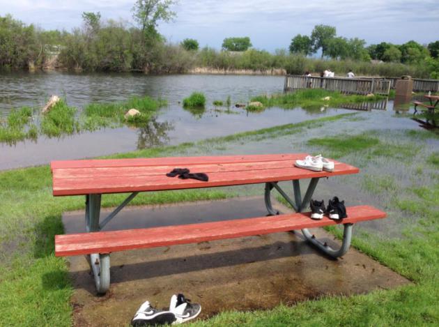
Lake Levels Running High
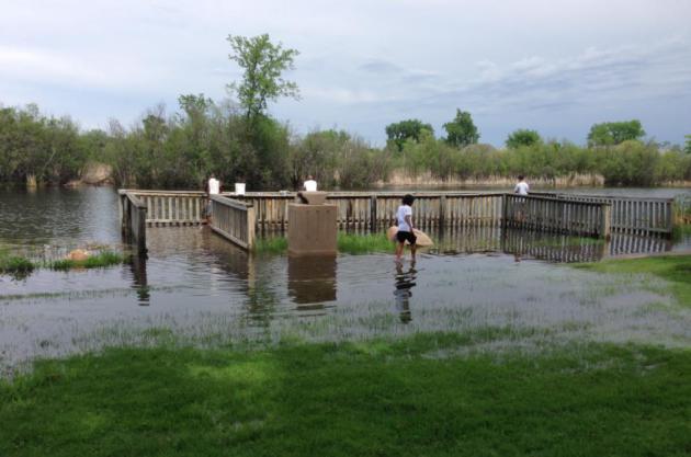
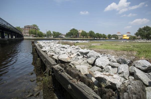
I snapped this picture Tuesday morning of Lake Minnetonka in Excelsior, MN. It is apparent that lake levels are running quite high from the recent heavy rain event from last weekend!!
Summer Solstice
The Summer Solstice arrives on Saturday, June 21st at 5:51am CDT
==============================
Stormy Outlook Ahead
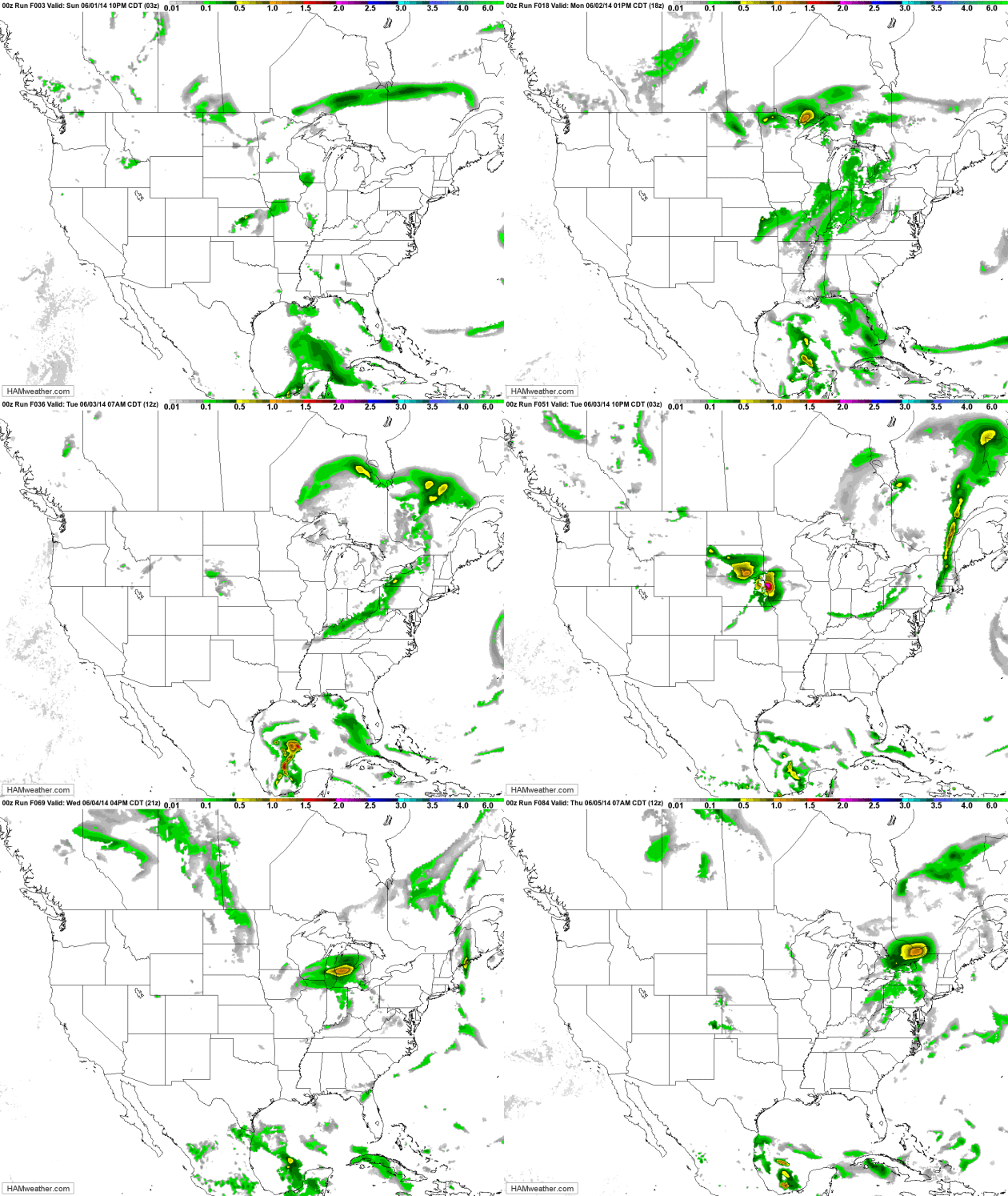
Look at the vigorous area of low pressure scooting through the central U.S.. This will be responsible for an ongoing severe weather threat through the 2nd half of the week and it tracks east. Not only will there be a severe weather threat, but a flood threat could be possible in areas that see heavy rains from convective precipitation.
Severe Threat Wednesday
...SUMMARY... STRONG TO SEVERE STORMS WILL BE POSSIBLE FROM PARTS OF THE SOUTHERN PLAINS AND NWD INTO THE CENTRAL HIGH PLAINS AS WELL AS FARTHER EAST INTO SOUTHEASTERN VIRGINIA AND EASTERN NORTH CAROLINA. ISOLATED DAMAGING WIND AND LARGE HAIL WILL BE THE MAIN THREATS. ...SYNOPSIS... THE LOW AMPLITUDE...PROGRESSIVE SHORTWAVE TROUGH WILL MOVE OFF THE ATLANTIC SEABOARD EARLY THURSDAY...BUT A BROAD SYNOPTIC UPPER TROUGH WILL REMAIN OVER THE ERN STATES. FARTHER UPSTREAM A ZONAL PATTERN WILL PERSIST FROM THE WEST COAST EWD THROUGH THE PLAINS AND MS VALLEY REGIONS. SEVERAL LOW AMPLITUDE SHORTWAVE TROUGHS WILL MOVE THROUGH THIS FLOW REGIME. AT THE SFC A COLD FRONT WILL MOVE OFF THE ATLANTIC SEABOARD IN ASSOCIATION WITH THE EXITING SHORTWAVE TROUGH. TRAILING PORTION OF THIS BOUNDARY WILL LIKELY STALL FROM OK EWD INTO THE LOWER MS VALLEY REGION. FARTHER NORTH A COLD FRONT IS FORECAST TO MOVE THROUGH THE NRN PLAINS AREA.
Severe Threat Thursday
...SUMMARY... STRONG TO SEVERE STORMS WILL BE POSSIBLE FROM PARTS OF THE SOUTHERN PLAINS AND NWD INTO THE CENTRAL HIGH PLAINS AS WELL AS FARTHER EAST INTO SOUTHEASTERN VIRGINIA AND EASTERN NORTH CAROLINA. ISOLATED DAMAGING WIND AND LARGE HAIL WILL BE THE MAIN THREATS. ...SYNOPSIS... THE LOW AMPLITUDE...PROGRESSIVE SHORTWAVE TROUGH WILL MOVE OFF THE ATLANTIC SEABOARD EARLY THURSDAY...BUT A BROAD SYNOPTIC UPPER TROUGH WILL REMAIN OVER THE ERN STATES. FARTHER UPSTREAM A ZONAL PATTERN WILL PERSIST FROM THE WEST COAST EWD THROUGH THE PLAINS AND MS VALLEY REGIONS. SEVERAL LOW AMPLITUDE SHORTWAVE TROUGHS WILL MOVE THROUGH THIS FLOW REGIME. AT THE SFC A COLD FRONT WILL MOVE OFF THE ATLANTIC SEABOARD IN ASSOCIATION WITH THE EXITING SHORTWAVE TROUGH. TRAILING PORTION OF THIS BOUNDARY WILL LIKELY STALL FROM OK EWD INTO THE LOWER MS VALLEY REGION. FARTHER NORTH A COLD FRONT IS FORECAST TO MOVE THROUGH THE NRN PLAINS AREA.
Heavy Rain Threat
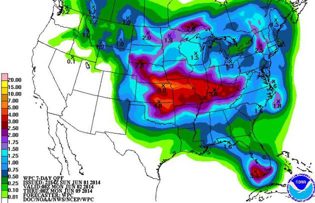
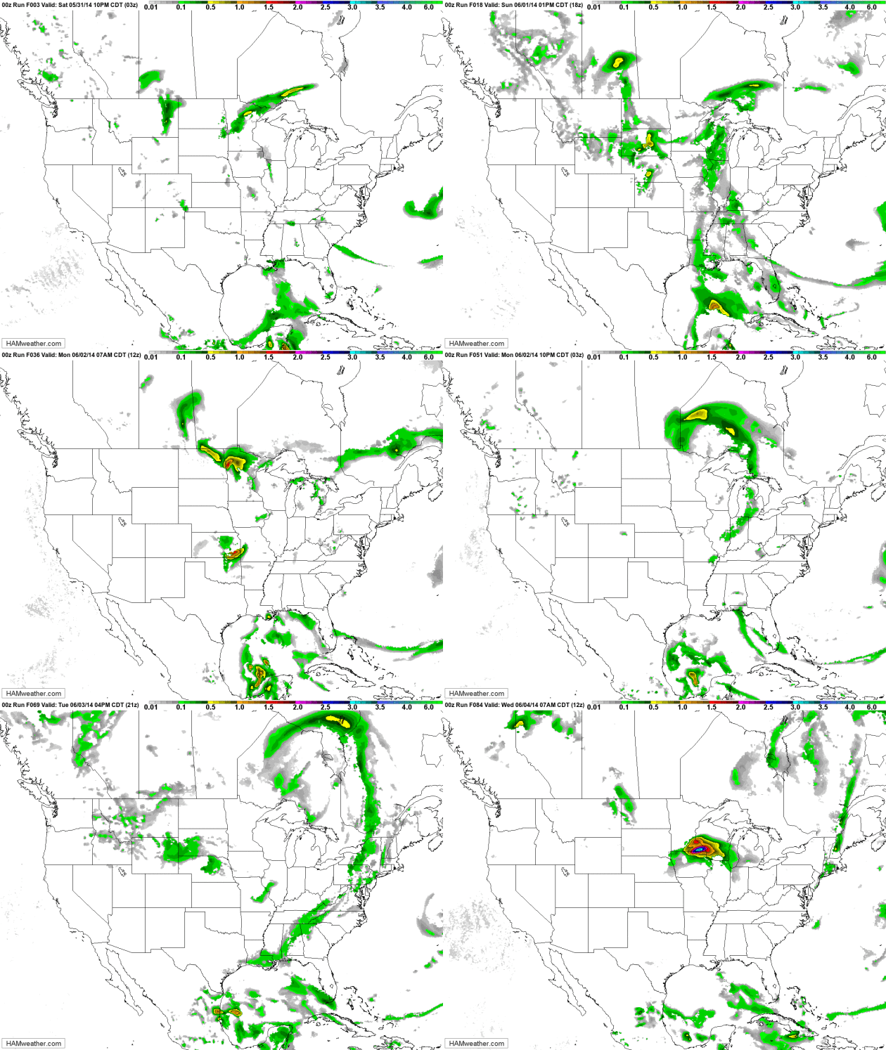
Another big concern will be the heavy rain over sections of the central U.S.. According to NOAA's HPC, the 5 day precipitation forecast (from AM Tuesday - AM Sunday) suggests nearly 5"+ over the nation's heartland. Most of this rainfall will occur in a short period, which may cause areas to see flash flooding.
Flash Flood Watch
Through AM Wednesday:
EXCESSIVE RAINFALL RATES WILL LEAD TO HIGH RUNOFF RATES OVERNIGHT. WIDESPREAD TOTAL PRECIPITATION AMOUNTS LOOK TO RANGE FROM 2 TO 4 INCHES BY WEDNESDAY MORNING...BUT COULD SEE ISOLATED AMOUNTS OF 5 INCHES OR GREATER. * SMALL CREEKS AND STREAMS TYPICALLY SUSCEPTIBLE TO FLASH FLOODING MAY RISE VERY RAPIDLY TONIGHT...ESPECIALLY IN URBAN AREAS.
Heat Concerns
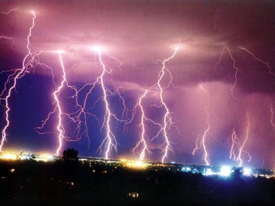
Record heat popped up earlier this week in places like Phoenix and Tucson, AZ as temperatures soared into the triple digits. It appears that more record and near record heat will continue over the next couple of days. Thanks to my parents for the pictures below from Sun City Grande. This was the sunset after a record setting 110F in Phoenix, AZ (tied 110F set in 2013).
AN EXCESSIVE HEAT WARNING REMAINS IN EFFECT UNTIL 8 PM MST THURSDAY. * AFFECTED AREA...THE PHOENIX METRO AREA AND SURROUNDING LOWER DESERTS INCLUDING GILA BEND...CASA GRANDE...COOLIDGE...AND OTHER NEARBY AREAS. * WARNING TIME EACH DAY...GENERALLY FROM 10 AM TO 8 PM. * TEMPERATURE...HIGHEST TEMPERATURES FROM 109-111 DEGREES. * IMPACTS...EXCEEDINGLY HIGH TEMPERATURES CAN CAUSE HEAT RELATED ILLNESS...EVEN DEATH. THOSE WORKING OR PLAYING OUTDOORS... THOSE WITHOUT AIR CONDITIONING...OR PEOPLE SENSITIVE TO HEAT WILL NEED TO TAKE PRECAUTIONS.
Tropical Update
This was the view of Tropical Storm Boris (BOR-EES) in the Eastern Pacific around midday Tuesday. Note the broad counterclockwise circulation just offshore (Mexico). This is our second named storm of the 2014 Eastern Pacific Hurricane Season. It was over Memorial Weekend that Hurricane Amanda rapidly developed into a category 4 storm, which became the strongest storm this early in the season for the Eastern Pacific.
Tracking The Tropics
DISCUSSION AND 48-HOUR OUTLOOK ------------------------------ SATELLITE DATA INDICATE THAT THE DEPRESSION HAS STRENGTHENED INTO A TROPICAL STORM. AT 1100 AM PDT...1800 UTC...THE CENTER OF TROPICAL STORM BORIS WAS LOCATED NEAR LATITUDE 14.7 NORTH...LONGITUDE 94.1 WEST. BORIS IS MOVING TOWARD THE NORTH NEAR 5 MPH...7 KM/H...AND THIS GENERAL MOTION IS EXPECTED FOR THE NEXT COUPLE OF DAYS. ON THE FORECAST TRACK...THE CENTER OF BORIS SHOULD BE NEAR THE COAST OF MEXICO WITHIN THE WARNING AREA EARLY WEDNESDAY. MAXIMUM SUSTAINED WINDS HAVE INCREASED TO NEAR 40 MPH...65 KM/H...WITH HIGHER GUSTS. NO SIGNIFICANT STRENGTHENING IS EXPECTED BEFORE LANDFALL. TROPICAL STORM FORCE WINDS EXTEND OUTWARD UP TO 80 MILES...130 KM...NORTHEAST OF THE CENTER. PUERTO CHIAPAS MEXICO HAS ALREADY REPORTED 3.78 INCHES OF RAIN FROM BORIS. THE ESTIMATED MINIMUM CENTRAL PRESSURE IS 999 MB...29.50 INCHES. HAZARDS AFFECTING LAND ---------------------- WIND...TROPICAL STORM CONDITIONS ARE REACHING THE COAST WITHIN THE WARNING AREA NOW AND SHOULD CONTINUE THROUGH TONIGHT. RAINFALL...BORIS IS EXPECTED TO PRODUCE AS MUCH AS 10 TO 20 INCHES OF RAIN OVER A LARGE PART OF SOUTHERN MEXICO THROUGH SATURDAY...WITH ISOLATED AMOUNTS EXCEEDING 30 INCHES LIKELY OVER THE MOUNTAINOUS TERRAIN OF THE MEXICAN STATES OF OAXACA AND CHIAPAS. BORIS IS ALSO EXPECTED TO PRODUCE TOTAL RAINFALL AMOUNTS OF 5 TO 10 INCHES IN GUATEMALA. THESE RAINS ARE LIKELY TO RESULT IN LIFE-THREATENING FLASH FLOODS AND MUD SLIDES.
Here are the spaghetti models for Boris as he tracks over southern Mexico. Note that most have Boris drifting north near the Bay of Campeche
Tracking Boris
This is the GFS (American Model) outlook for Boris as he drifts north. The images below are the forecast for AM Monday and AM Wednesday of next week. Note that this particular model has Boris drifting near the Yucatan Peninsula and toward Florida! Stay tuned...
Outlook AM Monday
Outlook AM Wednesday
Thanks for checking in and have a great rest of your week ahead! Don't forget to follow me on Twitter @TNelsonWNTV
Sunday, June 1, 2014
3-6 Week's Worth of Rain Upper Midwest - Is our Weather Increasingly Getting Stuck?
Slow-Motion Weather
This is why climate trends are important, why we should listen to the scientists and keep an eye on the symptoms and trends.
A warmer atmosphere is flavoring all weather now. Rapid warming of the Arctic may be impacting jet stream wind speeds over the Northern Hemisphere. So what? A slower jet increases the potential for blocking patterns; stalled storms more likely to spark flooding rains and temporarily "stuck" high pressure bubbles capable of sudden drought and heat.
If you're bailing water out of your basement there's a statistically significant chance it may be linked to these global trends. I've noticed an escalation of these blocking patterns since about 2010. Exhibit A: a 3 month polar vortex. I hope it's just my imagination.
The frontal battle zone that spawned "training thunderstorms" - a conga-line of storms bubbling up along the same boundary (much like the cars in a train pass over the same section of track) - shifts east later today, and we finally begin to dry out. We cool off a bit; more T-storms sprout next weekend. With luck the front won't stall and spark more flash floods.
That's the thing about climate change. It only hits home - when it hits home.
* more details on the study referenced above from Planet Earth Online.
Hi Paul,
We are wondering what is happening here, with the more intense storms lining up in a line like an arrow. You give such wonderful explanations, so would love to hear what goes on here! I never miss your Weather Blog.
Many thanks!!
Pat Jerde, an avid weather fan from Burnsville, MN
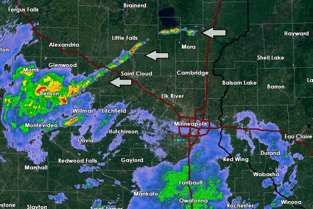
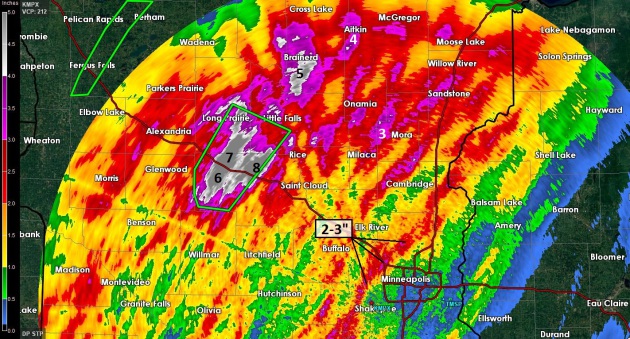
Thanks Pat - I appreciate you taking the time to write a very nice note. I was baffled by your question and don't pretend to have a definitive answer. Outflow boundaries, cool, rain and hail-cooled exhaust, miniature cool fronts, from T-storm downdrafts often spark additional storms nearby. But these storms mushroomed north/west of St. Cloud Sunday evening and persisted in place for several hours. One theory: the storms lined up very close to the heaviest rain axis late Saturday into early Sunday (6-8" amounts over western Stearns County). The sun came out for a time Sunday afternoon over central Minnesota, heating the ground, but the areas with heaviest rain (and standing water) would have cooled less. This, in turn, may have created the differential heating necessary to spark the low-level convergence necessary to support a quasi-stationary line of storms for a few hours. It's a WAG, but the best idea I was able to come up with.
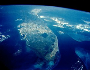
Read more here: http://www.miamiherald.com/2014/05/31/4150051/florida-riding-a-lucky-streak.html#storylink=cpy
Photo credit above: Joanna Dodder - The Daily Courier. "Will Bingman and Chris Stalzer from Juggernaut Defense show off FLASH field kits Thursday during a demonstration of the technology in Prescott."
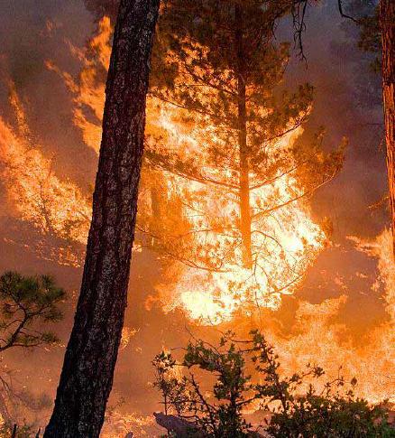
File photo: United States Forest Service.
Climate Stories...
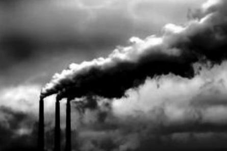
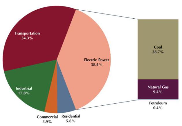
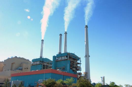
EPA To Seek 30% Cut in Carbon Emissions. The New York Times has a good overview of the announcement and new rules coming out of the White House and EPA today; here's a clip: "The
Environmental Protection Agency will unveil a draft proposal on Monday
to cut carbon pollution from the nation’s power plants 30 percent from
2005 levels by 2030, according to people briefed on the plan. The
proposed rule amounts to the strongest action ever taken by the United
States government to fight climate change. Coal-fired power plants are
the largest source of the greenhouse gas emissions that scientists blame
for trapping heat in the atmosphere and dangerously warming the planet.
The rule could trigger a fundamental transformation of the nation’s
energy systems – if it withstands an expected onslaught of legal and
legislative attacks..."
Myths and Facts About EPA's Carbon Pollution Standards. Here's an excerpt from Media Matters: "The
Environmental Protection Agency's forthcoming regulations on greenhouse
gas emissions will provide legally required protection for the health
and welfare of Americans at a cheap cost, while allowing states
flexibility -- contrary to media fearmongering about the landmark
standards."
- Are the EPA's regulations on carbon emissions legal?
- How will the regulations impacts jobs?
- How will the regulations impact electricity rates?
- Will they be forced onto states?
- Will the regulations be effective in curbing global warming?
In Norfolk, Evidence of Climate Change is in the Streets at High Tide. The Navy knows it has a long-term challenge, since Norfolk represents its biggest port. Here's a clip from The Washington Post: "...Obama
has ordered every agency to start planning for climate change, but
administration officials acknowledge that the process is in its infancy.
Meanwhile, there is no new money to help hard-hit places such as
Norfolk, where residents are clamoring for relief. Norfolk exists
because of the sea. Ships have been built in its harbors since the
Revolutionary War. It is home to the largest naval base on the globe.
Bounded by the Chesapeake Bay and two rivers, sliced by coastal creeks,
Norfolk has always been vulnerable to flooding. But over the past
decade, people began noticing alarming trends..."
Photo credit above: "Norfolk
wrestles with rising waters, sinking options: Effects of climate change
are visible every high tide but federal help for costly fixes is hard
to come by."
The Climate Change Science Cop-out. Here's an excerpt from meteorologist Jason Samenow at The Washington Post's Capital Weather Gang: "If
you’re asked about climate change science, duck and cover. That’s the
spineless strategy of politicians and governments without the courage to
discuss or encourage dialog on this important, timely issue. Politico reports
some Republicans have recently evaded questions about climate change
science with responses such as ”I am not a scientist” or “we are not
experts”. On Thursday, House Speaker John Boehner said he’s “not
qualified to debate the science over climate change” when asked if he
thought it was a problem. Meanwhile, the Canadian government has
directed its weather forecasters not to talk about climate change
according to environmental journalist Mike De Souza..."
Saturday, May 31, 2014
Flooding Rains Upper Midwest - Protecting Your Home from Disasters
Super Soakers
I'm thoroughly enjoying the Mosquito Olympics, now playing out in my buggy backyard (available on ESPN7). If the rains keep up I'm going to need a low-flying helicopter to cut my lawn.
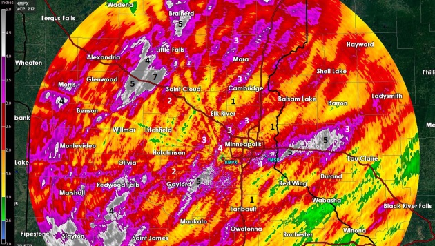
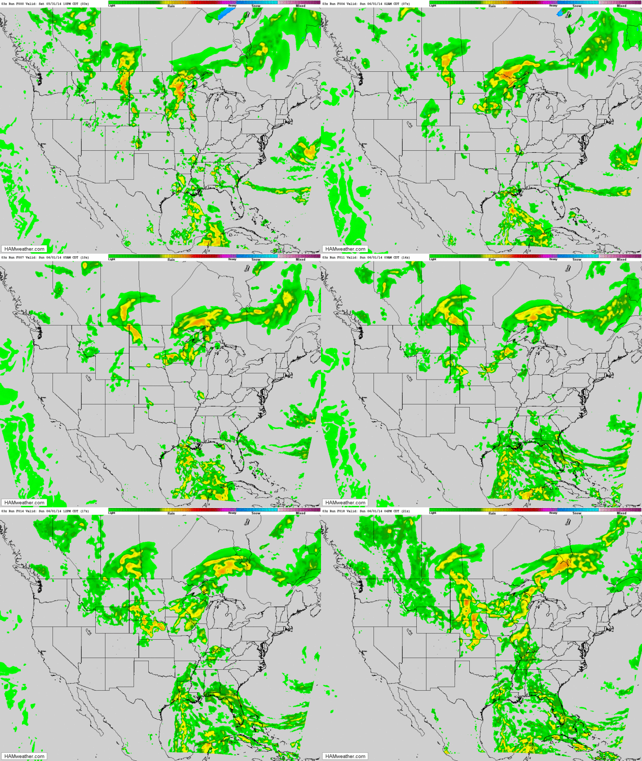
Welcome to monsoon season in Minnesota. Rainfall for the last 30 days is already 3-8 inches above average for portions of central Minnesota, and the rains just keep on coming. Once again, for the umpteenth time in recent memory, weather systems are stalling, and when weather gets stuck you need to pay close attention.
A stalled frontal boundary snaking across Minnesota will ignite more heavy T-storms again today; heaviest rains on the cooler north/west side of the front - but the MSP metro may see tropical downpours capable of 1-2 inches, enough for standing water and garage-worthy grad parties.
Have a Plan B and hope for the best.
A ripple of low pressure keeps gulley-washers in the forecast into Monday but Wednesday's storm may steer showers and storms south of the metro. We slowly warm late next week with spotty weekend T-storms. Right on cue.
I'm still betting on a wetter than average summer, statewide, but El Nino may keep us warmer and drier the latter half of 2014.
Keep the faith.
4.43" Sauk Centre
2.6" Breezy Point, on Pelican Lake
* Click here for rainfall and flash flood details, courtesy of NOAA.
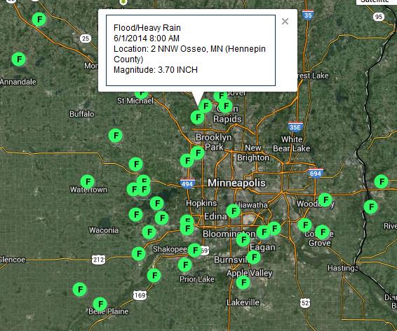
* more Minnesota rainfall amounts from CoCoRaHS.
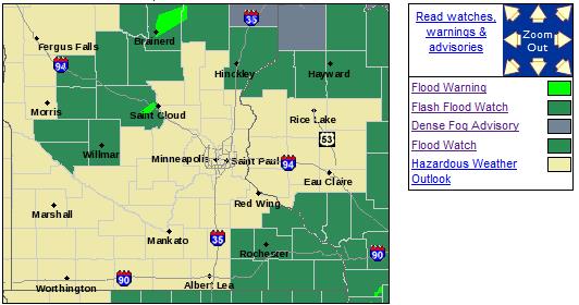
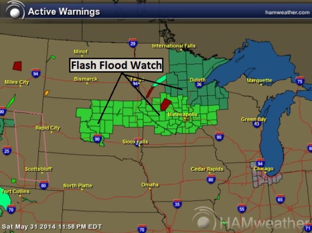
THE FLASH FLOOD WATCH IS NOW IN EFFECT FOR * PORTIONS OF CENTRAL MINNESOTA...EAST CENTRAL MINNESOTA AND WEST CENTRAL MINNESOTA...INCLUDING THE FOLLOWING AREAS...IN CENTRAL MINNESOTA...BENTON...KANDIYOHI...MEEKER...SHERBURNE... STEARNS AND WRIGHT. IN EAST CENTRAL MINNESOTA...ISANTI... KANABEC AND MILLE LACS. IN WEST CENTRAL MINNESOTA...CHIPPEWA... LAC QUI PARLE...POPE AND SWIFT. * THROUGH SUNDAY MORNING. * ADDITIONAL HEAVY RAIN WITH 2 TO 4 INCHES POSSIBLE IN SPOTS TONIGHT COMBINED WITH SATURATED SOIL...SWOLLEN CREEKS AND STREAMS COULD LEAD TO FLOODING. PRECAUTIONARY/PREPAREDNESS ACTIONS... A FLASH FLOOD WATCH MEANS THAT CONDITIONS MAY DEVELOP THAT LEAD TO FLASH FLOODING. FLASH FLOODING IS A VERY DANGEROUS SITUATION. YOU SHOULD MONITOR LATER FORECASTS AND BE PREPARED TO TAKE ACTION SHOULD FLASH FLOOD WARNINGS BE ISSUED.
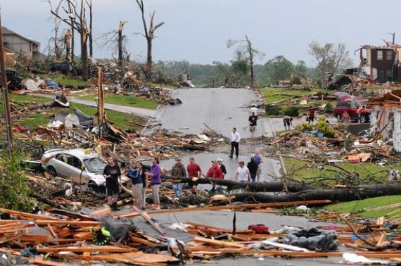
Photo credit above: "Residents of Joplin, Mo, survey the damage after a tornado hit the city in May 2011." Associated Press.
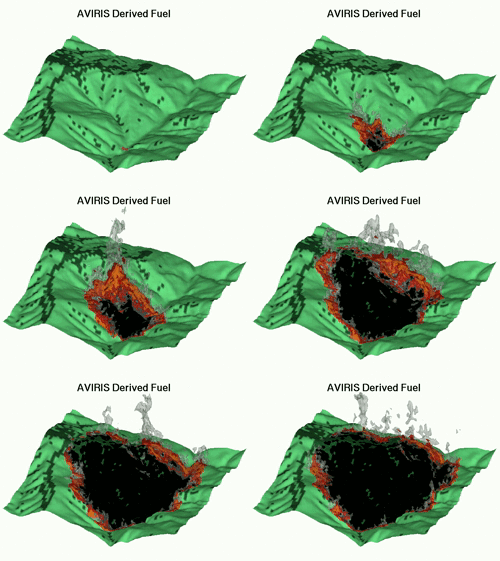
Animation credit above: "A FIRETEC animation of a 1996 blaze in Malibu." (icess.ucsb.edu).
The Wealthy, English-Speaking Country Starbucks Can't Conquer. Here's a snippet of a fascinating business case study at Quartz: "...The
Seattle-based chain also has a large and growing presence in
international markets: Seoul has more Starbucks locations than New York
City does, and Canada has more stores on a per capita basis than
anywhere else in the world. There
is, however, a wealthy international market where the coffee chain has
struggled: Australia. That might seem surprising, given it is one of
the world’s wealthiest countries and is also completely obsessed with coffee..."
* more fascinating details on Virgin Galactic's upcoming "flights" at The Houston Chronicle.
Climate Stories...
Global Warming and the Vulnerability of Greenland's Ice Sheet. Climate models have consistently underestimated the rate of ice melt in Greenland (and the Arctic). Here's an excerpt of a story at The Guardian: "...This work is important because in the past decade or so, it has been found that Greenland is losing ice, lots of ice, to the world’s oceans. As a consequence, Greenland is one of the significant contributors to sea level rise. The level our oceans will rise to in the next decades and centuries depends strongly on how fast the Greenland ice sheet will melt. This study is novel because of the way it combined measurements with mass-conservation calculations. The method allowed far better resolution of the thickness of Greenland glaciers and the shape of the valleys beneath the glaciers. The shape and depth of these valleys is important for moderating the speed of ice flow to the oceans. In fact, in the paper, authors state, “the overall state of mass balance of the ice sheet is affected by considerable uncertainties in bed topography and ice thickness...”
GOP Science Deniers Threaten National Security. Not my headline, but from a marine veteran who is hot under the collar. Here's a snippet of his Op-Ed at Marketwatch: "...The Republican Party
is now officially on record as the party of climate-science denialism.
These research programs, ongoing and widely used by the Pentagon in
strategic national defense planning for many years, could, if the Senate
agrees, become illegal to use. Yes, this Marine veteran is mad as hell.
GOP science deniers have “crossed the line,” they’re now messing with
national security. America is now under attack from an enemy within,
irrational science denialism, a toxic mind-set, a spreading,
self-destructive mental virus. Yes, this is a “War on America.” The
military has been using climate-science research for decades. This vote
is self-destructive. These research studies are essential in our
national defense..."
Graphic credit: Center for Climate and Energy Solutions.
Subscribe to:
Posts (Atom)